Contributory members are able to log private notes and comments about each site
Sites Stonetracker has logged. View this log as a table or view the most recent logs from everyone
Menhir du Moustoir
Date Added: 13th Dec 2024
Site Type: Standing Stone (Menhir)
Country: France (Bretagne:Morbihan (56))
Visited: Yes on 1st Sep 2024. My rating: Condition 4 Ambience 4 Access 4

Menhir du Moustoir submitted by thecaptain on 10th Jun 2006. The Moustoir tumulus has a small menhir on the top at the eastern end, and a larger one at the bottom of the western end.
The menhir at the western end is 3.3 metres high, quite thin and a nice pointed triangular shape.
(View photo, vote or add a comment)
Log Text: There are three menhirs near the Moustoir Tumulus. This is the western menhir in a small field across the dirt road which separates it from the western edge of the tumulus. See Moustoir Tumulus visitor's log for parking; it's the same for the menhir.
Menhir du tumulus du Moustoir
Date Added: 13th Dec 2024
Site Type: Standing Stone (Menhir)
Country: France (Bretagne:Morbihan (56))
Visited: Yes on 1st Sep 2024. My rating: Condition 4 Ambience 4 Access 3
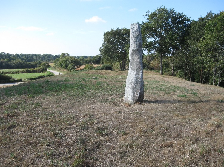
Menhir du tumulus du Moustoir submitted by DrewParsons on 7th Nov 2009. The menhir on the top of the tumulus
(View photo, vote or add a comment)
Log Text: There are three menhirs near the Moustoir Tumulus. This one is on top of the tumulus at its eastern end. It requires a very short but steep climb up the tumulus slope to access the top. Parking is the same as for the Moustoir Tumulus; see the visitor's log for that entry.
Note: This was the end of my Sept 2024 tour in the Carnac area. Hope to return to France in fall 2025, to visit sites in Finistere.
Menhir La Motte de Beurre
Date Added: 19th Nov 2024
Site Type: Standing Stone (Menhir)
Country: France (Bretagne:Morbihan (56))
Visited: Yes on 1st Sep 2024. My rating: Condition 3 Ambience 3 Access 3
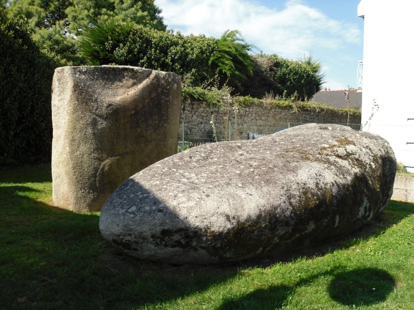
Menhir La Motte de Beurre submitted by regina on 12th Nov 2014. Site in Bretagne:Morbihan (56) France
(View photo, vote or add a comment)
Log Text: Parking is problematic as the menhir is located in a small park squeezed in between two houses in a densely packed residential alley. My solution was to park farther south where the alley widens to a real street near the Chapelle St Michel with on-street spaces. It is not a long walk from there to either Mane Rethuel Dolmen or the menhir.
The menhir is broken with the base still in the ground and the other half recumbent. It was originally 7.4 m in length, including the part below ground level. One face of the base has engravings but they are darkened with age and hard to see.
Menhirs de Keriaval
Date Added: 5th Oct 2024
Site Type: Standing Stone (Menhir)
Country: France (Bretagne:Morbihan (56))
Visited: Yes on 1st Sep 2024. My rating: Condition 2 Ambience 3 Access 3
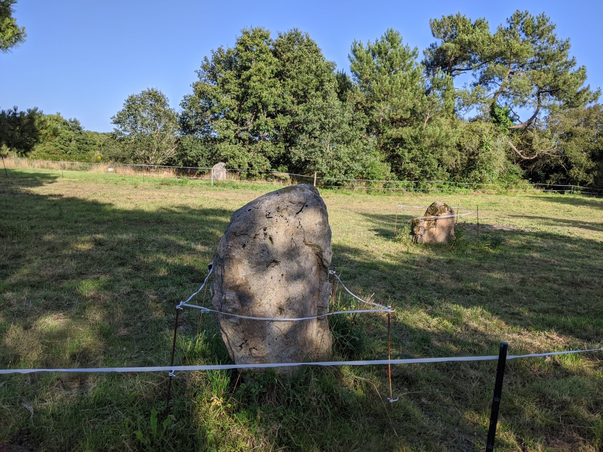
Menhirs de Keriaval submitted by aolson on 25th Jul 2020. Three of the eight menhirs that are listed for this site, although some of the others may have disappeared.
(View photo, vote or add a comment)
Log Text: Located 3 or 4 menhirs of the original 8 in a field about 50 m south of the passage grave along the trail. The area is fenced off and discourages further exploration.
Menhirs de Mané er Hroëck
Date Added: 22nd Nov 2024
Site Type: Standing Stone (Menhir)
Country: France (Bretagne:Morbihan (56))
Visited: Yes on 1st Sep 2024. My rating: Condition 3 Ambience 4 Access 4

Menhirs de Mané er Hroëck submitted by regina on 17th Nov 2014. Standing menhir
(View photo, vote or add a comment)
Log Text: I looked for the two menhirs described in the text and at the location given. Didn't definitively find either of them. However I did find a standing (actually leaning) menhir about 60 mtrs south of the location that didn't really look the same as the original photo (see my photo). The whole site looks quite different now with extensive lawn mowing and clearing of the grounds, so it's still possible that it's the original standing menhir with a lot of the overgrowth removed.
Menhirs le Vieux-Moulin (N)
Date Added: 30th Sep 2024
Site Type: Stone Row / Alignment
Country: France (Bretagne:Morbihan (56))
Visited: Yes on 1st Sep 2024. My rating: Condition 3 Ambience 4 Access 5

Menhirs le Vieux-Moulin (N) submitted by Ogham on 8th Jul 2012. The site is marked as menhirs but they are part of the alignment.
(View photo, vote or add a comment)
Log Text: There is a signpost "Vieux Moulin" off the D781 that is easy to miss. A dirt road leads a couple hundred meters past a house to a small hill. Park here. The menhirs are a very short easy walk east or south from there.
Mesa Verde - Cedar Tree Tower
Date Added: 14th Jul 2025
Site Type: Ancient Village or Settlement
Country: United States (The Southwest)
Visited: Yes on 1st May 2025. My rating: Condition 3 Ambience 4 Access 4
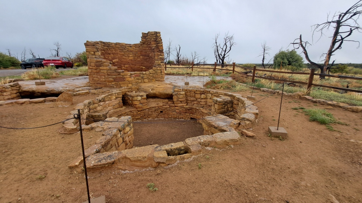
Mesa Verde - Cedar Tree Tower submitted by stonetracker on 14th Jul 2025. The multi-story tower in the background and Mesa Verdean-style kiva in the foreground. There is no site interpretation, but my guess is the complex was built sometime in the 1100 to early 1200 CE period.
(View photo, vote or add a comment)
Log Text: This site is at the end of a paved side road heading east from the main park road. The side road is approximately 5 miles south of the Far View Community site and a 1/2 mile north of the Spruce Tree House overlook and Chapin Mesa Museum.
The side road leads in about 1/2 mile to a dead end loop with on-street parking. The tower and kiva are located right next to the parking loop.
Mesa Verde - Cliff Palace
Date Added: 22nd Aug 2025
Site Type: Ancient Village or Settlement
Country: United States (The Southwest)
Visited: Saw from a distance on 1st May 2025. My rating: Condition 4 Ambience 5

Mesa Verde - Cliff Palace submitted by bat400 on 7th Aug 2012. A detail of Cliff Palace showing the square tower and two kivas. The kiva to the left (having an oval or "square" shape instead of a round shape) is "Kiva F"which is being shored up in 2012 to prevent its further cracking and damage.
Photo by bat400, spring 2012.
(View photo, vote or add a comment)
Log Text: Much has already been written about this, the largest, most magnificent of the Pueblo 3 cliff dwelling sites at Mesa Verde, so I won't rehash it here. Only to say that I opted to view the site from two overlooks due to bad weather and time constraints. In 2025, ranger-led tours commenced the first week in May, in fact the day before I had to return home. Next time...
You can get a great remote view of the site from an overlook at the Sun Temple and an even closer look at an overlook on the Cliff Palace driving loop via a short trail.
Mesa Verde - Coyote Village
Date Added: 24th Jun 2025
Site Type: Ancient Village or Settlement
Country: United States (The Southwest)
Visited: Yes on 1st May 2025. My rating: Condition 3 Ambience 5 Access 4
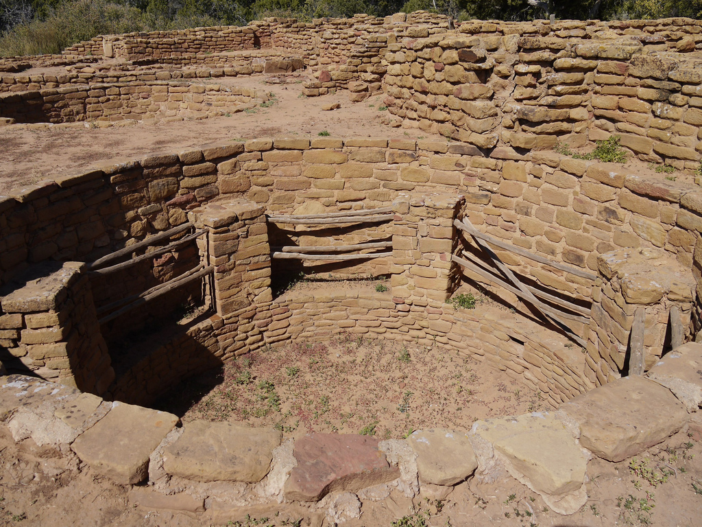
Mesa Verde - Coyote Village submitted by Flickr on 6th Jan 2019. Kiva, Coyote Village, Mesa Verde Image copyright: Suffolk Booklover, hosted on Flickr and displayed under the terms of their API.
(View photo, vote or add a comment)
Log Text: My favorite of the Far View community sites, as public access is allowed in the interior of the village site, so the kivas and room blocks can be examined at very close range (in contrast to Far View House, at least in May 2025). It's in good to excellent condition and was excavated in the late 1960's - much more recently than many of the structures in Far View.
Access is via an easy 800-1000 ft trail that departs SW from the parking loop rd near Far View House.
Mesa Verde - Far View House
Date Added: 22nd Jun 2025
Site Type: Ancient Village or Settlement
Country: United States (The Southwest)
Visited: Yes on 1st May 2025. My rating: Condition 3 Ambience 3 Access 4
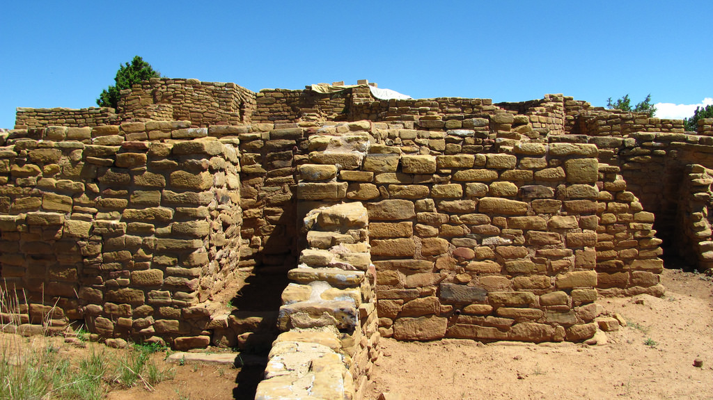
Mesa Verde - Far View House submitted by Creative Commons on 6th Jan 2019. Far View House Far View was one of the most densely populated parts of the mesa from A.D. 900 to about A.D. 1300. Nearly 50 villages have been identified within a half square mile area, and were home to hundreds of people. Today, several excavated and stabilized sites are linked by a trail system within a short walking distance. These surface sites include Far View House, Pipe Shrine House, Coyote Village, Far View Reservoir, Megalithic House, and Far View Tower. Image copyright: Anomieus (Rhia...
(View photo, vote or add a comment)
Log Text: This is a Chacoan style great house from the Pueblo 2 period (950 -1150 CE). Like most great houses, it served as a community center for ritual and social activities. It also possibly was used as a central storage point for harvested produce.
The people lived in room blocks in small villages dispersed around the great house. There were at least 50 villages in Far View, of which a handful have been excavated and restored and can be visited today.
To visit the Far View great house and village structures, drive approximately 2 miles south of Far View Terrace Cafe on the main park road and turn left onto a side road. Oddly for such a major site it is not well marked. The side road ends in a loop. Parking is limited to wherever you can pull off the road in various pullouts. There's no real parking lot !
The great house is steps away from the dead end loop.
Unfortunately, when I was there, the great house had a number of tarps strewn over parts of it and it looked like they were doing some restoration or maintenance. Most of the inside was roped off and closed to visitation. I don't know if this is always the case. But it was difficult to take any photos other than of the outside walls. A raised observation platform would have been helpful.
Mesa Verde - Far View Tower
Date Added: 13th Jul 2025
Site Type: Ancient Temple
Country: United States (The Southwest)
Visited: Yes on 1st May 2025. My rating: Condition 3 Ambience 4 Access 4
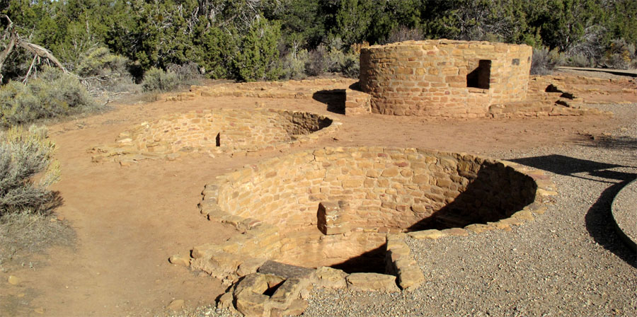
Mesa Verde - Far View Tower submitted by jeffrep on 10th Nov 2012. Tower and two kivas at Far View Tower in Mesa Verde.
(View photo, vote or add a comment)
Log Text: This is likely another small Ancestral Pueblo village site in the Far View Community consisting of multiple room blocks and kivas. After the initial construction and occupation, a tower was later built over one of the original kivas.
Access is via a 100-200 yd flat foot path that heads north from the loop road near Far View House. On-street parking is available on the Far View loop road.
Mesa Verde - Fire Temple
Date Added: 11th Aug 2025
Site Type: Ancient Village or Settlement
Country: United States (The Southwest)
Visited: Saw from a distance on 1st May 2025. My rating: Condition 3 Ambience 4
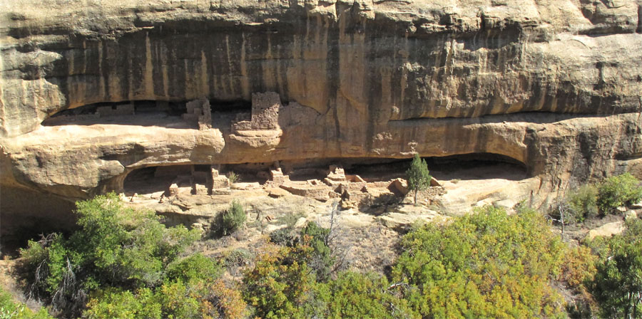
Mesa Verde - Fire Temple submitted by jeffrep on 14th Nov 2012. Fire Temple from the overlook across the canyon.
(View photo, vote or add a comment)
Log Text: This is actually two sites. The Fire Temple is what is believed to be a purely ceremonial structure. The New Fire House is adjacent and thought to be a cliff dwelling site for the caretakers of the temple. Both are late Pueblo 3 structures and not open to public visitation. However, they can be viewed remotely from the Fire Temple and New Fire House Overlook on the Mesa Top Loop drive.
Mesa Verde - Megalithic House
Date Added: 12th Jul 2025
Site Type: Ancient Village or Settlement
Country: United States (The Southwest)
Visited: Yes on 1st May 2025. My rating: Condition 3 Ambience 4 Access 3
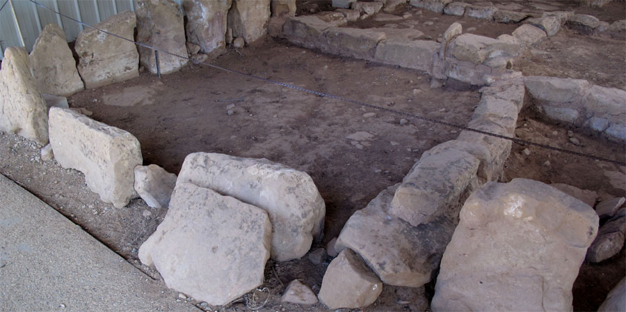
Mesa Verde - Megalithic House submitted by jeffrep on 10th Nov 2012. Megalithic House in Mesa Verde.
(View photo, vote or add a comment)
Log Text: This site is sbout 100-200 meters north of Far View Reservoir via a flat walking trail. It is a partially restored classic unit pueblo, probably occupied by a small family or clan, and consisting of 8 or 9 rooms plus a well-preserved kiva cut into bedrock.
The site is sheltered under a metal roof and includes interpretation.
Mesa Verde - Mesa Top Sites
Date Added: 1st Sep 2025
Site Type: Ancient Village or Settlement
Country: United States (The Southwest)
Visited: Yes on 1st May 2025. My rating: Condition 3 Ambience 5 Access 4
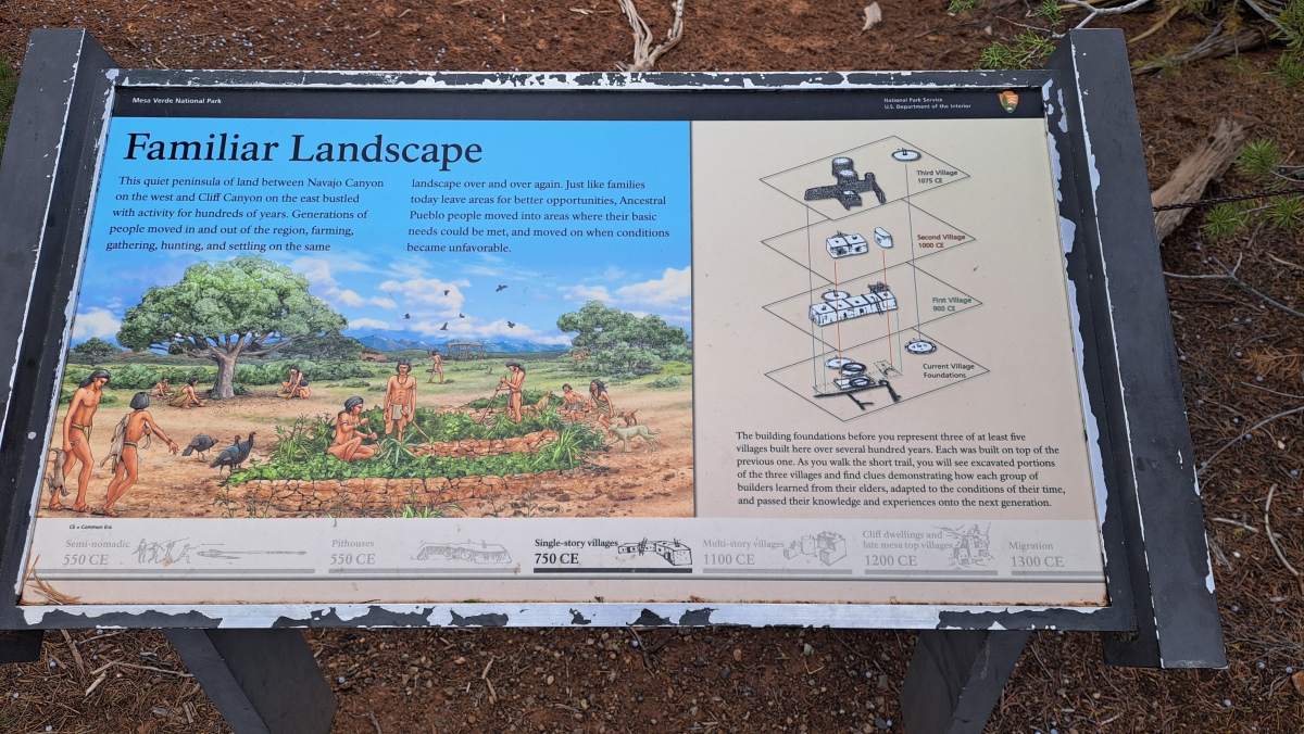
Mesa Verde - Mesa Top Sites submitted by stonetracker on 28th Aug 2025. Site interpretation showing the layers of each village
(View photo, vote or add a comment)
Log Text: One of the better outdoor exhibits at Mesa Verde describing how Ancestral Pueblo architectural styles evolved between 900 and 1075 CE on mesa top sites. This is a stop on the Mesa Top loop drive with a parking pull-off and handicapped-accessible paved walkway to the excavated sites with interpretation.
Mesa Verde - Mummy Lake
Date Added: 12th Jul 2025
Site Type: Misc. Earthwork
Country: United States (The Southwest)
Visited: Yes on 1st May 2025. My rating: Condition 3 Ambience 4 Access 3
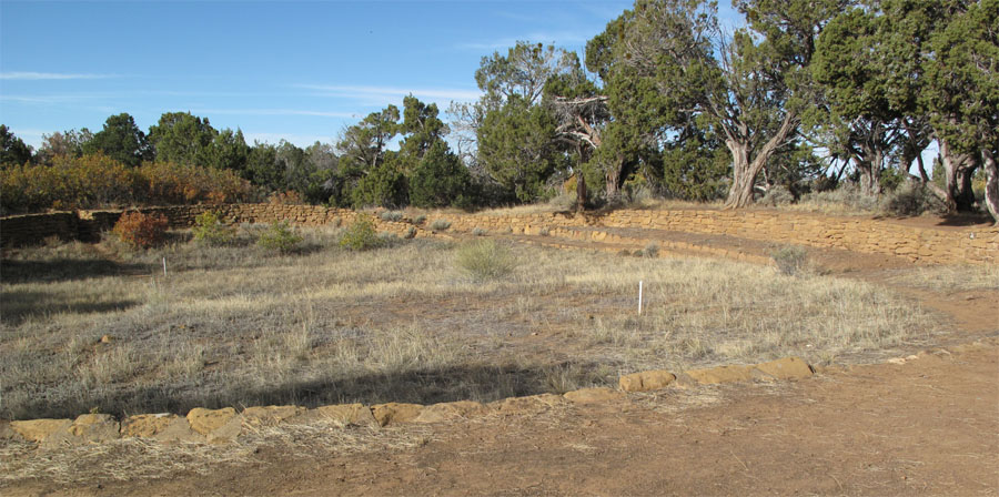
Mesa Verde - Mummy Lake submitted by jeffrep on 13th Nov 2012. Far View Reservoir (also known as Mummy Lake), one of four reservoirs for domestic water storage at Mesa Verde between 750 and 1180AD.
(View photo, vote or add a comment)
Log Text: This site is part of the Far View community of Ancestral Pueblo sites in Mesa Verde National Park. The structure, a large depression with earthen embankments reinforced by stone revetments in some parts, was originally thought to be a manmade water collection and reservoir area, likely built in the Pueblo 2 period. There is a ditch leading out the south side of the structure. It is in fact now called Far View Reservoir, rather than its original name of Mummy Lake.
However, this interpretation has been called into question and the purpose of the structure remains controversial.
It is accessible via a 1/4 to 1/2 mile flat walking trail north about midway down the access road to Far View House. Parking is available on the side of the road or at the dead end near Far View House.
Mesa Verde - Oak Tree House
Date Added: 6th Aug 2025
Site Type: Ancient Village or Settlement
Country: United States (The Southwest)
Visited: Yes on 1st May 2025. My rating: Condition 3 Ambience 4
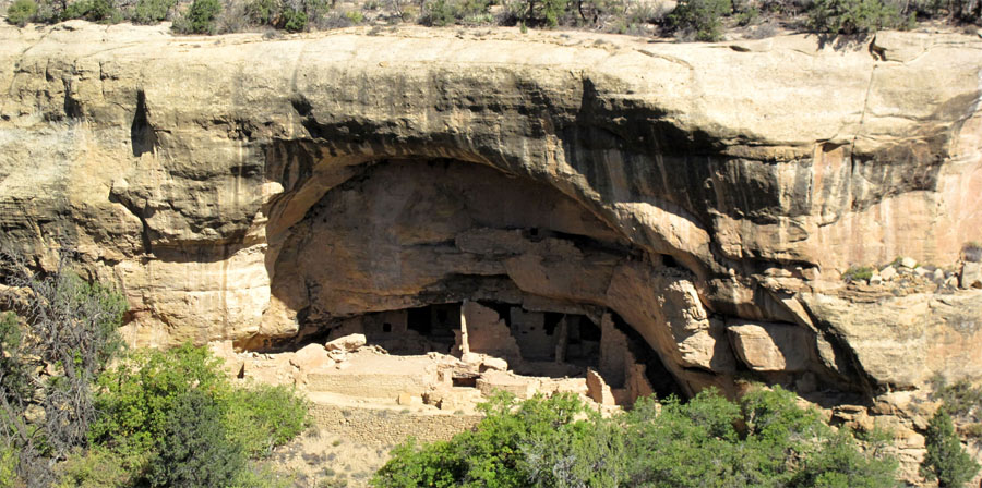
Mesa Verde - Oak Tree House submitted by jeffrep on 14th Nov 2012. Oak Tree House in Mesa Verde from across the canyon.
(View photo, vote or add a comment)
Log Text: I didn't actually visit the Oak Tree House site itself but viewed it remotely from the Oak Tree House View across the canyon. All of my images were captured from that overlook, which is a short walk from a paved parking pull-off on the Mesa Top Sites driving loop.
Mesa Verde - Pipe Shrine House
Date Added: 22nd Jun 2025
Site Type: Ancient Village or Settlement
Country: United States (The Southwest)
Visited: Yes on 1st May 2025. My rating: Condition 3 Ambience 4 Access 4
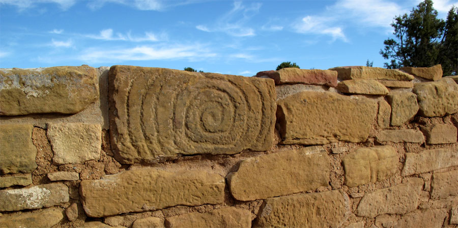
Mesa Verde - Pipe Shrine House submitted by jeffrep on 10th Nov 2012. Spiral Petroglyph on outer wall of Pipe Shrine House in Mesa Verde.
(View photo, vote or add a comment)
Log Text: Pipe Shrine House is an Ancestral Pueblo village built just 100 yds south of the Far View great house and consists of approximately 20 room blocks, a large interior kiva, and what appears to be a circular room next to the kiva that may have been a tower. The village was built and modified between 900 and 1300 CE, so it spans the Pueblo 2 and 3 periods. There is some debate as to whether this site was purely ceremonial or served as a homestead for villagers farming the mesa top. (or both!). More in Comments section.
To get there, see the visit log for Far View House as the directions are the same. Pipe Shrine House is but a 100 yd walk south from the great house. The interior of the room block site is off limits to visitation; however, the surrounding area is at enough of an elevation that you can get a good sense of the overall architecture. The kiva however is difficult to see well given the access restrictions in May of 2025.
Mesa Verde - Pithouse
Date Added: 18th Jul 2025
Site Type: Ancient Village or Settlement
Country: United States (The Southwest)
Visited: Yes on 1st May 2025. My rating: Condition 3 Ambience 4 Access 4
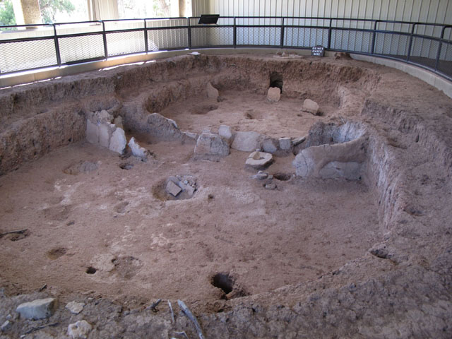
Mesa Verde - Pithouses and Pueblos submitted by jeffrep on 14th Nov 2012. Pit house.
(View photo, vote or add a comment)
Log Text: This is the first stop on the Mesa Top Loop, a one-way driving loop featuring actual excavated sites with interpretation that cover Basketmaker 3 through Pueblo 3 cultural periods.
The Pithouse stop is about a mile south of Chapin Museum and Spruce Tree House overlook. The actual pithouse is less than 100 ft south of the parking pulloff under a shelter, accessible via a paved foot path.
Mesa Verde - Pithouses and Pueblos
Date Added: 4th Sep 2025
Site Type: Ancient Village or Settlement
Country: United States (The Southwest)
Visited: Yes on 1st May 2025. My rating: Condition 3 Ambience 4 Access 4
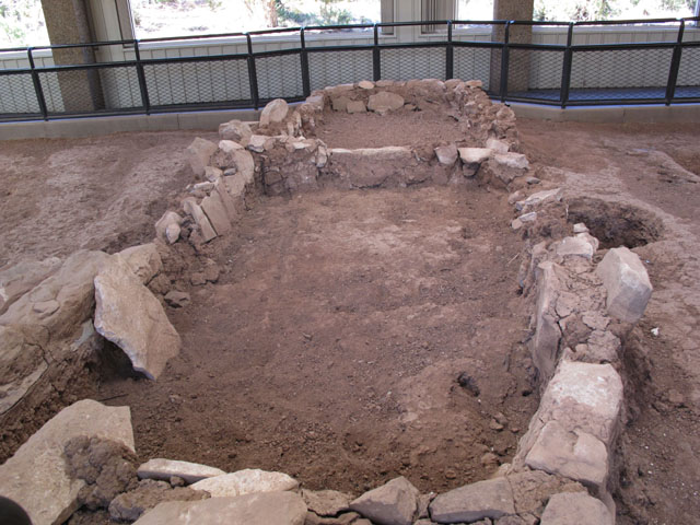
Mesa Verde - Pithouses and Pueblos submitted by jeffrep on 14th Nov 2012. Ruins of early pueblo.
(View photo, vote or add a comment)
Log Text: This is a stop on the Mesa Top loop drive that comprises two excavation sites. It explores the deevelopment of late Basketmaker pithouses into jacal dwellings and eventually into masonry room blocks with proto-kivas.
Access is via a parking pull-off and handicapped-accessible paved walkway.
Mesa Verde - Spruce Tree House
Date Added: 13th Jul 2025
Site Type: Ancient Village or Settlement
Country: United States (The Southwest)
Visited: Yes on 1st May 2025. My rating: Condition 4 Ambience 5 Access 4
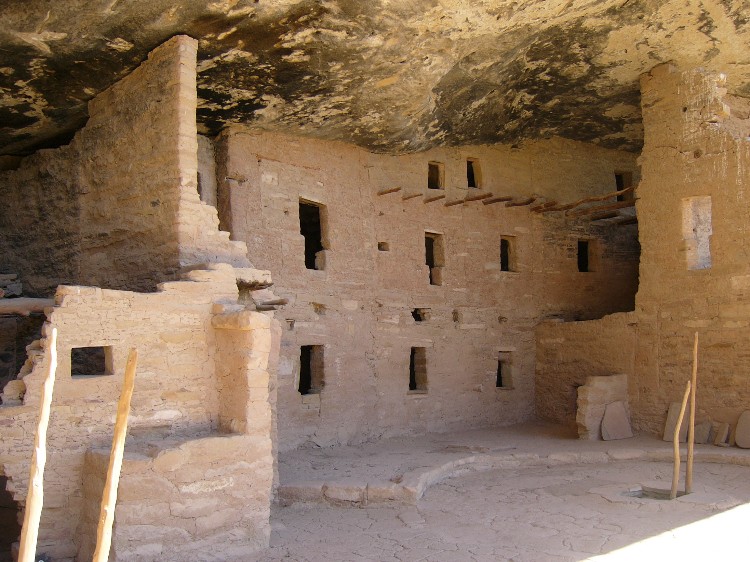
Mesa Verde - Spruce Tree House submitted by DrewParsons on 19th Oct 2008. Site in United States: Mesa Verde - Spruce Tree House photographed in September 2005
(View photo, vote or add a comment)
Log Text: Visited in May 2025. Unfortunately, this cliff dwelling from the Pueblo 3 period, probably the best preserved of all the cliff dwellings at Mesa Verde, has been closed to visitation since 2015. A portion of the alcove overhang collapsed, creating a serious safety issue, and forcing the closure ever since. There have been ongoing efforts to determine how to best stabilize the site for future visitation.
Meanwhile an overlook behind the Chapin Museum provides excellent views and interpretation of the cliff dwelling. The area is still well worth a visit. The short 100-200 yd path to the overlook is paved and I believe is wheel chair accessible.
