Contributory members are able to log private notes and comments about each site
Sites Stonetracker has logged. View this log as a table or view the most recent logs from everyone
Lower Jackson
Date Added: 25th Jan 2023
Site Type: Artificial Mound
Country: United States (The South)
Visited: Yes on 1st Oct 2021. My rating: Ambience 3

Lower Jackson submitted by bat400 on 30th Aug 2012. The distant view of Lower Jackson Mound from across the cotton fields.
Photo by bat400, Oct 2011.
(View photo, vote or add a comment)
Log Text: As noted in the description, there is no public access. Just a car pull-off next to a state historic marker. The mound is quite a distance south in a farm field but can be spotted with the naked eye.
Luthor List Mound
Date Added: 23rd Feb 2023
Site Type: Artificial Mound
Country: United States (Great Lakes Midwest)
Visited: Yes on 1st Apr 2021. My rating: Condition 3 Ambience 4 Access 5
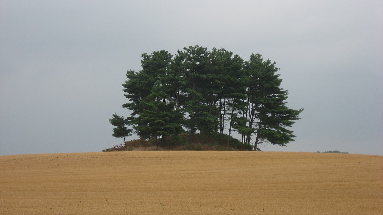
Luthor List Mound submitted by stonetracker on 23rd Feb 2023. Creative Commons photo from 2010. The mound is in a private field but easily viewable at distance from several streetside locations.
(View photo, vote or add a comment)
Log Text: Regarding accessibility, the mound is now protected on a property known as the Bartley Preserve (see comments). But it can be easily viewed from several car-friendly vantage points.
One is at the end of the Mound Trail road that heads east off of Kingston Pike (CR-9) into the Kingston Mound Manor apartment complex. An even closer access point is the SE corner of the complex's parking lot. The mound is about 100 yds from the latter spot.
Magee Mounds
Date Added: 2nd Mar 2025
Site Type: Artificial Mound
Country: United States (The South)
Visited: Saw from a distance on 1st Feb 2025. My rating: Condition 3 Ambience 4
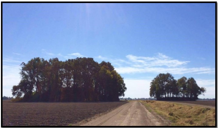
Magee Mounds submitted by stonetracker on 20th Nov 2023. 2014 photo from thesis author referenced in the site description. Mound A on the left, B on the right.
(View photo, vote or add a comment)
Log Text: These Mississippian mounds fall into the same category as a number of others that can only be viewed from long range, e.g. Metcalfe, Stoneville, Leland, and Mayersville. All are privately owned and on either agricultural land or large compounds set far back from the nearest public road. Unless permission is secured by the landowner, be prepared to shoot photos or videos from several 100 ft or more away. The best and closest viewing spot I found was on Furr Rd in Percy at approximately 33.09367, -90.85677 which lies about 800 ft north of the mound. There is a safe parking on a field road, where I captured most of the images. The two remaining mounds are on cultivated land and in good condition. The rest have been reduced to subsurface by cultivation.
Maison des Mégalithes
Date Added: 6th Oct 2024
Site Type: Museum
Country: France (Bretagne:Morbihan (56))
Visited: Yes on 1st Sep 2024. My rating: Condition 5 Ambience 3 Access 5
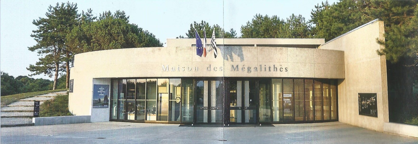
Maison des Mégalithes submitted by johnstone on 30th Sep 2022. Public folder
(View photo, vote or add a comment)
Log Text: This is the starting point of megalithic discovery in Carnac for many. It's a visitor center with some exhibits, although the interpretation of the stone alignments themselves is not particularly detailed. The scale models of the Manio Tumulus and Kermario Dolmen are nicely done, The introductory video is also well executed and delivered in multiple languages. The book and gift store is definitely worth a look.
Man Mound Park
Date Added: 30th Jul 2024
Site Type: Artificial Mound
Country: United States (Great Lakes Midwest)
Visited: Yes on 1st Jul 2024. My rating: Condition 2 Ambience 4 Access 4
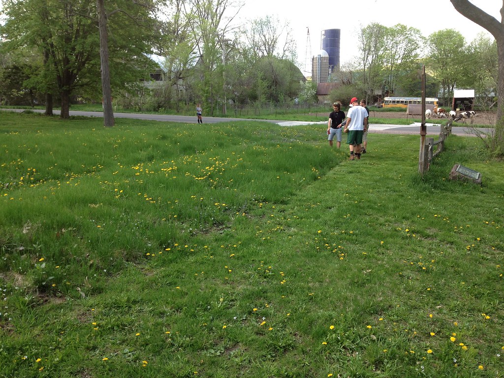
Man Mound Park submitted by Flickr on 26th May 2014. At Man Mound Park environmental geology students encountered another manifestation of the earlier Image copyright: stnorbert, hosted on Flickr and displayed under the terms of their API.
(View photo, vote or add a comment)
Log Text: The mound is almost impossible to photograph or video as it is very low profile and eroded. There are warning signs to stay off as they are trying to establish prairie grass growth on the mound and mow around it. Once it grows out a bit, the mound will become more obvious.
You can park nearly at the mound itself so access is not an issue.
Mané Bogad Dolmen
Date Added: 12th Dec 2024
Site Type: Burial Chamber or Dolmen
Country: France (Bretagne:Morbihan (56))
Visited: Yes on 1st Sep 2024. My rating: Condition 3 Ambience 4 Access 3
Mané Bogad dolmen submitted by krose on 5th Oct 2008. Mané Bogad
(View photo, vote or add a comment)
Log Text: This is a rather damaged passage grave within a visible mound with kerbstones. All of the cover stones are missing and the orthostats are short, but this is likely due to organic fill washing into the tomb over time.
The trickiest bit was finding the trail to it, as I was unable to find the one noted on the map. Parking is in a large dirt lot at the jct of D105 and Rte de Poul Hoh in Ploemel.
From the parking area, walk west on Poul Hoh about 200 m. The trail head is on a right of way squeezed in between private houses. There may or may not be a signpost. The site is up on a hill about 150 m north of the road.
Mané Bras
Date Added: 11th Dec 2024
Site Type: Burial Chamber or Dolmen
Country: France (Bretagne:Morbihan (56))
Visited: Yes on 1st Sep 2024. My rating: Condition 3 Ambience 4 Access 3
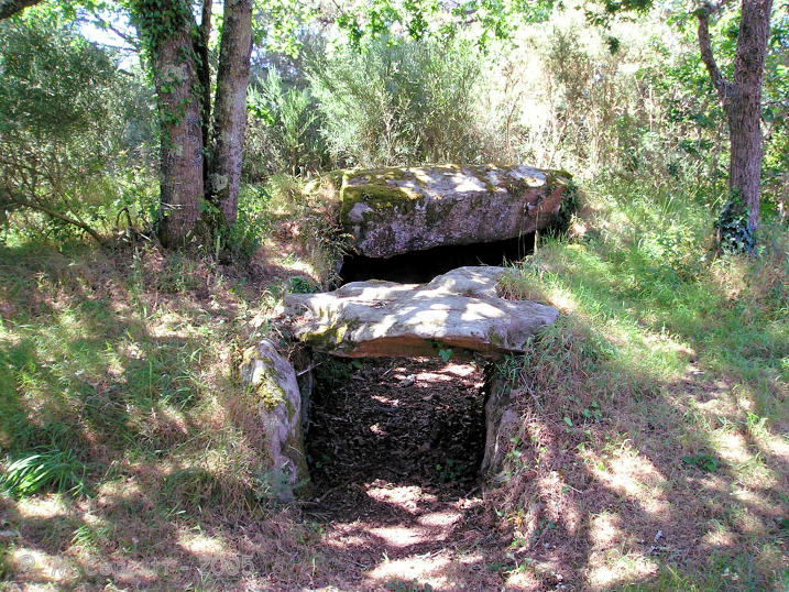
Mané Bras submitted by TheCaptain on 11th Nov 2007. On the left, an oval chamber without capstone, has about a 6 metre passage leading out to the edge of the mound.
(View photo, vote or add a comment)
Log Text: As stated in the description, this site comprises three passage graves on a small hill surrounded by the remnants of a 30 meter diameter mound. It is a bit off the beaten track but offers seclusion. It is accessed via a 500 m trail heading north from a side road off of D186 at the jct of Rue Kermarquer and Le Penher. Parking is limited to on-street only but you can pull partially off the road. The trail is signposted.
The trail and the site are well maintained, with little or no overgrowth to contend with.
Mané Keriaval
Date Added: 4th Oct 2024
Site Type: Passage Grave
Country: France (Bretagne:Morbihan (56))
Visited: Yes on 1st Sep 2024. My rating: Condition 3 Ambience 5 Access 3
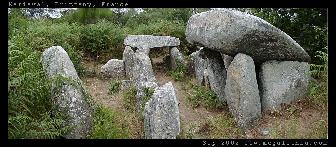
Mané Keriaval submitted by ermine on 30th Jun 2004. Morbihan, Carnac area
47.61535N 3.083378W WGS84 GPS onsite
You'd be forgiven for thinking this is a dolmen, and it is locally listed as such, but Burl sets you right. These stones were originally a passage grave with an earth mound on top
(View photo, vote or add a comment)
Log Text: I walked south across the D768 from the Mane Kerioned parking area along the Keriaval road (watch traffic !). Took the first left after the Master bowling center down a somewhat muddy lane which angles left past some obvious menhirs in a field. The passage grave is in a clearing about 50 m past that point.
Site is very clear of overgrowth and in good shape.
Mane Lud Dolmen
Date Added: 17th Oct 2024
Site Type: Chambered Cairn
Country: France (Bretagne:Morbihan (56))
Visited: Yes on 1st Sep 2024. My rating: Condition 3 Ambience 5 Access 4
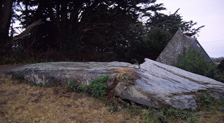
Mane Lud dolmen submitted by greywether on 30th Jun 2005. The massive broken granite capstone over the chamber (8.5 x 4.9m).
(View photo, vote or add a comment)
Log Text: This is currently one of the few passage graves/dolmens in the Locmariaquer area that you can get inside... at least legally. Several others have been fenced off and posted with official government warning signs urging visitors to keep out for safety reasons and view from a distance.
As for access, I parked at a public layby and lot located at 47.57362, -2.95311 off the Voie des Megalithes and walked a signposted dirt trail about 200 m east to what looks like a private paved driveway. Turn left here and walk a few more meters east on the driveway. The large knoll to the right is the tumulus. Walk up the hill and the huge chamber capstone should appear shortly, next to a Camping Interdit sign.
Mané-er-Hroëck tumulus
Date Added: 22nd Nov 2024
Site Type: Chambered Tomb
Country: France (Bretagne:Morbihan (56))
Visited: Yes on 1st Sep 2024. My rating: Condition 3 Ambience 4 Access 4
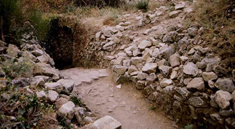
Mané-er-Hroëck tumulus submitted by greywether on 30th Jun 2005. The modern entrance to this underground chamber.
(View photo, vote or add a comment)
Log Text: This is one of the large Carnacean tumuli (see St Michel Tumulus and Tumiac for similar structures). Like Tumiac, the mound covers a rather modest stone burial vault which was originally covered, never meant to be re-opened. Except that it was, in the 20th century, when a stone passage and stairway were added to access the vault.
Unfortunately, official state notice was posted at the vault stairway in February or March of 2024 that access into the passage is now "interdit" (forbidden) due to safety concerns and potential rock slides. It is not roped off, but you now enter at your own risk, legal and otherwise. I didn't bother ;-). There is little to see other than the tumulus itself, which is impressive, and at least one menhir a short distance away from the mound on the side opposite the entrance.
There is a parking pulloff very close to a signposted trail head which leads in about 100 m to the tumulus. The entrance is a few more meters to the right beyond an information sign.
Mané-Groh Dolmen
Date Added: 9th Dec 2024
Site Type: Burial Chamber or Dolmen
Country: France (Bretagne:Morbihan (56))
Visited: Yes on 1st Sep 2024. My rating: Condition 3 Ambience 4 Access 4
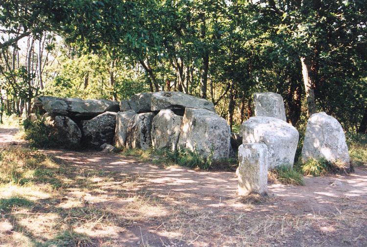
Mané-Groh dolmen submitted by JJ on 9th Nov 2002. Mané-Groh dolmen
(View photo, vote or add a comment)
Log Text: This passage grave is along the same road as the Crucuno Dolmen and about 1.5 km NE of the latter. There is a good sized parking area directly across the street from the site. From there it's a quick walk across the street and up a short 10 m path and there you are.
Currently there is a low rope fence around the dolmen and tumulus and, although there are no signs saying "Access Interdit," it's implied that visitors should tread carefully when approaching the dolmen.
Mané-Kerioned Dolmen
Date Added: 2nd Oct 2024
Site Type: Burial Chamber or Dolmen
Country: France (Bretagne:Morbihan (56))
Visited: Yes on 1st Sep 2024. My rating: Condition 4 Ambience 3 Access 4
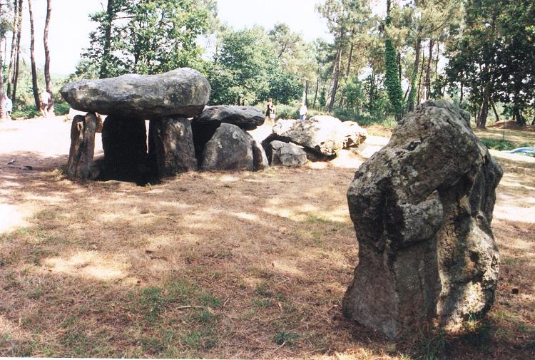
Mané-Kerioned dolmen submitted by JJ on 9th Nov 2002. Mané-Kerioned dolmen
(View photo, vote or add a comment)
Log Text: Located virtually right next to the north side of the busy D768. Parking is available on Rte de Quelvezin near its junction with D768 and the well-maintained site is a 100 m walk via a woods trail.
Mane-Rethuel Dolmen
Date Added: 18th Nov 2024
Site Type: Burial Chamber or Dolmen
Country: France (Bretagne:Morbihan (56))
Visited: Yes on 1st Sep 2024. My rating: Condition 3 Ambience 3 Access 3

Mane-Rethuel dolmen submitted by AlexHunger on 21st Sep 2004. Dolmen de Mane-Rithual in central Locmariaquer viewed from North. Entrance is at oposite end.
(View photo, vote or add a comment)
Log Text: This site is accessible via a short signposted trail west off of the Ruelle du Bronzo. The bigger challenge is finding a spot to park as the street (more like an alley) is densely residential and narrow with very limited parking. If you proceed farther south on the same road, the street widens with more parking spaces near the Chapelle Saint Michel. I parked here and walked back along the alley to the signposted trail (and later to visit the Motte de Beurre site nearby)
Unfortunately, as others have noted, the passage grave is fenced off for safety reasons and can only be viewed from the outside. It is not clear if or when the interior will be stabilized sufficiently to re-open the site.
Marsden Mounds
Date Added: 25th Jan 2023
Site Type: Artificial Mound
Country: United States (The South)
Visited: Yes on 1st Oct 2021. My rating: Condition 2 Ambience 3 Access 4
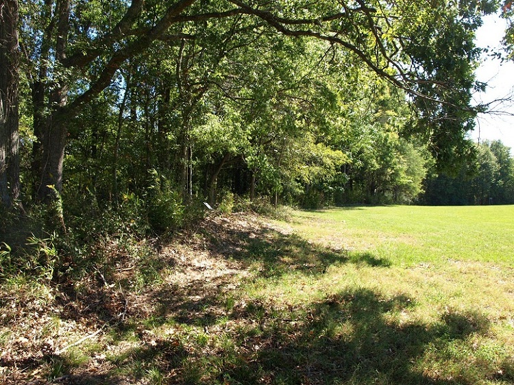
Marsden Mounds submitted by bat400 on 3rd Sep 2012. Mounds B, C, and D lie along the edge of this wood and the mowed grass plaza. They are quite low (only a few feet high) but still distinct.
Photo by bat400, Oct 2011.
(View photo, vote or add a comment)
Log Text: Mounds A-D mostly plowed or eroded down to nothing. I'm told E is still extant in woods but very tough to get to through the overgrowth. I gave up trying :-).
Mathew Mound
Date Added: 31st Oct 2023
Site Type: Artificial Mound
Country: United States (Great Lakes Midwest)
Visited: Yes. My rating: Condition 4 Ambience 4 Access 5
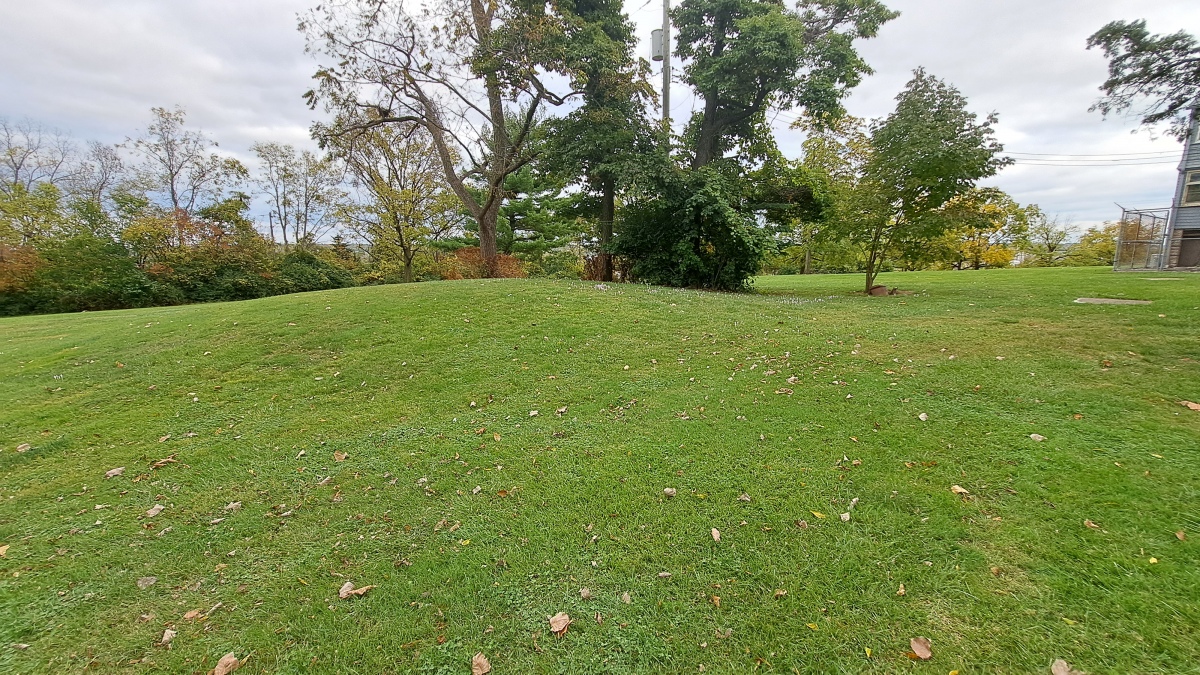
Mathew Mound submitted by stonetracker on 23rd Oct 2023. Reasonably (although not 100 %) sure this is the mound, as it conforms to the description and there is no other obvious candidate in the vicinity.
(View photo, vote or add a comment)
Log Text: Visited in late Oct 2023. This is very likely the location of the mound, as it matches the description and there are no other obvious candidates in the immediate area.
It is just north of the main administrative building in the Landmark Memorial Gardens, adjacent to a parking lot.
Mayersville Mounds
Date Added: 4th Mar 2025
Site Type: Artificial Mound
Country: United States (The South)
Visited: Saw from a distance on 1st Feb 2025. My rating: Condition 3 Ambience 2
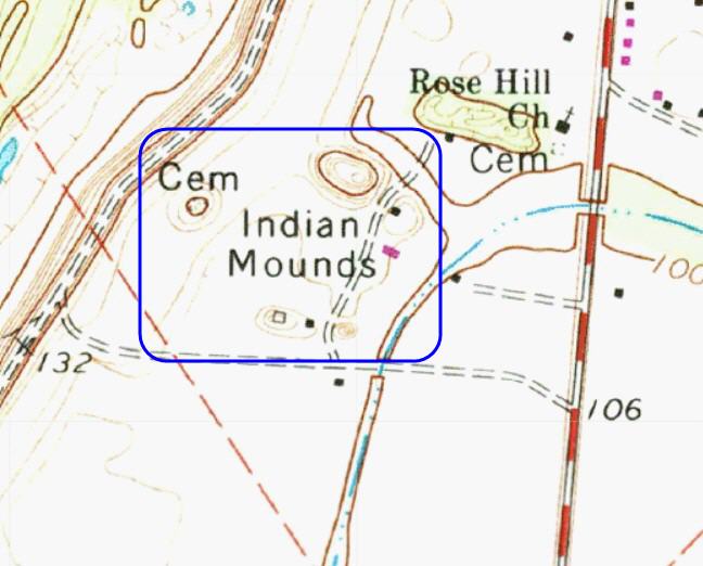
Mayersville Mounds submitted by stonetracker on 4th Mar 2025. Topo of the mound site. The five remaining mounds are all within the blue rectangle. The highest I believe is Mound A, although I have yet to see a map with mound IDs labeled.
(View photo, vote or add a comment)
Log Text: This site, a major Mississippian mound complex, was a disappointment due to access problems. It's all private roads to my knowledge, set well back from the main highway, and a number of the mounds are tree covered and obscured from a distance. The upshot is I didn't have time to knock on doors and get permission so maybe next time?
I did get a poor photo of what I think is the largest Mound A from the cemetery of a nearby church on State Route 1, which I'll post for what it's worth. The location coordinates given in the general description are for the same mound.
McLaughlin Mound
Date Added: 21st Feb 2023
Site Type: Artificial Mound
Country: United States (Great Lakes Midwest)
Visited: Would like to visit
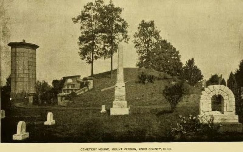
McLaughlin Mound submitted by stonetracker on 21st Feb 2023. Postcard of the mound, date uncertain. Shows the height of the mound above the facade of the crypt before it was drastically lowered.
Source: 1915 Ohio Archaeological Atlas.
(View photo, vote or add a comment)
Mendota Mental Health Institute Effigy Mounds
Date Added: 27th Aug 2024
Site Type: Artificial Mound
Country: United States (Great Lakes Midwest)
Visited: Yes on 1st Jul 2024. My rating: Condition 3 Ambience 5 Access 4

Mendota Mental Health Institute Effigy Mounds submitted by stonetracker on 22nd Aug 2024. At the far western edge of the Central Mound group is an unusual panther effigy on a rise of land with a curved, upturned tail.
Difficult to photograph, but the forelegs and hindlegs are on the left and right respectively. Head and tail out of view.
(View photo, vote or add a comment)
Log Text: As far as I know, public access to the Mendota Mental Health Institute grounds is allowed without permission, although it is recommended that one stop by the Administration Bldg to check in.
To access the Central Group of mounds, park in the large lot northeast of the intersection of Main Drive & Cinder Drive. It is 200 yd walk from there to the bird effigy mounds (see map) via a paved walkway. The upper panther mound is set apart from the others on Cinder Drive. However, there is no parking at that site and the Cinder Drive lot was under construction as of 2024. But it is a relatively easy walk to the upper panther mound from Main Drive or from the other effigies in this group.
To access the Western Group, continue on Main Drive heading west and take a left onto Memorial Drive. The large conical mounds are about 1000 ft further next to the road on the left at Farwell's Pt. I could only find on-street parking, but there was little or no traffic in that area.
Ménec alignements
Date Added: 5th Oct 2024
Site Type: Multiple Stone Rows / Avenue
Country: France (Bretagne:Morbihan (56))
Visited: Yes on 1st Sep 2024. My rating: Condition 4 Ambience 4 Access 4

Ménec alignements submitted by thecaptain on 18th Oct 2004. Ménec alignements, north of Carnac, Brittany, France.
View of the Ménec alignements as they were in summer 1987, when you could walk amongst them before they were fenced off, and with an awful lot of erosion going on around them.
(View photo, vote or add a comment)
Log Text: Access to this most famous of the Carnac alignments is so well documented that I won't rehash it here. I found that parking at the Maison des Megalithes lot and walking the fence line from the Menec Cromlech east and then looping back west was the best and easiest way to see it for those who can walk a fair distance. There are many other ways to do it, including organized tours and mini-trains.
Ménec cromlech
Date Added: 5th Oct 2024
Site Type: Stone Circle
Country: France (Bretagne:Morbihan (56))
Visited: Yes on 1st Sep 2024. My rating: Condition 3 Ambience 4 Access 4

Ménec cromlech submitted by AlexHunger on 20th Dec 2004. The Cromlec de Menec marks the westernmost extent of the Carnac Allignments. It basically starts on the road that separates it from the allignments, goes through a private garden, through the end of the village and ends in a creperie.
(View photo, vote or add a comment)
Log Text: I parked in the main lot for the Maison Des Megalithes and walked west, taking a right at the roundabout onto a paved lane that leads north to a small village and the creperie. Within 100 m you will see the unmistakeable menhirs of the cromlech on both sides of the lane.
You can get nice glimpses of the cromlech running through private gardens by simply walking down the little village byways to the west. I did not walk on creperie property but spotted a pretty intact section in there from a distance.
