Contributory members are able to log private notes and comments about each site
Sites Stonetracker has logged. View this log as a table or view the most recent logs from everyone
Hillside Haven Mound
Date Added: 22nd Feb 2023
Site Type: Artificial Mound
Country: United States (Great Lakes Midwest)
Visited: Would like to visit

Hillside Haven Mound submitted by stonetracker on 22nd Feb 2023. Mound now much reduced in height, due to excavation and erosion.
Photo is courtesy of Wikipedia Creative Commons.
(View photo, vote or add a comment)
Hodgen's Cemetery Mound
Date Added: 25th Nov 2023
Site Type: Artificial Mound
Country: United States (Great Lakes Midwest)
Visited: Would like to visit
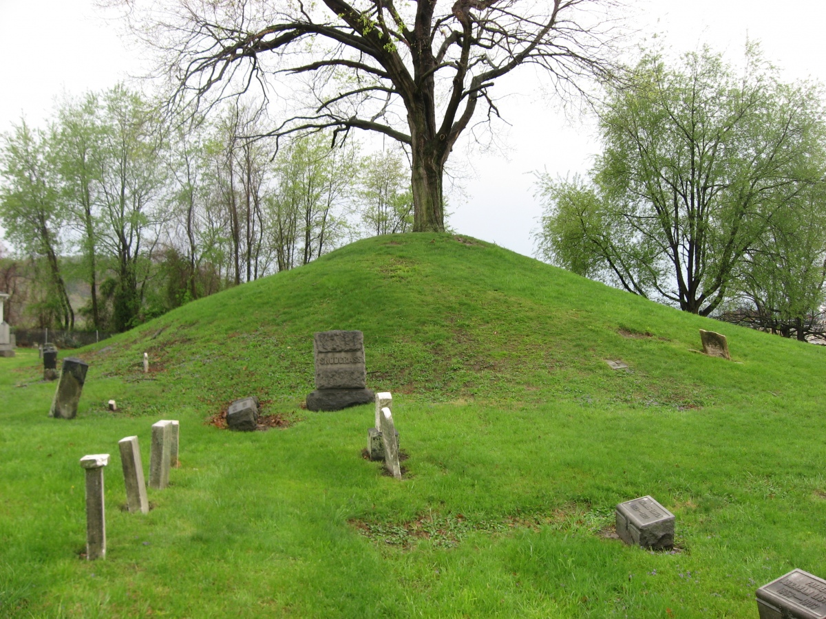
Hodgen's Cemetery Mound submitted by AKFisher on 20th Oct 2023. Hodgen's Cemetery Mound in Tiltonsville, Ohio. It is an Adena burial mound generally dated to 500 BC-AD 500. In the mid-1800s locals started using the mound as a cemetery, which saved the mound from excavations. Photo courtesy Dr Greg Little, author of the Illustrated Encyclopedia of Native American Indian Mounds & Earthworks (2016).
(View photo, vote or add a comment)
Hollywood Mounds
Date Added: 8th Mar 2024
Site Type: Artificial Mound
Country: United States (The South)
Visited: Yes on 1st Feb 2024. My rating: Condition 3 Ambience 3

Hollywood Mounds submitted by stonetracker on 8th Mar 2024. Mound A from 1000 ft away. As close as I could get as it's private property.
(View photo, vote or add a comment)
Log Text: Mound A, the largest, and three much smaller boundary mounds to the north of it are all located in a wooded area on private farm property several 100 yds north of the pullout area on the paved rd. This is as close as you can get (legally). All remaining boundary mounds and the three mounds to the east of Mound A were destroyed long ago. I could see Mound A easily but the three boundary mounds to the north of it were blocked from view.
This is on the Mississippi Mound Trail but the interpretive signage is missing, either stolen or vandalized.
Hopewell Culture National Historic Site
Date Added: 29th Jan 2023
Site Type: Misc. Earthwork
Country: United States (Great Lakes Midwest)
Visited: Yes on 1st Oct 2019. My rating: Condition 3 Ambience 4 Access 4
Hopewell Culture National Historic Site submitted by bat400 on 27th May 2006. Hopewell Culture NHP, Mound City Group.
Inside the main enclosure, this is a view looking toward the west. The large mound farthest back is the "Central Mound," the largest of the group. Closer is an elliptical mound, and a smaller conical mound is closest.
* The "Central Mound" was erected over the remains of two timber buildings with 13 cremated burials. Artifacts found included falcon effigies cut from copper sheets and fragments of human skull that had been cut and drilled (perhaps ...
(View photo, vote or add a comment)
Log Text: Site is as described in the overview and comments. A mostly faithful reconstructed site, due to damage from previous excavations and military or agricultural use of property. Many Hopewell mound and earthworks sites have suffered from similar modern activities. Some have been at least partially rebuilt.
Hopewell Mound Group
Date Added: 9th Feb 2023
Site Type: Artificial Mound
Country: United States (Great Lakes Midwest)
Visited: Yes on 1st Oct 2019. My rating: Condition 2 Ambience 4 Access 4
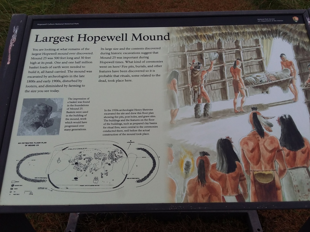
Hopewell Mound Group submitted by stonetracker on 5th Feb 2023. Interpretation for the largest known Hopewell burial mound ever built (Mound 25). It actually started as three mounds which were soon conjoined into one as burials and fill were added.
A floor plan from a 1920s excavation at the base of the mound shows fire pits, basins, post holes, and graves.
(View photo, vote or add a comment)
Log Text: Intent of this trip was to see what was left of the square earthwork (nothing) and the mounds within the much larger enclosure (only a few slight rises above the field now). This site was not reconstructed, so what you see is the result of ~ 2000 yrs of erosion, plowing, etc.
Hopewell Mound Group
Date Added: 5th Feb 2023
Site Type: Artificial Mound
Country: United States (Great Lakes Midwest)
Visited: Yes on 1st Apr 2021. My rating: Condition 2 Ambience 4 Access 4

Hopewell Mound Group submitted by stonetracker on 5th Feb 2023. Interpretation for the largest known Hopewell burial mound ever built (Mound 25). It actually started as three mounds which were soon conjoined into one as burials and fill were added.
A floor plan from a 1920s excavation at the base of the mound shows fire pits, basins, post holes, and graves.
(View photo, vote or add a comment)
Log Text: Found the extant wall and ditch segments, in fairly good shape.
Horse Rock Art Panels
Date Added: 15th May 2025
Site Type: Rock Art
Country: United States (The Southwest)
Visited: Yes on 1st May 2025. My rating: Condition 4 Ambience 4 Access 5
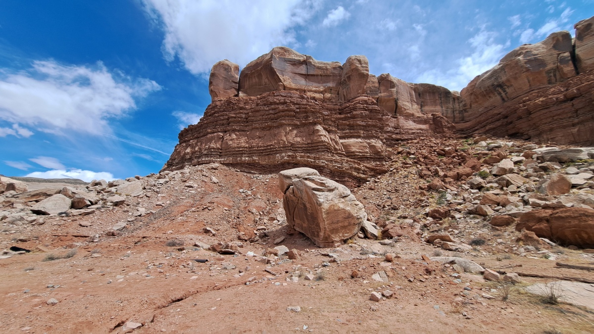
Horse Rock Art Panels submitted by stonetracker on 15th May 2025. The main rock art panel is on the boulder at photo center. The corral is out of view to the right.
(View photo, vote or add a comment)
Log Text: The main rock art panel is just 100-200 ft north of Route 162 about 0.2 miles east of Bluff. Parking is in a dirt lot next to a corral and a fenced utility building. For the mobility impaired, the panel is pretty visible with the naked eye from a vehicle if you park as far north as you can get and scan the central boulder.
I've been told there are more panels of a single horse and multiple animals behind the utility building fence and higher up the cliff slope.
Hovenweep - Settlement
Date Added: 12th May 2025
Site Type: Ancient Village or Settlement
Country: United States (The Southwest)
Visited: Yes on 1st May 2025. My rating: Condition 3 Ambience 5 Access 4
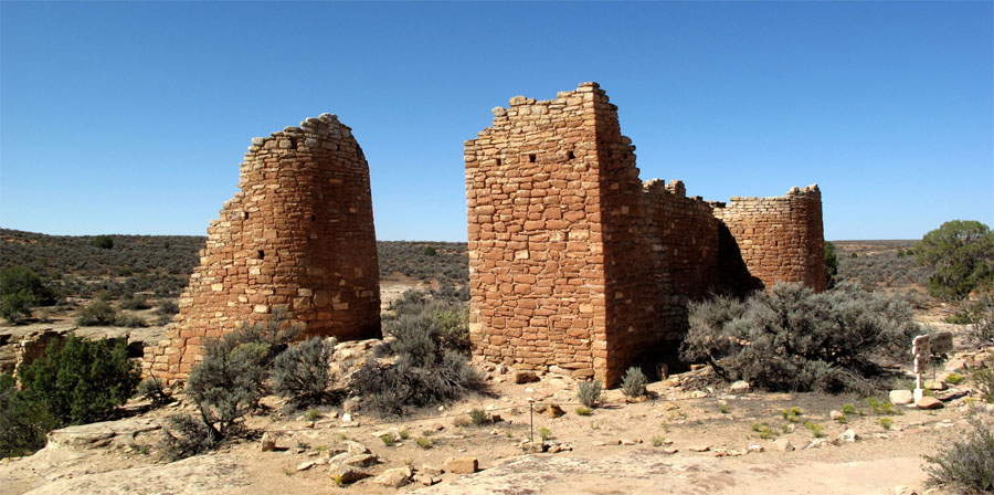
Hovenweep - Hovenweep Castle submitted by jeffrep on 9th Nov 2012. Hovenweep Castle.
(View photo, vote or add a comment)
Log Text: Only was able to visit Stronghold House and another ruin nearby. The rest were remote viewing only. See Hovenweep - Stronghold House for more details.
Hovenweep - Stronghold House
Date Added: 13th May 2025
Site Type: Ancient Village or Settlement
Country: United States (The Southwest)
Visited: Yes on 1st May 2025. My rating: Condition 3 Ambience 5 Access 4
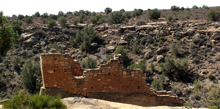
Hovenweep - Stronghold House submitted by jeffrep on 9th Nov 2012. Hovenweep. Remains of Stronghold House.
(View photo, vote or add a comment)
Log Text: Only had time to see Stronghold House and its tower, plus a nearby ruin. Everything else in the Square Tower Group was remote viewing from the edge of Little Ruin Canyon, only due to my time constraints.
Access to Stronghold House is via a handicapped accessible paved trail about 300 yds from the visitor center.
Hovenweep - Unit Type House
Date Added: 14th May 2025
Site Type: Ancient Village or Settlement
Country: United States (The Southwest)
Visited: Yes on 1st May 2025. My rating: Condition 2 Ambience 4 Access 3
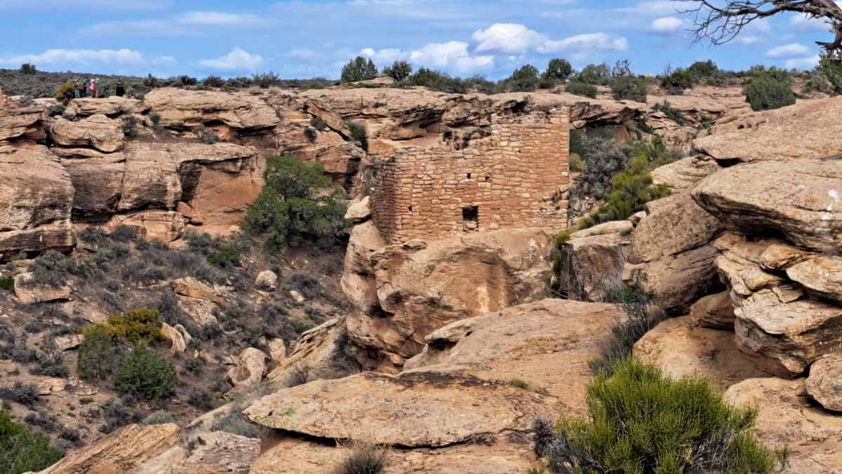
Hovenweep - Unit Type House submitted by stonetracker on 13th May 2025. A remote view of Unit Type House from Stronghold House
(View photo, vote or add a comment)
Log Text: I viewed this site at 200-300 yds away from Stronghold House. Someday I'll return to visit this and the other structures in the Square Tower Group more closely. My understanding is that you can get a much closer view of Unit Type House from the trail that circles the canyon.
Ingomar Mounds
Date Added: 8th Apr 2024
Site Type: Artificial Mound
Country: United States (The South)
Visited: Yes on 1st Apr 2024. My rating: Condition 2 Ambience 4 Access 4
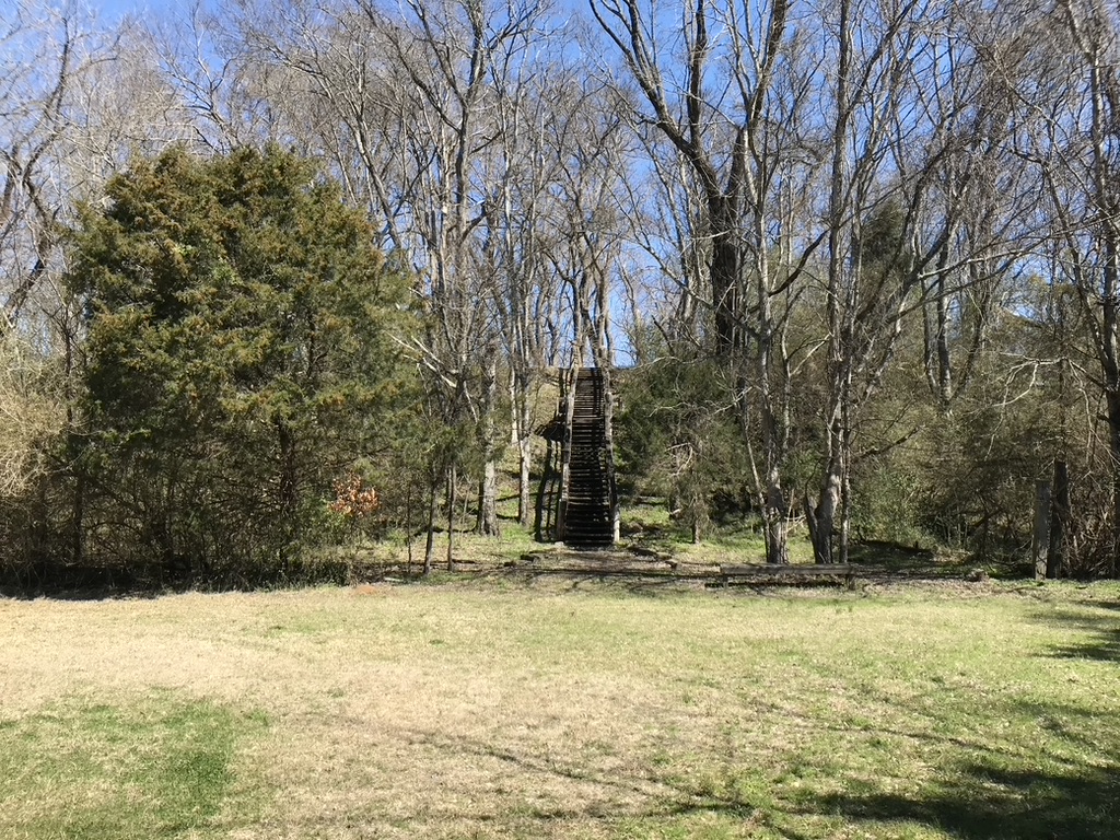
Ingomar Mounds submitted by AKFisher on 28th Jul 2023.
Ingomar Mound in Mississippi. It was a massive mound complex surrounded by an earthwork & palisade. This platform mound is all that remains today.
Photo courtesy Dr Greg Little, author of the Illustrated Encyclopedia of Native American Indian Mounds & Earthworks (2016).
(View photo, vote or add a comment)
Log Text: Most of this Middle Woodland site, once comprising 13 mounds and a palisade, was destroyed by cultivation. Was only able to find Mound 1 (a small burial mound only visible as a slight rise) and Mound 14 (a large rectangular platform mound in good condition).
All publicly accessible with parking and some interpretation. Mound 14 is about 1000 ft away on a mown footpath. Mound 1 is off to the left on the way to 14.
Insley Mounds
Date Added: 8th Mar 2025
Site Type: Artificial Mound
Country: United States (The South)
Visited: Yes on 1st Feb 2025. My rating: Condition 3 Ambience 3
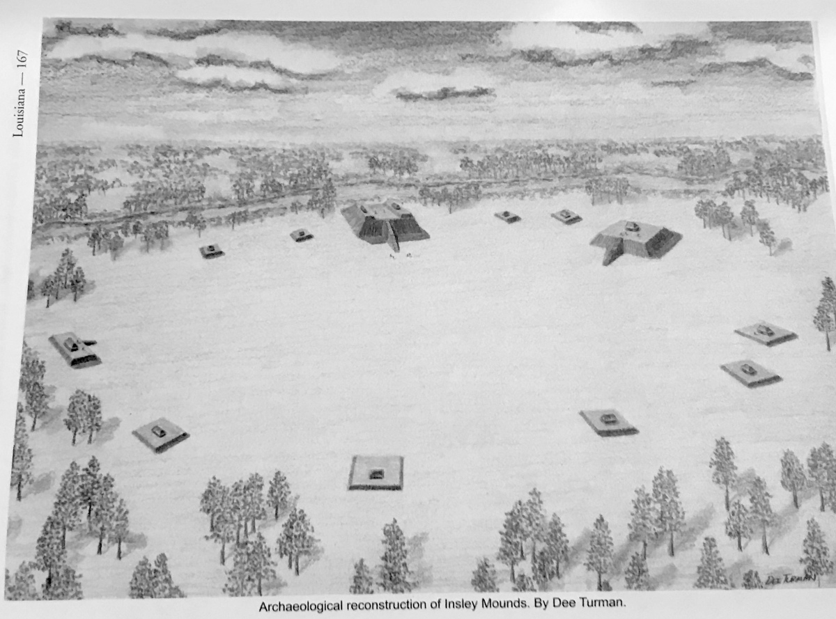
Insley Mounds submitted by AKFisher on 9th Aug 2023.
Archaeological reconstruction of the Insley Mounds in Louisiana from the mound encyclopedia.
Image courtesy Dr Greg Little, author of the Illustrated Encyclopedia of Native American Indian Mounds & Earthworks (2016).
(View photo, vote or add a comment)
Log Text: This site is spread out over a small residential area on Frankie Loftin Rd, a narrow rural roadway. Two mounds, B and C, are right next to the road and very close to Bayou Macon. There is no real parking area, but you can get mostly off the road near what looks like an abandoned house next to Mound C and near the interpretive sign. Mound B is a 100 yd walk north of the sign and surrounded by a wooden fence. Mound D is 200 yds south of the sign and about 200 yds west of the road in a private yard. It can only be viewed remotely. The mound in Dr. Little's photo is Mound D.
Most of the remaining mounds of the original 13 mound complex were leveled by cultivation. Supposedly there are 3 other small mounds to the east of the road, but I had no time to look for them and have no information on their whereabouts. They are almost certainly on private land.
Note: I was unable to positively locate Mound A.
Intestine Man rock paintings
Date Added: 24th May 2025
Site Type: Rock Art
Country: United States (The Southwest)
Visited: Yes on 1st May 2025. My rating: Condition 3 Ambience 4 Access 4
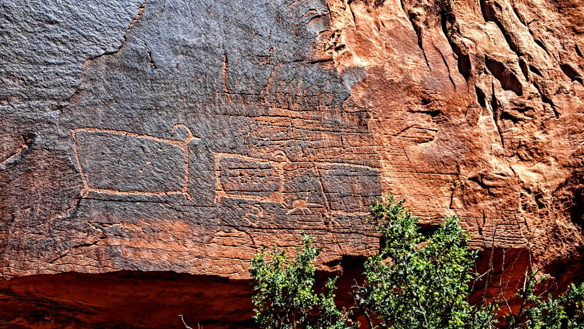
Intestine Man rock paintings submitted by stonetracker on 28th May 2025. These petroglyphs have been nicknamed the "box" or "TV" sheep, for obvious reasons. These are to the right of the main trail.
(View photo, vote or add a comment)
Log Text: This is a combination petroglyph and Archaic period pictograph (rock painting) site on Route 313, which is about 10 miles north of Moab. To get there, head west on Route 313 to about mile marker 2.7. There is a paved parking pullout there, big enough for 2-3 vehicles.
There is some limited interpretation signage and a short trail that leads in about 100 yds to the cliff face. The titular Intestine Man and other pictographs are to the left along a short trail. The mostly Ancestral Pueblo and Fremont petroglyphs are also a similar length trail to the right.
There are a few large boulders and rocks to wend your way around, but they shouldn't require any serious scrambling.
One plus of this site is that there are a number of other petroglyph sites on Route 313 that you can visit while there, although I had no time to do so.
Ismay Rock Shelter Petroglyphs
Date Added: 9th May 2025
Site Type: Rock Art
Country: United States (The Southwest)
Visited: Yes on 1st Apr 2025. My rating: Condition 3 Ambience 5 Access 3
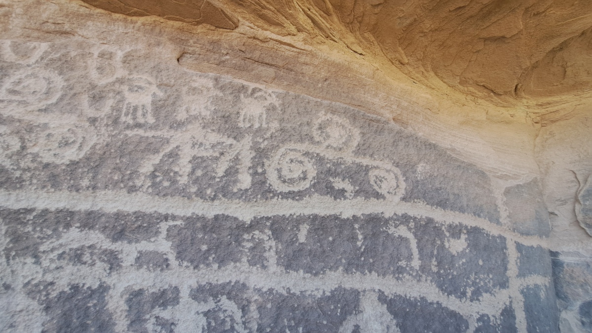
Ismay Rock Shelter Petroglyphs submitted by stonetracker on 8th May 2025. Spirals and sheep
(View photo, vote or add a comment)
Log Text: Site contains a possibly prehistoric Pueblo ruin and both modern and ancient rock art. Access is via a short but steep foot trail up a slope to a large boulder and the site.
I parked at the junction of County Road G and H near the old trading post. I then walked north on Road H (an unmarked dirt rd) about 200 yds north over a cattle guard and a slight rise. A trail leads east straight up a hill to the only obvious big boulder and the site. It may be possible to park at the trail head itself but the road is rough.
Johnson Cemetery Mound
Date Added: 9th Mar 2024
Site Type: Artificial Mound
Country: United States (The South)
Visited: Yes on 1st Feb 2024. My rating: Condition 3 Ambience 4 Access 4

Johnson Cemetery Mound submitted by AKFisher on 10th Aug 2023. Obscure Mounds: Johnson Cemetery Mound, Mississippi. Dated to AD 1300.
Photo courtesy Dr Greg Little, author of the Illustrated Encyclopedia of Native American Indian Mounds & Earthworks (2016).
(View photo, vote or add a comment)
Log Text: There is a parking pulloff within 150 ft of the mound. Mound is in good condition and there is at least one grave visible in the surface from the Afro American cemetery. Interpretive sign did not fare as well. The post is bent at an acute angle, obviously hit or vandalized by someone.
Julice Mound
Date Added: 11th Mar 2025
Site Type: Artificial Mound
Country: United States (The South)
Visited: Yes on 1st Feb 2025. My rating: Condition 3 Ambience 3 Access 4
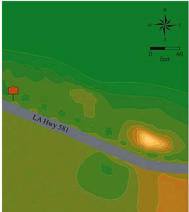
Julice Mound submitted by stonetracker on 13th Mar 2025. Site layout, courtesy of the "Indian Mounds of Northeast Louisiana" web site.
This was a single square platform mound, although it looks long and skinny on the north side of LA Hwy 581 today. A 1954 survey described it as 8 feet tall with a small platform on the summit, and noted that it had been impacted by Hwy 581 construction. Indeed, at least half of the mound was destroyed by road construction.
The interpretive sign is 100 yards west of the current mound in a flat area that is ...
(View photo, vote or add a comment)
Log Text: Like nearby Transylvania Mounds, parking is tricky here. I was unwilling to park a rental car near the interpretive sign in the adjacent historic cemetery as it would have involved crossing a ditch in who knows what condition. Your mileage may vary, but I was able to find a conveniently vacant property about 200 yds east near the jct of State Routes 581 and 881 and parked in the driveway. Then I walked 200 yds west down Route 581 to the site.
The mound literally abuts the highway as it was cut in half by road construction.
Kerbougnec Cromlech
Date Added: 1st Dec 2024
Site Type: Stone Circle
Country: France (Bretagne:Morbihan (56))
Visited: Yes on 1st Sep 2024. My rating: Condition 3 Ambience 4 Access 5
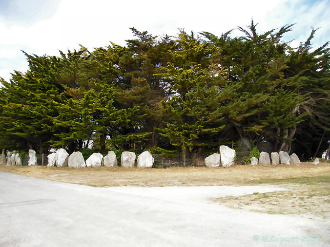
Kerbougnec Cromlech submitted by thecaptain on 12th Jun 2006. Found in amongst the houses of St-Pierre-Quiberon, this is nowadays a large semi circle of about 40 contiguous stones, average height about 1.8 metres.
(View photo, vote or add a comment)
Log Text: This cromlech is now an arc of about 40 large closely spaced standing stones that possibly was much larger once upon a time. However, the entire site is smack in the middle of the densely housed village of Kerbourgnec on the Quiberon Peninsula, so undoubtedly that has taken a toll on the original site.
Parking for me at least was a breeze, as empty spaces were available on Rue de Cromlech right next to the site. For the mobility impaired, this site can probably be viewed without having to leave the vehicle. The site itself is in a small public park.
Kerbourgnec Alignements
Date Added: 2nd Dec 2024
Site Type: Stone Row / Alignment
Country: France (Bretagne:Morbihan (56))
Visited: Yes on 1st Sep 2024. My rating: Ambience 5 Access 3

Kerbourgnec Alignements submitted by thecaptain on 12th Jun 2006. There seemed to me to be several very clear lines of rocks stretching out into the sea in parallel rows. I believe I could see at least seven rows of rocks from where I sat on the bottom of the steps down to the beach.
Fantastic!
(View photo, vote or add a comment)
Log Text: The beach where these sea-based rows were located is a short walk down an alley directly east from the St. Pierre Quiberon alignments.
Alas, timing is everything and the tide was simply too high to spot much, but the beach is very scenic. I've seen aerial views that certainly suggest there are multiple rows extending out into the ocean, plus they've been confirmed by sonar and other studies.
Kercado Tumulus
Date Added: 14th Oct 2024
Site Type: Chambered Tomb
Country: France (Bretagne:Morbihan (56))
Visited: Yes on 1st Sep 2024. My rating: Condition 4 Ambience 4 Access 3
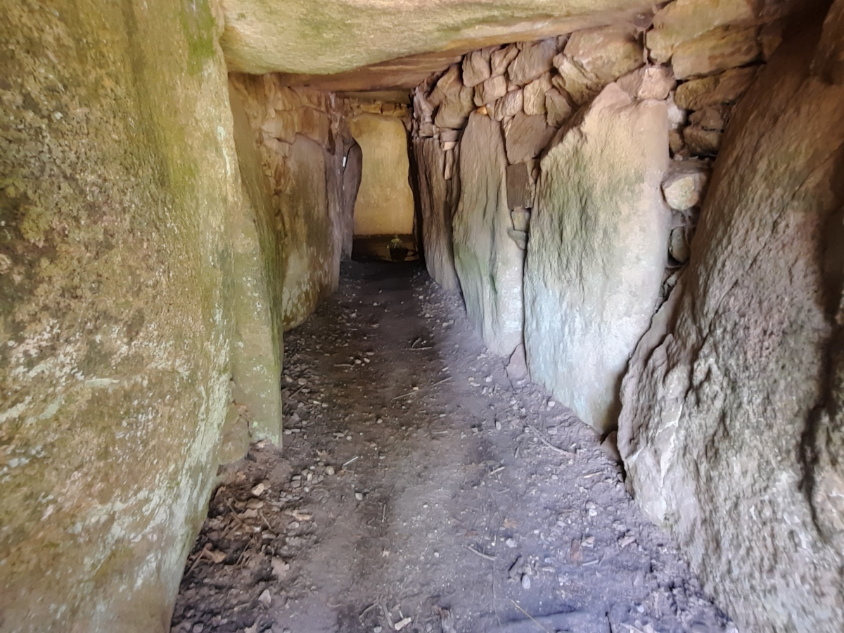
Kercado Tumulus submitted by johnstone on 3rd Oct 2022. Look through the passage towards the chamber on June 28, 2022
(View photo, vote or add a comment)
Log Text: Between the parking lots for the Manio and the Kerlescan alignments, a signposted private road leads south from the D196 about 1 km to a multi-road intersection and archway. There is a parking lot here on the left for the Kercado Tumulus. Across the road from the lot, there is a signpost directing walkers (pietons) west and south up the gravel road toward the site which is up on a hill next to a concrete water tower. Follow this gravel road for about 250 m. A much narrower signposted trail takes off to the left and leads slightly uphill to the tumulus.
Note: There was no honesty box or payment station that I could see, nor was I anywhere near a residence although the gravel road goes by some kind of building. No locked gate to go around either. I'm guessing the original way to the tumulus was altered recently to bypass all of that?
Kerlescan Alignements
Date Added: 12th Oct 2024
Site Type: Multiple Stone Rows / Avenue
Country: France (Bretagne:Morbihan (56))
Visited: Yes on 1st Sep 2024. My rating: Condition 4 Ambience 5 Access 4

Kerlescan Alignements submitted by thecaptain on 18th Oct 2004. Kerlescan Alignements, northeast of Carnac, Brittany.
This picture was taken looking east in 1987, when wandering amongst the stones was OK. I think many of them have been fenced off to try and combat erosion these days. I must go back sometime.
(View photo, vote or add a comment)
Log Text: I got lucky and was able to get close access to the alignments via an open gate next to D196. This was in September. One family was actually having a picnic next to one of the rows !
Car parking is available nearby in a public lot next to the equestrian center and there are trails from there leading to either the northern or southern side of the rows.
