Contributory members are able to log private notes and comments about each site
Sites Stonetracker has logged. View this log as a table or view the most recent logs from everyone
La Dame Du Manio
Date Added: 9th Oct 2024
Site Type: Standing Stone (Menhir)
Country: France (Bretagne:Morbihan (56))
Visited: Yes on 1st Sep 2024. My rating: Condition 4 Ambience 4 Access 4
La Dame Du Manio submitted by karolus on 24th Jun 2018. Site in Bretagne:Morbihan (56) France
(View photo, vote or add a comment)
Log Text: Located as described, about 20 m NW of the Pierre Carree along a narrow footpath
Tertre du Manio
Date Added: 10th Oct 2024
Site Type: Chambered Tomb
Country: France (Bretagne:Morbihan (56))
Visited: Yes on 1st Sep 2024
Tertre du Manio submitted by karolus on 9th Jan 2019. Le Manio 2 Menhir. The tumulus is much earlier than the alignments, which go right over it.
(View photo, vote or add a comment)
Log Text: I searched for this tertre at the location given and found nothing. The site is an unlikely one on a heavily wooded steep slope.
I could be wrong, but I suspect this record is in fact referring to Manio 1 (see Burl), a tertre that was overlaid later by the Kerloquet (Manio) alignments. The description here is nearly the same as that given in the Alignments of Kerloquet entry. Its coordinates are actually 47.60114, -3.05598.
Alignement de Kerloquet
Date Added: 10th Oct 2024
Site Type: Multiple Stone Rows / Avenue
Country: France (Bretagne:Morbihan (56))
Visited: Yes on 1st Sep 2024. My rating: Condition 4 Ambience 4 Access 3
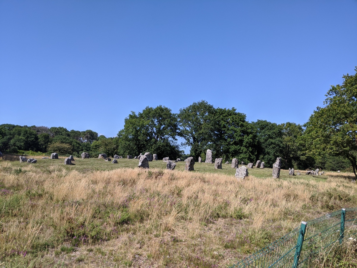
Alignement de Kerloquet submitted by aolson on 24th Jul 2020. The central groomed portion of the alignment
(View photo, vote or add a comment)
Log Text: Just west of the low wetland (formerly a reservoir), the Kermario alignments end on a bluff. They then seem to resume on the hill just east of the wetland as a much smaller separate site called the Kerloquet (or Manio) alignments. It's possible these alignments were unbroken and continuous in antiquity.
Parking is the same as that for the Manio Quadrilatere, right off D196. See that log for details. A trail heads up the hill and parallels the northern rows of the alignments.
Mané Bogad Dolmen
Date Added: 12th Dec 2024
Site Type: Burial Chamber or Dolmen
Country: France (Bretagne:Morbihan (56))
Visited: Yes on 1st Sep 2024. My rating: Condition 3 Ambience 4 Access 3
Mané Bogad dolmen submitted by krose on 5th Oct 2008. Mané Bogad
(View photo, vote or add a comment)
Log Text: This is a rather damaged passage grave within a visible mound with kerbstones. All of the cover stones are missing and the orthostats are short, but this is likely due to organic fill washing into the tomb over time.
The trickiest bit was finding the trail to it, as I was unable to find the one noted on the map. Parking is in a large dirt lot at the jct of D105 and Rte de Poul Hoh in Ploemel.
From the parking area, walk west on Poul Hoh about 200 m. The trail head is on a right of way squeezed in between private houses. There may or may not be a signpost. The site is up on a hill about 150 m north of the road.
Kerlescan cromlech
Date Added: 10th Oct 2024
Site Type: Stone Circle
Country: France (Bretagne:Morbihan (56))
Visited: Yes on 1st Sep 2024. My rating: Condition 3 Ambience 4 Access 3

Kerlescan cromlech submitted by LizH on 31st Oct 2007. The eastern stones of the western Kerlescan cromlech. The stones touch each other and face across (N-S) rather than being aligned E-W as the rows are.
(View photo, vote or add a comment)
Log Text: Kerlescan cromlech is probably the most intact of the main alignment cromlechs stretching from Menec through Kerlescan. Many of the stones on the south, west, and particularly the east sides are still in place. The northern stones are gone. Normally the area including the Kerlescan rows is fenced off in the summer, but I lucked out in Sept when I discovered later that one gate was open.
Even when closed, there are trails next to the equestrian center that get you close to stones on the western side and at various cleared spots along the fence there are vistas that allow photography of the other sides from a distance.
Car parking is available in a public lot next to the private equestrian center on the D196
Moustoir tumulus
Date Added: 12th Dec 2024
Site Type: Chambered Tomb
Country: France (Bretagne:Morbihan (56))
Visited: Yes on 1st Sep 2024. My rating: Condition 3 Ambience 4 Access 4

Moustoir tumulus submitted by thecaptain on 10th Jun 2006. This massive great mound, 90 metres in length, 40 metres wide and 8 metres high, can be found just to the south of the hamlet of Moustoir, a few kilometres to the north of Carnac.
It has become terribly overgrown.
(View photo, vote or add a comment)
Log Text: One of the huge Carnacean tumuli, with a semi-megalithic burial chamber on the western end and at least two burial cists between the mid-point and eastern end of the tumulus. Currently there is no public access to any of these interior features - they are all blocked.
The tumulus lies just southwest of the village of Moustoir, which itself is a short distance off the D186 on the Quatre Chemins road. There is a large dirt parking lot directly opposite the tumulus, which is no more than 100-200 m away.
Menhir du Moustoir
Date Added: 13th Dec 2024
Site Type: Standing Stone (Menhir)
Country: France (Bretagne:Morbihan (56))
Visited: Yes on 1st Sep 2024. My rating: Condition 4 Ambience 4 Access 4

Menhir du Moustoir submitted by thecaptain on 10th Jun 2006. The Moustoir tumulus has a small menhir on the top at the eastern end, and a larger one at the bottom of the western end.
The menhir at the western end is 3.3 metres high, quite thin and a nice pointed triangular shape.
(View photo, vote or add a comment)
Log Text: There are three menhirs near the Moustoir Tumulus. This is the western menhir in a small field across the dirt road which separates it from the western edge of the tumulus. See Moustoir Tumulus visitor's log for parking; it's the same for the menhir.
Menhir du tumulus du Moustoir
Date Added: 13th Dec 2024
Site Type: Standing Stone (Menhir)
Country: France (Bretagne:Morbihan (56))
Visited: Yes on 1st Sep 2024. My rating: Condition 4 Ambience 4 Access 3
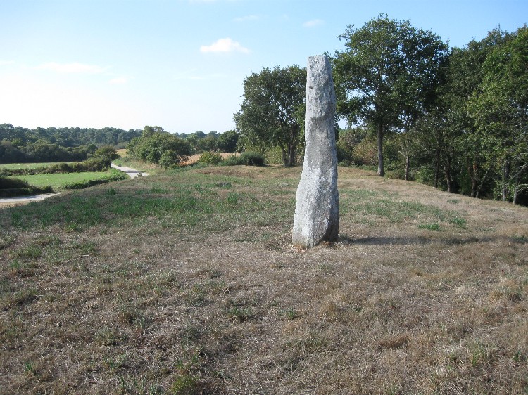
Menhir du tumulus du Moustoir submitted by DrewParsons on 7th Nov 2009. The menhir on the top of the tumulus
(View photo, vote or add a comment)
Log Text: There are three menhirs near the Moustoir Tumulus. This one is on top of the tumulus at its eastern end. It requires a very short but steep climb up the tumulus slope to access the top. Parking is the same as for the Moustoir Tumulus; see the visitor's log for that entry.
Note: This was the end of my Sept 2024 tour in the Carnac area. Hope to return to France in fall 2025, to visit sites in Finistere.
Crucuno Cromlech
Date Added: 13th Dec 2024
Site Type: Stone Circle
Country: France (Bretagne:Morbihan (56))
Visited: Yes on 1st Sep 2024. My rating: Condition 3 Ambience 5 Access 3
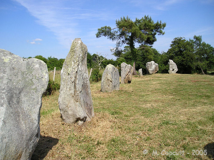
Crucuno cromlech submitted by thecaptain on 21st Dec 2007. There are 22 remaining stones, on average 2 metres in height, arranged in a rectangle measuring about 33 metres by 25 metres.
(View photo, vote or add a comment)
Log Text: This is a restored rectangular cromlech in good condition. It is not far from the much more frequented Crucuno Dolmen. If you want to lose the crowd, park near the dolmen and proceed down the dirt lane just to its left for 300-400 meters. Take the first trail to the right (avoid the residential abutters driveway!) and in another 100 m you will see a "Quadrilatere" sign on the right pointing out the short path to the site.
The area is quiet and secluded. There was no one there during my visit.
Kerlescan Alignements
Date Added: 12th Oct 2024
Site Type: Multiple Stone Rows / Avenue
Country: France (Bretagne:Morbihan (56))
Visited: Yes on 1st Sep 2024. My rating: Condition 4 Ambience 5 Access 4

Kerlescan Alignements submitted by thecaptain on 18th Oct 2004. Kerlescan Alignements, northeast of Carnac, Brittany.
This picture was taken looking east in 1987, when wandering amongst the stones was OK. I think many of them have been fenced off to try and combat erosion these days. I must go back sometime.
(View photo, vote or add a comment)
Log Text: I got lucky and was able to get close access to the alignments via an open gate next to D196. This was in September. One family was actually having a picnic next to one of the rows !
Car parking is available nearby in a public lot next to the equestrian center and there are trails from there leading to either the northern or southern side of the rows.
Kerlescan Tertre and menhir
Date Added: 12th Oct 2024
Site Type: Standing Stone (Menhir)
Country: France (Bretagne:Morbihan (56))
Visited: Yes on 1st Sep 2024. My rating: Condition 3 Ambience 4 Access 4
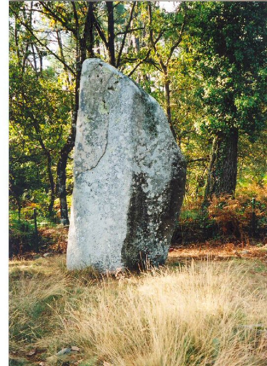
Kerlescan Tertre and menhir submitted by LizH on 31st Oct 2007. This stone stands at the west end of the Kerlescan rows, but to the north of them, at the western end of what was once a tumulus.
The small bear (Barnaby) at the bottom is from Hallbankgate school and is making a tour of pre-historic sites!
(View photo, vote or add a comment)
Log Text: This tertre and menhir are located in what would have been the NW corner of the main cromlech at Kerlescan. Normally this area is fenced off in summer, although you can still get quite close to these features along the fence line. Only later did I realize one of the gates was open, providing much closer access.
Car parking is available in a public lot next to the equestrian center off the D196. A trail leads around the horse stables to the site.
Kerlescan North Cromlech
Date Added: 13th Oct 2024
Site Type: Stone Circle
Country: France (Bretagne:Morbihan (56))
Visited: Yes on 1st Sep 2024. My rating: Condition 2 Ambience 3 Access 3
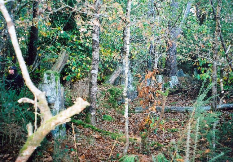
Kerlescan North Cromlech submitted by LizH on 31st Oct 2007. This shows some of the stones on what would be the western side of the cromlech, embedded in a more modern wall.
The trees and gorse are also visible. This was taken in one of the most open stretches of the wooded area, so not indicating how difficult it in fact was to see or move!
(View photo, vote or add a comment)
Log Text: This is the "other" cromlech at Kerlescan, about 100 m north of the Kerlescan tertre. Much seems to have changed since the photo by Lizh was posted. If you follow the fence line past the Kerlescan Tertre/Menhir, a very obvious wide trail eventually deviates off to the north into the wood. Trees have been cleared out quite a bit.
Soon you start seeing what look like obvious menhirs on the right side of the trail and roughly at the listed coordinates. However a much more recent embankment and stone wall was built and connects many of the taller stones. Is it what's left of this mysterious cromlech? With so little information to go on, it's hard to say but I'm guessing it is. If so, this is one side of it, and I didn't attempt a bushwhack to see if I could find anything else.
Car parking for this site is at a public lot next to the equestrian center. It's a fair trail walk from there to the site, maybe 0.7 km.
Kerlescan nord allée couverte
Date Added: 13th Oct 2024
Site Type: Passage Grave
Country: France (Bretagne:Morbihan (56))
Visited: Yes on 1st Sep 2024. My rating: Condition 2 Ambience 4 Access 2
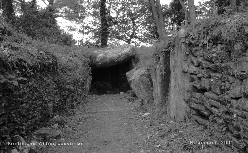
Kerlescan nord allée couverte submitted by Martin_L on 22nd Jan 2009. Inside the chamber.
(May 2001)
(View photo, vote or add a comment)
Log Text: At least for me, this was difficult to find, as there was no signposting and there was no obvious public parking nearby. I tried to shortcut it through a private field from a trail near the Kerlescan Tertre and was greeted with horses and no trespassing signs. Ultimately I parked near the equestrian center, walked along the southern side of the Kerlescan Alignments to nearly their end, took a left onto a road that looked like someone's driveway and then picked my way north through a maze of (private?) trails to the site. The whole thing wound up being about 1.5 km one way, so I got plenty of exercise. ;-) There may have been easier access points somewhere else...
Cutler Mound Group
Date Added: 27th Jul 2024
Site Type: Artificial Mound
Country: United States (Great Lakes Midwest)
Visited: Yes on 1st Jul 2024. My rating: Condition 3 Ambience 3 Access 4
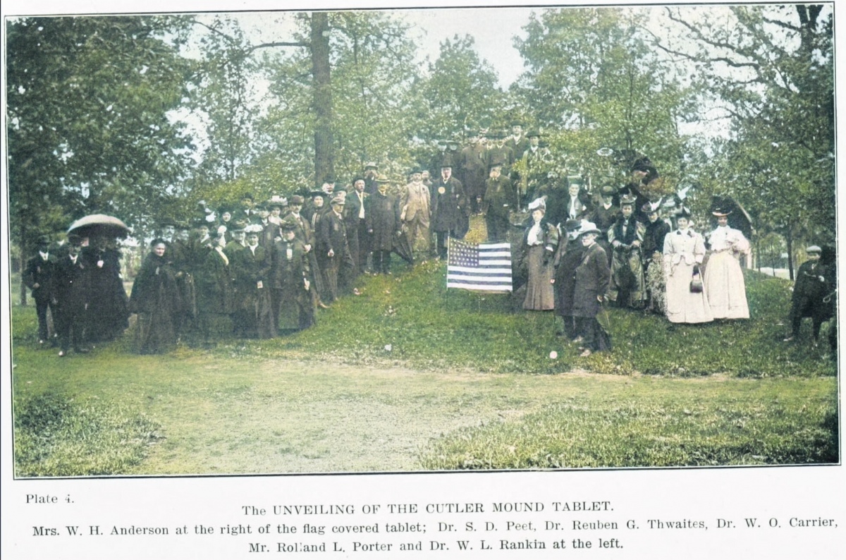
Cutler Mound Group submitted by AKFisher on 14th Oct 2023. Ceremony at the Cutler Mound where the Waukesha, Wisconsin Women's Club placed a bronze marker at the mound in 1906. The city had 55 mounds and the county had 411 mounds. Photo courtesy Dr Greg Little, author of the Illustrated Encyclopedia of Native American Indian Mounds & Earthworks (2016).
(View photo, vote or add a comment)
Log Text: Public parking is available in a lot next to the Waukesha Public Library near the corner of Maple and West Park Ave. The 3 mounds are maybe a 200 yd easy walk north over a manicured lawn area and obvious.
The site is as described, with a 7-8 foot high conical mound flanked by two smaller ones. Orange cones and "Keep Off" signs are in place to discourage people from walking on the mounds. Not aesthetic but needed in my opinion. The mounds are also covered with higher vegetation than the surrounding mowed lawn to prevent further erosion.
Effigy Mounds National Monument
Date Added: 27th Jul 2024
Site Type: Artificial Mound
Country: United States (The Plains)
Visited: Yes on 1st Jul 2024
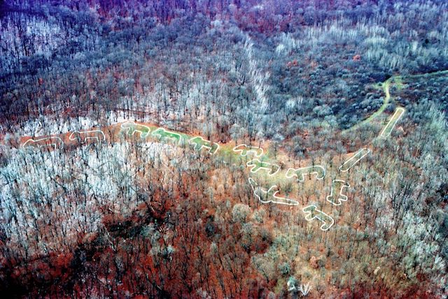
Effigy Mounds National Monument submitted by AKFisher on 26th Jul 2023. 1970s aerial photo of the Marching Bear Group at Effigy Mounds National Monument in Iowa. A group of college students outlined the effigy mounds with agricultural lime before the National Park Service took this photo. These are thought to have been made around AD 500.
(View photo, vote or add a comment)
Log Text: I visited in the heat of summer and opted not to attempt the steep climb to the mounds in the north or south unit of the park, but instead visited the park museum and tried some easier alternatives nearby.
There is a not very well known unit of the park called Sny Magill that contains over 100 effigy mounds and is located well south of the south unit. It is at the end of a gravel access road, accessed via a short trail from a boat ramp on the Mississippi. This site has the advantage of no climbing because it is located nearly at the level of the river. Unfortunately, the access road is prone to flooding and was closed that day. Will return at another time.
Wyalusing Mounds
Date Added: 28th Jul 2024
Site Type: Artificial Mound
Country: United States (Great Lakes Midwest)
Visited: Yes on 1st Jul 2024. My rating: Condition 3 Ambience 4 Access 3
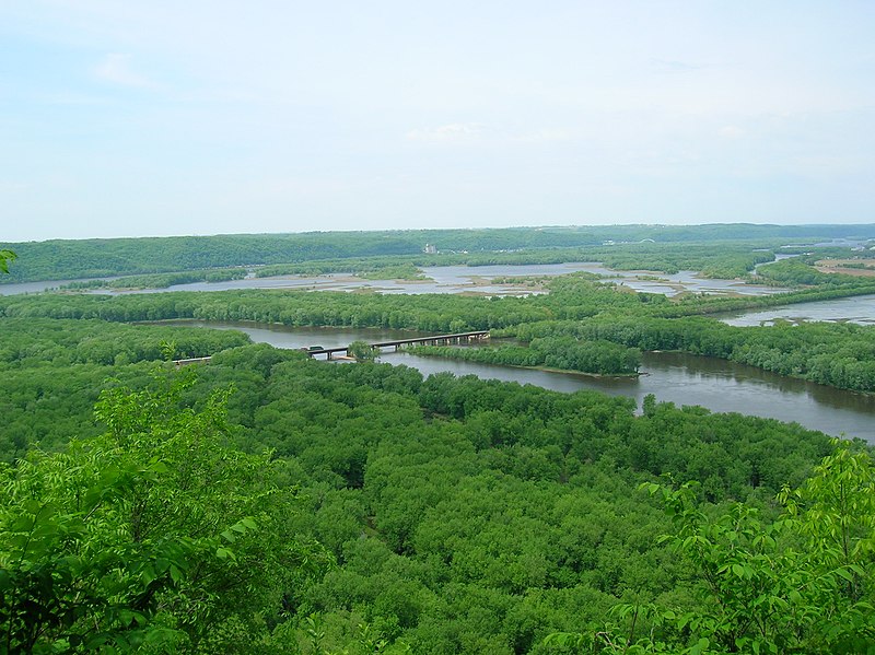
Wyalusing Mounds submitted by AKFisher on 9th Sep 2023. The Wisconsin River delta into the Mississippi River taken at Wyalusing State Park in Wisconsin. The Wisconsin flows from the near right to the Mississippi River. The Mississippi River flows from the right to the left. Iowa is visible in the distance on the other side of the Mississippi River, & Prairie du Chien is just out of view to the right. Photo credit: Wiki (Cindy-Flickr).
(View photo, vote or add a comment)
Log Text: There are 4-5 relatively accessible effigy mound groups according to the Wisconsin Mounds site. I was able to view several of them. As with most effigy mound sites, viewing conditions range from mowed and in good condition to either completely overgrown or eroded to the point of near invisibility. Even the best effigy mounds are difficult to photograph. I've provided some still shots or videos. Aerial LiDAR views frankly show these mounds better than any on the ground method so I hope to add those.
I was unable to access the Indoor Group Camp and Homestead Camp mound groups. They appear to require bushwhacks and both access points into the forest were occupied by campers.
Devil's Lake Mounds
Date Added: 29th Jul 2024
Site Type: Artificial Mound
Country: United States (Great Lakes Midwest)
Visited: Yes on 1st Jul 2024. My rating: Condition 3 Ambience 4 Access 4
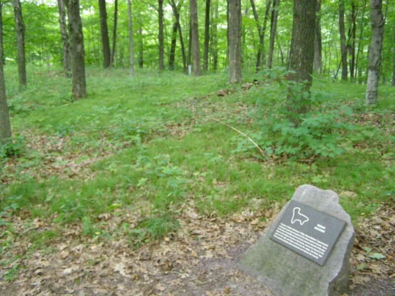
Devil''s Lake Mounds submitted by AKFisher on 3rd Sep 2023. Lynx Mound at Devil's Lake State Park, Wisconsin. Photo credit: Wiki (Chris Light).
(View photo, vote or add a comment)
Log Text: Wisconsin's largest state park is very popular, particularly in summer. There were plenty of visitors when I was there. Interesting geology, which I really didn't have time to explore.
As for the effigy mounds, most are well preserved with one or two exceptions and all were built during the Late Woodland period. There are four groups of them remaining, three on the North side of the lake and one single large bird effigy mound on the South end. All easy walk-in access and close to parking. See the official park map and the Wisconsin Mounds web site for locations.
Man Mound Park
Date Added: 30th Jul 2024
Site Type: Artificial Mound
Country: United States (Great Lakes Midwest)
Visited: Yes on 1st Jul 2024. My rating: Condition 2 Ambience 4 Access 4
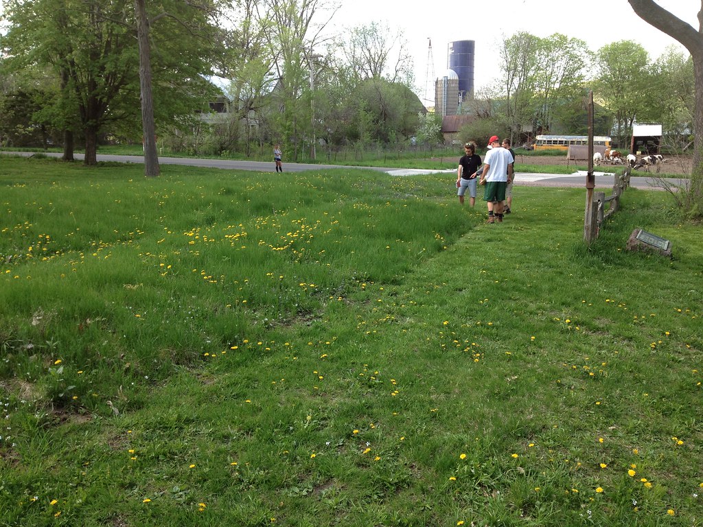
Man Mound Park submitted by Flickr on 26th May 2014. At Man Mound Park environmental geology students encountered another manifestation of the earlier Image copyright: stnorbert, hosted on Flickr and displayed under the terms of their API.
(View photo, vote or add a comment)
Log Text: The mound is almost impossible to photograph or video as it is very low profile and eroded. There are warning signs to stay off as they are trying to establish prairie grass growth on the mound and mow around it. Once it grows out a bit, the mound will become more obvious.
You can park nearly at the mound itself so access is not an issue.
Burrows Park Mound
Date Added: 31st Jul 2024
Site Type: Artificial Mound
Country: United States (Great Lakes Midwest)
Visited: Yes on 1st Jul 2024. My rating: Condition 3 Ambience 3 Access 4
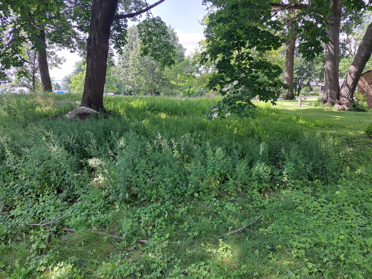
Burrows Park Mound submitted by stonetracker on 30th Jul 2024. As with all effigy mounds, they are hard to photograph. This is the bird's head looking towards the northern wing.
They have finally allowed native grasses to grow on top of the mound, which is good. However, there are still large trees right in the middle of the mound, which isn't so good.
(View photo, vote or add a comment)
Log Text: This is in a public park in Madison on the eastern shore of Lake Mendota. A large parking lot provides easy access and the effigy is situated a short walk up the bluff to the east.
Pikes Peak State Park Effigy Mounds
Date Added: 1st Aug 2024
Site Type: Artificial Mound
Country: United States (Great Lakes Midwest)
Visited: Yes on 1st Jul 2024. My rating: Condition 3 Ambience 4 Access 3
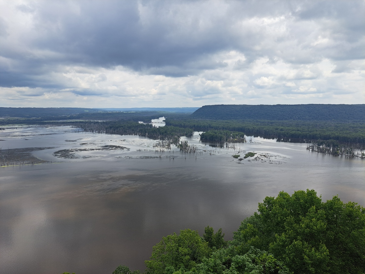
Pikes Peak State Park Effigy Mounds submitted by stonetracker on 31st Jul 2024. Closeup of the river confluence. The flat ridge to the right is the location of the Sentinel Ridge effigy mounds in Wyalusing State Park in Wisconsin.
(View photo, vote or add a comment)
Log Text: There are 5-6 clusters of effigy mounds scattered on ridges throughout the park.
Two of them are relatively short hikes from the main south entrance parking lot: Hickory Ridge (via Hickory Ridge Trail) and Deer Ridge (behind the campground or via the southern part of the Bridal Veil Trail). Additionally a bear mound and small conical are visible about 200 yds north of the park concession booth via a paved walkway. These are the only ones I was able to visit on this trip as the others are a longer hike.
Most of the mounds in the park are linear or conical. Unfortunately there is no official printed map showing mound locations. However, you can get a copy of a hand-marked map from the visitor center at Effigy Mounds NM.
