Contributory members are able to log private notes and comments about each site
Sites StoneTracker has logged. View this log as a table or view the most recent logs from everyone
Transylvania Mound
Date Added: 10th Mar 2025
Site Type: Artificial Mound
Country: United States (The South)
Visited: Saw from a distance on 1st Feb 2025. My rating: Condition 3 Ambience 3
submitted by on .
(View photo, vote or add a comment)
Log Text: This was originally a 12-mound site, but cultivation has completely leveled the smaller peripheral mounds. The site is now on a large private farm set well back from the road and only 5-6 mounds remain visible above the surface. The closest extant mound is about 500 ft south of LA State Highway 581 and the tallest mound is 1000 ft south of the roadway. As with many Louisiana mound sites, no dedicated parking is available so the only option is to pull off briefly on private field roads. There is one next to the interpretive sign for the site on Mound Rd. There are other field roads east and west of this location.
Mayersville Mounds
Date Added: 4th Mar 2025
Site Type: Artificial Mound
Country: United States (The South)
Visited: Saw from a distance on 1st Feb 2025. My rating: Condition 3 Ambience 2
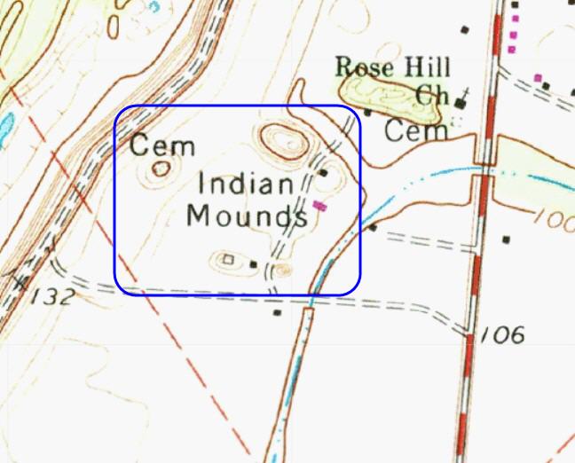
Mayersville Mounds submitted by stonetracker on 4th Mar 2025. Topo of the mound site. The five remaining mounds are all within the blue rectangle. The highest I believe is Mound A, although I have yet to see a map with mound IDs labeled.
(View photo, vote or add a comment)
Log Text: This site, a major Mississippian mound complex, was a disappointment due to access problems. It's all private roads to my knowledge, set well back from the main highway, and a number of the mounds are tree covered and obscured from a distance. The upshot is I didn't have time to knock on doors and get permission so maybe next time?
I did get a poor photo of what I think is the largest Mound A from the cemetery of a nearby church on State Route 1, which I'll post for what it's worth. The location coordinates given in the general description are for the same mound.
Refuge Mounds
Date Added: 3rd Mar 2025
Site Type: Artificial Mound
Country: United States (The South)
Visited: Saw from a distance on 1st Feb 2025. My rating: Condition 3 Ambience 4
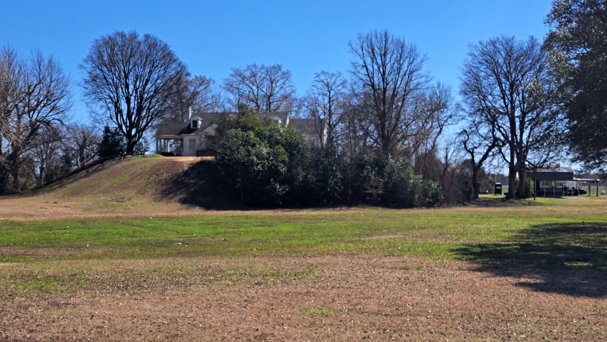
Refuge Mounds submitted by stonetracker on 2nd Mar 2025. The single remaining mound at Refuge, with a house on top.
(View photo, vote or add a comment)
Log Text: A much-studied Mississippian period mound site, but not on the official Mississippi Mound Trail. A house was built on the one remaining rectangular platform mound so the site is private. Unfortunately parking safely along busy Rte 454 is a challenge as there are no good pulloffs and a narrow shoulder. I found a somewhat wider section, parked there, and walked 100 yds to a point opposite the site for photos. The mound is 100-200 yds south of the modern road and close to the Mississippi River.
Magee Mounds
Date Added: 2nd Mar 2025
Site Type: Artificial Mound
Country: United States (The South)
Visited: Saw from a distance on 1st Feb 2025. My rating: Condition 3 Ambience 4
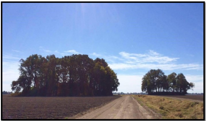
Magee Mounds submitted by stonetracker on 20th Nov 2023. 2014 photo from thesis author referenced in the site description. Mound A on the left, B on the right.
(View photo, vote or add a comment)
Log Text: These Mississippian mounds fall into the same category as a number of others that can only be viewed from long range, e.g. Metcalfe, Stoneville, Leland, and Mayersville. All are privately owned and on either agricultural land or large compounds set far back from the nearest public road. Unless permission is secured by the landowner, be prepared to shoot photos or videos from several 100 ft or more away. The best and closest viewing spot I found was on Furr Rd in Percy at approximately 33.09367, -90.85677 which lies about 800 ft north of the mound. There is a safe parking on a field road, where I captured most of the images. The two remaining mounds are on cultivated land and in good condition. The rest have been reduced to subsurface by cultivation.
Leland Mounds
Date Added: 2nd Mar 2025
Site Type: Artificial Mound
Country: United States (The South)
Visited: Saw from a distance on 1st Feb 2025. My rating: Condition 3 Ambience 4
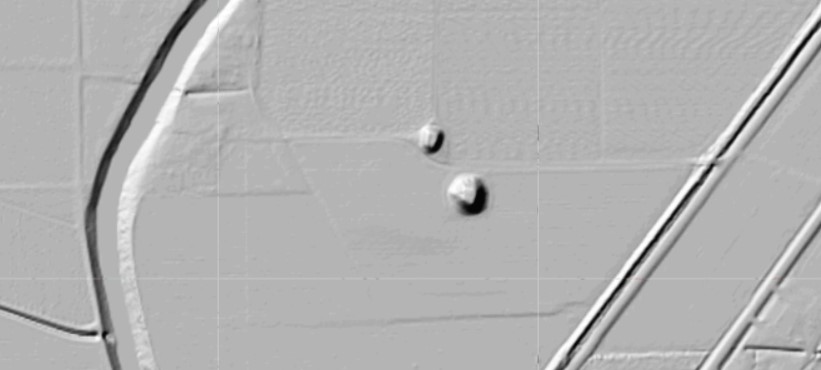
Leland Mounds submitted by stonetracker on 8th Dec 2023. Shaded relief map of same mounds shown in topo view.
(View photo, vote or add a comment)
Log Text: These Mississippian mounds fall into the same category as a number of others that can only be viewed from long range, e.g. Metcalfe, Stoneville, and Mayersville. All are privately owned and on either agricultural land or large compounds set far back from the nearest public road. Unless permission is secured by the landowner, be prepared to shoot photos or videos from several 100 ft or more away. The best and closest viewing spot I found was on Elizabeth Rd in Leland at approximately 33.41954, -90.88656 which lies about 1000 ft east of the mound. There is a safe parking shoulder near the landowner's driveway, where I captured most of the images. The two remaining mounds are on cultivated land and in good condition, particularly the largest (Mound A).
Metcalfe Mounds
Date Added: 2nd Mar 2025
Site Type: Artificial Mound
Country: United States (The South)
Visited: Saw from a distance on 1st Feb 2025. My rating: Condition 3 Ambience 3
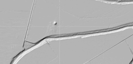
Metcalfe Mounds submitted by stonetracker on 7th Dec 2023. Shaded relief layer of same topo map. Mound is in the upper center of the map.
(View photo, vote or add a comment)
Log Text: This Mississippian mound falls into the same category as a number of others that can only be viewed from long range, e.g. Leland, Stoneville, and Mayersville. All are privately owned and on either agricultural land or large compounds set far back from the nearest public road. Unless permission is secured by the landowner, be prepared to shoot photos or videos from 1/4 to 1/2 mile away.
The best viewing spot I found was about at the midpoint of Metcalf Road which lies about 1000 ft west of the mound. There are no shoulders for safe parking so I had to park on a nearby field (dirt) road and walk about 100 ft.
The mound is on a farm just to the east of a large tan shed (see images). It is in good condition.
Stoneville Mounds
Date Added: 2nd Mar 2025
Site Type: Artificial Mound
Country: United States (The South)
Visited: Saw from a distance on 1st Feb 2025. My rating: Condition 3 Ambience 3

Stoneville Mounds submitted by stonetracker on 7th Dec 2023. Shaded relief layer of the topo showing the mound in the upper center.
(View photo, vote or add a comment)
Log Text: This Mississippian mound falls into the same category as a number of others that can only be viewed from long range, e.g. Leland, Stoneville, and Mayersville. All are privately owned and on either agricultural land or large compounds set far back from the nearest public road. Unless permission is secured by the landowner, be prepared to shoot photos or videos from several 100 ft or more away. The best viewing spot I found was about at the midpoint of Experiment Station Road which lies about 800 ft west of the mound. There are no shoulders for safe parking so I had to park on a nearby field (dirt) road and walk a short distance to a reasonable vantage point. The mound is on cultivated land and is in good condition.
Er Lannic
Date Added: 27th Nov 2024
Site Type: Stone Circle
Country: France (Bretagne:Morbihan (56))
Visited: Saw from a distance on 1st Sep 2024. My rating: Condition 2 Ambience 4
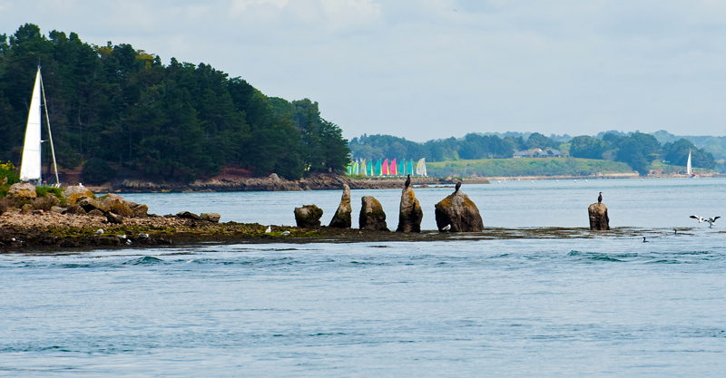
Er Lannic submitted by 43559959 on 15th May 2014. Er Lannic and it's birds.
(View photo, vote or add a comment)
Log Text: As noted by others, Er-Lannic is a bird sanctuary and access to the island is forbidden. I went on the combo trip that included the full Gavrinis tour and a boat circuit of Er-Lannic. However I quickly discovered the limits of a smartphone camera to take decent telephoto shots and most of the photos already here are far better than mine. I'll add a few, but pretty limited.
Commerce Mounds
Date Added: 25th Mar 2024
Site Type: Artificial Mound
Country: United States (The South)
Visited: Saw from a distance on 1st Feb 2024. My rating: Condition 3
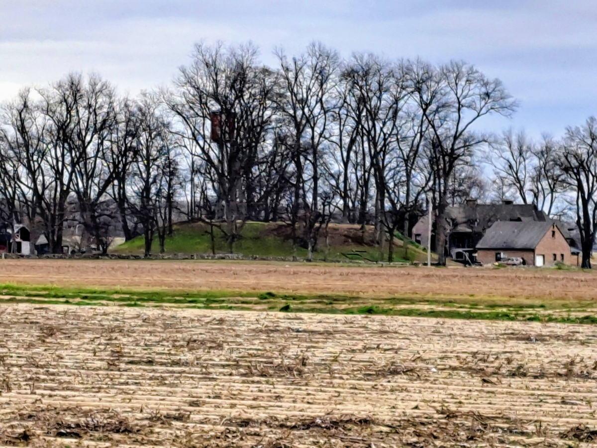
Commerce Mounds submitted by stonetracker on 8th Mar 2024. View of the one remaining large platform mound. Site is on private property, so the closest approach is about 1000 ft.
(View photo, vote or add a comment)
Log Text: This is on a large private farm with no close access and no safe on-street parking. There are private pkg lots across the main paved road about 1000 ft from the site where remote viewing is possible with some walking.
Richard's Bridge
Date Added: 19th Mar 2024
Site Type: Ancient Village or Settlement
Country: United States (The South)
Visited: Saw from a distance on 1st Feb 2024
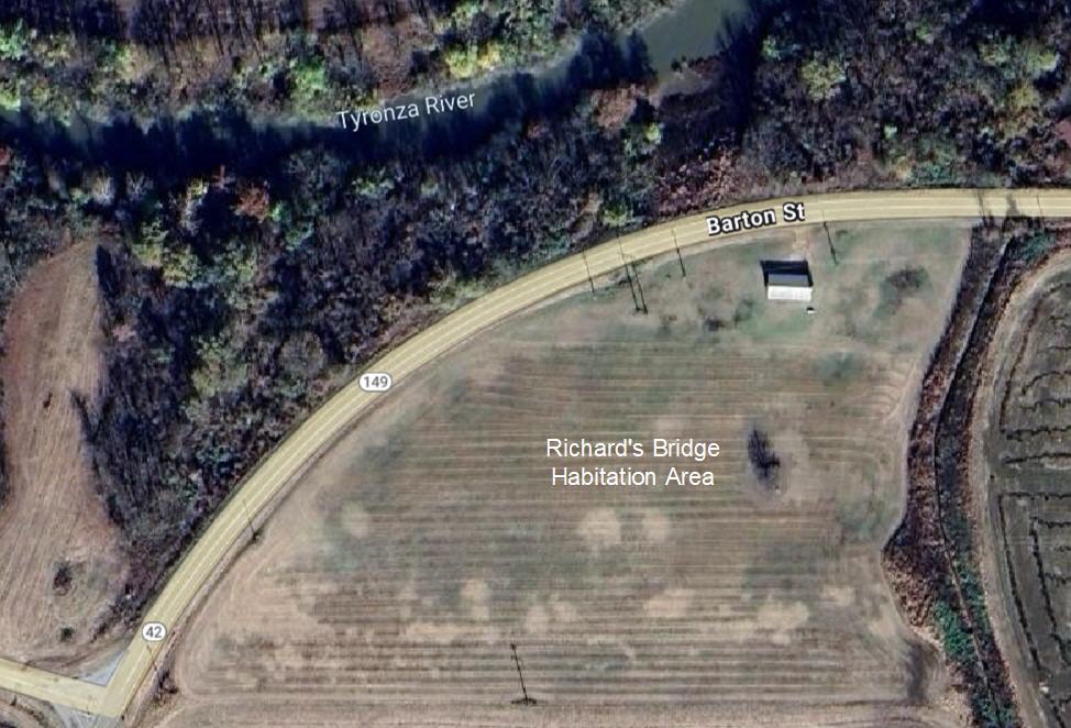
Richard's Bridge submitted by stonetracker on 19th Mar 2024. Aerial view of habitation site
(View photo, vote or add a comment)
Log Text: Saw from the road. The village is now in a cultivated field. The original mound was destroyed when the paved road was built.
Dunn Mounds
Date Added: 12th Mar 2024
Site Type: Artificial Mound
Country: United States (The South)
Visited: Saw from a distance on 1st Feb 2024. My rating: Condition 3 Ambience 3
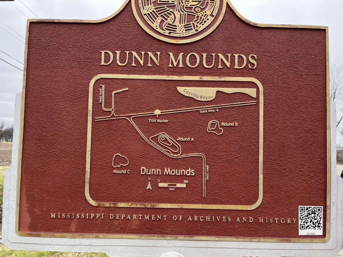
Dunn Mounds submitted by AKFisher on 10th Aug 2023. Dunn Mounds historical marker on site.
Photo courtesy Dr Greg Little, author of the Illustrated Encyclopedia of Native American Indian Mounds & Earthworks (2016).
(View photo, vote or add a comment)
Log Text: All of the mounds are on private residential property and farm land, so viewing is only possible from a distance. There is a parking pulloff next to the interpretive sign about 200 yds north of Mound A and considerably farther away from the other mounds.
Mound A is easily visible although quite overgrown, even in winter. A house sits on a very low rise which is presumably Mound B. I was unable to locate Mound C in the farm field.
Salomon Mounds
Date Added: 11th Mar 2024
Site Type: Artificial Mound
Country: United States (The South)
Visited: Saw from a distance on 1st Feb 2024. My rating: Condition 3 Ambience 3
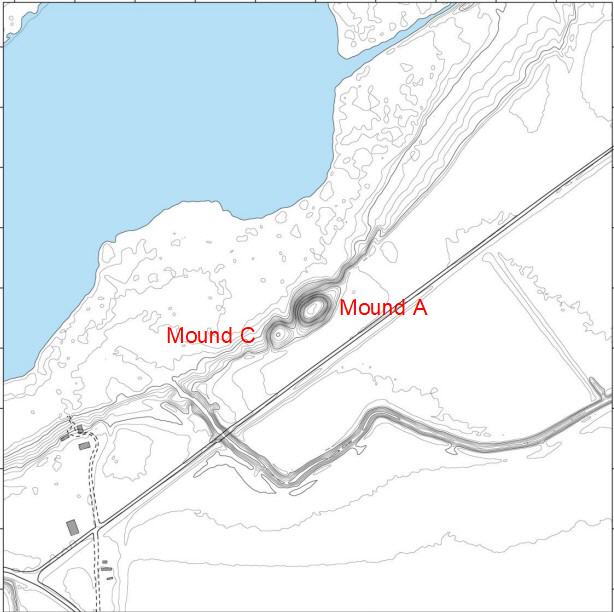
Salomon Mounds submitted by stonetracker on 11th Mar 2024. Contour map of site
(View photo, vote or add a comment)
Log Text: Site is mostly as described, in a private farm field. There is a parking pulloff and interpretive signage about 100-200 yds from Mound A, which is about as close as you can legally approach (No Trespassing signs make that clear!) . Mound C is just SW of Mound A. So close that past researchers have occasionally referred to it as a double-mound site.
Evansville Mounds
Date Added: 9th Mar 2024
Site Type: Artificial Mound
Country: United States (The South)
Visited: Saw from a distance on 1st Feb 2024. My rating: Condition 3 Ambience 3

Evansville Mounds submitted by stonetracker on 10th Mar 2024. My futile attempt to inconspicuously approach Mound B from the back, close enough for a photo. At the end my progress was thwarted by a nettle-infested bayou. There are some things we won't cross !
The mound is currently only 2-3 ft high. A nearly 100 year old abandoned schoolhouse sits on top.
(View photo, vote or add a comment)
Log Text: Parking pulloff is on Austin Rd, which is 200-300 yds north of Mounds A and B, although B is at the closer end of the range. Entire site is on private farm property so viewing is from a distance. Unobstructed view of A if you walk down the street 200 ft, but trees obscure B and require bushwhacking on private property to see even partially. I was unable to spot Mound C, if it indeed still exists. Interpretive sign is intact.
Bellows Falls Petroglyphs
Date Added: 16th Jul 2023
Site Type: Rock Art
Country: United States (New England)
Visited: Saw from a distance on 1st Aug 2022. My rating: Condition 4 Ambience 3 Access 2
Bellows Falls Petroglyphs submitted by trylondm on 21st Sep 2010. Closeup of one panel
(View photo, vote or add a comment)
Log Text: Saw at least one set of the markings from the bridge with binoculars. The yellow paint makes them easy to spot from high up. Took one look at the access from the outcrops and decided it was a bit too steep and rugged for my taste.
Mesa Verde - Pithouses and Pueblos
Date Added: 4th Sep 2025
Site Type: Ancient Village or Settlement
Country: United States (The Southwest)
Visited: Yes on 1st May 2025. My rating: Condition 3 Ambience 4 Access 4
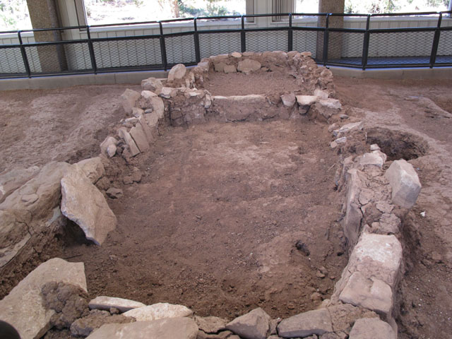
Mesa Verde - Pithouses and Pueblos submitted by jeffrep on 14th Nov 2012. Ruins of early pueblo.
(View photo, vote or add a comment)
Log Text: This is a stop on the Mesa Top loop drive that comprises two excavation sites. It explores the deevelopment of late Basketmaker pithouses into jacal dwellings and eventually into masonry room blocks with proto-kivas.
Access is via a parking pull-off and handicapped-accessible paved walkway.
Mesa Verde - Mesa Top Sites
Date Added: 1st Sep 2025
Site Type: Ancient Village or Settlement
Country: United States (The Southwest)
Visited: Yes on 1st May 2025. My rating: Condition 3 Ambience 5 Access 4
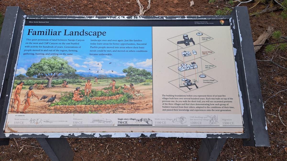
Mesa Verde - Mesa Top Sites submitted by stonetracker on 28th Aug 2025. Site interpretation showing the layers of each village
(View photo, vote or add a comment)
Log Text: One of the better outdoor exhibits at Mesa Verde describing how Ancestral Pueblo architectural styles evolved between 900 and 1075 CE on mesa top sites. This is a stop on the Mesa Top loop drive with a parking pull-off and handicapped-accessible paved walkway to the excavated sites with interpretation.
Mesa Verde - Sun Temple
Date Added: 12th Aug 2025
Site Type: Ancient Temple
Country: United States (The Southwest)
Visited: Yes on 1st May 2025. My rating: Condition 3 Ambience 4 Access 4
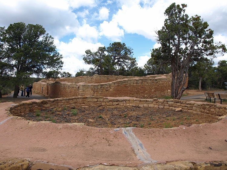
Mesa Verde - Sun Temple submitted by bat400 on 2nd Jun 2012. The eastern end of the Sun Temple. Photo taken over the separate associated round structure.
Photo by bat400, April 2012.
(View photo, vote or add a comment)
Log Text: This and one of the Cliff Palace overlooks are the last stops on the Mesa Top Loop drive. This structure is unique within Mesa Verde as far as I know and there are many theories as to its purpose. Unfortunately there is no access to the interior of the complex, so you have to stand on a ledge outside the wall to get any view at all of the inside. However, there is a standalone circular structure outside the main building that you can approach at close range. The mortar capping on the tops of the walls was done by the NPS, presumably as part of the preservation effort, and is not prehistoric.
There is a very large parking pulloff and the temple is no more than a 100 yd walk from there.
Mesa Verde - Oak Tree House
Date Added: 6th Aug 2025
Site Type: Ancient Village or Settlement
Country: United States (The Southwest)
Visited: Yes on 1st May 2025. My rating: Condition 3 Ambience 4
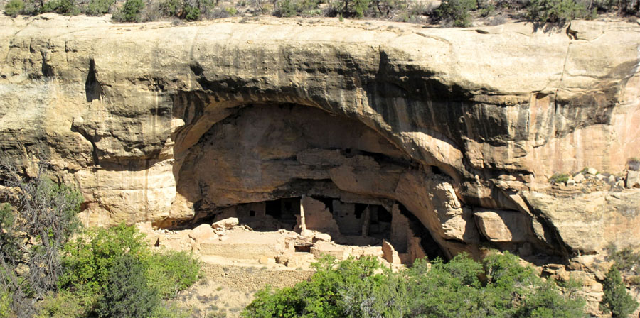
Mesa Verde - Oak Tree House submitted by jeffrep on 14th Nov 2012. Oak Tree House in Mesa Verde from across the canyon.
(View photo, vote or add a comment)
Log Text: I didn't actually visit the Oak Tree House site itself but viewed it remotely from the Oak Tree House View across the canyon. All of my images were captured from that overlook, which is a short walk from a paved parking pull-off on the Mesa Top Sites driving loop.
Sun Point Pueblo
Date Added: 6th Aug 2025
Site Type: Ancient Village or Settlement
Country: United States (The Southwest)
Visited: Yes on 1st May 2025. My rating: Condition 3 Ambience 4 Access 4
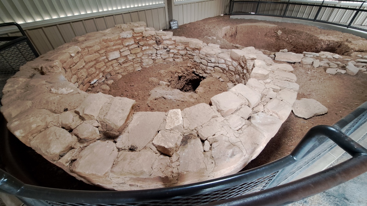
Sun Point Pueblo submitted by stonetracker on 6th Aug 2025. The tower in the foreground and the kiva behind it. Although there are varying theories, most experts feel that the hole in the floor of the tower is a tunnel connection to the kiva, purpose unknown.
(View photo, vote or add a comment)
Log Text: A late mesa-top Pueblo 2 small village site that was occupied for a short period of time before most of the inhabitants built and moved to the cliff dwellings. The remains of this site consist of a kiva and tower inside a metal shelter (for preservation). Foundations of the 30 or so room blocks surround the building.
Access is via a very short trail from a nearly parking pull-off on the Mesa Top Sites loop road.
Mesa Verde - Square Tower House
Date Added: 18th Jul 2025
Site Type: Ancient Village or Settlement
Country: United States (The Southwest)
Visited: Yes on 1st May 2025. My rating: Condition 3 Ambience 5 Access 4

Mesa Verde - Square Tower House submitted by DrewParsons on 18th Oct 2008. Detail of the Square Tower House site at Mesa Verde
(View photo, vote or add a comment)
Log Text: This is a cliff dwelling from the Ancestral Pueblo 3 period featuring the tallest tower structure still standing in the park. There are two ways to see the cliff dwelling. Remotely, from an overlook at the canyon rim. Or much closer, via periodically scheduled ranger-led hikes into the cliff dwelling complex itself. I opted for the overlook view, as they were just starting the guided tours (around the end of the first week in May in 2025).
Parking at the trailhead is available about 1/2 mile south of the Pithouse stop on the Mesa Top Loop road. The paved trail to the overlook is about 600 ft long and provides a nice view of the complex.
