Contributory members are able to log private notes and comments about each site
Sites SandyG has logged. View this log as a table or view the most recent logs from everyone
Craigneich Farm
Date Added: 11th Jan 2019
Site Type: Standing Stone (Menhir)
Country: Scotland (Perth and Kinross)
Visited: Yes on 5th May 2016. My rating: Condition 4 Ambience 4 Access 5
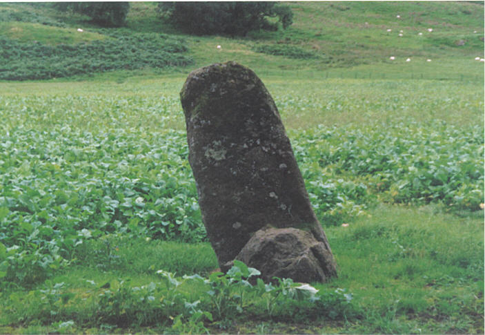
Craigneich Farm submitted by hamish on 26th Jul 2005. This stone is easily seen from the roadside.
(View photo, vote or add a comment)
Log Text: Parking is available at NN 79302 17844.
Craigneich Stones
Date Added: 11th Jan 2019
Site Type: Standing Stones
Country: Scotland (Perth and Kinross)
Visited: Yes on 5th May 2016. My rating: Condition 5 Ambience 4 Access 2
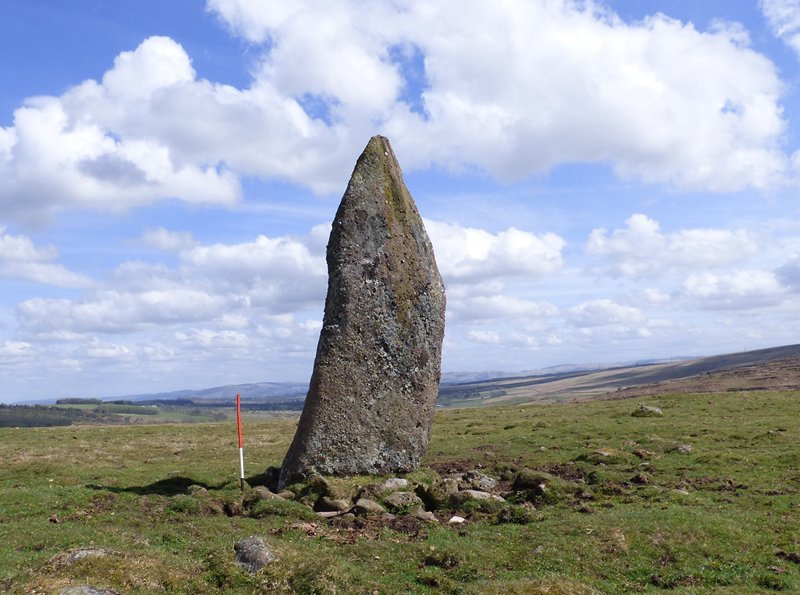
Craigneich Stones submitted by SandyG on 3rd Jan 2018. Stone A. This substantial stone does not form part of the alignment but is likely to have originally formed an integral part of this significant ritual landscape.
(View photo, vote or add a comment)
Log Text: Car parking is available at NN 78036 15154.
Creeg Tol
Date Added: 12th Feb 2020
Site Type: Rock Outcrop
Country: England (Cornwall)
Visited: Yes on 16th Sep 2019. My rating: Condition 5 Ambience 4 Access 4
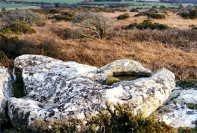
Creeg Tol basin submitted by AngieLake on 22nd Mar 2004. This is the Creeg Tol basin (not the Giant's Footprints - they are on a big stone to the right of this).
It struck me that this would be a very suitable ceremonial site, standing here, using the basin to anoint some leader (possibly?), who may have stood on the natural platform just underneath it, (lower right in pic) in sight of Boscawen Un, (top centre) and - looking down upon the tiny Creeg Tol "circle". (Out of sight, below right).
The whole setting has a strange atmosphere. I almost won...
(View photo, vote or add a comment)
Log Text: None
Creswell Crags
Date Added: 25th Feb 2015
Site Type: Cave or Rock Shelter
Country: England (Derbyshire)
Visited: Yes on 24th Feb 2015
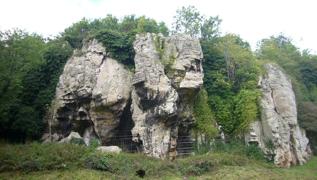
Creswell Crags submitted by SandyG on 24th Feb 2015. Dog Hole Cave (10th September 2008).
(View photo, vote or add a comment)
Log Text: None
Crois Chnoca Breaca
Date Added: 7th Feb 2019
Site Type: Standing Stone (Menhir)
Country: Scotland (South Uist)
Visited: Yes on 28th Aug 2015. My rating: Condition 4 Ambience 5 Access 4
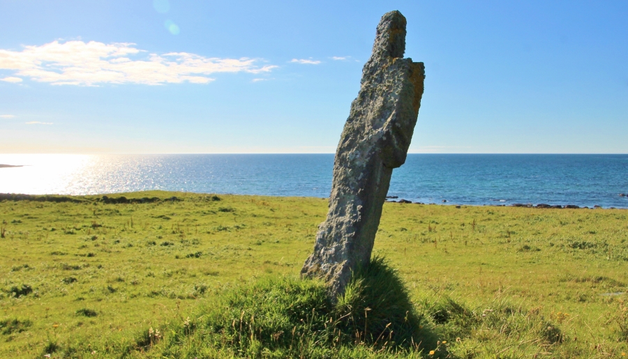
Crois Chnoca Breaca submitted by SumDoood on 15th Nov 2016. To the west.
(View photo, vote or add a comment)
Log Text: None
Crown End Alignment and Cross Dyke
Date Added: 8th Jan 2018
Site Type: Stone Row / Alignment
Country: England (Yorkshire (North))
Visited: Yes on 19th Sep 2017. My rating: Condition 3 Ambience 4 Access 4
Crown End Alignment and Cross Dyke submitted by johndhunter on 11th Oct 2017. This view was taken towards the end of the alignment where it runs down towards Baysdale Beck looking back up the Rigg. Photo taken in June 2013
(View photo, vote or add a comment)
Log Text: The nearest car parking is available at NZ 65234 07401. From here follow the road up the steep hill to NZ 65753 06988 and then follow the track to the row.
There is a slight chance that this represents the marking out for a cross dyke, but the fact that only a very short length of ditch survives means that it is much more likely to represent a stone row.
Cubbie Roo's Burden
Date Added: 10th Feb 2019
Site Type: Chambered Cairn
Country: Scotland (Orkney)
Visited: Yes on 3rd Jun 2015. My rating: Condition 3 Ambience 4 Access 4
Cubbie Roo's Burden submitted by SandyG on 18th Aug 2015. View from the south. Shame about the electric pole (3rd June 2015).
(View photo, vote or add a comment)
Log Text: None
Culbone Hill
Date Added: 17th Jan 2019
Site Type: Stone Row / Alignment
Country: England (Somerset)
Visited: Yes on 25th Apr 2018. My rating: Condition 3 Ambience 2 Access 5
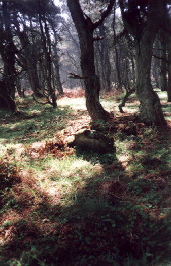
Culbone Hill submitted by TimPrevett on 5th Jul 2002. Culbone Hill Stone Row
SS832473
Date Visited Sunday 7th May 2000
Due to the explicit request not to go off the path, I did not get much evidence of the stone row. This was maddeningly frustrating, given its imminent proximity! However, having studied the map, I went back to where the car was parked, turned left further up the track, and then left up another track, where it intersects the stone row (fenced off with barbed wire). Two stones were just visible to my left through the dense ov...
(View photo, vote or add a comment)
Log Text: Limited car parking is available at SS 83350 47223. Access to the row itself is not currently freely available although the nearby Culbone Stone can be visited and at least two stones are visible from the permitted path that leads across the eastern length of the row.
Culbone Stone
Date Added: 17th Jan 2019
Site Type: Early Christian Sculptured Stone
Country: England (Somerset)
Visited: Yes on 25th Apr 2018. My rating: Condition 4 Ambience 4 Access 4
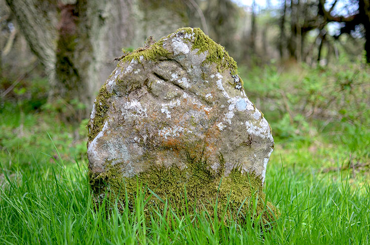
Culbone Stone submitted by PhilipGlastonbury on 23rd May 2013. Culbone Stone took ages to find, but it was worth it. The wood has an odd atmosphere, and the stone - when you eventually find it - seems to be waiting for you.
(View photo, vote or add a comment)
Log Text: Limited car parking is available at SS 83350 47223.
Cullerlie
Date Added: 30th Jan 2019
Site Type: Stone Circle
Country: Scotland (Aberdeenshire)
Visited: Yes on 14th Sep 2014. My rating: Condition 5 Ambience 4 Access 5
Cullerlie submitted by SandyG on 19th Sep 2014. View from above and north east.
(View photo, vote or add a comment)
Log Text: None
Culsh
Date Added: 30th Jan 2019
Site Type: Souterrain (Fogou, Earth House)
Country: Scotland (Aberdeenshire)
Visited: Yes on 10th Nov 2013. My rating: Condition 5 Ambience 2 Access 5
Culsh submitted by SandyG on 27th Dec 2014. The souterrain entrance in around 1977.
(View photo, vote or add a comment)
Log Text: None
Cut Hill Cairn
Date Added: 24th Jan 2019
Site Type: Cairn
Country: England (Devon)
Visited: Yes on 6th May 2018. My rating: Condition 4 Ambience 5 Access 1
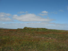
Cut Hill Cairn submitted by Anne T on 20th Sep 2016. This cairn, at SX 59823 82745, marks the south terminal of the stone row.
Picture courtesy of Prehistoric Dartmoor Walks: "Barrow c20m overall diameter on the top of 'Cut Hill' at 603m OD was observed during a field visit by Tom Greeves in 2004. The 1.5m high circular mound has a military range pole set in it & surface erosion has exposed a turf/peat core with a few stones. The surrounding ditch is over 1m wide & nearly filled with waterlogged vegetation."
(View photo, vote or add a comment)
Log Text: None
Cut Hill Stone Row
Date Added: 24th Jan 2019
Site Type: Stone Row / Alignment
Country: England (Devon)
Visited: Yes on 6th May 2018. My rating: Condition 2 Ambience 5 Access 1
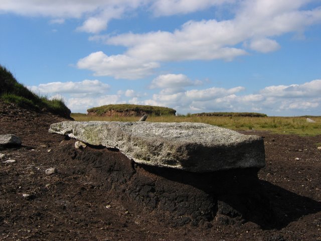
Cut Hill Stone Row submitted by Andy B on 10th Apr 2010. Granite Stone Row
Here is the roof of Dartmoor, from the top you can see right all across Dartmoor. In the picture is a piece of granite probably Megalithic in age and is in a series of stones running along the top of this hill. This row is unique within Dartmoor as it the only one with equal spacing within the row and above 600m, 100m above any other row in Dartmoor. The peat has washed away from around the stone but not from underneath, meaning the granite sticks out above the ground.
C...
(View photo, vote or add a comment)
Log Text: This is not an easy row to get to. It lies within the Okehampton Range and it is only possible to visit when live firing is not taking place. Details of firing times are available online. Access is difficult which ever direction it is approached from. After much thought, I decided that the south looked best. Car parking is available at Postbridge (SX 64667 78839). From here take the footpath leading north to SX 63444 79743. From here continue following the path to SX 62823 80230 and then along the western side of the East Dart River to SX 60837 82087. Follow the line of poles that separate the Okehampton and Merrivale Ranges to SX 59748 82645 then walk north to the row which is at the top of the hill. Allow a whole day and make sure you have map. My journey was eventful. At one point three sky larks attacked a cuckoo, another sky lark collided with me when being chased by a kestrel which then hovered for a few seconds within arms reach, in the middle of nowhere a group of people were partaking in what looked like a delicious cream tea and I was joined for part of the journey by a couple who made the final ascent pass without the expected pain.
Cuween Hill
Date Added: 10th Feb 2019
Site Type: Chambered Cairn
Country: Scotland (Orkney)
Visited: Yes on 2nd Jun 2015. My rating: Condition 5 Ambience 5 Access 4
Cuween Hill submitted by SandyG on 19th Aug 2015. View from the east of the well trodden path leading up to the cairn. (2nd June 2015).
(View photo, vote or add a comment)
Log Text: None
Dervaig centre
Date Added: 10th Jan 2019
Site Type: Stone Row / Alignment
Country: Scotland (Isle of Mull)
Visited: Yes on 4th Jun 2016. My rating: Condition 3 Ambience 4 Access 4
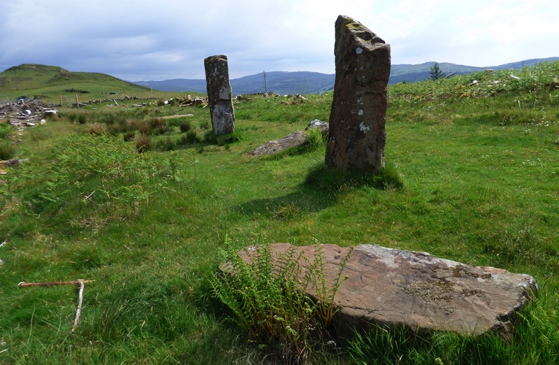
Dervaig centre submitted by SandyG on 27th Feb 2017. Looking south along the row. 4 June 2016.
(View photo, vote or add a comment)
Log Text: Car parking is available nearby at NM 43994 51847. The row is clearly visible from the car park. The car park is not suitable for high vehicles.
Dervaig SSE
Date Added: 10th Jan 2019
Site Type: Stone Row / Alignment
Country: Scotland (Isle of Mull)
Visited: Yes on 4th Jun 2016. My rating: Condition 3 Ambience 4 Access 4
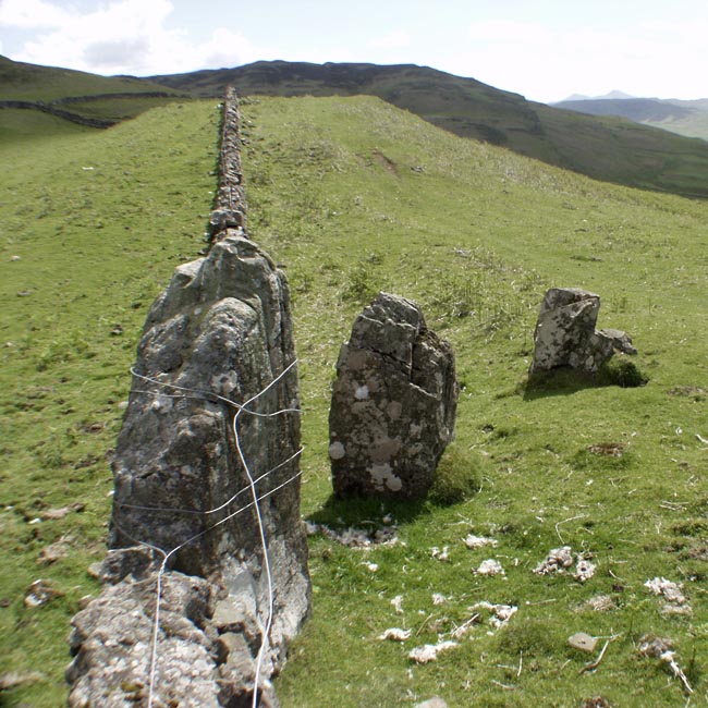
Dervaig SSE submitted by Tom_Bullock on 27th Feb 2005. Photo used by kind permission of Tom Bullock. More details of this location are to be found on his Stone Circles and Rows CD-ROM.
(View photo, vote or add a comment)
Log Text: Limited car parking is available at NM 43989 51626. The row is clearly visible from the parking area.
Devil's Arrows
Date Added: 13th Jan 2019
Site Type: Stone Row / Alignment
Country: England (Yorkshire (North))
Visited: Yes on 1st Aug 2017. My rating: Condition 4 Ambience 3 Access 5

Devil's Arrows submitted by Sunny100 on 30th Apr 2011. Old b/w image of 'The Devil's Arrows stone row, north Yorkshire, showing the almost true alignement.
These Bronze-Age menhirs vary in height from between 16 to 22 feet and are heavily grooved with centuries of erosion.
(View photo, vote or add a comment)
Log Text: There is limited safe parking in the vicinity of the monument.
Diarmid's Grave
Date Added: 16th Feb 2020
Site Type: Cairn
Country: Scotland (Argyll)
Visited: Yes on 13th Mar 2017. My rating: Condition 4 Ambience 3 Access 5
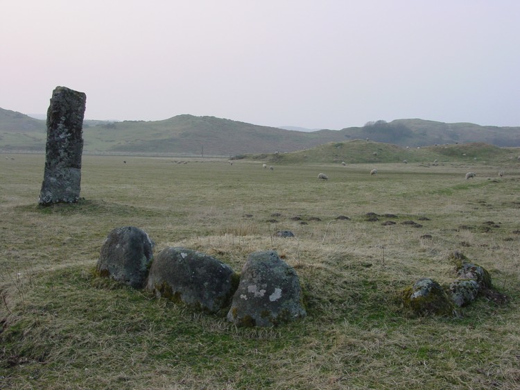
Diarmid's Grave submitted by PaulH on 1st May 2003. A kerb cairn near Strontoiller
Farm to the east of Oban with the standing stone of Clach na Carraig in the background.
(View photo, vote or add a comment)
Log Text: None
Dickmount Law
Date Added: 31st Jan 2019
Site Type: Cairn
Country: Scotland (Angus)
Visited: Yes on 1st Jan 1976. My rating: Condition 3 Ambience 4 Access 4
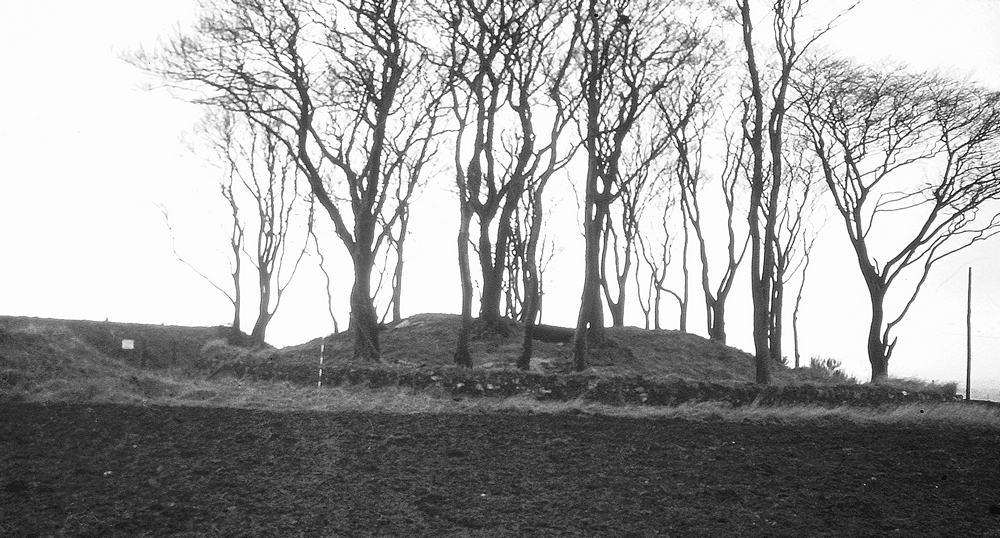
Dickmount Law submitted by SandyG on 31st Jan 2019. View from the north east. Photograph taken in around 1976.
(View photo, vote or add a comment)
Log Text: None
Dirlot (North)
Date Added: 13th Sep 2016
Site Type: Multiple Stone Rows / Avenue
Country: Scotland (Highlands)
Visited: Yes on 4th Sep 2016. My rating: Condition 3 Ambience 4 Access 3
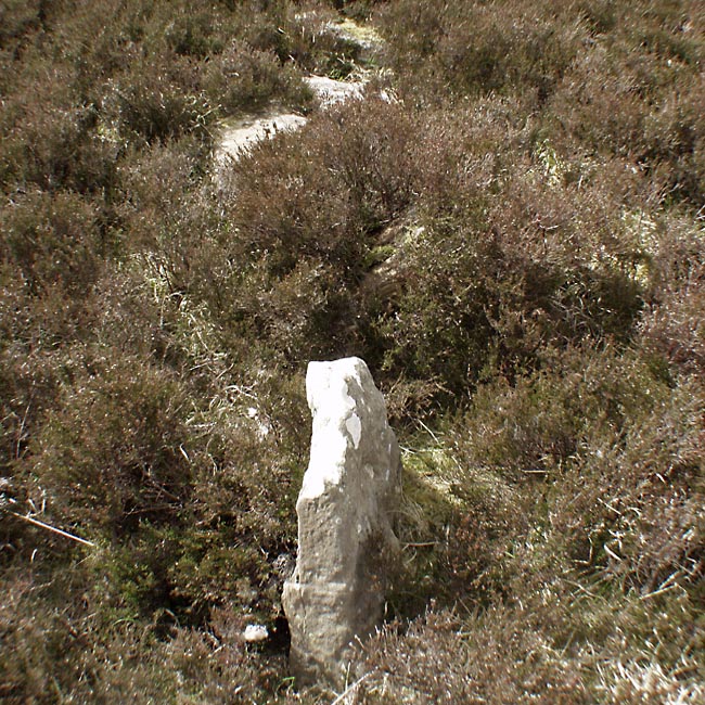
Dirlot (North) submitted by Tom_Bullock on 6th Feb 2005. Photo used by kind permission of Tom Bullock. More details of this location are to be found on his Stone Circles and Rows CD-ROM
(View photo, vote or add a comment)
Log Text: Take wellingtons with you. Very boggy.
