Contributory members are able to log private notes and comments about each site
Sites Richard13 has logged. View this log as a table or view the most recent logs from everyone
Knowlton Rings
Date Added: 11th Mar 2021
Site Type: Henge
Country: England (Dorset)
Visited: Yes on 28th Sep 2020. My rating: Condition 3 Ambience 4 Access 5
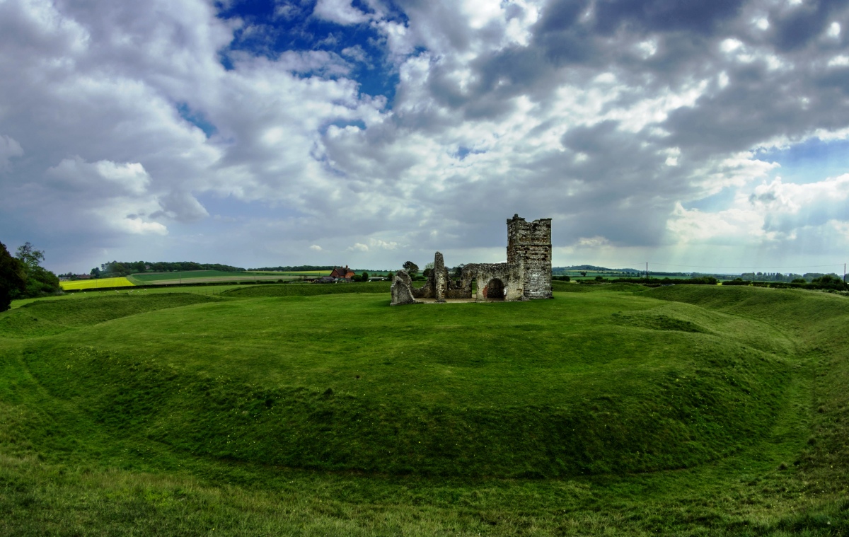
Knowlton Rings submitted by Humbucker on 19th Oct 2019. Knowlton Rings with the ruined Norman church at the centre.
(View photo, vote or add a comment)
Log Text: A quite remarkable site with an atmosphere and ambience of its own. The presence of the church within the Henge gives a stark illustration of the efforts made to christianise ancient sites. Yet now the church itself stands in ruins and the neolithic still seems to overshadow the Norman era here. A fascinating and thought-provoking place!
The Hurlers Pipers
Date Added: 21st Feb 2021
Site Type: Standing Stones
Country: England (Cornwall)
Visited: Yes on 1st Jul 2018. My rating: Condition 4 Ambience 4 Access 4
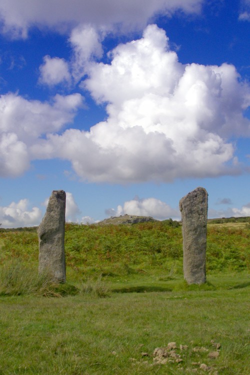
The Hurlers Pipers submitted by JimChampion on 24th Aug 2007. View through the 'goalposts' of the Pipers, neatly framing Stowe's Hill in the distance (home of the Cheesewring natural rock feature and the neolithic enclosure of Stowe's Pound). These two stones stand to the west of the Hurlers stone circles. The dung in the foreground is from the ponies that graze the moor.
(View photo, vote or add a comment)
Log Text: None
Minions Mound
Date Added: 21st Feb 2021
Site Type: Round Barrow(s)
Country: England (Cornwall)
Visited: Yes on 1st Jul 2018. My rating: Condition 2 Ambience 3 Access 5
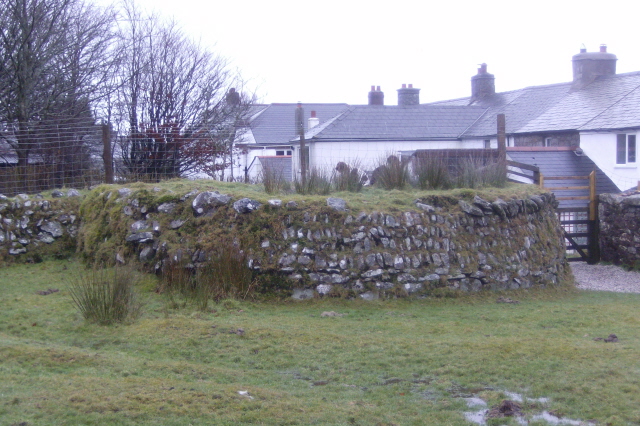
Minions Mound submitted by windowman on 21st Jan 2012. Minions Mound, a bronze age cairn that is situated by the car park for the Hurlers stone circle site. Easy to miss, many if not all the visitors to the car park are probably unaware just what this small mound is. The mound was damaged when the walls for the adjacent cottages were built, and half the mound was cut away, forming a 'D' shape. The cairn gave it's name to the village of Minions, which was previously called Cheewring Railway, a major junction point for the original Liskeard and Carad...
(View photo, vote or add a comment)
Log Text: None
The Hurlers (N)
Date Added: 21st Feb 2021
Site Type: Stone Circle
Country: England (Cornwall)
Visited: Yes on 1st Jul 2018. My rating: Condition 3 Ambience 4 Access 4
The Hurlers (N) submitted by hoya105 on 23rd Jul 2019. the northernmost stones..
(View photo, vote or add a comment)
Log Text: None
The Hurlers (S)
Date Added: 21st Feb 2021
Site Type: Stone Circle
Country: England (Cornwall)
Visited: Yes on 1st Jul 2018. My rating: Condition 3 Ambience 4 Access 4
The Hurlers (S) submitted by threlkeld on 21st May 2020. The Hurlers Central & North from the Hurlers South.
(View photo, vote or add a comment)
Log Text: None
The Hurlers
Date Added: 21st Feb 2021
Site Type: Stone Circle
Country: England (Cornwall)
Visited: Yes on 1st Jul 2018. My rating: Condition 3 Ambience 4 Access 4
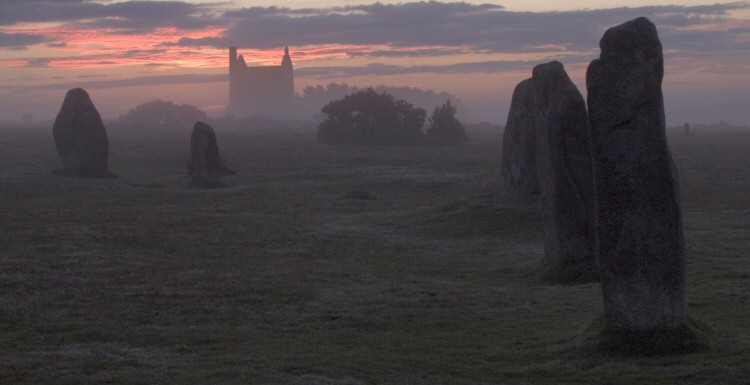
The Hurlers submitted by wayland on 10th Sep 2004. Middle-earth Gallery
Fog on the Barrow-Downs.
Fellowship of the Ring Book One Chapter VIII
Three stone circles almost in the shadow of two tin mines.
(View photo, vote or add a comment)
Log Text: None
Knowlton Great Barrow
Date Added: 18th Feb 2021
Site Type: Round Barrow(s)
Country: England (Dorset)
Visited: Saw from a distance on 28th Sep 2020. My rating: Condition 3 Ambience 3 Access 3

Knowlton Great Barrow submitted by JimChampion on 3rd Apr 2008. The Great Barrow viewed from within the Central Circle (the "Church Henge"), looking east through one of the entrances.
(View photo, vote or add a comment)
Log Text: None
Balliscate
Date Added: 18th Feb 2021
Site Type: Stone Row / Alignment
Country: Scotland (Isle of Mull)
Visited: Yes on 1st Aug 2008. My rating: Condition 3 Ambience 4 Access 3
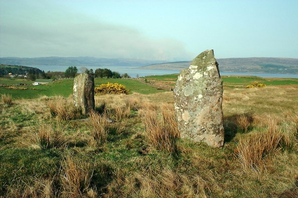
Balliscate submitted by Nick on 2nd Nov 2003. Isle of Mull
NM499541
Park at the Mull Pottery and take the track just north of the buildings which leads west up-hill. The stones are around 400m in, on a raised platform. There are 3 stones here, the centre one being recumbent. The northern stone is the larger, being just over 2.5m in height. The row runs roughly N-S, and the southern stone is well under 2m. The central recumbent stone looks as if it would have been the largest, it's around 3m long in its current position.
This is a p...
(View photo, vote or add a comment)
Log Text: None
Dervaig SSE
Date Added: 18th Feb 2021
Site Type: Stone Row / Alignment
Country: Scotland (Isle of Mull)
Visited: Yes on 1st Aug 2008. My rating: Condition 3 Ambience 3 Access 4
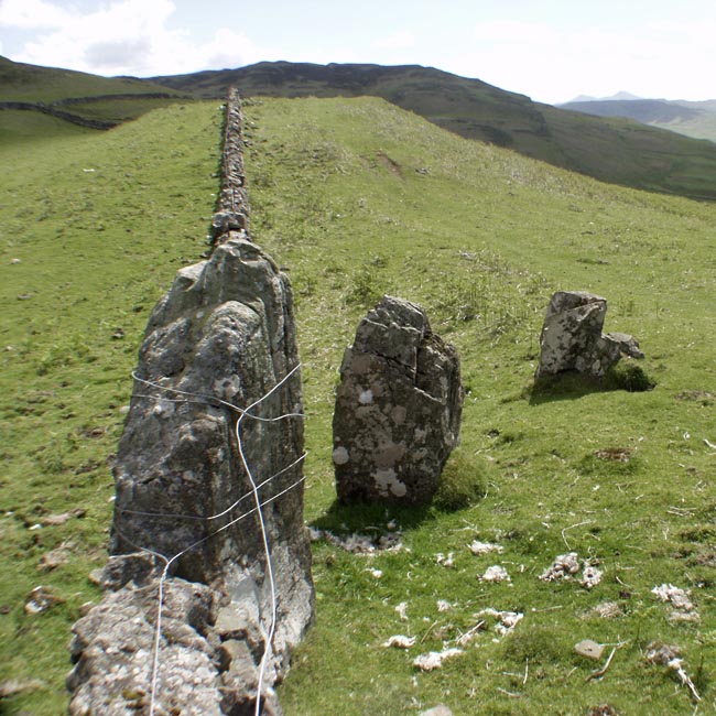
Dervaig SSE submitted by Tom_Bullock on 27th Feb 2005. Photo used by kind permission of Tom Bullock. More details of this location are to be found on his Stone Circles and Rows CD-ROM.
(View photo, vote or add a comment)
Log Text: None
Machrie Moor 10
Date Added: 18th Feb 2021
Site Type: Stone Circle
Country: Scotland (Isle of Arran)
Visited: Yes on 1st Oct 2005. My rating: Condition 3 Ambience 4 Access 3
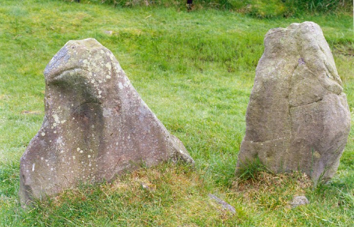
Machrie Moor 10 submitted by AngieLake on 8th Sep 2008. Stones at the SW of the Moss Farm Road (or Machrie Moor 10) circle. The stone on the left resembles the head and shoulders of a hooded person. It faces into the circle, and towards the NE and Midsummer sunrise. There's a dip in the hills at NE, and my ritual movement dowsing headed out of the circle in that direction. Its inner face also seems to have a circular carving.
(View photo, vote or add a comment)
Log Text: None
South Yarrows Chambered Cairn
Date Added: 18th Feb 2021
Site Type: Chambered Cairn
Country: Scotland (Caithness)
Visited: Yes on 1st Aug 2007. My rating: Condition 2 Ambience 3 Access 3
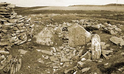
South Yarrows Chambered Cairn submitted by howe on 11th Jun 2009. South Yarrows S North Cairn. View of the terminal chamber from the rear showing the remaining uprights of the stalled arrangement.
(View photo, vote or add a comment)
Log Text: None
South Yarrows Long Cairn
Date Added: 18th Feb 2021
Site Type: Chambered Cairn
Country: Scotland (Caithness)
Visited: Yes on 1st Aug 2007. My rating: Condition 3 Ambience 4 Access 3
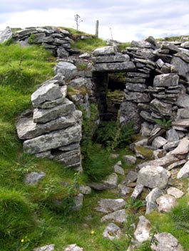
South Yarrows Long Cairn submitted by howe on 11th Jun 2009. South Yarrows S south cairn. View of the entrance to the east chamber. Some of the walling is a more modern addition.
(View photo, vote or add a comment)
Log Text: None
South Yarrows Broch
Date Added: 18th Feb 2021
Site Type: Broch or Nuraghe
Country: Scotland (Caithness)
Visited: Yes on 1st Aug 2007. My rating: Condition 3 Ambience 4 Access 4
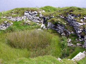
South Yarrows Broch submitted by howe on 11th Jun 2009. South Yarrows Broch. View of the interior looking towards the entrance
(View photo, vote or add a comment)
Log Text: None
The Langstane
Date Added: 18th Feb 2021
Site Type: Standing Stone (Menhir)
Country: Scotland (Aberdeenshire)
Visited: Yes on 1st Sep 1998. My rating: Condition 3 Ambience 1 Access 5
The Langstane submitted by cosmic on 29th Mar 2004. The Langstane at NJ938059 is situated only 30m from one of Aberdeen's main thoroughfares at the junction of Dee Street and Lanstane Place. It is embedded into a recess at the back of a branch of a well known fastfood restaurant.
It appears close to its present site on G&W Paterson's 1746 map of Aberdeen but it is suspected that it may have been part of a stone circle on the West side of the Denburn. Another stone, the Crab Stane, appears on the same map.
(View photo, vote or add a comment)
Log Text: None
Coetan Arthur Dolmen
Date Added: 18th Feb 2021
Site Type: Chambered Tomb
Country: Wales (Pembrokeshire)
Visited: Yes on 1st Jul 2020. My rating: Condition 3 Ambience 5 Access 3
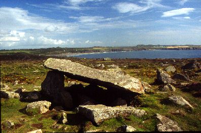
Coetan Arthur Dolmen submitted by Johnny on 25th Aug 2001. Coetan Arthur, St. David's Head, Dyfed
(SM725 281):
Impressively situated on the hillside close to St. David's Head, Coetan Arthur is the collapsed chamber of what is presumed to be a passage grave which also has a round barrow. The massive capstone measures approximately 5.9 meters by 2.6 meters and is supported on one side by an orthostat approximately 1.5 meters in height.
(View photo, vote or add a comment)
Log Text: None
Kilvaxter souterrain
Date Added: 18th Feb 2021
Site Type: Souterrain (Fogou, Earth House)
Country: Scotland (Isle of Skye)
Visited: Yes on 1st Aug 2009. My rating: Condition 5 Ambience 4 Access 5
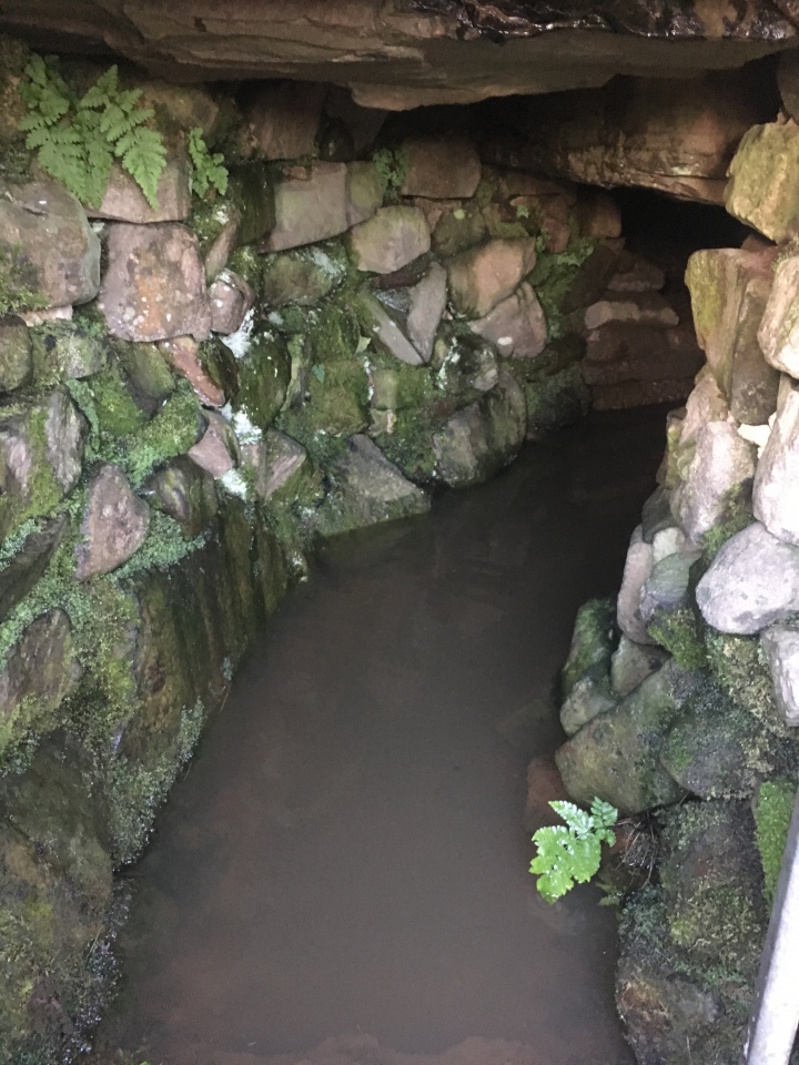
Kilvaxter souterrain submitted by Catrinm on 28th Mar 2020. Souterrain skye
(View photo, vote or add a comment)
Log Text: None
Torhousekie stone circle
Date Added: 18th Feb 2021
Site Type: Stone Circle
Country: Scotland (Dumfries and Galloway)
Visited: Yes on 1st Mar 2008. My rating: Condition 5 Ambience 5 Access 4
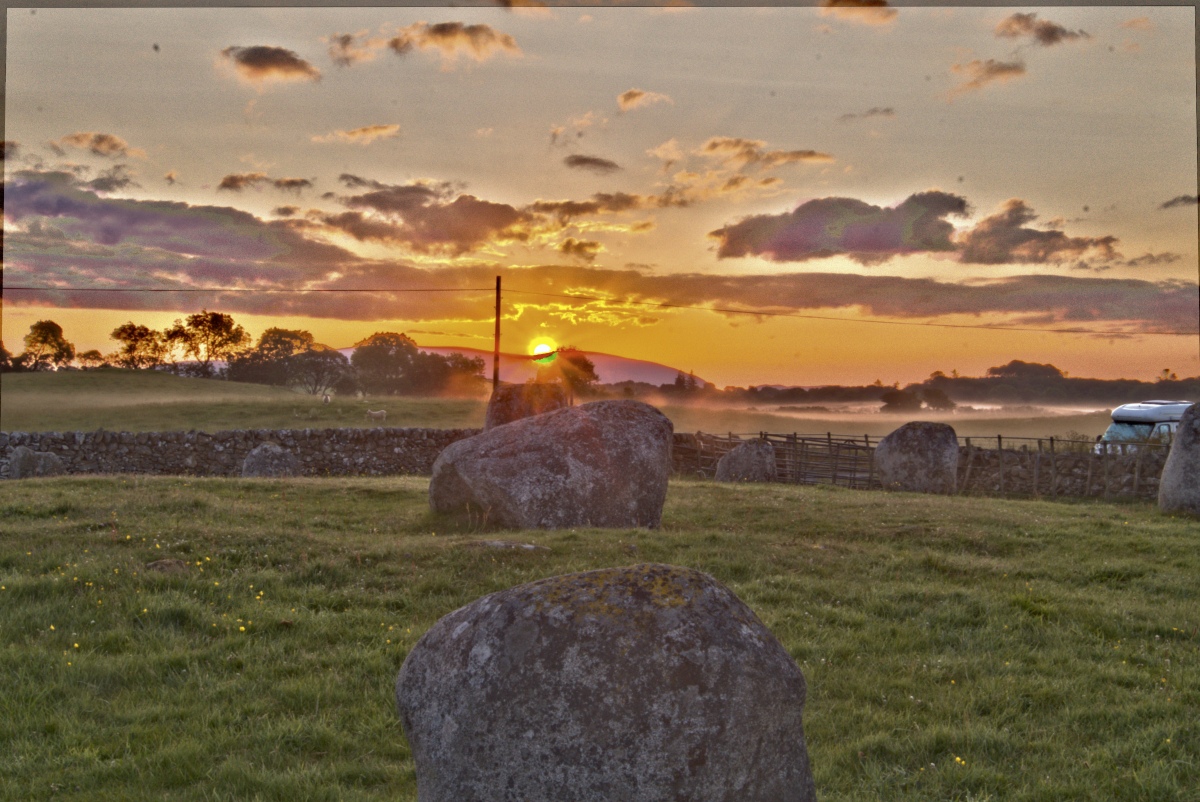
Torhousekie stone circle submitted by Energyman on 27th Jul 2019. First Gleam on the 7th July 04:10 an alignment with 3 stones. On processing this image, I hadn't noticed the 'fairy ring' of mist to the right
(View photo, vote or add a comment)
Log Text: None
Wren's Egg
Date Added: 18th Feb 2021
Site Type: Standing Stones
Country: Scotland (Dumfries and Galloway)
Visited: Yes on 1st Mar 2008. My rating: Condition 4 Ambience 4 Access 4
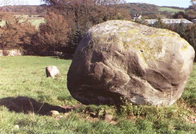
Wren's Egg submitted by cosmic on 7th Oct 2004. The Wren's Egg
(View photo, vote or add a comment)
Log Text: None
Drumtroddan Stone Row
Date Added: 18th Feb 2021
Site Type: Stone Row / Alignment
Country: Scotland (Dumfries and Galloway)
Visited: Yes on 1st Mar 2008. My rating: Condition 3 Ambience 3 Access 4
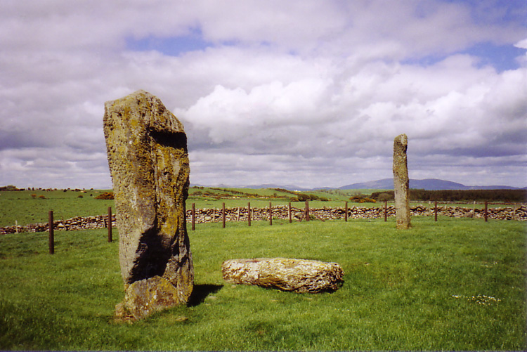
Drumtroddan Stone Row submitted by DavidRaven on 26th Jun 2005. Description useless. Go visit :-)
(View photo, vote or add a comment)
Log Text: None
Drumtroddan Cup and Ring Markings
Date Added: 18th Feb 2021
Site Type: Rock Art
Country: Scotland (Dumfries and Galloway)
Visited: Yes on 1st Mar 2008. My rating: Condition 3 Ambience 3 Access 4
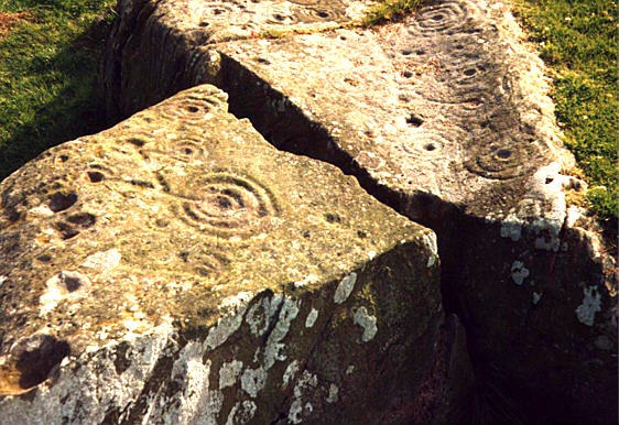
Drumtroddan Cup and Ring Markings submitted by rockartuk on 20th Aug 2001. On a fenced outcrop, 200m South of the farm (NX 362 447), R.W.B. Morris counted 84 cup-and-rings (1979). This photo was taken in 1993 with the carvings still clear. However, in 2000 the marks turned very faint. Acid rain? The question of preservation (after about 5000 years!) is now actual as well as urgent. How?
(View photo, vote or add a comment)
Log Text: None
