Contributory members are able to log private notes and comments about each site
Sites Marko has logged. View this log as a table or view the most recent logs from everyone
Cork Stone
Date Added: 10th Jun 2020
Site Type: Natural Stone / Erratic / Other Natural Feature
Country: England (Derbyshire)
Visited: Yes on 21st Mar 2020. My rating: Condition 3 Ambience 3 Access 4

Cork Stone submitted by Vicky on 13th Nov 2001. The Cork Stone, Stanton Moor, Derbyshire GR: SK245628
The Cork Stone is one of a number of impressive natural outcrops on Stanton Moor. Composed of weathered sandstone it resembles a huge mushroom or cork. As with the Andle Stone nearby it is covered in graffiti from the 19th and 20th centuries and has steps carved into the side to allow access to the top.
(View photo, vote or add a comment)
Log Text: None
Andle Stone (Stanton Moor)
Date Added: 10th Jun 2020
Site Type: Natural Stone / Erratic / Other Natural Feature
Country: England (Derbyshire)
Visited: Yes on 21st Mar 2020. My rating: Condition 4 Ambience 3 Access 4
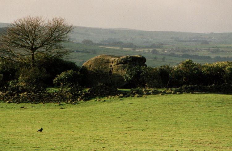
Andle Stone (Stanton Moor) submitted by PaulM on 1st Sep 2001. The Andle Stone, near Doll Tor Stone Circle, Stanton Moor, Derbyshire GR: SK241630
The Andle Stone or Oundle Stone is a dominating outcrop of sandstone, standing alone in the middle of a field, surrounded by a dry-stone wall and a mass of rhododendrons. Approximately 5m high by 4.5m wide, the rock is supposedly carved with ancient cupmarks on the, modern graffiti, a relatively recent inscription and climbing holes on the sides.
(View photo, vote or add a comment)
Log Text: None
Lud's Church
Date Added: 2nd Jun 2020
Site Type: Natural Stone / Erratic / Other Natural Feature
Country: England (Staffordshire)
Visited: Yes on 1st Jun 2020. My rating: Condition 4 Ambience 4 Access 2
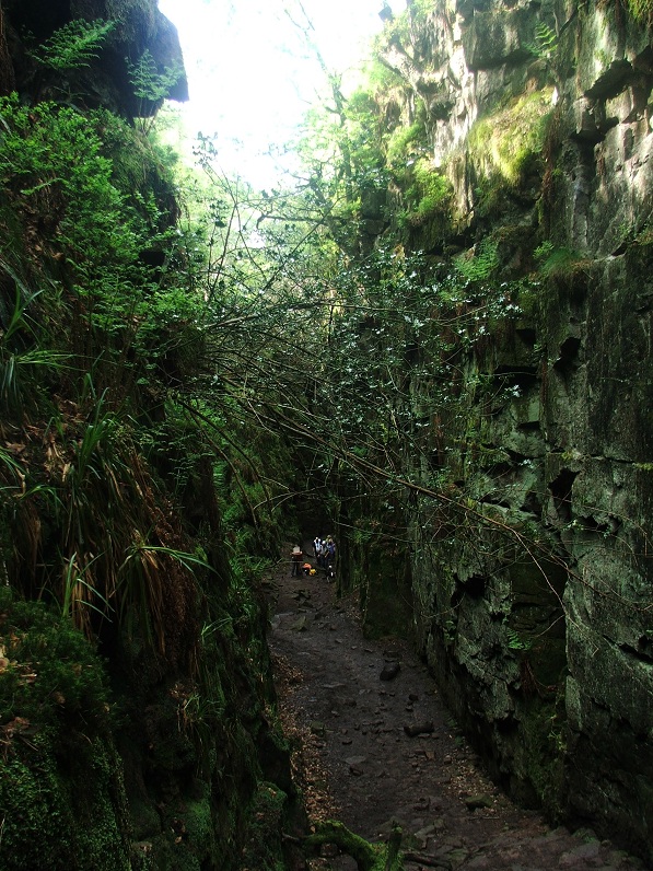
Lud's Church submitted by Postman on 16th Dec 2012. An Artist way back down there is past by a few walkers.
(View photo, vote or add a comment)
Log Text: None
Devil's Punch Bowl
Date Added: 11th Dec 2019
Site Type: Natural Stone / Erratic / Other Natural Feature
Country: Wales (Ceredigion)
Visited: Yes on 27th Jul 2017. My rating: Condition 5 Ambience 5 Access 4
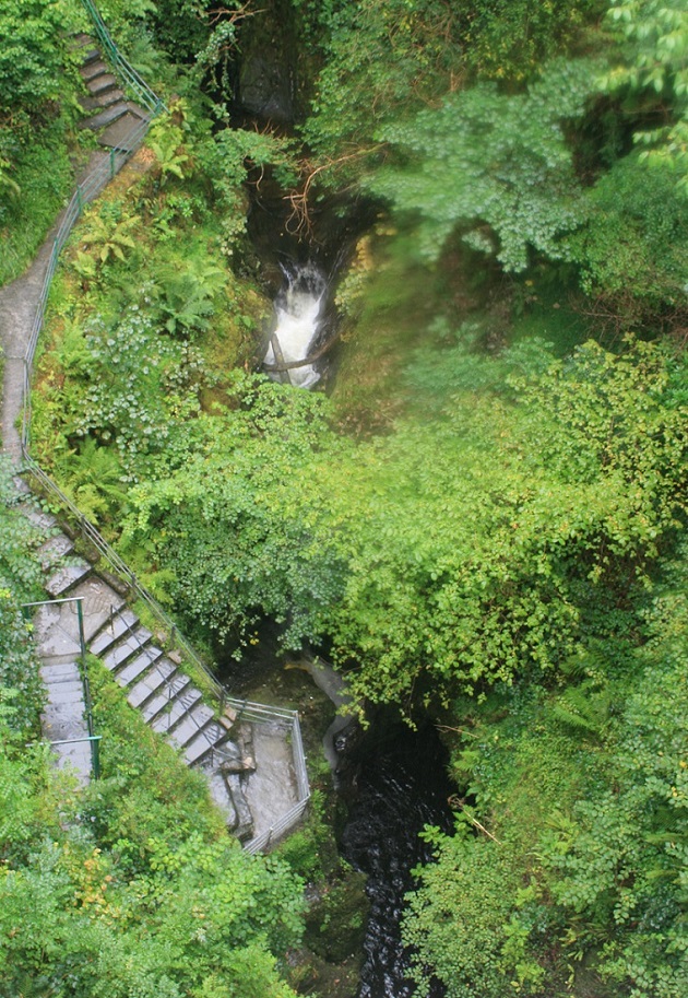
Devil's Punch Bowl submitted by Postman on 10th Sep 2018. Looking over the side of the bridge to the punchbowl, right next to the viewing stage.
(View photo, vote or add a comment)
Log Text: None
Camp d'Atilla
Date Added: 1st Oct 2019
Site Type: Ancient Village or Settlement
Country: France (Champagne:Marne (51))
Visited: Yes on 1st Oct 2019. My rating: Condition 3 Ambience 4 Access 5
Log Text: Very impressive in parts. Took a leisurely hour or so to walk round the top of the rampart.
Foel Fenlli
Date Added: 28th Jan 2019
Site Type: Hillfort
Country: Wales (Denbighshire)
Visited: Yes on 26th Jan 2019. My rating: Condition 3 Ambience 4 Access 3
Foel Fenlli submitted by TimPrevett on 27th Sep 2004. The north side of Foel Fenlli hillfort, a few minutes walk from the parking for Moel Famau.
The white dots on the lower slope are sheep, helping give a sense of the scale of the place. The road to Ruthin (from Mold) exits the picture lower right hand corner.
(View photo, vote or add a comment)
Log Text: None
Saxon's Lowe
Date Added: 2nd Jan 2019
Site Type: Round Barrow(s)
Country: England (Staffordshire)
Visited: Yes on 22nd Mar 2014. My rating: Condition 4 Ambience 3 Access 3
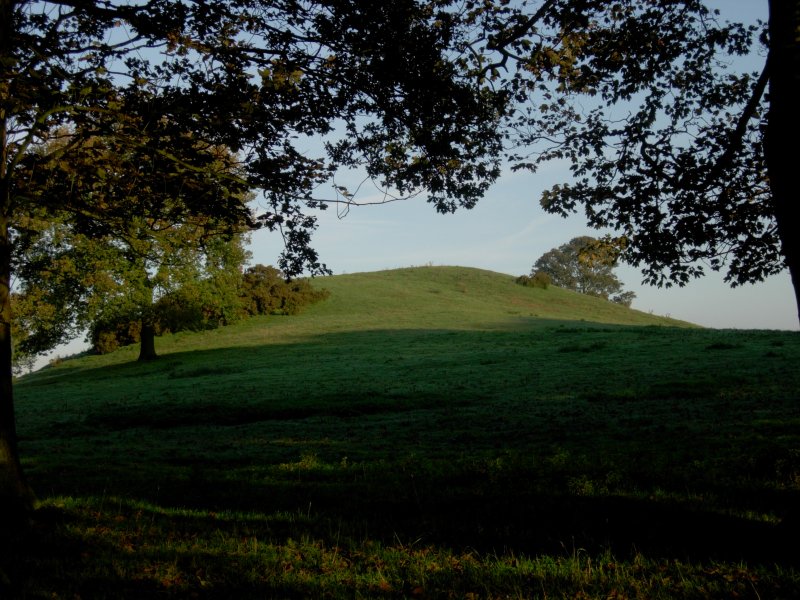
Saxon's Lowe submitted by TimPrevett on 24th Oct 2006. Saxon's Lowe on Tittensor Chase, between Newcastle Under Lyme and Stone. See main entry for details.
(View photo, vote or add a comment)
Log Text: None
Carreg Cennen Cave
Date Added: 12th Dec 2018
Site Type: Cave or Rock Shelter
Country: Wales (Carmarthenshire)
Visited: Yes on 17th Aug 2016. My rating: Condition 4 Ambience 3 Access 2

Carreg Cennen Cave submitted by postman on 16th Oct 2014. Looking down upon the covered walkway to the cave, which is under the stonework lower right, and showing the cave and the castle's superb position.
(View photo, vote or add a comment)
Log Text: None
Welshampton Bowl Barrow
Date Added: 1st Nov 2018
Site Type: Round Barrow(s)
Country: England (Shropshire)
Visited: Yes on 27th Oct 2018. My rating: Condition 2 Ambience 3 Access 5
Welshampton Bowl Barrow submitted by TimPrevett on 15th Jan 2005. The barrow adjoining the road in Welshampton; impressive stature - shame about the road cutting it in half, and the telegraph pole!
A good view into the enclosure, and idea of the surrounding countryside is possible by standing on the bank above the pavement. Snowdrops were growing on the barrow today (Sat 15th Jan 2005); an encouraging sign of the life stirring in the ground again.
See main entry - click on text to the left of picture for more information.
(View photo, vote or add a comment)
Log Text: None
Old Oswestry Fort
Date Added: 1st Nov 2018
Site Type: Hillfort
Country: England (Shropshire)
Visited: Yes on 27th Oct 2018. My rating: Condition 4 Ambience 3 Access 5
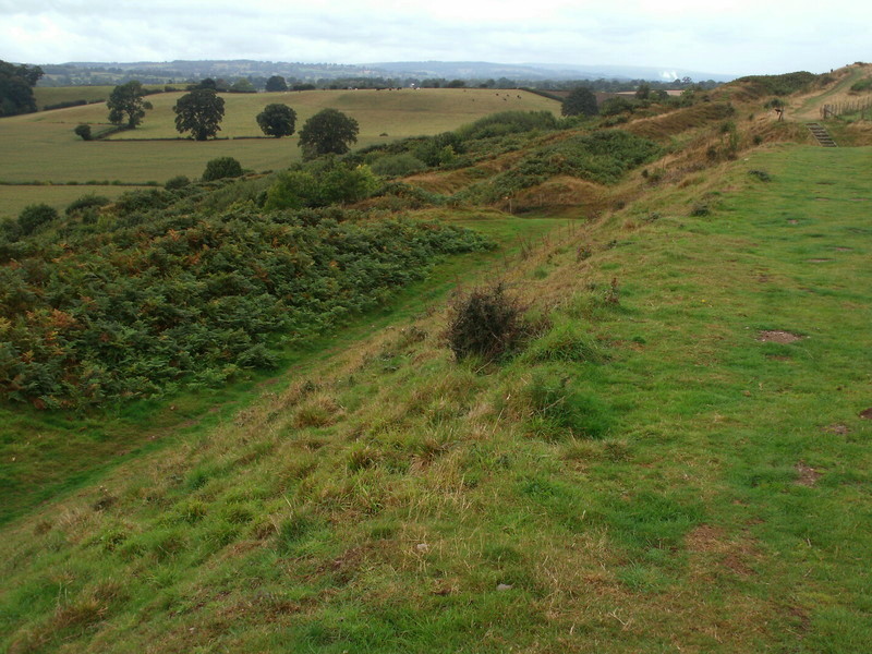
Old Oswestry Fort submitted by Bladup on 16th Jan 2016. Old Oswestry, western side looking north.
(View photo, vote or add a comment)
Log Text: None
Symonds Yat Fort
Date Added: 7th Sep 2018
Site Type: Hillfort
Country: England (Gloucestershire)
Visited: Yes on 30th Aug 2018. My rating: Condition 3 Ambience 2 Access 5

Symonds Yat Fort submitted by TheCaptain on 5th Apr 2004. Symonds Yat Fort, Symonds Yat, Gloucestershire, SO563157
Iron age hillfort on the headland of Symonds Yat Rock, high above a complete U Bend in the river Wye.
This is a view of the eastern end of the inner ditch and bank, the defended headland being to the right.
This is a smashing place to visit on a nice day, of which this was most definately NOT one.
(View photo, vote or add a comment)
Log Text: None
Mam Tor
Date Added: 7th Sep 2018
Site Type: Hillfort
Country: England (Derbyshire)
Visited: Yes on 18th Aug 2018. My rating: Condition 3 Ambience 3 Access 4
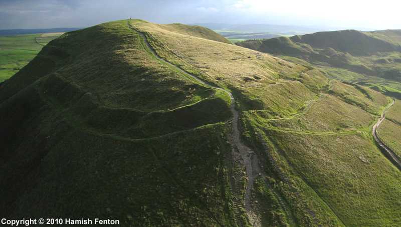
Mam Tor submitted by h_fenton on 27th Sep 2010. An almost horizontal kite aerial photograph of Mam Tor viewed from roughly north.
9 September 2010 @ 5.42pm
(View photo, vote or add a comment)
Log Text: None
Berry Ring
Date Added: 4th Apr 2018
Site Type: Hillfort
Country: England (Staffordshire)
Visited: Yes on 1st Apr 2018. My rating: Condition 2 Ambience 3 Access 4
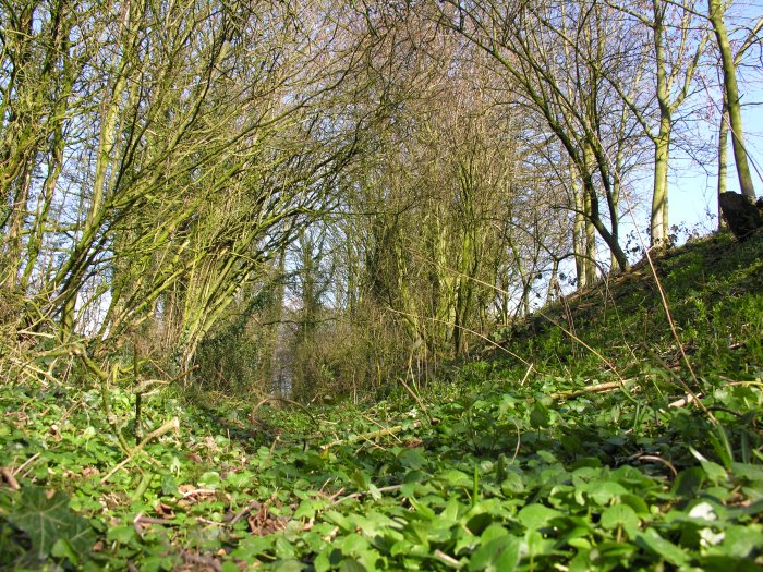
Berry Ring submitted by TimPrevett on 7th Mar 2007. Between the western ramparts, accessible from the adjoining lane, looking north.
(View photo, vote or add a comment)
Log Text: The closest hill fort to home and therefore one that i had never previously visited!
Good remains of the inner rampart ditch and counterscarp bank on the west side - just a few steps away from the modern lane. There is a suggestion that the lane might have been the site of another ditch but i've read that this theory is now discredited.
Also good remains of the rampart on the North side.
No remains left now of the entrance (South side) This was widened out some years ago when marl was being extracted from the interior of the fort. A modern house now spans the gap!
The mid point of the Western defences are also breached by a cottage- How the hell did these 2 propertIes get planning permission?! Shame on those who let them build on an ancient monument.
There is a spring fed pond in the North West corner.From where there are excellent views over to the Wrekin and its hill fort.
Devil's Ring and Finger
Date Added: 31st Mar 2018
Site Type: Holed Stone
Country: England (Staffordshire)
Visited: Yes on 30th Mar 2018. My rating: Condition 2 Ambience 3 Access 3
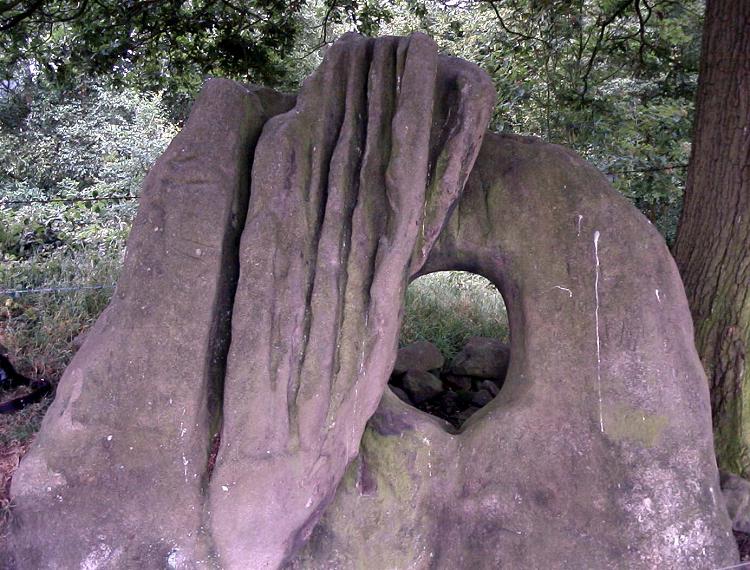
Devil's Ring and Finger submitted by Paul Morgan on 25th Jul 2001. This site is all that remains of a long cairn. The Devil's Ring is a perforated septal stone similar to the one at the Bridestones in Cheshire. The Finger was, perhaps, a portal stone. Neither are in their original position.
Located near Mucklestone, Staffordshire and marked on OS map 127.
(View photo, vote or add a comment)
Log Text: Easier to find than I thought. The fact that the stones had been moved from their original location to the field boundary some time in the distant past kind of reflected in the lack of ambience but was still worth the walk to it.. Pleased to say that the barbed wire fences mentioned on other members site logs are now 'down'.
Bradgate Hunt's Hill Stone
Date Added: 19th Mar 2018
Site Type: Standing Stone (Menhir)
Country: England (Leicestershire and Rutland)
Visited: Yes on 17th Mar 2018. My rating: Condition 5 Ambience 3 Access 4
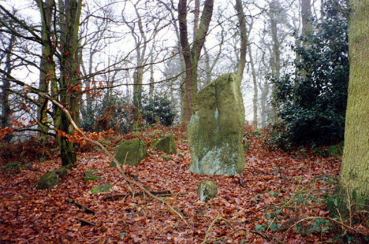
Bradgate Hunt's Hill Stone submitted by Stefan Spencer on 11th Feb 2004. Bradgate Hunt's Hill Stone
Information required please. Where is this?
(View photo, vote or add a comment)
Log Text: Debate over whether this site is a genuine standing stone or something some rogue Boy Scouts erected (if so then i hope they got a badge for it?!).
Very easy to find : 2 to 3 minute walk behind the toilet block as described elsewhere!
Ysbyty Cynfyn
Date Added: 1st Aug 2017
Site Type: Stone Circle
Country: Wales (Ceredigion)
Visited: Yes on 27th Jul 2017. My rating: Condition 4 Ambience 3 Access 5
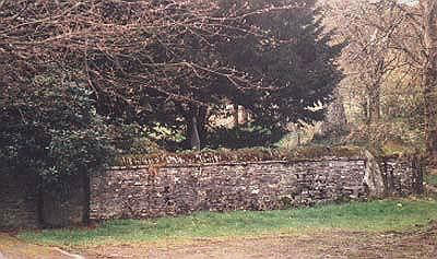
Ysbyty Cynfyn Stone Circle submitted by Johnny on 10th Oct 2001. Ysbyty Cynfyn "Stone Circle" (SN 752 791)
This readily accessible site is situated alongside the A4120 running south from Ponterwyd towards Devil's Bridge. The circle is not marked as an antiquity on recent OS maps but the church itself is easily found. Despite recent dissenting opinion, it has generally been accepted that this is an example of the early Christian Church adopting an ancient site, in this case an embanked Bronze Age stone circle, presumably in an attempt to "des...
(View photo, vote or add a comment)
Log Text: None
The Wrekin
Date Added: 1st Aug 2017
Site Type: Hillfort
Country: England (Shropshire)
Visited: Yes on 6th May 2017. My rating: Condition 4 Ambience 3 Access 3
The Wrekin submitted by TimPrevett on 2nd Jan 2005. Lookin to the North East, between the outer and inner ramparts of The Wrekin.
The path enters the inturned ramparts to the central area; the trig point and toposcope sit upon a Bronze Age Cairn, which is hardly in evidence.
Another, more slight rampart is visible to the left of the picture, before the hill becomes more rounded.
See main entry - click on the blue text to the left of the picture for more information.
(View photo, vote or add a comment)
Log Text: None
Berth Hill
Date Added: 4th Apr 2017
Site Type: Hillfort
Country: England (Staffordshire)
Visited: Yes on 2nd Apr 2017. My rating: Condition 3 Ambience 4 Access 3
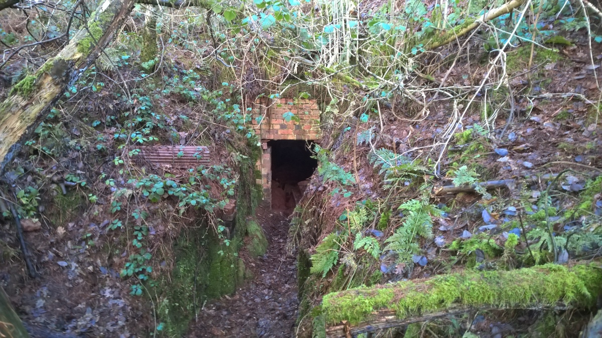
Berth Hill submitted by HarryTwenty on 2nd Oct 2022. Victorian aqueduct built into the eastern side of the hillfort to carry water from the spring to the hall and village of Maer (January 2022)
(View photo, vote or add a comment)
Log Text: It's been 3 years since i was last here and this time there was a lot more vegetation to contend with!
On my previous visit it was possible to walk around pretty much the whole of the inner rampart.
This time i reckon that less than 50% of the inner rampart was walkable.Lot's of bracken,fallen trees and unforgiving briars to contend with.
The fine inturned entrance on the S.W side now has large holly tree spoiling part of it.Also,tyre tracks were visible in the entrance on this visit.
With a bit of maintenance this could easily be (in my eyes) the jewel in ithe Crown of Staffordshire hillforts.
Dinas Bran
Date Added: 26th Feb 2017
Site Type: Hillfort
Country: Wales (Denbighshire)
Visited: Yes on 24th Feb 2017. My rating: Condition 2 Ambience 3 Access 3
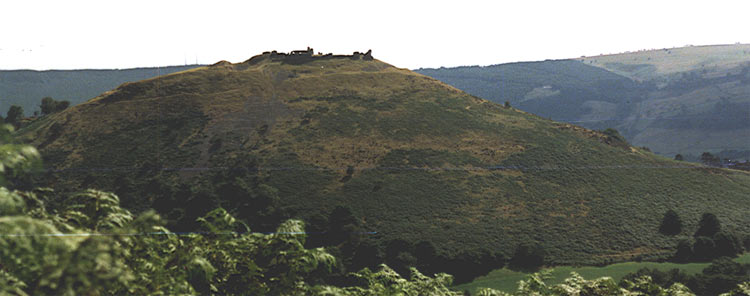
Dinas Bran submitted by blingo on 6th Jun 2004. SJ 223430 near Llangollen showing the hill you have to climb to reach the top!
Photo taken from top of hill at SJ 212445
(View photo, vote or add a comment)
Log Text: None
Beacon Hill (Leicestershire)
Date Added: 23rd Jan 2017
Site Type: Hillfort
Country: England (Leicestershire and Rutland)
Visited: Yes on 1st Nov 2016. My rating: Condition 2 Ambience 2 Access 4
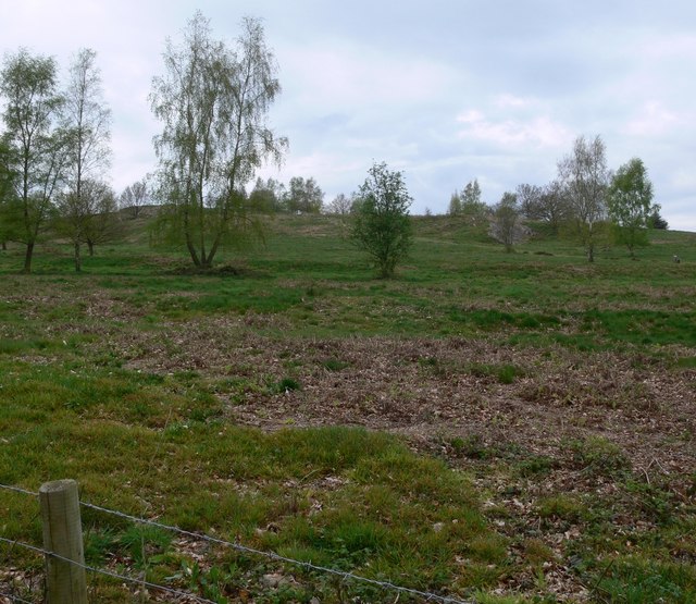
Beacon Hill (Leicestershire) submitted by Andy B on 11th Jul 2010. The Bronze Age `Fort` at Beacon Hill is at least 3000 years old.
Copyright Mat Fascione and licensed for reuse under the Creative Commons Licence.
(View photo, vote or add a comment)
Log Text: None
