Contributory members are able to log private notes and comments about each site
Sites Marko has logged. View this log as a table or view the most recent logs from everyone
Graig Lwyd Cairns
Date Added: 26th Apr 2021
Site Type: Cairn
Country: Wales (Conwy)
Visited: Yes on 23rd Apr 2021. My rating: Condition 3 Ambience 4 Access 2
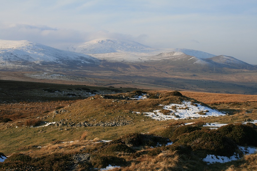
Graig Lwyd Cairns submitted by postman on 15th Apr 2013. Some magic views from here
(View photo, vote or add a comment)
Log Text: None
Graig Lwyd Neolithic Axe Factory
Date Added: 26th Apr 2021
Site Type: Ancient Mine, Quarry or other Industry
Country: Wales (Conwy)
Visited: Yes on 23rd Apr 2021. My rating: Condition 4 Ambience 4 Access 2
Graig Lwyd Neolithic Axe Factory submitted by TimPrevett on 8th Apr 2004. Graig Lwyd Neolithic Axe Factory sits on the extinct volcano above the North Wales coastal town of Penmaenmawr. Spectacular views abound, with panoramic views to the Tal Y Fan mountain to the south, the Great Orme to the east, and Anglesey to the west.
Access is questionable; the 'volcanic plug' from which was taken microdiorite or augite granophyre is on top of a ridge which is still being quarried on its east and north sides for rocks of different geological specifications. The outcrop can ...
(View photo, vote or add a comment)
Log Text: None
Ysbyty Cynfyn
Date Added: 1st Aug 2017
Site Type: Stone Circle
Country: Wales (Ceredigion)
Visited: Yes on 27th Jul 2017. My rating: Condition 4 Ambience 3 Access 5
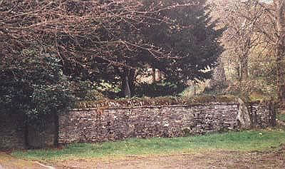
Ysbyty Cynfyn Stone Circle submitted by Johnny on 10th Oct 2001. Ysbyty Cynfyn "Stone Circle" (SN 752 791)
This readily accessible site is situated alongside the A4120 running south from Ponterwyd towards Devil's Bridge. The circle is not marked as an antiquity on recent OS maps but the church itself is easily found. Despite recent dissenting opinion, it has generally been accepted that this is an example of the early Christian Church adopting an ancient site, in this case an embanked Bronze Age stone circle, presumably in an attempt to "des...
(View photo, vote or add a comment)
Log Text: None
Devil's Punch Bowl
Date Added: 11th Dec 2019
Site Type: Natural Stone / Erratic / Other Natural Feature
Country: Wales (Ceredigion)
Visited: Yes on 27th Jul 2017. My rating: Condition 5 Ambience 5 Access 4
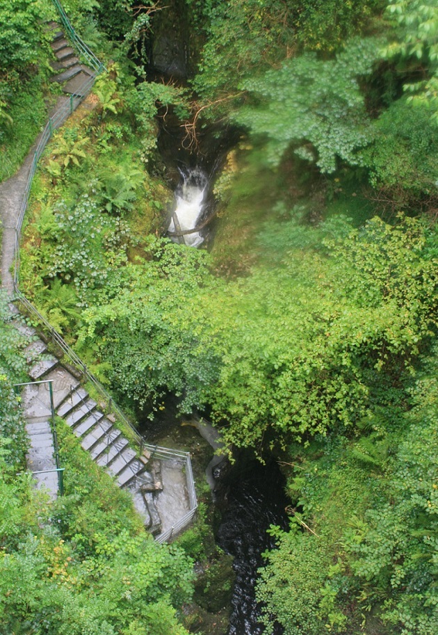
Devil's Punch Bowl submitted by Postman on 10th Sep 2018. Looking over the side of the bridge to the punchbowl, right next to the viewing stage.
(View photo, vote or add a comment)
Log Text: None
Carreg Cennen Cave
Date Added: 12th Dec 2018
Site Type: Cave or Rock Shelter
Country: Wales (Carmarthenshire)
Visited: Yes on 17th Aug 2016. My rating: Condition 4 Ambience 3 Access 2

Carreg Cennen Cave submitted by postman on 16th Oct 2014. Looking down upon the covered walkway to the cave, which is under the stonework lower right, and showing the cave and the castle's superb position.
(View photo, vote or add a comment)
Log Text: None
Dolmen dit la Table des Fées
Date Added: 23rd Jan 2017
Site Type: Burial Chamber or Dolmen
Country: France (Nord:Pas-de-Calais (62))
Visited: Yes on 11th Sep 2016. My rating: Condition 3 Ambience 4 Access 5
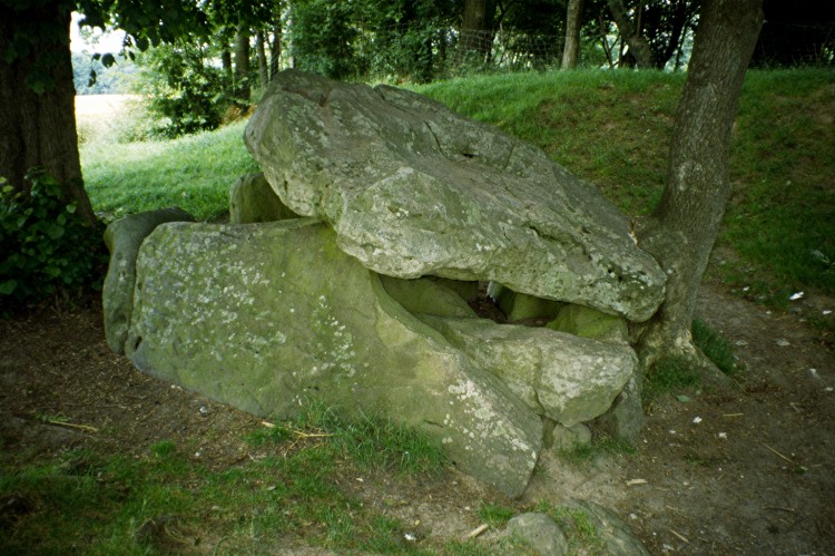
Dolmen dit la Table des Fées submitted by greywether on 30th Jun 2005. Dolmen dit la Table des Fées
(View photo, vote or add a comment)
Log Text: Stumbled accross this site by accident.
Was visiting a nearby castle and saw on one of the walls an old plan of ''Monument Celtique De Fresnicourt''.
The plan showed what had supposeddly been 4 dolmens linked by standing stones.In the central area was an eliptical stone circle radiating out from the Northern Dolmen.
The plan was undated.All very fanciful and possibly the delusions/wishful thinking of some Victorian(?) era antiquarian.
The Fresnicourt dolmen was well signposted from the village and was situated right by the side of the road.Without doubt the easiest site i've ever visited.
If there were ever another 3 dolmens plus standing stones,then i never saw any sign of them.
Fontaine des Chartreux
Date Added: 8th May 2022
Site Type: Holy Well or Sacred Spring
Country: France (Midi:Lot (46))
Visited: Yes on 4th May 2022. My rating: Condition 4 Ambience 4 Access 4
Fontaine des Chartreux submitted by theCaptain on 16th Jan 2012. Cross the wonderful Pont Valentré from the old town of Cahors, contained within its loop of the Lot river, and walk south along the riverside for a few hundred metres, and you will find this huge spring in the cliffside, with the crystal clear water surging out.
(View photo, vote or add a comment)
Log Text: None
Grotte de Pech-Merle
Date Added: 8th May 2022
Site Type: Cave or Rock Shelter
Country: France (Midi:Lot (46))
Visited: Yes on 5th May 2022. My rating: Condition 5 Ambience 5 Access 4

Grotte de Pech-Merle submitted by thecaptain on 14th Nov 2008. The entrance area to this fantastic cave, which I would thoroughly encourage anybody to visit.
One of the oak trees here (with the white paint) has one of its roots hanging down into the cave, which can be seen looking like a hairy stalactite.
(View photo, vote or add a comment)
Log Text: None
Chez Moutaud Dolmen
Date Added: 8th May 2022
Site Type: Burial Chamber or Dolmen
Country: France (Limousin:Haute-Vienne (87))
Visited: Yes on 6th May 2022. My rating: Condition 4 Ambience 4 Access 5
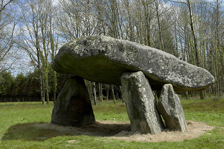
Chez Moutaud dolmen submitted by milka on 5th May 2006. Near the road, signs will help you find this big one. There is even a small car park, benches and camping tables around.
(View photo, vote or add a comment)
Log Text: None
Menhir dit de Chez Moutaud 1
Date Added: 8th May 2022
Site Type: Standing Stone (Menhir)
Country: France (Limousin:Haute-Vienne (87))
Visited: Yes on 6th May 2022. My rating: Condition 3 Ambience 4 Access 5
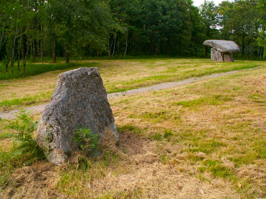
Menhir dit de Chez Moutaud 1 submitted by ocdolmen on 25th May 2009. The menhir and the dolmen of Chez Moutaud Menhir dit de Chez Monteau
(View photo, vote or add a comment)
Log Text: None
Camp d'Atilla
Date Added: 1st Oct 2019
Site Type: Ancient Village or Settlement
Country: France (Champagne:Marne (51))
Visited: Yes on 1st Oct 2019. My rating: Condition 3 Ambience 4 Access 5
Log Text: Very impressive in parts. Took a leisurely hour or so to walk round the top of the rampart.
Ingleborough Camp
Date Added: 15th Nov 2024
Site Type: Hillfort
Country: England (Yorkshire (North))
Visited: Yes on 8th Oct 2024. My rating: Condition 2 Ambience 3 Access 2
Ingleborough Camp submitted by DavidRaven on 3rd Mar 2004. Ingleborough from Crina Bottom.
(View photo, vote or add a comment)
Log Text: None
Wychbury Camp
Date Added: 28th Apr 2014
Site Type: Hillfort
Country: England (Worcestershire)
Visited: Yes on 9th Mar 2014. My rating: Condition 4 Ambience 4 Access 3
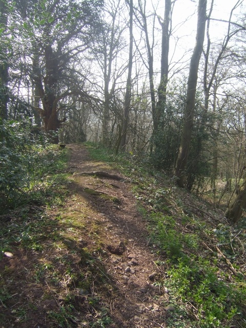
Wychbury Camp submitted by Andy B on 18th Jun 2011. Wychbury Hill Fort - Southern Rampart
The hill fort occupies a position on the end of the Clent Hills. It is very much hidden by the trees but would have views to other forts on the Malverns, Clee Hill and Dudley.
Copyright John M and licensed for reuse under this Creative Commons Licence.
(View photo, vote or add a comment)
Log Text: Appeared to be 3 ramparts and ditches running most of the way between the East and South West entances.
Both entrances are inturned with the East one being a paticularly good example.
Site also has approx 20+ yew trees growing both inside the fort and on its ramparts and in the ditches.
Bury Bank (Staffordshire)
Date Added: 25th Apr 2014
Site Type: Hillfort
Country: England (Staffordshire)
Visited: Yes on 22nd Mar 2014. My rating: Condition 3 Ambience 3 Access 3
Bury Bank (Staffordshire) submitted by TimPrevett on 20th May 2006. The inner platform with trees following the arc of the rampart. Courses of pebbles can also be traced, forming what must have been walls at some period. See main entry for details.
(View photo, vote or add a comment)
Log Text: Parked in the car park at nearby pub.(Darlaston Inn),at junction of the A34/A51.Walked up the A51 to footpath on the right,(just after passing Bury Bank farm),this led to the quarry area as described by Tim Prevett.A short walk then to the outer rampart.....protected by a low barbed wire fence.Spent an hour there with the place all to myself.
Best remains are on the West side.
Suggest you vist in Winter or Spring.........lower undergrowth!!
Kinver
Date Added: 25th Apr 2014
Site Type: Promontory Fort / Cliff Castle
Country: England (Staffordshire)
Visited: Yes on 16th Feb 2014. My rating: Condition 3 Ambience 3 Access 3
Kinver submitted by TheWhiteRider on 10th Jul 2006. Kinver Edge Hillfort - A view of the still impressive NW rampart.
(View photo, vote or add a comment)
Log Text: Busy with walkers and dogs so hard to capture the true ambience!
Walked the inner ditch on SE and SW sides.Massive inner rampart
No ditch or rampart on other two sides due to it being a 'promontary fort' Therefore due to the terrain,no defences were needed at the NW and NE sides.
Castle Ring (Staffordshire)
Date Added: 25th Apr 2014
Site Type: Hillfort
Country: England (Staffordshire)
Visited: Yes on 1st Feb 2014. My rating: Condition 4 Ambience 4 Access 4
Castle Ring (Staffordshire) submitted by TimPrevett on 5th Jan 2004. Castle Ring SK045128
Looking E / NE - despite Castle Ring being the highest part of Cannock Chase, the only part with a panoramic view, looks towards (Rugeley?) Power Station!
Castle Ring was actually recommended to me by a colleague at work who does not know of my stones / pre-history interest; she grew up in the Cannock area, and given we were making a trip to Stafford anyway, I'd heard that Cannock Chase was supposed to quite nice. Knowing that she grew up there, I
asked her if Cannock...
(View photo, vote or add a comment)
Log Text: Yet another visit to this marvellous place.
At times there is a tangible feel here of 'something else'. There are many stories of sightings here,including Roman legionaires,some sort of 'Bigfoot' and cowled figures.Never seen anything myself but there is cerainly a vibe here!!
One to return to.
Berth Hill
Date Added: 25th Apr 2014
Site Type: Hillfort
Country: England (Staffordshire)
Visited: Yes on 11th Apr 2014. My rating: Condition 3 Ambience 4 Access 3
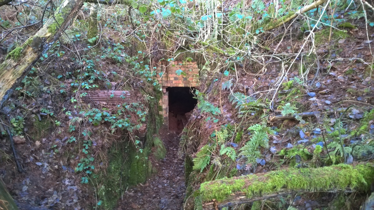
Berth Hill submitted by HarryTwenty on 2nd Oct 2022. Victorian aqueduct built into the eastern side of the hillfort to carry water from the spring to the hall and village of Maer (January 2022)
(View photo, vote or add a comment)
Log Text: See entry on Berth Hill main page
Berth Hill
Date Added: 4th Apr 2017
Site Type: Hillfort
Country: England (Staffordshire)
Visited: Yes on 2nd Apr 2017. My rating: Condition 3 Ambience 4 Access 3

Berth Hill submitted by HarryTwenty on 2nd Oct 2022. Victorian aqueduct built into the eastern side of the hillfort to carry water from the spring to the hall and village of Maer (January 2022)
(View photo, vote or add a comment)
Log Text: It's been 3 years since i was last here and this time there was a lot more vegetation to contend with!
On my previous visit it was possible to walk around pretty much the whole of the inner rampart.
This time i reckon that less than 50% of the inner rampart was walkable.Lot's of bracken,fallen trees and unforgiving briars to contend with.
The fine inturned entrance on the S.W side now has large holly tree spoiling part of it.Also,tyre tracks were visible in the entrance on this visit.
With a bit of maintenance this could easily be (in my eyes) the jewel in ithe Crown of Staffordshire hillforts.
Bishop's Wood
Date Added: 11th Sep 2018
Site Type: Hillfort
Country: England (Staffordshire)
Visited: Couldn't find on 30th Mar 2018
Log Text: On the scant info available i tried for the best part of 2 hours to locate the site! Using the map references I could find absolutely nothing on the ground ie bank's, ditches etc.
On the way back through the woods and at a different location/map coordinates I did see what could possibly have been the re entrant gully and 2 rather silted up ditches but the rest of the topography didn't fit the Hill Fort description I had. So overall I have to say that I didn't find it!
If anyone out there has any further info as to where exactly to locate this fort - please let me know.
Devil's Ring and Finger
Date Added: 31st Mar 2018
Site Type: Holed Stone
Country: England (Staffordshire)
Visited: Yes on 30th Mar 2018. My rating: Condition 2 Ambience 3 Access 3
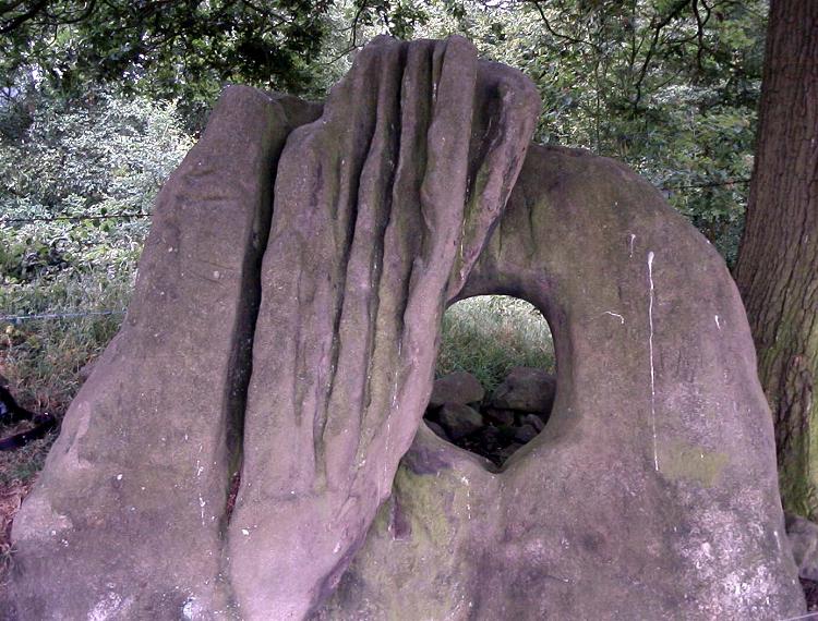
Devil's Ring and Finger submitted by Paul Morgan on 25th Jul 2001. This site is all that remains of a long cairn. The Devil's Ring is a perforated septal stone similar to the one at the Bridestones in Cheshire. The Finger was, perhaps, a portal stone. Neither are in their original position.
Located near Mucklestone, Staffordshire and marked on OS map 127.
(View photo, vote or add a comment)
Log Text: Easier to find than I thought. The fact that the stones had been moved from their original location to the field boundary some time in the distant past kind of reflected in the lack of ambience but was still worth the walk to it.. Pleased to say that the barbed wire fences mentioned on other members site logs are now 'down'.
