Contributory members are able to log private notes and comments about each site
Sites MarkJ99 has logged. View this log as a table or view the most recent logs from everyone
Balnuaran of Clava Kerb Cairn
Date Added: 28th Apr 2025
Site Type: Cairn
Country: Scotland (Highlands)
Visited: Yes on 2nd Nov 2011. My rating: Condition 2 Ambience 4 Access 5
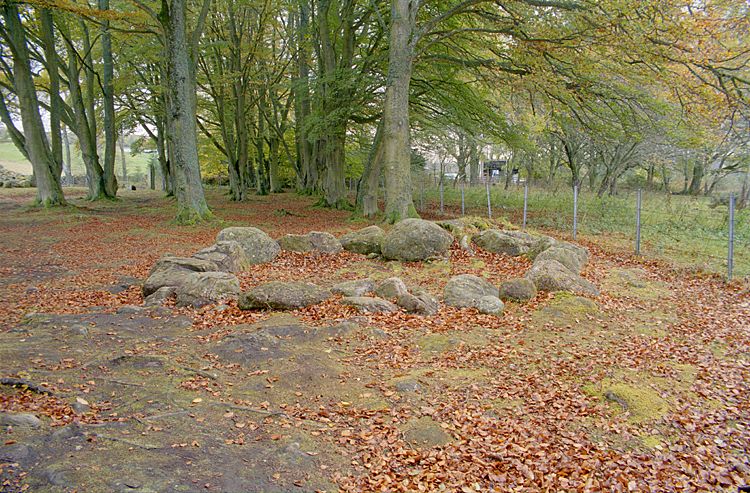
Balnuaran of Clava Kerb Cairn submitted by Klingon on 27th Feb 2006.
(View photo, vote or add a comment)
Log Text: Balnuaran of Clava Kerb Cairn is the odd one out at Balnauran: the unrestored circle of stones is small and mysterious compared to the restored large Clava Cairns around it.
Rubha Mor
Date Added: 25th May 2025
Site Type: Cairn
Country: Scotland (Highlands)
Visited: Yes on 1st Dec 2013. My rating: Condition 3 Ambience 4 Access 3
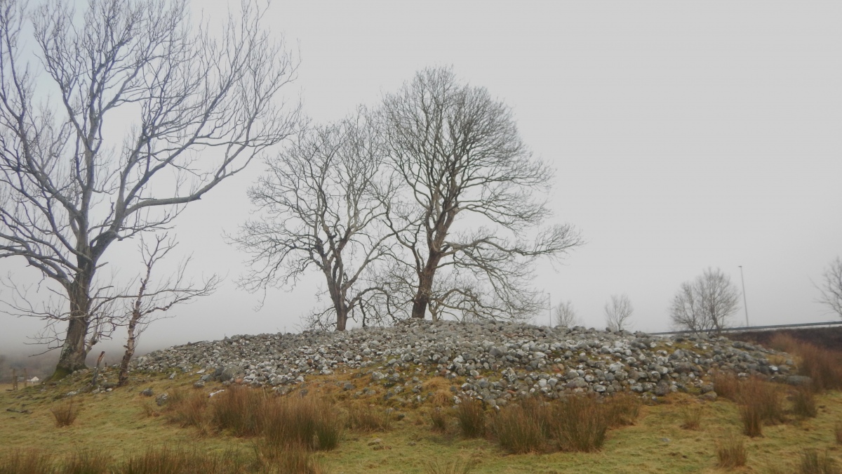
Rubha Mor submitted by PeteCrane5 on 17th Feb 2024. The large oval pile of bare stones that is Rubha Mor
(View photo, vote or add a comment)
Log Text: It is ironic that so many antiquarians have driven past this stony cairn crossing the Ballachulish Bridge to and from Fort William, yet so few have stopped to visit it. The cairn is not particularly impressive but it has good southern views.
Carn Glas
Date Added: 25th May 2025
Site Type: Chambered Cairn
Country: Scotland (Highlands)
Visited: Yes on 24th Apr 2012. My rating: Condition 2 Ambience 4 Access 3
Carn Glas submitted by markj99 on 21st Dec 2020. Carn Glas (Mains of Kilcoy) SW Chamber. (2012)
(View photo, vote or add a comment)
Log Text: Carn Glas (Mains of Kilcoy) is a ruined cairn which has been reduced to ground level. An exposed double chamber is located on the E Arc of the cairn, orientated ESE-WSW.
Carn Liath, Alness
Date Added: 26th May 2025
Site Type: Cairn
Country: Scotland (Highlands)
Visited: Yes on 26th Apr 2012
Carn Liath, Alness submitted by markj99 on 23rd Sep 2020. Approaching Carn Liath, Alness from NE. Obsdale Road is in the background.
(View photo, vote or add a comment)
Log Text: The circle of mature trees surrounding a naked cist with a massive capstone is one of my favourite sites. The trees both protect and add an air of mystery to the ancient monument.
Carn Liath (Sutherland)
Date Added: 28th May 2025
Site Type: Broch or Nuraghe
Country: Scotland (Highlands)
Visited: Yes on 5th Sep 2021. My rating: Condition 4 Ambience 4 Access 4
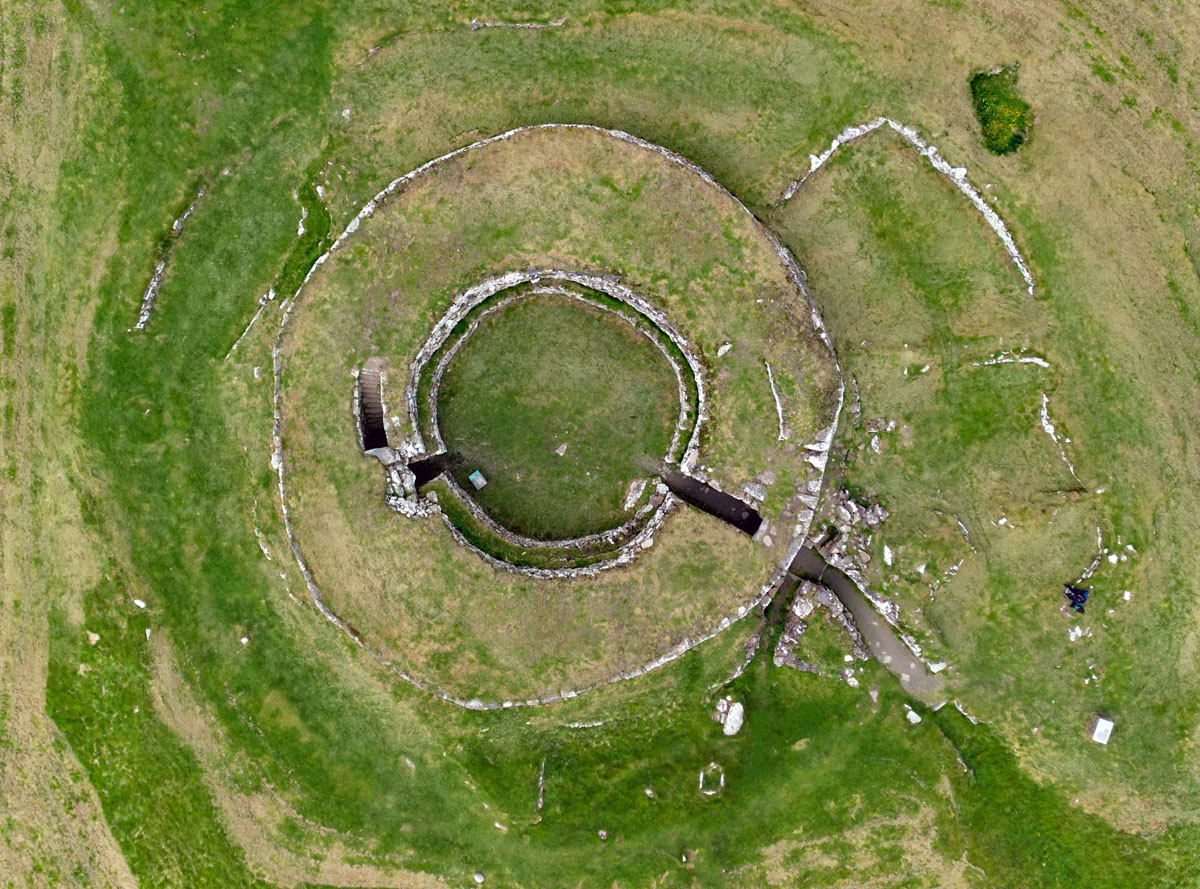
Carn Liath (Sutherland) submitted by Alasdair105 on 22nd May 2024. 5th May 2024 - well worth a visit, still looking good!
(View photo, vote or add a comment)
Log Text: I have visited this spectacular site several times in transit. It is probably one of the best preserved brochs on the Scottish Mainland.
Carn Liath, Shurrery
Date Added: 30th May 2025
Site Type: Cairn
Country: Scotland (Highlands)
Visited: Yes on 25th Jun 2014. My rating: Condition 2 Ambience 3 Access 3
Carn Liath, Shurrery submitted by markj99 on 25th Sep 2020. An orthostat on Carn Liath, Shurrery.
(View photo, vote or add a comment)
Log Text: Carn Liath (Shurrery) is located on the E bank of Forss Water, c. 400 yards W of a dead-end track leading to Loch Shurrery. The terrain is uneven and marshy making the walk challenging. The unspectacular mound is grassy with a scattering of stones protruding through the surface. I would not recommend a visit.
Morangie Forest
Date Added: 30th May 2025
Site Type: Chambered Cairn
Country: Scotland (Highlands)
Visited: Yes on 26th Apr 2012. My rating: Condition 3 Ambience 4 Access 2

Morangie Forest submitted by markj99 on 30th May 2025. An Excavated Pit in Carn Liath (Morangie Forest) Long Cairn.
(View photo, vote or add a comment)
Log Text: Carn Liath (Morangie Forest) is hidden in forestry c. 3 miles WSW of Tain. It is possible to access the cairn by walking or cycling 2.2 miles from Aldie Burn Car Park off Scotsburn road. See main page for directions.
Carr Brae
Date Added: 13th Jun 2025
Site Type: Rock Art
Country: Scotland (Highlands)
Visited: Yes on 12th Aug 2011. My rating: Condition 3 Ambience 4 Access 3
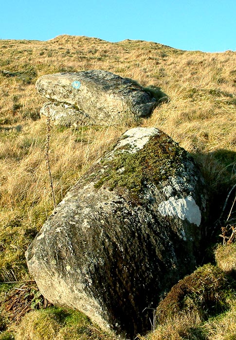
Carr Brae submitted by uisdean on 8th Feb 2007. Carr Brae (NG89782451). Cup marked boulder.
(View photo, vote or add a comment)
Log Text: I found Carn Brae Carved Stone on a steep hillside c. 120 yards S of Carr Brae single track road which runs parallel to the A87 near Eilean Donan Castle. Take the right turn for Carr Brae (Viewpoint) off the A87 c. 0.4 mile N of Inverate Petrol Station. Follow the single track road for c. 1.8 miles to a lay-by at NG 8962 2463. Walk W for c. 200 yards to reach a croft on the right. Head S through rough pasture for c. 120 yards to Carn Brae Carved Stone at NG 89780 24509.
Strathpeffer
Date Added: 22nd Jun 2025
Site Type: Class I Pictish Symbol Stone
Country: Scotland (Highlands)
Visited: Yes on 24th Apr 2012. My rating: Condition 4 Ambience 4 Access 4
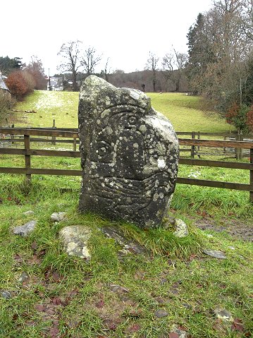
Strathpeffer submitted by wiccaman9 on 29th Nov 2007. The Strathpeffer Eagle stone
Aron Bowers
(View photo, vote or add a comment)
Log Text: The Eagle Stone is located at the end of a short signed path on the NE end of Strathpeffer. The carved Pictish Stone, dated to the 7th C. has bold carvings of a large horseshoe above a walking eagle.
Edderton 1
Date Added: 24th Jun 2025
Site Type: Class I Pictish Symbol Stone
Country: Scotland (Highlands)
Visited: Yes on 26th Apr 2012. My rating: Condition 3 Ambience 4 Access 4
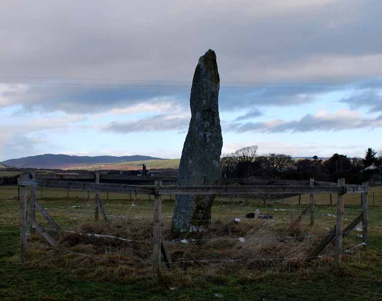
Edderton 1 submitted by NickiMacRae on 19th Sep 2011. The stone in Winter, within it's protective fencing.
(View photo, vote or add a comment)
Log Text: Edderton Pictish Symbol Stone has a boldly carved salmon above a traditional double disc & Z rod carving. The standing stone which bears the carvings is thought to date to the Bronze Age according to Canmore ID 14653.
Clach-a-charra
Date Added: 27th Jun 2025
Site Type: Standing Stone (Menhir)
Country: Scotland (Highlands)
Visited: Yes on 30th Apr 2010. My rating: Condition 4 Ambience 4 Access 4
Clach-a-charra submitted by Alta-Falisa on 2nd Jun 2015. One of the most tormented standing stones I have ever seen. May 2015.
(View photo, vote or add a comment)
Log Text: When I visited Clach-a-charra the field was in grass. The holes in the stone only add to the character of it.
Cnoc Chaornaidh North West
Date Added: 4th Jul 2025
Site Type: Chambered Cairn
Country: Scotland (Highlands)
Visited: Yes on 28th Jul 2015. My rating: Condition 3 Ambience 4 Access 3

Cnoc Chaornaidh North West submitted by markj99 on 5th Jul 2021. Interior of Cnoc Chaornaidh NW Cairn Chamber viewed from SW.
(View photo, vote or add a comment)
Log Text: To find Cnoc Chaornaidh North West Cairn you require GPS navigation because the cairn is not visible from the A837. I parked up at NC 29662 08278 at a private road end c. 170 yards W of Stratheskie. Cnoc Chaornaidh North West Cairn is c. 300 yards NE across pathless rough moorland from here.
Cnoc Chaornaidh Central
Date Added: 4th Jul 2025
Site Type: Cairn
Country: Scotland (Highlands)
Visited: Yes on 28th Jul 2015. My rating: Condition 2 Ambience 4 Access 3

Cnoc Chaornaidh Central submitted by markj99 on 5th Jul 2021. Cnoc Chaornaidh Central Cairn viewed from SW.
(View photo, vote or add a comment)
Log Text: Cnoc Chaornaidh Central Cairn is not visible from the A837. To locate the cairn park up at a passing place at NC 30120 07996. Walk c. 120 yards NNE to a mast on the hill. Cnoc Chaornaidh Central Cairn is c. 110 yards NNW (345°) of the mast. The cairn has a NW view of the iconic mountain Suilven.
Cnoc Chaornaidh South-east
Date Added: 4th Jul 2025
Site Type: Chambered Cairn
Country: Scotland (Highlands)
Visited: Yes on 28th Jul 2015. My rating: Condition 2 Ambience 4
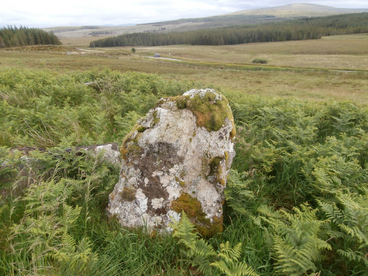
Cnoc Chaornaidh South-east submitted by markj99 on 5th Jul 2021. Interior of Cnoc Chaornaidh SE Cairn Chamber viewed from N.
(View photo, vote or add a comment)
Log Text: After visiting Cnoc Chaornaidh Central Cairn walk back to the mast then head SE (140°) for c. 220 yards to Cnoc Chaornaidh SE Cairn. It could be obscured by ferns in Spring and Summer.
Corrimony
Date Added: 11th Jul 2025
Site Type: Clava Cairn
Country: Scotland (Highlands)
Visited: Yes on 3rd May 2006. My rating: Condition 3 Ambience 4 Access 4
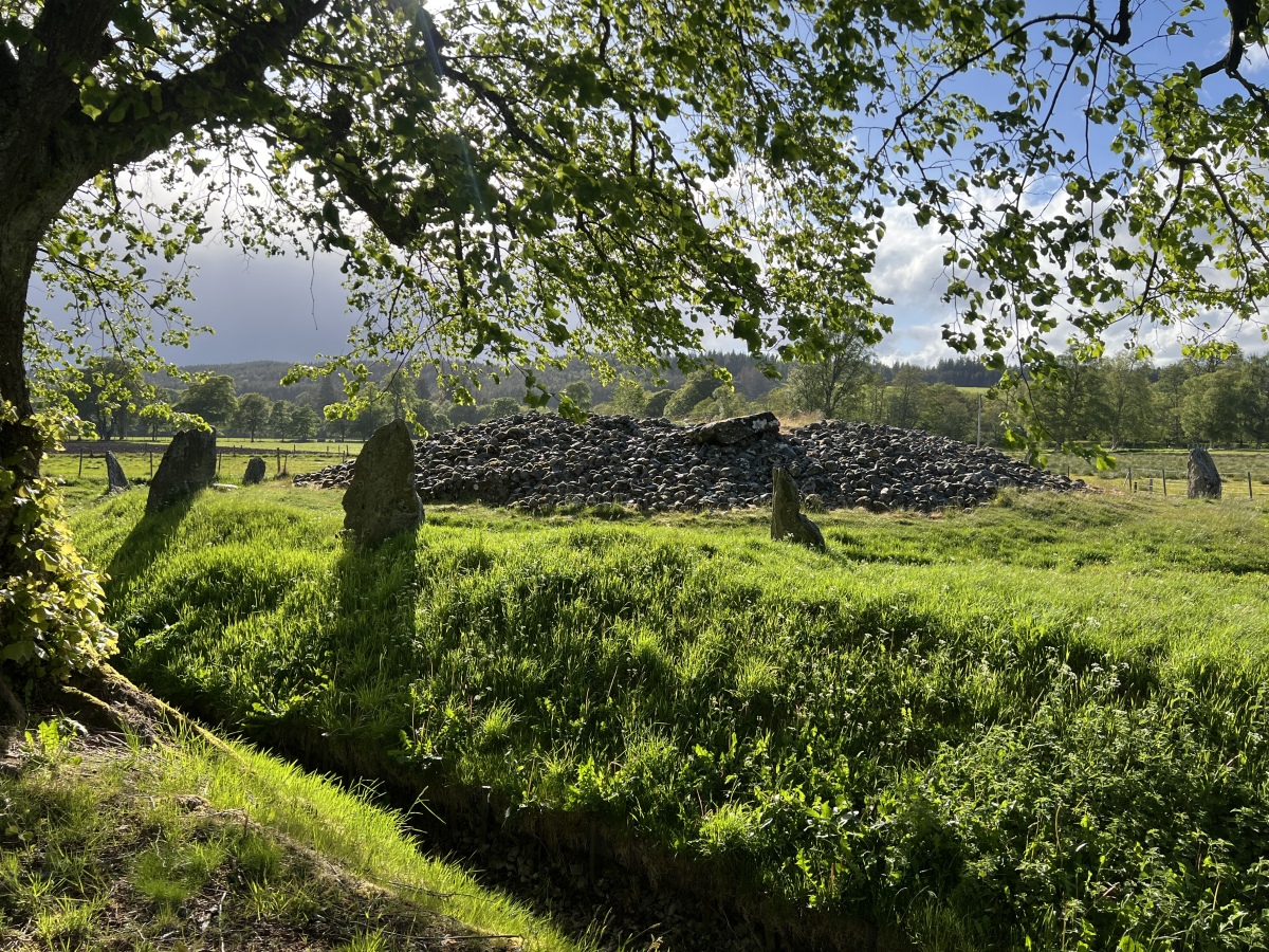
Corrimony submitted by Amouquesoy on 22nd Jun 2025. Taken from the entrance of the site (May 27th 2025 in the evening)
(View photo, vote or add a comment)
Log Text: Corrimony Clava Cairn has been excavated at least twice: first in 1830, then again in 1952. The central chamber was covered in 1830 but it is now open to the sky. Trove.scot Place 12256 states that 4 of the 11 outer stones are modern additions and 2 stones have been reset in modern times. With all this interference there is some doubt as to the authenticity of the clava cairn in its current form.
Cullearnie
Date Added: 26th Jul 2025
Site Type: Stone Circle
Country: Scotland (Highlands)
Visited: Yes on 21st Mar 2012. My rating: Condition 2 Ambience 4 Access 4
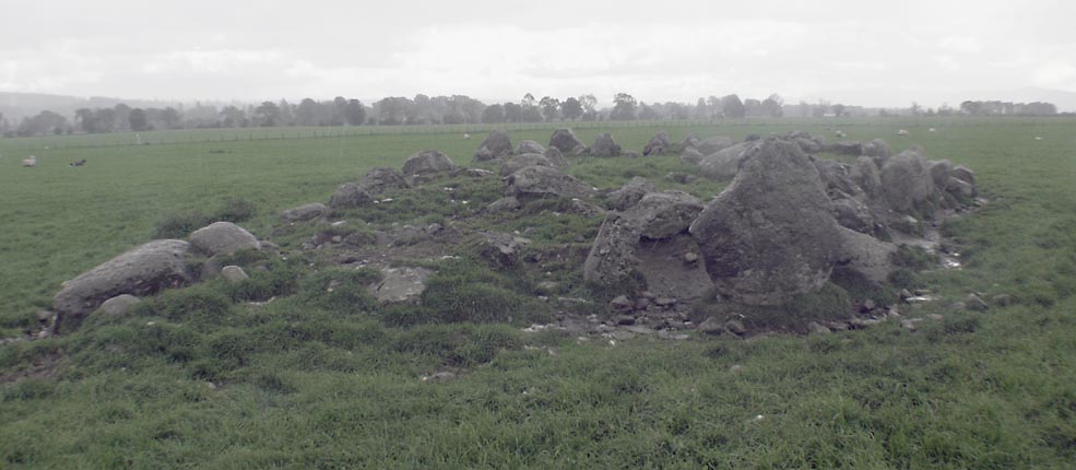
Cullearnie submitted by Tom_Bullock on 22nd Feb 2005. Photo used by kind permission of Tom Bullock. More details of this location are to be found on his Stone Circles and Rows CD-ROM.
(View photo, vote or add a comment)
Log Text: When I visited Cullernie Ring Cairn the field was in grass. I parked carefully in the wide junction of the A96 with Lower Cullernie Farm. There is a gate opposite the junction. This enabled me to walk safely along the margin of the field back to Cullernie Ring Cairn. It is not well preserved but it is still worth a visit if the field is not in crop.
Allanfearn
Date Added: 26th Jul 2025
Site Type: Chambered Cairn
Country: Scotland (Highlands)
Visited: Yes on 21st Mar 2012. My rating: Condition 2 Ambience 3 Access 4

Allanfearn submitted by TimPrevett on 31st Oct 2006. "Allanfearn" Chambered Cairn taken as the Rapsons bus whizzes along the A96. RCAHMS appears not to list it, so any more info appreciated.
(View photo, vote or add a comment)
Log Text: Culloden Cairn is a ruined cairn c. 25 yards NW of the A96 near Allanfearn Farm. The obvious feature of the cairn is an erect square pillar c. 5 feet high on the S Arc. There is a jumble of large recumbent stones on the grassy surface, possibly field clearance stones.
Dalcross Mains
Date Added: 29th Jul 2025
Site Type: Stone Circle
Country: Scotland (Highlands)
Visited: Yes on 21st Mar 2012
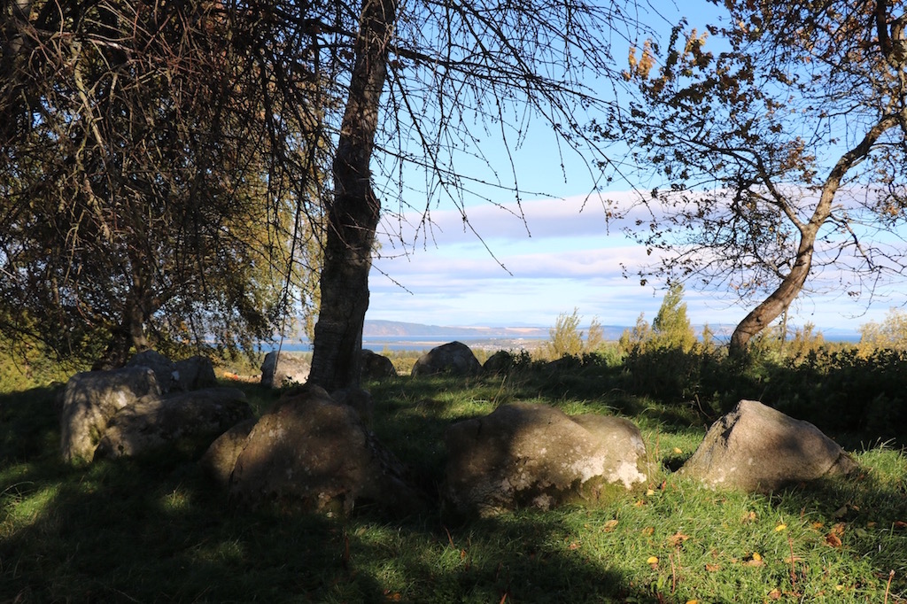
Dalcross Mains submitted by madmark23 on 23rd Oct 2015. A Professor comes and speaks to this cairn once a year.
(View photo, vote or add a comment)
Log Text: If you are visiting the Clava Cairns at Balnuaran it is a short detour to Dalcross Mains Clava Cairn. This unrestored site is an interesting contrast to the restored cairns. It has been subjected to extensive stone removal leaving a semi-circle of kerb stones on a grassy knoll with trees round the perimeter.
Daviot Ring Cairn
Date Added: 3rd Aug 2025
Site Type: Stone Circle
Country: Scotland (Highlands)
Visited: Yes on 21st Mar 2012
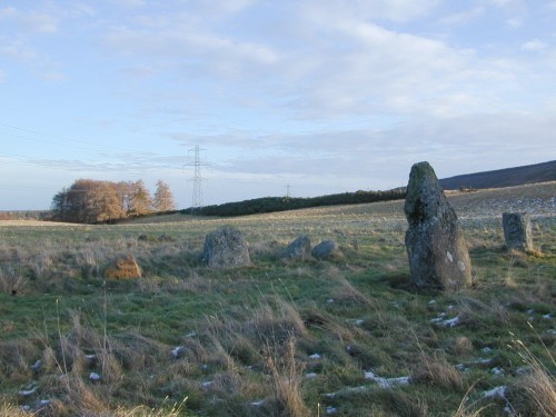
Daviot Ring Cairn submitted by steveco on 24th Feb 2002. Daviot Cairn & Circle NH727411. Surviving part of Clava type cairn and outer circle.
(View photo, vote or add a comment)
Log Text: Daviot Ring Cairn has 2 standing stone 20 feet S of the S Arc, sole remnants of a stone circle enclosing the ring cairn. It is defined by a round grassy platform with intermittent kerb stones up to c. 2 feet high in the centre.
Delfour
Date Added: 9th Aug 2025
Site Type: Cairn
Country: Scotland (Highlands)
Visited: Yes on 23rd Mar 2012. My rating: Condition 3 Ambience 4 Access 4
Delfour submitted by cosmic on 27th Sep 2006. Delfour from North
(View photo, vote or add a comment)
Log Text: It is surprising that there are substantial remains of Delfour Ring Cairn given its proximity to Mid & Easter Delfour Farms: most cairns located in arable land have been robbed out for construction of buildings and walls over the ages. There is a standing stone on the SW perimeter of Delfour Ring Cairn, sole survivor of an outer stone circle. The ring cairn has fared better with discernible inner and outer rings enclosed by large kerb stones.
