Contributory members are able to log private notes and comments about each site
Sites H_Fenton has logged. View this log as a table or view the most recent logs from everyone
Kinbrace Hill 1
Date Added: 3rd Feb 2012
Site Type: Cairn
Country: Scotland (Sutherland)
Visited: Yes on 14th Oct 2011

Kinbrace Hill 1 submitted by h_fenton on 14th Oct 2011. Kinbrace Hill, long cairn/s.
The coniferous plantation surrounding the site had recently been felled.
8 May 2011
(View photo, vote or add a comment)
Log Text: None
Roel Camp
Date Added: 3rd Feb 2012
Site Type: Hillfort
Country: England (Gloucestershire)
Visited: Yes on 15th Oct 2011
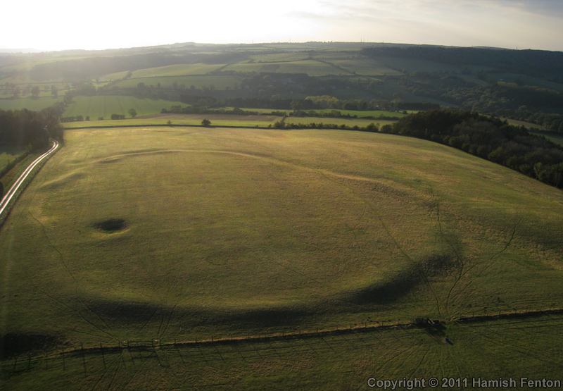
Roel Camp submitted by h_fenton on 15th Oct 2011. Roel Camp, photographed from the east.
Kite Aerial Photograph
15 October 2011 @ 4.56pm
(View photo, vote or add a comment)
Log Text: None
Edin's Hall
Date Added: 3rd Feb 2012
Site Type: Broch or Nuraghe
Country: Scotland (Scottish Borders)
Visited: Yes on 24th Oct 2011
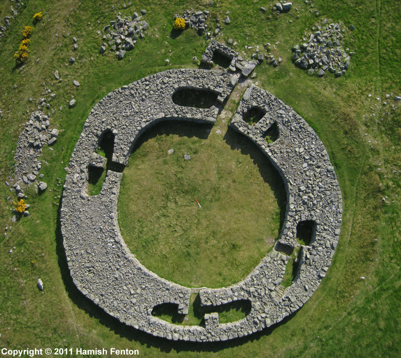
Edin's Hall submitted by h_fenton on 24th Oct 2011. Edin's Hall Broch, a vertical Kite Aerial Photograph, the scale in the centre of the broch is 1metre long (I'm not sure why I did not align it to north).
19 May 2011
(View photo, vote or add a comment)
Log Text: None
Leckhampton Hill
Date Added: 3rd Feb 2012
Site Type: Hillfort
Country: England (Gloucestershire)
Visited: Yes on 10th Nov 2011
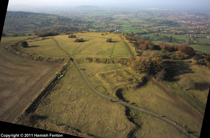
Leckhampton Hill submitted by h_fenton on 10th Nov 2011. Leckhampton Hill hillfort / promontory fort, Gloucestershire. Viewed from the east.
Kite Aerial Photograph
6 November 2011
(View photo, vote or add a comment)
Log Text: None
Cleeve Hill Cross Dyke
Date Added: 3rd Feb 2012
Site Type: Misc. Earthwork
Country: England (Gloucestershire)
Visited: Yes on 19th Nov 2011
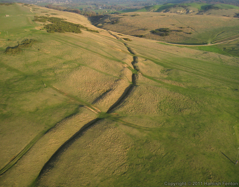
Cleeve Hill Cross Dyke submitted by h_fenton on 19th Nov 2011. Cleeve Hill Cross Dyke, photographed from the east.
Kite Aerial Photograph
13 November 2011
(View photo, vote or add a comment)
Log Text: None
The Ring (Gloucestershire)
Date Added: 3rd Feb 2012
Site Type: Ancient Village or Settlement
Country: England (Gloucestershire)
Visited: Yes on 19th Nov 2011

The Ring (Gloucestershire) submitted by h_fenton on 19th Nov 2011. The Ring, enclosure on Cleeve Hill (Cleeve Common) Gloucestershire.
Kite Aerial Photograph from the north west.
13 November 2011 @ 2.35pm
(View photo, vote or add a comment)
Log Text: None
Leckhampton Hill Barrow
Date Added: 3rd Feb 2012
Site Type: Round Barrow(s)
Country: England (Gloucestershire)
Visited: Yes on 22nd Nov 2011

Leckhampton Hill Barrow submitted by h_fenton on 22nd Nov 2011. Vertical Kite Aerial Photograph of the Square enclosure and barrow/pit remains of Leckhampton Hill Barrow. (top of photograph is north)
6 November 2011
(View photo, vote or add a comment)
Log Text: None
Nottingham Hill
Date Added: 3rd Feb 2012
Site Type: Hillfort
Country: England (Gloucestershire)
Visited: Yes on 29th Nov 2011
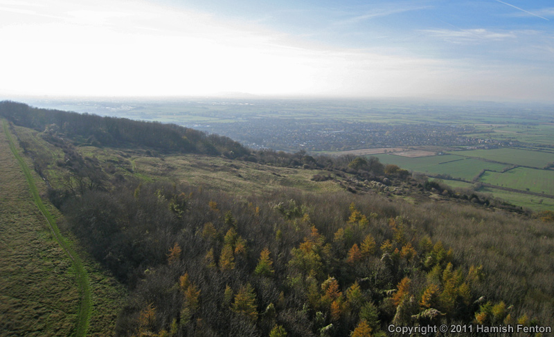
Nottingham Hill submitted by h_fenton on 29th Nov 2011. Looking southwards from the north western edge (left of photo) of Nottingham Hill, views over Bishops Cleeve and the Severn Valley.
Kite Aerial Photograph
13 November 2011
(View photo, vote or add a comment)
Log Text: None
Bukhara Ark
Date Added: 3rd Feb 2012
Site Type: Ancient Village or Settlement
Country: Uzbekistan
Visited: Yes on 29th Nov 2011
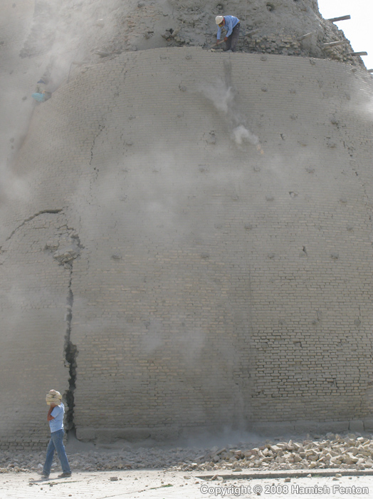
Bukhara Ark submitted by h_fenton on 29th Nov 2011. Demolishing the outer facing of the reconstructed old city walls (Bukhara Ark) prior to reconstructing them again.
29 May 2008
(View photo, vote or add a comment)
Log Text: None
The Knolls
Date Added: 3rd Feb 2012
Site Type: Ancient Village or Settlement
Country: England (Gloucestershire)
Visited: Yes on 29th Nov 2011
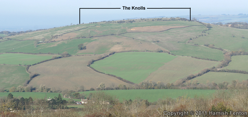
The Knolls submitted by h_fenton on 29th Nov 2011. The Knolls, viewed from the south (Nottingham Hill).
13 November 2011
(View photo, vote or add a comment)
Log Text: None
The Borg
Date Added: 3rd Feb 2012
Site Type: Broch or Nuraghe
Country: Scotland (Sutherland)
Visited: Yes on 30th Nov 2011
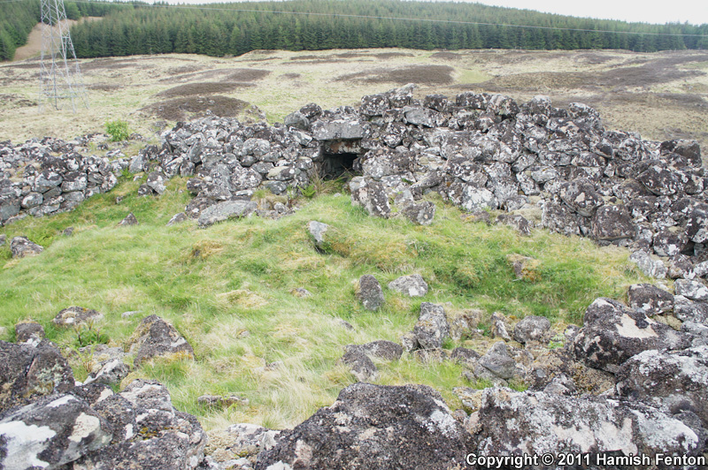
The Borg submitted by h_fenton on 30th Nov 2011. The interior of The Borg (Broch).
11 May 2011
(View photo, vote or add a comment)
Log Text: None
Garrywhin Fort
Date Added: 3rd Feb 2012
Site Type: Hillfort
Country: Scotland (Caithness)
Visited: Yes on 30th Nov 2011
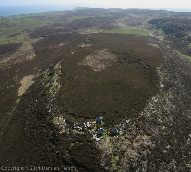
Garrywhin Fort submitted by h_fenton on 30th Nov 2011. Garrywhin Fort, viewed from the north.
Kite Aerial Photograph
9 May 2011
(View photo, vote or add a comment)
Log Text: None
Garrywhin Multiple Stone Rows
Date Added: 3rd Feb 2012
Site Type: Multiple Stone Rows / Avenue
Country: Scotland (Highlands)
Visited: Yes on 30th Nov 2011
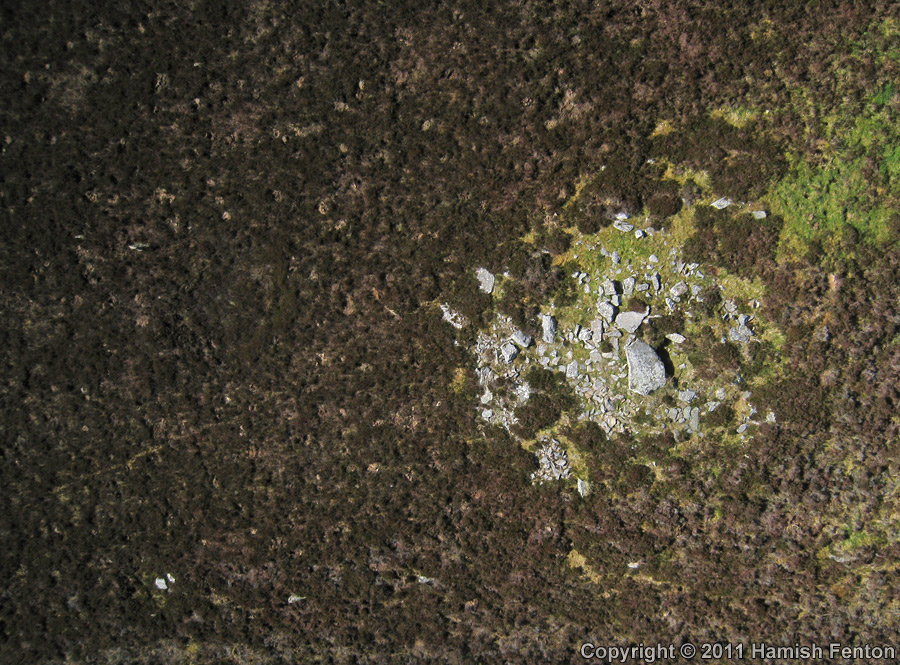
Garrywhin Multiple Stone Rows submitted by h_fenton on 30th Nov 2011. Vertical Kite Aerial Photograph of the cairn/cist which Garrywhin stone rows radiate out from, the right of the photo is roughly northeast.
The cist lies in the shadow of the large slab at the centre of the cairn.
There is a stone row close to and running parallel with the bottom of the photo, the stones are on edge. there are further fragments of stone rows visible in other parts of the left side of the photograph.
9 May 2011
(View photo, vote or add a comment)
Log Text: None
Lodge Park
Date Added: 3rd Feb 2012
Site Type: Long Barrow
Country: England (Gloucestershire)
Visited: Yes on 6th Dec 2011

Lodge Park submitted by h_fenton on 6th Dec 2011. Erosion on the north east side of Lodge Park Long Barrow. Sheep are probably the main perpetrators here.
The barrow has now been temporarily enclosed by an electric fence to keep the sheep off.
16 October 2011
(View photo, vote or add a comment)
Log Text: None
Burderop Down
Date Added: 3rd Feb 2012
Site Type: Ancient Village or Settlement
Country: England (Wiltshire)
Visited: Yes on 9th Dec 2011

Burderop Down submitted by h_fenton on 9th Dec 2011. Celtic field systems on Burderop Down. Viewed from the west.
Kite Aerial Photograph
9 December 2011 @ 12.08
(View photo, vote or add a comment)
Log Text: None
Stonehenge Bowl Barrow
Date Added: 3rd Feb 2012
Site Type: Round Barrow(s)
Country: England (Wiltshire)
Visited: Yes on 23rd Dec 2011
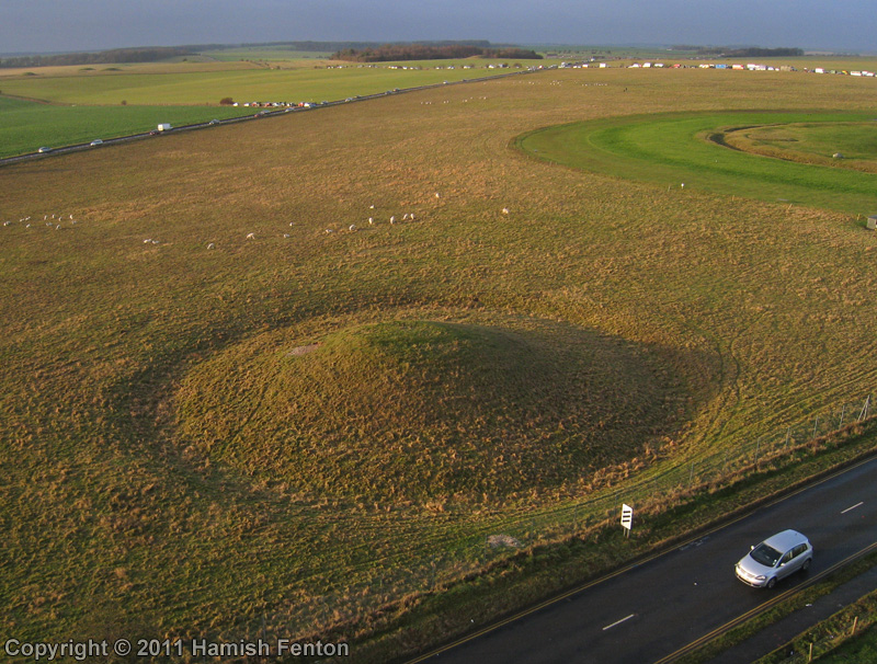
Stonehenge Bowl Barrow submitted by h_fenton on 23rd Dec 2011. Amesbury 11 bell barrow located about 150metres to the east of Stonehenge.
Kite Aerial Photograph
22 December 2011 @ 9.17am
(View photo, vote or add a comment)
Log Text: None
The Avenue
Date Added: 3rd Feb 2012
Site Type: Ancient Trackway
Country: England (Wiltshire)
Visited: Yes on 29th Dec 2011
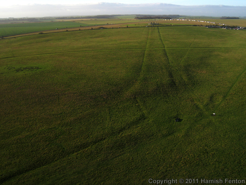
The Avenue submitted by h_fenton on 29th Dec 2011. The 'Elbow' of the Stonehenge Avenue as it rises out of the valley and turns towards stonehenge.
Grid Reference: SU 1272 4258
Kite Aerial Photograph
22 December 2011 @ 10.08am
(View photo, vote or add a comment)
Log Text: None
Dreva Craig
Date Added: 3rd Feb 2012
Site Type: Hillfort
Country: Scotland (Scottish Borders)
Visited: Yes on 3rd Feb 2012
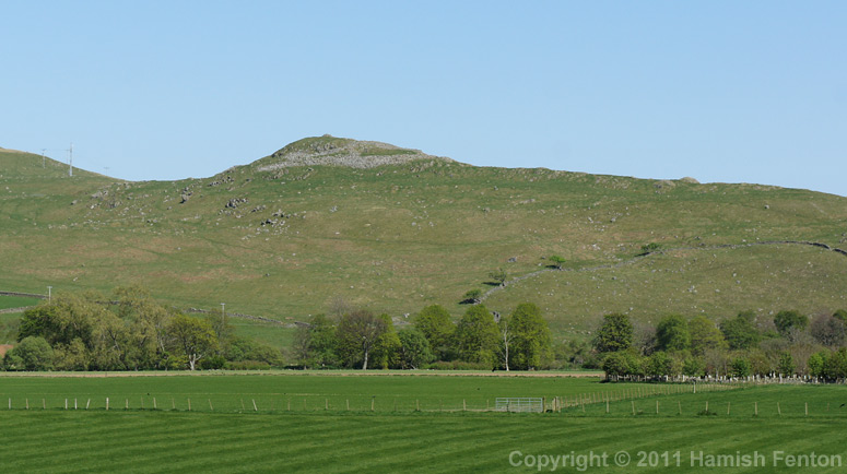
Dreva Craig submitted by h_fenton on 3rd Feb 2012. Dreva Craig, viewed from the west (A701).
30 April 2011
(View photo, vote or add a comment)
Log Text: None
Sueno's Stone
Date Added: 12th Jun 2011
Site Type: Class III Pictish Cross Slab
Country: Scotland (Moray)
Visited: Yes on 6th May 2011
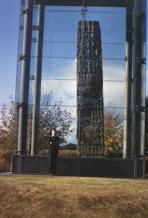
Sueno's Stone submitted by Cosmic on 9th Nov 2003. Another view of the Sueno Pictish Stone at NJ046595. The largest stone we've ever seen - enclosed in perspex case to protect it - only yards away from A96 Dual carriageway and yet how many people ever notice it?
(View photo, vote or add a comment)
Log Text: Its a great shame that the glass surrounding the stone is so reflective, OK the stone is protected from the weather but you can't see it properly for all the reflections.
Cullykhan
Date Added: 12th Jun 2011
Site Type: Promontory Fort / Cliff Castle
Country: Scotland (Aberdeenshire)
Visited: Yes on 6th May 2011. My rating: Access 4
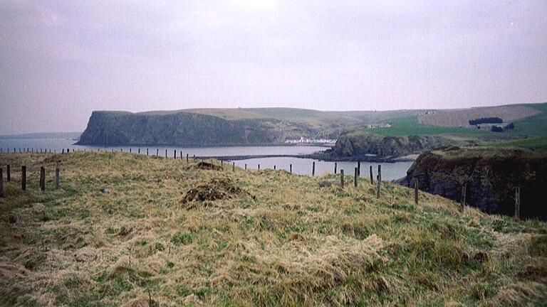
Cullykhan submitted by tyrianterror on 24th Jun 2007. Promontory fort; multi-phase site with a scooped platform site on N side; a double-palisade on W entrance with associated gateslot; a large timber-built gateway with gateslot and remains of large oak timbers still in situ in post-holes; remains of houses of different phases; an industrial area with working bowls and hearths, with a complete crucible found beside one of the hearths. A vitrified timber-laced rampart, possibly double on the W side and single in the N; some evidence of a Pictish str...
(View photo, vote or add a comment)
Log Text: Trenches from archaeological excavations not backfilled, site looks a mess. Difficult to interpret what is at this site due to trenches everywhere. Lack of spoil heaps suggests to me there there was no spoil to backfill the trenches because it was probably tipped over the cliff.
