Contributory members are able to log private notes and comments about each site
Sites George998 has logged. View this log as a table or view the most recent logs from everyone
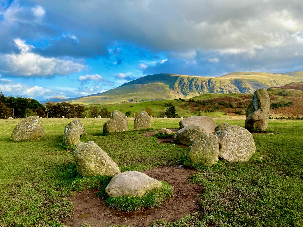
Castlerigg
Date Added: 16th Feb 2025
Site Type: Stone Circle
Country: England (Cumbria)
Visited: Yes on 16th May 2023. My rating: Condition 4 Ambience 5 Access 4

Castlerigg submitted by Pressure on 9th Nov 2022. Castlerigg October 22
(View photo, vote or add a comment)
Log Text: None
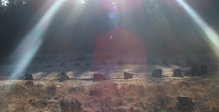
Fernworthy circle
Date Added: 2nd Feb 2025
Site Type: Stone Circle
Country: England (Devon)
Visited: Yes on 1st Jan 2021. My rating: Condition 4 Ambience 4 Access 3

Fernworthy circle submitted by postman on 31st May 2013. Setting the controls for the heart of the sun.
(View photo, vote or add a comment)
Log Text: None
Fernworthy stone row SW
Date Added: 2nd Feb 2025
Site Type: Multiple Stone Rows / Avenue
Country: England (Devon)
Visited: Yes on 1st Jan 2021. My rating: Condition 4 Ambience 4 Access 3

Fernworthy stone row SW submitted by thecaptain on 14th Aug 2004. Fernworthy South Avenue, leading to the stone circle.
Picture from about 1995
(View photo, vote or add a comment)
Log Text: None
Pontesford Hill
Date Added: 12th Apr 2022
Site Type: Hillfort
Country: England (Shropshire)
Visited: Yes on 1st Apr 2022. My rating: Condition 3 Ambience 4 Access 4
Pontesford Hill submitted by TimPrevett on 29th Jun 2004. Find a hill in Shropshire, and it likely has a hillfort upon it! In this picture are two hillforts - Earl's Hill Camp (a rampart can be seen upon the right hand side of the top hill), and Pontesford Hill hillfort, covered by trees now. Taken on the move on the A488 looking south.
(View photo, vote or add a comment)
Log Text: None
Earls Hill Camp
Date Added: 12th Apr 2022
Site Type: Hillfort
Country: England (Shropshire)
Visited: Yes on 4th Jan 2020. My rating: Condition 4 Ambience 4 Access 3

Earls Hill Camp submitted by stevep on 4th Nov 2009. earls hill hillfort closeup. the inner and outer ramparts can be clearly seen.
(View photo, vote or add a comment)
Log Text: None
Caer Caradoc (Church Stretton)
Date Added: 12th Apr 2022
Site Type: Hillfort
Country: England (Shropshire)
Visited: Yes on 12th Apr 2022. My rating: Condition 4 Ambience 5 Access 2
Caer Caradoc (Church Stretton) submitted by TimPrevett on 28th Jun 2004. Caer Caradoc, taken from a northwest angle on a lovely summer's morning. Indeed, this offers some formidable defense. If this were the place of Caratacus' last stand against the Romans, this would have indeed been something difficult to conquer, even by Roman standards. However, there is no evidence to confirm this suggestion.
(View photo, vote or add a comment)
Log Text: None
Mitchell's Fold
Date Added: 12th Apr 2022
Site Type: Stone Circle
Country: England (Shropshire)
Visited: Yes on 20th Jun 2021. My rating: Condition 4 Ambience 5 Access 4

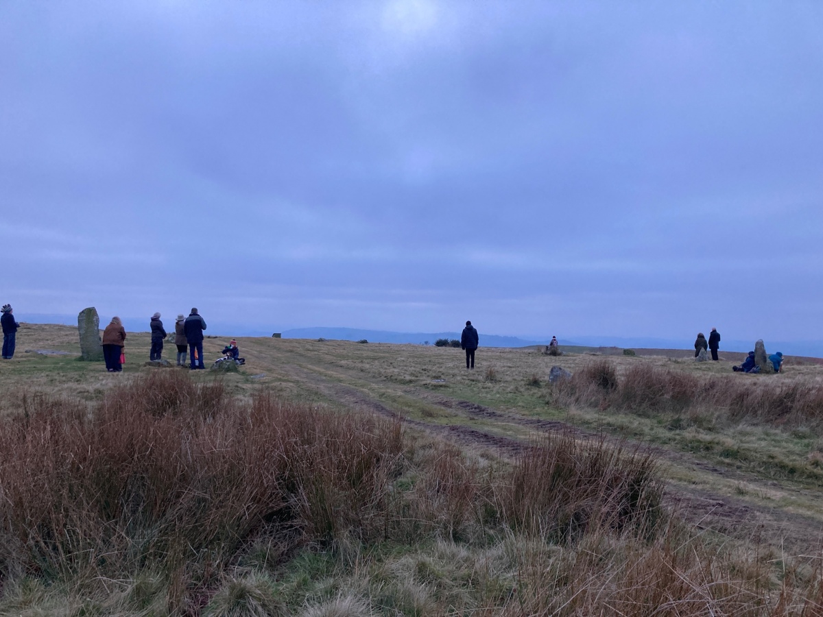
Mitchell's Fold submitted by w650marion on 21st Dec 2021. Gathering at Mitchell’s Fold circle for the setting sun on the winter solstice 2021. Lovely atmosphere despite the cloudy sky at sunset!
(View photo, vote or add a comment)
Log Text: None
Pen-Y-Wern Hill
Date Added: 25th Jan 2025
Site Type: Stone Circle
Country: England (Shropshire)
Visited: Yes on 25th Jan 2025. My rating: Condition 2 Ambience 4 Access 4
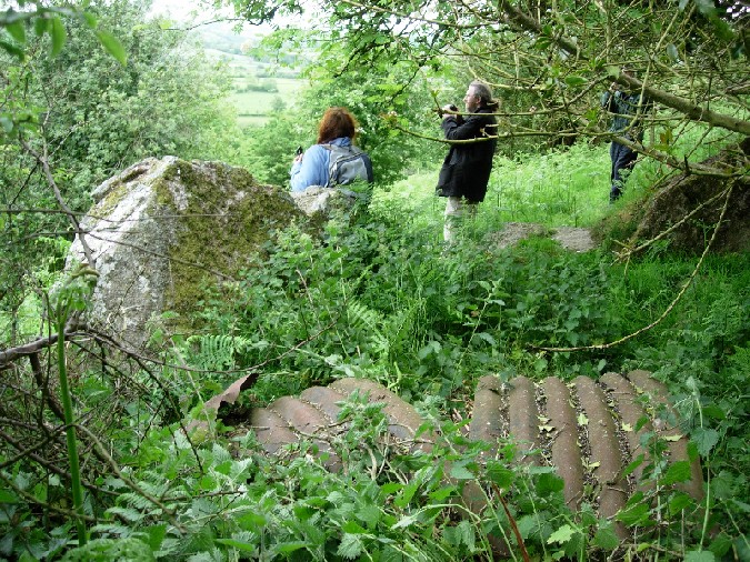
Pen-Y-Wern Hill submitted by Firewhorl on 7th Jun 2004. Pen-Y-Wern Hill, Shropshire
(View photo, vote or add a comment)
Log Text: None
Botley Stone
Date Added: 30th Mar 2025
Site Type: Ring Cairn
Country: England (Shropshire)
Visited: Yes on 1st Mar 2025. My rating: Condition 2 Ambience 4 Access 3
Botley Stone submitted by TimPrevett on 16th May 2004. Picture shows the ring cairn in the foreground, looking north into the forest.
Botley Stone is classified as the remains of a Bronze Age ring cairn. What is visible now, is a hollowed out grass ring; upon closer inspection a good number of angular rocks are visible under the grass. Ring cairns are very rare in Shropshire, and given that all other burial monuments upon The Long Mynd are barrows comprised of earth (some with varying degrees of stones or kerbing surviving) of, this ring cairn is...
(View photo, vote or add a comment)
Log Text: Actually located about 100m west of where the icon is shown on the megalithic map.
Ritton Castle
Date Added: 30th Mar 2025
Site Type: Hillfort
Country: England (Shropshire)
Visited: Yes on 1st Jan 2024. My rating: Condition 2 Ambience 3 Access 1
Ritton Castle submitted by TheWhiteRider on 30th May 2006. Ritton Castle. Taken last July, this part of the bank near the footpath is almosty completely obscured by grasses and trees.
(View photo, vote or add a comment)
Log Text: None
Mitchell's Fold outlier
Date Added: 30th Mar 2025
Site Type: Standing Stone (Menhir)
Country: England (Shropshire)
Visited: Yes on 1st Jan 2024. My rating: Condition 4 Ambience 5 Access 4

Mitchell's Fold outlier submitted by Humbucker on 4th Jan 2018. The outlier to Mitchells Fold with Corndon Hill as a backdrop. When the ferns are in full glory it can be pretty difficult to locate this stone at all.
(View photo, vote or add a comment)
Log Text: None
Cow Stone (Shropshire)
Date Added: 30th Mar 2025
Site Type: Standing Stone (Menhir)
Country: England (Shropshire)
Visited: Yes on 1st Jan 2024. My rating: Condition 5 Ambience 4 Access 4
Cow Stone (Shropshire) submitted by baz on 19th Jan 2003. The Cow Stone or "Dead Cow". SO308988.
Approx. 400 yards N.E. of Mitchells Fold stone circle, beside the path leading from the circle to Stapeley Hill, lies the Cow Stone, or "Dead Cow". In the 1920s, chippings were analyzed from this stone, one from Mitchells Fold and four from the Hoarstones stone circle, which lies just over one mile away to the N.E. They were all found to be of dolerite, a vein of which runs through the area. Two miles to the south was the Cwm Mawr dolerite stone axe factor...
(View photo, vote or add a comment)
Log Text: None
Bury Ditches (Shropshire)
Date Added: 30th Mar 2025
Site Type: Hillfort
Country: England (Shropshire)
Visited: Yes on 1st Jan 2024. My rating: Condition 3 Ambience 4 Access 3
Bury Ditches (Shropshire) submitted by TimPrevett on 13th Feb 2006. A composite of 3 shots, looking south at the eastern entrance of Bury Ditches. John & Lynne K here help give a sense of scale.
(View photo, vote or add a comment)
Log Text: None
Wildmoor Bowl Barrow
Date Added: 30th Mar 2025
Site Type: Round Barrow(s)
Country: England (Shropshire)
Visited: Yes on 1st Jan 2023. My rating: Condition 3 Ambience 4 Access 4
Wildmoor Bowl Barrow submitted by TheWhiteRider on 26th Jun 2006. Wildmoor Bowl Barrow.
(View photo, vote or add a comment)
Log Text: None
Robin Hood's Butts (Shropshire)
Date Added: 30th Mar 2025
Site Type: Round Barrow(s)
Country: England (Shropshire)
Visited: Yes on 1st Jan 2024. My rating: Condition 3 Ambience 5 Access 4
Robin Hood's Butts (Shropshire) submitted by TimPrevett on 25th Apr 2004. A pair of round barrows 150 feet apart on the northern edge of The Long Mynd, bearing the same name of many other pairs of barrows throughout England.
The best preserved barrow is 110 feet in diameter, and 12 feet high, and fairly accessible, though a trouser clad trek through the heather is necessary. Its northern edge is bisected by a field boundary. Though now defined by a barbed wire fence, the boundary is thought likely to be of prehistoric origin.
The other barrow is some 60 feet acr...
(View photo, vote or add a comment)
Log Text: None
Callow Hill Camp
Date Added: 30th Mar 2025
Site Type: Hillfort
Country: England (Shropshire)
Visited: Yes on 1st Jan 2022. My rating: Condition 2 Ambience 3 Access 4
Callow Hill Camp submitted by TheWhiteRider on 30th Jul 2005. Part of the Southern Sector.
(View photo, vote or add a comment)
Log Text: None
Stapeley Hill Earthworks
Date Added: 6th Apr 2025
Site Type: Misc. Earthwork
Country: England (Shropshire)
Visited: Yes on 1st Apr 2025. My rating: Condition 4 Ambience 5 Access 4
Stapeley Hill Earthworks submitted by TimPrevett on 6th May 2005. Showing one of the Bronze Age earthworks that completely traverses Stapeley Hill east to west here; I've marked a line just under the dark green cross dyke here to help the unfamiliar spot the feature. See the main entry for more details - click the blue highlighted text to the top left of the pic for more information.
(View photo, vote or add a comment)
Log Text: None
Stapeley Hill Cairn
Date Added: 6th Apr 2025
Site Type: Cairn
Country: England (Shropshire)
Visited: Yes on 1st Apr 2025. My rating: Condition 3 Ambience 5 Access 3
Stapeley Hill Cairn submitted by TimPrevett on 30th Dec 2004. A cairn on Stapeley Hill; see main entry for full details - click on blue text link to the left of the picture.
A composite shot looking towards Corndon Hill, and Mitchell's Fold (out of view).
It was snowing hard at this point on Midwinter Solstice Eve, and even I was questioning my sanity about being in this exposed, beautiful and dramatic landscape.
A biting wind meant I did not stay here for any longer than necessary to get a shot, but on subsequent trips, it will be worth spending tim...
(View photo, vote or add a comment)
Log Text: None
Giant's Grave (Shropshire)
Date Added: 6th Apr 2025
Site Type: Burial Chamber or Dolmen
Country: England (Shropshire)
Visited: Yes on 1st Apr 2025. My rating: Condition 2 Ambience 4 Access 1

Giant's Grave (Shropshire) submitted by TimPrevett on 21st Jan 2006. Picture is at the front of the recess into the hill, known as Giant's Grave, or Cave,which has been postulated as a possible dolmen. We thought that very unlikely, though with stones across the entrance, a shelter for the living seemed more possible as the hill blocks the prevailing SW, or W winds. The landowner seemed delighted with our visit, and gave us permission, and as much information as he knew.
(View photo, vote or add a comment)
Log Text: None
Holywell Brook (Rorrington)
Date Added: 6th Apr 2025
Site Type: Holy Well or Sacred Spring
Country: England (Shropshire)
Visited: Yes on 1st Apr 2025. My rating: Condition 1 Ambience 5 Access 3
Holywell Brook (Rorrington) submitted by TimPrevett on 12th Jul 2005. On the far north end of Stapeley Hill, two springs close to each other emanate from the hillside, converging into one brook.
For centuries these springs were venerated, even as late as the 19th Century. On Holy Thursday, there would be a procession here, and the springs decorated and dressed. Ritual dropping of pins into the water, drinking of a brew made from water and sugar, and eating of cakes were observed. All this followed by a fair in Rorrington village itself.
Source: Stapeley Hill H...
(View photo, vote or add a comment)
Log Text: None
