Contributory members are able to log private notes and comments about each site
Sites FrothNinja has logged. View this log as a table or view the most recent logs from everyone
The Great Stone Of Fourstones
Date Added: 16th Jan 2017
Site Type: Natural Stone / Erratic / Other Natural Feature
Country: England (Yorkshire (North))
Visited: Yes
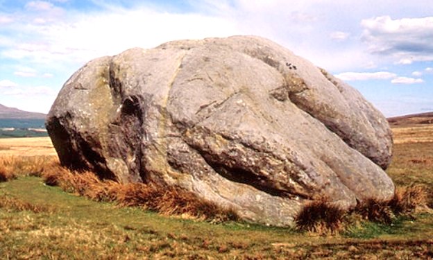
The Great Stone Of Fourstones submitted by Sunny100 on 9th Jun 2010. The Great Stone Of Fourstones Nr Bentham, N.Yorks at SD.669663.
(View photo, vote or add a comment)
Log Text: None
The Braaid
Date Added: 16th Jan 2017
Site Type: Ancient Village or Settlement
Country: Channel Islands and Isle of Man (Isle of Man)
Visited: Yes
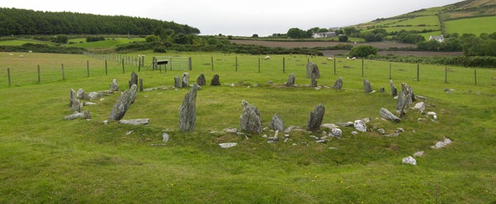
The Braaid submitted by howe on 26th Aug 2010. The site consists of three structures, one circular the others rectangular. Excavated in 1935 and 1962, the circular structure has been suggested as a Bronze Age stone circle, the structure of which was incorporated in a round house, the earliest phase being estimated as Iron Age. It may have been re-modelled when the other structures were built. These consist of a boat-shaped Norse hall and outbuilding, both of which had stones side walls and timber gables.
(View photo, vote or add a comment)
Log Text: None
The Avenue
Date Added: 16th Jan 2017
Site Type: Ancient Trackway
Country: England (Wiltshire)
Visited: Yes
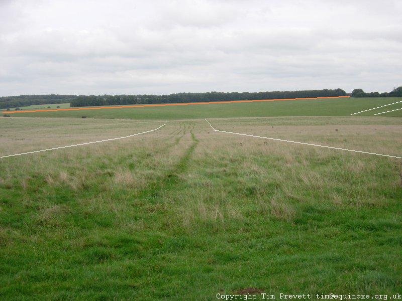
The Avenue submitted by TimPrevett on 10th Oct 2006. Looking NE along the last stretch of The Avenue. I've appended, albeit somewhat crudely, some lines to show the course of the outside of the parallel banks, and their *approximate* direction swinging off to the east. The tan line in the distance shows the line of some of the Cursus, which predates the Avenue considerably.
(View photo, vote or add a comment)
Log Text: None
Swastika Stone 01
Date Added: 16th Jan 2017
Site Type: Rock Art
Country: England (Yorkshire (West))
Visited: Yes
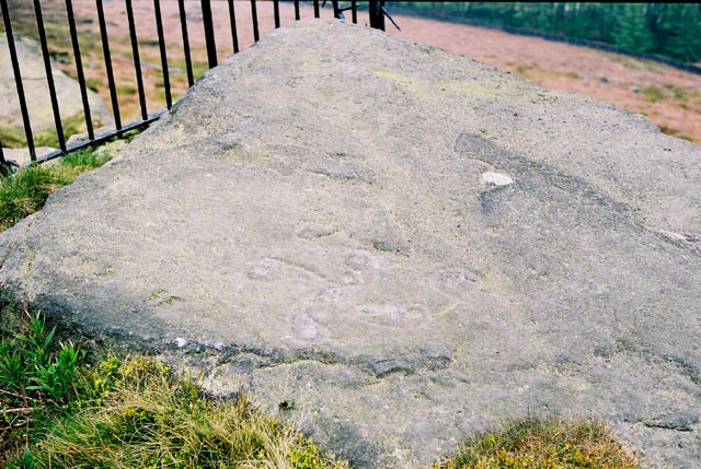
Swastika Stone 01 submitted by andy_h on 17th May 2003. The swastika motif is now badly worn, but is still possible to see a cross of cups, five by five, surrounded by four curved arms. The right hand one ending in a loop and cup mark.
(View photo, vote or add a comment)
Log Text: None
Summerhouse Hill Cairn
Date Added: 16th Jan 2017
Site Type: Cairn
Country: England (Lancashire)
Visited: Couldn't find on 12th Jul 2016. My rating: Condition 2 Ambience 4 Access 4

Summerhouse Hill Cairn submitted by LivingRocks on 17th Apr 2005. The cairn sited east of the flat summit of Summerhouse Hill.
(View photo, vote or add a comment)
Log Text: None
Summerhouse Hill
Date Added: 16th Jan 2017
Site Type: Modern Stone Circle etc
Country: England (Lancashire)
Visited: Yes on 12th Jul 2016. My rating: Condition 2 Ambience 4 Access 4
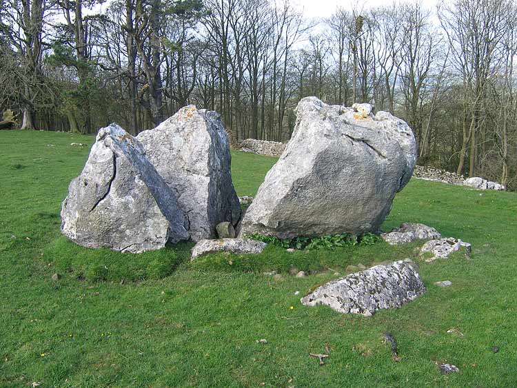
Summerhouse Hill submitted by LivingRocks on 12th Apr 2005. The northerly split stone.
(View photo, vote or add a comment)
Log Text: None
Stenness
Date Added: 16th Jan 2017
Site Type: Stone Circle
Country: Scotland (Orkney)
Visited: Yes on 1st Nov 1986. My rating: Condition 3 Ambience 4 Access 5
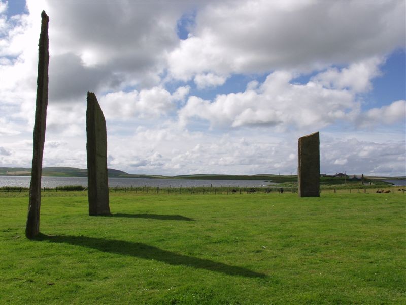
Stenness submitted by Runemage on 15th Jul 2005. Ethereal and numinous.
(View photo, vote or add a comment)
Log Text: None
St. Patrick's Chair
Date Added: 16th Jan 2017
Site Type: Early Christian Sculptured Stone
Country: Channel Islands and Isle of Man (Isle of Man)
Visited: Yes
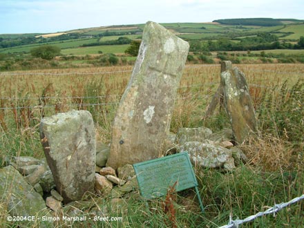
St. Patrick's Chair submitted by Kammer on 30th Jan 2004. St. Patrick's Chair (SC315779) is usually interpreted as an early Christian meeting place. Photo taken 25th August 2003.
(View photo, vote or add a comment)
Log Text: None
St Columba's Well (Southend)
Date Added: 16th Jan 2017
Site Type: Holy Well or Sacred Spring
Country: Scotland (Argyll)
Visited: Yes on 1st Aug 2014
St Columba's Well (Southend) submitted by KiwiBetsy on 8th Oct 2006. The church, cemetery, well and footprint lie on the north side of the minor road to the Mull of Kintyre … about two miles past Southend. The well lies about 20 yards northwest of the northwest corner of the ruined church. The easiest way to reach it is to park in the cemetery carpark and walk around the next corner (heading to the Mull of Kintyre). Just around the bend is a signed path to the footprint. Take this path past the foot print and you will come to the well on your left just by the p...
(View photo, vote or add a comment)
Log Text: None
St Buryan (Village)
Date Added: 16th Jan 2017
Site Type: Ancient Cross
Country: England (Cornwall)
Visited: Yes on 7th Aug 2016. My rating: Condition 3 Ambience 3 Access 5
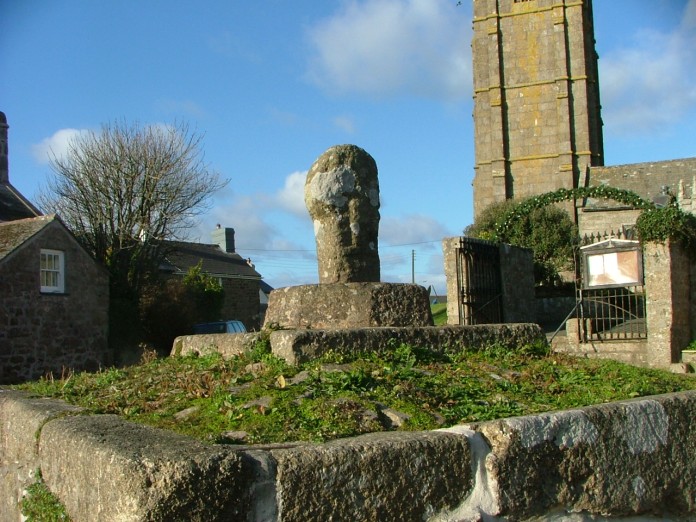
St Buryan (Village) submitted by enkidu41 on 16th Nov 2004. It is possible that this cross may have been adopted as a Market Cross when the parish of St. Buryan was granted a market charter in 1302. The platform is certainly at a focal point of the village.
(View photo, vote or add a comment)
Log Text: None
St Buryan (Churchyard)
Date Added: 16th Jan 2017
Site Type: Ancient Cross
Country: England (Cornwall)
Visited: Yes on 7th Aug 2016. My rating: Condition 3 Ambience 4 Access 5
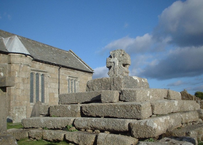
St Buryan (Churchyard) submitted by enkidu41 on 16th Nov 2004. One of the most impressive pre-conquest crosses in Penwith.
(View photo, vote or add a comment)
Log Text: None
Spiral stone (Ballaragh)
Date Added: 16th Jan 2017
Site Type: Rock Art
Country: Channel Islands and Isle of Man (Isle of Man)
Visited: Yes
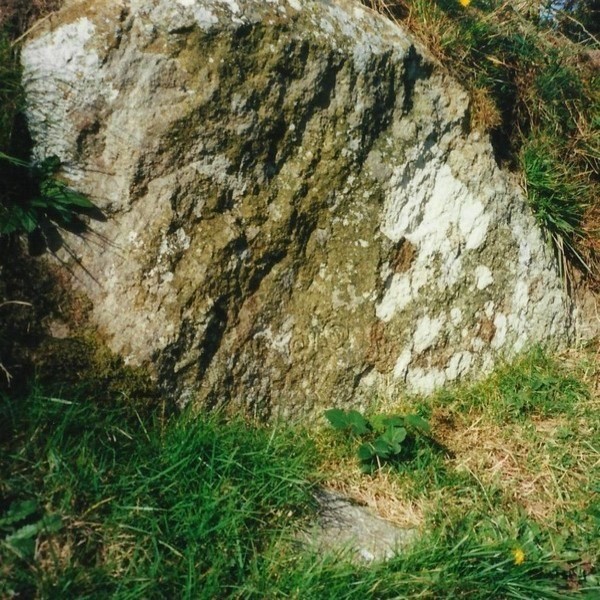
Spiral stone (Ballaragh) submitted by Bladup on 18th Oct 2014. Spiral stone, you can see the spirals towards the bottom of the stone.
(View photo, vote or add a comment)
Log Text: None
Smitten Corner
Date Added: 16th Jan 2017
Site Type: Barrow Cemetery
Country: England (Dorset)
Visited: Yes on 1st Aug 2013
Smitten Corner submitted by TimPrevett on 23rd May 2005. At least three barrows are visible next to this path, looking north west, where the path emerges from the wood near Hardy Monument.
(View photo, vote or add a comment)
Log Text: None
Skara Brae
Date Added: 16th Jan 2017
Site Type: Ancient Village or Settlement
Country: Scotland (Orkney)
Visited: Yes on 1st Nov 1986. My rating: Condition 3 Ambience 5 Access 5
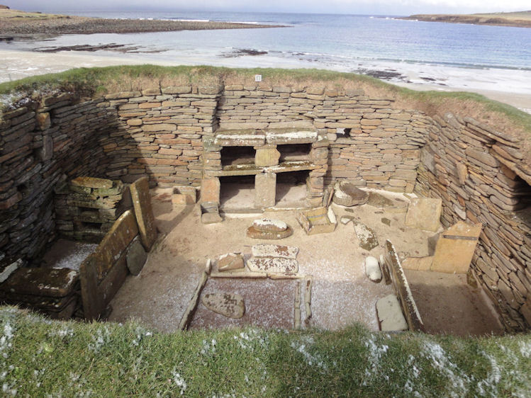
Skara Brae submitted by paulinelen on 30th Apr 2012. Hut 1 looking out over the sea - such beautiful colour contrasts creates a fantastic atmosphere.
(View photo, vote or add a comment)
Log Text: None
Silbury Hill
Date Added: 16th Jan 2017
Site Type: Artificial Mound
Country: England (Wiltshire)
Visited: Saw from a distance
Silbury Hill submitted by MikeyB on 26th Nov 2012. Reflections of Silbury Hill
(View photo, vote or add a comment)
Log Text: None
Shooting Box Disc Barrow
Date Added: 16th Jan 2017
Site Type: Round Barrow(s)
Country: England (Shropshire)
Visited: Yes. My rating: Condition 3 Ambience 4 Access 4
Shooting Box Disc Barrow submitted by TimPrevett on 25th Apr 2004. The best, most obvious barrow remaining on The Long Mynd, and the sole known example of a disc barrow in Shropshire.
It covers a circular area some 170 feet in diameter, with an outer raised heather-covered ring circa 15 feet wide, and the inner green mound 60 feet across and up to 8 feet high.
It is so named due a grouse shooting box that was on its northern side until 1992; it now leaves a large depression in the green mound, with a similar depression on the east side, suggesting another...
(View photo, vote or add a comment)
Log Text: None
Shap Avenue
Date Added: 16th Jan 2017
Site Type: Multiple Stone Rows / Avenue
Country: England (Cumbria)
Visited: Yes
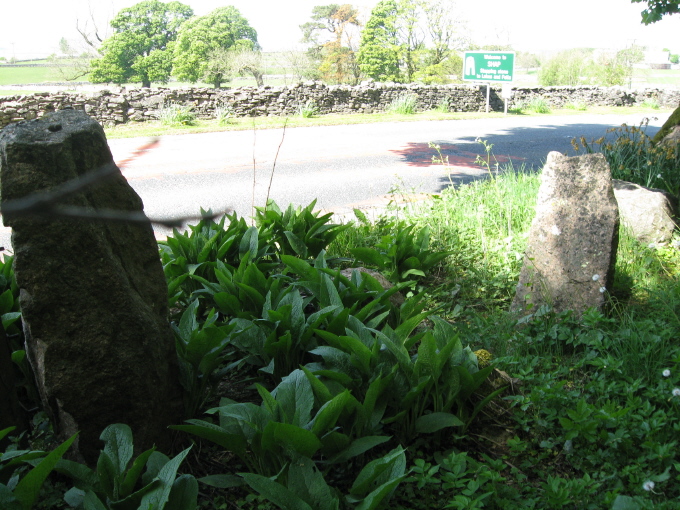
Shap Avenue submitted by AngieLake on 3rd Jun 2011. These were the most noticeable stones fringing the east side of the road, heading back towards the village after visiting Kemp Howe, that might have possibly come from the ancient monuments.
(View photo, vote or add a comment)
Log Text: None
Runic Cross (Ballaugh Old Church)
Date Added: 16th Jan 2017
Site Type: Ancient Cross
Country: Channel Islands and Isle of Man (Isle of Man)
Visited: Yes
Runic Cross (Ballaugh Old Church) submitted by TimPrevett on 24th Jun 2015. An eleventh century runic cross inside St Mary de Ballaugh old church; access subject to church being open.
A leaflet in the church remarks that it shows the work of a famous sculptor, Gaut. The runes commemorate the cross being raised by Olaf Liotulfson in memory of his son, Ulf.
(View photo, vote or add a comment)
Log Text: None
Robin Hood's Butts (Shropshire)
Date Added: 16th Jan 2017
Site Type: Round Barrow(s)
Country: England (Shropshire)
Visited: Yes. My rating: Condition 3 Ambience 5
Robin Hood's Butts (Shropshire) submitted by TimPrevett on 25th Apr 2004. A pair of round barrows 150 feet apart on the northern edge of The Long Mynd, bearing the same name of many other pairs of barrows throughout England.
The best preserved barrow is 110 feet in diameter, and 12 feet high, and fairly accessible, though a trouser clad trek through the heather is necessary. Its northern edge is bisected by a field boundary. Though now defined by a barbed wire fence, the boundary is thought likely to be of prehistoric origin.
The other barrow is some 60 feet acr...
(View photo, vote or add a comment)
Log Text: None
Ridge Hill
Date Added: 16th Jan 2017
Site Type: Barrow Cemetery
Country: England (Dorset)
Visited: Yes on 1st Aug 2013
Ridge Hill submitted by TimPrevett on 24th May 2005. The Ridge Hill barrows are harder to see; many are behind field boundaries and tall hedges, and others are considerably denuded.
(View photo, vote or add a comment)
Log Text: None
