Contributory members are able to log private notes and comments about each site
Sites FrothNinja has logged. View this log as a table or view the most recent logs from everyone
Mitchell's Fold
Date Added: 16th Jan 2017
Site Type: Stone Circle
Country: England (Shropshire)
Visited: Yes on 1st May 1975. My rating: Condition 2 Ambience 4 Access 4

Mitchell's Fold submitted by PaulM on 22nd Jan 2002. Mitchell's Fold in the snow on New Year's Day 2002.
(View photo, vote or add a comment)
Log Text: None
Shooting Box Disc Barrow
Date Added: 16th Jan 2017
Site Type: Round Barrow(s)
Country: England (Shropshire)
Visited: Yes. My rating: Condition 3 Ambience 4 Access 4
Shooting Box Disc Barrow submitted by TimPrevett on 25th Apr 2004. The best, most obvious barrow remaining on The Long Mynd, and the sole known example of a disc barrow in Shropshire.
It covers a circular area some 170 feet in diameter, with an outer raised heather-covered ring circa 15 feet wide, and the inner green mound 60 feet across and up to 8 feet high.
It is so named due a grouse shooting box that was on its northern side until 1992; it now leaves a large depression in the green mound, with a similar depression on the east side, suggesting another...
(View photo, vote or add a comment)
Log Text: None
Long Mynd C
Date Added: 16th Jan 2017
Site Type: Round Barrow(s)
Country: England (Shropshire)
Visited: Yes. My rating: Condition 3 Ambience 5
Long Mynd C submitted by TimPrevett on 31st Dec 2004. A depleted bowl barrow, north east from the Shooting Box disc barrow, with signs of excavation in the centre. It has a very slight profile and is best detected as a raised mound on the skyline when approaching from the south east, having turned north before the Boiling Well.
(View photo, vote or add a comment)
Log Text: None
Robin Hood's Butts (Shropshire)
Date Added: 16th Jan 2017
Site Type: Round Barrow(s)
Country: England (Shropshire)
Visited: Yes. My rating: Condition 3 Ambience 5
Robin Hood's Butts (Shropshire) submitted by TimPrevett on 25th Apr 2004. A pair of round barrows 150 feet apart on the northern edge of The Long Mynd, bearing the same name of many other pairs of barrows throughout England.
The best preserved barrow is 110 feet in diameter, and 12 feet high, and fairly accessible, though a trouser clad trek through the heather is necessary. Its northern edge is bisected by a field boundary. Though now defined by a barbed wire fence, the boundary is thought likely to be of prehistoric origin.
The other barrow is some 60 feet acr...
(View photo, vote or add a comment)
Log Text: None
Old Radnor Church
Date Added: 16th Jan 2017
Site Type: Standing Stone (Menhir)
Country: Wales (Powys)
Visited: Yes. My rating: Condition 2 Ambience 5 Access 5
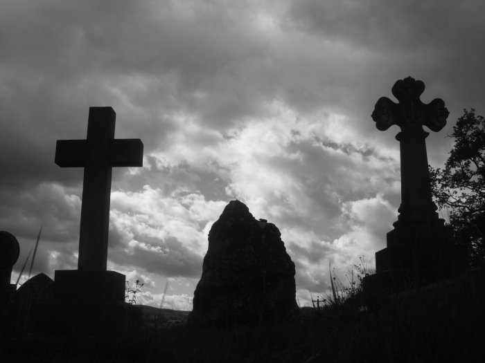
Old Radnor Church submitted by TimPrevett on 2nd Sep 2006. The possible standing stone at Old Radnor Church, flanked by much later memorials. Looking north.
(View photo, vote or add a comment)
Log Text: None
Arthur's Stone
Date Added: 16th Jan 2017
Site Type: Chambered Tomb
Country: England (Herefordshire)
Visited: Yes on 1st Jun 1987. My rating: Condition 2 Ambience 4 Access 5
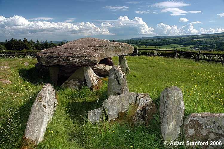
Arthur's Stone submitted by Adam Stanford on 21st Jul 2006. Taken during recent work to investigate the full extent of the covering mound for this monument. Cheers AS.
(View photo, vote or add a comment)
Log Text: None
Gurness
Date Added: 16th Jan 2017
Site Type: Broch or Nuraghe
Country: Scotland (Orkney)
Visited: Yes on 1st Nov 1986. My rating: Condition 2 Ambience 5 Access 4
Gurness submitted by SueS on 16th Jul 2013. The Broch of Gurness aerial photo from the west showing its position in relation to the sea
Taken at 20-30 hrs on 6 June 2013
(View photo, vote or add a comment)
Log Text: None
Birsay
Date Added: 16th Jan 2017
Site Type: Ancient Village or Settlement
Country: Scotland (Orkney)
Visited: Yes on 1st Nov 1986. My rating: Condition 2 Ambience 5 Access 3
Birsay submitted by howar on 23rd Jan 2013. Earl's place and some of the longhouses outlined by snow.
(View photo, vote or add a comment)
Log Text: None
Dwarfie Stane
Date Added: 16th Jan 2017
Site Type: Rock Cut Tomb
Country: Scotland (Orkney)
Visited: Yes on 1st Nov 1986. My rating: Condition 4 Ambience 5 Access 4
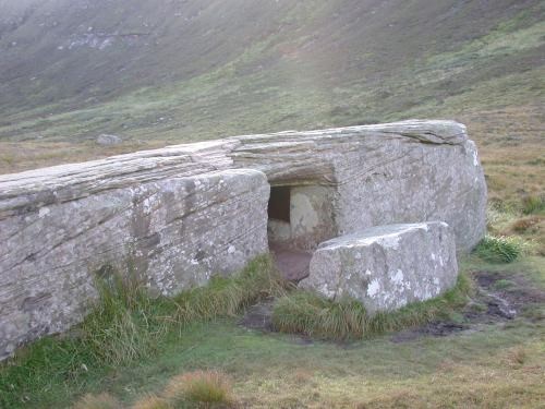
Dwarfie Stane submitted by steveco on 24th Feb 2002. Dwarfie Stane Rock Cut Tomb HY244005. Unique to the this area of abundant ancient sites.
(View photo, vote or add a comment)
Log Text: None
Stenness
Date Added: 16th Jan 2017
Site Type: Stone Circle
Country: Scotland (Orkney)
Visited: Yes on 1st Nov 1986. My rating: Condition 3 Ambience 4 Access 5
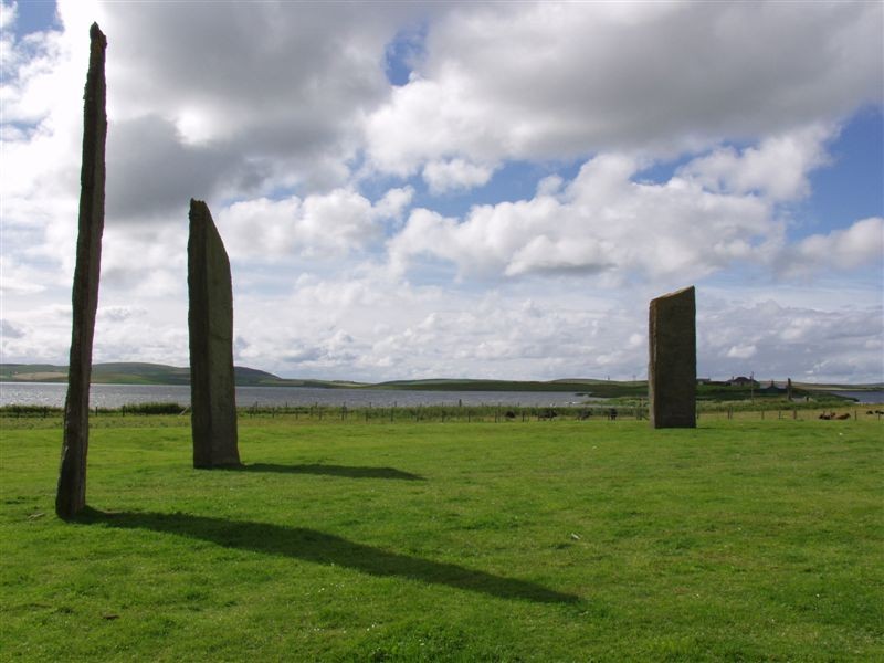
Stenness submitted by Runemage on 15th Jul 2005. Ethereal and numinous.
(View photo, vote or add a comment)
Log Text: None
Skara Brae
Date Added: 16th Jan 2017
Site Type: Ancient Village or Settlement
Country: Scotland (Orkney)
Visited: Yes on 1st Nov 1986. My rating: Condition 3 Ambience 5 Access 5
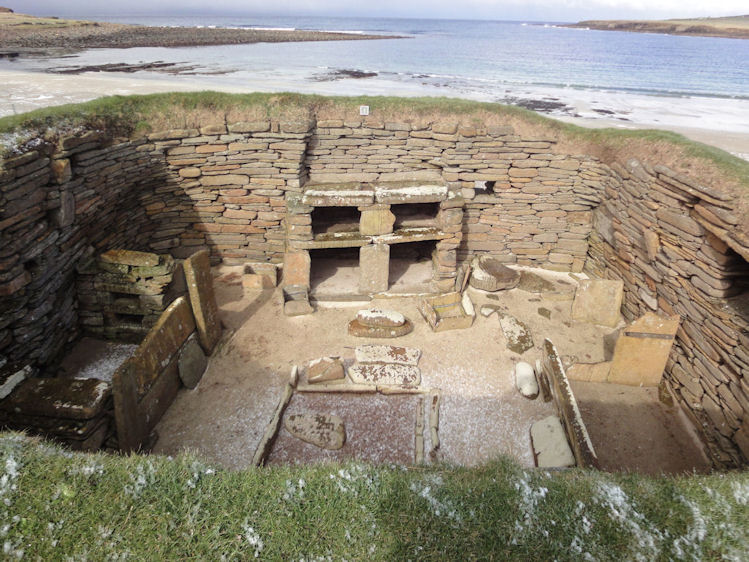
Skara Brae submitted by paulinelen on 30th Apr 2012. Hut 1 looking out over the sea - such beautiful colour contrasts creates a fantastic atmosphere.
(View photo, vote or add a comment)
Log Text: None
Dyke Row
Date Added: 16th Jan 2017
Site Type: Stone Row / Alignment
Country: Scotland (Dumfries and Galloway)
Visited: Saw from a distance
Dyke Row submitted by cosmic on 4th Jun 2004. Dyke Row at NT084036 is just to the south of Moffat
(View photo, vote or add a comment)
Log Text: None
Silbury Hill
Date Added: 16th Jan 2017
Site Type: Artificial Mound
Country: England (Wiltshire)
Visited: Saw from a distance
Silbury Hill submitted by MikeyB on 26th Nov 2012. Reflections of Silbury Hill
(View photo, vote or add a comment)
Log Text: None
Walkers Hill Earthwork
Date Added: 16th Jan 2017
Site Type: Misc. Earthwork
Country: England (Wiltshire)
Visited: Saw from a distance
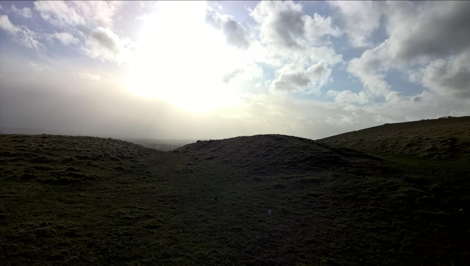
Walkers Hill Earthwork submitted by HarryTwenty on 11th Mar 2019. Western end.
(View photo, vote or add a comment)
Log Text: None
Adam's Grave's Round Barrows 1
Date Added: 16th Jan 2017
Site Type: Round Barrow(s)
Country: England (Wiltshire)
Visited: Saw from a distance

Adam's Graves Round Barrows 1 submitted by twentytrees on 29th Jul 2006. Nice barrow. Nice place - an absoltue must for anyone wanting to capture the feel of the place. Go to the top of Adam's Grave or Knapp Hill and you can see for miles.
(View photo, vote or add a comment)
Log Text: None
Long Bredy Bank Barrow
Date Added: 16th Jan 2017
Site Type: Long Barrow
Country: England (Dorset)
Visited: Saw from a distance on 1st Aug 2013

Long Bredy Bank Barrow submitted by JimChampion on 25th Apr 2005. April 2005. A composite view of the bank barrow, looking south from the field gate (standing on the gatepost to get a better view). The curvature of the appropriately named Long Barrow Hill means that it is difficult to see the barrow from this close distance. The break in the bank is clearly visible, occurring about a third of the way along the barrows 200m length.
(View photo, vote or add a comment)
Log Text: None
Long Bredy 2
Date Added: 16th Jan 2017
Site Type: Long Barrow
Country: England (Dorset)
Visited: Saw from a distance on 1st Aug 2013

Long Bredy 2 submitted by JimChampion on 27th Apr 2005. April 2005. Looking north at the long barrow, with its larger eastern end nearer the camera. The earthwork behind the western end is a modern farm reservoir with a level signal sticking out of the top.
(View photo, vote or add a comment)
Log Text: None
Pitcombe Down
Date Added: 16th Jan 2017
Site Type: Barrow Cemetery
Country: England (Dorset)
Visited: Saw from a distance on 1st Aug 2013
Pitcombe Down submitted by TimPrevett on 23rd May 2005. A footpath runs across Pitcombe Down with several barrows adjacent. This is looking west.
(View photo, vote or add a comment)
Log Text: None
Gunnerkeld
Date Added: 16th Jan 2017
Site Type: Stone Circle
Country: England (Cumbria)
Visited: Saw from a distance. My rating: Condition 3 Ambience 5
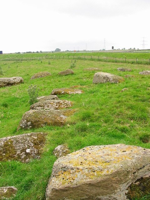
Gunnerkeld submitted by stu on 20th Jul 2002. 568178 NE Lakes Sheet.
Right next to the M6 southbound carriageway. Ruined double ring, the noise from the motorway takes nothing away from this site. Ask at the farm.
(View photo, vote or add a comment)
Log Text: None
Four Stones (Powys)
Date Added: 16th Jan 2017
Site Type: Stone Circle
Country: Wales (Powys)
Visited: Saw from a distance. My rating: Condition 2
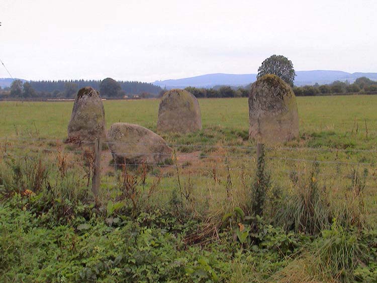
Four Stones (Powys) submitted by vicky on 13th Sep 2002. The Four Stones Stone Circle in Powys. Photo taken by Cassian Hall.
(View photo, vote or add a comment)
Log Text: None
