Contributory members are able to log private notes and comments about each site
Sites Ermine has logged. View this log as a table or view the most recent logs from everyone
Woolpit Cross
Date Added: 22nd Jun 2016
Site Type: Ancient Cross
Country: England (Suffolk)
Visited: Yes on 16th Oct 2004
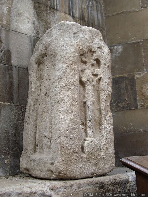
Woolpit Cross submitted by ermine on 16th Oct 2004. This is described as part of a Saxon cross in the guide to St Mary, Woolpit church.
TL974625
(View photo, vote or add a comment)
Log Text: None
Kersey Puddingstone
Date Added: 22nd Jun 2016
Site Type: Natural Stone / Erratic / Other Natural Feature
Country: England (Suffolk)
Visited: Yes on 15th Nov 2005

Kersey Puddingstone submitted by ermine on 15th Nov 2005. This is the overview of where this stone is, half buried in the pavement by the footbridge over the watersplash. It is on the left if you are standing on the bank overlooking the watersplash up the hill towards the church.
Don't miss the other stone which is about 200 metres away on the other side of the road erupting from the pavement near some steps
(View photo, vote or add a comment)
Log Text: None
Whitestreet Green
Date Added: 22nd Jun 2016
Site Type: Natural Stone / Erratic / Other Natural Feature
Country: England (Suffolk)
Visited: Yes on 26th Oct 2015
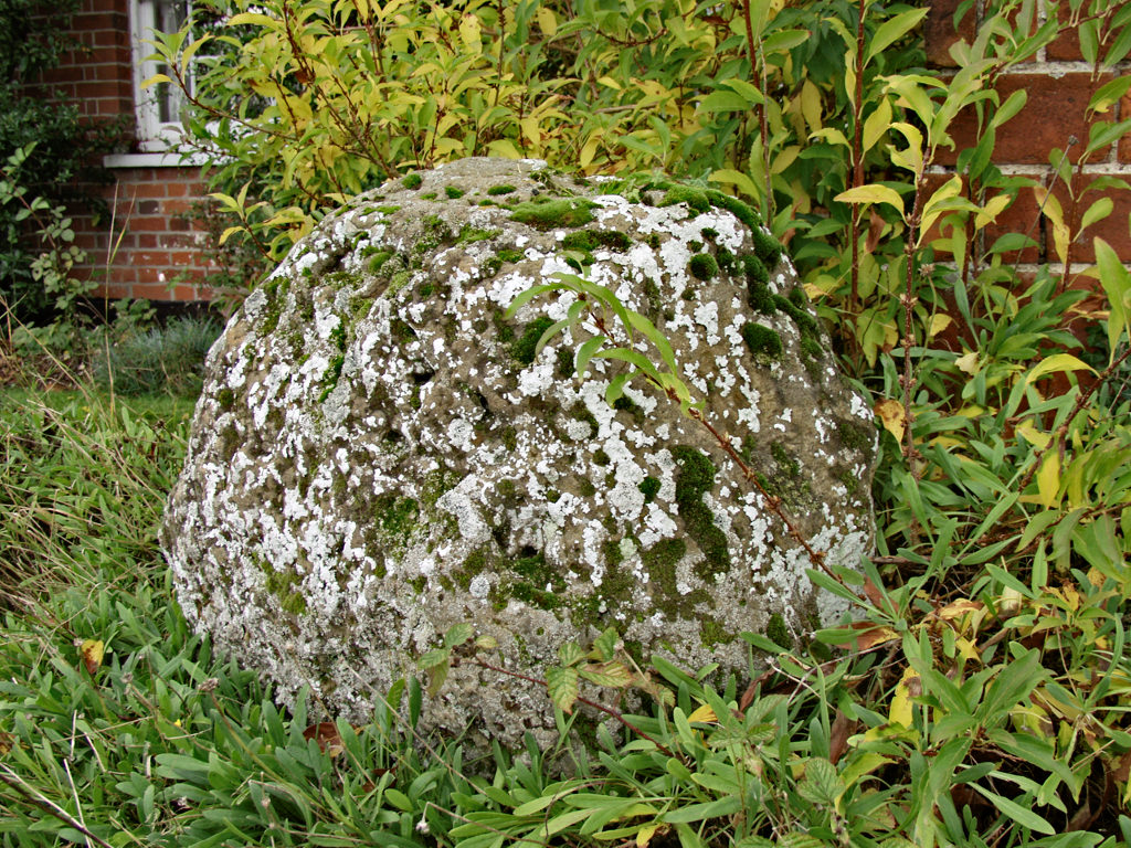
Whitestreet Green submitted by ermine on 26th Oct 2015. This stone/boulder is about 1m high on Whitestreet Green, potentiall on the puddingstone trail
(View photo, vote or add a comment)
Log Text: None
The Bridestones (Staindale)
Date Added: 22nd Jun 2016
Site Type: Natural Stone / Erratic / Other Natural Feature
Country: England (Yorkshire (North))
Visited: Would like to visit
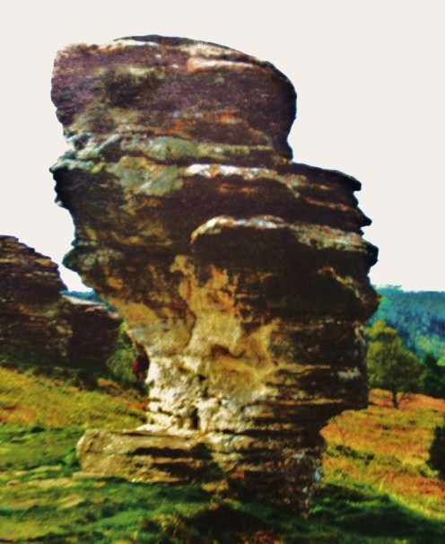
The Bridestones (Staindale) submitted by Sunny100 on 20th Sep 2010. Probably one of the best known of the sandstone rock formations known as The Bridestones at Staindale, North York Moors, is the salt-seller or pepperpot standing at 30 feet tall on its slender stone pedestal. Erosion over thousands of years has caused these curious shapes to occur.
(View photo, vote or add a comment)
Blue Man-i'-th'-Moss Standing Stone.
Date Added: 22nd Jun 2016
Site Type: Standing Stone (Menhir)
Country: England (Yorkshire (North))
Visited: Would like to visit

Blue Man-i'-th'-Moss Standing Stone. submitted by Bladup on 28th Jan 2014. Blue Man-i''-th''-Moss Standing Stone.
(View photo, vote or add a comment)
Hart Leap Stones
Date Added: 22nd Jun 2016
Site Type: Misc. Earthwork
Country: England (Yorkshire (North))
Visited: Would like to visit
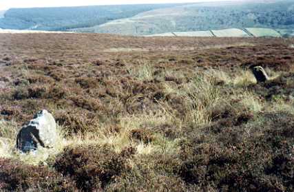
Hart Leap Stones submitted by kelpie on 7th Jul 2002. Said to mark the dying leap of a hunted hart these are probably the remains of a stone row. NZ 73476 03555
(View photo, vote or add a comment)
Kerloas Menhir
Date Added: 22nd Jun 2016
Site Type: Standing Stone (Menhir)
Country: France (Bretagne:Finistère (29))
Visited: Yes on 14th Jul 2004
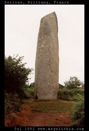
Kerloas menhir submitted by ermine on 14th Jul 2004. This is the tallest standing stone in Europe, according to Aubrey Burl, and would be even taller had it not been hit by lightning 200 years ago. It stands today at 9.5 m above ground.
(View photo, vote or add a comment)
Log Text: None
Kerlescan Alignements
Date Added: 22nd Jun 2016
Site Type: Multiple Stone Rows / Avenue
Country: France (Bretagne:Morbihan (56))
Visited: Yes on 10th Sep 2002

Kerlescan alignements submitted by ermine on 10th Sep 2002. View of the Kerlescan alignments at Carnac.
The alignments are formed of rows of standing stones running for several hundred yards approximately E/W Panorama is taken from the NW
(View photo, vote or add a comment)
Log Text: None
Ménec alignements
Date Added: 22nd Jun 2016
Site Type: Multiple Stone Rows / Avenue
Country: France (Bretagne:Morbihan (56))
Visited: Yes on 10th Sep 2002

Ménec alignements submitted by ermine on 10th Sep 2002. View of the Carnac Alignments from Le Menec village at the western end. The alignments consist of up to twelve rows of menhirs extending for almost a kilometre
(View photo, vote or add a comment)
Log Text: None
Kerran Dolmens
Date Added: 22nd Jun 2016
Site Type: Chambered Tomb
Country: France (Bretagne:Morbihan (56))
Visited: Yes on 27th Jun 2004

Kerran dolmens submitted by ermine on 27th Jun 2004. Kerran
47.598N 2.988W
This is one of two dolmens near the intersection of the D28 with the D781 (the other is more dilapidated)
(View photo, vote or add a comment)
Log Text: None
Pierres Plates (Locmariaquer)
Date Added: 22nd Jun 2016
Site Type: Burial Chamber or Dolmen
Country: France (Bretagne:Morbihan (56))
Visited: Yes on 27th Jun 2004
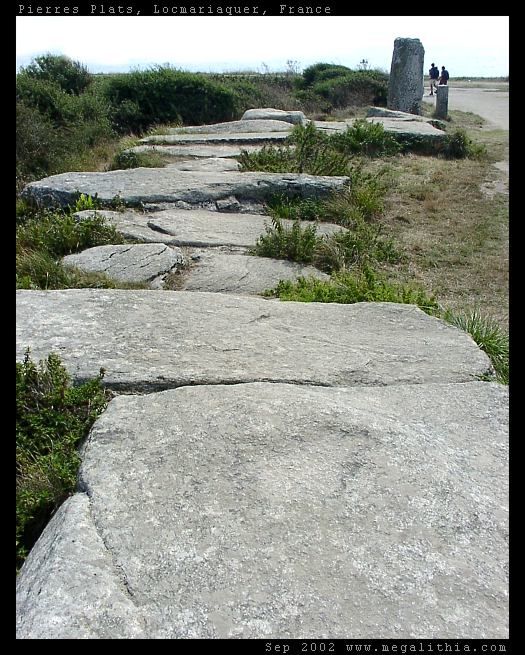
Pierres Plates (Locmariaquer) submitted by ermine on 27th Jun 2004. Les Pierres Plates
(View photo, vote or add a comment)
Log Text: None
La Table des Marchands
Date Added: 22nd Jun 2016
Site Type: Burial Chamber or Dolmen
Country: France (Bretagne:Morbihan (56))
Visited: Yes on 27th Jun 2004

La Table des Marchands submitted by ermine on 27th Jun 2004. Table des Marchands - carving in capstone
(View photo, vote or add a comment)
Log Text: None
Luffang Allée Couverte
Date Added: 22nd Jun 2016
Site Type: Passage Grave
Country: France (Bretagne:Morbihan (56))
Visited: Yes on 27th Jun 2004

Luffang Allée Couverte submitted by ermine on 27th Jun 2004. 47.61309N 3.024552W
This passage-grave contained unique artwork on the end stone, now preserved in Carnac museum. Signposted at the site as Allee Couverte
(View photo, vote or add a comment)
Log Text: None
Grand Menhir Brisé
Date Added: 22nd Jun 2016
Site Type: Standing Stone (Menhir)
Country: France (Bretagne:Morbihan (56))
Visited: Yes on 27th Jun 2004
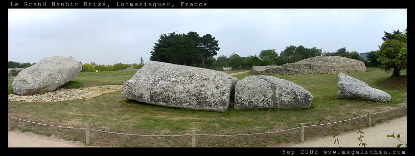
Grand Menhir Brisé submitted by ermine on 27th Jun 2004. Grand Menhir Brisé, Locmariaquer.
A megalithic tragedy.
(View photo, vote or add a comment)
Log Text: None
Mané Keriaval
Date Added: 22nd Jun 2016
Site Type: Passage Grave
Country: France (Bretagne:Morbihan (56))
Visited: Yes on 30th Jun 2004
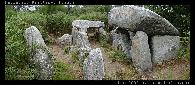
Mané Keriaval submitted by ermine on 30th Jun 2004. Morbihan, Carnac area
47.61535N 3.083378W WGS84 GPS onsite
You'd be forgiven for thinking this is a dolmen, and it is locally listed as such, but Burl sets you right. These stones were originally a passage grave with an earth mound on top
(View photo, vote or add a comment)
Log Text: None
Kerzerho Alignements
Date Added: 22nd Jun 2016
Site Type: Multiple Stone Rows / Avenue
Country: France (Bretagne:Morbihan (56))
Visited: Yes on 1st Jul 2004
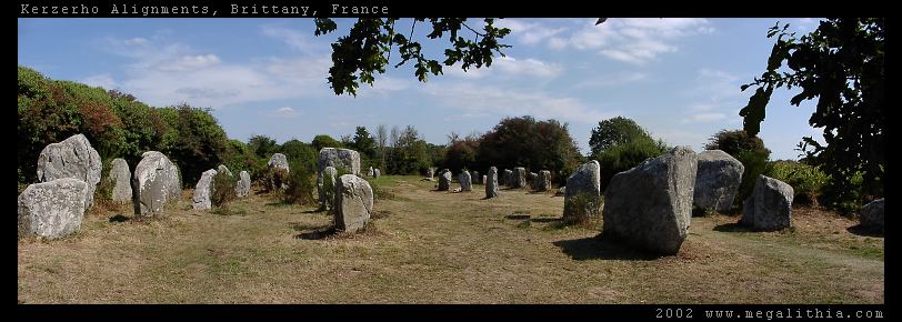
Kerzerho Alignements submitted by ermine on 1st Jul 2004. Kerzerho Alignments
Brittany, Morbihan
47.634690N 3.148402W GPS onsite
You can still walk among the stones at Kerzerho (in 2002 at east) which are near Carnac but not quite so busy. Head up the D781 to Erdeven. You can park nearby, and from there you can also take the path to the large stones of the Table du Sacrifice
(View photo, vote or add a comment)
Log Text: None
Le Petit Ménec
Date Added: 22nd Jun 2016
Site Type: Multiple Stone Rows / Avenue
Country: France (Bretagne:Morbihan (56))
Visited: Yes on 6th Aug 2004
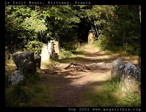
Le Petit Ménec submitted by ermine on 6th Aug 2004. Confusingly, Petit-Menéc is in fact at the opposite, eastern end of the alignments to le Menéc village at the western end. You need to turn left onto the D186 main road after continuing from Kerlescan. After about 250m turn right into a minor road going past a forest, there is a clearing where you can park after about 400m. The menhirs are in the forest on your right, arranged in a gentle curve. You don't get the same clear overview of the alignments since the view is obscured by the trees, bu...
(View photo, vote or add a comment)
Log Text: None
Menhir de Goulvars
Date Added: 22nd Jun 2016
Site Type: Standing Stone (Menhir)
Country: France (Bretagne:Morbihan (56))
Visited: Yes on 8th Aug 2004

Menhir de Goulvars submitted by ermine on 8th Aug 2004. This 4m tall granite menhir stands near the Conguel campsite and the Quiberon aerodrome - it extends another 1m into the ground, according to the information board
(View photo, vote or add a comment)
Log Text: None
Degernau Menhir
Date Added: 22nd Jun 2016
Site Type: Standing Stone (Menhir)
Country: Germany (Baden-Wuerttemberg)
Visited: Yes on 27th Jun 2004
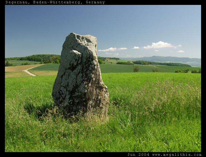
Degernau Menhir submitted by ermine on 27th Jun 2004. Menhir of Degernau, Baden-Württemberg, Germany
47.66380N 8.401683E
lovely setting on the crest of a rise with a commanding view
(View photo, vote or add a comment)
Log Text: None
Clendy Steinalleen
Date Added: 22nd Jun 2016
Site Type: Stone Row / Alignment
Country: Switzerland (Waadt)
Visited: Yes on 23rd Jun 2004
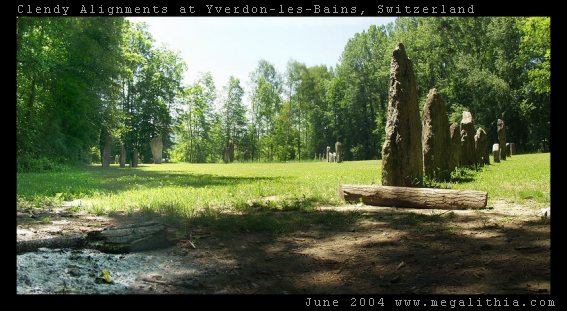
Clendy Steinalleen submitted by ermine on 23rd Jun 2004. Alignment of standing stones at the southern end of Lac Neuchatel, Switzerland near Yverdon-Les_Bains. Two lines of standing stones intersect, roughly at the camera POV. As well as the straight lines, there is a semicircle of stones. For more details see http://www.megalithia.com/sites/4678n0666e.html
(View photo, vote or add a comment)
Log Text: None
