Contributory members are able to log private notes and comments about each site
Sites DrOlaf has logged. View this log as a table or view the most recent logs from everyone
Gunnerkeld
Date Added: 11th Apr 2022
Site Type: Stone Circle
Country: England (Cumbria)
Visited: Yes on 18th Sep 2021. My rating: Condition 2 Ambience 3 Access 2
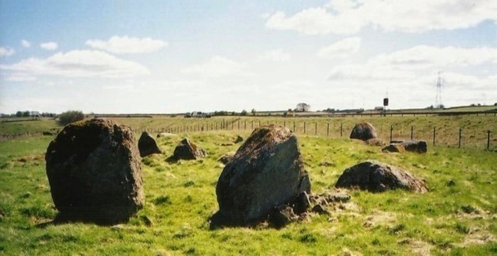
Gunnerkeld submitted by Bladup on 8th Oct 2014. Gunnerkeld.
(View photo, vote or add a comment)
Log Text: a '2x donut' with a northern 'portal' and inner facade. seems to have been built around a couple of large granite erratics.
Doon Castle (Broch)
Date Added: 11th Apr 2022
Site Type: Broch or Nuraghe
Country: Scotland (Dumfries and Galloway)
Visited: Yes on 31st Mar 2022. My rating: Condition 2 Ambience 5 Access 3
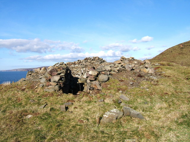
Doon Castle (Broch) submitted by Andy B on 18th Apr 2010. A much better view of the landmark on a pleasant February day as promised after my first photo of this.
Copyright Colin McDonald and licensed for reuse under the Creative Commons Licence.
(View photo, vote or add a comment)
Log Text: a great location-the broch is on a very steep rock outcrop, and would have been very hard to attack, but also very hard to escape from.
Kirkcudbright Standing Stones
Date Added: 3rd Apr 2022
Site Type: Standing Stones
Country: Scotland (Dumfries and Galloway)
Visited: Yes on 28th Mar 2022. My rating: Condition 4 Ambience 4 Access 4
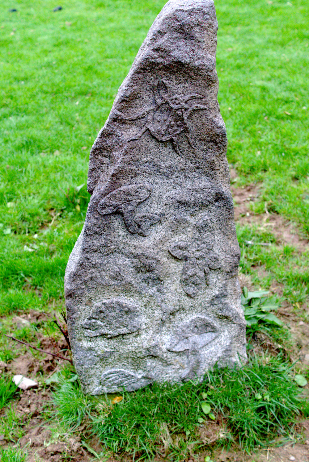
Kirkcudbright Standing Stones submitted by Energyman on 20th Sep 2018. The lower stone.
(View photo, vote or add a comment)
Log Text: quaint modern stones set in a sloping field. Made me think, maybe the old Bronze Age stones were not that serious either!
Rispain Camp
Date Added: 3rd Apr 2022
Site Type: Ancient Village or Settlement
Country: Scotland (Dumfries and Galloway)
Visited: Yes on 1st Apr 2022. My rating: Condition 3 Access 4
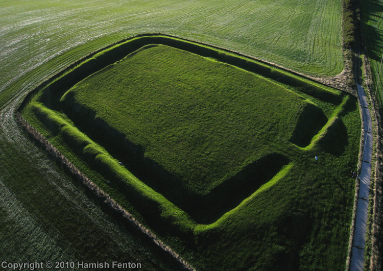
Rispain Camp submitted by h_fenton on 3rd Oct 2010. Rispain Camp, a Kite Aerial Photograph taken close to the end of the day, this view is from the east.
16 September 2010 @ 6.10pm
(View photo, vote or add a comment)
Log Text: in very good nick, with good views NE across Wigtown bay to Cairnharrow and the hills around Cairnhulie.
turn left at the road sign and park up at the visitors car park. then it's a short walk.
Barsalloch
Date Added: 3rd Apr 2022
Site Type: Promontory Fort / Cliff Castle
Country: Scotland (Dumfries and Galloway)
Visited: Yes on 1st Apr 2022. My rating: Condition 3 Ambience 5 Access 4
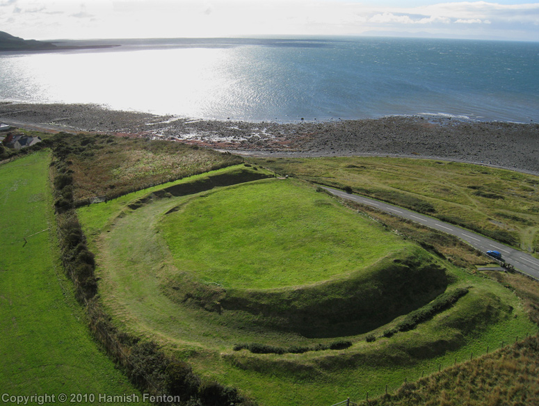
Barsalloch submitted by h_fenton on 29th Nov 2010. Barsalloch Promontory Fort viewed from roughly north.
Kite Aerial Photograph
17 September 2010
(View photo, vote or add a comment)
Log Text: Iron Age hillfort right in coast with excellent views across to Isle of Man
Caves of Kilhern
Date Added: 3rd Apr 2022
Site Type: Chambered Cairn
Country: Scotland (Dumfries and Galloway)
Visited: Yes on 30th Mar 2022. My rating: Condition 3 Ambience 4 Access 3
Caves of Kilhern submitted by rogerkread on 1st May 2013. The main 'cave', on a wild April day.
(View photo, vote or add a comment)
Log Text: similar burial cairn to Mid Gleniron 1 with cists NE NW SE and SW. in an enclosed valley, with only far views to hills to the NE. Built on a (probable) drumlin/glacial hillock, of which there are several in the area.
Mid Gleniron 1
Date Added: 3rd Apr 2022
Site Type: Chambered Cairn
Country: Scotland (Dumfries and Galloway)
Visited: Yes on 30th Mar 2022. My rating: Condition 3 Ambience 4 Access 4
Mid Gleniron 1 submitted by rogerkread on 1st May 2013. The cairn with the most visible internal structure at Mid Gleniron, the one furthest west.
(View photo, vote or add a comment)
Log Text: a good example of a Galloway burial cairn
Brownthwaite Pike Round Cairn
Date Added: 21st Sep 2021
Site Type: Round Cairn
Country: England (Cumbria)
Visited: Yes on 17th Sep 2021. My rating: Condition 3 Ambience 5 Access 2
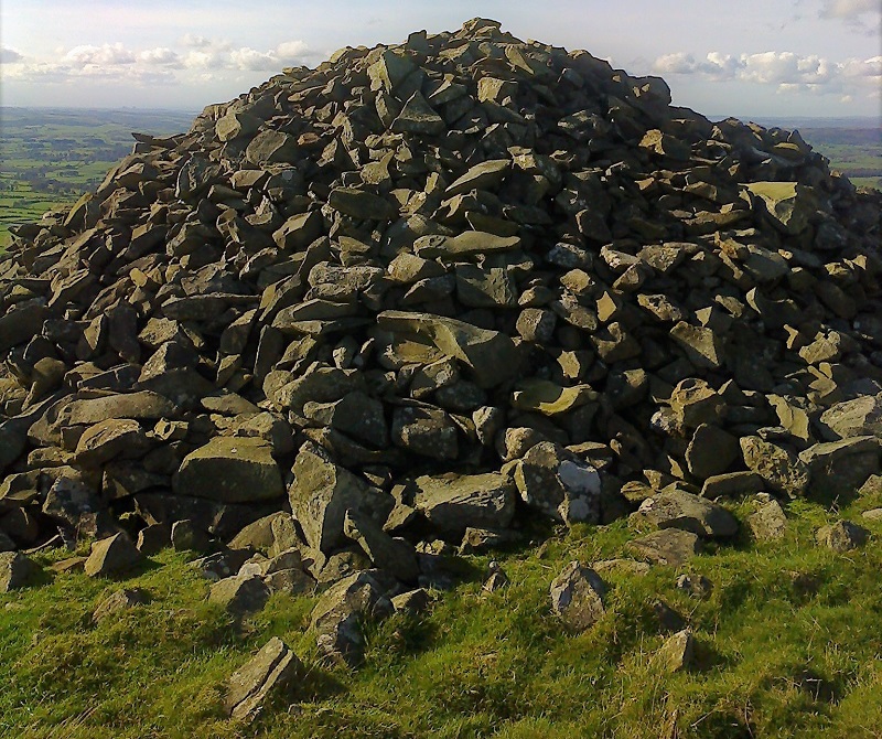
Brownthwaite Pike Round Cairn submitted by SumDoood on 27th Oct 2017. Photo by Carol Doughery (taken with a not-smart phone).
(View photo, vote or add a comment)
Log Text: lucky with the weather-a fine clear day for the views
King Arthur's Round Table
Date Added: 21st Sep 2021
Site Type: Henge
Country: England (Cumbria)
Visited: Yes on 18th Sep 2021. My rating: Condition 3 Ambience 3 Access 4
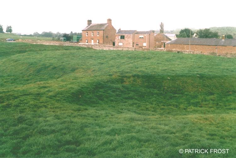
King Arthur's Round Table submitted by Patrick Frost on 14th Oct 2002. King Arthur's Round Table in Cumbria.
(View photo, vote or add a comment)
Log Text: similar in form to the ure henges
Casterton
Date Added: 21st Sep 2021
Site Type: Stone Circle
Country: England (Cumbria)
Visited: Yes on 20th Sep 2021. My rating: Condition 3 Ambience 4 Access 3
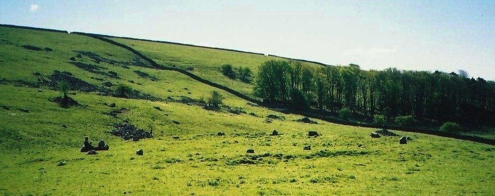
Casterton submitted by Bladup on 8th Oct 2014. Casterton stone circle.
(View photo, vote or add a comment)
Log Text: about 17 stones with a few gaps. stones are only about 12-18 inches high, but quite regularly spaced. It is sited in a relatively level site on a steep hillside, near where a beck starts. Some trouble was taken to level the site, by embanking the eastern side. The site looks out across to the southern Cumbrian heights.
Kemp Howe
Date Added: 21st Sep 2021
Site Type: Stone Circle
Country: England (Cumbria)
Visited: Yes on 18th Sep 2021. My rating: Condition 2 Ambience 2 Access 4
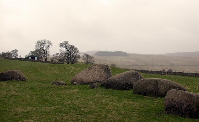
Kemp Howe submitted by nicoladidsbury on 29th Mar 2004. This is the remains of what must have been a beautiful stone circle. The stones are pink granite and have a lovely glow. Unfortunately the ambience has been shattered by the "wonderful" victorians, who built the railway on top of it.
(View photo, vote or add a comment)
Log Text: some large lumps of granite-the ring must have been pretty impressive
Castle Dykes
Date Added: 21st Sep 2021
Site Type: Henge
Country: England (Yorkshire (North))
Visited: Yes on 21st Sep 2021. My rating: Condition 3 Ambience 5 Access 2

Castle Dykes submitted by rich32 on 7th Jul 2004. Castle Dykes Henge, nr Aysgarth, North Yorkshire (SD98228728)
The henge has a diameter of about 75m with the ditch being up to 2m in some places. There are entrances to the north, south & east, although only the eastern one is thought to be original and of antiquity.
This henge is fairly well preserved, but as seems obligatory with our henges its covered in cow poo. This photo (looking east) does not really do the site justice.
(View photo, vote or add a comment)
Log Text: the henge lies on a rise to the east of Addleborough hill, and sits directly between that hill and Pen hill to the east, two very distinctive hills. There are good long distance views to the east (North York Moors) and north to Carperby cairn. No attempt has been made to level the site so it takes the shape of the spur it is on. A small amount of rabbit damage.
Street House Farm
Date Added: 12th Sep 2021
Site Type: Barrow Cemetery
Country: England (Cleveland)
Visited: Yes on 11th Sep 2021. My rating: Condition -1 Ambience 1 Access 4
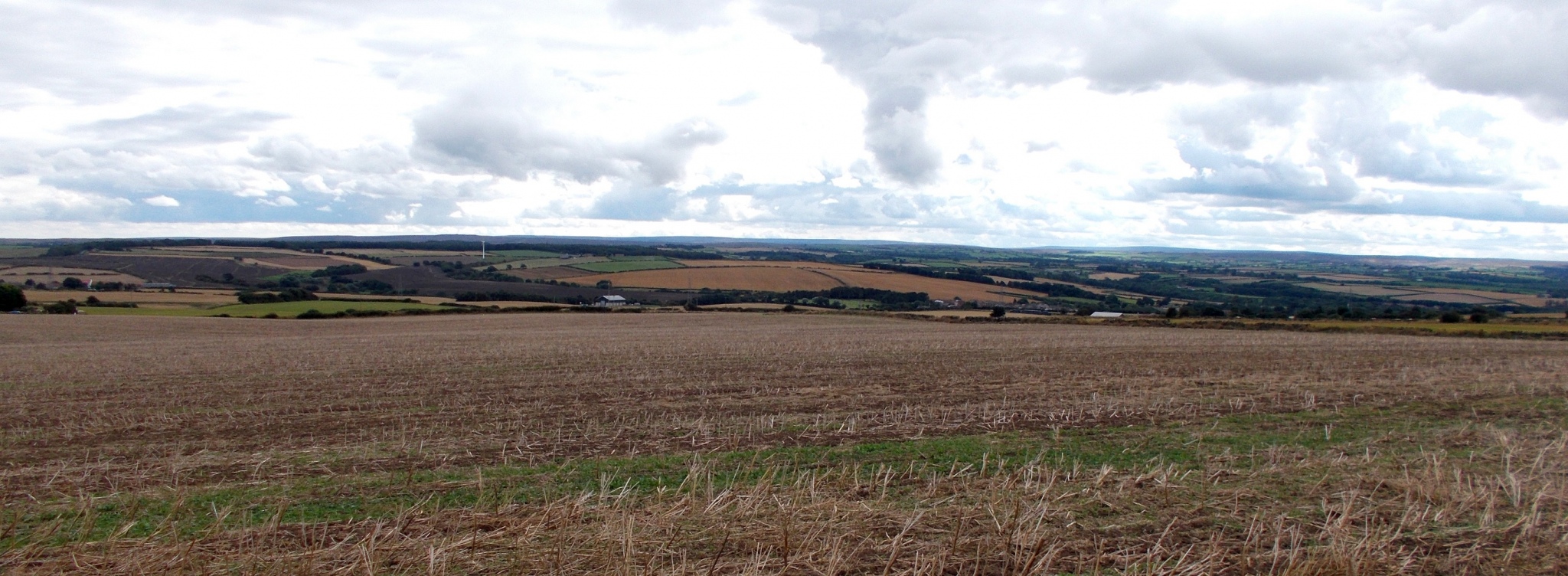
Street House Farm submitted by drolaf on 12th Sep 2021. view from the site of the neolithic longcairn/timber portal
(View photo, vote or add a comment)
Log Text: as with many such sites it is the excavation drawings that tell the story. It sits in a timescale overlapping with the neolithic saltworks, and 1500 years before the nearby timber 'wossit'
Yockenthwaite
Date Added: 12th Sep 2021
Site Type: Ring Cairn
Country: England (Yorkshire (North))
Visited: Yes on 10th Sep 2021. My rating: Condition 4 Ambience 5 Access 4
Yockenthwaite submitted by DavidRaven on 24th Jan 2004. Stormy weather coming from Langstrothdale Chase in the west.
(View photo, vote or add a comment)
Log Text: a lovely little kerb cairn/ring. a delightful walk along the Upper Wharfe, with its water-carved limestone. About 70 metres upstream from the ring is Yockenthwaite 'cave' a small fissure, from which some water issues, and also the eerie sound of an underground waterfall deep in the hillside. I wonder if this was there in the Bronze Age and had something to do with the siting of this ring. and what did they think the sound was? The river here is a disappearing/appearing one, as it discharges into several holes into underground aquifers, leaving downstream a dry bed, until a new water source enters it.
Nympsfield
Date Added: 22nd Jun 2021
Site Type: Long Barrow
Country: England (Gloucestershire)
Visited: Yes on 20th Jun 2021. My rating: Condition 3 Ambience 4 Access 4
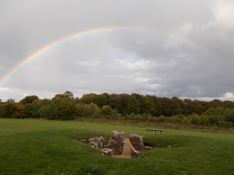
Nympsfield submitted by AngieLake on 11th Oct 2015. A magical double rainbow (you can't see the upper arc here) over Nympsfield longbarrow, viewed from the rear of the mound. 22nd Sept.
(View photo, vote or add a comment)
Log Text: just one of several long barrows along the ridge, it lies in the steep escarpment edge but faces east.
Drakestone Camp
Date Added: 15th Jun 2021
Site Type: Misc. Earthwork
Country: England (Gloucestershire)
Visited: Yes on 16th Jun 2016. My rating: Condition 3 Ambience 4 Access 3
Drakestone Camp submitted by 4clydesdale7 on 6th Jul 2011. One of the middle banks and ditches
(View photo, vote or add a comment)
Log Text: None
Haresfield Beacon and Ring
Date Added: 15th Jun 2021
Site Type: Hillfort
Country: England (Gloucestershire)
Visited: Yes on 15th Jun 2017. My rating: Condition 3 Ambience 4 Access 3
Haresfield Beacon and Ring submitted by 4clydesdale7 on 24th Jun 2011. From the same spot looking NNW over the inside of the Fort
(View photo, vote or add a comment)
Log Text: None
Haresfield Beacon tumulus
Date Added: 15th Jun 2021
Site Type: Round Barrow(s)
Country: England (Gloucestershire)
Visited: Yes on 15th May 2016. My rating: Condition 3 Ambience 5 Access 3

Haresfield Beacon tumulus submitted by TheCaptain on 3rd Sep 2020. The tumulus with trig point on top, at the western end of Haresfield Beacon.
(View photo, vote or add a comment)
Log Text: None
Catstones Ring
Date Added: 6th May 2021
Site Type: Misc. Earthwork
Country: England (Yorkshire (West))
Visited: Yes on 21st Jun 2017. My rating: Condition 2 Ambience 3 Access 4
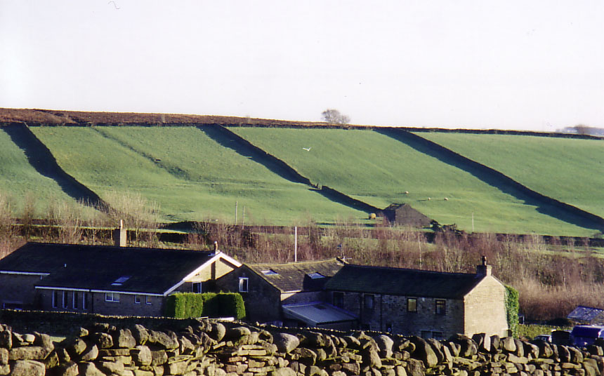
Catstones Ring submitted by DavidRaven on 22nd Dec 2004. The earthwork that straddles Harden Moor, West Yorks. Showing the banks and ditch where they leave the moorland and enter pasture.
(View photo, vote or add a comment)
Log Text: good vantage point over the valley
Harden Moor Ring Cairn
Date Added: 5th May 2021
Site Type: Ring Cairn
Country: England (Yorkshire (West))
Visited: Yes on 5th May 2021. My rating: Condition 3 Ambience 4 Access 4
Harden Moor Ring Cairn submitted by rich32 on 11th Jun 2004. Harden Moor, nr Bingley, West Yorkshire (SE074386)
A ring cairn according to Defra, although some believe its a stone circle. Two other cairns are also nearby.
(View photo, vote or add a comment)
Log Text: a lovely little banked and kerbed ring cairn (not a stone circle) on a hill with outstanding views to Baildon, Ilkley et al.
