


Contributory members are able to log private notes and comments about each site
Sites Chappers60 has logged on trip number: 1 (View all trips)
View this log as a table or view the most recent logs from everyone
Ferrybridge Henge
Trip No.1 Entry No.1 Date Added: 24th Aug 2026
Site Type: Henge
Country: England (Yorkshire (West))
Visited: Yes on 23rd Aug 2026. My rating: Condition 1 Ambience 2 Access 4
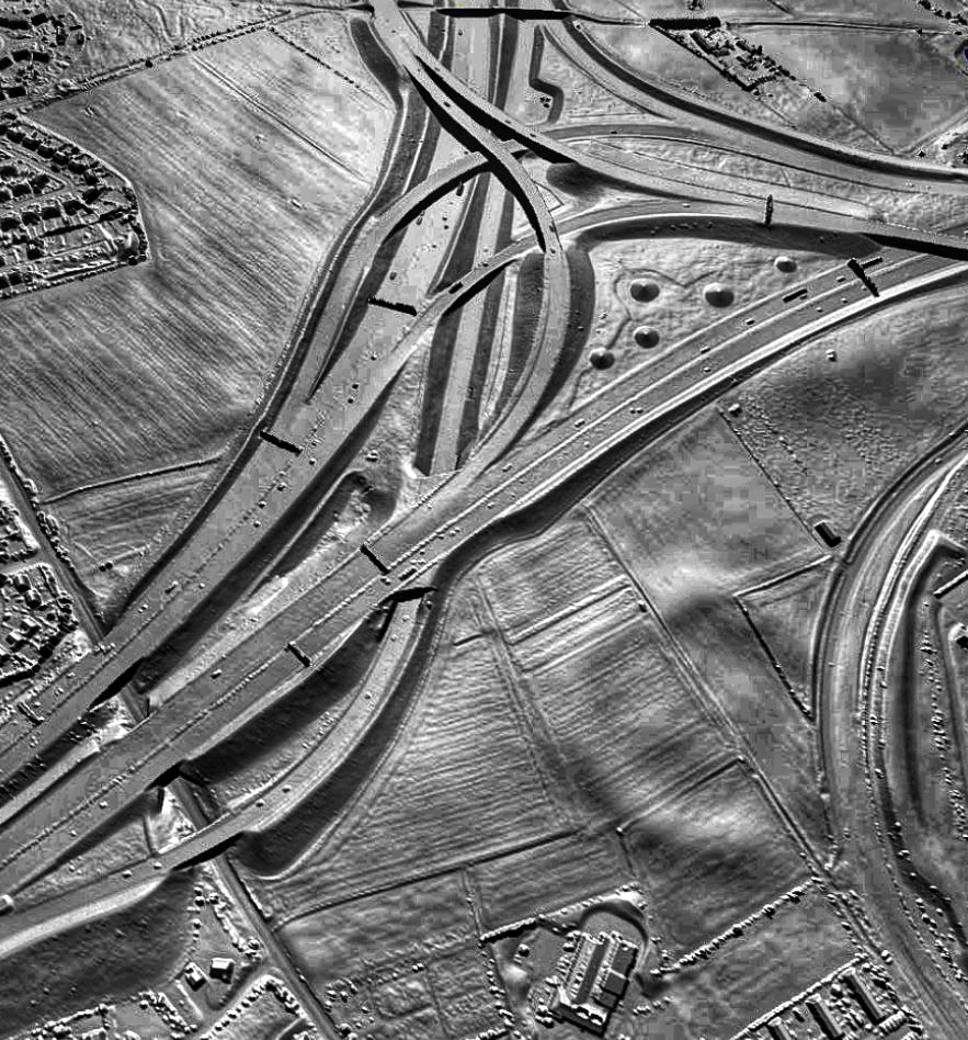
Ferrybridge Henge submitted by Bladup on 3rd Dec 2025. A stunning Lidar image of Ferrybridge Henge by Dr John Wells
Source: www.lidarfinder.com
(View photo, vote or add a comment)
Log Text: Interestingly, an overgrown path, known as 'New' road that follows field boundaries on either side seems to intersect the henge through the entrances. This same path follows in a direct line down to the river at the old ferry bridge. Was this also an ancient crossing point?
Very little to see on the ground, perhaps the eastern bank seen as a rise in the landscape.
Newton Kyme Henge
Trip No.1 Entry No.2 Date Added: 24th Aug 2026
Site Type: Henge
Country: England (Yorkshire (North))
Visited: Yes on 23rd Aug 2026. My rating: Ambience 2 Access 5

Newton Kyme Henge submitted by Bladup on 3rd Dec 2025. Lidar image of Newton Kyme Henge
Source: www.lidarfinder.com
(View photo, vote or add a comment)
Log Text: On private land and crops in field at time of visit so unable to ascertain condition except outer bank possibly still visible in ploughed field adjacent. From signs on display, farmer appears to be unwilling to grant access (possible problems with metal detectorists interested in the nearby roman fort?).
Interestingly a pathway between field boundaries runs alongside the henge and all the way up to a roman road (Ebor Way) running at 90 degrees to this path along to a river and another ancient crossing point. Note similarities at Ferrybridge henge.
Green Howe (North Deighton)
Trip No.1 Entry No.3 Date Added: 24th Aug 2026
Site Type: Round Barrow(s)
Country: England (Yorkshire (North))
Visited: Saw from a distance on 23rd Aug 2026. My rating: Condition 2 Ambience 3 Access 3

Green Howe (North Deighton) submitted by listerinepree on 16th Jul 2015. Another photo from the other side.
(View photo, vote or add a comment)
Log Text: Difficulties with access. Local farmer attempting to erect fences to block, even along permitted route on OS