Contributory members are able to log private notes and comments about each site
Sites BrownEdger has logged. View this log as a table or view the most recent logs from everyone
Bosley Cloud (1)
Date Added: 21st Aug 2011
Site Type: Standing Stone (Menhir)
Country: England (Cheshire)
Visited: Yes on 1st Jan 0000. My rating: Condition 4 Ambience 4
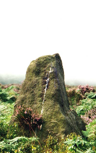
Bosley Cloud (1) submitted by PaulM on 19th Aug 2002. Bosley Cloud Stone
This stone is located SJ905636 on the back slope of Bosley Cloud, a hill in Cheshire.
It is not known if this stone is prehistoric standing stone or a natural boulder but it has been utilised as a marker (a cross is carved into the top of the stone) for the Cheshire/Staffordshire county boundary which splitsthe Cloud. If it is natural it is fortuitously placed but it is a stone out of keeping with those in the immediate area.
A track runs right beside it.
(View photo, vote or add a comment)
Log Text: None
Bower Farm
Date Added: 26th Sep 2015
Site Type: Cave or Rock Shelter
Country: England (Staffordshire)
Visited: Would like to visit
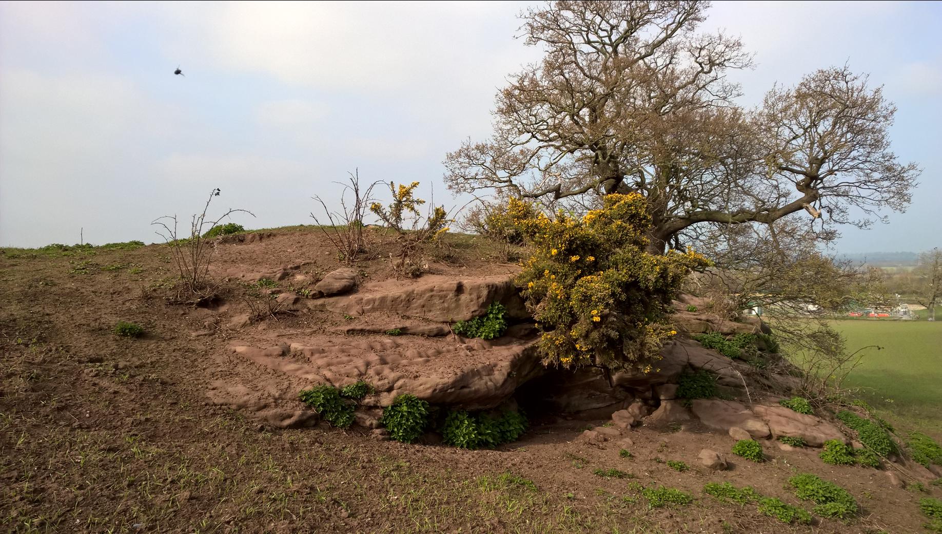
Bower Farm submitted by HarryTwenty on 1st Apr 2019. Southern side looking north. The sewage plant is visible in the background.
The giant insect is probably a survivor from the Carboniferous Period : )
(View photo, vote or add a comment)
Brown Low (staffs)
Date Added: 8th Jun 2013
Site Type: Round Barrow(s)
Country: England (Staffordshire)
Visited: Yes on 1st Apr 2013. My rating: Condition 3 Ambience 4 Access 4
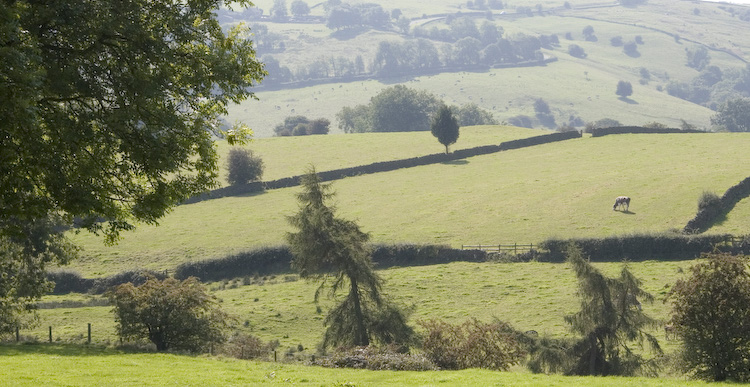
Brown Low (staffs) submitted by twentytrees on 9th Sep 2006. Brown Low, sometimes referred to as Brownlow, seen just to the right of the lonely tree which sits astride the dry stone wall near the centre of the photo. Taken from the path from Warslow.
Scheduled monument number 22412.
(View photo, vote or add a comment)
Log Text: None
Brund Low
Date Added: 13th Aug 2014
Site Type: Round Barrow(s)
Country: England (Staffordshire)
Visited: Yes on 6th May 2013. My rating: Condition 3 Ambience 3 Access 5
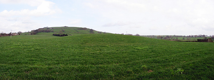
Brund Low submitted by stu on 10th Dec 2005. SK103618. The barrow of Brund Low, Sheen Hill beyond.
(View photo, vote or add a comment)
Log Text: Visible from the road. Top has been levelled but otherwise in reasonable condition.
Bullstones
Date Added: 7th Sep 2014
Site Type: Stone Circle
Country: England (Cheshire)
Visited: Yes on 21st Aug 2011. My rating: Condition 3 Ambience 4 Access 4
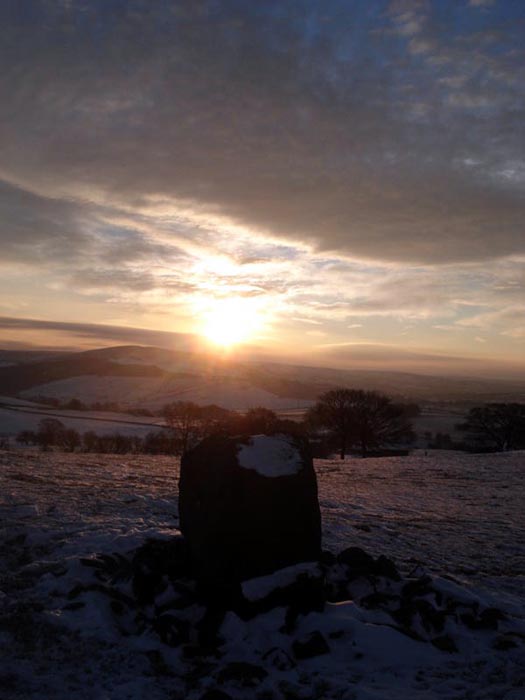
Bullstones submitted by astronomer on 22nd Dec 2010. The winter solstice sunrise is still celebrated at Bullstones as this picture, taken by writer, broadcaster and folklorist, Doug Pickford shows.
(View photo, vote or add a comment)
Log Text: None
Bury Bank (Staffordshire)
Date Added: 27th Sep 2015
Site Type: Hillfort
Country: England (Staffordshire)
Visited: Would like to visit
Bury Bank (Staffordshire) submitted by TimPrevett on 20th May 2006. The inner platform with trees following the arc of the rampart. Courses of pebbles can also be traced, forming what must have been walls at some period. See main entry for details.
(View photo, vote or add a comment)
Calton Round Barrow
Date Added: 26th Sep 2015
Site Type: Round Barrow(s)
Country: England (Staffordshire)
Visited: Would like to visit
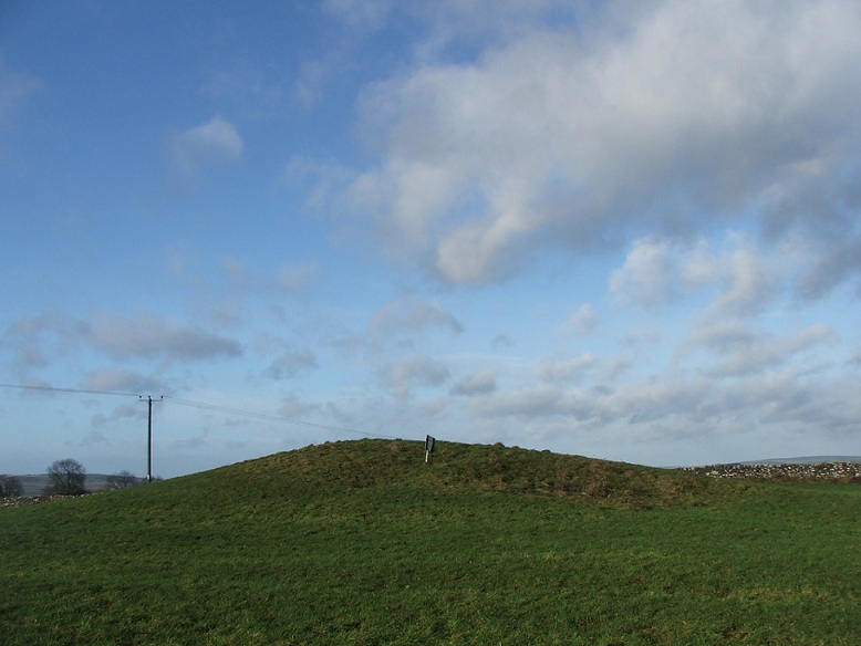
Calton Round Barrow submitted by postman on 18th Dec 2012. Looking south west
(View photo, vote or add a comment)
Caltonmoor
Date Added: 12th Aug 2014
Site Type: Round Barrow(s)
Country: England (Staffordshire)
Visited: Yes on 5th May 2014. My rating: Condition 1 Ambience 2 Access 5
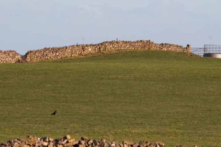
Caltonmoor submitted by twentytrees on 7th Mar 2007. View from the road.
(View photo, vote or add a comment)
Log Text: Descheduled rather than unscheduled. Calton Moor Barrow is probably seen by more people each day than any other in Staffordshire, but it is virtually destroyed. Of the four quadrants only one partially survives and that's badly plough damaged. Main reason for descheduling though is the track cutting through the centre which Carrington reported.
Castle Ring (Staffordshire)
Date Added: 26th Sep 2015
Site Type: Hillfort
Country: England (Staffordshire)
Visited: Would like to visit
Castle Ring (Staffordshire) submitted by TimPrevett on 5th Jan 2004. Castle Ring SK045128
Looking E / NE - despite Castle Ring being the highest part of Cannock Chase, the only part with a panoramic view, looks towards (Rugeley?) Power Station!
Castle Ring was actually recommended to me by a colleague at work who does not know of my stones / pre-history interest; she grew up in the Cannock area, and given we were making a trip to Stafford anyway, I'd heard that Cannock Chase was supposed to quite nice. Knowing that she grew up there, I
asked her if Cannock...
(View photo, vote or add a comment)
Charles Head
Date Added: 25th Sep 2015
Site Type: Round Barrow(s)
Country: England (Cheshire)
Visited: Would like to visit
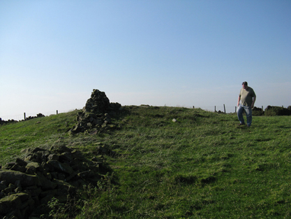
Charles Head submitted by astronomer on 30th Sep 2011. Charles Head tumulus is on private land owned by Spring Bank Farm. Following unauthorized digging some years ago and the removal of artifacts, the present landowner expressly forbids access.
We were kindly granted access and permission to take photographs only because of personal relationships with nearby landowners.
The tumulus is approximately 1m high and 12m in diameter and is crossed, E-W, by a dilapidated stone wall.
(View photo, vote or add a comment)
Cheshire Wood Cave
Date Added: 26th Sep 2015
Site Type: Cave or Rock Shelter
Country: England (Staffordshire)
Visited: Would like to visit
Clulow Cross
Date Added: 21st Aug 2011
Site Type: Round Barrow(s)
Country: England (Cheshire)
Visited: Saw from a distance on 21st Aug 2011. My rating: Condition 3 Ambience 4 Access 3
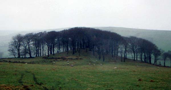
Clulow Cross submitted by vicky on 22nd Jul 2002. Clulow Cross - possibly a prehistoric round barrow surmounted by a more recent cross.
(View photo, vote or add a comment)
Log Text: None
Coatestown Barrow
Date Added: 26th Sep 2015
Site Type: Round Barrow(s)
Country: England (Staffordshire)
Visited: Would like to visit
Cock Low (Leek)
Date Added: 5th Oct 2015
Site Type: Round Barrow(s)
Country: England (Staffordshire)
Visited: Yes on 1st Mar 2012. My rating: Condition -1 Ambience 3 Access 5
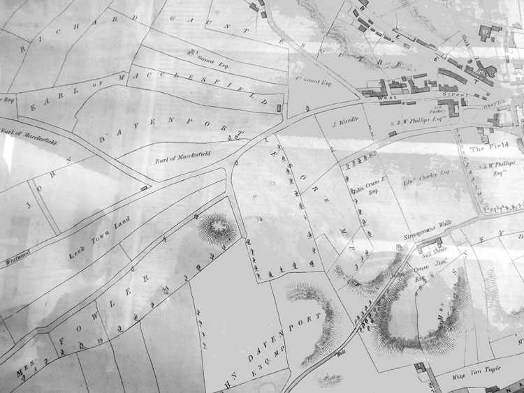
Cock Low (Leek) submitted by astronomer on 8th Mar 2015. Thanks to Leek historians, Margaret and Colin Bowyer, who kindly supplied an image of an 1838 map of Leek, it might be possible to shed some more light on Cock Low. The map clearly shows a prominent mound near what is now the playing fields at Spring Gardens. In her 1999 book, 'Leek's Forgotten Centuries', E.A Biddulph states that the burial mound, 18ft high and 120ft wide was on part of the property owned by a Mrs Watt, standing between Waterloo Rd, Messr's Broster's Mill and Spring Gardens. Sh...
(View photo, vote or add a comment)
Log Text: None
Damgate Cairn 1
Date Added: 27th Sep 2015
Site Type: Cairn
Country: England (Staffordshire)
Visited: Would like to visit
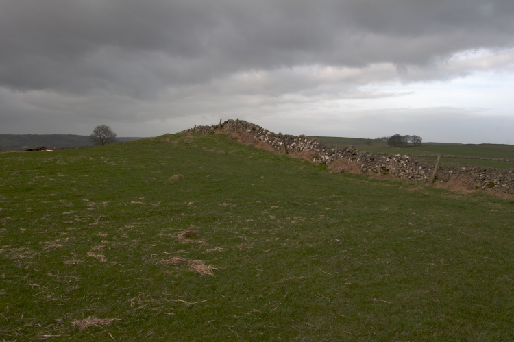
Damgate Cairn 1 submitted by TwentyTrees on 25th Jan 2008. Scheduled monument 13540. Easy to find but somewhat dilapidated.
Views to Minninglow in the east, some six miles away.
(View photo, vote or add a comment)
Damgate Cairns 2
Date Added: 13th Aug 2014
Site Type: Cairn
Country: England (Staffordshire)
Visited: Yes on 11th Aug 2013. My rating: Condition 3 Ambience 3 Access 4

Damgate Cairns 2 submitted by TwentyTrees on 24th Jan 2008. The two northerly barrows either side of the gap in the dry stone wall which is built over both.
(View photo, vote or add a comment)
Log Text: Visible from Ilam Moor Lane, the footpath running through the adjacent field and from Pasture Lane, Stanshope near to Stanshope Cairns 1.
Darfar Ridge Cave
Date Added: 26th Sep 2015
Site Type: Cave or Rock Shelter
Country: England (Staffordshire)
Visited: Would like to visit
Devil's Ring and Finger
Date Added: 26th Sep 2015
Site Type: Holed Stone
Country: England (Staffordshire)
Visited: Would like to visit
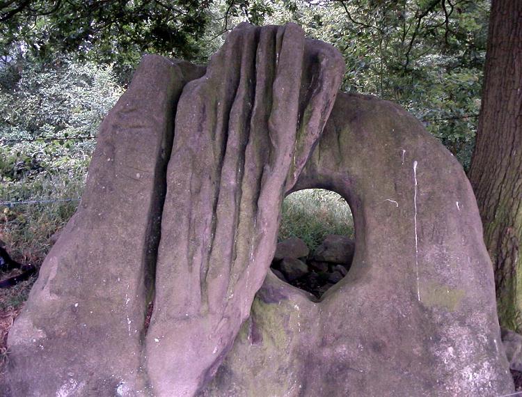
Devil's Ring and Finger submitted by Paul Morgan on 25th Jul 2001. This site is all that remains of a long cairn. The Devil's Ring is a perforated septal stone similar to the one at the Bridestones in Cheshire. The Finger was, perhaps, a portal stone. Neither are in their original position.
Located near Mucklestone, Staffordshire and marked on OS map 127.
(View photo, vote or add a comment)
Dun Low
Date Added: 26th Sep 2015
Site Type: Round Barrow(s)
Country: England (Staffordshire)
Visited: Would like to visit
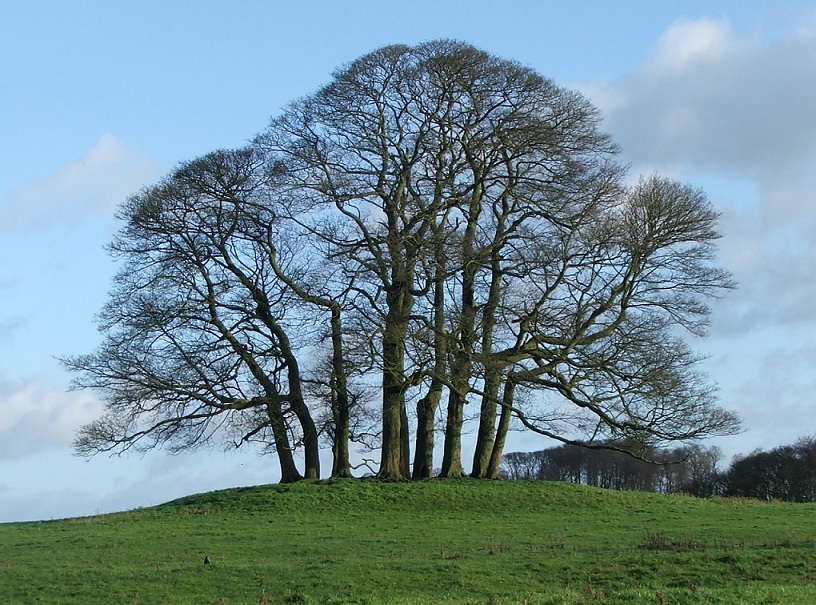
Dun Low submitted by postman on 18th Dec 2012. Looking east. Surmounted by ten trees, an oddly round number. standing stones abound in the field next door but they're only old gateposts
(View photo, vote or add a comment)
Egg Well
Date Added: 5th Sep 2011
Site Type: Holy Well or Sacred Spring
Country: England (Staffordshire)
Visited: Yes on 3rd Sep 2011. My rating: Condition 3 Ambience 4 Access 4

Egg Well submitted by TimPrevett on 26th Jul 2007. The cross shaped chamber, and stick I used to approximately gauge depth. Also notice the floating dead bodies - at least two frogs, and I think, something resembling a rat...
(View photo, vote or add a comment)
Log Text: Improvements have been made to the site with an information board and fence to stop the local livestock crowding round the entrance!
