Contributory members are able to log private notes and comments about each site
Sites BrownEdger has logged. View this log as a table or view the most recent logs from everyone
Merryton Low 2
Date Added: 10th Jun 2013
Site Type: Round Barrow(s)
Country: England (Staffordshire)
Visited: Yes on 1st Apr 2013. My rating: Condition 3 Ambience 3 Access 4
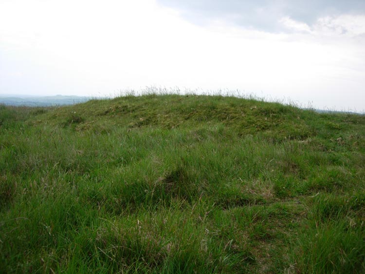
Merryton Low 2 submitted by astronomer on 3rd Jun 2007. Merryton Low II. Accessibility 4, ambiance 3.
This is an odd one. The tumulus lies within sight of Merryton I just in from the edge of a low escarpment dropping down to the road from the Mermaid PH to Warslow. I parked on this road near to the side road to Elkestone. From this junction road there is a fence leading NW up to the edge.Climb the hill parallel to the fence and the tumulus sits 25m in front of you by the side of a track leading to Merryton Low 1.
Merryton II is an elongat...
(View photo, vote or add a comment)
Log Text: Very narrow for a barrow
The Butter Cross (Cheddleton)
Date Added: 12th Aug 2014
Site Type: Ancient Cross
Country: England (Staffordshire)
Visited: Yes on 16th Feb 2014. My rating: Condition 4 Ambience 4 Access 4
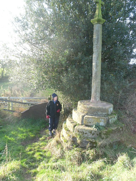
The Butter Cross (Cheddleton) submitted by malboll on 27th Nov 2011. Cheddleton Buttercross.
(View photo, vote or add a comment)
Log Text: Never seen so many gnats in one place! Other than that a really good site and easy to access.
Stonesteads
Date Added: 12th Aug 2014
Site Type: Round Barrow(s)
Country: England (Staffordshire)
Visited: Yes on 6th Jul 2013. My rating: Condition 3 Ambience 3 Access 4
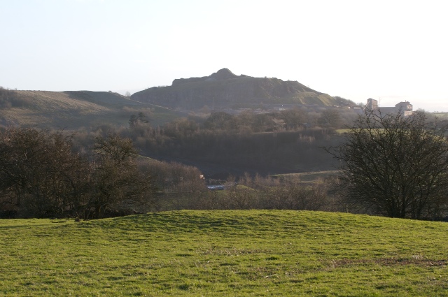
Stonesteads submitted by twentytrees on 7th Mar 2007. Looking south, across the Hamps valley, to one of the ubiquitous Peak District quarries.
(View photo, vote or add a comment)
Log Text: Rather overgrown when I visited. 'Gulliver' and the Cement works formed a contrasting backdrop. Must try to visit it again when the farmer has mown the fields.
Lamber Low
Date Added: 12th Aug 2014
Site Type: Round Barrow(s)
Country: England (Staffordshire)
Visited: Yes on 6th Jul 2013. My rating: Condition 2 Ambience 3 Access 4
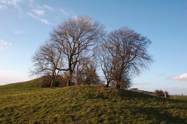
Lamber Low submitted by twentytrees on 7th Mar 2007. Lamber Low in the foreground with a natural rock outcrop behind.
(View photo, vote or add a comment)
Log Text: The field containing the site was full of cows. They seemed to have uncovered a patch of grass just below the barrow and broken the exposed stone. That may have been a remnant of the field wall.
Hoften's Cross
Date Added: 12th Aug 2014
Site Type: Early Christian Sculptured Stone
Country: England (Staffordshire)
Visited: Yes on 1st Jun 2013. My rating: Condition 3 Ambience 3 Access 5
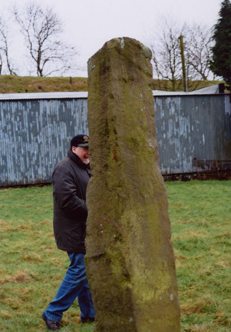
Hoften's Cross submitted by Astronomer on 18th Mar 2004. A 'rude' cross, possibly a re-used prehistoric, standing stone located near Caldon Low quarries at a crossroads called Hoften's Cross. There is a pub called the Cross (or something similar) over the road from this 2.5m standing stone, map ref SK072481 on the OS Explorer 259, Derby, Uttoxeter, Ashbourne & Cheadle map.
(View photo, vote or add a comment)
Log Text: Visible from the road and the car park of The Cross pub across the road. A footpath enters the field where Hoften's Cross is located. The close proximity of a stable made this not one of the more scenic spots. A shame that the pub sign has a crusader knight on it rather than this rude cross!
Windywaycross
Date Added: 12th Aug 2014
Site Type: Early Christian Sculptured Stone
Country: England (Staffordshire)
Visited: Yes on 1st Jun 2012. My rating: Condition 3 Ambience 4 Access 5
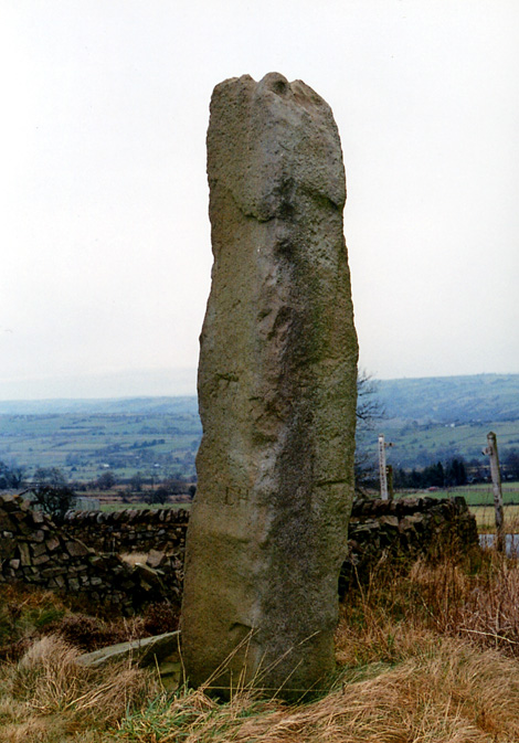
Windywaycross submitted by Astronomer on 18th Mar 2004. Windywaycross, possibly a re-used standing stone on Ippestones Edge at SK056492 at a place called Windywaycross, just off the road branching to Alton Towers, off the Leek-Ashbourne road. Approaching from the north, the stone is 8m off the RH side of the road.
(View photo, vote or add a comment)
Log Text: It has the date it was erected carved into it.
Grindon Moor Barrow
Date Added: 12th Aug 2014
Site Type: Round Barrow(s)
Country: England (Staffordshire)
Visited: Yes on 7th Apr 2013. My rating: Condition 2 Ambience 3 Access 4
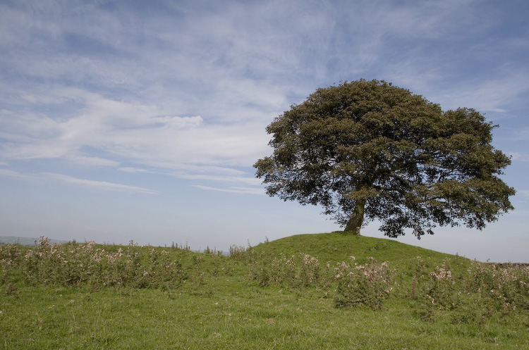
Grindon Moor Barrow submitted by twentytrees on 9th Sep 2006. Well preserved, although unscheduled round barrow located at the highest point of what was Grindon Moor (the land is now dairy farming with a small part of the moor remaining nearby).
The tree is rooted in the barrow.
(View photo, vote or add a comment)
Log Text: Visible from the road. A footpath crosses the field containing the site. The field is full of lumps, bumps, mounds, pits etc.
Hurst Low
Date Added: 12th Aug 2014
Site Type: Round Barrow(s)
Country: England (Staffordshire)
Visited: Couldn't find on 7th Apr 2013
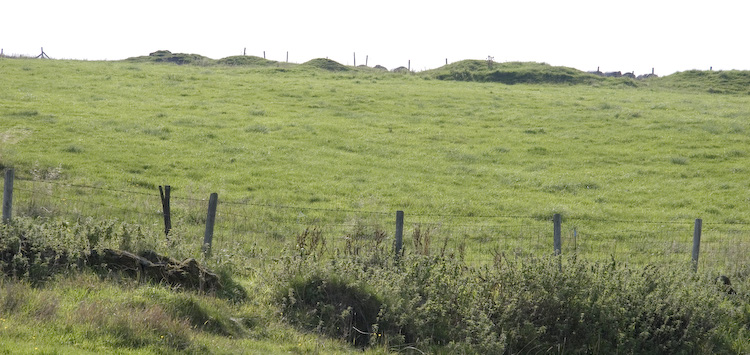
Hurst Low submitted by twentytrees on 9th Sep 2006. Marked as Tumuli on the map but this may refer to nearby Grindon Moor barrow. There appears to be numerous mounds in a line (lined up on nearby Butterton church spire?) but they are in a much denunded state, so difficult to be sure. Not scheduled.
(View photo, vote or add a comment)
Log Text: Saw a huge misshapen mound in the field containing Hurst Low but that looked more like a spoil heap or something. Large agricultural building has been erected nearby in same field too. Whole area very messy with vehicles parked in the field and bits of rusty agricultural equipment lain about. Failed to I.D. the barrow.
Caltonmoor
Date Added: 12th Aug 2014
Site Type: Round Barrow(s)
Country: England (Staffordshire)
Visited: Yes on 5th May 2014. My rating: Condition 1 Ambience 2 Access 5
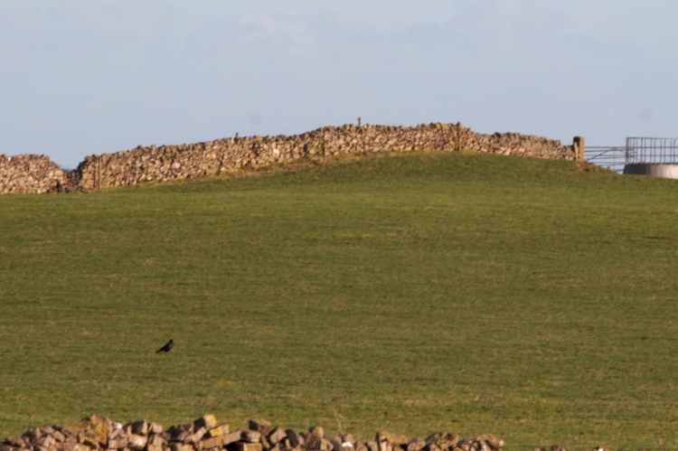
Caltonmoor submitted by twentytrees on 7th Mar 2007. View from the road.
(View photo, vote or add a comment)
Log Text: Descheduled rather than unscheduled. Calton Moor Barrow is probably seen by more people each day than any other in Staffordshire, but it is virtually destroyed. Of the four quadrants only one partially survives and that's badly plough damaged. Main reason for descheduling though is the track cutting through the centre which Carrington reported.
Top Low 1
Date Added: 12th Aug 2014
Site Type: Round Barrow(s)
Country: England (Staffordshire)
Visited: Yes on 5th May 2014. My rating: Condition 2 Ambience 4 Access 3
Log Text: Site is located on private land with no footpath access to site. However, both sets of field walls between the public footpath lower down the hill and the site are down for some reason there is nothing to prevent anyone from climbing to the top of the hill at the moment.
Top Low 2
Date Added: 12th Aug 2014
Site Type: Round Barrow(s)
Country: England (Staffordshire)
Visited: Yes on 5th May 2014. My rating: Condition 3 Ambience 4 Access 4
Log Text: Footpaths run along the hillside above the site and along the valley floor below. Mutilation on the mound reveals natural rock, so the barrow may merge with a natural feature. Sheep using the hollow on the top of the barrow as a bed when I visited.
Damgate Cairns 2
Date Added: 13th Aug 2014
Site Type: Cairn
Country: England (Staffordshire)
Visited: Yes on 11th Aug 2013. My rating: Condition 3 Ambience 3 Access 4

Damgate Cairns 2 submitted by TwentyTrees on 24th Jan 2008. The two northerly barrows either side of the gap in the dry stone wall which is built over both.
(View photo, vote or add a comment)
Log Text: Visible from Ilam Moor Lane, the footpath running through the adjacent field and from Pasture Lane, Stanshope near to Stanshope Cairns 1.
Stanshope Cairn 1
Date Added: 13th Aug 2014
Site Type: Cairn
Country: England (Staffordshire)
Visited: Yes on 11th Aug 2013. My rating: Condition 2 Ambience 3 Access 4

Stanshope Cairn 1 submitted by twentytrees on 27th Oct 2007. The barrow in the foreground on the far side of the wall with the cows on!
(View photo, vote or add a comment)
Log Text: No parking at the end of Pasture Lane, but only a short walk to this site along the Lane. Pasture Lane is not a vehicular access.
Stanshope Cairn 2
Date Added: 13th Aug 2014
Site Type: Cairn
Country: England (Staffordshire)
Visited: Yes on 11th Aug 2013. My rating: Condition 1 Ambience 2 Access 4

Stanshope Cairn 2 submitted by twentytrees on 27th Oct 2007. The view from the lane with Alstonefield church beyond.
(View photo, vote or add a comment)
Log Text: Descheduled. The earthwork mound reported by Bateman has gone. The natural rock outcrop shows little evidence of use for the funerary deposits recorded by Bateman and Carrington due to quarrying, the wall being built on top of it etc. Due to Bateman's vague description of location difficult to be sure this is the actual site he opened.
Rye Low
Date Added: 13th Aug 2014
Site Type: Round Barrow(s)
Country: England (Staffordshire)
Visited: Yes on 6th May 2013. My rating: Condition 3 Ambience 4 Access 4
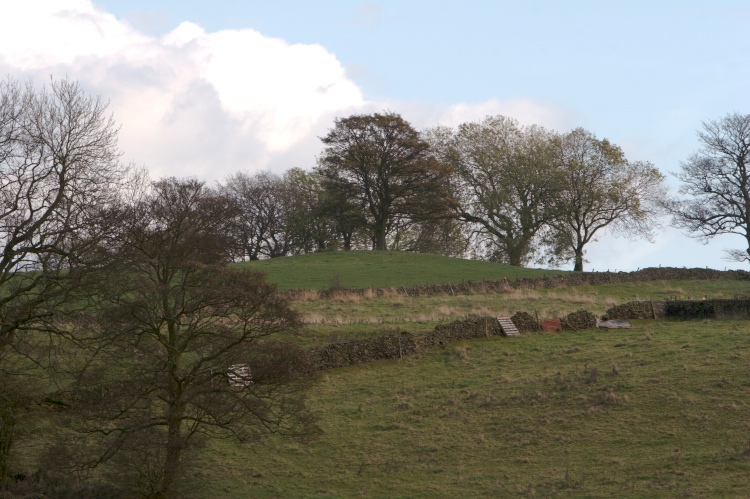
Rye Low submitted by twentytrees on 30th Oct 2007. View from the road. The barrow is prominent despite having trees nearby and one on top.
(View photo, vote or add a comment)
Log Text: Well preserved apart from the central crater in which the oak tree stands. Public footpath from Brund to Sheen runs right past the Southern edge of the barrow.
Brund Low
Date Added: 13th Aug 2014
Site Type: Round Barrow(s)
Country: England (Staffordshire)
Visited: Yes on 6th May 2013. My rating: Condition 3 Ambience 3 Access 5
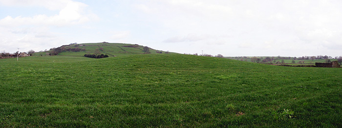
Brund Low submitted by stu on 10th Dec 2005. SK103618. The barrow of Brund Low, Sheen Hill beyond.
(View photo, vote or add a comment)
Log Text: Visible from the road. Top has been levelled but otherwise in reasonable condition.
Booth Low 1
Date Added: 13th Aug 2014
Site Type: Round Barrow(s)
Country: England (Staffordshire)
Visited: Yes on 6th May 2013. My rating: Condition 3 Ambience 4 Access 4
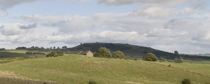
Booth Low 1 submitted by twentytrees on 29th Aug 2006. The highest of the three Booth Low barrows visible is front of the building. 2.3m high with maximum dimensions 32.5x29m.
(View photo, vote or add a comment)
Log Text: This is the barrow Elizabeth Biddulph calls Fawfieldhead Low in her book Leek's Forgotten Past. Very large, dwarfs the modern barn next to it. One of my favourite barrows in Staffordshire Moorlands.
Booth Low 2
Date Added: 13th Aug 2014
Site Type: Round Barrow(s)
Country: England (Staffordshire)
Visited: Yes on 6th May 2013. My rating: Condition 2 Ambience 3 Access 3
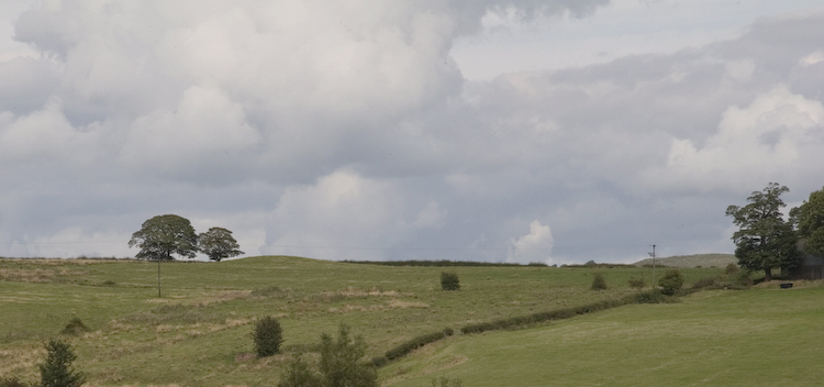
Booth Low 2 submitted by twentytrees on 3rd Sep 2006. The second of the three Booth Low barrows (although only two are scheduled) on the horizon left of centre, seen from the B5053 Longnor - Warslow road. Scheduled Monument 13523.
(View photo, vote or add a comment)
Log Text: Not as large or as well preserved as Booth Low I. The field gate just happened to be open when I visited. The footpath runs below the site.
Booth Low 3
Date Added: 13th Aug 2014
Site Type: Round Barrow(s)
Country: England (Staffordshire)
Visited: Yes on 6th May 2013. My rating: Condition 1 Ambience 2 Access 5
Log Text: Possible only viewpoint for this site may be the road leading past Low farm (yes it is a public highway). Very badly damaged. Unscheduled?
Bishop's Wood
Date Added: 13th Aug 2014
Site Type: Hillfort
Country: England (Staffordshire)
Visited: Yes on 2nd Jun 2013. My rating: Condition 3 Ambience 4 Access 2
Log Text: The road leading to the site is a private road. The main road running South from Loggerheads is very busy and nowhere to park. I would suggest parking in Loggerheads itself and walking to the site. There are paths leading nearly all the way around the fort. Ditches and banks visible in parts. Fairly heavily afforested.
