Contributory members are able to log private notes and comments about each site
Sites BrownEdger has logged. View this log as a table or view the most recent logs from everyone
Grindon Moor Barrow
Date Added: 12th Aug 2014
Site Type: Round Barrow(s)
Country: England (Staffordshire)
Visited: Yes on 7th Apr 2013. My rating: Condition 2 Ambience 3 Access 4
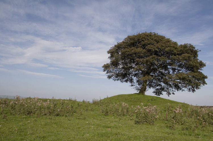
Grindon Moor Barrow submitted by twentytrees on 9th Sep 2006. Well preserved, although unscheduled round barrow located at the highest point of what was Grindon Moor (the land is now dairy farming with a small part of the moor remaining nearby).
The tree is rooted in the barrow.
(View photo, vote or add a comment)
Log Text: Visible from the road. A footpath crosses the field containing the site. The field is full of lumps, bumps, mounds, pits etc.
Hurst Low
Date Added: 12th Aug 2014
Site Type: Round Barrow(s)
Country: England (Staffordshire)
Visited: Couldn't find on 7th Apr 2013
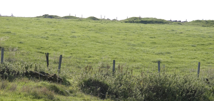
Hurst Low submitted by twentytrees on 9th Sep 2006. Marked as Tumuli on the map but this may refer to nearby Grindon Moor barrow. There appears to be numerous mounds in a line (lined up on nearby Butterton church spire?) but they are in a much denunded state, so difficult to be sure. Not scheduled.
(View photo, vote or add a comment)
Log Text: Saw a huge misshapen mound in the field containing Hurst Low but that looked more like a spoil heap or something. Large agricultural building has been erected nearby in same field too. Whole area very messy with vehicles parked in the field and bits of rusty agricultural equipment lain about. Failed to I.D. the barrow.
Blake Low
Date Added: 8th Jun 2013
Site Type: Round Barrow(s)
Country: England (Staffordshire)
Visited: Yes on 1st Apr 2013. My rating: Condition 3 Ambience 3 Access 4
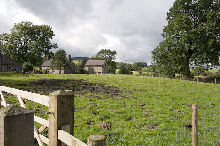
Blake Low submitted by twentytrees on 29th Aug 2006. You can just discern the curve of the barrow in this picture - in real life it is more prominent - 1.1m high, and 25x22m. Investigation in the 19th century discovered a cremation, charcoal, and a flint scraper and knife.
(View photo, vote or add a comment)
Log Text: An easy site to access but the wooden fence surrounding the site and the close proximity of the farm buildings give the site a rather 'hemmed in' feel to it.
Brown Low (staffs)
Date Added: 8th Jun 2013
Site Type: Round Barrow(s)
Country: England (Staffordshire)
Visited: Yes on 1st Apr 2013. My rating: Condition 3 Ambience 4 Access 4
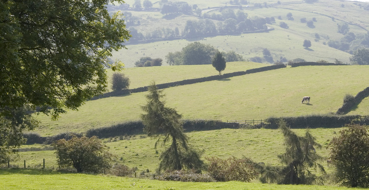
Brown Low (staffs) submitted by twentytrees on 9th Sep 2006. Brown Low, sometimes referred to as Brownlow, seen just to the right of the lonely tree which sits astride the dry stone wall near the centre of the photo. Taken from the path from Warslow.
Scheduled monument number 22412.
(View photo, vote or add a comment)
Log Text: None
Merryton Low 1
Date Added: 10th Jun 2013
Site Type: Round Barrow(s)
Country: England (Staffordshire)
Visited: Yes on 1st Apr 2013. My rating: Condition 2 Ambience 3 Access 5
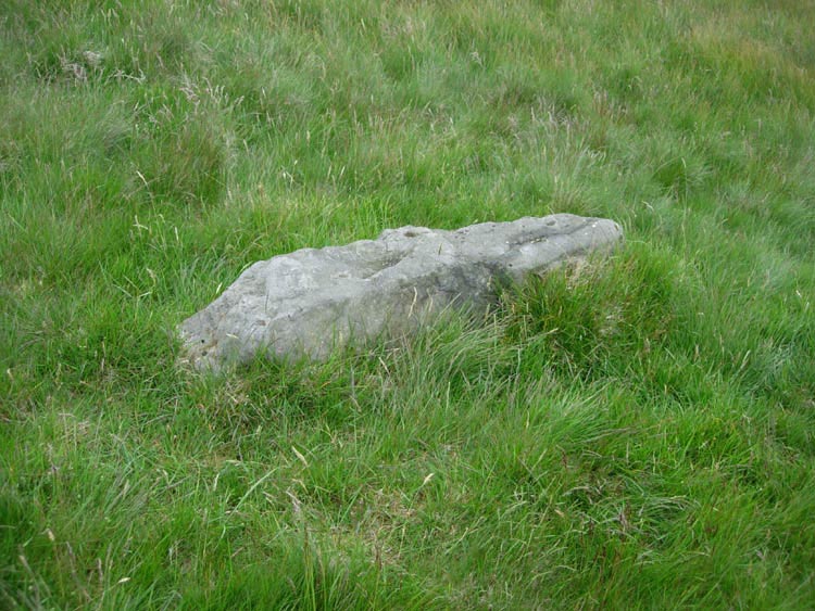
Merryton Low 1 submitted by astronomer on 3rd Jun 2007. Merryton Low fallen stone closeup. I suggest that this stone may have perhaps stood on the nearby tumulus and was replaced by the present Trig point.
(View photo, vote or add a comment)
Log Text: The war memorial is to commerate members of the Leek Home Guard who then went on to serve in the regular armed forces and lost their lives in combat.
Merryton Low 2
Date Added: 10th Jun 2013
Site Type: Round Barrow(s)
Country: England (Staffordshire)
Visited: Yes on 1st Apr 2013. My rating: Condition 3 Ambience 3 Access 4
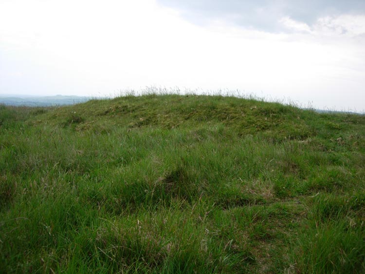
Merryton Low 2 submitted by astronomer on 3rd Jun 2007. Merryton Low II. Accessibility 4, ambiance 3.
This is an odd one. The tumulus lies within sight of Merryton I just in from the edge of a low escarpment dropping down to the road from the Mermaid PH to Warslow. I parked on this road near to the side road to Elkestone. From this junction road there is a fence leading NW up to the edge.Climb the hill parallel to the fence and the tumulus sits 25m in front of you by the side of a track leading to Merryton Low 1.
Merryton II is an elongat...
(View photo, vote or add a comment)
Log Text: Very narrow for a barrow
Holy Trinity Church, Eccleshall
Date Added: 7th Sep 2014
Site Type: Ancient Cross
Country: England (Staffordshire)
Visited: Yes on 28th Jul 2012. My rating: Condition 3 Ambience 3 Access 5
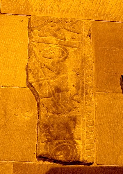
Holy Trinity Church, Eccleshall submitted by TimPrevett on 12th Sep 2005. The right hand (eastern) cross fragment in the choir vestry. Please note, the light conditions were dire, and so I have edited the photo to bring out as much detail as possible. A wheelie bin used as a tripod for this one. See main entry for detailed write up.
(View photo, vote or add a comment)
Log Text: None
Windywaycross
Date Added: 12th Aug 2014
Site Type: Early Christian Sculptured Stone
Country: England (Staffordshire)
Visited: Yes on 1st Jun 2012. My rating: Condition 3 Ambience 4 Access 5
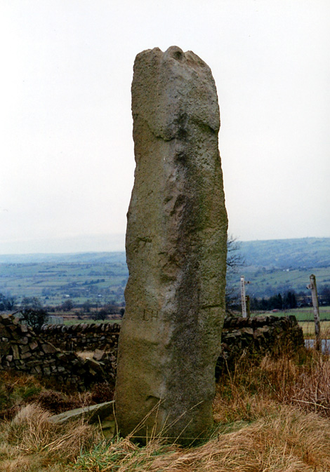
Windywaycross submitted by Astronomer on 18th Mar 2004. Windywaycross, possibly a re-used standing stone on Ippestones Edge at SK056492 at a place called Windywaycross, just off the road branching to Alton Towers, off the Leek-Ashbourne road. Approaching from the north, the stone is 8m off the RH side of the road.
(View photo, vote or add a comment)
Log Text: It has the date it was erected carved into it.
Nicholson Museum and Art Gallery
Date Added: 5th Oct 2015
Site Type: Museum
Country: England (Staffordshire)
Visited: Yes on 1st Mar 2012. My rating: Condition 4 Ambience 4 Access 5
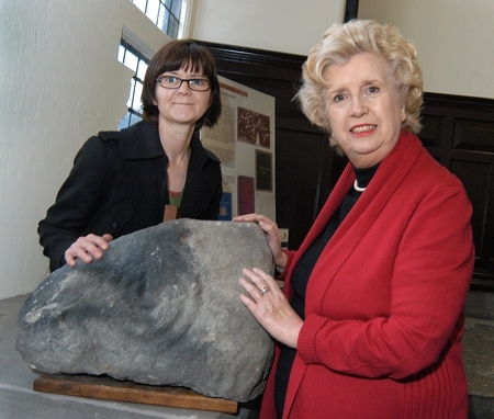
Nicholson Museum and Art Gallery submitted by Andy B on 6th Jan 2012. Neolithic cup-and-ring stone found near Alton Towers donated to Leek museum
The stone with council arts events co-ordinator Alison Thomas (left) and Council leader Sybil Ralphs.
Photo copyright Staffordshire Moorlands District Council
(View photo, vote or add a comment)
Log Text: None
Cock Low (Leek)
Date Added: 5th Oct 2015
Site Type: Round Barrow(s)
Country: England (Staffordshire)
Visited: Yes on 1st Mar 2012. My rating: Condition -1 Ambience 3 Access 5
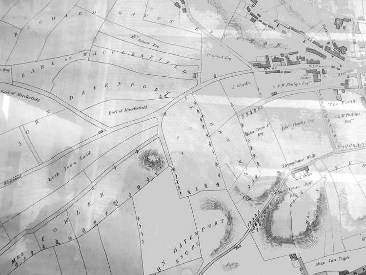
Cock Low (Leek) submitted by astronomer on 8th Mar 2015. Thanks to Leek historians, Margaret and Colin Bowyer, who kindly supplied an image of an 1838 map of Leek, it might be possible to shed some more light on Cock Low. The map clearly shows a prominent mound near what is now the playing fields at Spring Gardens. In her 1999 book, 'Leek's Forgotten Centuries', E.A Biddulph states that the burial mound, 18ft high and 120ft wide was on part of the property owned by a Mrs Watt, standing between Waterloo Rd, Messr's Broster's Mill and Spring Gardens. Sh...
(View photo, vote or add a comment)
Log Text: None
St James the Great, Audlem
Date Added: 7th Sep 2014
Site Type: Round Barrow(s)
Country: England (Cheshire)
Visited: Yes on 1st Jan 2012. My rating: Condition 4 Ambience 4 Access 5
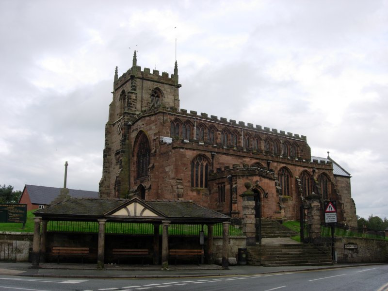
St James the Great, Audlem submitted by TimPrevett on 18th Oct 2006. This church is claimed to reside on a "Celtic Burial Ground"; see main entry for details.
(View photo, vote or add a comment)
Log Text: None
The Bear Stone
Date Added: 7th Sep 2014
Site Type: Natural Stone / Erratic / Other Natural Feature
Country: England (Cheshire)
Visited: Yes on 1st Jan 2012. My rating: Condition 4 Ambience 3 Access 5
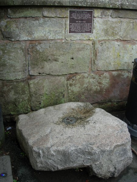
The Bear Stone submitted by TimPrevett on 18th Oct 2006. Seen as most will see the stone. See main entry for details.
(View photo, vote or add a comment)
Log Text: None
Sandbach Crosses
Date Added: 7th Sep 2014
Site Type: Ancient Cross
Country: England (Cheshire)
Visited: Yes on 1st Jan 2012. My rating: Condition 3 Ambience 4 Access 5
Sandbach Crosses submitted by TimPrevett on 25th Mar 2005. The two huge crosses at Sandbach (pronounced sand-batch; most are probably familiar with the Sandbach Services on the M6) ; I've travelled many miles taking in other crosses en route, but these two are as near as on my doorstep, and I'd never visited! The astonishment I felt at their size was in proportion to said size.
I wasn't particularly happy with the photos I took on this visit, but having been once and being so close, I'll return, and also for a night shot when they are lit up, hopefull...
(View photo, vote or add a comment)
Log Text: None
Egg Well
Date Added: 5th Sep 2011
Site Type: Holy Well or Sacred Spring
Country: England (Staffordshire)
Visited: Yes on 3rd Sep 2011. My rating: Condition 3 Ambience 4 Access 4

Egg Well submitted by TimPrevett on 26th Jul 2007. The cross shaped chamber, and stick I used to approximately gauge depth. Also notice the floating dead bodies - at least two frogs, and I think, something resembling a rat...
(View photo, vote or add a comment)
Log Text: Improvements have been made to the site with an information board and fence to stop the local livestock crowding round the entrance!
Bullstones
Date Added: 7th Sep 2014
Site Type: Stone Circle
Country: England (Cheshire)
Visited: Yes on 21st Aug 2011. My rating: Condition 3 Ambience 4 Access 4
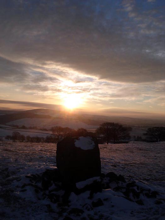
Bullstones submitted by astronomer on 22nd Dec 2010. The winter solstice sunrise is still celebrated at Bullstones as this picture, taken by writer, broadcaster and folklorist, Doug Pickford shows.
(View photo, vote or add a comment)
Log Text: None
The Plague Stone
Date Added: 21st Aug 2011
Site Type: Ancient Cross
Country: England (Cheshire)
Visited: Yes on 21st Aug 2011. My rating: Condition 3 Ambience 4 Access 5
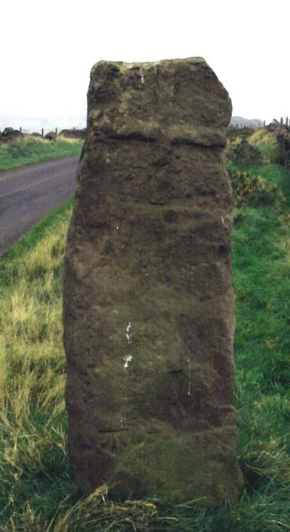
The Plague Stone submitted by Vicky on 18th Oct 2001. THE PLAGUE STONE , Higher Sutton, near Macclesfield SJ9561469227
This wayside cross, possibly a Christianised standing stone, was apparently the place where goods were left by the healthy for sale to the plague-stricken. The latter took the goods and left the money in a pot of water. Interestingly the 1904 OS map shows an isolation hospital located near by.
(View photo, vote or add a comment)
Log Text: None
Longgutter
Date Added: 21st Aug 2011
Site Type: Round Barrow(s)
Country: England (Cheshire)
Visited: Yes on 21st Aug 2011. My rating: Condition 2 Ambience 3 Access 4
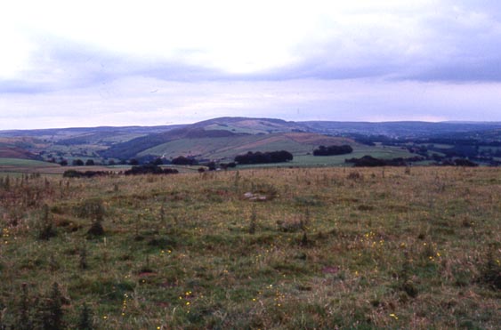
Longgutter submitted by astronomer on 26th Jul 2004. This elusive circle is mentioned by Paul and Vicky Morgan but is difficult to find although only 300m south of Bullstones. It might be a stone circle but then again may be the base of a roundhouse. In 1878, JD Sainter records roundhouses some 200m further south again, in the field north of the road.
(View photo, vote or add a comment)
Log Text: None
Clulow Cross
Date Added: 21st Aug 2011
Site Type: Round Barrow(s)
Country: England (Cheshire)
Visited: Saw from a distance on 21st Aug 2011. My rating: Condition 3 Ambience 4 Access 3
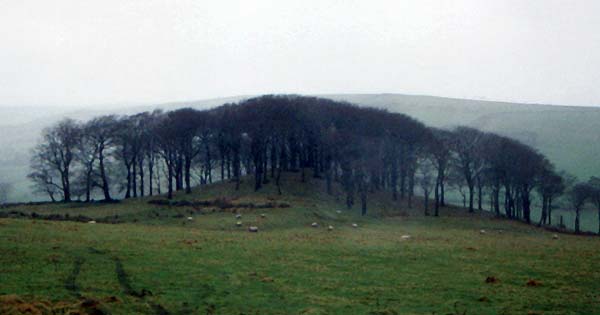
Clulow Cross submitted by vicky on 22nd Jul 2002. Clulow Cross - possibly a prehistoric round barrow surmounted by a more recent cross.
(View photo, vote or add a comment)
Log Text: None
Sutton Hall
Date Added: 21st Aug 2011
Site Type: Round Barrow(s)
Country: England (Cheshire)
Visited: Yes on 21st Aug 2011. My rating: Condition 2 Ambience 2 Access 4
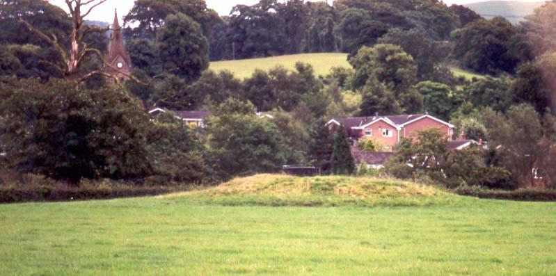
Sutton Hall submitted by PaulM on 14th Aug 2001. This somewhat dilapidated barrow (now the resting place of a water trough) is located adjacent to the grounds of Sutton Hall (pricey country pub). NGR: SJ92497132 (map 118). It can be viewed from Bullocks Lane, Sutton (east of Macclesfield).
(View photo, vote or add a comment)
Log Text: None
The Wrekin
Date Added: 16th Aug 2011
Site Type: Hillfort
Country: England (Shropshire)
Visited: Yes on 14th Aug 2011. My rating: Condition 3 Ambience 4
The Wrekin submitted by TimPrevett on 2nd Jan 2005. Lookin to the North East, between the outer and inner ramparts of The Wrekin.
The path enters the inturned ramparts to the central area; the trig point and toposcope sit upon a Bronze Age Cairn, which is hardly in evidence.
Another, more slight rampart is visible to the left of the picture, before the hill becomes more rounded.
See main entry - click on the blue text to the left of the picture for more information.
(View photo, vote or add a comment)
Log Text: None
