Contributory members are able to log private notes and comments about each site
Sites Bat400 has logged. View this log as a table or view the most recent logs from everyone
Mesa Verde - Cliff Palace
Date Added: 5th Jun 2012
Site Type: Ancient Village or Settlement
Country: United States (The Southwest)
Visited: Yes on 28th Apr 2012. My rating: Condition 3 Ambience 5 Access 3

Mesa Verde - Cliff Palace submitted by DrewParsons on 18th Oct 2008. Mesa Verde - The Cliff Palace. September 2005
(View photo, vote or add a comment)
Log Text: Cliff Palace is the largest cliff dwelling in the park. It faces west and gets maximum light in the late afternoon. You are allowed to walk along the restored retaining wall (now a walkway) and around several kivas in front of the square tower. We were invited to look up into the Sqare Tower to see the plastered wall mural on the thrid floor, which I was itching to do since I knew it was up there. This access is only as part of a tour, although you can look from two different overlooks to your heart's content, sans guidance.
There are simple tour guides available, and a great many web and other media resources you can absorb ahead on your visit. The ranger will give you a substantial amount of information on the current archaeological thought about why the cliff dwellings were built and later abandoned, as well as the history of excavation and resoration. How well they do this probably varies, although I was very satisfied with my tour's leader.
This is one of the most visited on Ranger Led tours. (These tours are for a very small additional fee over the park entrance fee, but they limit the number of people who can visit the site.) The rangers will warn you (for all tours) about the number of steps, ladders, and the impact of altitude. If you are used to hiking and are moderately healthy, this tour is not difficult, even accounting for the altitude.
The tour is advertised as 1 hour long, although this stretches in the shoulder season when there are fewer tours scheduled farther apart.
Mesa Verde - Sun Temple
Date Added: 5th Jun 2012
Site Type: Ancient Temple
Country: United States (The Southwest)
Visited: Yes on 28th Apr 2012. My rating: Condition 3 Ambience 4 Access 5
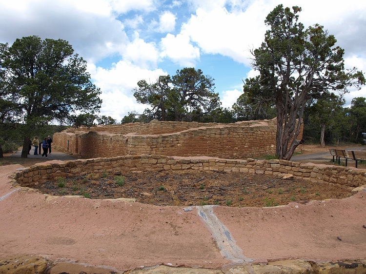
Mesa Verde - Sun Temple submitted by bat400 on 2nd Jun 2012. The eastern end of the Sun Temple. Photo taken over the separate associated round structure.
Photo by bat400, April 2012.
(View photo, vote or add a comment)
Log Text: A large somewhat mysterious pueblo site on the lip on the canyon overlooking the Cliff Palace and about a dozen other sites. What you see is a restoration, although when the mound of collected dust, dirt, and fallen masonary was removed and examined, it was obvious that the building never had a roof. In that and other features, tt's quite different architecturally from any other sites at Mesa Verde or other places in the area.
You'll see photos showing visitors walking inside the massive outer walls, using ladders to climb in and out of the site, but this doesn't seem to be allowed any more.
Mesa Verde - Balcony House
Date Added: 5th Jun 2012
Site Type: Ancient Village or Settlement
Country: United States (The Southwest)
Visited: Saw from a distance on 29th Apr 2012. My rating: Condition 3 Ambience 5 Access 3

Mesa Verde - Balcony House submitted by jeffrep on 13th Nov 2012. Balcony House cliff dwelling showing the balcony (right) that gives this site its name.
(View photo, vote or add a comment)
Log Text: Balcony House is in an alcove directly below a road where people park to take the tour. As a result, you cannot see it from that location. If you cannot take the guided tour (which is possibly the most physically demanding of the short Ranger Led tours) you can take a short hike (about 3/4 of a mile, one way) to the Soda Canyon overlook of Balcony House.
The hike is relatively flat on a well defined sand and dirt track. When you get to the Soda Canyon edge, Balcony House is clearly visible, but binoculars are needed to see the details of the building. There are also several other, much smaller cliff dwellings in the canyon walls and visible from points on the trail.
Anasazi Indian State Park
Date Added: 25th May 2012
Site Type: Ancient Village or Settlement
Country: United States (The Southwest)
Visited: Yes on 1st May 2012. My rating: Condition 2 Ambience 3 Access 4

Anasazi Indian State Park submitted by TheCaptain on 5th Dec 2010. Pit house structure at Boulder Anasazi village.
Picture from a 1990 trip, and now faded and deteriorated.
(View photo, vote or add a comment)
Log Text: None
Marsden Mounds
Date Added: 28th Apr 2017
Site Type: Artificial Mound
Country: United States (The South)
Visited: Yes on 3rd Sep 2012
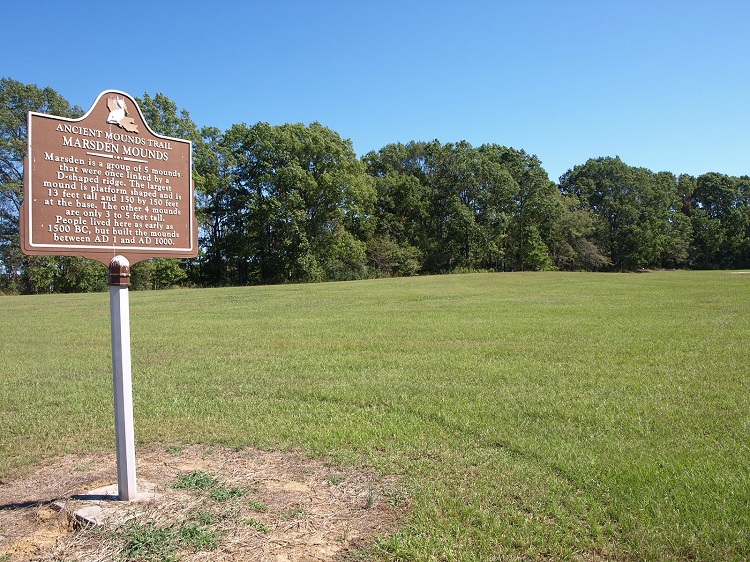
Marsden Mounds submitted by bat400 on 3rd Sep 2012. Mound A lies between the marker and Mounds B, C, and D, which are right at the edge of the woods seen in the background. Mound A is large in diameter, but so reduced in height that it is difficult to see at all.
Photo by bat400, October 2011.
(View photo, vote or add a comment)
Log Text: None
Poverty Point
Date Added: 28th Apr 2017
Site Type: Ancient Village or Settlement
Country: United States (The South)
Visited: Yes on 4th Sep 2012
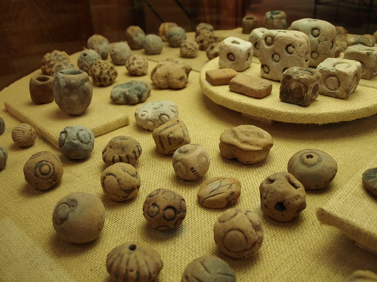
Poverty Point submitted by bat400 on 4th Sep 2012. The "Poverty Point Objects" (PPOs). These fired earthen balls and cubes are unique to the Poverty Point culture. These on display in the park museum are decorated, although many are plain. There is a lot of speculation on what purpose they served, but a general opinion is that they were heated used for earth oven cooking, the area lacks stones more generally used for similar purposes at other sites and called "fire cracked rock" (FCR).
Photo by bat400, October 2011.
(View photo, vote or add a comment)
Log Text: None
Poverty Point - Earthworks
Date Added: 28th Apr 2017
Site Type: Ancient Village or Settlement
Country: United States (The South)
Visited: Yes on 4th Sep 2012
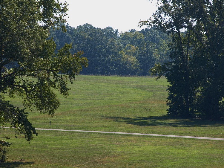
Poverty Point - Earthworks submitted by bat400 on 4th Sep 2012. A view from the top of Mound A of the semi-circular or octagon earthwork ridge area. The curve of a ridge can be seen in the different texture of the ground cover. The white structure is a "ghost dwelling" showing the rought footprint and speculated height of one of the dwellings that were built on the ridges.
Photo by bat400, October 2011.
(View photo, vote or add a comment)
Log Text: None
Poverty Point - Mound A
Date Added: 28th Apr 2017
Site Type: Artificial Mound
Country: United States (The South)
Visited: Yes on 4th Sep 2012
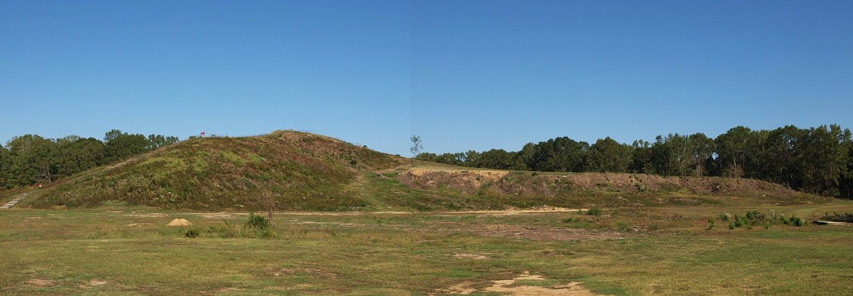
Poverty Point - Mound A submitted by bat400 on 4th Sep 2012. Mound A seen from the south east. The 'tail' of the bird is to the right. The highest point is across the wing span, on the 'bird's' back. There is a boardwalk that allows you to walk up onto the mound.
Photo by bat400, October 2011.
(View photo, vote or add a comment)
Log Text: None
Bynum
Date Added: 28th Apr 2017
Site Type: Barrow Cemetery
Country: United States (The South)
Visited: Yes on 6th Sep 2012
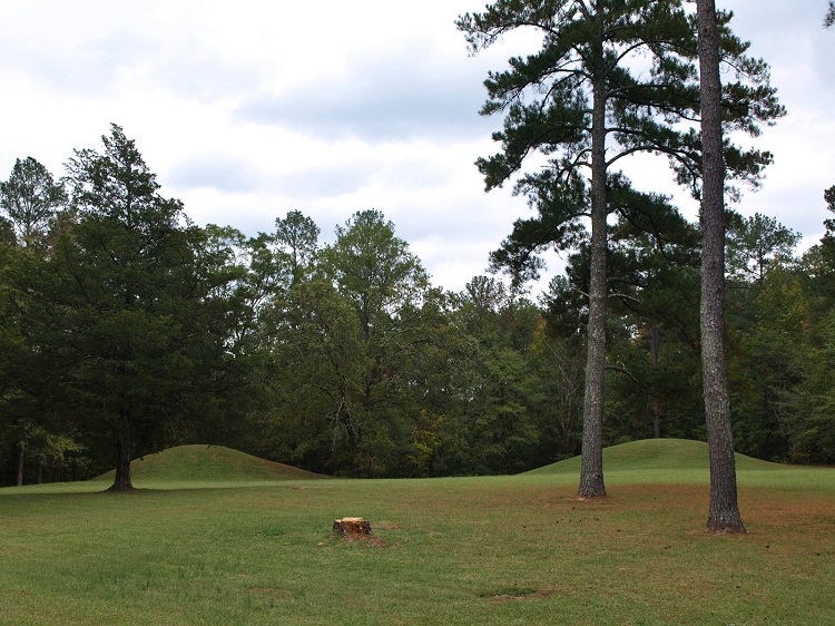
Bynum submitted by bat400 on 6th Sep 2012. Bynum Mounds and Village site. There were originally six burial mounds (the smaller ones much eroded by the plow.) All six were fully excavated and the two largest mounds were reconstructed .
Photo by bat400, Oct 2011.
(View photo, vote or add a comment)
Log Text: None
Pharr Mounds
Date Added: 28th Apr 2017
Site Type: Artificial Mound
Country: United States (The South)
Visited: Yes on 6th Sep 2012
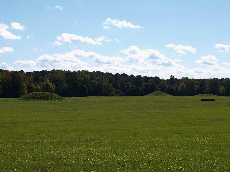
Pharr submitted by bat400 on 6th Sep 2012. Shows only some of the many domed burial mounds in the Pharr complex.
Photo by bat400, October 2011.
(View photo, vote or add a comment)
Log Text: None
Marietta Earthworks - Conus
Date Added: 28th Apr 2017
Site Type: Artificial Mound
Country: United States (Great Lakes Midwest)
Visited: Yes on 13th Jan 2013
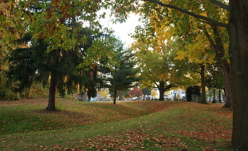
Marietta Earthworks - Conus submitted by bat400 on 13th Jan 2013. The Conus Mound and its enclosing ditch and embankment. This view is from the south side.
Photo by bat400, October 2012.
(View photo, vote or add a comment)
Log Text: None
Marietta Earthworks
Date Added: 28th Apr 2017
Site Type: Misc. Earthwork
Country: United States (Great Lakes Midwest)
Visited: Yes on 13th Jan 2013
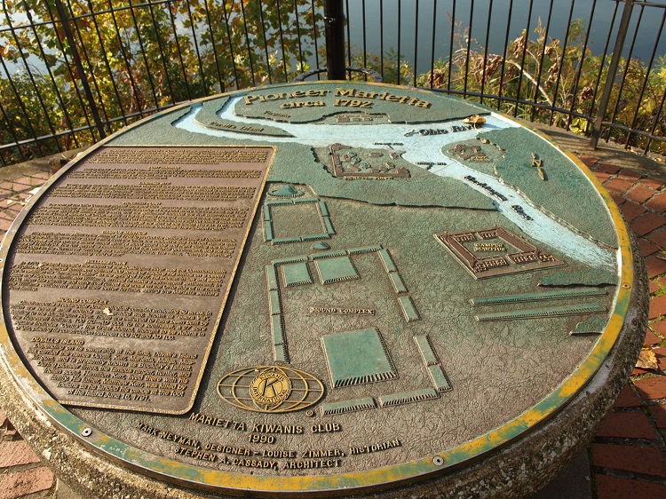
Marietta Earthworks submitted by bat400 on 13th Jan 2013. A riverside park plaque showing the Marietta Earthwork Complex as is appeared when the modern town was first built in the late 18thC.
"Conus" with its embankment appears just upper left of the center.
The rectangular "Quadranaou" is at lower center and the "Capitolium" lying as one of the smaller rectangular mound between Conus and Quadranaou.
The "Sacra Via" appears at the right.
Photo by bat400, Oct 2012.
(View photo, vote or add a comment)
Log Text: None
Marietta Earthworks - Quadranaou
Date Added: 28th Apr 2017
Site Type: Pyramid / Mastaba
Country: United States (Great Lakes Midwest)
Visited: Yes on 14th Jan 2013
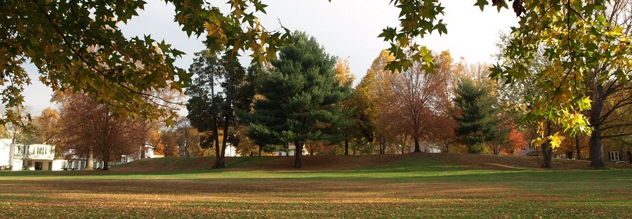
Marietta Earthworks - Quadranaou submitted by bat400 on 14th Jan 2013. The Quadranaou, a flat topped earthen pyramid with centered ramps on each of the four sides. The slope you see at the extreme right and left are the ramps, and not the pyramid itself.
Photo by bat400, October 2012.
(View photo, vote or add a comment)
Log Text: None
University of Chicago Institute
Date Added: 28th Apr 2017
Site Type: Museum
Country: United States (Great Lakes Midwest)
Visited: Yes on 31st Jan 2013
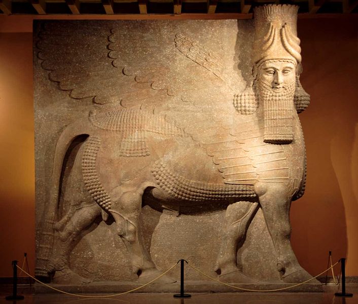
University of Chicago Oriental Institute submitted by bat400 on 31st Jan 2013. The Assyrian Lamassu at the Oriental Institute Museum at the University of Chicago.
Gypsum (?) Khorsabad, entrance to the throne room Neo-Assyrian Period, ca. 721-705 B.C. OIM A7369
This 40 ton statue - one of two flanking the entrance to the throne room of King Sargon II. A protective spirit known as a lamassu, it is shown as a composite being with he head of a human, the body and ears of a bull, and the wings of a bird. When viewed from the side, the creature appears to be walking; w...
(View photo, vote or add a comment)
Log Text: None
Kituwah
Date Added: 28th Apr 2017
Site Type: Ancient Village or Settlement
Country: United States (The South)
Visited: Yes on 24th Feb 2013
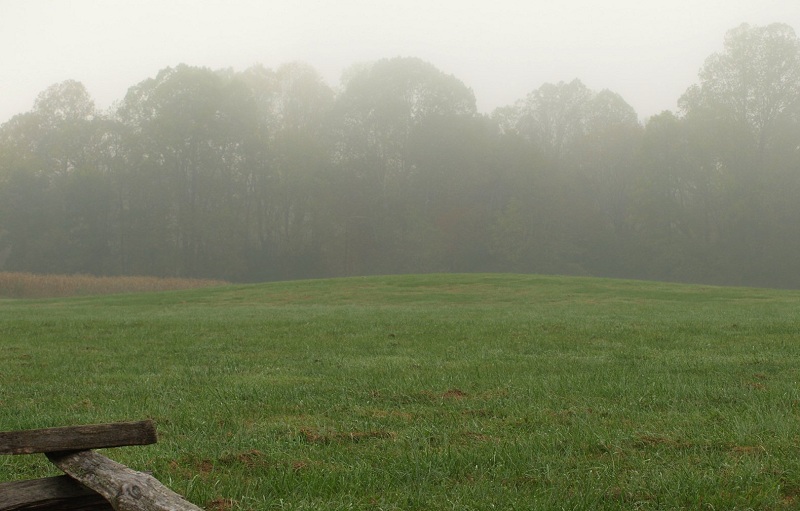
Kituwah submitted by bat400 on 24th Feb 2013. Kituwah. This town site in North Carolina is marked today by the remains of this earthen mound, much reduced from its original size to only about 5 feet high.
photo by bat400, Oct 2012.
(View photo, vote or add a comment)
Log Text: None
Bandelier National Monument
Date Added: 28th Apr 2017
Site Type: Ancient Village or Settlement
Country: United States (The Southwest)
Visited: Yes on 26th Feb 2013
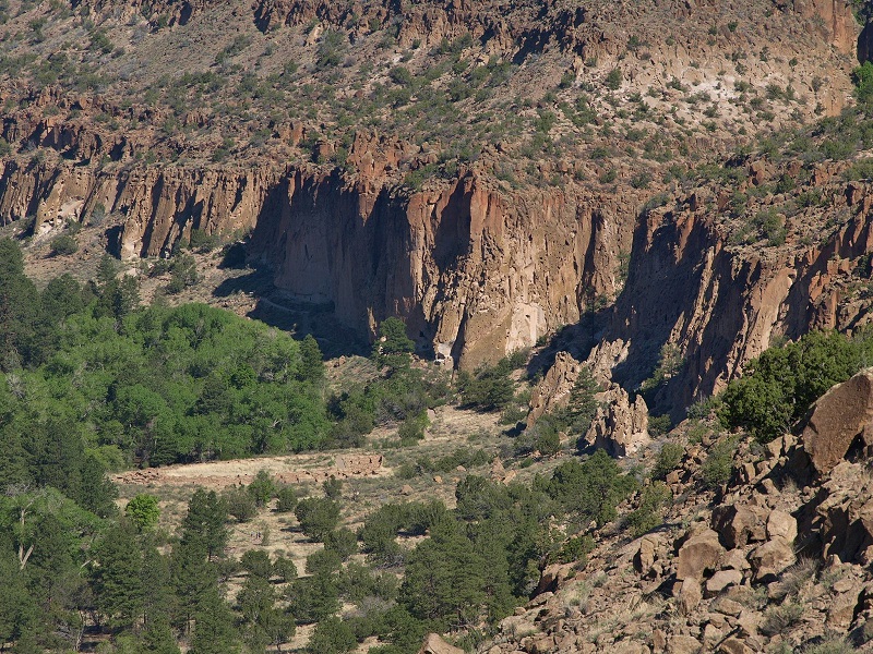
Bandelier National Monument submitted by bat400 on 26th Feb 2013. A view of the main ruins sites on the floor of Frijoles Canyon. Tyounyi is to the left in tan colored stone. "Cavates" dug or enlarges in the cliff wall and the remains of a long line of buildings at the base of the cliff can be see along the cliff wall to the right and center.
Photo by bat400, April 2012.
(View photo, vote or add a comment)
Log Text: None
Bandelier National Mounument - Tyuonyi
Date Added: 28th Apr 2017
Site Type: Ancient Village or Settlement
Country: United States (The Southwest)
Visited: Yes on 26th Feb 2013
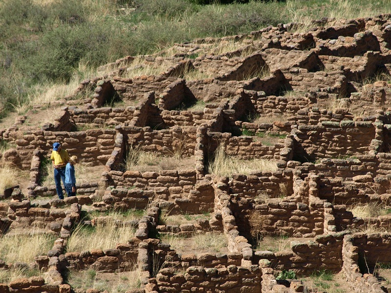
Bandelier National Mounument - Tyuonyi submitted by bat400 on 26th Feb 2013. Tyuonyi pueblo as seen from the ledges along the cliffside. Originally there were 400 rooms, most of which were used for storage.
Photo by bat400.
(View photo, vote or add a comment)
Log Text: None
Bandelier National Monument - Long House
Date Added: 28th Apr 2017
Site Type: Ancient Village or Settlement
Country: United States (The Southwest)
Visited: Yes on 26th Feb 2013
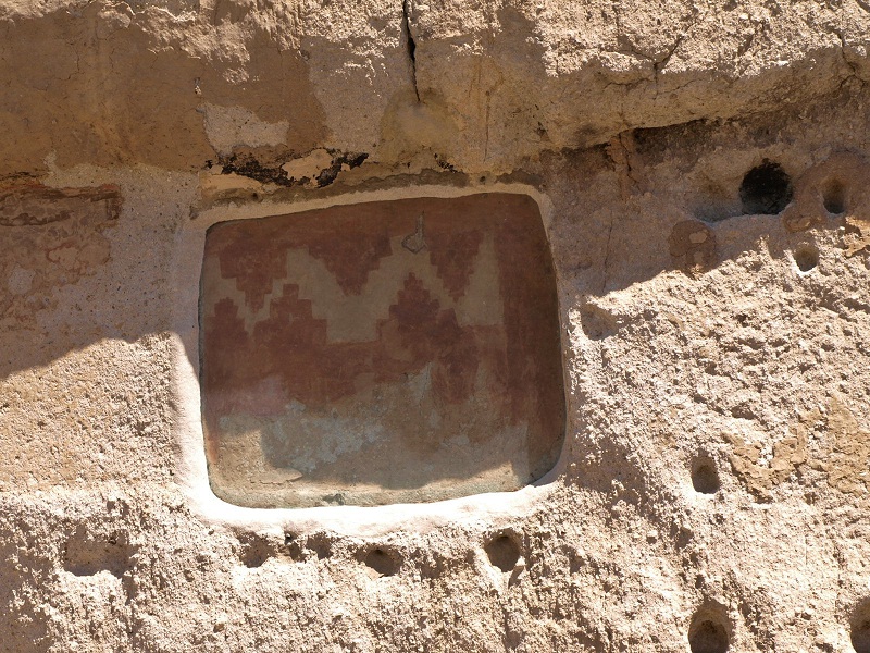
Bandelier National Monument - Long House submitted by bat400 on 26th Feb 2013. Pictogram in Long House Pueblo, which used the cliffside ans the back wall of the rooms.
Photo by bat400, April 2012.
(View photo, vote or add a comment)
Log Text: None
Bandelier National Monument - Alcove House
Date Added: 28th Apr 2017
Site Type: Ancient Village or Settlement
Country: United States (The Southwest)
Visited: Yes on 26th Feb 2013
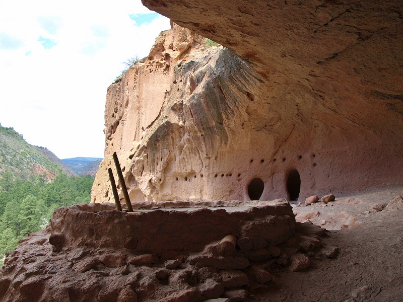
Bandelier National Monument - Alcove House submitted by bat400 on 26th Feb 2013. Alcove House.
Photo by bat400, April 2012.
(View photo, vote or add a comment)
Log Text: None
Lake Koshkonong Mounds
Date Added: 28th Apr 2017
Site Type: Artificial Mound
Country: United States (Great Lakes Midwest)
Visited: Yes on 31st Mar 2013
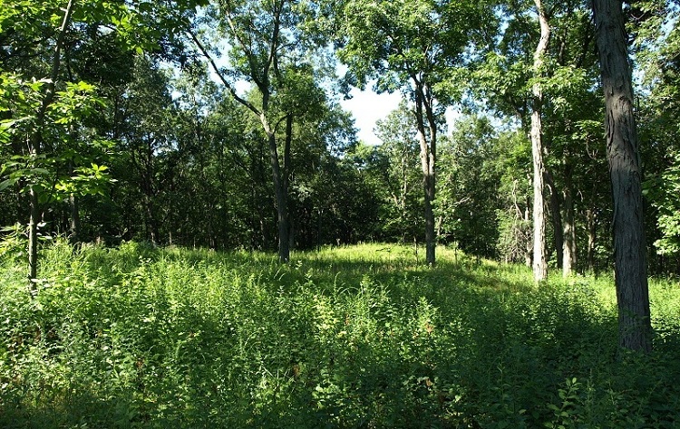
Lake Koshkonong Mounds submitted by bat400 on 31st Mar 2013. One of the larger remaining mounds in this group, shaped like a turtle. However, this is just about impossible to tell from a photo, both because there is no way to see the overall shape from ground level, and because these mounds are not kept carefully trimmer of high vegetation or outlines with contrasting ground cover.
Photo by bat400, July 2010.
(View photo, vote or add a comment)
Log Text: None
