Contributory members are able to log private notes and comments about each site
Sites Bat400 has logged. View this log as a table or view the most recent logs from everyone
Lake Okeechobee
Date Added: 12th Sep 2010
Site Type: Ancient Village or Settlement
Country: United States (The South)
Visited: Yes on 2nd Oct 2008
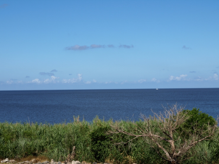
Lake Okeechobee submitted by bat400 on 2nd Oct 2008. Lake Okeechobee. Taken from the eastern shore of the lake, north of Belle Glade. Heavy rains from the 2008 Hurricane season have increased the water levels slightly, but drought conditions still are reducing the lake depth in some areas. As you can see, Okeechobee is too wide to see the opposite shore.
Photo - bat400, Sept 2008.
(View photo, vote or add a comment)
Log Text: None
Glenn Black Laboratory
Date Added: 12th Sep 2010
Site Type: Museum
Country: United States (Great Lakes Midwest)
Visited: Yes on 27th Feb 2009
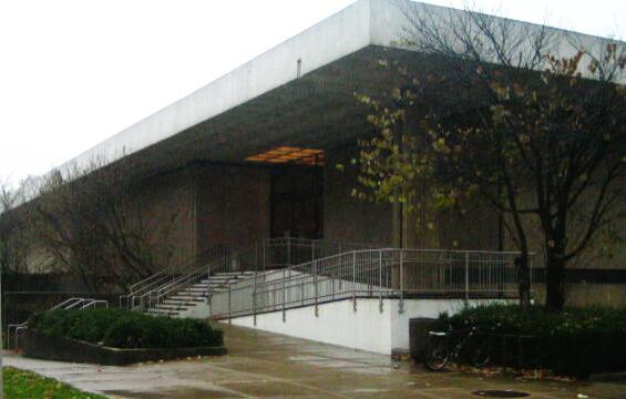
Glenn Black Laboratory submitted by bat400 on 27th Feb 2009. Glenn A. Black Laboratory of Archaeology. Exterior.
(View photo, vote or add a comment)
Log Text: None
Sugarloaf Mound, Missouri
Date Added: 23rd Apr 2017
Site Type: Artificial Mound
Country: United States (The Plains)
Visited: Yes on 1st Jun 2009. My rating: Condition 2 Ambience 2
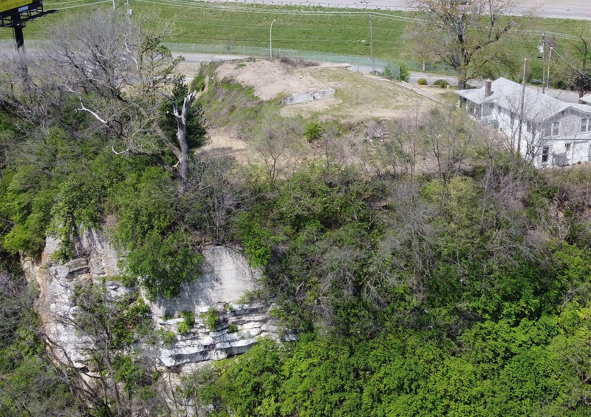
Sugarloaf Mound, Missouri submitted by AKFisher on 9th Aug 2023.
"Sugar Loaf Mound" in St. Louis, Missouri, the only remaining mound of what was a huge mound complex along the Mississippi River in what is today downtown St. Louis. [Wiki: Teeks99]
Photo courtesy Dr Greg Little, author of the Illustrated Encyclopedia of Native American Indian Mounds & Earthworks (2016).
(View photo, vote or add a comment)
Log Text: It's easy to view this mound from Ohio street.
Sonnenobservatorium Goseck
Date Added: 12th Sep 2010
Site Type: Henge
Country: Germany (Saxony-Anhalt)
Visited: Yes on 26th Jun 2009
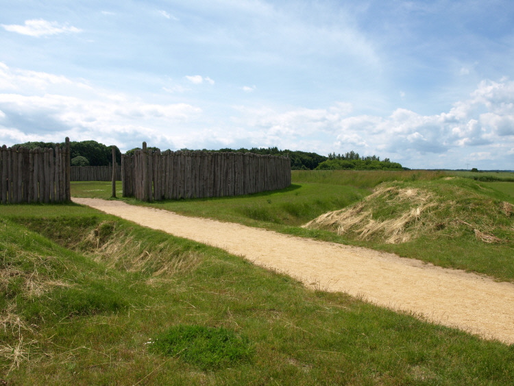
Sonnenobservatorium Goseck submitted by bat400 on 26th Jun 2009. Goseck Earthwork and Timber Circle in Saxony-Anhalt, Germany. This Reconstruction of the concentric timber palisades was made on site in 2005.
Photo by bat400, Jun2009.
(View photo, vote or add a comment)
Log Text: None
Strickland Mound Complex
Date Added: 17th Feb 2012
Site Type: Barrow Cemetery
Country: United States (The South)
Visited: Yes on 1st Sep 2009. My rating: Condition 3 Ambience 3 Access 3
Log Text: Ask a park ranger for directions to these mounds. They are on a footpath and marked once to arrive, however the path entrance from a picnic and boat launch area is not identified for the Strickland Mounds. They may not be accessible year round as the area is closed off during bird nesting times. Wear insect repellant at any time of the year to visit this location.
Nocoroco
Date Added: 17th Feb 2012
Site Type: Ancient Village or Settlement
Country: United States (The South)
Visited: Yes on 1st Sep 2009. My rating: Condition 1 Ambience 3 Access 4
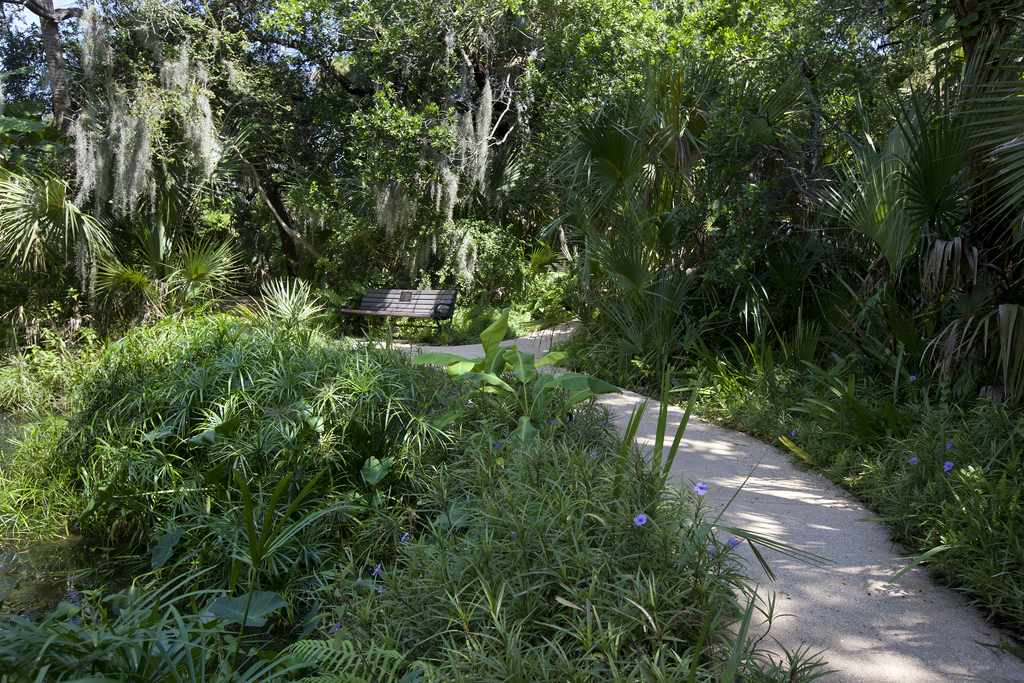
Nocoroco submitted by Flickr on 19th Dec 2018. Spanish Heritage Trail, Ormond Beach (Photos by Julie Fletcher) Ormond Memorial Art Museum and Gardens is an urban oasis. The gardens are a lush, tropic rainforest nestled into the heart of the Ormond beachside adjoining the museum. Inside the work of prominent Florida, regional and national artist, are featured.
Tomoka State Park in Ormond Beach, Florida, contains the Nocoroco Site, a Timucuan Indian village reported by Spanish explorers in the early 1600's as the first south of St. Augusti...
(View photo, vote or add a comment)
Log Text: The village site is on a spit of land extending into a bay area. You can drive right into the area as a picnic area with shelterhouses is located there. The only visible evidence of the original village are midden mounds all around the perimiter - they are not particularly noticable although some of them are quite large.
The most notable feature is a strange, deteriorating Art Deco sculpture of a sort of pyramid of Indian men. This was once a fountain and pool depicting an "Indian Legand" which may have been entirely fabricated in the 20th century.
Windover (Florida)
Date Added: 17th Feb 2012
Site Type: Barrow Cemetery
Country: United States (The South)
Visited: Couldn't find on 1st Sep 2009
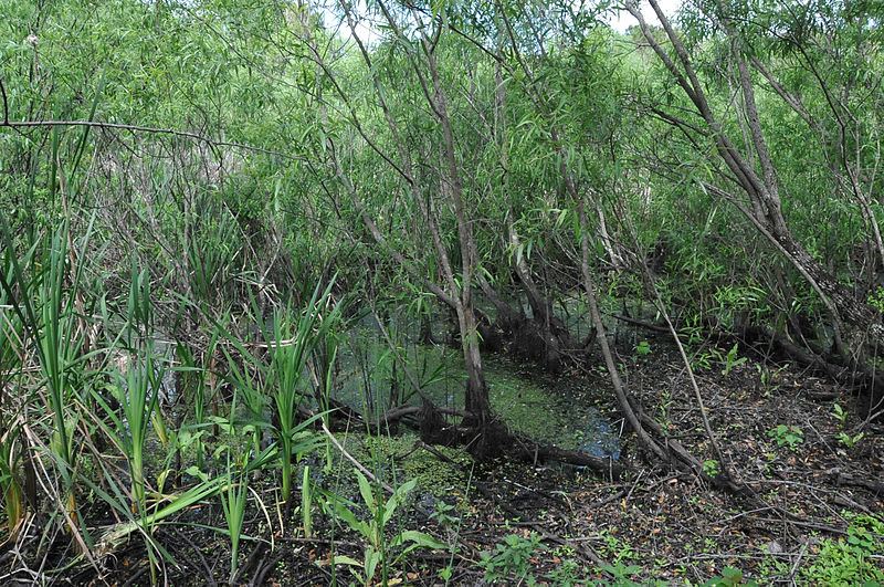
Windover (Florida) submitted by bat400_photo on 9th Jan 2014. "This is a peat bog accidentally discovered in 1982 which preserved the burials of native americans 7,000 to 8,000 years ago. It is located in dense woods and hard to find ... but locals who are proud of the site will help you find it."
12 March 2012, 17:24:15
Author: Roy Klotz MD
This file is licensed under the Creative Commons Attribution-Share Alike 3.0 Unported license.
(View photo, vote or add a comment)
Log Text: I drove passed this site multiple times without knowing it (while hunting for it!) Despite the pond's location directly along a paved road through a housing estate, there is no place to stop and look at the pond without walking through a private home's back garden or "bushwacking" through Florida underbrush. As described in the site listing, you are better off visiting the Brevard County History and Science Museum and asking them if any visits to the site are planned.
Snyder's Mound
Date Added: 17th Feb 2012
Site Type: Ancient Mine, Quarry or other Industry
Country: United States (The South)
Visited: Yes on 1st Sep 2009. My rating: Condition 3 Ambience 4 Access 5
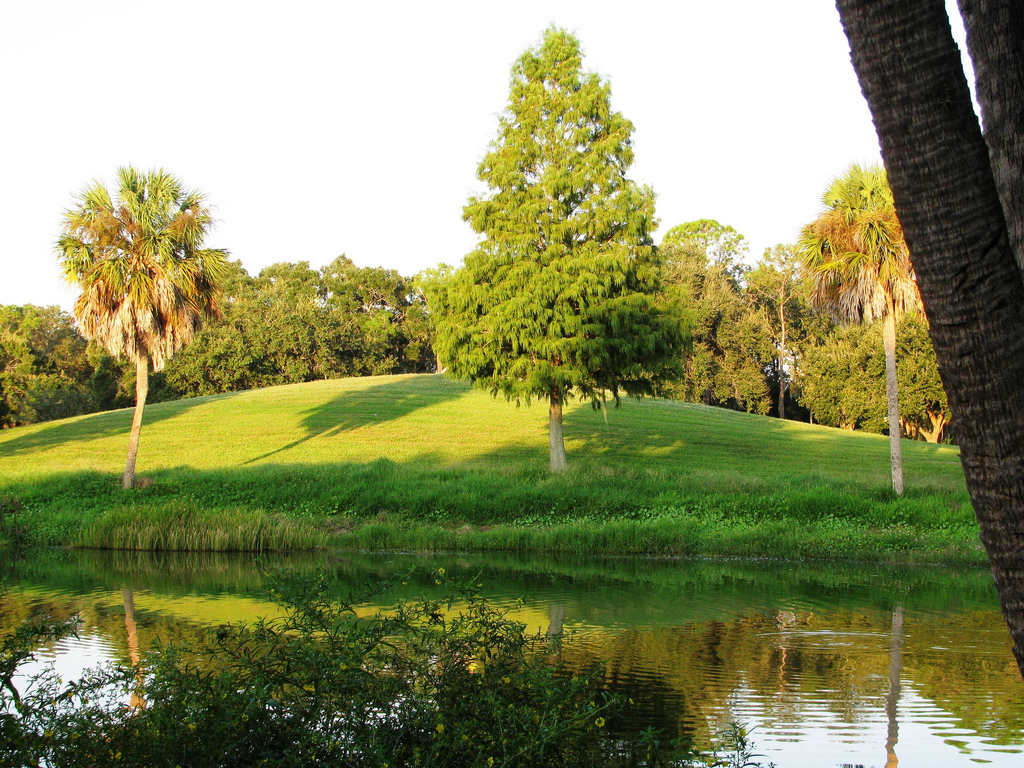
Snyder's Mound submitted by Flickr on 19th Dec 2018. The Mound This is a man made hill in Lake Seminole Park...of course, this is not THE lake that the Park is named after. Image copyright: gstephenson54 (Gayle Stephenson), hosted on Flickr and displayed under the terms of their API.
(View photo, vote or add a comment)
Log Text: See my description in the site listing. I visited very early in the morning, before any tours of the Instone house, so I am unsure if the docents or rangers provide much information about the mound or original Indian village.
Ohio Historical Center
Date Added: 13th Sep 2010
Site Type: Museum
Country: United States (Great Lakes Midwest)
Visited: Yes on 1st Oct 2009. My rating: Condition 5 Ambience 4 Access 5
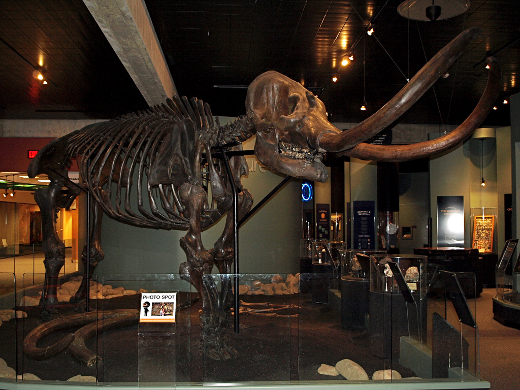
Ohio Historical Center submitted by Flickr on 29th Dec 2018. Mastodon Skeleton I took my daughter to the Ohio Historical Center - the first time I'd been there (to see the exhibits) in many, many years. Great building with a lot of interesting stuff inside.
This is the mastodon skeleton near the main entrance. Image copyright: tim.perdue (Tim Perdue), hosted on Flickr and displayed under the terms of their API.
(View photo, vote or add a comment)
Log Text: None
Shrum Mound
Date Added: 13th Sep 2010
Site Type: Artificial Mound
Country: United States (Great Lakes Midwest)
Visited: Yes on 1st Oct 2009. My rating: Condition 3 Ambience 3 Access 5
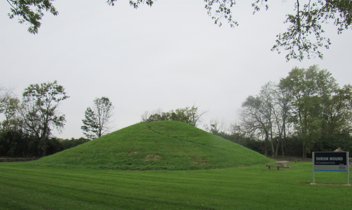
Shrum Mound submitted by baz on 30th Aug 2019. Shrum Mound
(View photo, vote or add a comment)
Log Text: None
Indian Mound Park
Date Added: 13th Sep 2010
Site Type: Artificial Mound
Country: United States (Great Lakes Midwest)
Visited: Yes on 1st Oct 2009. My rating: Condition 1 Ambience 2 Access 5
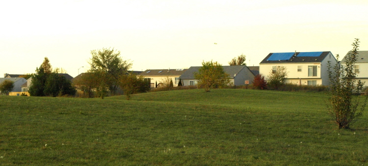
Indian Mound Park submitted by bat400 on 6th Sep 2010. A general view of the two mounds in Indian Mound Park, Columbus OH. Looking north.Photo by bat400, Oct 2008.
(View photo, vote or add a comment)
Log Text: None
Jeffers Mound
Date Added: 13th Sep 2010
Site Type: Artificial Mound
Country: United States (Great Lakes Midwest)
Visited: Yes on 1st Oct 2009. My rating: Condition 3 Ambience 3 Access 5
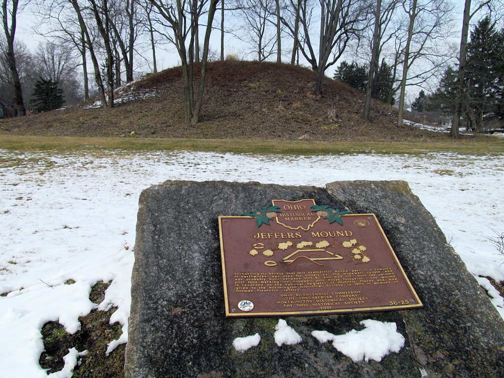
Jeffers Mound submitted by Flickr on 29th Dec 2018. Earthworks built by the Hopewell people between 100 BC and AD 400. Image copyright: Molly Montale (Molly Montale), hosted on Flickr and displayed under the terms of their API.
(View photo, vote or add a comment)
Log Text: None
The Field Museum
Date Added: 12th Sep 2010
Site Type: Museum
Country: United States (Great Lakes Midwest)
Visited: Yes on 8th Dec 2009
The Field Museum submitted by bat400 on 8th Dec 2009. Chicago's Field Museum "The Ancient Americas" permanent exhibit. The entrance into the extensive galleries.
Photo by bat400, March 2009.
(View photo, vote or add a comment)
Log Text: None
Arizona Museum of Natural History
Date Added: 13th Sep 2010
Site Type: Museum
Country: United States (The Southwest)
Visited: Yes on 1st Jan 2010. My rating: Condition 4 Ambience 4 Access 5
Log Text: None
Park of the Canals
Date Added: 13th Sep 2010
Site Type: Ancient Village or Settlement
Country: United States (The Southwest)
Visited: Yes on 1st Jan 2010. My rating: Condition 2 Ambience 3 Access 5
Log Text: None
Pueblo Grande - Park of Four Waters
Trip No.1 Entry No.3 Date Added: 8th Jun 2012
Site Type: Ancient Village or Settlement
Country: United States (The Southwest)
Visited: Saw from a distance on 1st Jan 2010. My rating: Condition 2 Ambience 4
Log Text: In addition to the main grounds of the site, there are regularly scheduled tours of the remains of some of the canals at the Park of Four Waters adjacent to Pueblo Grande.
Next go to "Hayden Butte". [URL=http://www.megalithic.co.uk/article.php?sid=17352]http://www.megalithic.co.uk/article.php?sid=17352[/URL].
Owl Creek
Date Added: 23rd May 2019
Site Type: Artificial Mound
Country: United States (The South)
Visited: Yes on 1st Jan 2010. My rating: Condition 3 Ambience 4 Access 5
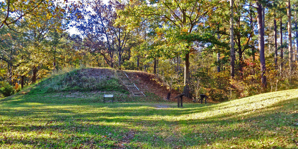
Owl Creek submitted by Creative Commons on 6th Jan 2019. Owl Creek Mounds The five Mississippian period platform mounds at this site were built between 1100 and 1200 A.D. The U.S. Forest Service owns two of the mounds including the largest 17-foot-high Mound I. Both are open to public visitation. Archeological excavations conducted at the site in 1991-1992 by Mississippi State University revealed the foundation remains of a ceremonial temple or elite residence that once stood atop Mound
www.nps.gov/nr/travel/mounds/owl.htm ...
(View photo, vote or add a comment)
Log Text: None
Pueblo Grande
Trip No.1 Entry No.1 Date Added: 9th Apr 2017
Site Type: Ancient Village or Settlement
Country: United States (The Southwest)
Visited: Yes on 11th Jan 2010. My rating: Condition 2 Ambience 4 Access 5
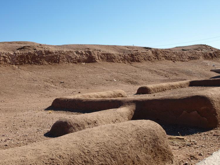
Pueblo Grande submitted by bat400 on 9th Mar 2010. The platform mound from the northwest. The remaining walls of ground level structures in the foreground.
Photo: Jan 2010, bat400.
(View photo, vote or add a comment)
Log Text: Salt River Hohokam by Public Transit and Foot.
This day trip will take you to a 1,500 year old ruin of a Hohokam village, Pueblo Grande, a butte where the Hohokam left petrogyphs, and the ruin of a Hohokam farmstead - a "suburb" of Pueblo Grande. All the sites are accessible by public transportation and walks on either city streets or maintained trails. The trip could take as little as two and a half hours or as much as five hours, but four hours touring time is a reasonable estimate if you want to fully enjoy the museum and each site.
Start at Pueblo Grande site and museum at the SE corner of Washington and 44th Street, Phoenix. On the SW corner is a [url=www.valleymetro.org/]Valley Metro[/url] light rail station, accessible by bus in the Valley Metro system. A free shuttle bus from the Phoenix Sky Harbor Airport also runs to this station regularly from early morning to late evening. I made this trip as part of a planned, 6 hour layover at the airport.
Pueblo Grande is one of the main accessible Hohokam village or town sites. The prehistoric Hohokam (1AD - 1450AD) lived in central and southern Arizona. They farmed corn, beans, squash, and cotton and are best known for their water management skills. Prior to modern reservoir systems, the Salt River flowed year round and the Hohokam built and maintained irrigation systems. Along these abandoned canals the remains of their villages and extended homesteads were found by historic Europeans. Many of the canals were so well laid out that the new pioneers often followed and simply renewed prehistoric canals to supply their own fields. The Hohokam built their villages in adobe, regularly centered around platform mounds and ballcourts. Drought, floods, and possible internal conflict caused the Hohokam to abandon the Salt River Valley in the 1400's. The historic Akimel O'odham (Pima) people are the most likely descendants of the Hohokam.
The museum on site explains the irrigation systems and describes how Pueblo Grande extended over a much larger area than is preserved today.
A visit to the Pueblo Grande site can take 1-2 hours depending on your level of interest.
Now go to "Pueblo Grande - Ball Court". [URL=http://www.megalithic.co.uk/article.php?sid=15417]http://www.megalithic.co.uk/article.php?sid=15417[/URL].
Pueblo Grande - Ball Court
Trip No.1 Entry No.2 Date Added: 9th Apr 2017
Site Type: Ancient Village or Settlement
Country: United States (The Southwest)
Visited: Yes on 11th Jan 2010. My rating: Condition 2 Ambience 3 Access 5
Pueblo Grande - Ball Court submitted by bat400 on 9th Mar 2010. The south half of the ball court. Photo: Jan 2010, bat400.
(View photo, vote or add a comment)
Log Text: The ball court is on the grounds of Pueblo Grande.
Next go to "Pueblo Grande - Park of Four Waters".
[URL=http://www.megalithic.co.uk/article.php?sid=16941]http://www.megalithic.co.uk/article.php?sid=16941[/URL].
Loma del Rio Ruins
Trip No.1 Entry No.5 Date Added: 9th Apr 2017
Site Type: Ancient Village or Settlement
Country: United States (The Southwest)
Visited: Yes on 11th Jan 2010. My rating: Condition 2 Ambience 3 Access 3
Loma del Rio Ruins submitted by bat400 on 11th Mar 2010. The ruin from the southeast. On the crest of the hill you're seeing the narrow edge of the building, two rooms across. To the right, and just below, you can make out a single room, separated from the larger, six room building on the hilltop.Photo: Jan 2010, bat400.
(View photo, vote or add a comment)
Log Text: Back at the south base of the butte, make your way NW towards Mills Ave, and then walk toward the river in the north bound lane. You'll cross a scenic bridge over Tempe Town Lake. (The year round water level is maintained by the use of inflatable barriers.)
On the north side of the river, watch for a stairway on the right that takes you down on to North Loop road. Keep heading north. As you come out from under the 202 freeway and head up hill, you'll see a large open area and a trail head on the right side of the road, with a barrier to prevent cars from parking there. You are now on the SW corner of Papago Park. The walk from the butte to this point should take less than a half hour.
Take the trail east and watch for a footbridge on your left (north). Cross on this footbridge at the Indian Bend Canal, a modernized remnant of an ancient Hohokam canal. You are now on the trail to the Loma del Rio Ruin which lies at the top of the hill directly to your right. Follow the trail in a clockwise curve up and around the hill to the ruin. There is a shaded area right next to the stabilized seven room ruin.
This was an outlying Hohokam farmstead. It lies close on the elevated freeway and overhead electrical pylons. It takes a good imagination to block these modern developments out and focus on the remains of a prehistoric farm. After visiting, return to the North Loop Road the way you came. The walk up to the ruin and back to the road is about 30 minutes.
Now you can return to a light rail station to complete your journey. If you're heading back west, toward Phoenix, continue north on North Loop Road, to Curry Road. (Nearly at Curry Road, on the left, is a park with shaded picnic areas and restrooms.)
Turn left and walk west on Curry Road, across an intersection, and straight on (Curry Road becomes Washington Street at this point.) Or, if you stopped in the park, you can make your way to the same intersection by walking west through the park.
Walk west on Washington Street until you see a rail station in the median strip. The walk from the trail head on North Loop Road to the station will take about 10 minutes.
There are many other public Hohokam sites in the Valley, but most of them require a bike or car.
