Contributory members are able to log private notes and comments about each site
Sites Bat400 has logged. View this log as a table or view the most recent logs from everyone
Ras Al Khaimah Tombs
Date Added: 28th Apr 2017
Site Type: Chambered Tomb
Country: United Arab Emirates
Visited: Would like to visit on 1st Jan 0000

Ras Al Khaimah Tombs submitted by bat400 on 21st Jan 2014. Shimal site Site in United Arab Emirates.
"One of the ancient tombs near Shimal, an indicator of how long the Ras al Khaimah area has been settled. This is from the Wadi Suq Period (almost 4000 years ago!). "
-Gordontour
One of the ancient tombs near Shimal, an indicator of how long the Ras al Khaimah area has been settled. This is from the Wadi Suq Period (almost 4000 years ago!). Earlier sites also exist nearby. For a brief introduction see the RAK Museum's site with more at Qarn a...
(View photo, vote or add a comment)
Sea of Galilee Cairn
Date Added: 28th Apr 2017
Site Type: Cairn
Country: Israel
Visited: Would like to visit on 1st Jan 0000
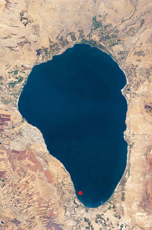
Sea of Galilee Cairn submitted by bat400 on 6th Feb 2014. Sea of Galilee showing approximate location.
(View photo, vote or add a comment)
Lyminge Anglo Saxon Feasting Hall
Date Added: 28th Apr 2017
Site Type: Ancient Palace
Country: England (Kent)
Visited: Would like to visit on 1st Jan 0000
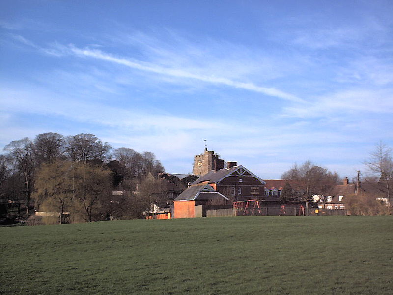
Lyminge Anglo Saxon Feasting Hall submitted by bat400 on 10th Feb 2014. Tayne Field, Lyminge, Kent, UK. Taken by James Armitage, 30th March 2001.
This work has been released into the public domain by its author, JTA at the wikipedia project. This applies worldwide.
In case this is not legally possible:
JTA grants anyone the right to use this work for any purpose, without any conditions, unless such conditions are required by law.
(View photo, vote or add a comment)
Dalmanutha
Date Added: 28th Apr 2017
Site Type: Ancient Village or Settlement
Country: Israel
Visited: Would like to visit on 1st Jan 0000
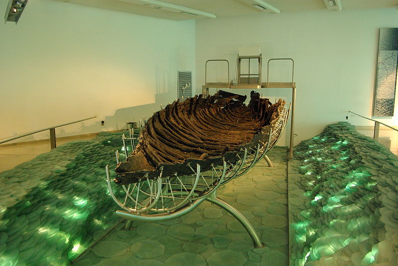
Dalmanutha submitted by bat400 on 17th Feb 2014. Site in Israel. Sea of Galilee Boat, exhibit at Kibbuz Ginnossar, Yigal Allon Center. Photo by Berthold Werner, 19 September 2010.
" I, the copyright holder of this work, release this work into the public domain. This applies worldwide.
In some countries this may not be legally possible; if so:
I grant anyone the right to use this work for any purpose, without any conditions, unless such conditions are required by law."
(View photo, vote or add a comment)
Ancient clam gardens on Quadra Island
Date Added: 28th Apr 2017
Site Type: Ancient Mine, Quarry or other Industry
Country: Canada
Visited: Would like to visit on 1st Jan 0000
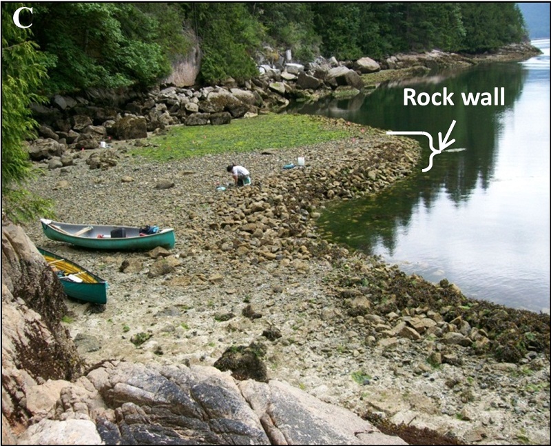
Ancient clam gardens on Quadra Island submitted by bat400_photo on 4th Apr 2014. Ancient clam gardens on Quadra Island, BC, Canada, are intertidal beach terraces built by humans by constructing a rock wall at low tide typically between 0.7–1.3 m above chart datum.
Quadra Island clam gardens range in size and shape but generally create shallow sloping intertidal terraces encompassing tidal heights of 0.9–1.5 m above chart datum.
doi:10.1371/journal.pone.0091235.g001
Citation: Groesbeck AS, Rowell K, Lepofsky D, Salomon AK (2014) Ancient Clam Gardens Increased Sh...
(View photo, vote or add a comment)
Tel Tsaf
Date Added: 28th Apr 2017
Site Type: Ancient Village or Settlement
Country: Israel
Visited: Would like to visit on 1st Jan 0000
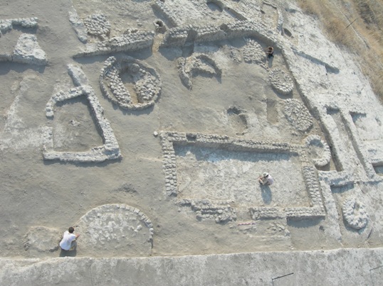
Tel Tsaf submitted by bat400 on 18th Aug 2014. Site in Israel.
"Tel Tsaf courtyard building". Via Wikipedia - http://en.wikipedia.org/wiki/File:Tel_Tsaf_courtyard_building.jpg#mediaviewer/File:Tel_Tsaf_courtyard_building.jpg
This work is licensed under the Creative Commons Attribution-ShareAlike 3.0 License.
(View photo, vote or add a comment)
Little Wood Hill
Date Added: 28th Apr 2017
Site Type: Causewayed Enclosure
Country: Scotland (Dumfries and Galloway)
Visited: Would like to visit on 1st Jan 0000
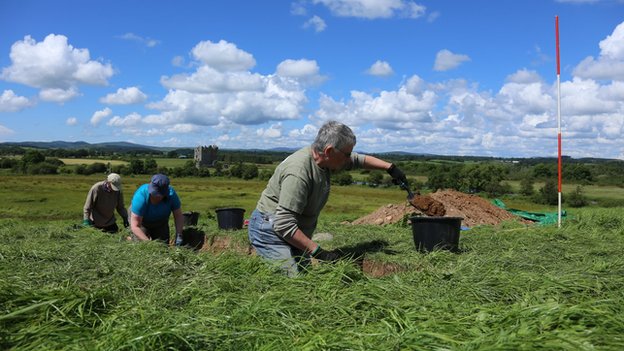
Little Wood Hill submitted by bat400 on 8th Mar 2015. "Archaeologists and volunteers spent a week excavating the site" Credit BBC News at http://www.bbc.com/news/uk-scotland-south-scotland-30095028
(View photo, vote or add a comment)
Grimes Point Arch. Area
Date Added: 28th Apr 2017
Site Type: Cave or Rock Shelter
Country: United States (The West)
Visited: Would like to visit on 11th Dec 2016
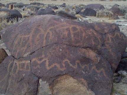
Grimes Point Arch. Area submitted by bat400 on 11th Dec 2016. Example of Native American rock art on the Grimes Point trail.
Source: US BUREAU OF LAND MANAGEMENT website: https://www.blm.gov/nv/st/en/fo/carson_city_field/blm_programs/recreation/grimes_point.html
U.S. federal government works are not eligible for copyright protection (17 USC 105). This may not apply world-wide -- see the CENDI Copyright FAQ list. The U.S. government states that they "may assert copyright outside of the United States for U.S. government works."
(View photo, vote or add a comment)
Lower Memaloose Island
Date Added: 28th Apr 2017
Site Type: Barrow Cemetery
Country: United States (The West)
Visited: Saw from a distance on 1st May 2015
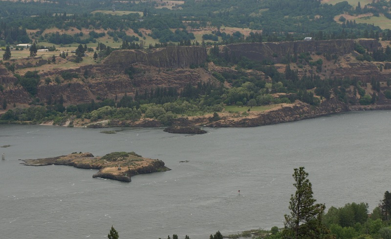
Lower Memaloose Island submitted by bat400 on 14th Jan 2017. Photo taken from a roadside overlook on Oregon highway 84.
May 2013.
(View photo, vote or add a comment)
Log Text: None
Fort Ancient - Moorehead Circle
Date Added: 28th Apr 2017
Site Type: Timber Circle
Country: United States (Great Lakes Midwest)
Visited: Yes on 21st Sep 2007
Fort Ancient - Moorehead Circle submitted by bat400 on 21st Sep 2007. A dig unit still open in the North Section. This is in the area of the timber circle that was first found by geophysical surveys in 2005. Several recent digs have focused on this structure.
Photo by bat400, 15 Sept 2007.
(View photo, vote or add a comment)
Log Text: None
Marsden Mounds
Date Added: 28th Apr 2017
Site Type: Artificial Mound
Country: United States (The South)
Visited: Yes on 3rd Sep 2012
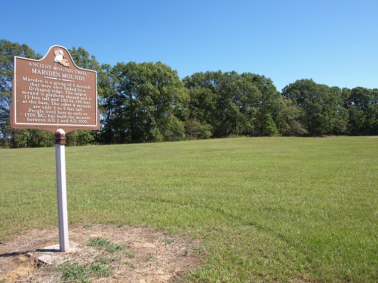
Marsden Mounds submitted by bat400 on 3rd Sep 2012. Mound A lies between the marker and Mounds B, C, and D, which are right at the edge of the woods seen in the background. Mound A is large in diameter, but so reduced in height that it is difficult to see at all.
Photo by bat400, October 2011.
(View photo, vote or add a comment)
Log Text: None
Poverty Point
Date Added: 28th Apr 2017
Site Type: Ancient Village or Settlement
Country: United States (The South)
Visited: Yes on 4th Sep 2012
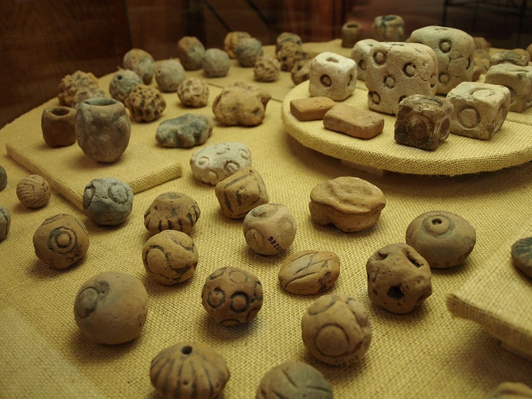
Poverty Point submitted by bat400 on 4th Sep 2012. The "Poverty Point Objects" (PPOs). These fired earthen balls and cubes are unique to the Poverty Point culture. These on display in the park museum are decorated, although many are plain. There is a lot of speculation on what purpose they served, but a general opinion is that they were heated used for earth oven cooking, the area lacks stones more generally used for similar purposes at other sites and called "fire cracked rock" (FCR).
Photo by bat400, October 2011.
(View photo, vote or add a comment)
Log Text: None
Poverty Point - Earthworks
Date Added: 28th Apr 2017
Site Type: Ancient Village or Settlement
Country: United States (The South)
Visited: Yes on 4th Sep 2012
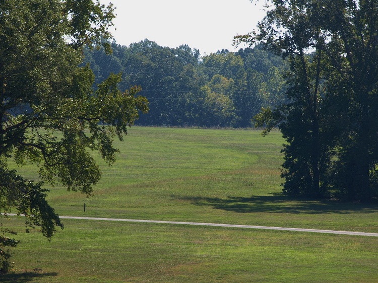
Poverty Point - Earthworks submitted by bat400 on 4th Sep 2012. A view from the top of Mound A of the semi-circular or octagon earthwork ridge area. The curve of a ridge can be seen in the different texture of the ground cover. The white structure is a "ghost dwelling" showing the rought footprint and speculated height of one of the dwellings that were built on the ridges.
Photo by bat400, October 2011.
(View photo, vote or add a comment)
Log Text: None
Poverty Point - Mound A
Date Added: 28th Apr 2017
Site Type: Artificial Mound
Country: United States (The South)
Visited: Yes on 4th Sep 2012
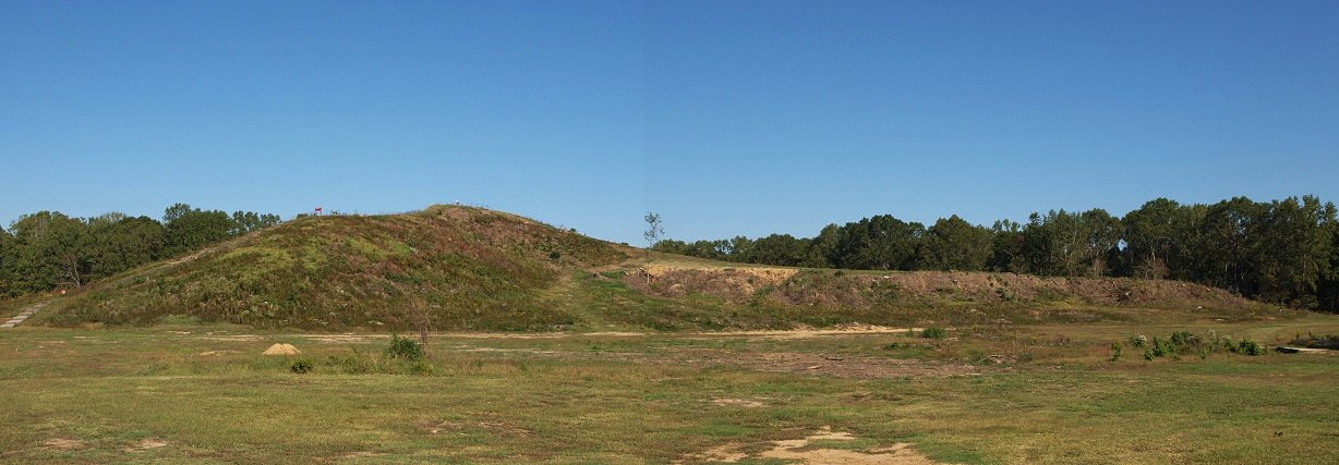
Poverty Point - Mound A submitted by bat400 on 4th Sep 2012. Mound A seen from the south east. The 'tail' of the bird is to the right. The highest point is across the wing span, on the 'bird's' back. There is a boardwalk that allows you to walk up onto the mound.
Photo by bat400, October 2011.
(View photo, vote or add a comment)
Log Text: None
Bynum
Date Added: 28th Apr 2017
Site Type: Barrow Cemetery
Country: United States (The South)
Visited: Yes on 6th Sep 2012
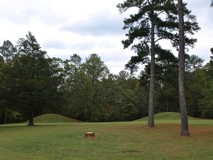
Bynum submitted by bat400 on 6th Sep 2012. Bynum Mounds and Village site. There were originally six burial mounds (the smaller ones much eroded by the plow.) All six were fully excavated and the two largest mounds were reconstructed .
Photo by bat400, Oct 2011.
(View photo, vote or add a comment)
Log Text: None
Pharr Mounds
Date Added: 28th Apr 2017
Site Type: Artificial Mound
Country: United States (The South)
Visited: Yes on 6th Sep 2012
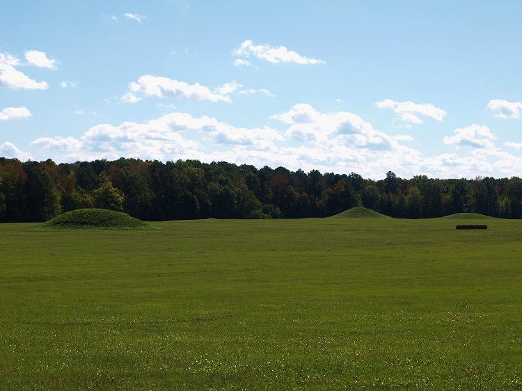
Pharr submitted by bat400 on 6th Sep 2012. Shows only some of the many domed burial mounds in the Pharr complex.
Photo by bat400, October 2011.
(View photo, vote or add a comment)
Log Text: None
Marietta Earthworks - Conus
Date Added: 28th Apr 2017
Site Type: Artificial Mound
Country: United States (Great Lakes Midwest)
Visited: Yes on 13th Jan 2013
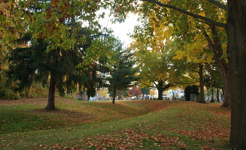
Marietta Earthworks - Conus submitted by bat400 on 13th Jan 2013. The Conus Mound and its enclosing ditch and embankment. This view is from the south side.
Photo by bat400, October 2012.
(View photo, vote or add a comment)
Log Text: None
Marietta Earthworks
Date Added: 28th Apr 2017
Site Type: Misc. Earthwork
Country: United States (Great Lakes Midwest)
Visited: Yes on 13th Jan 2013
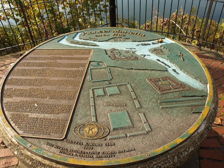
Marietta Earthworks submitted by bat400 on 13th Jan 2013. A riverside park plaque showing the Marietta Earthwork Complex as is appeared when the modern town was first built in the late 18thC.
"Conus" with its embankment appears just upper left of the center.
The rectangular "Quadranaou" is at lower center and the "Capitolium" lying as one of the smaller rectangular mound between Conus and Quadranaou.
The "Sacra Via" appears at the right.
Photo by bat400, Oct 2012.
(View photo, vote or add a comment)
Log Text: None
Marietta Earthworks - Quadranaou
Date Added: 28th Apr 2017
Site Type: Pyramid / Mastaba
Country: United States (Great Lakes Midwest)
Visited: Yes on 14th Jan 2013
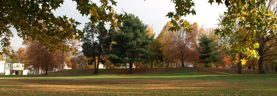
Marietta Earthworks - Quadranaou submitted by bat400 on 14th Jan 2013. The Quadranaou, a flat topped earthen pyramid with centered ramps on each of the four sides. The slope you see at the extreme right and left are the ramps, and not the pyramid itself.
Photo by bat400, October 2012.
(View photo, vote or add a comment)
Log Text: None
University of Chicago Institute
Date Added: 28th Apr 2017
Site Type: Museum
Country: United States (Great Lakes Midwest)
Visited: Yes on 31st Jan 2013
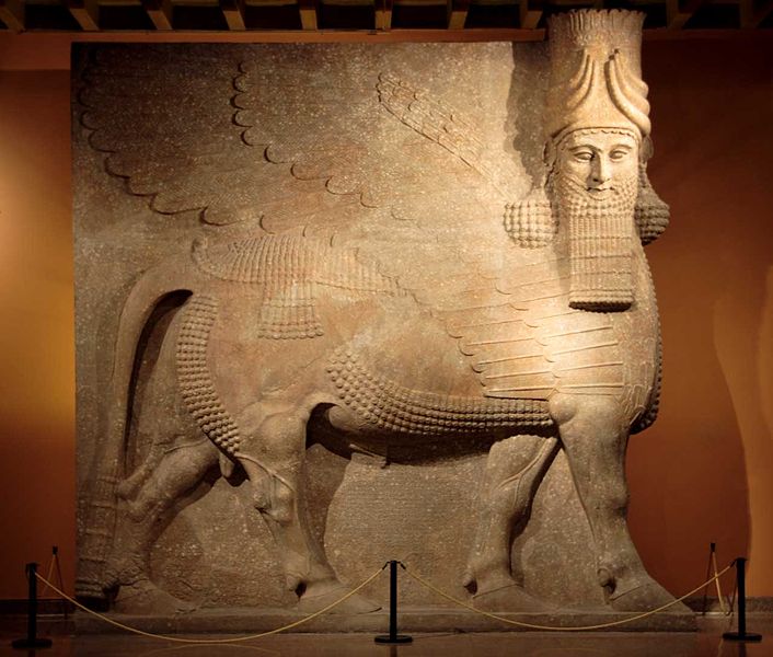
University of Chicago Oriental Institute submitted by bat400 on 31st Jan 2013. The Assyrian Lamassu at the Oriental Institute Museum at the University of Chicago.
Gypsum (?) Khorsabad, entrance to the throne room Neo-Assyrian Period, ca. 721-705 B.C. OIM A7369
This 40 ton statue - one of two flanking the entrance to the throne room of King Sargon II. A protective spirit known as a lamassu, it is shown as a composite being with he head of a human, the body and ears of a bull, and the wings of a bird. When viewed from the side, the creature appears to be walking; w...
(View photo, vote or add a comment)
Log Text: None
