

Contributory members are able to log private notes and comments about each site
Sites AstroGeologist has logged on trip number: 14 (View all trips)
View this log as a table or view the most recent logs from everyone
Langbank Crannog (East)
Trip No.14 Date Added: 17th Jul 2019
Site Type: Crannog
Country: Scotland (Renfrewshire)
Visited: Yes on 17th May 2019. My rating: Condition 2 Ambience 3 Access 3
")
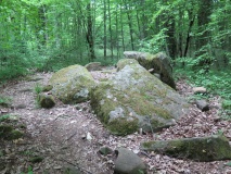
Langbank Crannog (East) submitted by AstroGeologist on 19th May 2019. Facing N (17.05.19) : Remains of Langbank Crannog (East) at low tide - Dumbarton Rock (74m) is 1.4km away, and Ben Lomond (974m) is 30km.
(View photo, vote or add a comment)
Log Text: Langbank Crannog (East) :
Today was the 2nd lowest tide of the year, so l wanted to get out and have a look at two of the Clyde Crannog's while the water levels were low.
About 100m from the Southern Bank of the River Clyde are the remains of a 30m+ diameter Crannog. Not much of it remains these days, at least not above surface level. I approached from the bank of the Clyde by walking up through the causeway remains. Once I got close I saw that is now a massive pile of stones and boulders, totally covered in seaweed.
You can see the basic oval shape it has, by the boulders poking out through the seaweed. I had a good look around, trying to detect some of the Timbers described in 1972, but they have either rotted away, or were under some of the seaweed (It would take a fast & efficient team to clear the Crannog remains of seaweed and review the site before the tide came back in)
I spent just over an hour at the Crannog, going around it many times, looking for. . . . .anything really, but saw nothing except rocks and seaweed.
As it was the lowest tide of the year so far I was able to walk out as far as 150m from the Southern bank of the river. I couldn't see the circular stone-edged pools that hold water on the North of the site that were reported, but did see one SW of the Crannog, lined with seaweed and filled with water.
I wanted to stay for longer and keep looking until I found something, but there wasn't long left before the tide was due to start coming back in, so I left and made my way to Langbank Crannog (West) which is about a 1/2 hour walk away.
This is 1 of 5 River Clyde Crannog's.
*Getting There ; From Langbank train station it is 2.25km away (25 min walk)
If coming from Langbank Crannog (West) it is a 2.8km walk, taking about a half hour.
Come out the train station and turn right, walk East along Main Road (B789) for 350m passing a roundabout on your left, keep walking another 575m and you'll soon come to a curve in the road going under the railway bridge on your right hand side.
At this point take the path on your left next to the Greenock Road (A8) and keep walking for 700m, you'll come to a bridge under the tracks as the A8 branches off a slip road ahead. When the official path next to the road ends and you have to walk up a path between the trees and continue East for 5 minutes, until you reach the roundabout going under the M8.
Take a left and walk North under the roundabout, heading towards the River. Walk to the end of the car park at West Ferry and down onto the river banks and your there.
Langbank Crannog (West)
Trip No.14 Date Added: 17th Jul 2019
Site Type: Crannog
Country: Scotland (Renfrewshire)
Visited: Yes on 17th May 2019. My rating: Condition 2 Ambience 3 Access 3
")
Langbank Crannog (West) submitted by AstroGeologist on 19th May 2019. Facing SE (17.05.19) : Remains of Langbank Crannog (West) at low tide - 60m from Southern Bank of the Clyde
(View photo, vote or add a comment)
Log Text: Langbank Crannog (West) :
Today was the 2nd lowest tide of the year, so l wanted to get out and have a look at two of the Clyde Crannog's while the water levels were low.
Only 20m from the Southern Bank of the River Clyde (After the building of the motorway) are the remains of a Crannog nearly 30m in diameter.
Not much of it remains these days, at least not above surface level. As I approached I could see what is now a large pile of boulders and stones, covered in seaweed.
You could easily see it's basic circular shape, by the boulders poking out through the seaweed. I had a good look around, trying to detect well-defined Ring of Piles described in 1972, but could only find one, on the Western arc of the Crannog. And I found that by accident when I was photographing a Crab, I saw a small bit of wood poking out through a bit of seaweed, when I removed it there was a solitary, small stumpy pile poking out of the mud. It was about 10cm tall.
I spent just under an hour at the Crannog, going around it many times, looking for more piles amongst the seaweed covered rocks. Near the edge of the Crannog, on the Western side I saw a bit of bit of wood, 1m long and wedged between some rocks, at first I got excited as I thought it might be a part of a log or beam with some relation to the Crannog, but when I picked it up I realised it couldn't have been 2,000 years old, the wood was too new, there was no darkening of the wood that is usually seen with ancient wood that has been buried under water.
I placed the small log in the position I found it, which was near the 10cm Pile I saw on the outer perimeter. A few metres North of the main pile of stones were 2 other bit of wood driven into the mud, 1 is about 30cm and the other about 90cm. I do not think these two bits of wood have anything to do with the Crannog but could be wrong.
Even though there isn't much there I didn't really want to leave. I stayed until I noticed the tide was starting to turn, so although the Sun had came back out I had to go.
This is 1 of 5 River Clyde Crannog's.
*Getting There ; From Langbank train station it is only 650m away (5 min walk)
If coming from Langbank Crannog (East) it is a 2.8km walk, taking about a half hour.
Come out the train station and turn left, walk West along Main Road (B789) for 425m and you'll soon come to a curve in the road on your right hand side. The Greenock Road (A8) should be on your right. Find a gap in the bushes and climb the fence.
You'll now have to cross the A8 dual carriageway, l was there when there wasn't much traffic so crossing was easy, but it can be busy at times. Once across make your way down the embankment and head West along the shoreline for 150m and your there.