Contributory members are able to log private notes and comments about each site
Sites Anne T has logged on trip number: 60 (View all trips)
View this log as a table or view the most recent logs from everyone
Snuff Mill (Stainton)
Trip No.60 Entry No.1 Date Added: 24th Nov 2017
Site Type: Standing Stone (Menhir)
Country: England (Cumbria)
Visited: Yes on 20th Nov 2017. My rating: Condition 3 Ambience 3 Access 5

Snuff Mill (Stainton) submitted by Anne T on 24th Nov 2017. First view of the stone from across the road. The dry stone wall behind and to the north eastern side of the stone has been dog-legged around it, indicating the stone was here well before the wall.
(View photo, vote or add a comment)
Log Text: Snuff Mill Standing (?) Stone: On the way back from Pooley Bridge to Stainton and Newbeggin, I saw a standing stone by the side of the road (A592) so Andrew turned around and we parked in the driveway of Snuff Mill Water Treatment Centre. The stone was just passed a corner of this busy little road, and it felt quite dangerous as none of the cars moved very far out of the way for us walkers.
The dry stone wall had been ‘kinked’ to go around the stone. It was heavily covered in moss.
I can’t find anything about it on Pastscape or Historic England, so will email Mark Brennand at Cumbria County Council.
Newton Reigny Enclosure
Trip No.60 Entry No.2 Date Added: 26th Nov 2017
Site Type: Misc. Earthwork
Country: England (Cumbria)
Visited: Yes on 20th Nov 2017. My rating: Condition 2 Ambience 3 Access 5

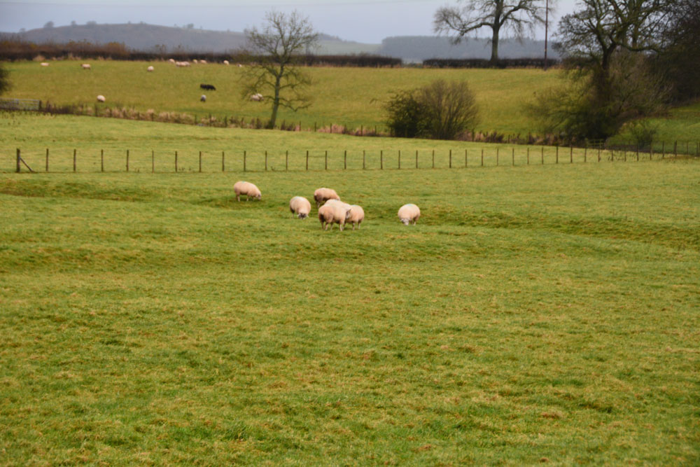
Newton Reigny Enclosure submitted by Anne T on 26th Nov 2017. Standing at the gate to the field containing part of this enclosure, looking north. A series of low banks and ditches can be seen, largely to the left hand side of the small cluster of sheep. Not a huge amount to be seen, but this site is believed to be of Dark Ages origin, according to the Curator of Carlisle Museum.
(View photo, vote or add a comment)
Log Text: Newton Reigny Enclosure: Having put the wellies in the back of the car, we decided to try and walk along the lanes from the south of Newton Reigny, where traditionally one of the stone rows ran towards Newbeggin. On our last visit, back in February 2017, the lane was ankle deep in water and mud.
I spotted this enclosure on the map, and keen to see something other than possible (non-existent) standing stones, was keen to see something of historic value. There were road works immediately opposite the field this enclosure was in, and the workmen, who were partly blocking the road waved us through. We, however, didn't want to be waved on, so my husband drove just past where they were working and I hopped out with the camera, much to the amusement of the workmen who must have wondered what we were looking at.
There were the outlines of low banks and a deeper ditch criss-crossing the field. Not a huge amount to look at, but worth stopping to look at. On looking at the information available on Pastscape and Historic England, this is a scheduled site. It is just to the east of the church of St. John in the village
Belsay Tower Cross (Northumberland)
Trip No.60 Entry No.2 Date Added: 27th Nov 2017
Site Type: Ancient Cross
Country: England (Northumberland)
Visited: Yes. My rating: Condition 3 Ambience 3 Access 4

Belsay Tower Cross (Northumberland) submitted by Anne T on 27th Nov 2017. The cross as seen from its eastern side, with Belsay Castle in the background.
(View photo, vote or add a comment)
Log Text: Belsay Tower Cross, Northumberland: Passing Belsay on the way back from the Bolam Cairn, we decided to try and trace the cross marked on the OS map. Although we’ve been here before, we’d not tried to look for this, as we largely had our small grand daughter with us.
The cross is located (on the map) very close to the Castle, so we walked through the grounds, having received a stern reminder from one of the staff members, that we had to vacate the car park by 4pm, but became thoroughly disorientated. Husband, Andrew, got his compass out and we decided that to reach the cross from the castle, we would have had to jump the ha-ha or scale a fence to get into a field to cross over to it.
In the end, we walked back through the Quarry Gardens to the private road which runs north from the gate at the bottom of the croquet lawn (where the paths from the Hall cross over to Quarry Gardens); after 100 metres it joins the road which runs east-west between the Hall and the Castle. Turning east along this, we walked for around 150 metres, then found a short trackway running through a sparse wooded area, into a field. Through the wooded area, we got our first sight of this cross.
It is on private land, but we took the chance of going through the gate and taking a quick look. It is within 200 metres of the castle, which is to the west, but the land is well fenced off.
In the end, it would have been easier to walk from the car park, past the estate cottages towards the castle, then take the first track on the north side of this minor road into the field with the cross.
It really reminded me of the Shitlington Cross, with its chamfered sides and missing top.
Mossthorn Long Cairn 1
Trip No.60 Entry No.3 Date Added: 24th Nov 2017
Site Type: Cairn
Country: England (Cumbria)
Visited: Yes on 20th Nov 2017. My rating: Condition 2 Ambience 4 Access 3

Mossthorn Long Cairn 1 submitted by Anne T on 24th Nov 2017. Approaching the northern end of the this long, rectangular cairn, which was made up of small to medium sized stones and earth.
(View photo, vote or add a comment)
Log Text: Mossthorn Long Cairn, Copt Howe, Newton Reigny: We wrote to Mossthorn Farm immediately after our last visit here in February 2017, but our letter was ignored and we didn’t get a reply. A local historian, who we’d made contact with to find out more about the standing stones / stone row said he had contacts who would give permission for us to visit, but nothing.
In our latest visit to Newbeggin, we went armed with wellington boots and socks and trudged down the lanes from the southern side of Newton Reigny. Whilst the lane is gated, it looks to be frequently used by walkers, so we followed the footpath to Copt Howe at NY 48258 30770. The gate into the field was wide open and a large dung heap had been placed near the field gate. As the rest of the field was pasture, we decided to walk quickly over to the long cairn and take a closer look. The field was very boggy and I was glad of my wellies.
Strangely, I noticed lots of quartz stones scattered around the perimeter of the cairn, shining white in the drizzle amongst the brown-red earth. This cairn had plenty of stones down its length.
We saw the side of Mossthorn Long Cairn 2 that we hadn’t seen before from the eastern hedge line of the field but didn’t want to incur the wrath of the farmer, who was working on his tractor in the field nearby.
Mossthorn Long Cairn 2
Trip No.60 Entry No.4 Date Added: 24th Nov 2017
Site Type: Cairn
Country: England (Cumbria)
Visited: Saw from a distance on 20th Nov 2017. My rating: Condition 2 Ambience 3 Access 3

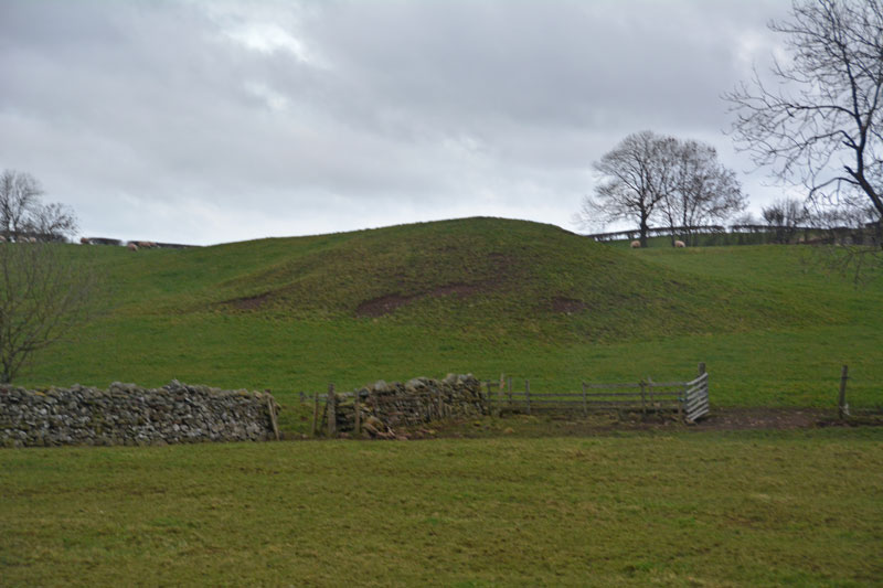
Mossthorn Long Cairn 2 submitted by Anne T on 13th Feb 2017. The long cairn at grid reference NY 48289 30440, taken from the layby outside The Wreays on the minor road from the A66 to Greystoke.
(View photo, vote or add a comment)
Log Text: Mossthorn Long Cairn 2, Copt Howe, Newton Reigny: See the visit report for Mossthorn Long Cairn 1 for more details. This is the side of the long cairn (or natural feature, as Pastscape says?) we couldn’t see from the road on our last visit on 12th February 2017. This time, we could only see it from the field boundary near the southern end of Mossthorn Long Cairn 1. From this angle, it does look like a natural hummock, although more like a cairn from the main road.
