Contributory members are able to log private notes and comments about each site
Sites Anne T has logged on trip number: 49 (View all trips)
View this log as a table or view the most recent logs from everyone
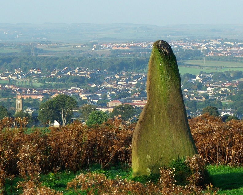
Galabraes
Trip No.49 Entry No.1 Date Added: 5th Oct 2017
Site Type: Standing Stone (Menhir)
Country: Scotland (West Lothian)
Visited: Yes on 22nd Sep 2017. My rating: Condition 3 Ambience 4 Access 4

Galabraes submitted by postman on 11th Nov 2012. Site in West Lothian Scotland
Galabraes standing stone, it's not far from Cairnpapple and very close to the road, how com no-ones posted on here before
(View photo, vote or add a comment)
Log Text: Gala Braes Standing Stones, Bathgate: We drove up and down the road, but couldn’t see a gate into the field along either from the ‘main’ road (Drumcross Road) or the side road running north-south up to Cairnpapple Hill, so we ended up clambering over an almost demolished stone wall and squeezing through the wire fencing. There was a big (very unfriendly looking) bull in the field just below the western end of the ridge, who stood his ground and kept looking at us, so we didn’t dare approach the other small knoll where the other stone (B) should have been located.
As we were leaving, I spotted some old boundary features to the south of the standing stone so was photographing these, when I heard some cawing behind me. Looking up, a large crow was sitting on the standing stone, bobbing up and down. Eerie!
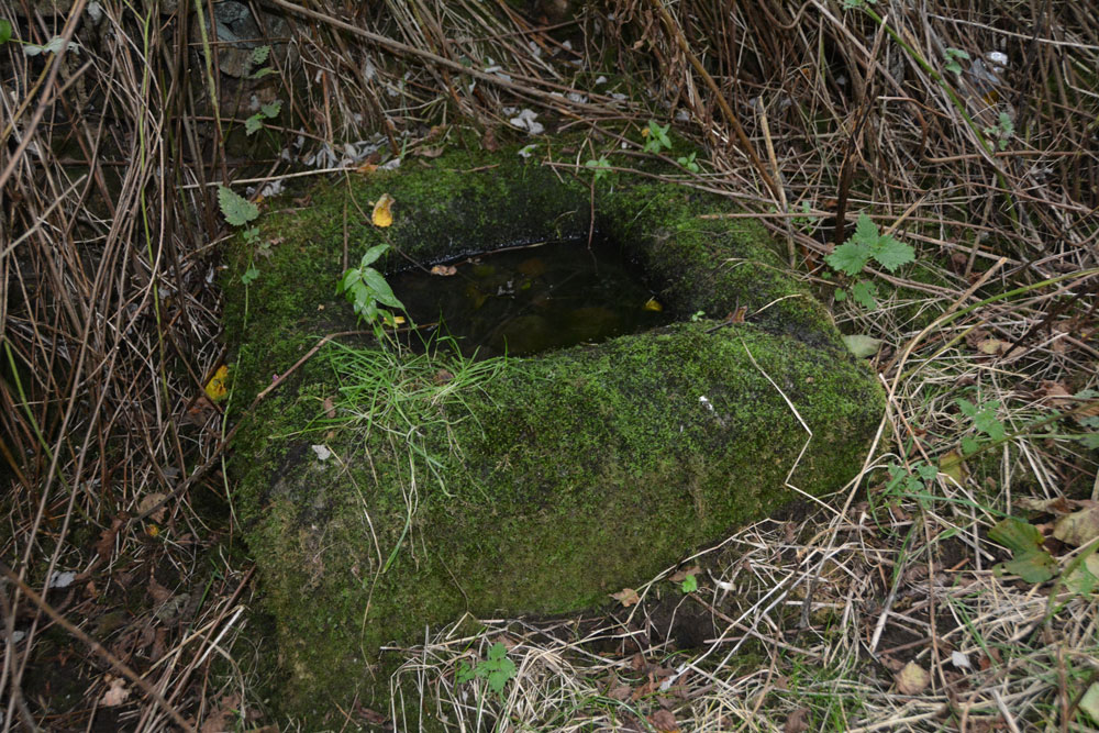
Lower Craigmailing (Torphichen)
Trip No.49 Entry No.2 Date Added: 5th Oct 2017
Site Type: Ancient Cross
Country: Scotland (West Lothian)
Visited: Yes on 22nd Sep 2017. My rating: Condition 2 Ambience 1 Access 5

Lower Craigmailing (Torphichen) submitted by Anne T on 5th Oct 2017. In the bottom right hand corner, the shallow channel formed into the corner can be seen, suggesting it might have been used as a trough at some point in its past.
(View photo, vote or add a comment)
Log Text: Lower Craigmailing Socketed Stone: This socketed stone was well hidden under shrubbery at the start of a footpath running from Cathlaw Lane to Witch Craig/Crag. I would have walked right by it, had husband, Andrew, not pushed his way through the shrubbery to find it.
What a sad fate for this socketed stone. Being located so close to Torphichen, I assume it had something to do with marking the way to/from the Abbey, possibly up to Cairnpapple Hill.
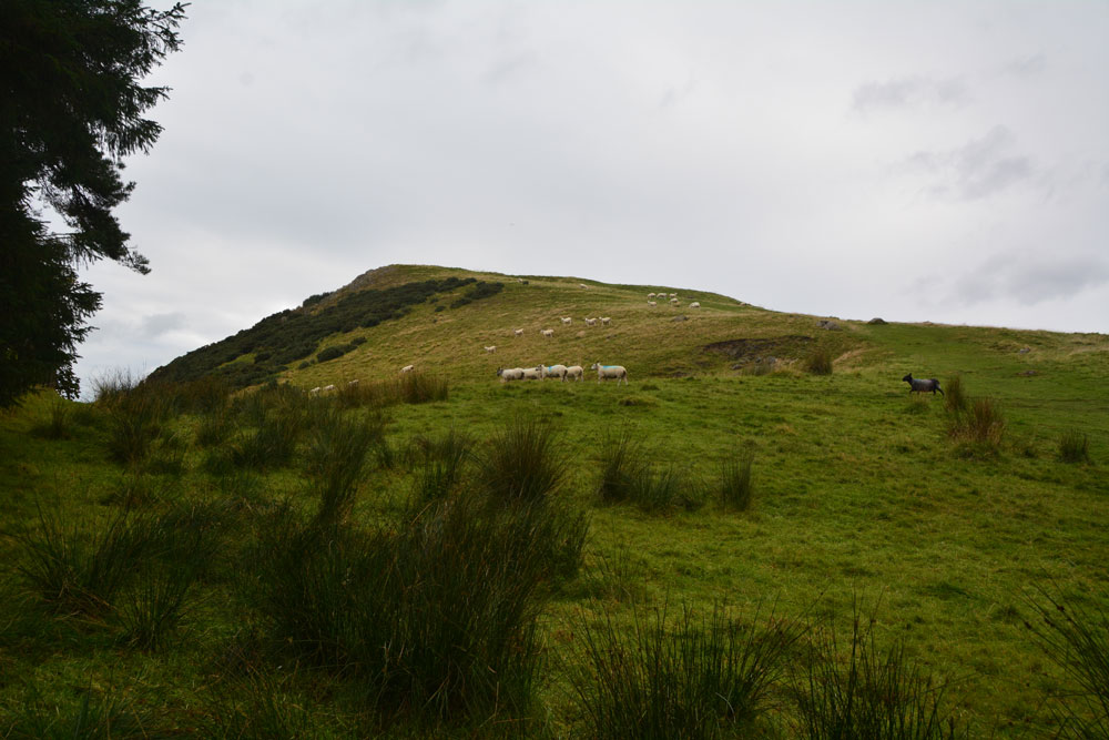
Cockleroy Hill (Beecraigs)
Trip No.49 Entry No.3 Date Added: 22nd May 2019
Site Type: Hillfort
Country: Scotland (West Lothian)
Visited: Yes on 22nd Sep 2017. My rating: Condition 2 Ambience 3 Access 4

Cockleroy Hill (Beecraigs) submitted by Anne T on 5th Oct 2017. First view of Cockleroy Hillfort, having walked from the small car park to the gate into the field. The hill rises reasonably steeply up to 278 metres and has a trig point and view point on top.
(View photo, vote or add a comment)
Log Text: Cockleroy Hillfort, Beecraigs Country Park: From Lower Craigmailing Socketed Stone, we drove north past the Korean War Memorial to Beescraig Country Park. There was a small car park at about NS 99445 74270, where a path led through the forest, leading to a gate into the field containing the hillfort.
According to the Scotsman of 9th December 2012, Cocklroy means “the hat of the kings”. Situated in Beecraigs Country Park forest, there is a climb of 278 metres to the top and a mown path goes straight up the hill to the top of the fort, where there is a viewpoint. I wasn’t feeling too good, so opted out half way up the climb. Andrew continued up to the trig point at the top, and had great views across Lochcote Reservoir to the south west and the Forth Bridges at Queensferry to the north east.
Andrew said there wasn’t much to see of the fort itself – there were very little signs on the ground. I sat on the large stones about half way up the slope, at first thinking they were defensive ditches and banks, but were in fact modern quarries, when I looked closer!
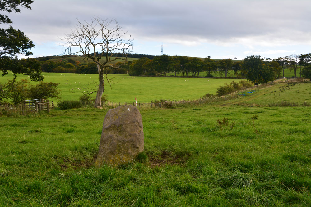
Gormyre
Trip No.49 Entry No.4 Date Added: 6th Oct 2017
Site Type: Standing Stone (Menhir)
Country: Scotland (West Lothian)
Visited: Yes on 22nd Sep 2017. My rating: Condition 3 Ambience 4 Access 4

Gormyre submitted by Anne T on 23rd Mar 2019. Hi, AstroGeologist, With reference to your comment about the farmer having moved the stone, I don't think he has. Here's my version of your photo shown in PID 194979 with the same tree, albeit from a slightly different angle, taken on 22nd September 2017. The stone still sits on top of the distinct, flat-topped high point on the hill. The angle of the hedge line running across the photo is still the same. The stone was recorded by Canmore as being at this same location in 1856.
(View photo, vote or add a comment)
Log Text: Gormyre Stone, Torphichen: Ever since I went to Torphichen on 13th May 2017, I’ve wanted to come back and not only look round the Preceptory, but also try to find the other refuge stones associated with the Sanctuary Stone in the churchyard.
Today, despite not feeling 100% I was glad to be in search of this stone, and delighted to be able to see it from the road. We parked at NS 98072 72853 (there was just enough room by the gate to pull off the road), approximately 1.2 km east of Torphichen Preceptory.
The farmer had padlocked the gates into the field and the track which ran alongside it; these were really high and a little precarious to climb over (didn’t want to break them), so I ended up clambering gingerly over the wooden fence next to the gate. Following the grassy trackway north, just over 200 metres further on there was another gate, again padlocked, so we negotiated the wooden fence next to it. Thankfully, the huge bull and his ladies were in the adjoining field.
This stone sits on top of a natural mound. We couldn’t see the outline of the Maltese Cross on the north face of the stone, despite careful looking at a number of different angles and distances (although looking at one of the photographs, it does stand out a little). A really nice location, and a very friendly stone.
