Contributory members are able to log private notes and comments about each site
Sites Anne T has logged on trip number: 126 (View all trips)
View this log as a table or view the most recent logs from everyone
Warden Hill Hillfort
Trip No.126 Entry No.1 Date Added: 5th May 2019
Site Type: Hillfort
Country: England (Northumberland)
Visited: Yes on 1st May 2019. My rating: Condition 2 Ambience 4 Access 4

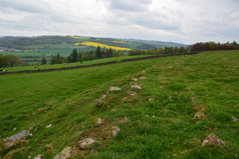
Warden Hill Hillfort submitted by Anne T on 5th May 2019. Standing almost on the north western corner of the hillfort, looking north east over the northern rampart, with the Tyne Valley in the distance.
(View photo, vote or add a comment)
Log Text: Warden Hill Hillfort: Homer’s Lane is very narrow, so we struggled to park the car. We eventually ended up bumped up on the verge at the wide entrance to a farm house at NY 91187 67190, ensuring there was plenty of room for tractors, trailers and other traffic to get past.
Walking back to the start of the footpath at NY 91217 67247, we used the kissing gate and walked up hill, turning left onto the well-marked path, zig-zagging through what is virtually a small village at High Warden (there are so many signposts and ‘private’ signs’ people must have become fed up with walkers). We ended up on a small woodland path leading northwards along the edge of a field towards the telecoms mast just below the summit of Warden Hill. By the mast, the track dog-legs slightly westwards, with the path running north up-hill through the centre of a field of pasture.
Towards the top of the hill there is a trig point, immediately to the east of the gate into the next field. Going through the gate, there is an interesting series of low banks which are medieval/post medieval in date. Walking 10-15m further onto the hill, the outer banks of the hill fort become clear.
We spent ages walking around the outside and inside of the hillfort. We’d taken the printed HE and Pastscape records with us, determined to understand all the features. We particularly looked for the Roman signal station, and identified a small, square structure where the grid reference said it should have been. From here, running eastwards, a line of stones poked up intermittently out of the grass.
There are brilliant views in most directions, although the endless noise of the A69 became a little tedious.
Homers Lane (Warden)
Trip No.126 Entry No.2 Date Added: 1st May 2019
Site Type: Rock Art
Country: England (Northumberland)
Visited: Couldn't find on 1st May 2019. My rating: Ambience 2 Access 4

Homers Lane (Warden) submitted by Anne T on 1st May 2019. But which boulder is it?? Looking over the dry stone wall, we were within 8-9m of the previously recorded location of the rock art panel. All the large boulders from around the tree to the top right hand side of the photo, which is where the panel had previousy been located, appeared to have rolled down the hill. We spent ages peering over the wall trying to spot any possible boulders the same size and shape as the panel, or any boulders with possible cups but drew a blank. Disappointing.
(View photo, vote or add a comment)
Log Text: Homers Lane, Warden, Rock Art Panel: Having visited Warden Hill Hillfort, we decided to drive the 1.15km to try and find this rock art panel, as it was so close. Driving north up the almost single track lane we managed to park next to the gate into the field with the rock art panel in, at NY 91110 68391, and walked back south the 50m or so towards the grid reference where the panel was located.
I'd gone armed with the ERA information and their photographs, and the GPS took us to within 9m of the previously recorded location of the panel. We leaned over the very ivy covered dry stone wall and tried to identify the boulder, but could not see it.
The field was planted with wheat, but with a large, long pile of fertiliser combined with a wide grassy edge to the field, we thought if we trod very carefully, we could let ourselves in through the gate and walk back to the piles of boulders. This was easy enough to do, although I wish there was someone I could have asked permission from first!
Using the GPS, we got to within 3m of the recorded grid reference, but still could not find a boulder the right size and shape. With the ERA photos in hand, I identified the two trees in one of the their photos, lined them up, but there were no boulders at that location. It looked as if they had been rolled further downhill, towards the drystone wall, to make room for the huge pile of fertiliser.
Andrew very bravely balanced on the boulders, trying to locate the panel, but after a reasonably through search, had to give up. Disappointing, but the NADRAP survey photos were dated 2008 - some 11 years ago.
St Michael's Church (Warden)
Trip No.126 Entry No.3 Date Added: 5th May 2019
Site Type: Ancient Cross
Country: England (Northumberland)
Visited: Yes on 1st May 2019. My rating: Condition 3 Ambience 4 Access 4

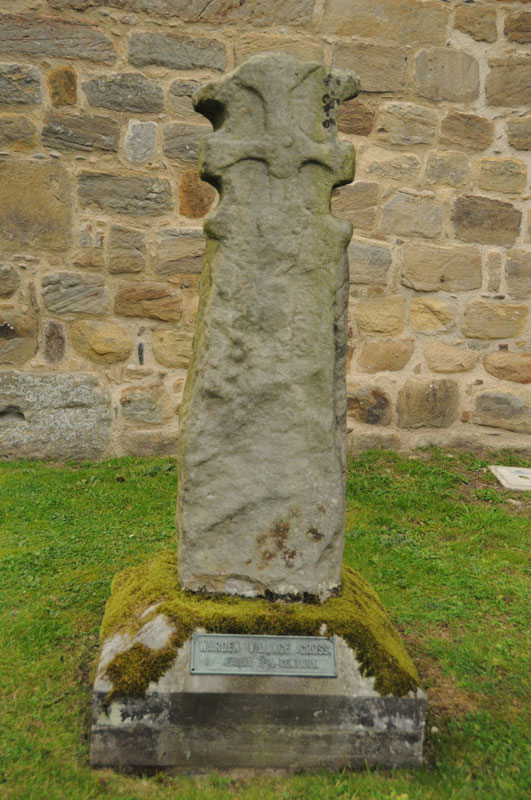
St Michael's Church (Warden) submitted by Anne T on 4th Sep 2014. The 7th century cross at the west side of the porch of St. Michaels, by the Saxon tower.
(View photo, vote or add a comment)
Log Text: St Michael and All Saints, Warden: Anglo Saxon Sculptured Stones, including The Warden Man and Hammerhead Churchyard Cross: I last visited this church on 3rd September 2014, when I was almost new to the Portal, and hadn’t yet come across Pastscape, Historic England or the Corpus of Anglo Saxon Stone Sculpture databases, so taking Andrew back here was a very pleasant surprise, as I learned an awful lot about these stones.
Well worth a repeat visit!
