Contributory members are able to log private notes and comments about each site
Sites Anne T has logged on trip number: 40 (View all trips)
View this log as a table or view the most recent logs from everyone
St Mary's Motte (Beaumont)
Trip No.40 Entry No.8 Date Added: 25th Aug 2017
Site Type: Misc. Earthwork
Country: England (Cumbria)
Visited: Yes on 20th Aug 2017. My rating: Condition 3 Ambience 4 Access 5
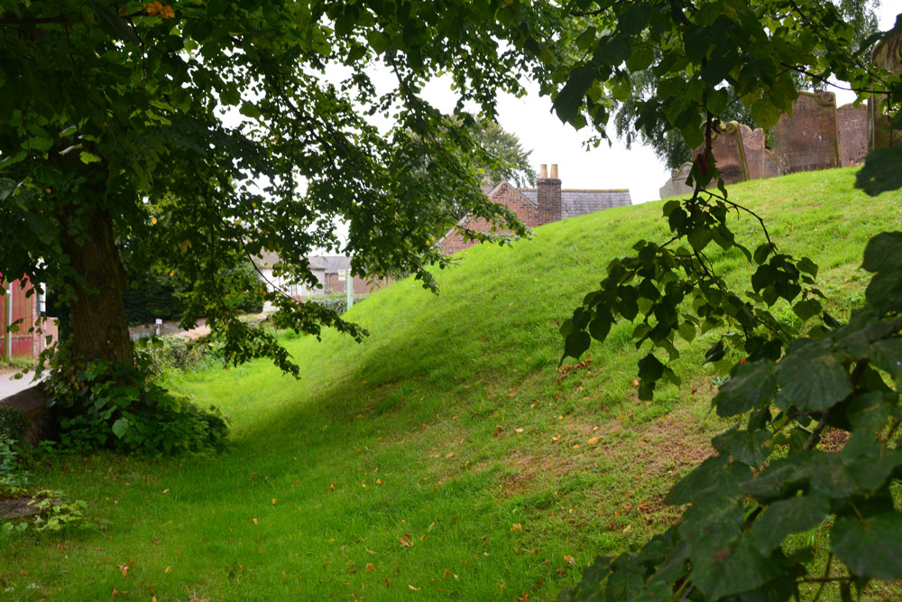
St Mary's Motte (Beaumont) submitted by Anne T on 22nd Aug 2017. Looking at the southern section of the motte, which has been partly cut by the modern road through the village. Pastscape says that the site may originally have been a Saxon or Danish settlement, then the site of turret 70a on Hadrian's Wall, then a Norman motte, finally being replaced by the church in the 12th century.
(View photo, vote or add a comment)
Log Text: St. Mary's Beaumont: Church built on a motte, on a milecastle on a possible Saxon camp: We came to try to see St. Ann’s Well, marked on the OS map as being just off the small triangular village green, but found it was in a private garden surrounded by either a tall hedge or other buildings, so there was no access and no-one around to ask. According to the Old Cumbria Gazetteer, the well is at NY35055942, which is nearer the River Eden, says the well is at NY35055942 (which is different to the OS map) and: “This provided very cold water, useful for helping set the butter. By the time you’d got back up the bank your bucket was only half full.” Dated to 1867 to 1868.
There were lots of walkers trundling along Hadrian’s Wall Path at this point, with a large notice by the interpretation board saying there was a detour due to a large landslip. By this time, my attention had been grabbed by the interpretation board saying this church was built on the line of Hadrian’s Wall and that at one point, a turret (70A) would have stood on the site of the church. The church guide continues: “When the Normans arrived they constructed a motte and baillie as a vantage point to repel invasion from the Scots …. Stones from the wall provided ready building material.”
This is a very pleasant spot. There were so many tractors driving around at this time of the evening we felt out of place! There are farms all along the road through the village. I’d have liked to have seen across to the River Eden, but the farm buildings and houses along its western bank obscured the view. We decided on one final visit, to try and see St. Edward’s Monument (so wet we couldn’t get near last time).
Bride's Well (Stapleton)
Trip No.40 Entry No.5 Date Added: 25th Aug 2017
Site Type: Holy Well or Sacred Spring
Country: England (Cumbria)
Visited: Yes on 20th Aug 2017. My rating: Condition -1 Access 4
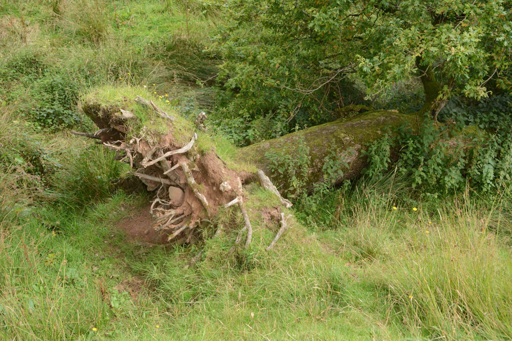
Bride's Well (Stapleton) submitted by Anne T on 25th Aug 2017. This was the fallen tree which lies over the position given for Bride's Well at St Mary's Church in Stapleton, so it may possibly be destroyed. The church warden I contacted thinks the well is in a field behind the vicarage and is going to check and get back to me.
(View photo, vote or add a comment)
Log Text: Bride's Well, Stapleton: Now underneath a fallen tree? Having had to run away from this site to collect our cats from the vets after a very brief search for the well last Thursday, we went back armed with the GPS and OS map and found we’d been looking in the wrong direction.
I’d seen a set of stile leading down to the meadow from the eastern side of the church yard so we found these. They led down to the meadow and the burn running north-south through the field, although they were completely overgrown by nettles. Whilst there were only two small steps on the church yard side, there were around 8 going down into the field below.
We walked round and round and the only feature we could see at the exact grid reference given by Pastscape was this fallen tree. Has the well been destroyed? We had a good look round all along the stream in this field.
I sent an email to the Rector when I got home, and received the reply below. She thinks the well might be in the field behind the rectory, which is above the church, and will check and send an update.
Irthington Mill
Trip No.40 Entry No.4 Date Added: 25th Aug 2017
Site Type: Misc. Earthwork
Country: England (Cumbria)
Visited: Yes on 20th Aug 2017. My rating: Condition 2 Ambience 3 Access 5
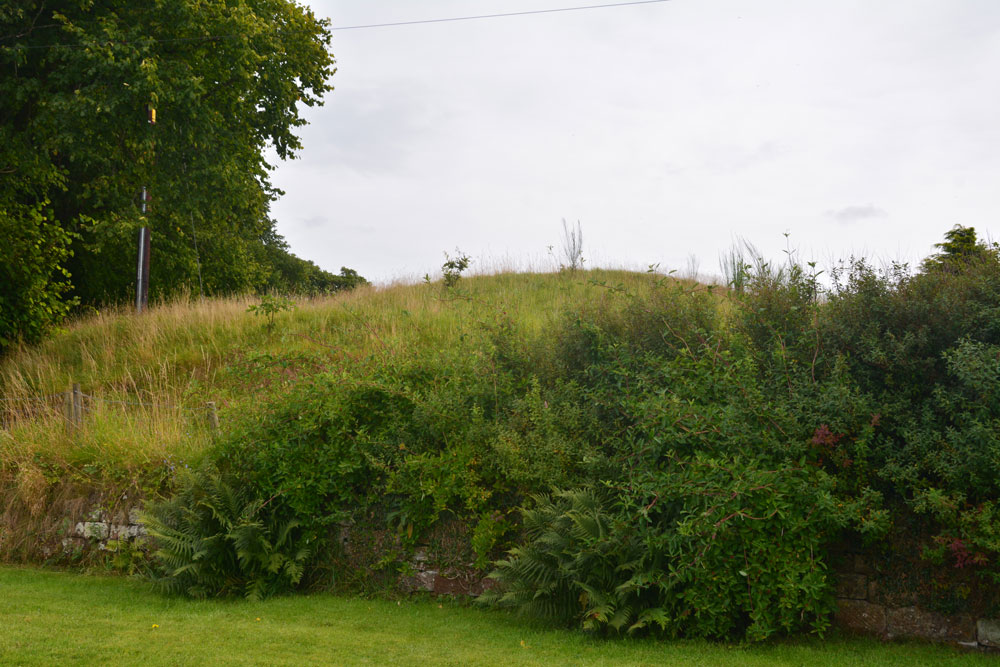
Irthington Mill submitted by Anne T on 25th Aug 2017. The 'motte' from near the driveway to Irthington Mill house. Fancy having part of your garden growing on such an old feature, especially if it is a motte!
(View photo, vote or add a comment)
Log Text: Irthington Mill 'motte or not?': Having spotted two mottes and a holy well just off the road we were travelling on to Carlisle, I asked to take a detour to find these. Whilst this is marked as a motte on the OS map, and certainly looked like one, I got home to find there is some debate about whether this is a motte or a natural feature (it is not recorded on Historic England’s listings).
Situated between a farm with some very old buildings and Irthington Mill house, with part of the Mill’s garden growing up its western slope, and not far from Irthington Bridge, it seemed to me that this motte was in a much more strategic defensible position near the modern day river crossing. Perhaps the course of the river moved over the years and the site of the motte was changed? This is me not wanting to belive its just a natural feature!
Irthington Motte
Trip No.40 Entry No.3 Date Added: 24th Aug 2017
Site Type: Misc. Earthwork
Country: England (Cumbria)
Visited: Yes on 20th Aug 2017. My rating: Condition 2 Ambience 3 Access 5
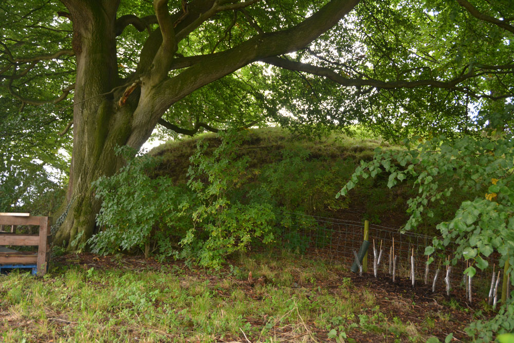
Irthington Motte submitted by Anne T on 24th Aug 2017. Leaning over the fence from the builder's yard, the oval of this earthwork was more obvious. I would have liked to have gone in to the yard for a closer look, but there was a lot of rubble, heavy equipment and a padlocked gate.
(View photo, vote or add a comment)
Log Text: Irthington Motte, Cumbria: We continued walking down the lane which leads to the River Irthing. At first, nothing appeared to stand out as a motte, then I realised that the mound behind the fence, sitting between the farm and the builder’s yard was actually the motte.
Walking down nearer to the entrance to the builder’s yard, the shrubbery was less intrusive and the oval shape of the motte became more apparent.
I would have liked to have gone into the builder’s yard but there was so much rubble, heavy equipment and a padlocked gate. No-one in the farm yard to ask, despite several cars being around.
Hall Well (Irthington)
Trip No.40 Entry No.2 Date Added: 24th Aug 2017
Site Type: Holy Well or Sacred Spring
Country: England (Cumbria)
Visited: Yes on 20th Aug 2017. My rating: Condition 2 Ambience 3 Access 5
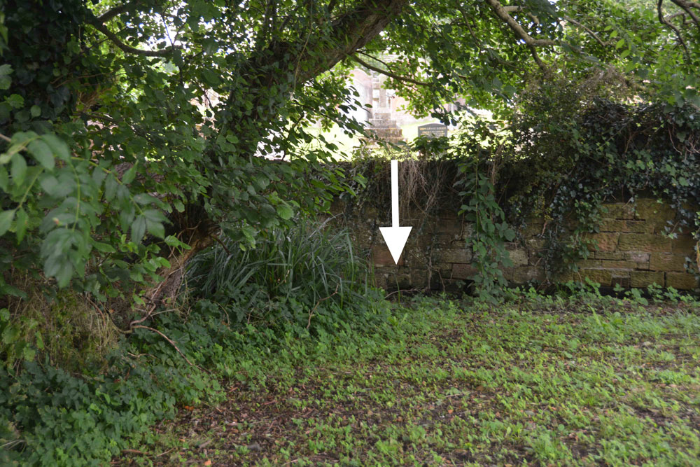
Hall Well (Irthington) submitted by Anne T on 24th Aug 2017. At the southern end of this small grassy area is a boggy area. Just underneath the wooden fence into the neighbouring garden a stream appears from under the bank. This stream has a good flow of water.
(View photo, vote or add a comment)
Log Text: Hall Well, Irthington: From Walton we made our way over to Irthington – not a planned visit, but because I saw the holy well and 2 mottes in close proximity in this village.
This small village (too large to be called a hamlet, but too small to be a good sized village) is obviously old. It’s not that far from Carlisle Airport and stands on the line of Stanegate and is also close to the line of Hadrian’s Wall.
Being armed with the OS map and a GPS, we went in search of the holy well first (passing by the first motte as we’d look for somewhere to park on the way back). According to the OS map the well lies not far outside the south-eastern wall of the church yard. Walking through the churchyard, this area is covered in brambles, nettles and shrubs, but we found some steps leading through the wall and onto the grassy area beyond. At the grid reference above there are some reeds and shrubs sitting in a boggy area. Peering over the fence into the garden of the house sitting immediately to the south, a stream suddenly appears out of the ground and rushes through the garden and is piped under the road, presumably to the modern water pumping station opposite. Nothing exists of any well housing (that we could see) and I’ve emailed the vicar through the ‘A Church Near You’ website.
Just down the road is one of the mottes. Note: the grid reference given by Pastscape indicates the site of the well is around the steps from the churchyard.
King Edward's Monument
Trip No.40 Entry No.7 Date Added: 22nd Aug 2017
Site Type: Cairn
Country: England (Cumbria)
Visited: Yes on 20th Aug 2017. My rating: Condition 3 Ambience 4 Access 4
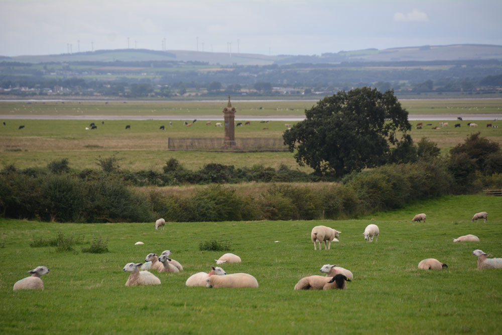
King Edward's Monument submitted by Anne T on 22nd Aug 2017. First view of the monument from the parking area at NY 32876 60329
(View photo, vote or add a comment)
Log Text: King Edward's Monument, Burgh-by-Sands: After having visited Beaumont, I was reluctant to go home without seeing something of the Solway, and looking across to Dumfries & Galloway, where we spent 12 years. When we last visited in February 2014 we were unable to get down the lane because it was so waterlogged (we got about one third of the way down and had to abandon the visit, having seen the monument only from afar). This time, the lane looked dry, so we parked by the little triangle of grass and could see the monument on the marshland below.
Appearances were certainly deceptive – parts of the lane were ankle deep in mud, and we picked our way from the track to the marshy grass land next to it, to dry stones and boulders where we could. Eventually we came to the stile over a small stream at NY 32773 60897, which led immediately down to a small wooden bridge and onto another stile. The other side of this stile was deep in water, but thankfully previous walkers had moved ‘stepping stones’ into the water. Once onto Burgh Marshes, the mounds left by ridge and furrow ploughing kept our feet dry until we got to the monument. Parts by the brick wall/metal railings surrounding the monument looked as if it was surrounded by a small moat!
What a place to have waited to cross the Solway. I think I would have preferred to have seen the original cairn rather than this Victorian monstrosity. The chimneys of Chapelcross, the decommissioned nuclear power plant, could be seen across the estuary, together with the flattened hilltop of Burnwark hillfort.
At the time of our visit, the tide was out, but I could imagine the shimmering water of the Solway to the west. A fitting end to a nice afternoon out.
St Mary's Church (Walton)
Trip No.40 Entry No.1 Date Added: 22nd Aug 2017
Site Type: Ancient Cross
Country: England (Cumbria)
Visited: Yes on 20th Aug 2017. My rating: Condition 3 Ambience 3 Access 5
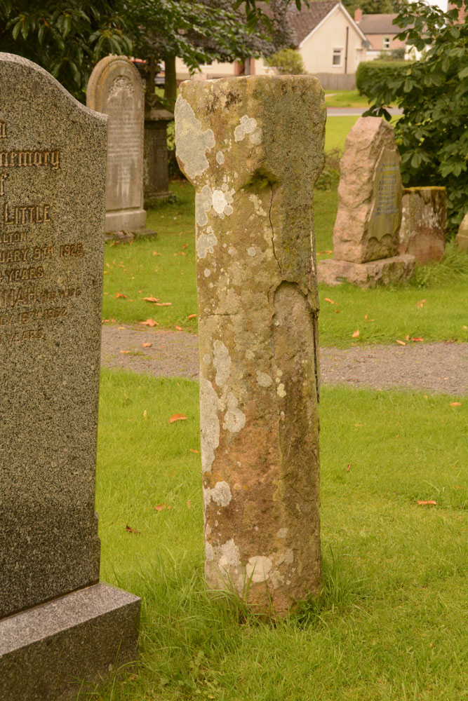
St Mary's Church (Walton) submitted by Anne T on 22nd Aug 2017. Standing nearer to the south western corner of the church looking back at the cross shaft. The stone is badly shattered and spalled off on this side.
(View photo, vote or add a comment)
Log Text: St. Mary's, Walton: Went to see a cross head, but found an 11th century market cross instead! This is a very pretty little village, and was on our way back to Stapleton to try to find the Bride’s Well (ran out of time last Thursday). We parked opposite the church on the side of the village green and walked across to the church, letting ourselves in through the rather rusty gate (it took us ages to work out how to open it). I excitedly followed my husband into the church but stopped dead as there was no sign of the cross head at all.
We hunted under pews, up and down the aisles, on window ledges, around the font, inside a chest, and all the places we could think of. The only sign of the cross was a photograph and a brief description on the display boards against the north western wall of the nave, which showed it displayed on top of the font cover. (I’ve since sent an email to the vicar to enquire where it might be located or moved to, but not had a reply yet).
We did however, see a paragraph on the display boards headed AD850 to 1066: “During the latter part of the 9th century to the middle of the 11th century, Walton, as a community, developed. The evidence for this is shown by the relics found in or around the present church. Between the years of 850 to 950, a preaching cross was erected and similarly between 1000 and 1050, a market cross was probably erected.” There is an image of the remains of the market cross in the churchyard. We then went to find this, disappointed not to have found the cross head, but pleased there was something of antiquity to have made this detour worthwhile.
St Andrew's Well (Kirkandrews-on-Eden)
Trip No.40 Entry No.6 Date Added: 22nd Aug 2017
Site Type: Holy Well or Sacred Spring
Country: England (Cumbria)
Visited: Yes on 20th Aug 2017. My rating: Condition 3 Ambience 4 Access 4
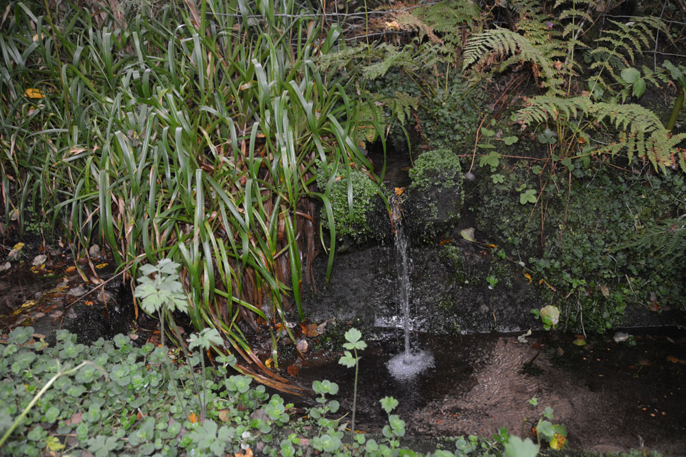
St Andrew's Well (Kirkandrews-on-Eden) submitted by Anne T on 22nd Aug 2017. Standing looking at the bank where the spring emerged, with the well pool - a rectangular stone (or brick?) basin - below. There was a steady flow of water, which could be heard from quite a way away.
(View photo, vote or add a comment)
Log Text: St Andrew's Well, Kirkandrews-on-Eden: From Stapleton, we headed to junction 44 of the M6 and stopped for refreshments at Houghton Park Garden Centre, then set off via the A689 (western part of the bypass round Carlisle, turning right at the roundabout where the A689 joins Burgh Road. Kirkandrews is almost 2.5 km to the north west of this point.
In the middle of Kirkandrews-on-Eden the road splits. The left hand fork goes directly to Monkhill, the right hand fork to Beaumont. The old churchyard is somewhat hidden behind bushes, but is approx. 120 metres from the fork in the road. We parked at the wide farm entrance a little further up the road and walked back to the footpath sign.
We followed the footpath for about 50 metres (the old grave stones peer out of the very high grass to your right hand side. As the path starts to descend, we could hear a steady trickle of water and found the well hidden behind weeds that were as tall as I was. Gently moving these aside, so we have a clear view (we thought the weeds might be poisonous) I took photographs. My husband announced this was a very spooky spot (overgrown trees next to a decidedly no longer used grave yard) although I found it strangely tranquil.
There was a channel running down the hillside taking rainwater down to the well pool. The main water came out of the bank to the side at a 90 degree angle to the sandstone basin, then trickled down into a second channel running down the hill.
The basin was much silted up with sandy soil but the flow was strong and clear. Although Pastscape says the well pool is 1.0 metre square, I thought it was rectangular, measuring 1.5 m long b about 80cm wide.
Don’t know what happened to the church, but then just discovered the small mention below – closed in the 1750s with no visible evidence remaining.
