Contributory members are able to log private notes and comments about each site
Sites Anne T has logged on trip number: 28 (View all trips)
View this log as a table or view the most recent logs from everyone
Harbottle
Trip No.28 Entry No.7 Date Added: 30th May 2017
Site Type: Modern Stone Circle etc
Country: England (Northumberland)
Visited: Yes on 28th May 2017. My rating: Condition 3 Ambience 5 Access 4
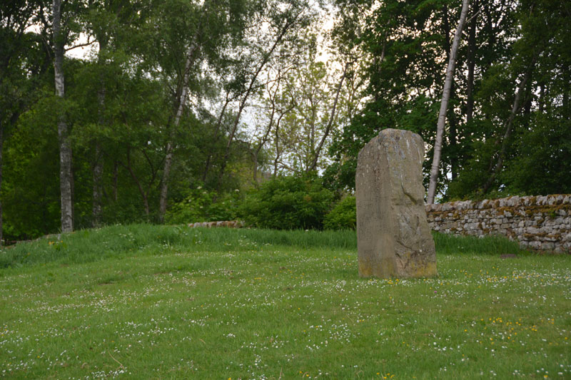
Harbottle submitted by Anne T on 30th May 2017. This modern standing stone can be found on a grassy bank at the western side of the car park for the castle.
(View photo, vote or add a comment)
Log Text: Harbottle Modern Standing Stone/Castle: From Holystone, we passed through Harbottle to get back to the A68, so stopped to look at the castle. The site is lovely.
I spotted the modern standing stone to the west of the car park. The standing stone is inscribed with words:
The Sad Castle
Who Made me/Into a ruin/like an old city?
Was it the soldiers who rode out on horseback?
Was it my old enemy the Scots?
Or was it those Border Reivers?
Perhaps it was just the centuries passing.
Felicity Lance
Apparently there are supposed to be 2 poems, the above by Felicity Lance, another by Robert Corley from Harbottle School, carved into the stone by local stonemason David Edwick. I walked all around the stone, even photographing the other faces to see if anything came up on the camera, but only saw the one poem.
The Pastscape record says there could have been a pre-Conquest fortress on the site. The motte is very steep, and a walk around the moat/outer ditch was charming. Walking into the ruins from the eastern side, there are lots of lumps and bumps of the remains of walls and buildings. Very enigmatic. Really pleased to have been here.
Bellshiel Law
Trip No.28 Entry No.1 Date Added: 29th May 2017
Site Type: Chambered Cairn
Country: England (Northumberland)
Visited: Yes on 28th May 2017. My rating: Condition 3 Ambience 5 Access 5
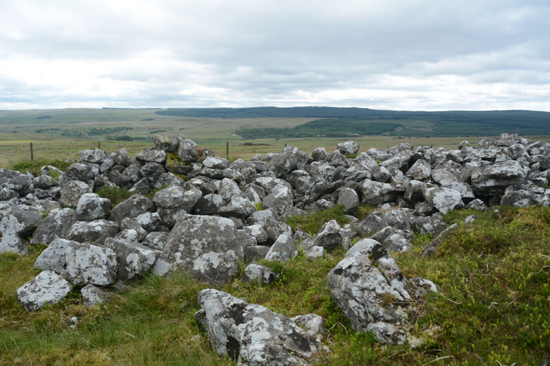
Bellshiel Law submitted by Anne T on 29th May 2017. The northern side of the cairn is partly earth and turf covered for the first few feet. Whether this is just build of earth through the prevailing wind blowing it in or the remains of a purpose built covering was difficult to tell.
(View photo, vote or add a comment)
Log Text: Bellshiel Law, Otterburn Ranges: It felt very strange driving onto the Otterburn Ranges with no red flags flying and no military around – I felt like I was trespassing. The ranges are absolutely huge – the Access map and Guide says they cover 90 square miles. We saw 3 other cars all day, 2 of those from a long distance, and 3 cyclists.
Bellshiel Law can be reached by a military road approx. 2 km on the western side of Rochester. The start to this road system is quite complex, but we headed left and left again taking us up over Bellshiel Road. AT NT 81079 01161 the road forks. At this point take the right hand fork. The cairn comes into view on the right hand side of the road. There is a small parking area underneath a natural crag at NT 81267 01260. My first reaction was “Wow, this is huge”.
Narrow trackways through the grass lead you to the cairn, which is fenced off and labelled “Archaeological Area” and “Out of bounds to Troops”. A gate (difficult to open with all the marren grass around it, but managed to squeeze through) lets you into the cairn. It is large – Pastscape recording it as 367 feet long and 52 feet wide at its eastern end, with a maximum height of 6ft (1932 measurements), which translates to 109m long, varying in width from 8.8m at the west end to 15m at the broader east end, maximum height of 1.6m (1994 English Heritage Scheduling).
Someone has built a sheep pen on the southern side, presumably using stones from the cairn. Walking along the stones at the side of the cairn, largely turf covered, I spotted a number of circular ‘rooms’ inside the cairn, with one oblong shape. Called a long cairn by Pastscape, they record “the cairn on the whole, was found to contain no structural remains of an earlier period (ie cists, chambers, revetments internal structures ….. and cannot be dated any earlier than Early Bronze Age and possibly later.”
Great views to the south to the River North Tyne Valley and beyond.
St Mungo's Well (Northumberland)
Trip No.28 Entry No.6 Date Added: 29th May 2017
Site Type: Holy Well or Sacred Spring
Country: England (Northumberland)
Visited: Yes on 28th May 2017. My rating: Condition 4 Ambience 4 Access 5
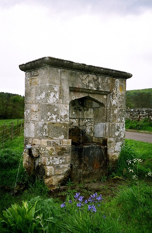
St Mungo's Well (Northumberland) submitted by KiwiBetsy on 27th Nov 2004. St Mungo's Well amidst well watered wildflowers.
(View photo, vote or add a comment)
Log Text: St. Mungo's Well, Holystone, Northumberland: We’d already visited the lovely Lady Well on 8th September 2013, but stopped to look at this one, which is at the side of the Coquet River. Sitting by the right hand side of the road just before entering the village from the Otterburn Ranges, just before the corner of the road leading up to Holystone Priory Farm and the footpath up to Lady’s Well.
The grass and weeds had grown right up to the well, although there was a small track to the well basin, showing a few other people had visited.
I did taste the water, which was clear, but didn’t taste of any particular mineral. The flow of water was strong (but not as strong as St. Cuthbert’s Well in Bellingham), indicating it might be artesian after a long spell of very dry weather in this part of the world.
I hadn’t done any research on this well before visiting, just passing by on the spur of the moment. Pastscape is dubious about this being a holy well. The shrubbery around the well hid the overflow pipe at the burn side of the structure, and I wished I had looked for the conduit at the village green. Another trip to this beautiful part of the county is called for.
Ridlees Cairn
Trip No.28 Entry No.5 Date Added: 29th May 2017
Site Type: Cairn
Country: England (Northumberland)
Visited: Yes on 28th May 2017. My rating: Condition 3 Ambience 4 Access 4
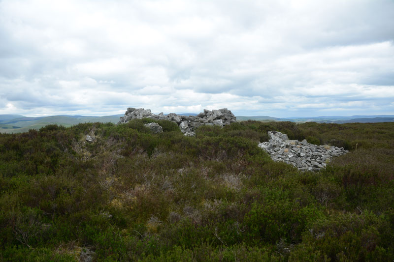
Ridlees Cairn submitted by Anne T on 29th May 2017. Approaching Ridlees Cairn from the east. It is a substantial cairn, made up of small and medium sized stones.
(View photo, vote or add a comment)
Log Text: Ridlees Cairn, Otterburn Ranges: This is one of the times I’ve actually made it up to a Trig Point (usually too steep a climb or too high a drop for my liking), but this was easy. Ridlees Cairn was actually 250 metres to the east north east of Bushman’s Crag, but I’m sure some people may visit the crag thinking it is the cairn. The views here are impressive. No wonder the military have a bunker hidden just up the road, and possibly hollowed out the centre of the cairn for use as a machine gun nest (apologies if this is not the case, this is just husband guessing).
Parking at the cairn (the metalled roads had deteriorated from this point and were very narrow), we walked to the east of the cairn and pushed through the heather to reach it.
It is substantial, with a flattened stone kerb around it, partly hidden by heather, partly by tumbled stones.
Inner Golden Pot (Otterburn)
Trip No.28 Entry No.2 Date Added: 29th May 2017
Site Type: Marker Stone
Country: England (Northumberland)
Visited: Yes on 28th May 2017. My rating: Condition -1 Ambience 4 Access 5
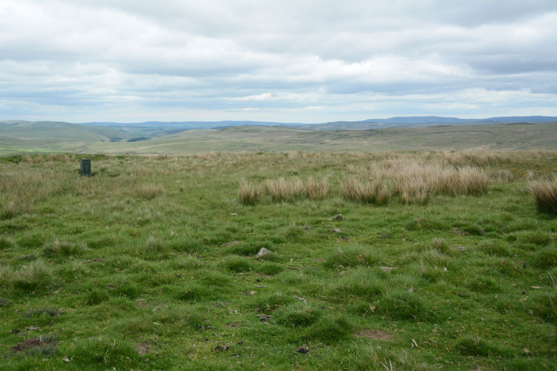
Inner Golden Pot (Otterburn) submitted by Anne T on 29th May 2017. At the site of the Inner Golden Pot there were only broken sandstone pieces and modern army equipment. I thought it was worth stopping to look to see if anything remained, especially as it was a nice viewpoint.
(View photo, vote or add a comment)
Log Text: Inner Golden Pot, Otterburn Ranges: No trace of this cross base can be found, but I couldn't resist having a look. There were some small sandstone pieces around the grid reference point, together with a funny green box - presumably some military equipment. A great viewpoint across to Upper Coquetdale.
Outer Golden Pot (Otterburn)
Trip No.28 Entry No.4 Date Added: 29th May 2017
Site Type: Marker Stone
Country: England (Northumberland)
Visited: Yes on 28th May 2017. My rating: Condition 2 Ambience 4 Access 5
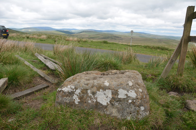
Outer Golden Pot (Otterburn) submitted by Anne T on 29th May 2017. From it's eastern side, the Outer Golden Pot has wonderful views over Upper Coquetdale.
(View photo, vote or add a comment)
Log Text: Outer Golden Pot (Otterburn): What stunning views across to Upper Coquetdale from here. No wonder the site is marked as a view point on the Otterburn Ranges Access Map. The fencing surrounding this Golden Pot has been broken on three sides, so it’s possible to appreciate its form more fully than the Middle Golden Pot.
The base is smaller than the Shitlington Cross but is about the same size as many of the Anglo Saxon Cross Bases we’ve seen in and around churches in North Yorkshire.
As I stepped back towards the road to photograph the base, I saw what looked like a cart track running diagonally up the hillside, crossing under the road and carrying on in a north-east/south-west direction. Andrew pointed out that if I moved a bit further over, I could see the second ditch, so this was the old course of Dere Street, now metalled and called ‘Roman Road’.
After stopping to photograph this stone, we went in search of Ridlees Cairn and Bushman’s Crag, to the south east of these intriguing cross bases.
Middle Golden Pot (Otterburn)
Trip No.28 Entry No.3 Date Added: 29th May 2017
Site Type: Marker Stone
Country: England (Northumberland)
Visited: Yes on 28th May 2017. My rating: Condition 2 Ambience 4 Access 5
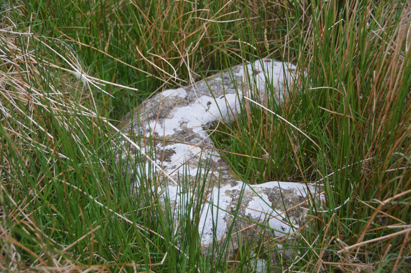
Middle Golden Pot (Otterburn) submitted by Anne T on 29th May 2017. The Middle Golden Pot from a different angle.
(View photo, vote or add a comment)
Log Text: Middle Golden Pot (Otterburn): Fenced off behind a nice, neat fence with a label “Do not feed the cross base” – no seriously, “Archaeological Area”. This stone was mostly hidden under the marsh grass and I struggled to get decent photographs as the camera kept focusing on the grass rather than the stone. Whilst I snapped away, Andrew went off wandering along the top of Dere Street off to the east – very well defined with a visible ditch on either side. The modern metalled road (imaginatively called ‘Roman Road’ turns a left-handed right angle here, as the course of Dere Street changes. Being just below the brow of a hill, I wondered why the stone was placed here, but looking at the change of direction of the road, it made sense. Stepping behind the stone and looking north-west, Dere Street could be seen running up hill, joining with the section to the east of the stone.
