Contributory members are able to log private notes and comments about each site
Sites Anne T has logged on trip number: 39 (View all trips)
View this log as a table or view the most recent logs from everyone
St Ninian's Well (Brisco)
Trip No.39 Entry No.2 Date Added: 31st Jul 2019
Site Type: Holy Well or Sacred Spring
Country: England (Cumbria)
Visited: Yes on 17th Aug 2017. My rating: Condition 3 Ambience 3 Access 4

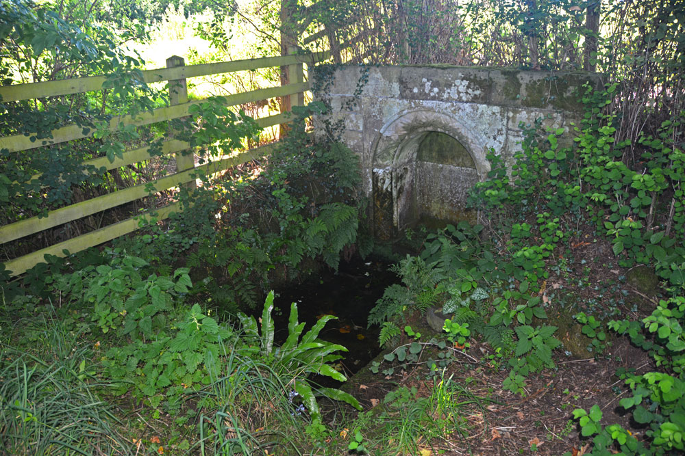
St Ninian's Well (Brisco) submitted by Anne T on 18th Aug 2017. First view of St Ninian's Well as we turned the corner of the dog-leg in the footpath.
(View photo, vote or add a comment)
Log Text: St Ninian's Well, Brisco, Cumbria: From Carlatton Demesne Standing Stone, heading back onto the A69, we took the M6 to junction 42, then the third exit towards Durdar. Brisco (Briscoe according to Pastscape) is the first turn to the right. The village is a line of houses on both sides of the road. We parked where the road widened slightly at Brisco Hall farm and walked back southwards to the footpath, which runs to the north of Well View cottage (they have a sign on the side of the house saying their drive is Elvis Presley Boulevard!), and followed the grassy lane down towards the railway line. Where the path does a right hand turn, there is a small set of stone steps. The footpath then turns north east towards the railway line, going through a gate into a field. The well is in this small enclosed area, tucked away at its south eastern end, mostly hidden by shrubs and brambles.
There is an arched well head that looks Victorian, and Pastscape and Historic England says was erected in the 1830s to 1840s. A step goes down to the well basin, in which, under the water, is a circular structure with a circular hole in its middle. In the corner of the fence facing the well is a small wooden bench, covered by brambles when we visited, but we used sticks to move these away and sit and admire this spot.
From the well, a gate leads through a fence-line down into a field of pasture below (the ground drops by 3-4 feet and there are steps down to the new ground level). This ground is wet and boggy and in line with the well head and pool is a cattle truck. A steady trickle of water comes through the bottom of the trough into a pool which has large boulders pushed around it in a partial circle, now partly destroyed. It looks like this might have been the original well pool. At the bottom of the field, the main west coast railway line runs and we watched several intercity trains and a steam train go by before returning to go into Carlisle for a late lunch then onto our next stop – a wheel-headed cross north west of Carlisle in Rockcliffe.
Carlatton Demesne
Trip No.39 Entry No.1 Date Added: 18th Aug 2017
Site Type: Standing Stone (Menhir)
Country: England (Cumbria)
Visited: Yes on 17th Aug 2017. My rating: Condition 3 Ambience 4 Access 4

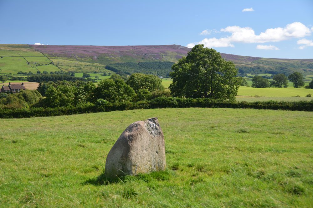
Carlatton Demesne submitted by Anne T on 18th Aug 2017. Standing on the edge of the slight mound on which the stone sits, looking south east towards Castle Carrock Fell.
(View photo, vote or add a comment)
Log Text: Carlatton Demesne Standing Stone: Following the A69 to Carlisle, the only way we could turn left off the A69 to get to Carlatton was to drive north into Brampton and back out again, under the A69. We then followed the B6413 through Castle Carrock, turning off westwards along the minor road past Moor House and Black Dub. The entrance to Carlatton Demesne Farm is around 650 metres further south of the track to Black Dub farm and there is a small hard-cored area just to the south of Carlatton Demesne Farm track, alongside the road.
At first, we walked back towards the small wood to the north-north-east to where we’d seen a gate. The gate was only held up by four pieces of wire and was very rickety, so we abandoned attempts to climb over and walked back up the farm track to where the footpath ran. I heard the farmer start his machinery up in the yard so walked along to have a word with him. It was actually a young farm worker who told me it was OK to walk through the field to look at the standing stone. He told me if we carried along the road towards Penrith, we’d get some pretty spectacular views. In the end, we retraced our steps and didn’t go down that way, but will bear that in mind for future visits.
The countryside is very pretty here, although gaining entry into the field was fun with its very muddy patch by the gate, and having stepped into the pasture, there were hidden, still soft cow pats hidden under the calf length grass. Our stone is number 4 in the list below. It appeared to be sited on top of a small, but pronounced mound with superb views around 360 degrees, with Carrock Fell to the east. It would have been a splendid setting for a stone circle.
Plotting out the points on UK Grid Reference Finder, the NGRs mentioned below form a loose alignment rather than a circle.
