Contributory members are able to log private notes and comments about each site
Sites Anne T has logged. View this log as a table or view the most recent logs from everyone
Castle Hill (Whittonstall)
Trip No.16 Entry No.1 Date Added: 13th Apr 2017
Site Type: Ancient Village or Settlement
Country: England (Northumberland)
Visited: Yes on 12th Apr 2017. My rating: Condition 2 Ambience 3 Access 5
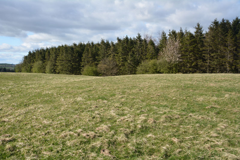
Castle Hill (Whittonstall) submitted by Anne T on 12th Apr 2017. Standing in the slight ditch at the south-western side of the settlement. Much easier to see with the eye than in the photograph.
(View photo, vote or add a comment)
Log Text: Castle Hill, between New Ridley and Whittonstall, Northumberland: This is only a couple of miles from our house, and being a lovely sunny evening, decided to try and find some of the earthworks on the OS map.
This site has the advantage of being close to Wheelbirks Farm with its café, unpasteurised milk and wonderful ice cream. Parking in the layby almost at the junction of the B6309 and the Lead Road, we walked along the busy main road for a couple of hundred yards until we reached the far end of the Castle Hill plantation. Here, the stone wall falls back from the road, and you can walk through to the brambles to the wall. An old gate (?) has been placed so the bars act as a ladder to climb over either into the plantation or the pastureland.
Standing at the stone wall, its possible to see the hump of the settlement with one accompanying outer ditch in front of you. Clambering over into the grassy field (didn't see anyone to ask - sorry), a quick walk along this corner of the field brought the whole of the settlement platform into view. It was much easier to see with the naked eye, rather than try and capture with the camera. Logging onto Pastscape when I got home, I was fascinated to read the history and interpretation of this very ordinary site. Obviously a lot more interesting in the past!
We did go on to Whittonstall to try to find the manorial earthworks not far from The Anchor pub, but these have all been ploughed out. We did carry on to Ebchester, near Newlands, where the line of Dere Street can be seen in the fields to the north east of the B6309. From the gate in the field near the layby almost opposite the junction with the road to Newlands, you can see a cross-section of the road. Interesting.
Castle Hill (Northumberland)
Trip No.12 Entry No.2 Date Added: 7th Mar 2017
Site Type: Hillfort
Country: England (Northumberland)
Visited: Yes on 5th Mar 2017. My rating: Condition 3 Ambience 4 Access 4
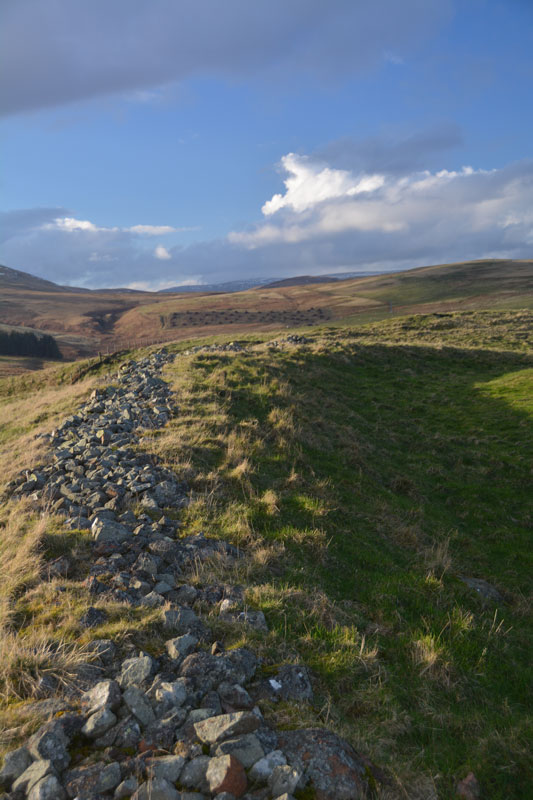
Castle Hill (Northumberland) submitted by Anne T on 7th Mar 2017. To the north west of the fort, the outer bank is made up of stones and earth, making a substantial boundary.
(View photo, vote or add a comment)
Log Text: Castle Hill Fort & Settlement, near Alnham, Northumberland: From St Michael & All Saints (Alnham) and its location next to the trickling River Aln, we headed further up the winding (almost harepin at a couple of points) narrow, single track road climbing up the hill to Castle Hill Fort and Settlement. At the top of the hill, there is a cottage located just below the lea of the hill. Just past this is a cattle grid and a footpath sign leading to the west and the fort. There is room for one car to park just before the cattle grid, where the ground is relatively firm.
Nothing can be seen of the fort at this point, but going through the gate and climbing up the gentle hill, following the line of what seems to be an old stone wall, the low lines of grass covered banks (the boundary lines of old enclosures?) comes into view. The ground then climbs a little more steeply, as you walk onto the first outer bank. Then the outlines of banks and ditches comes into view, together with the ghost of a round house immediately in front of you. There’s nobody here, not even sheep.
The early spring sun was low in the sky, making the contrast between the height of the outer defensive bank with its protruding line of stones, looking steeply down to the north west and Spartley Burn, its waters sparkling in the sunlight. To the east is Hazeltonrig Burn.
We walked all round the outer bank. Two banks and ditches to the north and east, becoming three to the west. Well worth a visit. I just wish I’d brought the notes with me to help interpret what I was seeing.
From Castle Hill, we set off towards Biddlestone, making our way back into Alnham, driving back down through Scrainwood, through Biddlestone Town Foot to Biddlestone. This road is gated, and very muddy. The road twists and turns, and a couple of times we almost went off down farm tracks rather than the road. Very remote. Very lovely.
Castle Hill (Bishopton)
Trip No.56 Entry No.2 Date Added: 16th Oct 2017
Site Type: Misc. Earthwork
Country: England (County Durham)
Visited: Yes on 15th Oct 2017. My rating: Condition 2 Ambience 4 Access 4
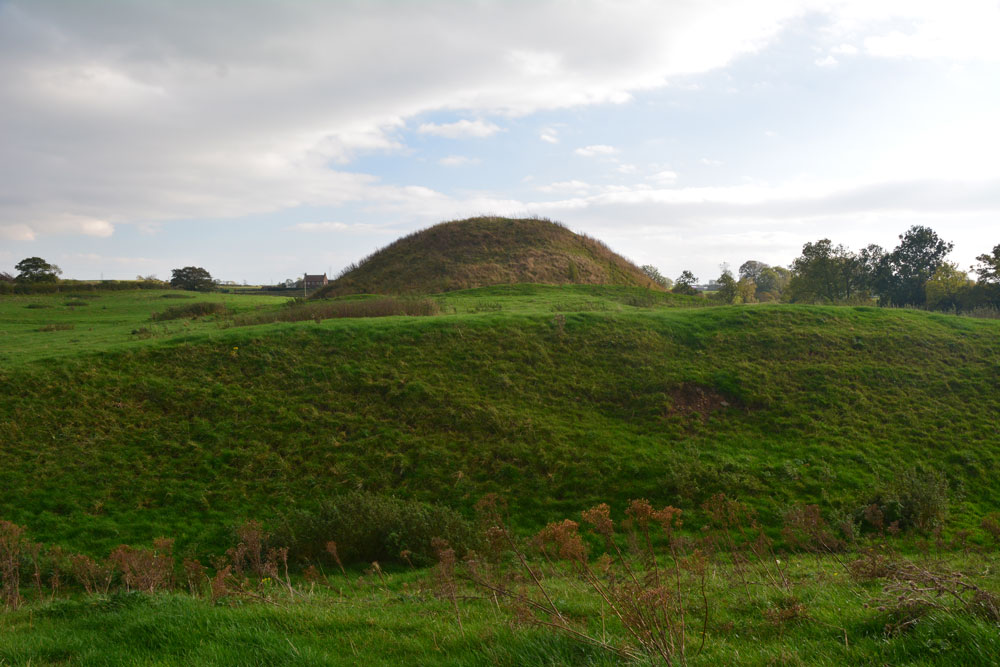
Castle Hill (Bishopton) submitted by Anne T on 16th Oct 2017. The motte from the north western outer defensive bank.
(View photo, vote or add a comment)
Log Text: Castle Hill, Bishoptop: This monument is literally just within sight of the church, just over 420 metres to the north west, at the south eastern edge of the village, opposite the pub and next to a garage.
There is a public footpath which runs through the field in which this motte and bailey is sited, accessible by a rather tumbledown stile. There is also an information board, although this had cracked and fallen off its plinth. We pieced it back together to have a quick read, although the text was so faded we couldn’t really make it out.
The site is really well preserved, and I’ve not seen another quite like this. It is as if someone has built a large hillfort in a flat piece of land and put a round mound towards one end. There are also extensive earthworks leading off this.
The motte itself has been fenced off, presumably to stop the sheep and cattle from damaging it, although there is a gate in the south western part of the fence, with a very steep path leading up to the top of the motte.
We walked around the exterior twice, marvelling at the deep ditches and banks.
Castle Hill (Ancrum)
Trip No.47 Entry No.4 Date Added: 4th Oct 2017
Site Type: Hillfort
Country: Scotland (Scottish Borders)
Visited: Saw from a distance on 20th Sep 2017. My rating: Condition 2 Ambience 4 Access 4
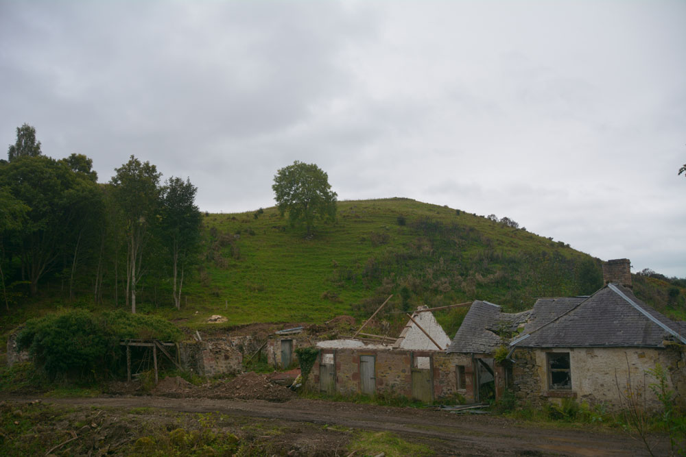
Castle Hill (Ancrum) submitted by Anne T on 4th Oct 2017. Walking through the gate at the eastern side of the ruins, and walking over the old pack horse bridge, the western side of the hillfort can be seen. We were unable to get any further along this path as it was closed due to building works. There is another route to the eastern side of the fort from Ancrum village.
(View photo, vote or add a comment)
Log Text: Castle Hill Hillfort, Ancrum, Scottish Borders: It was getting late in the evening, with dusk coming on, so sadly there wasn’t time to drive back into Ancrum and back round the other side to clamber up to this enticing hill fort, which is visible from Ancrum Old Church and can also be clearly seen on UK Grid Reference Finder. We did try walking across the pack horse bridge across Ale Water, letting ourselves out of the wrought iron gates at the eastern side, but the cottage and adjacent barns we’d have needed to walk through were a building site and were cordoned off.
Decided to leave this for another day, and drove back past the market cross to photograph that before heading off to Armadale.
Casterton
Trip No.144 Entry No.5 Date Added: 13th Aug 2019
Site Type: Stone Circle
Country: England (Cumbria)
Visited: Yes on 8th Aug 2019. My rating: Condition 2 Ambience 3 Access 3
Casterton submitted by WindC on 26th Feb 2012. Looking eastwards, a moment when the cloud base lifted..
26/2/12
(View photo, vote or add a comment)
Log Text: Casterton Stone Circle and Settlement: I found this walk VERY difficult once we were in the field containing the stone circle, largely due to the steepness of the slope, but mainly due to all the stones and boulders hidden under the turf. I did not enjoy this visit at all, despite having really wanted to visit this stone circle.
We parked at SD 64084 79316 and walked northwards up the lane towards Brownthwaite Pike, a steady uphill plod, passing a spring which emerged from just the other side of the wall, and piped under the footpath to the field beyond.
Reaching the gate into the field with the stone circle, which the farmer allows access to, we had to wade through the first 10-15m, as water was trickling down the slope from across the footpath and pooling around the gate. I was quite astonished at all the heaps of stones (clearance cairns) and part-walls all across the field. It reminded me of the ‘5,000 tons of stones’ site in County Durham that Time Team looked at but couldn’t work out what it was.
On (finally) reaching the stone circle, which took the best part of 40 minutes, my interpretation was that this was a ring cairn, not a stone circle.
On the way back up the slope, did we find a boulder with cup mark? The interior was very smooth, unlike the solution holes, which have a rim. There was also another boulder with a large ‘solution hole’ on its side – an odd location for a solution hole.
Carry House Enclosure (Birtley Shields)
Trip No.63 Entry No.3 Date Added: 10th Jan 2018
Site Type: Ancient Village or Settlement
Country: England (Northumberland)
Visited: Yes on 7th Jan 2018. My rating: Condition 2 Ambience 4 Access 5
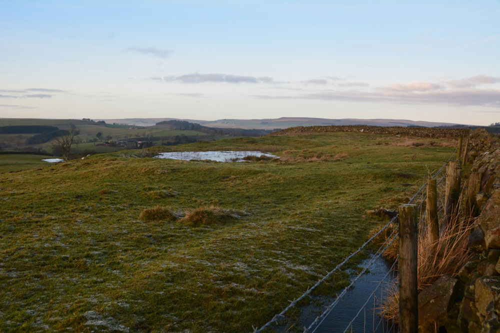
Carry House Enclosure (Birtley Shields) submitted by Anne T on 10th Jan 2018. Leaning right over the stone wall at the east of the settlement, looking northwards over the hut circle(s) trying to locate the cairn mentioned in Pastscape.
(View photo, vote or add a comment)
Log Text: Carry House Settlement, Birtley Shields: Cut by two stone walls and ploughed away at its northern end, but this was a stunning spot, tucked below a hill and with a steep slope down to the River North Tyne Valley below.
In the distance I could hear the farmer on his tractor running animal feed to his Blackies. I said to my husband, "He's going to come over." Five minutes later he drove up on his quad bike and engaged us in conversation, telling how this block of land belonged to the Duke of Northumberland "who didn't like visitors and didn't want them taking photographs" ("What, even though its marked on the OS map and its next to a public highway? Why are there no notices telling us this?" I think he was just winding me up!). Anyway, he was very pleasant and told us about his farm and a brief history of the area.
As the farmer was around, we stuck to walking up to the wall and along the track to take photographs. Shame, as I would have nipped through the gate to look for the cairn.
Carrawburgh Roman Fort
Trip No.140 Entry No.4 Date Added: 23rd Jun 2019
Site Type: Stone Fort or Dun
Country: England (Northumberland)
Visited: Yes on 23rd Jun 2019. My rating: Condition 2 Access 4
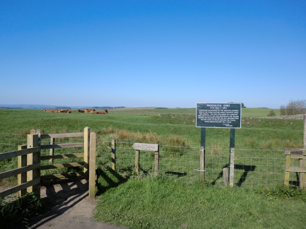
Carrawburgh Roman Fort submitted by johndhunter on 22nd Jun 2019. Signpost at the entrance to the fort taken in May 2012 – The sign post tells us that it was successively garrisoned by the Aquitani (from present day south west France), Cugerni (from present day Xanten on the Rhine) and in the third century Batavi (from the present day Dutch Rhine Delta) infantry units some 500 strong, It also tells us that it was built after the Wall on the infilled Vallum. ( The Vallum is a massive earthwork which runs to the south of the wall along its complete length, co...
(View photo, vote or add a comment)
Log Text: Carrawburgh Roman Fort/Brocolitia: When I last came here in 2014 there was a £4 charge for the car park which allowed you to also park at Housesteads and at other car parks at locations along the wall. Today, the machine has been upgraded and it is £1 for up to one hour. Other charges apply beyond that time. Having been to the Sill and paid to park there, we thought that charge covered this car park as well, but we had no receipt to leave in the car, so we paid our £1 again.
The sign at the entrance to the fort reads: “Carrawburgh (Procolitia) AD 134-383.
Garrisoned successively by the Aquitani, Cugerni and, in the third century, the Batavi; infantry units 500 strong. This was the last fort to be added to Hadrian’s Wall and obliterates the vallum. / Permissable access to the fort. No access to the trail. Please do not leave litter or disturb the cattle and sheep. Dogs to be kept on a lead. J. du Cane. Freeholder.”
The earthworks are nowhere near as impressive as the remains of Great Chesters Rman fort, further to the west, but it is a sizeable fort. We walked around the eastern, southern and western sides of the earthworks; some remains of the ramparts on the western side remains. We needed to walk back to the south eastern corner to go through the gate to the path down to the Temple of Mithras.
On our way back, Andrew went off the track to try and find a tumulus nearby. This had all but disappeared and we were unable to locate it, but we came across a spring, marked by a wooden post (as Robin Hood’s Well in Chollerton), with large stones and boulders piled up around a drinking trough. The spring is marked on the HE map of the area but no formal records of it (for photos see my separate entry below).
Carperby Cross
Trip No.144 Entry No.1 Date Added: 13th Aug 2019
Site Type: Ancient Cross
Country: England (Yorkshire (North))
Visited: Yes on 8th Aug 2019. My rating: Condition 3 Ambience 4 Access 5
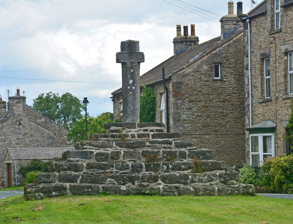
Carperby Cross submitted by Anne T on 13th Aug 2019. The cross from the village green, just to its western side, looking up the road through the village towards Redmire and Leyburn
(View photo, vote or add a comment)
Log Text: Carperby Cross: Not on our original schedule, we drove past this market cross and just had to turn back to take a closer look. Located on the village green in Carperby, which is a long, narrow, triangular strip of grass orientated SW-NE, the base or steps of the cross looked ancient, whereas the shaft of the cross looks modern, although it is dated 1674. The top of the cross has been broken off and re-cemented in at some stage. There are some interesting carved faces at the ends of the short, horizontal arms.
The information sign reads: “Carperby (West End). ‘Kerperbi’ is found in the Domesday Book of 1086. The name probably comes from early Scandinavian settlers, with ‘-by’ meaning farmstead and ‘kjarr’ meaning a bushy, boggy area, in old Danish.
Carperby has been designated as a Conservation Area because of its important historic character. The village is unusual in that it has two distinct centres, one at this end around the 17th century market cross and one at the east end where the original medieval manor house may have been.
The Market
The Market Cross suggests that Carperby’s medieval markets were held here but research shows otherwise. The original site at the far end of the village seems to have fallen into disuse after 1587 when Askrigg began to corner trade in the upper dale. It was briefly revived again in the 17th century, but this time at this end of the village. The date of 1674 carved on the cross supports this theory.
Religion
From the mid-17th century, non-conformism began to sweep through the Yorkshire Dales. The first converts worshipped in each other’s houses but eventually they built their own chapels.
West Lea Cottage was the first Methodist chapel, built in 1826. A little further east is its 1890 replacement (Greygarth), a simple Gothic building.
The Grade II listed Friends Meeting House of 1864 is the most sophisticated looking building in the village, with its heavily carved stonework. It seems to have replaced an earlier meeting house (Quaker Cottages) licensed in 1828 but later converted into cottages.
Education
Formal education in Carperby was provided by the school (Quarter House). It looks to be of 19th century date and the school records go back to 1870. A shaped tablet between the windows is inscribed ‘Carperby School’ but the rest is hidden by the later porch roof. The school closed in 1962.”
Carlisle Cross
Trip No.114 Entry No.1 Date Added: 10th Jan 2019
Site Type: Ancient Cross
Country: England (Cumbria)
Visited: Yes on 9th Jan 2019. My rating: Condition 3 Ambience 4 Access 4

Carlisle Cross submitted by Anne T on 10th Jan 2019. The Carlisle Cross, with its base and steps in deep shade. Taken on my mobile phone, as its about the first time I've not seen anyone sat or playing around its base. Will try and get some better photos on our next trip to Carlisle. Standing just over 100m to the east of the eastern wall of the cathedral, the cross stands on the site of an earlier cross and marks the centre of Carlisle City.
(View photo, vote or add a comment)
Log Text: Carlisle Cross: in a visit to Carlisle, we decided not to make an hour to visit what we thought was a cross in Rickerby Park (turned out to be the carved stump of a tree trunk!) and a holy well nearby. This was the first time I've not seen anyone sitting or playing around the base of the cross, and not having my camera, took some photos using my mobile phone. Will return on our next trip to Carlisle and get some better photos.
Didn't realise this cross stands on the base of an earlier cross (the five steps look much older than the 1682 top), marks the centre of the City of Carlisle and stands where the Roman Forum used to stand - see the HE and Pastscape entries for more info.
Carleith (Crook of Devon)
Trip No.109 Entry No.3 Date Added: 11th Nov 2018
Site Type: Cairn
Country: Scotland (Perth and Kinross)
Visited: Saw from a distance on 31st Oct 2018. My rating: Condition 3 Ambience 4 Access 4
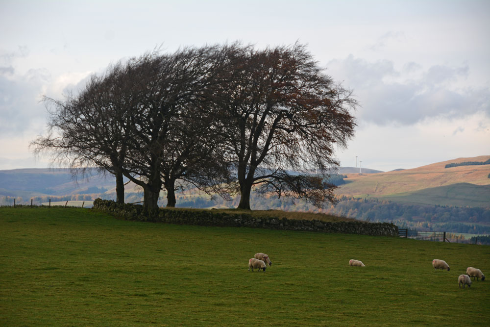
Carleith (Crook of Devon) submitted by Anne T on 11th Nov 2018. Using the camera lens on maximum zoom to try and get an idea of this perfectly circular cairn, bounded by a drystone dyke.
(View photo, vote or add a comment)
Log Text: Carleith Cairn (Crook of Devon): We didn’t go into the field as there were two very boisterous young bullocks who crowded the gate, along with their protective mothers, so I photographed it mainly from the gate into the field. From the edge of the field, this looked almost completely round, and I would have loved to have walked over it. The view to the distant hills was lovely.
Carlatton Demesne
Trip No.39 Entry No.1 Date Added: 18th Aug 2017
Site Type: Standing Stone (Menhir)
Country: England (Cumbria)
Visited: Yes on 17th Aug 2017. My rating: Condition 3 Ambience 4 Access 4
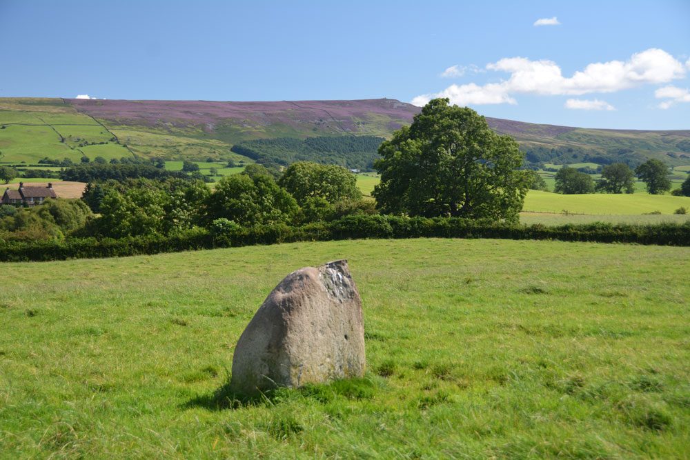
Carlatton Demesne submitted by Anne T on 18th Aug 2017. Standing on the edge of the slight mound on which the stone sits, looking south east towards Castle Carrock Fell.
(View photo, vote or add a comment)
Log Text: Carlatton Demesne Standing Stone: Following the A69 to Carlisle, the only way we could turn left off the A69 to get to Carlatton was to drive north into Brampton and back out again, under the A69. We then followed the B6413 through Castle Carrock, turning off westwards along the minor road past Moor House and Black Dub. The entrance to Carlatton Demesne Farm is around 650 metres further south of the track to Black Dub farm and there is a small hard-cored area just to the south of Carlatton Demesne Farm track, alongside the road.
At first, we walked back towards the small wood to the north-north-east to where we’d seen a gate. The gate was only held up by four pieces of wire and was very rickety, so we abandoned attempts to climb over and walked back up the farm track to where the footpath ran. I heard the farmer start his machinery up in the yard so walked along to have a word with him. It was actually a young farm worker who told me it was OK to walk through the field to look at the standing stone. He told me if we carried along the road towards Penrith, we’d get some pretty spectacular views. In the end, we retraced our steps and didn’t go down that way, but will bear that in mind for future visits.
The countryside is very pretty here, although gaining entry into the field was fun with its very muddy patch by the gate, and having stepped into the pasture, there were hidden, still soft cow pats hidden under the calf length grass. Our stone is number 4 in the list below. It appeared to be sited on top of a small, but pronounced mound with superb views around 360 degrees, with Carrock Fell to the east. It would have been a splendid setting for a stone circle.
Plotting out the points on UK Grid Reference Finder, the NGRs mentioned below form a loose alignment rather than a circle.
Carey Burn (Harthope Valley)
Trip No.36 Entry No.4 Date Added: 31st Jul 2017
Site Type: Ancient Village or Settlement
Country: England (Northumberland)
Visited: Yes on 30th Jul 2017. My rating: Condition 1 Ambience 2 Access 4
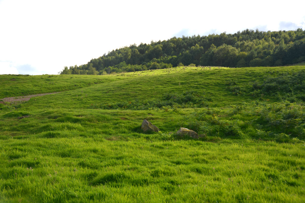
Carey Burn (Harthope Valley) submitted by Anne T on 31st Jul 2017. Looking westwards up Snear Hill to the second scooped settlement, which wasn't marked on the OS map. The western bank of this settlement can be seen running across the middle of the photograph, left to right.
(View photo, vote or add a comment)
Log Text: Carey Burn Votadinian settlement, Harthope Valley: After the beautiful Maiden/Pin Well, I got stuck on a 'precipice' above the Coldgate Burn trying to get to the Romano-British settlements to the west of North Middleton and bottled out (my dreaded fear of falling - I've subsequently found the map showed a low level, apparently straightforward footpath from North Middleton, although it was about a mile either way). After this experience, I need to try and regain my composure.
On the map, just across the road from the footpath we’d tried, and just west of Carey Burn Bridge, a track ran up the hill at NT 97513 24937, just above a currently empty barn. A settlement was shown here. An NNPA footpath ran up the hill, so we opened the gate and followed the path up.
We did find the settlement, but it looked as if a fence had recently been installed along the north western bank, crossing over part of it to the eastern side.
A long, low earth and stone bank about 1 metre tall and 2 metres wide ran parallel to the fence from NT 97353 24907 to NT 97301 24938 then curves around to the Carey Burn at NT 97337 25012. This bank can be seen on UK Grid Reference Finder.
On getting home, I discovered from Pastscape that the settlement we looked at was classed as Votadinian. There is a second settlement, which isn’t marked on the map at NT 97132488, which is further up the hill.
Carby Hill
Trip No.31 Entry No.5 Date Added: 30th Jun 2017
Site Type: Ancient Village or Settlement
Country: Scotland (Scottish Borders)
Visited: Saw from a distance on 24th Jun 2017. My rating: Condition 2 Ambience 4 Access 3
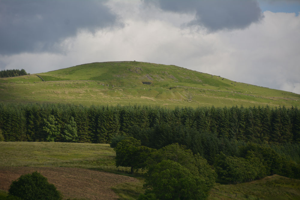
Carby Hill submitted by Anne T on 25th Jun 2017. We only saw Carby Hill Settlement from the Milnholm Cross just south of Newcastleton, then again from the track by the quarry just below the fort/settlement. When we arrived, we saw some enormous cattle grazing the site. Even my husband balked, and he was brought up on a farm and is used to these beasts. Looking forward to a return trip in the not too distant future - it looks amazing.
(View photo, vote or add a comment)
Log Text: Carby Hill Settlement, Scottish Borders: We only got to see this from a distance because of the ENORMOUS cattle grazing it's slopes. Even my husband, who was brought up on a farm was wary of these beasts. We plan to come back for a repeat visit in a month or so. Whilst the hill looks steep, from the path from the nearby quarry towards the base of the hill, the climb didn't look too bad.
Carby Hill
Trip No.73 Entry No.1 Date Added: 14th May 2018
Site Type: Ancient Village or Settlement
Country: Scotland (Scottish Borders)
Visited: Yes on 13th May 2018. My rating: Condition 3 Ambience 5 Access 4

Carby Hill submitted by Anne T on 25th Jun 2017. We only saw Carby Hill Settlement from the Milnholm Cross just south of Newcastleton, then again from the track by the quarry just below the fort/settlement. When we arrived, we saw some enormous cattle grazing the site. Even my husband balked, and he was brought up on a farm and is used to these beasts. Looking forward to a return trip in the not too distant future - it looks amazing.
(View photo, vote or add a comment)
Log Text: Carby Hill Hillfort/Settlement, Scottish Borders: Literally just across the border from England, we parked by the cattle grid at NY 48834 83744, opposite the bungalow/farm. Just to our south east, there was (unusually for Scotland) a footpath sign which led up to the hillfort, so we decided to follow it. A mistake. The gate into the field of sheep was wired shut, so we had to duck under the electric fence. Following the slope uphill, we had to tackle three or four deep field drains, full of running water.
It wasn’t until we got towards the top of the slope that the walls of the settlement came into view. And what walls.
This is a really brilliant site. The last time we tried to get up here, there was an absolutely monumentally huge bull and cattle on top of the hill. This time, there were only sheep and their lambs. With 360 degree views, it was superb.
The interior of the hillfort is not large, but we made out four, if not five, hut circles, still with their banks intact, plus a watchtower in the north eastern corner.
Not much of the walls remains on the north/north eastern side, but there are lower banks of stones. We walked round the outer edge of the wall, to where stones have been piled up to form a modern cairn, overlooking the Liddel Water valley below. We descended the hill from the western side of the hillfort, which avoided the field drains, and a much easier walk.
Canongate Mercat Cross
Trip No.153 Entry No.2 Date Added: 9th Oct 2019
Site Type: Ancient Cross
Country: Scotland (Midlothian)
Visited: Yes on 1st Oct 2019. My rating: Condition 3 Ambience 4 Access 4
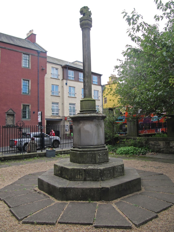
Canongate Mercat Cross submitted by Anne T on 9th Oct 2019. Standing in the NE corner of the courtyard, looking SW to Canongate. The cross looks modern, but then Canmore (and British Listed Buildings) tell us that the octagonal cross shaft is original; the rest are 'modern' replacements.
(View photo, vote or add a comment)
Log Text: Canongate Mercat Cross: Again, we found this cross by chance by following the clues on the "Old Edinburgh Town" Treasure Trail, whilst looking for the answers to two clues within the churchyard. I am sure I annoyed my friend by stopping to photograph all the sites of ancient crosses and wells that we came across, as our 2 hour 'trail' took 4 hours (although this included a coffee and cake stop, too).
Never really having explored Edinburgh Old Town, I was really surprised to find out how much, and how historic, Canongate and surrounding area is.
Camp Hill (Catcherside)
Trip No.119 Entry No.5 Date Added: 28th Feb 2019
Site Type: Hillfort
Country: England (Northumberland)
Visited: Yes on 24th Feb 2019. My rating: Condition 3 Ambience 4 Access 4
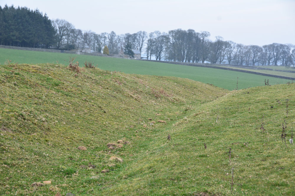
Camp Hill (Catcherside) submitted by Anne T on 28th Feb 2019. Standing in the deepest part of the ditch towards the north western part of the hillfort, looking north east towards Catcherside Farm.
(View photo, vote or add a comment)
Log Text: Camp Hill Hillfort, Catcherside, Knowesgate: We drove up to Catcherside, which was very obviously a very well looked after cluster of farmhouses with a common courtyard between. As Andrew was looking for somewhere to park, a man walked out of Catcherside Cottage so I leapt out of the car and asked if it would be OK if we could park for 20 mins to go and look at the settlement. He said it was his daughter’s farm, but went away to ask, came back and said that was OK. As Andrew came back from parking a little way out of the lane, he hadn’t brought my walking poles, so the gentleman lent me one of his. Nice!
As we walked by the gate into the garden of the cottage, I spotted a carved stone at NY 99191 87596, which looked like a round cross or pillar base (reminded me of the one we saw at Bamburgh Castle in the Stones Museum).
The farmland here looks really fertile, and the sheep were magnificent. The hillfort has been ploughed out on the southern and south western side, but the ditch, rampart and hollow way through the entrance on the north western sides are still clear. We did look for signs of structures within the oval platform at the top of the hill, but these looked as if they had been ploughed out by rig and furrow. A really nice walk on a warm February evening.
Callaly Castle Hillfort
Trip No.67 Entry No.5 Date Added: 20th Mar 2018
Site Type: Hillfort
Country: England (Northumberland)
Visited: Yes on 21st Feb 2018. My rating: Condition 2 Ambience 3 Access 3
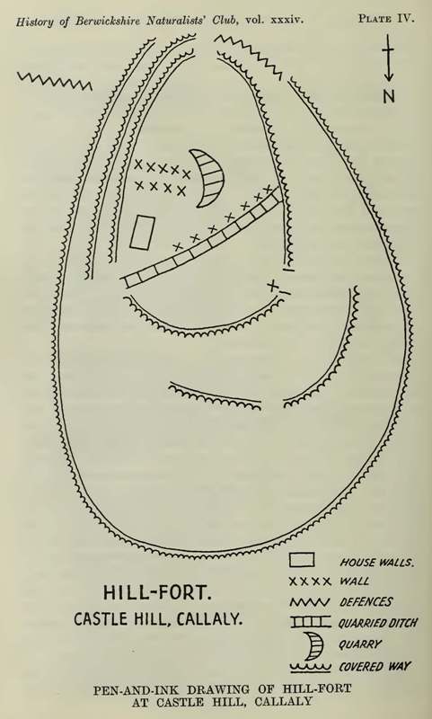
Callaly Castle Hillfort submitted by durhamnature on 10th Sep 2012. Callaly Castle hillfort, from Berwickshire Naturalists via archive.com.
(View photo, vote or add a comment)
Log Text: Castle Hill Hillfort, Callaly: After Millstone Burn Standing stone, there was time for one more visit before dusk. Andrew had marked this site on the map, so we drove round to the permissive footpath which led up through the deciduous wood to the top of the hill.
It was a very good job that we’d worn wellies, as the path was ankle deep in mud in parts. The site was so overgrown that we barely recognised the outer defences as we approached from the north west,
The interior of the hillfort was very rocky. Whilst the plan of the hillfort looks fascinating, much of it is hidden by the tall bracken and trees growing within and without. Some great fungi and a lovely walk, though.
Cale Cross (Newcastle)
Trip No.148 Entry No.2 Date Added: 9th Sep 2019
Site Type: Ancient Cross
Country: England (Tyne and Wear)
Visited: Yes on 7th Sep 2019. My rating: Condition -1 Ambience 3 Access 5
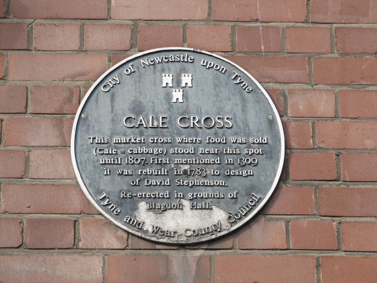
Cale Cross (Newcastle) submitted by Anne T on 9th Sep 2019. The blue plaque is currently the only sign that the Cale (or Cabbage) cross stood at or near this location.
(View photo, vote or add a comment)
Log Text: Site of Cale Cross (Newcastle): The plaque commemorating this cross is attached the eastern wall of what I think is 3, Akenside Hill (or possibly Akenside House), on the Quayside, just to the west of the A167 where it is about to go south over the Tyne Bridge, and just north-north-east of the Swing Bridge.
The building sits at the junction of Dean Street and Queen Street, just before Dean Street meets Sandhill (the B1600) and Quayside. I imagine in olden times, this would have been the ideal place for a market.
It was the afternoon before the main Great North Run and Quayside was hugely busy with other races starting and finishing. What a crowd, but a lively, friendly atmosphere. I had great fun finding my way back up the hill through tiny lanes I didn’t know existed, passing the Church of All Saints, a huge viaduct, some of the old city walls and Castle Keep.
The plaque reads: “City of Newcastle upon Tyne. Cale Cross. This market cross where food was sold (cale = cabbage) stood near this spot until 1807. First mentioned in 1309 it was rebuilt in 1783 to design of David Stephenson. Re-erected in the grounds of Blagdon Hall Tyne and Wear County Council”.
If the original cross had gone to Blagdon Hall, I would have set off in search of it, but this is only the 1783 re-design.
Caiy Stane
Trip No.106 Entry No.2 Date Added: 5th Nov 2018
Site Type: Standing Stone (Menhir)
Country: Scotland (Midlothian)
Visited: Yes on 28th Oct 2018. My rating: Condition 3 Ambience 4 Access 5
Caiy Stane submitted by crannog on 22nd Feb 2012. Edinburgh council has to be commended for the care they take in preserving ancient sites/monuments, like this. It is located at the end of a street with lots of homes all around.
(View photo, vote or add a comment)
Log Text: The Caiy Stane, Edinburgh: It was a good job we had the SatNav to help us find this stone, as all the streets around were called ‘Caiy (something)’ and we could have been driving around for ages!
This is a magnificent stone, set back in a niche backing onto someone’s garden on Caiystane View. It is possible to walk all the way around it, so we saw the 6 cups marks and the more modern graffiti on the back face.
The small sign at the front base of the stone reads: “The Caiy Stone. The Property of The National Trust for Scotland.” The larger sign, on the low wall to the left of the stone reads: “The Caiy Stane. Standing at over nine feet high on a summit, originally with wide views, this broad slab of red sandstone includes a line of six, probably prehistoric, cup marks on its reverse face. / The stone may have been erected as early as the Neolithic period, possibly before 3000BC, to denote a ritual or burial place. Records of cairns, cists and urns found in the immediate vicinity show that the hilltop continued to be used for burial in the Bronze Age. / Discovery of these remains led to the supposition that Caiyside Hill was the site of a battle, variously suggested to have involved Romans, Danes (Vikings); ore Cromwellians. The Caiy Stane, also known as the Kel Stane, the Cat Stane or the Camus Stane, was thought to have been a battle memorial stone.”
Cairnweil standing stone
Trip No.136 Entry No.15 Date Added: 26th Jun 2019
Site Type: Standing Stone (Menhir)
Country: Scotland (Dumfries and Galloway)
Visited: Yes on 17th Jun 2019. My rating: Condition 3 Ambience 4 Access 4

Cairnweil standing stone submitted by Jackanol on 11th Nov 2016. I think this is quite an impressive stone. It's true there are telegraph poles close to it, but it still has a lot of presence.
Taken September 2016.
(View photo, vote or add a comment)
Log Text: South Carnweil Standing Stone: From Kirkmadrine Church, we travelled back along the road eastwards towards the A716, we stopped off to see this standing stone, by a wall, up a hill, but not quite at the top of the hill. It certainly is a big stone.
The road was narrow, so we bumped right up on the grass blocking a gated entrance to a field, ready to run back if we were causing an obstruction. After such a heavy rainstorm not half an hour before, we got quite wet walking up the hill, but it was worth it.
In some ways, this made up for not being able to see the stones at Kirkmadrine very well.
