Contributory members are able to log private notes and comments about each site
Sites Anne T has logged. View this log as a table or view the most recent logs from everyone
Stob Rig (Yetholm)
Trip No.37 Entry No.7 Date Added: 8th Aug 2017
Site Type: Misc. Earthwork
Country: Scotland (Scottish Borders)
Visited: Yes on 6th Aug 2017. My rating: Condition 2 Ambience 4 Access 3
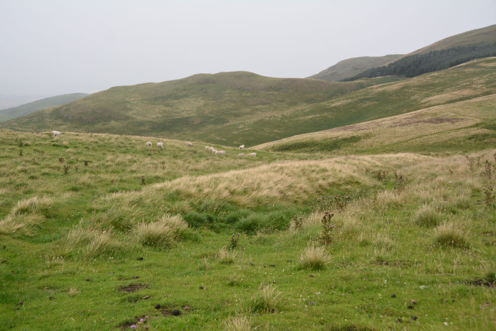
Stob Rig (Yetholm) submitted by Anne T on 7th Aug 2017. This is the eastern most of the banks with a slight ditch on its downhill side. The bank running parallel to it can be seen just on the horizon to the middle-left hand side of the photograph, delineated by the yellow grass growing on the bank.
(View photo, vote or add a comment)
Log Text: Stob Rig Earthworks: On the way up to the Stob Stones from the Pennine Way, there were two really obvious earthworks running in parallel towards the stones and we walked between them to reach the stones. I was keen to try and get out of the wind and the rain (almost impossible in this high, exposed spot) so didn't stop to photograph them.
On the way back down to re-join the Pennine Way, the earthworks were slightly less obvious. With the howling wind and the rain lashed sharply against my cheeks, I was tempted to put the camera safely in the rucksack, but having walked all this way up the hill, I wanted to document them.
In the end, I only managed to photograph the eastern most of the banks; the photos of the western-most had too many raindrops on the camera lens to be of any use.
Stob Stones
Trip No.37 Entry No.6 Date Added: 8th Aug 2017
Site Type: Standing Stones
Country: Scotland (Scottish Borders)
Visited: Yes on 6th Aug 2017. My rating: Condition 3 Ambience 4 Access 3

Stob Stones submitted by Anne T on 7th Aug 2017. Whilst the rain lessened for a moment, the hills at the western side of the Bowmont Water Valley came briefly into view!
(View photo, vote or add a comment)
Log Text: Stob Stones, Scottish Borders: From the Green Humbleton Scooped Settlement, by the time we started climbing up towards the Stob Stones, not only was the wind was howling and I was leaning hard into it, but the rain drops were like small pins being driven into my cheeks. I confess to getting a bit fed up and wanting to turn around at this point, but a long-held desire to see these stones kept me going. It was worth it.
Walking over the Stob Rig earthworks (I stopped to photograph these on the way down), the Stob Stones are two standing stones, one now broken and lying prone, sitting on a sort of promontory as the ground to the north and west drops steeply down. Canmore says these stones are at over 1,000 ft above sea level and are situated 230 yards west of the Border. They definitely sit on some kind of mound.
To the west lies the border between England and Scotland, and we walked a 100 metres or so further up the hill, just so we could see the stone wall which makes up the boundary. Tantalisingly, we could see cairns on the adjacent hillside, but being England, different rules for walking (and I was too wet to want to go on).
Stobo Kirk standing stone
Trip No.82 Entry No.9 Date Added: 24th Jul 2018
Site Type: Standing Stone (Menhir)
Country: Scotland (Scottish Borders)
Visited: Yes on 12th Jul 2018. My rating: Condition 3 Ambience 5 Access 4
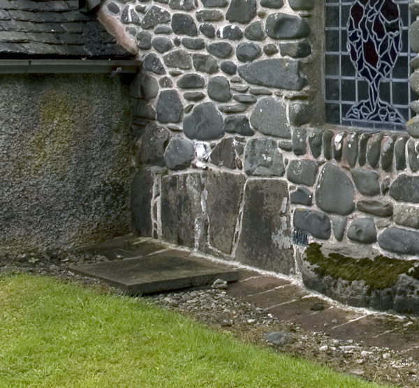
Stobo Kirk standing stone submitted by nicoladidsbury on 14th Oct 2007. Stobo Kirk - standing stone 2 - close up
(View photo, vote or add a comment)
Log Text: Stobo Kirk, Scottish Borders: This was the highlight of my visit. A church I’ve wanted to see for a long, long time, and I thought I’d better grab the chance whilst we were nearby. As we drew up outside the church, my heart sank, as it looked just like another austere Church of Scotland church. “This isn’t the church I saw on the Portal”, I said to Andrew, “their images are of a pebble built wall with standing stones in it.”
All was explained when we walked into the church and saw the north aisle chapel, from the inside first.
My photography skills were challenged trying to photograph the three large tombstones held by iron staples to the wall. This part of the church felt very old.
We looked at the long stone in the external west wall of the north aisle chapel carefully (due to the chairs in the chapel, we couldn’t really see much without removing several rows of tightly packed wooden chairs). At first glance, it looked as if it went from the south side of the window cill, southwards. Closer inspection made us realise it extended under the window as well.
We bought a guide book and a couple of the postcards of the stained glass windows, as by this time, it was getting quite late and it was at least another hour until we reached our bed for the night. Much too brief a visit - a return visit in bright sunshine is a must!
Stone of Mannan
Trip No.84 Entry No.9 Date Added: 26th Jul 2018
Site Type: Standing Stone (Menhir)
Country: Scotland (Clackmannanshire)
Visited: Yes on 14th Jul 2018. My rating: Condition 3 Ambience 4 Access 5

Stone of Mannan submitted by peigimccann on 27th Aug 2017. Stone of Mannan
(View photo, vote or add a comment)
Log Text: Stone of Mannan, Clackmannan: I was surprised to find this only about 20m east of the Mercat Cross (refer to that page for the rest of my visit report). Right next to the market cross and the Tolbooth. See the report above. I was interested to read the plaque on the eastern wall of the Tolbooth: “The Stone or Clack, originally placed at the foot of Lookabootye Brae, was sacred to the pre-Christian deity Mannan and is an unique relic of pagan times. It was raised on the large shaft in 1833”.
Strontoiller circle
Trip No.87 Entry No.4 Date Added: 29th Jul 2018
Site Type: Stone Circle
Country: Scotland (Argyll)
Visited: Yes on 17th Jul 2018. My rating: Condition 3 Ambience 3 Access 4
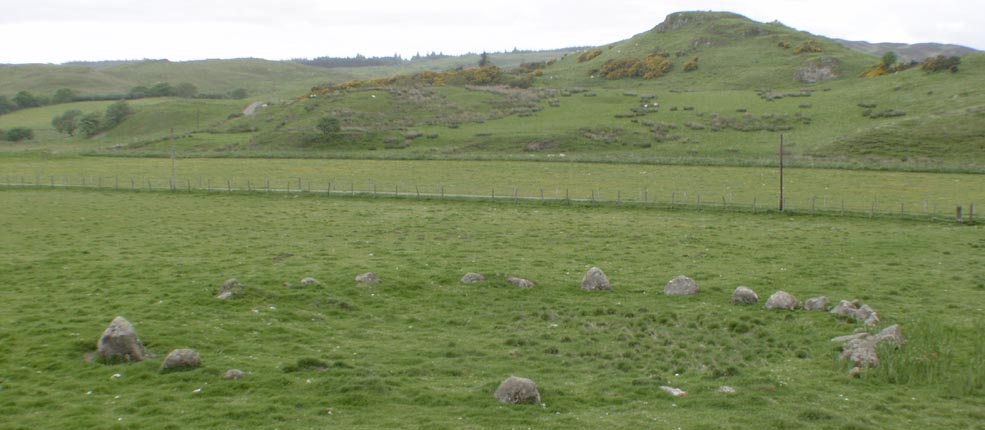
Strontoiller circle submitted by Tom_Bullock on 1st Mar 2005. Photo used by kind permission of Tom Bullock. More details of this location are to be found on his Stone Circles and Rows CD-ROM.
(View photo, vote or add a comment)
Log Text: Strontoiller Stone Circle, Lorn: After having taken a few photographs of the small cairn, we walked a couple of hundred yards back along the road to the gate in the field, which is at the corner of the road and the track to Strontoiller farmhouse/cottage. It was a short walk over the pasture to the stone circle – whilst we could see a few stones, mainly the cluster at the northern side (which looked a little like large toadstools popping their heads above the grass), the circle was largely hidden by tall grass and marsh grass.
I was amazed how close the stones were to each other; I’d read about one small stone circle where the stones had been touching, but there were definite gaps between the stones. I thought at first that the stones towards the NNE were part of a ‘double row’, but reading Canmore when I got access to the internet, Canmore says these are four stones which have probably been displaced.
I didn’t get the usual sense of atmosphere at this stone circle, unless others I’d been to, although this was a very pleasant spot, and had three other monuments within a few hundred yards (a small cairn, large cairn and a spectacular standing stone). Worth seeing, and I’d glad we’d stopped. We then strolled the 75m or so to investigate the larger cairn in the field.
Strontoiller Large Cairn
Trip No.87 Entry No.5 Date Added: 29th Jul 2018
Site Type: Cairn
Country: Scotland (Argyll)
Visited: Yes on 17th Jul 2018. My rating: Condition 2 Ambience 3 Access 4
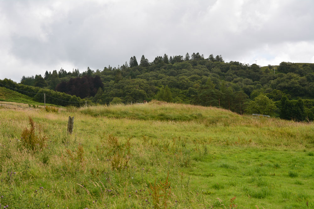
Strontoiller Large Cairn submitted by Anne T on 29th Jul 2018. The larger of the two cairns in this field, as seen from the east of the stone circle.
(View photo, vote or add a comment)
Log Text: Strontoiller Round Cairn, Lorn: This cairn is just to the south west of the stone circle. From the stone circle, it definitely looks like a grassed-over round cairn. As we walked over to it, on our way back to the standing stone, I was not convinced we were looking at the right thing, but the GPS and its position in relation to the stone circle and the standing stone were correct.
In actual fact, looking back on the photographs, and now having seen a number of large, circular, stony cairns, I realise what I was looking at, and wished I’d taken more notice at the time (well, I confess to being keen to see more standing stones before having to head off back to the cottage).
Sunderland Museum and Winter Gardens
Trip No.152 Entry No.2 Date Added: 26th Sep 2019
Site Type: Museum
Country: England (Tyne and Wear)
Visited: Yes on 20th Sep 2019. My rating: Condition 4 Ambience 4 Access 5
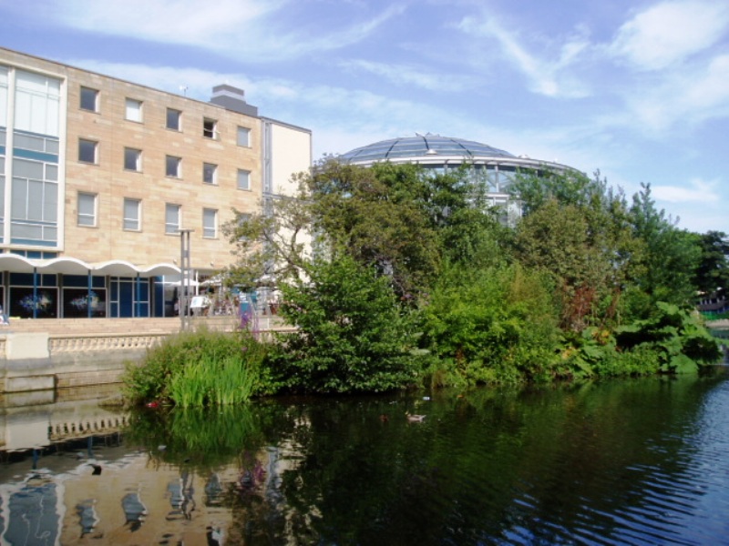
Sunderland Museum and Winter Gardens submitted by durhamnature on 21st Aug 2012. Sunderland Museum, in Mowbray Park
(View photo, vote or add a comment)
Log Text: Sunderland Museum: Despite having been here for many meetings and conferences over the years, I've never wandered around this museum - a series of permanent and special displays in themed rooms off the main corridor leading from the main entrance/gift shop to the cafeteria.
Having spent longer than we thought (well, it was VERY interesting!) at St. Peter's, we knew we didn't have time to go the Minster to see their stones collection before shutting to visitors at 2.30pm, so came here instead (it was supposed to be our third, and last, stop of the afternoon).
We focused mainly on the Secrets of the Past Exhibition on the ground floor, which has some of the Anglo Saxon stone fragments recorded by the Corpus of Anglo Saxon Stone Sculpture. Not all of them (mostly the smallest) fragments were on display, so I have asked if it's possible for us to see, and photograph, these.
There were also prehistoric cists with grave goods, stone axes, jewellery, and other artefacts on display.
The museum seemed largely deserted at this time of day, apart from a few people coming down the staircase at the rear of this exhibition hall.
We enjoyed a rather large, and tasty, lunch in the cafeteria before leaving.
Swinburne Stone
Date Added: 15th Jun 2014
Site Type: Standing Stone (Menhir)
Country: England (Northumberland)
Visited: Yes on 13th Jun 2014. My rating: Condition 3 Ambience 4 Access 4
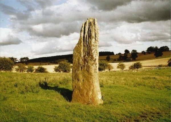
Swinburne Stone submitted by Bladup on 30th Dec 2013. The lovely tall and slender Swinburn Castle standing stone.
(View photo, vote or add a comment)
Log Text: We sought the landowner's permission prior to visiting the stone. We parked outside the Roman Catholic Church at Ox Hills, and walked back to the footpath leading firstly to Swinburne Castle, then splitting off to the left at a large tree to tumuli and the standing stone.
The footpath is easy walking. Almost immediately to the left are some impressive earthworks (possibly related to the original castle?) and some large terraces - much bigger than normal ridge and furrow ploughing. Websites from local historians say these may be medieval strip lynchets.
We first visited the tumuli just before a gate/field boundary crosses the path, before doubling back to the gate which allowed access to the field with the stone (there being sunken stone walls between the footpath and the field boundary, presumably allowing views of the stone from the upper floors of the castle (now private house).
The stone isn't visible from the footpath, but as soon as you top the brow of a small hill, the stone stands below you in the middle of the field.
The stone is impressive, being around 12 feet tall, and if the compass on my phone is correct (it switched 180 degrees several times during my visit) the wider faces are orientated north-north-west/south-south-east.
The southern face of the stone has some easily identifiable cup marks; generally there are quite a few initials carved into the stone.
There are also a couple of other tumuli, which are in private fields, but this is beautiful and peaceful part of the countryside, and we spent a very pleasant afternoon exploring.
Swinside
Date Added: 7th Jul 2014
Site Type: Stone Circle
Country: England (Cumbria)
Visited: Yes on 5th Jul 2014. My rating: Condition 4 Ambience 5 Access 3
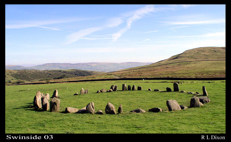
Swinside submitted by rldixon on 15th Jan 2006. Swinside well worth the walk
(View photo, vote or add a comment)
Log Text: After an afternoon spent visiting the Shap Stone Row, my husband was particularly keen to see Swinside Stone Circle, so we took an additional hour to travel to this site. I have to say it was well worth the visit, and I would very definitely go again.
We parked in a small layby just down from Cragg Hall and walked up the marked public bridleway to Swinside (Sunkenkirk) Stone Circle. The first part of the track was steep, but concreted and thankfully short; the rest of the walk was relatively level and had magnificent views. Visibility during our visit was amazing, and we estimated we could see a good 30 miles to the eastern lakes in the far distance. The tide was out, but we had a good view of (what I am assuming from my limited map reading skills!) Duddon Sands in the estuary below until the land levelled out and we could see the circle in the far distance ahead of us.
Surprisingly, we were passed by two separate cars heading up to the farmhouses further up the track - what a remote, but very lovely place to live.
The circle surpassed my expectations. It had a wonderful atmosphere, and I would happily have stayed there until sunset, which, being summer, was a good 5 or 6 hours away, and sadly we had to get home the same evening.
My photographs aren't as good as some of the ones already on the Portal website, so in the images I've submitted, I've tried to pick out some of the features which stood out for me, which include the portal stones at the entrance to the circle.
On reflection, I think we should have climbed up Swinside Fell to get a distant shot of the circle, which would have completed my album for the circle. Next time.
Just to note that in the fields to either side of the bridlepath (particularly the right hand side) leading up to the circle, there were a large number of what appeared to be shaped stones, and we wondered if at one time there had been an avenue leading up to the circle. I've submitted a picture of one stone which has a striking resemblance to the stone in the circle with the quartz banding across it.
Talla Linnfoots
Trip No.82 Entry No.1 Date Added: 23rd Jul 2018
Site Type: Cairn
Country: Scotland (Scottish Borders)
Visited: Saw from a distance on 12th Jul 2018. My rating: Condition 2 Ambience 3 Access 4

Talla Linnfoots submitted by Anne T on 23rd Jul 2018. I'm not sure if I've photographed the right monument, as we couldn't get through the tall, very long deer fence, but this is the site estimated from the map and using our GPS to help. The enclosure lies some 100m to the north west of this 'cairn', which is the grassy lump which runs across the middle of the photograph.
(View photo, vote or add a comment)
Log Text: Cairn & Enclosure at south eastern end of Talla Reservoir: Our first, proper, stop of the day, as I can’t count the visit to Tweedmuir Kirk, as the stone we saw from from the 1600s.
This is a remote, but very pretty spot, albeit with tall, brooding hills around, only tempered by the gentle trickling of the Coddleteth Burn, Games Hope Burn and Talla Water, which join up before entering the reservoir lake.
We were prevented from getting right up to this cairn and enclosure by a long, continuous deer fence. I think I’ve photographed the cairn, but we had difficulty in seeing the enclosure on the ground.
The enclosure can just be seen, very faintly, on UK Grid Reference Finder.
Tamlane's Well (Carterhaugh)
Trip No.158 Entry No.4 Date Added: 5th Mar 2020
Site Type: Holy Well or Sacred Spring
Country: Scotland (Scottish Borders)
Visited: Yes on 27th Feb 2020. My rating: Condition 3 Ambience 4 Access 5
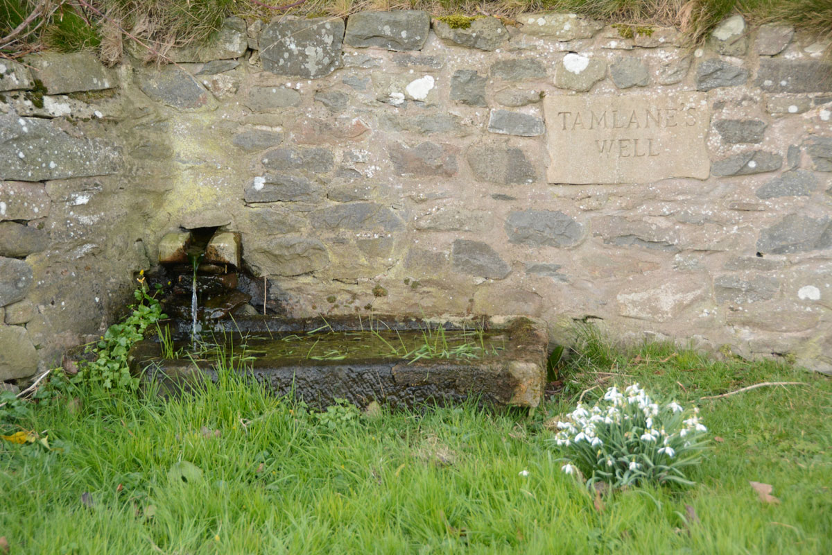
Tamlane's Well (Carterhaugh) submitted by Anne T on 5th Mar 2020. Getting closer to the well trough. The water must drain from the stone trough into a modern drain, about a metre in front of the current structure, then through a pipe under the road into a small stream/field drain in the field to the south.
(View photo, vote or add a comment)
Log Text: Tamlane's Well, Carterhaugh: A delightful spot, next to the single track B7039, parts of which aren’t terribly well defined (and we ended up in a very large farmyard, having taken a wrong turn!). The well is located right by the road, in a small grassy area just to the south of a large set of the Carterhaugh farm buildings/barns, although separated it by a dry stone wall. Whilst the original well was some 2.5m behind the wall, and is now filled in, the well is now presented in a nice way, presumably to allow visitors to access the well, which was really good of the farmers.
There was a steady flow of water into a trough which then drained into a modern manhole about a metre to the south of the well trough.
Temple of Mithras (Carrawburgh)
Trip No.140 Entry No.5 Date Added: 23rd Jun 2019
Site Type: Ancient Temple
Country: England (Northumberland)
Visited: Yes on 23rd Jun 2019. My rating: Condition 3 Ambience 4 Access 4
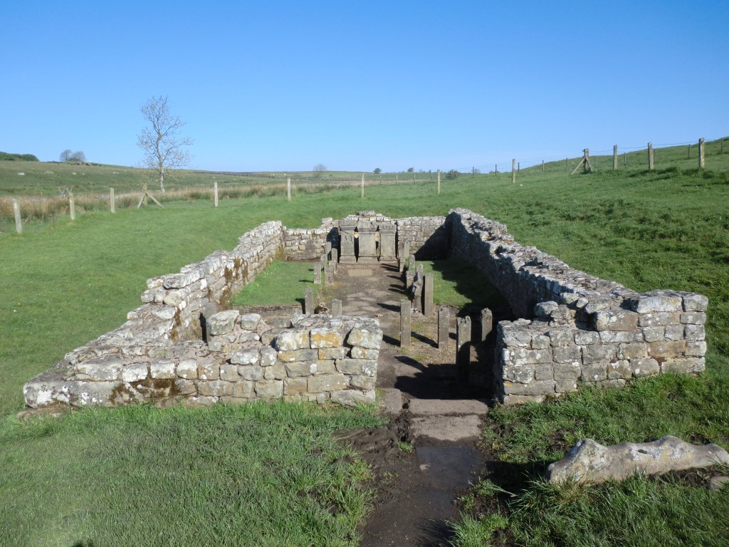
Temple of Mithras (Carrawburgh) submitted by johndhunter on 15th Jun 2019. Temple of Mithras - May 2012
(View photo, vote or add a comment)
Log Text: Temple of Mithras, Brocolita: This being a Sunday, there was a constant stream of visitors, most of whom ignored the fort and came straight down to the temple. I had hoped for bright blue skies and fluffy white clouds, which there had been at Great Chesters a couple of hours earlier.
Nothing much in the temple had changed since 2014, although I spotted more details on the altar stones this time, and took a few more photographs. Having just re-read Pastscape 1013363, "Replicas of the internal fittings have been fitted in cast stone", which came as a bit of a surprise!
Temple Wood N
Trip No.87 Entry No.13 Date Added: 4th Aug 2018
Site Type: Stone Circle
Country: Scotland (Argyll)
Visited: Yes on 17th Jul 2018. My rating: Condition 3 Ambience 4 Access 4
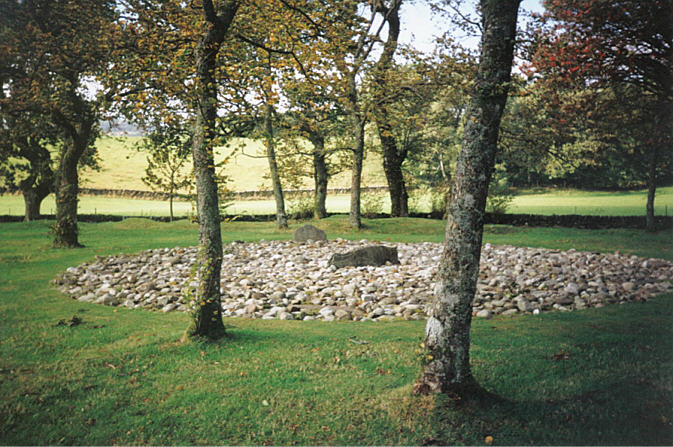
Temple Wood N submitted by hamish on 6th Aug 2005. Temple Wood North. I love this place,enigmatic as always.Being among the trees makes it so different.It's beautiful.
(View photo, vote or add a comment)
Log Text: Temple Wood North East circle: Within sight of the Temple Wood South West circle (I got my bearings all confused here!). This cairn has obviously been recreated, with concrete posts and blocks representing post holes and kerb stones. Nicely done.
Temple Wood S
Trip No.87 Entry No.12 Date Added: 4th Aug 2018
Site Type: Stone Circle
Country: Scotland (Argyll)
Visited: Yes on 17th Jul 2018. My rating: Condition 3 Ambience 4 Access 4
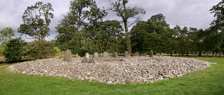
Temple Wood S submitted by funsize on 4th Jun 2007. This is a cracking site. Large cobble mound with slivers of upright slabs and a central cist. Very accessible and one of many impressive sites within a small area of the Kilmartin Valley. This shows the larger cairn, there is a smaller one ringed by trees a stones throw to the south west.
(View photo, vote or add a comment)
Log Text: Temple Wood South West Circle: We had this site all to ourselves for all of five minutes before other parties followed us in. We did look for the rock art quite carefully, but were unable to find it.
The Anker's House
Date Added: 2nd Oct 2014
Site Type: Ancient Cross
Country: England (County Durham)
Visited: Yes on 25th Sep 2014. My rating: Condition 4 Ambience 5 Access 5
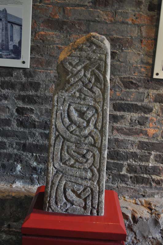
The Anker's House submitted by Anne T on 30th Sep 2014. Upper part of cross-shaft from the first half of tenth century.
Anglo-Saxon Stone Sculpture reference = Chester-le-Street 02.
(View photo, vote or add a comment)
Log Text: The Anker House (Anglo Saxon Cross Shafts and Cross Arms): The purpose of my visit was to see the Anglo Saxon cross fragments, but the impact of this visit is still with me today - the tiny little Anker House and what it meant to commit yourself to the rest of your life in this tiny village was quite a spiritual awakening for me.
I am very nervous about driving to places I've never been to before, and I was a bit of a quiver thinking about how to drive to Chester-le-Street and find the church. From Bywell, rather than drive the longer way down the A695/A1, I went down the B6309/A693, which was easy enough, as it was signposted Beamish Museum then Chester le Street.
Chester le Street was actually bigger and busier than I remembered from a visit to Langley Castle for a conference many years ago, but the spire of the church stood proud behind the shops on the left hand side of the main shopping street, so at the roundabout at the edge of the shops, I turned left and found two car parks straight away. Parking was only 80p for 3 hours (the machine wasn’t accepting certain coins so I was committed to paying 80p or £1) and the Ankers House was signposted from the car park. It was only round the corner.
Wow. I am so pleased I took the time to come here.
When I first arrived, the ladies couldn’t find the key so I had to wait for someone to come back to the church from the Parish Office (which wasn’t long really) and the ladies kept me engaged in conversation, pointing out the squint from the built in Anchorite House and the slot where food was pushed through into the house.
The house was quaint and minute and ancient. It has been extended in modern times, but it was easy enough to get an idea of what it would have been like. The stewards told me that before the Anchorite was walled up in the house a funeral service was held in the church for them so they could say ‘goodbye’ to the real world.
Whilst the atmosphere in the museum was quiet and gentle it was also somewhat spooky and it was very odd to be shut in there alone. I sort of hurried to get through taking my photos, especially as the door to the outside world kept banging in the breeze. Some of the items were apparently on loan to a Lindisfarne Gospels exhibition (the lady said I should speak to ‘Mike’ but no further details).
They had a copy of the Lindisfarne Gospels in the church – apparently they were translated from Anglo-Saxon to Latin on this site. Kept in a glass case and covered with a red cloth, the ladies lifted the cloth to give me a sight of this impressive (modern) copy. A superb afternoon. Shame the museum is not open again until next spring.
The Boat Stone
Trip No.83 Entry No.6 Date Added: 24th Jul 2018
Site Type: Standing Stone (Menhir)
Country: Scotland (Perth and Kinross)
Visited: Yes on 13th Jul 2018. My rating: Condition 3 Ambience 4 Access 4
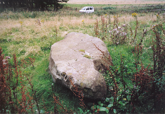
The Boat Stone submitted by hamish on 23rd Jul 2005. After you have been to Sherriffmuir Stones keep on up the road. Don't try to find Wester Briggs Circle, it's hidden in the heather. Just down the road past the woods on the left is the Boat Stone. You have to clamber over the stone wall with a barbed wire topping to get to this stone. Nearly broke my leg but survived.
(View photo, vote or add a comment)
Log Text: The Boat Stone, Sheriffmuir to Dunblane lane: Marked on the OS map, but not on Canmore, this fallen standing stone is featured on the Portal and The Northern Antiquarian. The road is single track at this point, with not many passing places. The farmer had left the gate into the field wide open, and it was dry, bare soil. We dared to pull the car just inside the gate.
The farmer had heaped a beautifully large pile of maturing manure between the gate and the stone, so I took a slightly wider berth round this than I might have, with the heat and the flies!
This large stone is impressive. It sites on a mound (I walked around it to photograph it and had to step up the mound to get to the top of the stone) and has some lovely quartz inclusions.
The Butter Stone
Trip No.44 Entry No.2 Date Added: 10th Sep 2017
Site Type: Standing Stone (Menhir)
Country: England (County Durham)
Visited: Yes on 9th Sep 2017. My rating: Condition 3 Ambience 3 Access 4
The Butter Stone submitted by durhamnature on 16th Jul 2012. The Butter Stone, the hills of Teesdale in the background.
Site in County Durham England
(View photo, vote or add a comment)
Log Text: The Butter Stone, Cotherstone: From the cross base, we continued along the B6277, turning onto the minor road from Cotherstone towards the Battle Hill Ranges. We hadn’t expected to turn from pasture and woodland almost straight onto a moorland road.
From the turning in Cotherstone to the Butter Stone is almost 1.7km. Just passing a farm entrance to the east of the road, the stone is almost immediately to the west, about 25 metres from the side of the road. A narrow grassy footpath leads from the road to the stone, which appears to be a well eroded natural erratic. It just about shows above the tussocky grass around it.
A old penny had been glued into a hollow in the top of the stone, and in the other hollows around the outside of the stone there were 20 pence pieces slotted into them.
I was surprised to find this stone was used as an exchange/boundary point during the 17th century plague, and it is sited just below the brow of the hill.
The Castles
Date Added: 4th Aug 2014
Site Type: Stone Fort or Dun
Country: England (County Durham)
Visited: Yes on 3rd Aug 2014. My rating: Condition 3 Ambience 4 Access 4
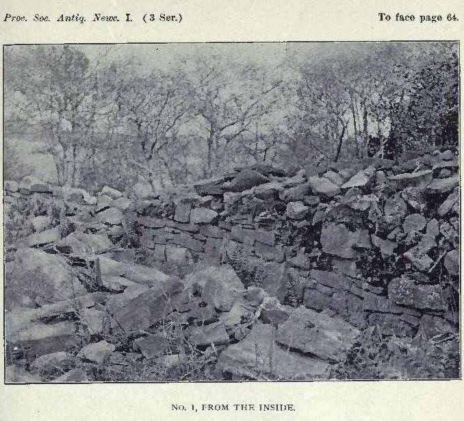
The Castles submitted by durhamnature on 24th Aug 2012. View from inside The Castles. 1903 image of archaeological investigation.
Site in County Durham England
(View photo, vote or add a comment)
Log Text: We’d come across mention of this site from Time Team Series 15 episode 11 (“5000 tons of stone”) in 2007, and noted it because it was a site relatively local to us. Being late on a windy, but sunny, Sunday afternoon, and wanting to go out somewhere without going far, we decided to head off to Hamsterley to see if we could find this site.
Following the signs for Hamsterley village from the A68, we went through the village along Saunders Avenue, turning first right up Bedburn Road when almost through the village, then first right again along Howlea Lane. I didn’t measure the distance from Hamsterley village, but it is at least several kilometres along this lane. West Shipley Farm doesn’t have a sign outside, but having spotted a sign for Shipley Moss Farm, we knew we were close.
West Shipley Farm is the next farmhouse on the left hand side of the road, and has a wide entrance to the farm track, so we bumped up on one side. The track goes past the farmhouse, then a stile crosses a stone wall (broken right hand post on the far side, so be careful – having fallen heavily during a walk the weekend before, I ended up going back to the gate to the field and walking around), and down hill to what I believe is the Harthorpe Beck valley below.
To the left hand side of the track, there is a modern curving stone wall with a wooded area behind. Between the trees, we could see tantalising glimpses of hefty stone walls. Following the modern stone wall, there is a gate towards the southern end of the field, at approximately grid reference NZ 10269 33059, which took us straight into the un-farmed field containing The Castles.
This is certainly an intriguing site. We gained access by walking across the ditch (not deep in the south west corner) and clambering up a fallen section of wall in the same area – following tracks where other people have done this).
Once inside the Castles, you are immediately within a large stone-built enclosure, away from the wind and very, very quiet and peaceful. There are vast dry stone walls, largely tumbled, but with the lower courses very much in tact. Having walked around the inside of the walls, there appears to be only one entrance, to the east of the site, and this contains a ‘guard room’, or small room, built within the wall itself. A ditch runs around the whole exterior of The Castles, although there is enough flat land between the exterior stone walls and the ditch to walk around the circumference of the walled area (avoiding trees occasionally). The eastern entrance leads down to a stream, which helps to form the eastern boundary.
The site itself is on a slope, half way down the hillside, somewhat similar to Maiden Castle in North Yorkshire, but rather than having a levelled interior like Maiden Castle, the site itself slopes downhill to the stream below, which would make no sense if the site had been occupied. However, the site was wooded and overgrown, so it was very difficult (virtually impossible) to make out any internal ground features.
I went onto the Wessex Archaeology web site when I returned home, and downloaded their archaeological evaluation and assessment for the site. They note that the site is likely to be iron age, although they had very few (virtually no!) finds, and is of rhomboidal, describing an area some 81.26m (west)/85.6m (east) by 65.83m (north)/79.5 m (south), with the wall in the east being thickest – 7m wide at the base.
Certainly enigmatic!
The Chesters
Trip No.52 Entry No.8 Date Added: 10th Oct 2017
Site Type: Hillfort
Country: Scotland (East Lothian)
Visited: Yes on 27th Sep 2017. My rating: Condition 3 Ambience 4 Access 4

The Chesters submitted by uisdean on 1st May 2008. Southerly ramparts of The Chesters. The hill overlooking the fort can be seen rising to the left of the picture.
(View photo, vote or add a comment)
Log Text: The Chesters Hillfort, East Lothian: Most places we drove past today had signposts to The Chesters, so reluctant to go back to the house before dark, we decided to stop off and look at this hillfort, which I thought must have been visited by many other Portal users/members, but only uisdean has submitted photographs – I was very surprised.
There is a small car park near Dalvreck Farm House, with a signposted walk through (at this time of the evening) a dark wood. This opens out into a meadow, which has tall wire fences all around it, “to prevent rabbit damage”, and to my horror, a very tall stile leading over another fence into the fort itself.
Actually, this stile was one of the easiest I’ve ever used to get over, as it had supports at the top to let me stand upright and feel balanced and secure, before clambering down the other side.
This is certainly a complex site. I was fascinated by a large boulder to the east of the site, and there is also an unknown part of the meadow to the north.
We tramped around, enjoying the quiet and the complexity of the site, until dusk fell really heavily and we decided it was time to go back and have something to eat.
The Cockpit
Date Added: 1st Jul 2014
Site Type: Stone Circle
Country: England (Cumbria)
Visited: Yes on 28th Jun 2014. My rating: Condition 3 Ambience 4 Access 3
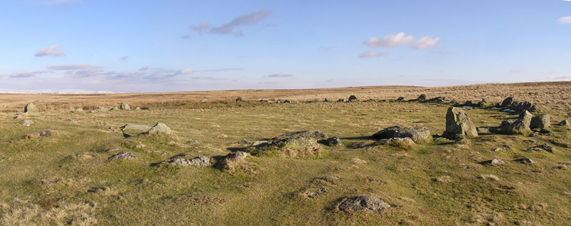
The Cockpit submitted by LivingRocks on 18th Mar 2005. A panoramic view of the Cockpit Stone Circle which according to Magicmap ‘includes a circular kerbed stone bank 2.8m -11.2m wide and up to 0.5m high which encloses an area approximately 27m in diameter. There are 27 (?) standing and recumbent stones set largely into the internal face of this bank, thereby creating the stone circle. The tallest standing stone measures about 0.95m high and some of the recumbent stones are up to 1.9m in length. Within the eastern side of the stone circle, abuttin...
(View photo, vote or add a comment)
Log Text: Almost at the course of High Street Roman Road, there is a view of Ullswater from the footpath just below the Cock Pit Stone Circle.
As the circle is on a good footpath, most of the people stopped at the circle. It's always nice to see people appreciate ancient sites, but I had to wait quite a while to get take photographs without anyone else in it! We found a couple of the outlying stones, and identified a couple of cairns nearby, but couldn't get good enough photographs to make these out properly.
By standing just below the circle, on the main footpath, it's possible to make out the bank.
Well worth a visit, and the view of Ullswater and Pooley Bridge below was worth the easy walk.
