Contributory members are able to log private notes and comments about each site
Sites Anne T has logged. View this log as a table or view the most recent logs from everyone
Dunning
Trip No.84 Entry No.2 Date Added: 25th Jul 2018
Site Type: Standing Stone (Menhir)
Country: Scotland (Perth and Kinross)
Visited: Saw from a distance on 14th Jul 2018. My rating: Condition 3 Ambience 3 Access 4

Dunning submitted by Nick on 5th Nov 2002. The stone looking north
(View photo, vote or add a comment)
Log Text: Dunning North Standing Stone: From St Serf’s church, we walked along Kirk Wynd, down alongside the stream, down past some cottages, to where the footpath split. The standing stone was right in front of us, albeit in the middle of a ripening crop of wheat. It seemed very far away, and I was very, very reluctant to trample any of the crop, so we stuck to the footpath. With the camera lens on maximum zoom I tried to capture the different faces of the stone, but as the footpath ran roughly west-east, we couldn’t really get close.
The guide in the church told us there were two standing stones nearby; most people visited the northern (this) stone, but apparently not many people went to the southern stone.
If the field hadn’t been set with a crop, I’d have been tempted to look for the gate, or an alternate route to get closer.
Our next stop was to the very peculiar "Maggie Wall Monument", 1km west of Dunning on the B8062. This is a 20ft tall monument topped by a cross to a witch called Maggie Wall who was apparently burnt in 1657. The stories I've all tracked down say Maggie Wall didn't exist. This monument definitely made me shiver!
Forteviot Cross
Trip No.84 Entry No.4 Date Added: 25th Jul 2018
Site Type: Sculptured Stone
Country: Scotland (Perth and Kinross)
Visited: Yes on 14th Jul 2018. My rating: Condition 5 Ambience 4 Access 5
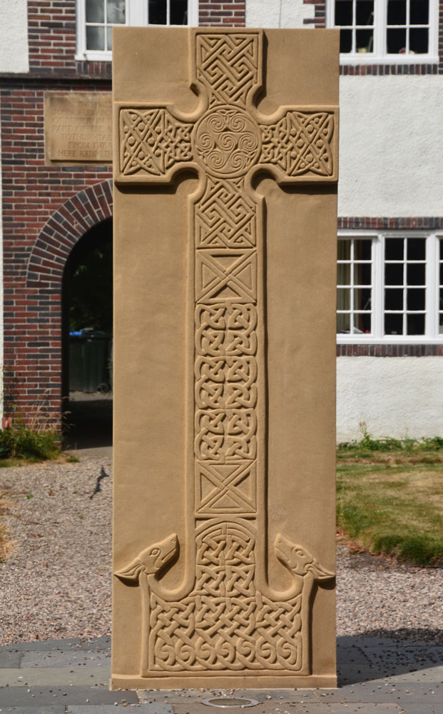
Forteviot Cross submitted by Anne T on 25th Jul 2018. The front of this modern Pictish cross slab, only unveiled in mid-March this year.
(View photo, vote or add a comment)
Log Text: Modern Pictish Cross Slab, Forteviot: Having been spooked by the Maggie Wall Memorial and disappointed at not being able to get into Forteviot parish church (St. Andrews), the lady gardener told us to walk down the road to look at the new cross slab that had just been erected.
Just behind the bus-stop, and in front of a charming courtyard of whitewashed houses, we found out later this cross had been erected only on either 17th or 18th March 2018, so very new.
The lady gardener told us there were some leaflets ‘in the bus stop’ and indeed there were several tucked underneath the bus timetable board. The cross was carved by David McGovern, of Monikierockart for the 2017 Tay Landscape Partnership project. “In the form of a Pictish Cross Slab, the new cross celebrates Forteviot’s status as an early Christian site and its association with King Cinead mac Alpin. The Pictish stone fragments that inspired the cross design can also be visited across the road in St Andrew’s Church (when open).” The leaflet also gives a guide to the patterns on the cross.
Gray Stone (Dunning)
Trip No.84 Entry No.5 Date Added: 26th Jul 2018
Site Type: Standing Stone (Menhir)
Country: Scotland (Perth and Kinross)
Visited: Yes on 14th Jul 2018. My rating: Condition 3 Ambience 4 Access 4
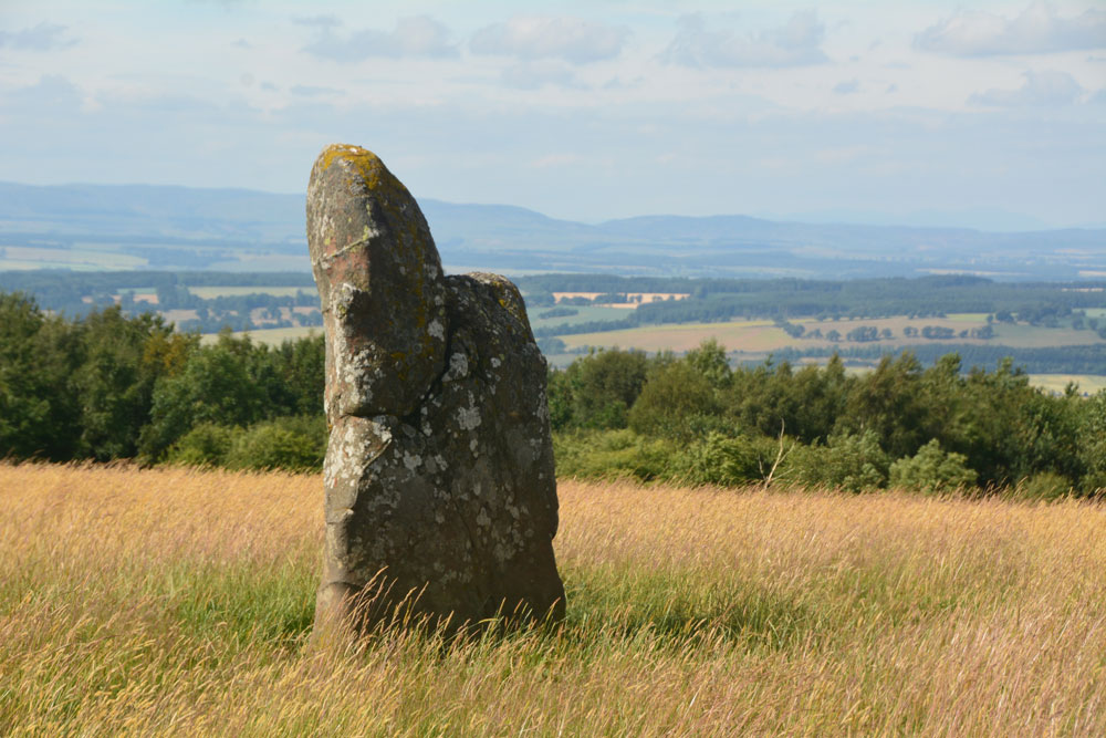
Gray Stone (Dunning) submitted by Anne T on 26th Jul 2018. Getting closer to the stone, approaching it from the gate into the field (south), we started to see the 'shoulder' on its northern side.
(View photo, vote or add a comment)
Log Text: The Gray Stone, Dunning: Thrilled to be seeing my second standing stone of the day (and one we were likely to get close to), we parked at the end of the driveway up to The Knowes farm. The stone is signposted, but the signpost follows the line of the fence and wood to the north west. Undecided whether to follow the sign and walk through the knee high grass or take the farm track which ran directly westwards. Consulting the map, we didn’t come to any firm conclusion, so to avoid having to climb over any fences, we ended up walking up the farm track, ending up at the cottage just before the gate to the big farmhouse to the left. Turning to our right here, in front of the cottage, there is a way across the deep, wide ditch which ran to our right hand side all along the track, then followed another farm track which ran north east to two field gates at NO 02171 11700. Opening the left hand gate, we let ourselves into the field, and the stone was immediately in front of us, about half way along the middle of the field, near to the fence line with the neighbouring wood which is to the stone’s eastern side.
Walking towards the stone (through what looked like a field of wheat, looking back on the photos, but is actually tall, yellow grass which has gone to seed) which is about 7ft tall, we realised it had a ‘shoulder’ to its northern side. Having seen a few other stones like this recently (the Megget Stone springs immediately to mind), I wondered if this had been deliberately cut like this, but looking at the bashes this stone has had, and the cracks and loose pieces on it, it looks as if it has fractured and a piece fallen off.
Whilst the views to the south and east are blocked now by forestry, there was a great vista northwards to Dunning and the hills (which appeared as a blue mist) in the far distance. On its northern side, there is a change in slope down from the stone; to its west and slightly to the south, there is a very slight rise. I wondered if the change in ground level might be because either farming, or perhaps a prevailing wind over time, has caused the ground level to build up here.
A very peaceful and beautiful place.
Bull Stone (Crook of Devon)
Trip No.109 Entry No.2 Date Added: 10th Nov 2018
Site Type: Standing Stone (Menhir)
Country: Scotland (Perth and Kinross)
Visited: Yes on 31st Oct 2018. My rating: Condition 2 Ambience 3 Access 4
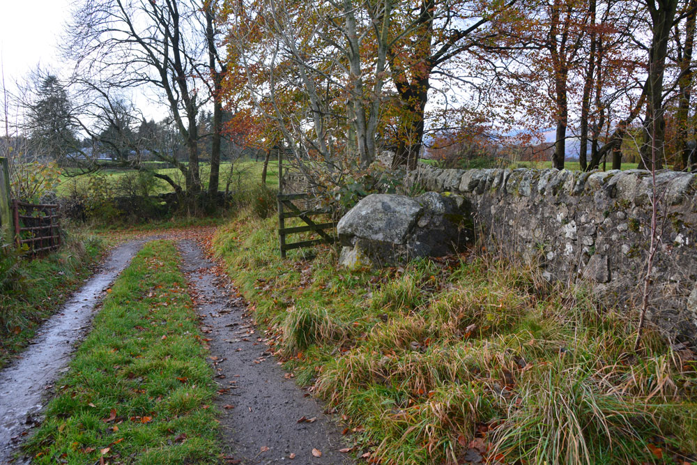
Bull Stone (Crook of Devon) submitted by Anne T on 10th Nov 2018. The Bull Stone, showing how it sits in relation to the footpath leading south from Church Road, and the farm track leading east.
(View photo, vote or add a comment)
Log Text: The Bull Stone, Crook of Devon: We parked in St Serf’s Road, Crook of Devon, at NO 03303 00037 and walked down Church Road, then took the right hand fork of the footpath, which lead almost directly south. Just under 220 metres from the fork, there is a farm track which leads off to the east. The Bull Stone is showed on the map just up this track, on its northern side.
I thought this stone was just part of an old stone wall, as the stone was fragmented and cemented together again. It wasn’t until I saw the photo on TNA that I believed we had seen the right stone! Not a brilliant monument, but a nice, short walk, and another to ‘tick off the list’ of sites seen.
Altar Stone, Stobo
Trip No.5 Entry No.4 Date Added: 14th Aug 2016
Site Type: Standing Stone (Menhir)
Country: Scotland (Scottish Borders)
Visited: Yes on 10th Aug 2016. My rating: Condition 2 Ambience 3 Access 5
Altar Stone, Stobo submitted by austenjohnreid on 5th May 2010. Site in Scottish Borders Scotland
(View photo, vote or add a comment)
Log Text: Altar Stone, near Stobo, Scottish Borders: This stone is clearly marked on the map and features on the Portal, but I can find out nothing about it on Canmore or other web sites.
From Tinnis Castle, driving up the B712 through Drumelzier and Drumelzier Haugh, just past Dawyck Botanic Garden, a small road turns sharp left up through a hamlet called ‘Altarstone’. Opposite the farmhouse, hidden beneath tree branches at the edge of the road is the altar stone Intriguing Need to find out more about this.
Midshiels Cairn
Trip No.29 Entry No.8 Date Added: 31st Jul 2017
Site Type: Cairn
Country: Scotland (Scottish Borders)
Visited: Saw from a distance on 3rd Jun 2017. My rating: Condition 3 Ambience 4 Access 4
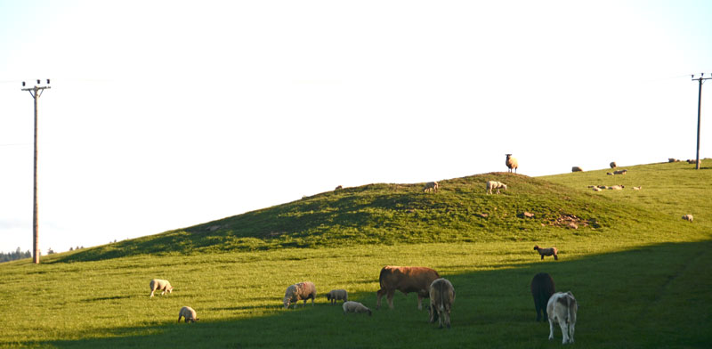
Midshiels Cairn submitted by Anne T on 4th Jun 2017. This is the closest we could get to the cairn on this visit - most of the young bullocks that had been on the right hand slope of the cairn were running (fast!) towards where we were standing at the gate to the field.
(View photo, vote or add a comment)
Log Text: Midshiels Cairn, Hawick: See visit report for Midshiels Standing Stone (the two are 90 metres apart), sites entered separately as Canmore lists them individually. Couldn't get really close to the cairn - would have loved to have walked up to it, but there was a really big bull and lots of over-friendly and very lively bullocks in the field. Must revisit at a different time of year!
There are plenty of other forts and settlements around here. The problem with another visit, is which sites to pick?
Ca Knowe (Hawick)
Trip No.29 Entry No.3 Date Added: 31st Jul 2017
Site Type: Cairn
Country: Scotland (Scottish Borders)
Visited: Yes on 3rd Jun 2017. My rating: Condition 2 Ambience 4 Access 4
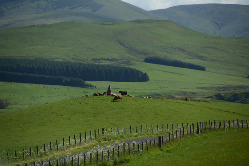
Ca Knowe (Hawick) submitted by Anne T on 4th Jun 2017. Ca Knowe Cairn from Lord's Tree Cairn.
(View photo, vote or add a comment)
Log Text: Ca Knowe Cairn, Hawick (aka Hero's Grave): Simply marked as ‘cairn’ on Trigpointing UK's OS map, we could see this cairn from Lord’s Tree Cairn. There is a proper tarmacked footpath up to the modern standing stone with plaque on it. Closer to, it is much larger than it appears from the mark on the map, and has a proper tarmacked path up to it.
Unfortunately, both on our way to our next site, and our way back to Hawick, the monument was surrounded by a number of very large cows with their calves, so we decided not to risk upsetting them and drove on after having taken some photographs.
Carby Hill
Trip No.31 Entry No.5 Date Added: 30th Jun 2017
Site Type: Ancient Village or Settlement
Country: Scotland (Scottish Borders)
Visited: Saw from a distance on 24th Jun 2017. My rating: Condition 2 Ambience 4 Access 3
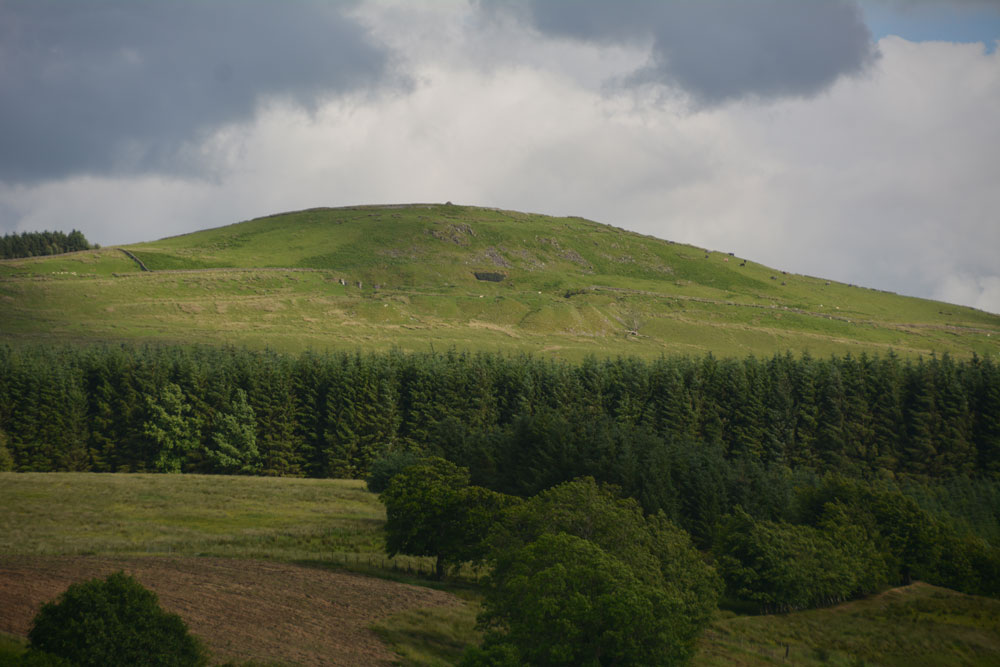
Carby Hill submitted by Anne T on 25th Jun 2017. We only saw Carby Hill Settlement from the Milnholm Cross just south of Newcastleton, then again from the track by the quarry just below the fort/settlement. When we arrived, we saw some enormous cattle grazing the site. Even my husband balked, and he was brought up on a farm and is used to these beasts. Looking forward to a return trip in the not too distant future - it looks amazing.
(View photo, vote or add a comment)
Log Text: Carby Hill Settlement, Scottish Borders: We only got to see this from a distance because of the ENORMOUS cattle grazing it's slopes. Even my husband, who was brought up on a farm was wary of these beasts. We plan to come back for a repeat visit in a month or so. Whilst the hill looks steep, from the path from the nearby quarry towards the base of the hill, the climb didn't look too bad.
Castleton (Newcastleton)
Trip No.31 Entry No.3 Date Added: 30th Jun 2017
Site Type: Ancient Cross
Country: Scotland (Scottish Borders)
Visited: Yes on 24th Jun 2017. My rating: Condition 1 Ambience 4 Access 5
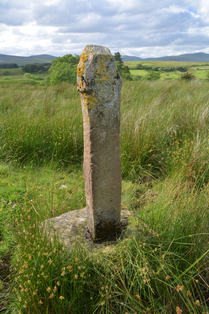
Castleton (Newcastleton) submitted by Anne T on 30th Jun 2017. Standing just behind the cross at its eastern side, looking back over the Liddel Water valleys.
(View photo, vote or add a comment)
Log Text: Castleton Cross, Near Newcastleton: Whilst this cross can be seen from the road, it is best viewed from the field (gate opposite the cemetery, otherwise its a clamber over a barbed wire fence in boggy ground). The shaft is a modern replacement, made of concrete. The field contains many lumps and bumps - the remains of the old village. This spot is virtually opposite Old Castleton earthworks (Liddel Castle) and with the enigmatic cemetery with its strange grave markers and brilliant views, it was well worth the stop. Shame the road was so busy at this time on night; cars whizzed by at 60 mph at regular intervals. Not the safest place to walk.
Rhymer's Stone (Melrose)
Trip No.50 Entry No.7 Date Added: 7th Oct 2017
Site Type: Marker Stone
Country: Scotland (Scottish Borders)
Visited: Yes on 24th Sep 2017. My rating: Condition 3 Ambience 3 Access 4
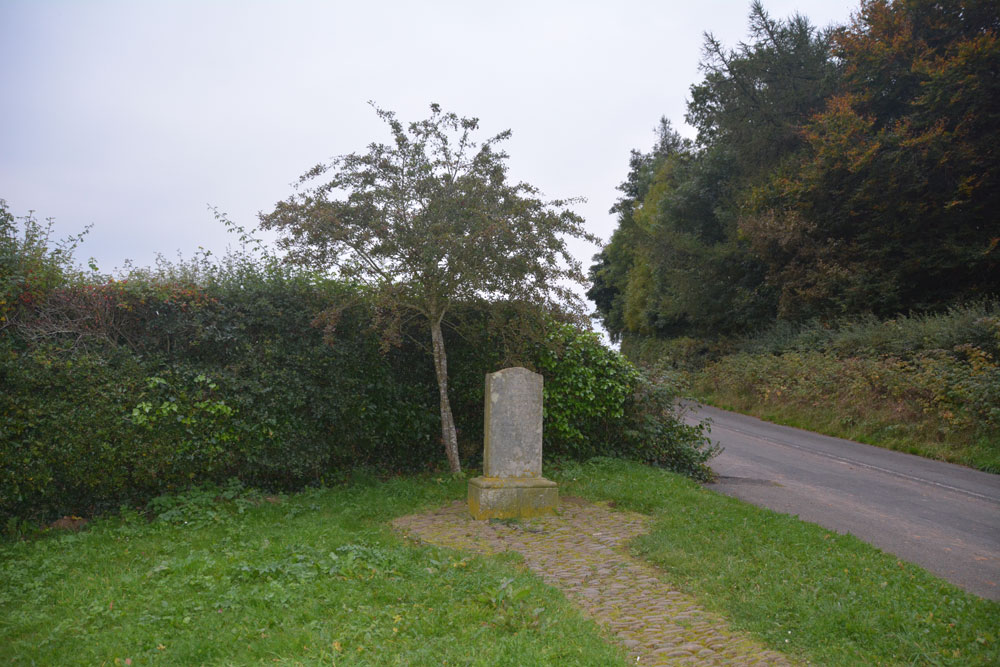
Rhymer's Stone (Melrose) submitted by Anne T on 7th Oct 2017. Contrary to first appearances, not a grave stone, but a modern marker stone! First view of the Rhymer Stone, erected in 1929 by the Melrose Literary Society.
(View photo, vote or add a comment)
Log Text: Eildontree Stone/Rhymer Stone, Melrose: After our failed attempt to find St. Dunstan’s Well in Melrose, we wanted to end the day on a positive note, so asked to come here, particularly because of the Steeleye Span song. The sign from the road said ‘Rhymer’s Stone’ ½ mile. It was more like a good mile, then a walk of about 300 metres from the layby by the gate closing the road. Loved the view up to Eildon Hillfort, but far too late in the day to go exploring.
Rubers Law
Trip No.93 Entry No.2 Date Added: 31st Aug 2018
Site Type: Hillfort
Country: Scotland (Scottish Borders)
Visited: Saw from a distance on 29th Aug 2018. My rating: Condition 3 Ambience 4 Access 3
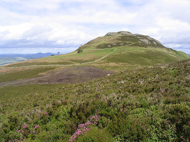
Rubers Law submitted by Creative Commons on 30th Aug 2010. Site in Scottish Borders Scotland
Approaching Rubers Law
Walking through heather near Cloon Craig towards the distinctive summit of Rubers Law with the Eildon Hills on the horizon to the left.
Copyright Walter Baxter and licensed for reuse under the Creative Commons Licence.
http://www.geograph.org.uk/profile/6638
(View photo, vote or add a comment)
Log Text: Rubers Law (only seen from a distance): This impressive hill fort dominates the area. We decided it was too far and too high to attempt today, although I was fascinated by its changing profile as we drove along the minor roads to Bedrule. We will come back when we're feeling fit and strong - it looks like a long walk, gaining height very quickly over a relatively short distance.
I stopped to take photo from the well house (MP 93.1), then at various points along the route:
1. NT 57304 12321
2. NT 59495 15298 By entrance to track signposted to Rubers Law
3. NT 59965 17983 From Bedrule Parish Church
Fast Castle (Bedrule)
Trip No.93 Entry No.4 Date Added: 31st Aug 2018
Site Type: Misc. Earthwork
Country: Scotland (Scottish Borders)
Visited: Yes on 29th Aug 2018. My rating: Condition 2 Ambience 4 Access 4
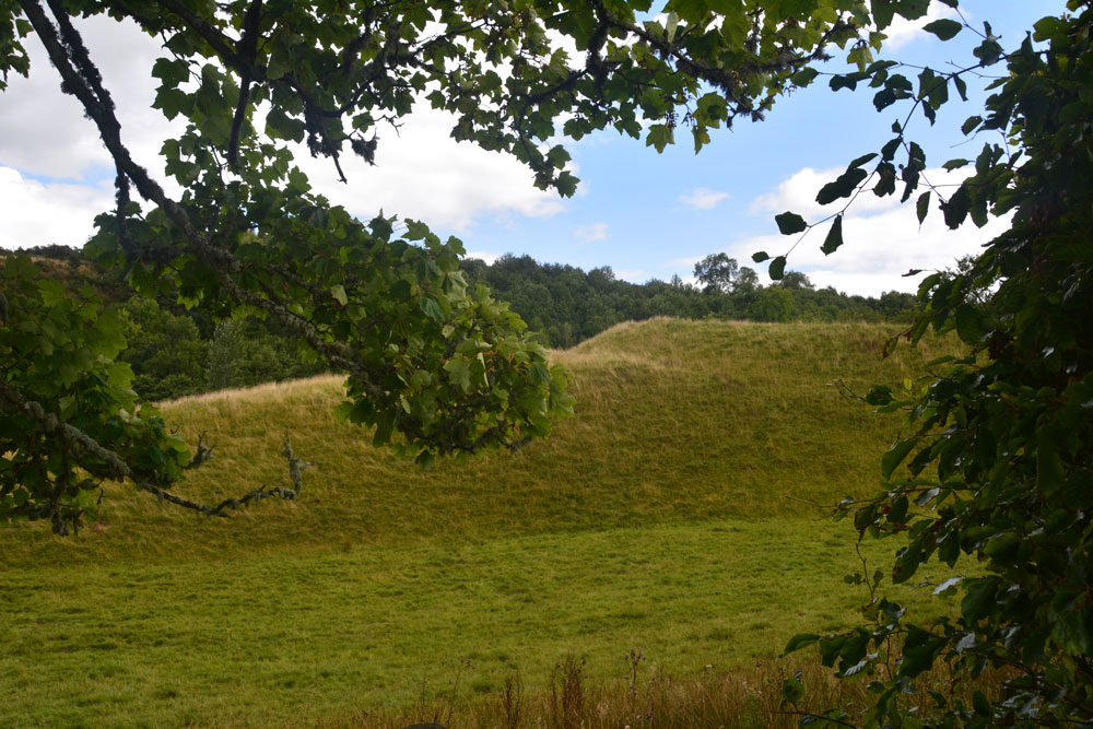
Fast Castle (Bedrule) submitted by Anne T on 31st Aug 2018. Our first view of this large earthwork/motte through the trees from the minor road from Bedrule to the Jedburgh Road.
(View photo, vote or add a comment)
Log Text: Fast Castle/Bedrule Motte: Not far from Bedrule Church this motte is marked on the map. At first it just appeared as a mound behind some trees, and we weren’t going to stop, until we realised the tree cover finished and the motte was clearly visible from the track going to Bedrule Mill. We let ourselves in through the gate and stopped to photograph this impressive mound. It sits by a bend in the very pretty river Rule.
Midshiels Cairn
Trip No.93 Entry No.7 Date Added: 31st Aug 2018
Site Type: Cairn
Country: Scotland (Scottish Borders)
Visited: Yes on 29th Aug 2018. My rating: Condition 3 Ambience 4 Access 4

Midshiels Cairn submitted by Anne T on 4th Jun 2017. This is the closest we could get to the cairn on this visit - most of the young bullocks that had been on the right hand slope of the cairn were running (fast!) towards where we were standing at the gate to the field.
(View photo, vote or add a comment)
Log Text: Midshiels Cairn: Having been warned about the large cattle who might "go for us if they saw us", I was cautious about walking the additional 100m from the standing stone to the cairn. Andrew decided that as the cattle were at the far end of the field, and though large, looked relatively docile. “If they come for me I can always leap over the fence (to the railway embankment)”, he said, so I gave him the camera and left to explore the cairn, which seemed much further away than the standing stone, but in reality was only around 90m away.
The Canmore entry of 1948 says the cairn was ‘planted with trees’, although it is now only covered in grass.
Borthwick Mains
Trip No.93 Entry No.8 Date Added: 31st Aug 2018
Site Type: Class I Pictish Symbol Stone
Country: Scotland (Scottish Borders)
Visited: Couldn't find on 29th Aug 2018
Log Text: Borthwick Mains Possible Pictish Symbol Stone: We got the location of this symbol stone completely wrong, and whilst we found Borthwick Mains, did not find the symbol stone. Its now high on my 'wish list' to return to. A lot of building work had been happening here, with the entrance to the farm in the process of being widened, and the house nearest the road empty and almost derelict. I did venture into the garden, but not having any phone signal, did not have the photo of the stone on Canmore to refer to.
Whitcastle Hill
Trip No.93 Entry No.10 Date Added: 31st Aug 2018
Site Type: Hillfort
Country: Scotland (Scottish Borders)
Visited: Saw from a distance on 29th Aug 2018. My rating: Condition 2 Ambience 4 Access 3
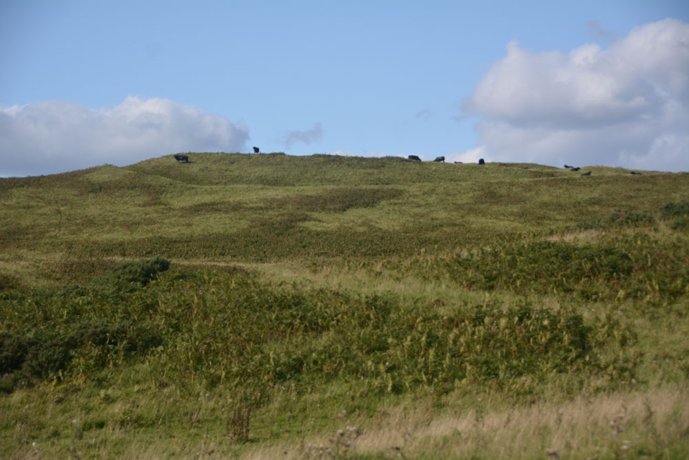
Whitcastle Hill submitted by Anne T on 31st Aug 2018. The groove of the outer defensive bank and ditch of this large prehistoric earthwork/hillfort can be seen at the top of the hill. Having already had one encounter with large cattle earlier in the day, we elected to return another day to take a closer look.
(View photo, vote or add a comment)
Log Text: Whitcastle Hill Prehistoric Earthwork: We decided to return to this site another day, having had a glimpse of the herd of very large cattle grazing over the site. Shame - the aerial photograph of this site on Canmore looks absolutely fascinating!
Crailing Cross
Trip No.123 Entry No.2 Date Added: 2nd Apr 2019
Site Type: Ancient Cross
Country: Scotland (Scottish Borders)
Visited: Yes on 31st Mar 2019. My rating: Condition 3 Ambience 3 Access 4
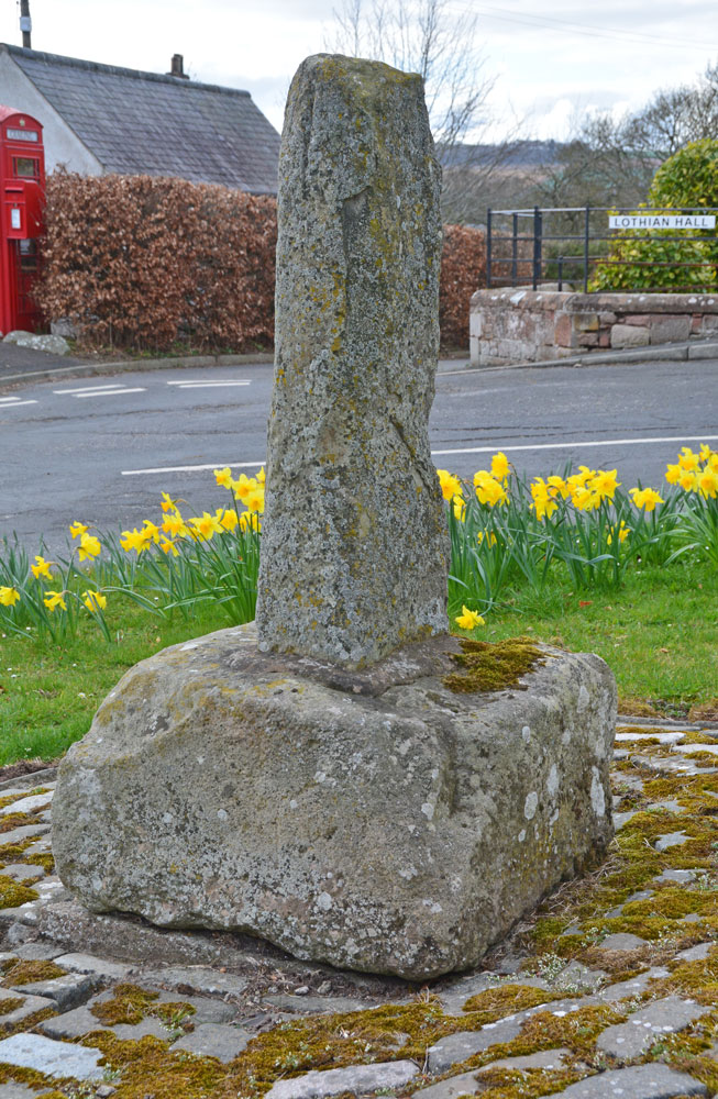
Crailing Cross submitted by Anne T on 2nd Apr 2019. The sad remains of the old 'mercat cross' at Crailing. The Canmore record for this cross says: "A local gamekeeper stated that the "cross" has been in its present position for at least 50-60 years but enquiries at Crailing House and the Lothian Estates office produced no knowledge of the 'cross' at all".
(View photo, vote or add a comment)
Log Text: Crailing Cross: We’d driven by this cross a couple of times before, but just thought it was a stone bearing the name of the village. This time, I got a closer look, then looked it up on Canmore after we drove past and confirmed it was a medieval ‘mercat’ cross. We stopped on our way back from Kelso to take a few photos. Nothing special, but another to tick off as a visited site.
I was aiming to take a photograph of the cross from the south side of the A698, but the traffic was so fast and frequent, I decided not to risk getting run over.
Falla Knowe Cairn
Date Added: 24th Apr 2015
Site Type: Cairn
Country: Scotland (Scottish Borders)
Visited: Saw from a distance on 23rd Apr 2015. My rating: Access 4

Falla Knowe Cairn submitted by durhamnature on 3rd Oct 2012. Cross-section drawing from Berwickshire Naturalists via archive.org, showing location of urn and flint scraper.
Site in Scottish Borders Scotland
(View photo, vote or add a comment)
Log Text: Falla Knowe Cairn, Scottish Borders: Not quite the actual Falla Knowe robbed out cairn, but one nearby.
Travelling up Dere Street, having parked next to Pennymuir Roman Camp A just across the road from this section of the Roman Road, we made our way north up this deeply rutted section of the footpath towards Black Knowe and Trestle Cairns (wellies will be needed after wet weather - it was bad enough after a dry spell). Whilst there were a number of cairns, settlements and earthworks marked on the map in the field to our left, it was difficult to make out any features amongst the tussocks of grass and heather. The forest marked on the map immediately after the road has now been cut down, leaving large stumps sticking up out of the ground like ancient teeth.
We did notice that the corner of the stone wall/dyke and wooden fence post was placed almost dead centre of a circular raised mound. Whilst this cairn is marked on the Canmore Mapping for RCAHMS site 58154 no details are given. Grid reference for this cairn is NT 75204 14973.
Black Knowe (Borders)
Date Added: 24th Apr 2015
Site Type: Standing Stone (Menhir)
Country: Scotland (Scottish Borders)
Visited: Yes on 23rd Apr 2015. My rating: Condition 3 Ambience 4 Access 3
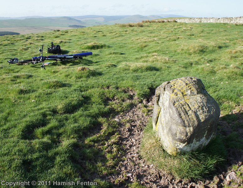
Black Knowe (Borders) submitted by h_fenton on 17th Aug 2011. Black Knowe Standing Stone viewed from roughly north. although known as a standing stone it is better described as a boulder and may have once been part of the nearby Black Knowe Cairn.
27 April 2011
(View photo, vote or add a comment)
Log Text: Black Knowe Standing Stone, Scottish Borders: Continuing on northwards from the Falla Knowe Cairn the path becomes more of a grassy footpath with evidence of ditches at either side in parts, so we knew we were following the old Roman road of Dere Street (funny, as this Roman road continues south down through Corbridge just a few miles from where we live). Climbing the gentle slope, to the left hand side the Black Knowe Cairn comes creeping into view. On the right hand side of Dere Street are what might be other archaeological features (look like a mixture of rectangular remains of old walls and sunken waterlogged patches with reeds).
Suddenly the land flattens out slightly and there is what looks like a free-standing boulder sitting almost next to the path. Interestingly the RCAHMS records “contradicts” itself – for Site NT71NE 44/Canmore ID 57960 the 1973 visit records it as a natural erratic boulder; the 1979 visit report says “its size and shape suggest that it may be a companion to the outlying stones of the adjacent cairn”. We’ve come across these solitary standing stones next to Roman Roads before, as if they were used as markers/waypoints or to pass and respect sites that were ancient when these roads were built.
Looking more closely there are actually three boulders, one just to the south and another just to the north. My opinion is that it is either a small cairn in its own right or is associated with Black Knowe Cairn, but the stone wall/dyke in between the two features makes it difficult to ascertain. Even though my husband went up to the stone wall to line himself up with the larger cairn behind to see if we could make any connections between the two monuments it was difficult to tell. Oh to have an octo-copter with camera!.
The views from here are spectacular, particularly as we were just under the edge of a weather front, with big dark rain clouds coming down from the north and the sunlight hills all around the other compass points.
As there were no gates in the long, long stone wall (I never know what to call these – when we lived in Dumfries the locals referred to them as dykes; where I was brought up in Yorkshire, dykes were ditches!), we continued up the hill to Trestle Cairn.
Trestle Cairn
Date Added: 25th Apr 2015
Site Type: Stone Circle
Country: Scotland (Scottish Borders)
Visited: Yes on 23rd Apr 2015. My rating: Condition 3 Ambience 4 Access 3
Trestle Cairn submitted by minteddy on 4th Dec 2006. NT752162
Looking north over Trestle Cairn
(View photo, vote or add a comment)
Log Text: Trestle Cairn, off Dere Street, Scottish Borders: Continuing north up Dere Street from the Black Knowe standing stone, the stone wall is continuous uphill. To get back to Black Knowe Cairn we either had to carry on to Trestle Cairn then double back to Black Knowe Cairn or walk back down the hill to a gate lower down the field at the lower field boundary and walk back uphill to Black Knowe Cairn. We chose the former.
Continuing uphill, there is a gate in the next field boundary. At the time of our visit there was stock in the field and an electric fence which we had to duck under. A few yards to the left hand side there was a gate into the field immediately below Trestle Cairn. 50 yards along the stone wall to the left there was a gate into the Trestle Cairn field giving easy access to the cairn.
The Canmore/RCAHMS records for this site (Canmore ID 57949 Site Number NT71NE 34) record in 1947 that this is a ‘Druidical Circle .... consists of 17 stones distributed within the circumference of a demolished cairn which originally measured 55’ in diameter’. There were clearly 2 ovals/circles of irregularly placed stones with banks and ditches around them. My impression was that this was a cairn, with some similarities to the Loupin’ Stanes which we’d seen near Eskdalemuir a few weeks before. The views to the west and south were stunning at this time of early evening, with the distant hills bleeding into the grey of the dusk.
From here we could see the Five Stones Stone Circles down in the valley to the right of Dere Street, which we’d hoped to make it to that day. The walking had been slower than we anticipated so we stayed to photograph and appreciate the location of this cairn and made our way downhill to Black Knowe Cairn. There is so much to see in this area that we’re going to make another trip, with the Five Stones Stone Circles top of the list.
Note for future visitors: returning to the gate in the field within Plea Shank, don’t go back to the gate onto Dere Street. Continuing down the field you will come to some smoothly mown pathways within the heavily tussocked grass. These lead back to Trestle Cairn and is easier walking than in the long grass.
Dere Street Cairn
Date Added: 25th Apr 2015
Site Type: Round Cairn
Country: Scotland (Scottish Borders)
Visited: Yes on 23rd Apr 2015. My rating: Condition 3 Ambience 5 Access 3
Dere Street Cairn submitted by minteddy on 4th Dec 2006. NT750155. Looking east over cairn towards whaleback of Cheviot
(View photo, vote or add a comment)
Log Text: Black Knowe Cairn (Dere Street Cairn), Scottish Borders:
From Trestle Cairn we followed the other side of the stone wall from Dere Street back downhill (this being Scotland I can’t get wholly used to the ‘right to roam’ even though we lived here for over 10 years. I wish we had this in England, too) with some interesting ‘lumps and bumps’ in the landscape on our right hand side – old quarries for Dere Street, old buildings or just marshy patches that have collapsed over the years?
Further down hill towards Black Knowe Cairn we spotted a green mown path cutting through the heavily tussocked grass that we were walking on by the stone wall, so switched onto this and it was easy walking down to the cairn.
What a site to end up at at the end of the day – it was very atmospheric and we spent ages wandering around the stones, looking at what might possibly be alignments between them, spotting two outliers to the north west and west, and just generally soaking up the magic of the place.
At the large stone in the field to the west I thought I saw a cup mark – it was definitely very smooth but worn, but I never know if my imagination is getting carried away. My husband certainly found no mention of rock art in this area before the visit.
Hubby walked over to the stone wall to see if there was possibly an alignment with the Black Knowe Standing Stone at the other side, but it was difficult to tell (I’d love to see an aerial photograph of these features).
Standing on the outlier at the north eastern edge of the cairn looking back, five of the stones seem to form an alignment running south west down the hill.
From the cairn the grassy path continues southwards down the hill. The only gate from the field is right in the middle of the lower side, then we had to track diagonally left to get back to the gate leading back onto Dere Street near the Scout Hut and parking area by Pennymuir Roman Camp A.
