Contributory members are able to log private notes and comments about each site
Sites Anne T has logged. View this log as a table or view the most recent logs from everyone
Copt Howe
Date Added: 25th Aug 2015
Site Type: Rock Art
Country: England (Cumbria)
Visited: Yes on 11th Aug 2015. My rating: Condition 3 Ambience 5 Access 4
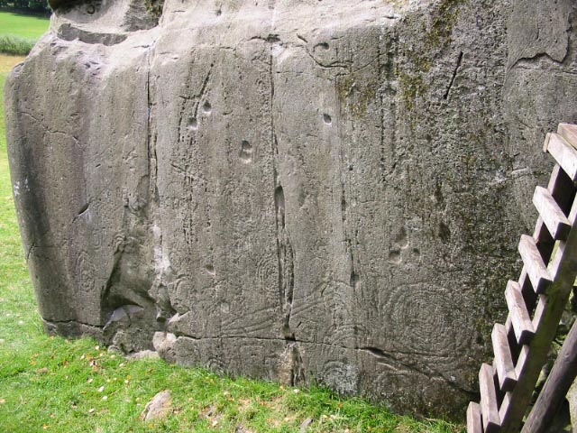
Copt Howe submitted by stu on 12th Oct 2003. NY3140 0582. Great carvings with one of the best views in the country.
(View photo, vote or add a comment)
Log Text: Copt Howe (The Langdale Boulders): When we drove past here on the way to Mickleden further down the Great Langdale valley, we spotted the signpost to Copt Howe but the road was so narrow and busy there was no room to stop. On the way back it was now after 6pm and the roads were quiet apart from one or two cars and cyclists. We parked behind another car in what seemed to be a narrow lay-by almost opposite the gate into the field containing these boulders.
If I thought the Mickleden walk scenery was beautiful (if stark with its tall peaks scree slopes) then this view down the Great Langdale valley was spectacular – green, lush and with rolling hills in the distance. What a location.
The rock art was on the largest boulder which was lowest in the field, sitting below the outcrop in which a tree now grows in the middle of. A very rickety stile climbed the stone wall to the other side, although when I touched this it came away from the wall, so I opted to walk down to the gate lower down in the field.
The early evening light was conducive in helping the motifs spring out of the rock. A few of the ‘cups’ were similar to the double cups on the Twelve Apostles in Dumfries, these being formed through natural erosion rather than pecking. I compared the designs I could see to the interpretation board but couldn’t quite reconcile the two.
In walking back up to the car I went round the left hand side of the tree (facing the road) and spotted a large single cup mark in the centre of the face.
Hexham Abbey
Date Added: 24th Aug 2015
Site Type: Ancient Cross
Country: England (Northumberland)
Visited: Yes on 3rd Sep 2014. My rating: Condition 3 Ambience 4 Access 5
Hexham Abbey submitted by Thorgrim on 18th Sep 2004. Roman tombstone now in Hexham Abbey NY773684
Memorial to Flavinus a Roman Standard hero
(see same design in Colchester Castle)
(View photo, vote or add a comment)
Log Text: Hexham Abbey, Northumberland: St Acca and Spital Cross Shafts.
23rd August 2015: Took my daughter and her husband to the new visitor centre after a lovely lunch in the Refectory (much recommended). We had great fun dressing up as Queen Ethelreda, Bishop Wilfrid and Augustinian monks). There was brass rubbing and computerised caligraphy to try. As well as interactive displays for the young at heart, there is also a serious section with a display of Anglo Saxon and Viking stones, a model of, and press-screen history of the abbey. A great time was had by all and I found not only the Spital Cross but a number of other stones I'd been searching for in the Anglo Saxon Corpus of Stone Sculpture and not found in my previous visit. Well worth coming.
3rd September 2014: Acca succeeded St. Wilfrid as the Bishop of Hexham in AD709, withdrawing (or also said to have been deposed) from office in AD732 and dying in AD740. The two crosses purported to mark the head and foot of his grave stand in the south transept of Hexham Abbey (on the right hand side as you enter the main church from the porch), next to St. Etheldreda’s Chapel. However, there is some confusion as to whether or not these two cross shafts are St. Acca’s grave markers, or whether the larger may just be a preaching cross set up in the first years of Christianity. However, Hexham Abbey proudly displays them as St. Acca’s.
The two cross shafts stand side by side. The larger cross shaft is called ‘St. Acca’s Cross’. The second, smaller cross-shaft, is known as the ‘Spital Cross’.
I approached a steward to ask if was OK to take some photographs, and he told me it was, providing I didn’t use flash. He knew a fair bit about the crosses, very kindly photocoping a leaflet on Acca and Acca’s Cross for me to take away. He told me that St. Acca’s cross had been broken up in antiquity and the pieces scattered, being put back together in the 19th century – there is a plain piece of modern stone where the cross arms would have been. Interestingly, he told me that the lower portion of St. Acca’s cross was found at nearby Dilston, where it had been used as a lintel in a farmhouse door.
St. Acca’s Cross is most gloriously decorated with vine scrolls which interleave and entwine.
The Spital Cross, as described in his leaflet: “was found at Spital which is 1.3 km west of Hexham, and stood near a house on the site of the medieval Hospital ofSt. Giles.” This cross shaft has very interesting vine scrolls on three sides and a crucifixion scene on its front face.
The area within the Abbey immediately around the crosses is used by the Stewards who greet people who come to look at the Abbey and to display information for visitors and worshippers – which strangely echoes their possible past uses as preaching crosses. When I was there, most people actually walked by without noticing them, although because I was taking photographs, a couple of people came up to ask more.
Opposite both cross shafts, and at the bottom of the Abbey night stair, is a Roman tombstone which dates from the first century.
All Saints (Kirby Hill)
Date Added: 4th Aug 2015
Site Type: Ancient Cross
Country: England (Yorkshire (North))
Visited: Yes on 28th Jul 2015. My rating: Condition 3 Ambience 5 Access 5
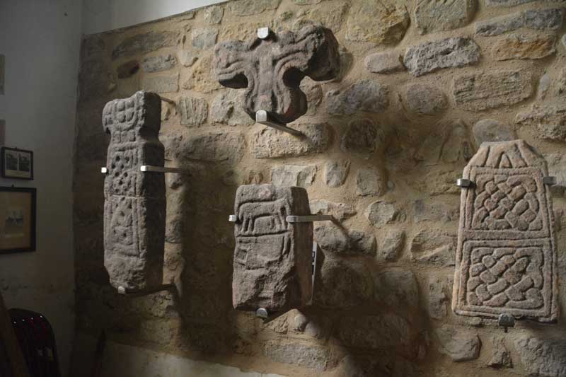
All Saints (Kirby Hill) submitted by Anne T on 4th Aug 2015. These are the Anglo Saxon cross shafts, cross head and an early grave marker displayed on the north wall of the tower.
(View photo, vote or add a comment)
Log Text: Anglo Saxon Crosses, Kirby on the Moor (Kirby Hill), North Yorkshire: All Saints sits on a green just outside the village of Kirby on the Moor, between Church Lane and Millings Lane. There was a notice near the entrance gate saying the church was open on Sundays between 2pm and 4.30pm and ‘all welcome’. However there was a car parked by the church gate and we could hear someone playing the organ. Entering cautiously, I asked if it was OK if we could look around, and the gentleman nodded. He was clearly practicing a piece over and over and I felt we were distracting him somewhat. He had lit the area around the organ, but no lights were on in the church, so it became a bit difficult see the crosses into the interior church walls as I kept having to fire the flash to see. We thanked him and escaped.
The majority of the crosses are displayed in the north wall of the tower, next to the font, so it’s a bit difficult to get great photos as the space is so small. There was a leaflet about the Anglo Saxon stone sculptures that was really helpful.
I’ve just found their web site, All Saints Kirby Hill, which is great. The church is grade 1 listed, the nave being part late Saxon/early Norman, built with large irregular stones including carved slabs and cross shafts of Saxon origin. The web site tells me that the site is one mile north of Boroughbridge, the church is also known as Kirby Hill, and is at the highest point of the village, in line with Aldborough (the Roman civil capital Isurium Brigantum) and other probable sites of the Roman crossings of the River Ure.and is probably on the site of much earlier shrines dating back to Roman or even Celtic times.
All Saints (Northallerton)
Date Added: 4th Aug 2015
Site Type: Ancient Cross
Country: England (Yorkshire (North))
Visited: Yes on 28th Jul 2015. My rating: Condition 3 Ambience 4 Access 5

All Saints (Northallerton) submitted by Anne T on 4th Aug 2015. This wonderful cross head sits on the step at the north western corner of the quire.
(View photo, vote or add a comment)
Log Text: Anglo Danish cross fragments, All Saints Church, Northallerton, North Yorkshire: I found the exterior of All Saints in Northallerton, which sits at the northern end of the High Street on the A167, very forbidding with its blackened stones. However, the inside was nice enough, although very Victorian, and we were made very welcome by a parishioner who had popped in to collect the church magazine. I had to chuckle as the “A Brief Guide to All Saints Parish Church” which says the oldest thing in the church is the Norman grave cover (to be found at the northern eastern corner of the nave). They have ignored the Anglo Saxon (or they correctly call it in this part of the world, Anglo Danish) stones on the window ledges.
The guide book says that there was supposed to be a church of stone built here in the early 7th century by St. Paulinus. “Fragments of stone crosses, possibly of this period, still exist, some built into the walls at various places, while a very fine cross head and separate shaft are on permanent loan to Bede’s World ..... although there is no visual evidence to suggest a significant stone building before the 11th century.” For the picture of the Northallerton Cross at Bede’s world, follow the link http://www.megalithic.co.uk/modules.php?op=modload&name=a312&file=index&do=showpic&pid=133724.
All the crosses, apart from one, which is at the south eastern corner of the choir, sit on window-ledges, most along the north wall and north transept, but some in the small kitchen area at the west end of the north transept. Most remarkable is the fragment with what looks like a sheep.
I’ve had difficulty in finding out more about these stone fragments, although the Corpus of Anglo Saxon Stone Sculpture web site says the North Yorkshire collection will be on-line soon.
Funnily enough, the church guide prides itself on the Robert Mouseman mice on the wooden furniture, and there is a special “Mouse Guide To All Saints Parish Church Northallerton.”
St Wilfrid's Holy Well
Date Added: 1st Aug 2015
Site Type: Holy Well or Sacred Spring
Country: England (Yorkshire (North))
Visited: Yes on 23rd Jul 2015. My rating: Condition 3 Ambience 3 Access 5
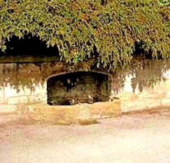
St Wilfrid's Holy Well submitted by Sunny100 on 8th Jun 2010. St Wilfrid's Holy Well at Ripon, N.Yorks. SE.309710.
(View photo, vote or add a comment)
Log Text: St. Wilfrid's Holy Well, Skellgate Road, Ripon: Armed with only a 6 digit grid reference and a GPS device that was rapidly running out of battery, this well took some finding, but in the end we did. St. Wilfrid’s Well is located at the north side of the B6265, some 700 metres west of the city centre, where Skellbank Road becomes Mallorie Park Drive. A few yards east of the well are some steps leading up to Ripon Spa Gardens. The 8 digit grid reference is SE 3085 7102.
The well is located within a stone wall, almost overhung by bushes from the bank above. At the time of our visit there was no water trickling into the well at all. Someone seems to care for it, for there was no litter in or around it.
St Wilfrid is the patron saint of Ripon (the crypt at Ripon Cathedral is purported to be part of his early church, although I’ve yet to verify this). The St Wilfrid’s Day parade takes place on the Saturday before the first Monday of August each year (this year it happens to be 1st August (2015)) in which an actor takes the part of St. Wilfrid. The procession now centres around the Market Square, starting at Studley Road, then Westgate, Market Place West, North Street, North Road, Magdalens Road, Stonebridgegate, Allhallowgate, Market Place East, Kirkgate, Bedern Bank, Bondgate, Southgate, Barefoot Street, Harrogate Road, High Skellgate, Westgate, Blossomgate, Marshall Way, North Street, Market Place East, Kirkgate, ending at Ripon Cathedral.
Worth stopping to look if you are passing by this well.
St Mary (Masham)
Date Added: 1st Aug 2015
Site Type: Ancient Cross
Country: England (Yorkshire (North))
Visited: Yes on 23rd Jul 2015. My rating: Condition 3 Ambience 4 Access 5
St Mary (Masham) submitted by rogerkread on 22nd Oct 2013. The splendid Masham cross pillar, in the rain (as usual when I'm taking photos for the Megalithic Portal!).
(View photo, vote or add a comment)
Log Text: Four Anglo Saxon Crosses in the church of St. Mary The Virgin, Masham, North Yorkshire: After seeing the Anglo-Danish and Anglo-Saxon crosses at both East Hauxley and Wath, we went into Masham to get some lunch. Having visited here twice before, we’d never ventured into the church here (either having been with some disinterested visitors or at the end of an already long day), although I vaguely knew there were some Anglo Saxon crosses here.
The base of the large sandstone cross shaft cannot be missed and stands in the churchyard near the porch and dates from the early ninth century. The church guide states that "recent research has linked it stylistically with a broken cross shaft of similar date now at Cundall and Aldborough.” The panels on this cross shaft are very worn, and the top is capped with an ugly lead cap, presumably to stop further weathering. The text in the church and the church guide book told us that the incomplete top panels almost certainly represent Christ and his Apostles; the second and third panels contain scenes from the Old Testament.
Inside the church are three other cross shafts, two hidden conveniently in an alcove in the wall in the south aisle, behind the votive candle table, which we moved to take photographs, and carefully placed back. Exploring some medieval grave markers next to these, we came across another fragment of cross shaft with a notice next to it telling us it was from the late 8th/early 9th century. This fragment was very plain with only edge moulding visible on one edge.
St Mary (Wath)
Date Added: 1st Aug 2015
Site Type: Ancient Cross
Country: England (Yorkshire (North))
Visited: Yes on 23rd Jul 2015. My rating: Condition 3 Ambience 3 Access 5
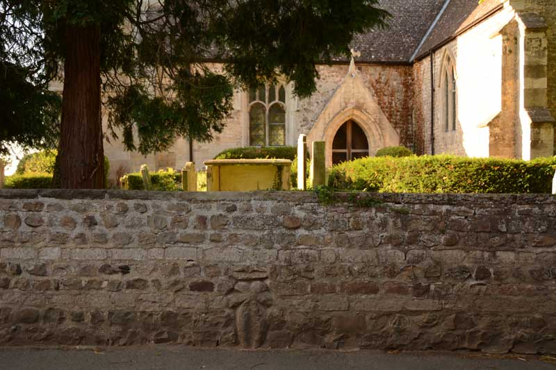
St Mary (Wath) submitted by Anne T on 1st Aug 2015. As the church was locked at the time of our visit, this is the only cross we could find, in the exterior church wall, almost in line with the porch in the south wall of the church.
(View photo, vote or add a comment)
Log Text: Anglo Saxon Cross, St. Mary's Church, Wath: Situated on a bend in Main Street, Wath, this church is in a pretty little village. We parked outside the main gate of the church (there is just room for one car to sit here, as someone else’s gates are immediately adjacent). We eventually found the cross in the exterior of the church wall, in line with the porch in the south wall of the church. There are only narrow pavements running alongside; the size of the lorries that rumble through making taking photographs of this cross precarious, to say the least. Andrew watched both sides of the bend to ensure I wasn’t going to get run over when I took a photograph from the middle of the road.
I found a document by Harrogate Council which told me a little more about the church and village: Wath is the Old Norse term meaning ‘ford’ and is mentioned in the Domesday Book of 1086. There are parts of the church that are very old indeed, and the above booklet mentions “The only built fabric from around this time are the remains of Saxon sculptures in the organ chamber of the present St Mary’s Church and the stone cross embedded into the church boundary wall.” The church was locked at the time of our visit (which was after 6pm) so we couldn’t get into see these. There was an old sundial in the churchyard, just south of the porch. The booklet goes onto say that Wath was essentially the estate village to Norton Conyers, and “St Mary’s Church is the oldest building in the village. It dates primarily from the thirteenth century with additions and enlargement in the fifteenth century and a tower of 1812. It might have originally been a manorial chapel which was rebuilt as a parish church in the twelfth or thirteenth century. The next oldest building in the village is the Rectory, which dates from the sixteenth century and was probably built on the site of its predecessor.”
St Mary (Thornton Watlass)
Date Added: 1st Aug 2015
Site Type: Ancient Cross
Country: England (Yorkshire (North))
Visited: Yes on 23rd Jul 2015. My rating: Condition 3 Ambience 3 Access 5
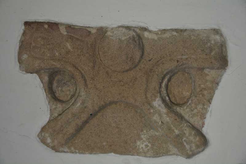
St Mary (Thornton Watlass) submitted by Anne T on 1st Aug 2015. This is the second cross head which is built into the east wall of the porch. It dates from the first half of the tenth century.
(View photo, vote or add a comment)
Log Text: Anglo Saxon Cross Heads, St Mary The Virgin (Thornton Watlass), North Yorkshire: St Mary The Virgin is 3 miles from Bedale and 11 miles from Ripon. It is grade II listed (English Heritage Building ID: 333615), dating largely from the 15th century.
There are two Anglo Saxon cross heads on display in the porch, one on the east wall and one on the west. The church was firmly locked at the time of our visit although the door to the porch was left open. We parked on the small triangle of land at the cross-roads opposite. It was tricky to cross the road as the church lies in the crook of a sharp bend and traffic cannot be seen until the last minute, so cross quickly!
According to the Corpus of Anglo Saxon Stone Sculpture by James Lang (Google books) "The cross head built into the interior east wall of the porch was first noted in 1908 by E. Bogg as being in its present position. Its height is 44.2 cms by 32.8 cms wide and 17 cms deep. Made of fine to medium-grained millstone grit, the right arm of the cross is lost and only one face is visible, and is part of a wheel-head cross with wedge-shaped arms and a ring recessed from the face. Date: first half of 10th century; The cross head in the west wall is 29.5 cms high, 48 cms wide (no depth recorded as it is built into the wall). The upper limb of the cross is lost; only one face is visible. Part of a plate-headed wheel cross, the rim raised and recessed from the face. A plain edge moulding follows the perimeter of the cross ... the lower limb of the cross has a curved incision which creates the impression at the sides of heavily stylised legs for a Crucifixion; conversely it could be the arris of a plain panel. The lateral arms are filled by hands with a wrist band and three huge fingers. In the centre of the cross is a large boss. Date: first half of the tenth century."
I admit to not being able to see the crucifixion scene described by James Lang in the Corpus of Anglo-Saxon Stone Sculpture (Google books) until I rotated my photograph by 90 degrees!
Fallowlees Settlement
Date Added: 1st Aug 2015
Site Type: Ancient Village or Settlement
Country: England (Northumberland)
Visited: Yes on 15th Jul 2015. My rating: Condition 3 Ambience 4 Access 3
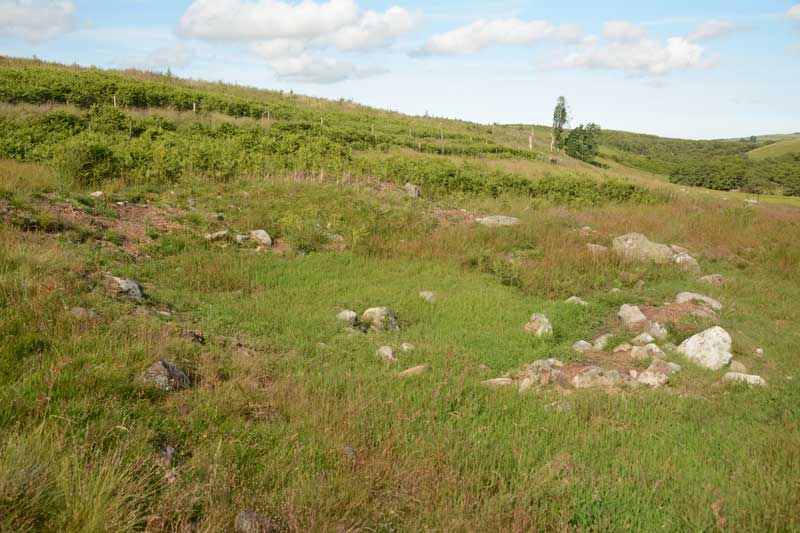
Fallowlees Settlement submitted by Anne T on 20th Jul 2015. This is one of the smaller hut circles, the foundations clearly visible above the turf. Just left of centre within the hut are a mound of stones which we would have liked to have thought of as the hearth.
(View photo, vote or add a comment)
Log Text: Fallowlees Settlement, just off the National Trust Greenleighton Walk, Northumberland: Close to Fontburn a(vi), a(vii) and a(viii). See visit report for Hollinghill Enclosure. From a distance, coming up the quad bike track from Fallowlees Burn, there appear to be standing stones on the slope, but as we got closer, it became apparent these were the foundations of three hut circles, with another disappearing into the plantation to the north. What a lovely site to live in - a sheltered spot with water close by and fertile ground for farming. No wonder our ancestors chose to live here. The boulders with rock art on are just to the south, and appear to be part of cairns. Well worth the walk to see this.
Fontburn a(viii)
Date Added: 1st Aug 2015
Site Type: Rock Art
Country: England (Northumberland)
Visited: Yes on 15th Jul 2015. My rating: Condition 3 Ambience 4 Access 3
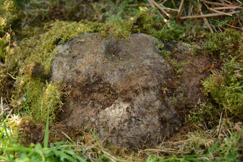
Fontburn a(viii) submitted by Anne T on 20th Jul 2015. This is one good photograph I managed to get of Fontburn a(viii). The ERA-1356 record tells me that the cup mark on the top of the rock is almost certainly artificial, the 'cup' on its lower edge is probably weathering.
(View photo, vote or add a comment)
Log Text: Fontburn a(viii), just off the National Trust Greenleighton Walk, Northumberland: See visit report for Hollinghill Enclosure.
Fontburn a(vii)
Date Added: 1st Aug 2015
Site Type: Rock Art
Country: England (Northumberland)
Visited: Yes on 15th Jul 2015. My rating: Condition 3 Ambience 4 Access 3
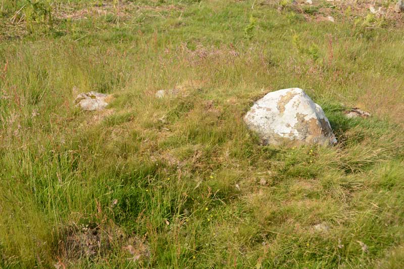
Fontburn a(vii) submitted by Anne T on 20th Jul 2015. Close up of the Fontburn a(vii) boulder, but even now the sun is out, the photo doesn't manage to highlight the two cup marks which are on it. I've posted this so other visitors can identify the right stone.
(View photo, vote or add a comment)
Log Text: Fontburn a(vii), just off the National Trust Greenleighton Walk, Northumberland: See visit report for Hollinghill Enclosure.
Fontburn a(vi)
Date Added: 1st Aug 2015
Site Type: Rock Art
Country: England (Northumberland)
Visited: Yes on 1st Aug 2015. My rating: Condition 3 Ambience 4 Access 3

Fontburn a(vi) submitted by Anne T on 20th Jul 2015. Close up of the two deepest cups on the southern/top side of Fontburn a(vi). It was amazing how smooth and well definted these were, even after all these centuries.
(View photo, vote or add a comment)
Log Text: Fontburn a(vi), just off the National Trust Greenleighton Walk, Northumberland: See visit report for Hollinghill Enclosure.
Fontburn a(iii)
Date Added: 1st Aug 2015
Site Type: Rock Art
Country: England (Northumberland)
Visited: Yes on 1st Jan 2015. My rating: Condition 3 Ambience 4 Access 3
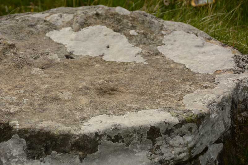
Fontburn a(iii) submitted by Anne T on 20th Jul 2015. We could only make out one cup mark on this boulder, although the Beckensall Archive says there is a line of 5, 12 others and two lightly peck marked areas. The ERA-1351 record identies three possible cups, although we were unable to see these.
(View photo, vote or add a comment)
Log Text: Fontburn a(iii), just off the National Trust Greenleighton Walk, Northumberland: See visit report for Hollinghill Enclosure.
Fontburn a(ii)
Date Added: 1st Aug 2015
Site Type: Rock Art
Country: England (Northumberland)
Visited: Yes on 15th Jul 2015. My rating: Condition 3 Ambience 4 Access 3
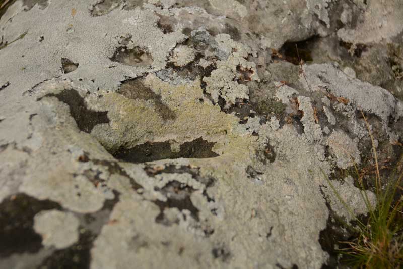
Fontburn a(ii) submitted by Anne T on 20th Jul 2015. There is one large oval shaped cup mark on top of this boulder. The rest of the marks appear to be natural weathering of the sandstone.
(View photo, vote or add a comment)
Log Text: Fontburn a(ii), just off the National Trust Greenleighton Walk, Northumberland: See visit report for Hollinghill Enclosure.
Fontburn a(i)
Date Added: 1st Aug 2015
Site Type: Rock Art
Country: England (Northumberland)
Visited: Yes on 15th Jul 2015. My rating: Condition 3 Ambience 4 Access 3
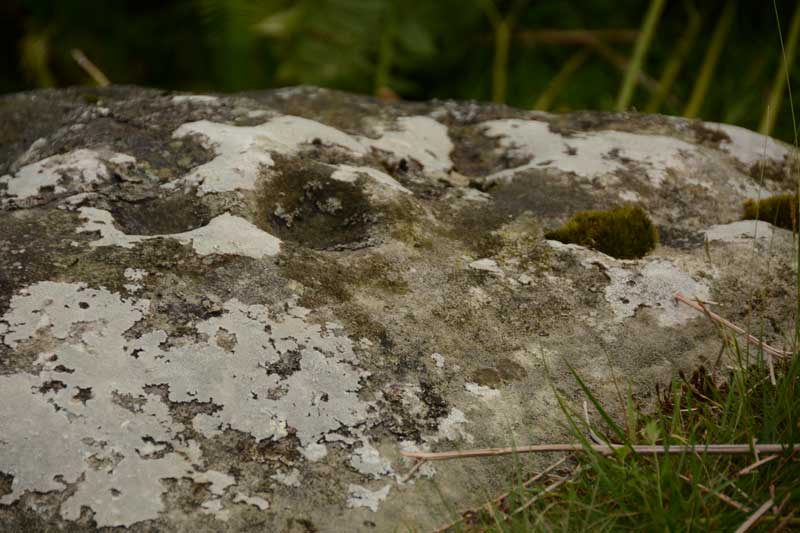
Fontburn a(i) submitted by Anne T on 20th Jul 2015. A close up of some of the cups and weathering marks on the top surface of Fontburn a(i). I counted 6 cups; the rest seemed to be caused by either natural weathering or were heavily eroded cups.
(View photo, vote or add a comment)
Log Text: Fontburn a(i), just off the National Trust Greenleighton Walk, Northumberland: See visit report for Hollinghill Enclosure.
West Shank Enclosure
Date Added: 1st Aug 2015
Site Type: Misc. Earthwork
Country: England (Northumberland)
Visited: Yes on 15th Jul 2015. My rating: Condition 2 Ambience 3 Access 3
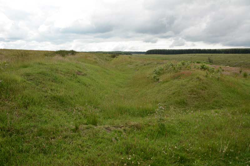
West Shank Enclosure submitted by Anne T on 18th Jul 2015. Standing in the boundary ditch where the footpath cuts the enclosure looking east back towards Hollinghill Enclosure. The banks rise gently up on either side. The vegetation here is short grass, cropped by sheep, so are more obvious than the banks and ditches of the neighbouring Hollinghill Enclosure.
(View photo, vote or add a comment)
Log Text: West Shank Enclosure, near Fontburn Reservoir, Northumberland: See visit report for Hollinghill Enclosure.
Hollinghill Enclosure
Date Added: 1st Aug 2015
Site Type: Misc. Earthwork
Country: England (Northumberland)
Visited: Yes on 15th Jul 2015. My rating: Condition 2 Ambience 3 Access 3
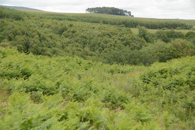
Hollinghill Enclosure submitted by Anne T on 18th Jul 2015. Believe it or not, there is a ditch approximately 1 metre deep in the lower right hand quadrant of the photograph, on the gentle slope leading down to Fallowlees Burn. Across the burn to the north lies the Fontburn Four Poster Stone Circle. This photograph is taken from the Greenleighton Walk footpath, where it cuts the eastern bank of the enclosure half way along its length.
(View photo, vote or add a comment)
Log Text: Hollinghill Enclosure, near Fontburn Reservoir, Northumberland: Before setting off on this walk, we'd identified a number of sites (2 enclosures and several rock art boulders) close to tracks/marked pathways on the Ordnance Survey map. Parking at the car park to the east of Fontburn Reservoir (near the fishing hut and as far south as we could get), we followed the Waterside Walk along the south side of the reservoir. This was slow as we got caught up with a large walking group who hogged the boardwalks, but we finally managed to overtake them. At the sign for the Nature Reserve, we clambered up the small slope onto the track across the access land leading to the west of the reservoir. I confess to finding walking across this access land challenging due to the heavily tussocked grass, no clear pathways, the number of drainage channels, small streams and boggy areas to cross (but seasoned walkers will have no difficulty!). Passing the large cup marked boulder (Fontburn B) on route, we made our way onto the ridge running east-west south of Fallowlees Burn, and onto the National Trust Greenleighton walk with its grassy, mown trackways clearly visible.
It is relatively easy to spot this settlement as the path cuts right through it and there is a lone, low hawthorn tree at its western side. From here, you can see across the Burn to Fontburn Four Poster (it looks, from a distance) as if someone has cut down the hawthorn trees near the stones making up this little circle).
Stopping for a drink and to take photos, we carried on westwards until we got to West Shank enclosure, which is much more visible in the landscape in the then took the modern farm track down the slope to Fallowlees Burn, then across the wooden bridge. On the north side of the bridge two sets of quad bike tracks lead off to the left and right. To the right, the land slopes upwards. Fontburn a(i), a(ii) and a(iii) sit on this land, no more than 100 metres from the footpath, but at this time of year a(i) and a(ii) are hidden by tall bracken. Fontburn a(iii) gleams at you from across the valley.
Having taken these three boulders in, we retraced our steps to the footbridge and took the quad bike tracks to the left hand side, picking our way over two small streams which join Fallowlees Burn close to the the footbridge. From here, it is easy walking up the slope, about 200 yards to Fontburn a(vi), a(vii) and a(viii) and Fallowlees Settlement.
All in all, this 4 and a half mile walk took us 6 hours because of the heavy terrain and exploring the archaeology, but well worth it.
Corbridge Rock Art Panel
Date Added: 24th Jul 2015
Site Type: Rock Art
Country: England (Northumberland)
Visited: Yes on 12th Jul 2015. My rating: Condition 3 Ambience 4 Access 5
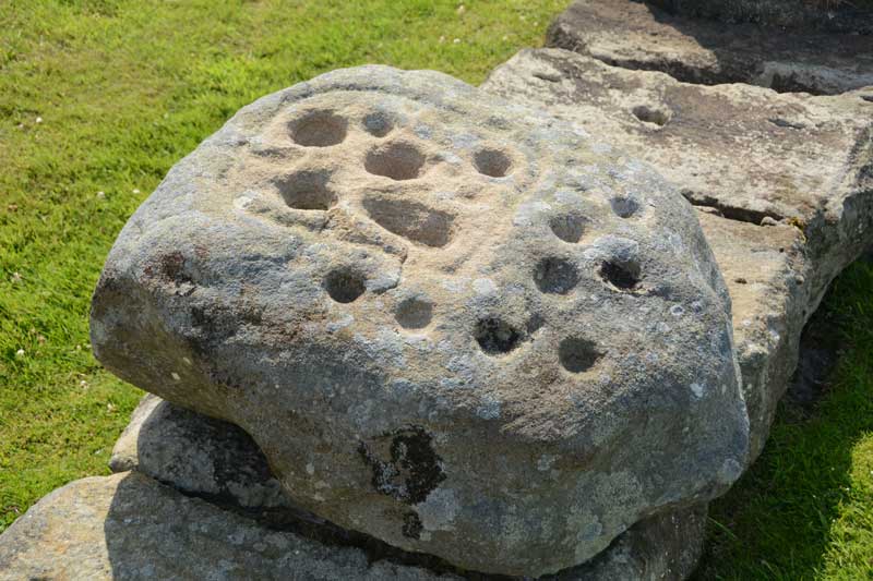
Corbridge Rock Art Panel submitted by Anne T on 13th Jul 2015. Close up of the rock art boulder which sits on the northern side of Stanegate, almost at the eastern end of the Corbridge Roman Fort site.
(View photo, vote or add a comment)
Log Text: Corbridge Rock Art Panel at Corbridge Roman Fort, Northumberland: OK, we've lived in this area for 13 years now, and the nearest we've been to this site is to take my daughter for driving lessons as it was good to practice reversing around corners in the quiet cul-de-sacs around here. Having said that, the Romans generally leave me 'cold' as they as so organised, everything is on a huge, grand scale, and having seen one or two forts, you can generally predict the layout of another. Sceptical? Probably.
However, the purpose of today's visit was to try to find the rock art panel which appears to just have been 'dumped' within the site; no-one seems sure where it comes from, apart from nearby somewhere.
The fort sits on level ground on top of a slope on the north side of the River Tyne, and as there is an old Roman bridge down by the river, this must have been a good place to cross in times gone by.
The staff at the kiosk knew nothing about the stone, until I called up an entry on the Modern Antiquarian (sorry, Portal) to show them, then the lady told me it was mentioned in the guided walks, and told me it was on the north side of the roman road (Stanegate) running through the site. After this, it was easy to find, almost at the far side of the site.
In the distance, across the fields, the church of St. Andrew's in Corbridge, with its anglo-saxon fragments, can be clearly seen.
I did find the strong room, with its set of narrow steps leading down into it, quite fascinating.
Wallington Hall Standing Stone
Date Added: 24th Jul 2015
Site Type: Standing Stone (Menhir)
Country: England (Northumberland)
Visited: Yes on 1st Jul 2015. My rating: Condition 3 Ambience 4 Access 4
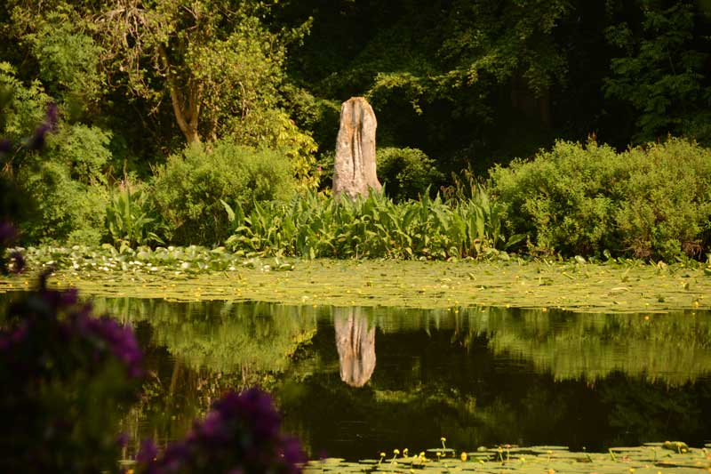
Wallington Hall Standing Stone submitted by Anne T on 6th Jul 2015. The first view of the Wallington Hall Standing Stone from the footpath. The stone sits on the south eastern side of the pond and is easily accessible by paths leading around the pond.
(View photo, vote or add a comment)
Log Text: Wallington Hall Standing Stone, Northumberland: Having been treated to National Trust membership for my birthday, we then sat and wondered how best to make use of this. We'd heard that there was a standing stone at Wallington Hall, but had never found it before. Having tracked down the location (around the China Pond (used to be called the Chinese Pond)), and absolutely loving their walled garden, which is absolutely breathtaking at this time of year, we set up on a Menhir Hunt.
Note to new visitors to Wallington: whereas you could park in the car park near the house then go to the hut to pay admittance, staff are on the entrance to the car park to take entrance money on the way in. I had my cards in the boot of the car, which didn't make me popular with the queue behind, but the less said about that, the better).
This stone, which is said to be the pair to the stone at the Poind and His Man, sits at the far side of the China Pond having been moved here by the famous Mr. Blackett who has built many structures and follys in and around Northumberland. Walking from the house and crossing the busy road to the forest walks, the China Pond is signposted, and it is less than a five minute walk. It certainly sits in a beautiful spot, although I was a little saddened to see it sitting on a concrete/stone base, having been propped up by bits of slates and other stones.
Whilst taking photographs, a couple stopped to watch, saying to each other "they're taking photographs for that Countryfile competition". We assured them we weren't. They were on the look-out for red squirrels, and listened politely when I explained about the standing stone.
Carrying on to the walled garden, I was stunned at the amount of work which goes into keeping this place immaculate. Whilst sipping hot tea at the cafe in the walled garden, the skies got very dark and we were treated to some some spectacular lightening on the way back. Shame the trees blocked the view of the lightening from the standing stone - that would have made a good photo.
Glebe Stone
Date Added: 29th Jun 2015
Site Type: Standing Stone (Menhir)
Country: Scotland (Scottish Borders)
Visited: Yes on 27th Jun 2015. My rating: Condition 3 Ambience 4 Access 4
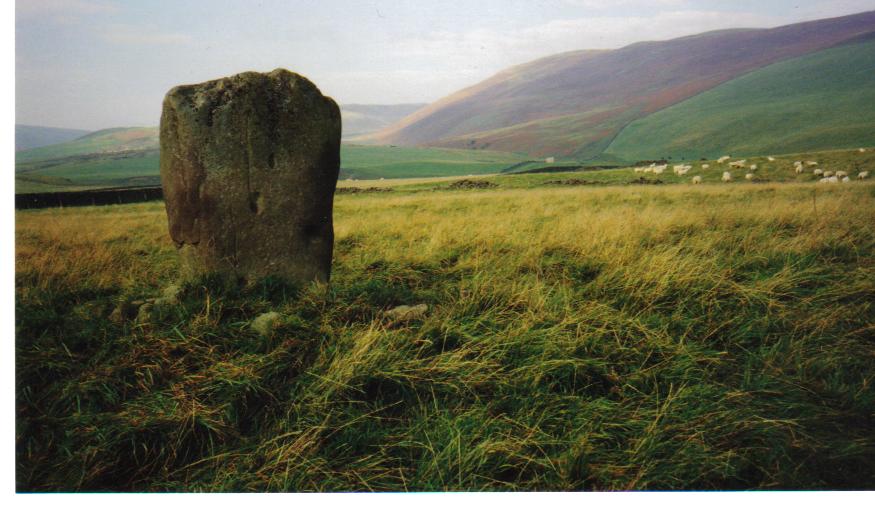
Glebe Stone submitted by mafenty on 6th Feb 2007. The Glebe Stone looking to the west.
(View photo, vote or add a comment)
Log Text: The Glebe Stone, Yarrow, Scottish Borders: parked at NT 35172 27575
Driving back westwards from Warrior’s Rest standing stone, we immediately spotted the Glebe Stone in a field to the north of the road – how had we missed it the first time? With granddaughter’s pushchair in tow, we didn’t dare walk down this narrow, busy, country road, so we parked in the gateway to a barn at grid reference NT 35172 27575. Just as husband got out of the car to see how to access the field, a girl and her dog drove past the car to the barn behind on a quad bike, so I hopped out to explain what we were doing. “No, you’re very welcome to look. There’s a gate a 100 yards or so down the field”, she told me.
This stone, the Canmore Site no. 53061 notes tell me, sits 530 yards ENE of the Yarrow Stone and sits 40 yards north of the main road. These notes say “the stone has been fenced in (although the fence is not now in place) and measures 4ft 6ins in height, from 2ft 7 ins to 3ft 10ins in width and 1ft 4ins in thickness. The broader sides face WNW and ESE. On the latter side, near the base, there are two doubtful cup marks, one measuring 3ins in diameter and ½ inch deep, another 4ins by 5ins and 2 and ½ ins deep. Around the stone there was formerly a large cairn covering a quantity of decomposed bones.”
It was an easy walk up a shallow grassy slope to the stone, and I went all around taking photographs. There is a pleasant view over to Yarrow Water (this stone sits closest of the three stones close together – this stone, the Yarrow Stone & Warrior’s Rest stones) just the other side of the road.
I definitely saw some cup marks on the eastern face of the stone – photographs here to see what others think.
From here, it was back into Selkirk and onto Melrose to see the Abbey before going onto the Kelpies at Falkirk. A great day out!
