Contributory members are able to log private notes and comments about each site
Sites Anne T has logged. View this log as a table or view the most recent logs from everyone
The Portsburgh Stone
Trip No.11 Entry No.1 Date Added: 2nd Mar 2017
Site Type: Natural Stone / Erratic / Other Natural Feature
Country: Scotland (Midlothian)
Visited: Yes on 20th Feb 2017. My rating: Condition 3 Ambience 3 Access 5
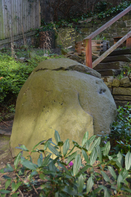
The Portsburgh Stone submitted by Anne T on 23rd Feb 2017. The Portsburgh Stone, photograph taken over the iron railings of the West Port Community Garden, which is only open on Sundays.
(View photo, vote or add a comment)
Log Text: Portsburgh Stone, Natural Erratic, Edinburgh: Intrigued by the 'no photograph' of this site in the heart of Edinburgh, I determined to find it, although we did mis-interpret the location published in the Portal text and walked in a couple of decreasing circles! The actual grid reference is NT 25283 73276, the West Port Garden (or Geddes Garden).
A notice on the padlocked gate to the garden told us that the garden was only open on Sundays, so I had to stand looking over the iron railings to try and get the best photographs I could of the stone.
Couldn’t spot any other erratics in the adjacent walls. Located the old Salvation Army building, and also walked around the nearby Art School buildings, but didn’t see anything. The Vennel, with its many steps, was very interesting to walk up.
Cat Stane (Inch)
Trip No.11 Entry No.2 Date Added: 26th Feb 2017
Site Type: Standing Stone (Menhir)
Country: Scotland (Midlothian)
Visited: Yes on 20th Feb 2017. My rating: Condition 2 Ambience 2 Access 5

Cat Stane (Inch) submitted by golux on 9th Feb 2014. View looking NW, without the incongruous background.
(View photo, vote or add a comment)
Log Text: Cat Stane (Inch), Standing Stone, Edinburgh: Also known as the Liberton Road / Gilmerton Road Standing Stone, this stone has obviously been relocated next to what appears to be the rear entrance of Inch View nursing home, off Gilmerton Road, next to Inch Park. Driving into the complex from Gilmerton Road, there is a circular car park in front of you. Immediately to 12 o’clock of this circle is a small access road to (the rear?) of Inch View Care Home for the Elderly. Just before a small wooden hut, the stone is located in a small rectangle of grass, surrounded by a knee high metal railing.
This area appeared to be a garden, so I started to take some quick photos, only to be challenged (quite rightly!) by one of the nurses who shot out to talk to us. She explained for security reasons, they needed to be vigilant for visitors. Having explained what we were doing, she told us some of the history of the surrounding area, particularly relevant to fans of Sir Walter Scott and Mary Queen of Scots.
Not in an impressive location, this stone could easily be mistaken for a large garden ornament, but worth seeing whilst in the area. I spotted some quarry marks in the face facing the building.
St Margaret's Well (Edinburgh)
Trip No.11 Entry No.4 Date Added: 26th Feb 2017
Site Type: Holy Well or Sacred Spring
Country: Scotland (Midlothian)
Visited: Yes on 20th Feb 2017. My rating: Condition 3 Ambience 3 Access 5
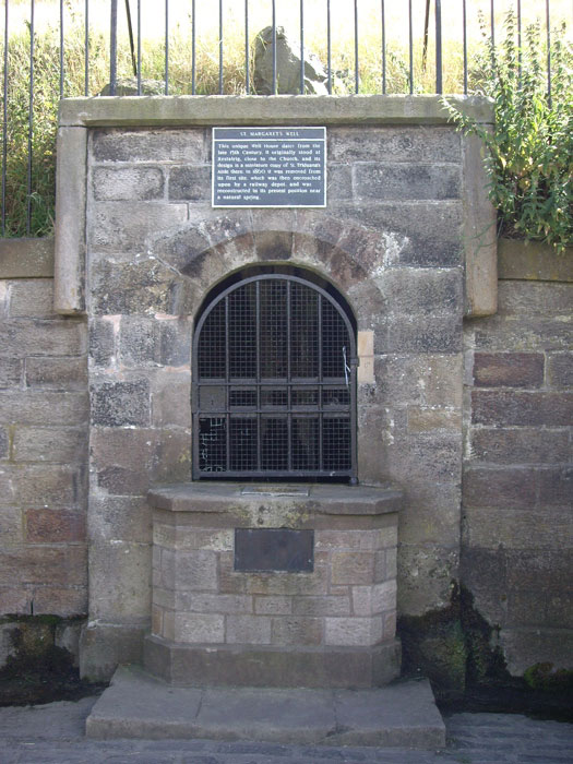
St Margaret's Well (Edinburgh) submitted by feorag on 12th Aug 2006. St. Margaret's Well in Holyrood Park, Edinburgh. Photographed 12th August 2006.
(View photo, vote or add a comment)
Log Text: St Margaret's Well, Holyrood, Edinburgh: Located just off Queen’s Drive in Holyrood, near Dynamic Earth, and 400 metres from St. Anthony’s Well, this well house can be seen from the road.
I had to photo-shop out the pile of rubbish that had gathered at the base of the well (disgusting!). There was a good flow of water out of the pipe inside the well house, although it was impossible to get a photograph of this there was a black heavy metal grill covering it.
I came across a reference on Pixyledpublications telling me “the spring itself is a holy well, called The Well of the Holy Rood or St. David’s Well and dates from 1198, the well head was re-erected from St. Margaret’s Well at Restalrig ….. legend has it that King David after mass decided to go hunting in the area and was thrown from his horse by a giant stag which then carried the king, stopping at the spring. In thanks for his deliverance, he built the Abbey of Holyrood there …. (the well house) has an internal width of six feet by five feet in height with a central pier with a carved head which is provided with a spout.”
The well house bears a plaque which reads: “This unique Well House dates from the late 15th Century. It originally stood at Restalrig, close to the Church, and its design is a miniature copy of St. Triduana’s Aisle there. In 1860 it was removed from its first site, which was then encroached upon by a railway depot, and was reconstructed in its present position near a natural spring.”
Canongate Mercat Cross
Trip No.153 Entry No.2 Date Added: 9th Oct 2019
Site Type: Ancient Cross
Country: Scotland (Midlothian)
Visited: Yes on 1st Oct 2019. My rating: Condition 3 Ambience 4 Access 4
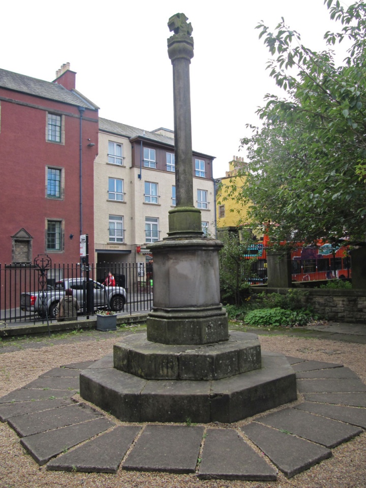
Canongate Mercat Cross submitted by Anne T on 9th Oct 2019. Standing in the NE corner of the courtyard, looking SW to Canongate. The cross looks modern, but then Canmore (and British Listed Buildings) tell us that the octagonal cross shaft is original; the rest are 'modern' replacements.
(View photo, vote or add a comment)
Log Text: Canongate Mercat Cross: Again, we found this cross by chance by following the clues on the "Old Edinburgh Town" Treasure Trail, whilst looking for the answers to two clues within the churchyard. I am sure I annoyed my friend by stopping to photograph all the sites of ancient crosses and wells that we came across, as our 2 hour 'trail' took 4 hours (although this included a coffee and cake stop, too).
Never really having explored Edinburgh Old Town, I was really surprised to find out how much, and how historic, Canongate and surrounding area is.
Girth Cross (Canongate)
Trip No.153 Entry No.4 Date Added: 9th Oct 2019
Site Type: Ancient Cross
Country: Scotland (Midlothian)
Visited: Yes on 1st Oct 2019. My rating: Condition -1 Ambience 3 Access 5
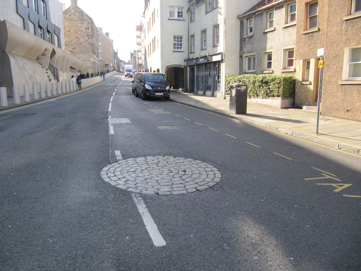
Girth Cross (Canongate) submitted by Anne T on 9th Oct 2019. Standing on the pedestrian island at the western side of the roundabout, I had to wait for ages to get a view without traffic whizzing by on either side. The outer wall Scottish Parliament building is on the left hand side of the photograph. This view looks west up Canongate. If I hadn't have known, from our Treasure Trail clues, that this was the site of the cross, I would have passed it by, but it marks the western limit of the Girth of Holyrood, the largest sanctuary in Scotland, and the las...
(View photo, vote or add a comment)
Log Text: Site of the Girth Cross, Canongate: Again, we picked this location up from the Treasure Trail, after Clue 15, there is a ‘Did you know?’ box which reads: “Where Canongate meets Abbeyhill look out for the circle of cobbles. This is the site of the ‘Old Girth Cross’ where proclamations and executions took place. In 1600 Lady Warriston was beheaded by guillotine for conspiring to murder her abusive husband”.
This site is at a very busy road junction, west of Holyrood Palace, and at the eastern end of Canongate, where Canongate meets Abbeyhill, Abbey Strand and Horse Wynd.
Not much to see really, apart from a circle of grey pavers
Edinburgh Runestone
Trip No.157 Entry No.4 Date Added: 20th Feb 2020
Site Type: Carving
Country: Scotland (Midlothian)
Visited: Yes on 18th Feb 2020. My rating: Condition 3 Access 4
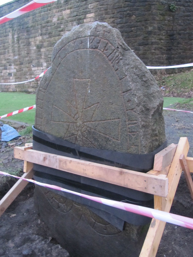
Edinburgh Runestone submitted by Anne T on 7th Jan 2018. The Runestone seen by clambering up the steep muddy track from Princes Street Gardens, just below the Castle Esplanade. The runes read: ""Ari engraved this stone in memory of Hialm his father. God help his soul."
(View photo, vote or add a comment)
Log Text: Edinburgh Runestone, George's Square: A friend very kindly told me this stone has now been relocated, although it is still in the process of being bedded into its new spot, with the concrete shuttering still around its base.
The red cross on the eastern narrow side of the stone has now been picked out in red paint. The plain, southern side, is presumably to be hidden by shrubs once the bed is replanted.
Gogar Stone
Trip No.25 Entry No.4 Date Added: 21st May 2017
Site Type: Standing Stone (Menhir)
Country: Scotland (Midlothian)
Visited: Saw from a distance on 18th May 2017. My rating: Ambience 3 Access 4
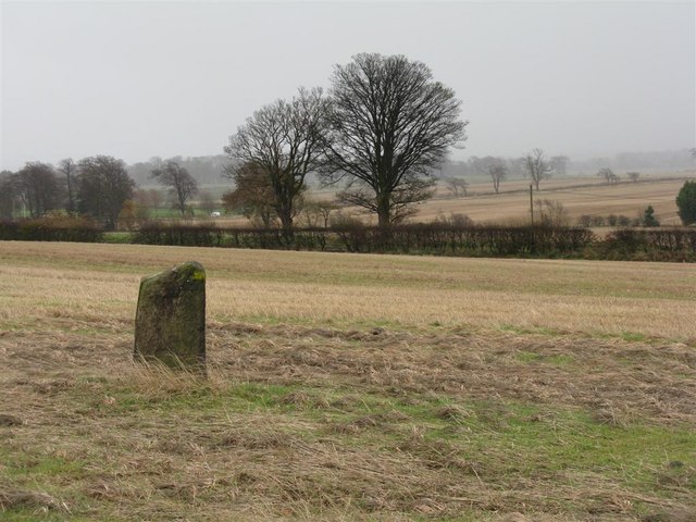
Gogar Stone submitted by Andy B on 13th Mar 2010. Standing stone at Gogar
Copyright M J Richardson and licensed for reuse under the Creative Commons Licence.
(View photo, vote or add a comment)
Log Text: The Gogar Stone, West Lothian: This stone was conveniently located on our way back into Edinburgh, although we were only able to see it from a distance. Sited towards southern edge of a huge field, about 300 metres south east of East Norton Farm, access to the field can be gained from Freelands Road through the large gaps in the hedge which runs to the northern side of the road.
At the time of our visit, a crop of wheat was almost knee high in the field. We walked along the crop-free area of the field running alongside Freelands Road side, seeking a tractor track we could walk along to reach the stone. Not finding this, we turned and walked north, following the edge of the field along Gogarstone Road. Again, no track. I started trying to place my feet carefully between the densely planted rows of wheat without damaging them, but even my feet were too large to fit sideways inside the rows; it took me five minutes to get some 20 rows in, and only 1/10th way there!
I could have kept walking round this enormous field, but time was running short. We decided to come back once the crop had been harvested, and moved on to the Physic Well in Corstophine.
Physic Well (Corstorphine)
Trip No.25 Entry No.5 Date Added: 21st May 2017
Site Type: Holy Well or Sacred Spring
Country: Scotland (Midlothian)
Visited: Yes on 18th May 2017. My rating: Condition 3 Ambience 4 Access 5

Physic Well (Corstorphine) submitted by feorag on 31st Aug 2006. The overgrown remains of the Physic Well, Corstorphine. Photographed 23rd October 2005.
(View photo, vote or add a comment)
Log Text: The Physic Well, Corstophine, Edinburgh: Pulling up on the northern section of Dunsmuir Court from Ladywell Road, I thought we’d spotted the well head under the trees between the houses and the main road, but this turned out to be a milestone!
Thankfully having the image of the well from the Portal, we followed the Court round to the garden at the back, and found the well behind a black metal railing which looked as if it had been painted recently.
The area between the houses has been turned into a modern garden, with tall stones looking like standing stones between the plants.
A lovely little spot, a little oasis away from the busy Edinburgh roads not far away. The blocks of flats here are being renovated and the area has a bright, airy feel. Shame there was no water in the well, though, especially as it used to be such a tourist attraction in the past.
National Museum of Scotland
Trip No.62 Entry No.1 Date Added: 8th Jan 2018
Site Type: Museum
Country: Scotland (Midlothian)
Visited: Yes on 19th Dec 2017. My rating: Condition 4 Ambience 5 Access 5

National Museum of Scotland submitted by dodomad on 10th Jul 2016. The Greenlaw axehead
Photo Credit: National Museum of Scotland
(View photo, vote or add a comment)
Log Text: Pictish and Early Christian Stones, NMS: The weather prohibited my friends and I from doing much outside, so the National Museum of Scotland seemed like a good place to visits. Neither of us had been before, and as neither of us knew where we were going, asked the lady at the reception desk for the Pictish Stones. She was very helpful, pulling out a guide of the museum and telling us that some of them were in the basement, other in the Kingdom of the Scots exhibition on the first/part floor. She said she would contact one of her colleagues.
She pointed us in the direction of the stairs to the next floor down, and by the time we reached the bottom, a colleague was already waiting to greet us. He walked us round to the start of the exhibition and round to the pod to the side of the ‘early people exhibition’ on the lower ground floor. I spent a very happy couple of hours wandering around the exhibitions and photographing the stones.
The one downside was that not all the signs telling us what the exhibits were could be found. I did try and find someone to ask later in the afternoon, but could find no-one on the museum floor that we were on. I will email or revisit to find out more about the exhibits I'm really interested in.
National Museum of Scotland (Early Christian Stones)
Trip No.74 Entry No.1 Date Added: 20th May 2018
Site Type: Ancient Cross
Country: Scotland (Midlothian)
Visited: Yes on 17th May 2018. My rating: Condition 4 Ambience 4 Access 5
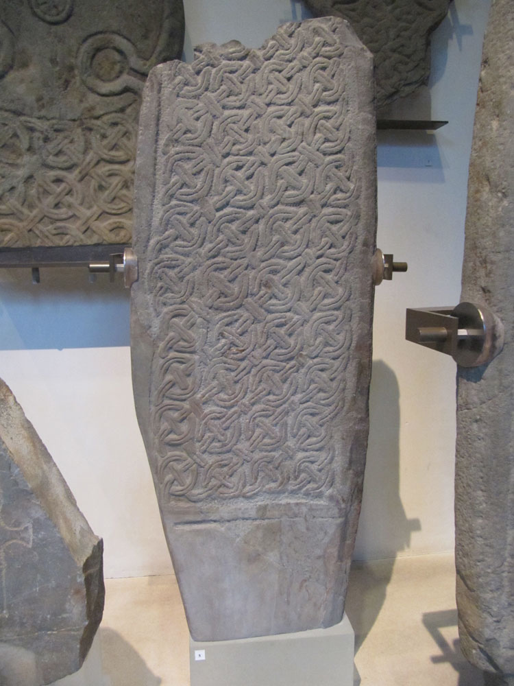
National Museum of Scotland (Early Christian Stones) submitted by Anne T on 18th Jan 2018. This Whithorn Style Cross Shaft is on display in the 'Early People's Exhibition on Level -1. It comes from Craiglemine, Glasserton, Wigtownshire near Whithorn, Dumfries and Galloway. Submitted with the kind consent of National Museums of Scotland. Exhibit X.IB 122. Dates from 900-100 AD.
(View photo, vote or add a comment)
Log Text: Early Christian Stones at the National Museum of Scotland: We returned to go to the Research Library to find out more about the Pictish Stones, and to photograph some more exhibits, only to find Tim Peake's Spacecraft had arrived that morning, with a PR exercise in full swing and the gallery we needed to get to had been closed off until 2pm (didn't say anything about this on the web site, until we dug deeper into the events schedule). Fortunately, by the time we'd been and looked at some casts of grave slabs in part of the Kingdom of the Scots exhibit, the gallery we wanted to go to was temporarily re-opened and we managed to get in and out in between the various waves of visitors and school children. The space craft was minute, and like a cross between something out of Dr. Who and The Clangers. Apparently, Tim Peake had attended earlier that morning, but we'd missed him.
I spent an hour in the research library, coming away with some photocopies and the names/details of a number of reference books.
We also managed to go into the 'Early People's Exhibit' which had been closed during our last visit - more Pictish Symbol stones and Early Christian stones, which more than made up for the disappointment of having arrived at 10.30am and being told we'd have to wait until 2pm to get in because of Tim Peake!
Castle Law
Trip No.85 Entry No.1 Date Added: 26th Jul 2018
Site Type: Hillfort
Country: Scotland (Midlothian)
Visited: Yes on 15th Jul 2018. My rating: Condition 3 Ambience 4 Access 4
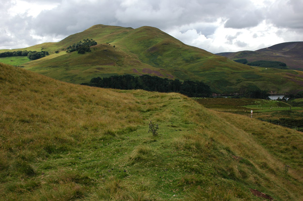
Castle Law submitted by nicoladidsbury on 14th Oct 2007. Castlelaw Hillfort - this photo shows the earth banks and terraces of the hill fort.
(View photo, vote or add a comment)
Log Text: Castle Law Hillfort, Glencorse: First stop of the day, and I was surprised this hill fort was so close to a modern military firing range. Because of its proximity to Edinburgh, there were a few other people parked in the small car park below the fort, but very few walked up onto it; a track carried on up the hill.
The earth house was very unusual, with steps leading down into it, and a narrow, curving passage leading into it. About half way down, a small doorway leads into a circular chamber.
We searched, and found, the cup marked stone towards the eastern wall of the terminus. If other stones had been put on top of this, the cups couldn’t have been seen. It was difficult to capture the cups (and some micro-cups?) in the dim lighting, even using flash and a torch, and had me giggling with our efforts to get a good photograph.
We walked round the inner defences of the fort, admiring the shooting range below, then carried on up the hill to what was left of the palisaded settlement. Walking up the hill to this site gave us an excellent view down on to the hillfort.
Castle Knowe (Glencorse)
Trip No.85 Entry No.2 Date Added: 27th Jul 2018
Site Type: Ancient Village or Settlement
Country: Scotland (Midlothian)
Visited: Yes on 15th Jul 2018. My rating: Condition 2 Ambience 3 Access 4
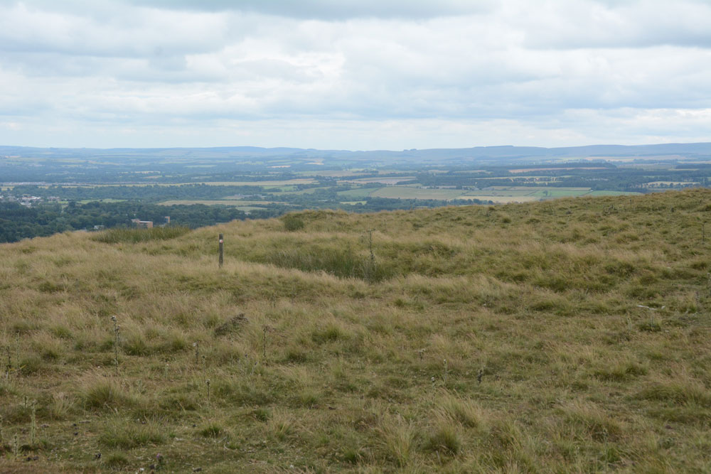
Castle Knowe (Glencorse) submitted by Anne T on 27th Jul 2018. The main line of the low palisade bank/trench to the north eastern side of this palisaded settlement.
(View photo, vote or add a comment)
Log Text: Castle Knowe Palisaded Settlement, Glencorse: From Castle Law hill fort, we continued northwards up the track, turning right up another footpath onto the Castle Knowe Palisaded Settlement. I stopped half way up to get some photos of Castle Law Hill Fort, looking down on it. There were a few other people walking up the track, and whilst they had largely stopped at the fort to look quickly around, no-one paid any attention to this settlement.
There wasn’t a lot to see, apart from some small boundary banks and ditches on the northern and just the north eastern side. There is a modern cairn on top – just a pile of red sandstone rocks, but this was very eye-catching, particularly from the car park and fort below, mostly because of its red colour.
The military earthworks to the north of this settlement look like a much more substantial monument, but are just for military training exercises.
Whilst there were only a couple of the palisade trenches visible on the north and north east side of the settlement, and possibly signs of one of the timber house circles, it was well worth walking further up the hills for the views to the east and north.
Glencorse Cup and Ring Marked Stone
Trip No.85 Entry No.3 Date Added: 27th Jul 2018
Site Type: Rock Art
Country: Scotland (Midlothian)
Visited: Yes on 15th Jul 2018. My rating: Condition 3 Ambience 3 Access 5

Glencorse Cup and Ring Marked Stone submitted by uisdean on 19th Apr 2007.
Cup and ring marked stone in Glencorse (NT24706259)
(View photo, vote or add a comment)
Log Text: Glencorse Cup and Ring Marked Stone: Just outside the tall, imposing (and locked) Parish Church, which had an amazing old tree in the field opposite, and a long layby; this village is obviously popular with walkers, as there were lots of cars parked around here, and footpaths leading through the woods, away from the church.
This poor cup and ring stone is contained behind railings, so it looked as if the stone had been caged. The lichen and moss growing on it made it a little difficult to pick out the cups (we certainly couldn’t count 22), and we saw a couple of cup and ring motifs. Even trying to view the stone from different angles, to try and highlight the cups, didn’t make it any easier. A brush and a bottle of water would have come in useful.
I was much amused by the ‘reserved’ signs next to the stone, as if the minister and church warden might have had cars with specially shaped bonnets to fit neatly around the ‘railing cage’.
We did try the church door, just in case, but like many of these churches, locked and bolted. This church had the most amazing number of floodlights around it, so it must have been well lit in the dark.
St Matthew's Well (Roslin)
Trip No.85 Entry No.4 Date Added: 27th Jul 2018
Site Type: Holy Well or Sacred Spring
Country: Scotland (Midlothian)
Visited: Yes on 15th Jul 2018. My rating: Condition 3 Ambience 3 Access 4
St Matthew's Well (Roslin) submitted by KiwiBetsy on 6th Oct 2006. The water flows into a white (or it probably once was) concrete dome which is brick lined and is very hard to spot in the undergrowth.
(View photo, vote or add a comment)
Log Text: St. Matthew's Well, Roslin: Getting to this well was interesting! Parking in Roslyn Chapel car park at NT 27405 63109, we took the gate from the south east of the car park through the cemetery, then out of the cemetery down a very overgrown lane, with very tall nettles on either side. About 50m from the grid reference for the well, we needed to head off south west into the wood. There were some tracks through here, but obviously not regularly used. We could see a green, mossy mounds/structure through the trees, but couldn’t find a way of getting down to them. In the end, I realised the track had been covered by a heavy, large dead tree branch, which Andrew and I managed to haul away from the path with a little difficulty. Having cleared the track, we used the tree roots as stepping stones at first, then slide the 20m or so down the slope to the well (I told myself it was always easier going up!).
At first we thought there was only one dome here, but looking harder, there was a second one, a few metres up the slope. The front face of the second dome (nearest the river Esk) had a hole in the front, which I poked the camera through to take a photograph. The was a large iron pipe which gushed water into the well chamber. A continuation of this pipe could be seen in a small gully which headed towards the river from the well chambers, although the gloom and all the detitus made it difficult to capture the location.
Heading back to look at the ruins of St. Michael’s church, we looked over the western end of the graveyard, looking south west, and realised we could not only see the well houses, but it also looked as if there were the remains of a wall and steps, as there were cut blocks of stone lying around.
I went back to photograph the 'Spooky Angel' I'd seen when I visited with my friend two years ago (hidden under a bush by the small outbuildings) - she much reminded me of an episode of Dr. Who, where the angels only moved when you didn't look at them.
Grassmarket modern menhir
Trip No.98 Entry No.1 Date Added: 21st Sep 2018
Site Type: Standing Stone (Menhir)
Country: Scotland (Midlothian)
Visited: Yes on 18th Sep 2018. My rating: Condition 3 Ambience 3 Access 5

Grassmarket modern menhir submitted by ladrin on 8th Mar 2018. Modern menhir on the Grassmarket, Edinburgh.
(View photo, vote or add a comment)
Log Text: Modern Megalith, Grassmarket, Edinburgh: This stone was on our walk for the afternoon. It took a bit of finding, located behind the bins and underneath the trees. This modern megalith stands under a group of trees on the paved area of Grassmarket. In the time we spent photographing it, no-one else appeared remotely interested, despite the large numbers of tourists in the area.
It has a plaque which reads: “This plaque was unveiled on 3rd of October 1977 by the Rt. Hon. Kenneth Borwick, Lord Provost of the City of Edinburgh, to commemorate the 500th anniversary of a reorganisation of Edinburgh Markets authorised by King James III on 3rd of October 1477. The Cattle Market was situated at the western end of the Grassmarket and in King’s Stables Road. This area was then just outside the Burgh.” Underneath this larger plaque is a smaller one which says: “Stone laid by Grassmarket Area Traders Association, 3rd October 1977.”
Edinburgh Runestone
Trip No.98 Entry No.2 Date Added: 21st Sep 2018
Site Type: Carving
Country: Scotland (Midlothian)
Visited: Yes on 18th Sep 2018. My rating: Condition 3 Ambience 3 Access 4

Edinburgh Runestone submitted by Anne T on 7th Jan 2018. The Runestone seen by clambering up the steep muddy track from Princes Street Gardens, just below the Castle Esplanade. The runes read: ""Ari engraved this stone in memory of Hialm his father. God help his soul."
(View photo, vote or add a comment)
Log Text: New site of the Edinburgh Runestone (not been moved yet): As we were going to a building near to hear, we thought we’d do a detour to this part of the University.
We wandered around George Square first of all, but only found a modern sculpture called The Dreamer. We then identified 50 George Square (taken from the BBC article about the relocation of the stone), but only spotted a large hole in the middle of a square flower bed, hedged by low privet, around the side of the building. Having walked all around it, we went into check and I asked the security guard at the reception desk. He told us the stone hadn’t yet been moved, but the hole had been dug in preparation. I thanked him and went to take a photograph of the new site.
Caiy Stane
Trip No.106 Entry No.2 Date Added: 5th Nov 2018
Site Type: Standing Stone (Menhir)
Country: Scotland (Midlothian)
Visited: Yes on 28th Oct 2018. My rating: Condition 3 Ambience 4 Access 5
Caiy Stane submitted by crannog on 22nd Feb 2012. Edinburgh council has to be commended for the care they take in preserving ancient sites/monuments, like this. It is located at the end of a street with lots of homes all around.
(View photo, vote or add a comment)
Log Text: The Caiy Stane, Edinburgh: It was a good job we had the SatNav to help us find this stone, as all the streets around were called ‘Caiy (something)’ and we could have been driving around for ages!
This is a magnificent stone, set back in a niche backing onto someone’s garden on Caiystane View. It is possible to walk all the way around it, so we saw the 6 cups marks and the more modern graffiti on the back face.
The small sign at the front base of the stone reads: “The Caiy Stone. The Property of The National Trust for Scotland.” The larger sign, on the low wall to the left of the stone reads: “The Caiy Stane. Standing at over nine feet high on a summit, originally with wide views, this broad slab of red sandstone includes a line of six, probably prehistoric, cup marks on its reverse face. / The stone may have been erected as early as the Neolithic period, possibly before 3000BC, to denote a ritual or burial place. Records of cairns, cists and urns found in the immediate vicinity show that the hilltop continued to be used for burial in the Bronze Age. / Discovery of these remains led to the supposition that Caiyside Hill was the site of a battle, variously suggested to have involved Romans, Danes (Vikings); ore Cromwellians. The Caiy Stane, also known as the Kel Stane, the Cat Stane or the Camus Stane, was thought to have been a battle memorial stone.”
Hanging Stanes (Braid Road)
Trip No.105 Entry No.3 Date Added: 5th Nov 2018
Site Type: Marker Stone
Country: Scotland (Midlothian)
Visited: Yes on 28th Oct 2018. My rating: Condition 2 Ambience 3 Access 5
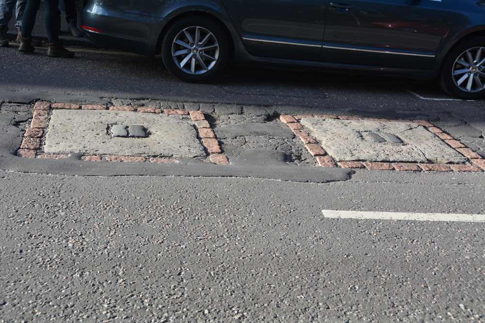
Hanging Stanes (Braid Road) submitted by Anne T on 5th Nov 2018. The two gallow bases are embedded in the road surface. I originally thought this site was associated with witches, but was the site of the execution of the last two highwaymen in Scotland. We picked this site up from the Ancient Stones website, and as it was very close to the Buckstane, thought we'd take a look.
(View photo, vote or add a comment)
Log Text: The Hanging Stanes: Having spotted this site on the Ancient Stones website, and with them being just down the road from the Buck Stane, we decided to pay this site a visit on the way into Edinburgh City Centre. I don't know why I thought these were originally associated with witches, but found out otherwise during the visit.
We pulled up next to the junction of Braid Road and Comiston Road, as per the directions on the Ancient Stones, only to find some people from the house immediately next to it were leaving and getting into their car. The older gentleman from the house asked me if we’d seen the plaque on the street and told me around 30 people each day come to see these stones.
The plaque in the pavement reads: “The Hanging Stanes. Thomas Kelly and Henry O’R eil, the last two highwaymen in Scotland to be executed, were hanged in public on 25th January 1616, from the gallows erected on the two stanes still visible on the spot, which was where the robbery took place. Paid for by public subscription. 1995.”
I risked getting run over to avoid my shadow falling across the stones, but they were half in shade and half in the sun, so the photos weren’t great. With these stones being sited on the slope of a hill with views over the city centre, without the traffic and the people around, this would have been a very atmospheric and enigmatic place.
Slidey Stane (Holyrood Park)
Trip No.106 Entry No.4 Date Added: 5th Nov 2018
Site Type: Natural Stone / Erratic / Other Natural Feature
Country: Scotland (Midlothian)
Visited: Yes on 28th Oct 2018. My rating: Condition 3 Ambience 3 Access 4
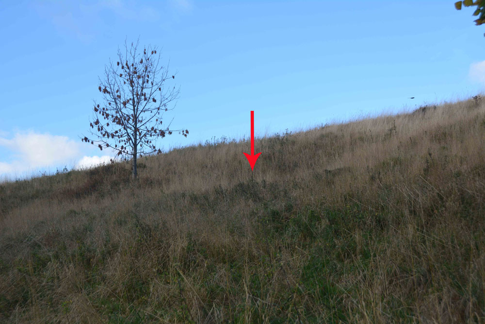
Slidey Stane (Holyrood Park) submitted by Anne T on 5th Nov 2018. The Slidey Stane is well hidden on this hillside, from above and below. From the path below, all that can be seen is a small dip in the slope of the hill. Similarly from the footpath running above the stone, although there are much larger chunks of bedrock sticking up at the side of the path.
(View photo, vote or add a comment)
Log Text: The Slidey Stane, Holyrood Park: As we were in Edinburgh City Centre, we thought we'd try and find this large erratic stone which is featured on The Ancient Stones website, but my goodness - what a search we had!
We followed the directions given on The Ancient Stones, and even armed with the GPS we walked up and down and down and up and round and round. Eventually, I took my phone out and managed to find a forum post on the Modern Antiquarian which gave a link to a search by the park rangers. This, thankfully, included photographs of the route to find the stone. It is in fact at the location given by the Ancient Stones, but is so hidden in a dip on the hillside, that we were unable to see it, either from below or above. We finally saw it from a couple of metres away, but what a disappointment!
The stone is small, although the top is shiny as if it has been polished over the years. There are larger stones on the footpath running above the Slidey Stone.
Well, at least we found it, photographed it and have now posted the results here. We too a more accurate grid reference of NT 26766 72765.
Gogar Stone
Trip No.105 Entry No.6 Date Added: 6th Nov 2018
Site Type: Standing Stone (Menhir)
Country: Scotland (Midlothian)
Visited: Yes on 28th Oct 2018. My rating: Condition 3 Ambience 4 Access 4

Gogar Stone submitted by Andy B on 13th Mar 2010. Standing stone at Gogar
Copyright M J Richardson and licensed for reuse under the Creative Commons Licence.
(View photo, vote or add a comment)
Log Text: The Gogar or Easter Norton Standing Stone: The last time I visited this stone, the field was planted with crop with no easy way of crossing the knee high rows of plants, so we viewed it from a distance. On this visit, the field had been left fallow, so we parked in the small layby on Freelands Road and walked through a gap in the hedgerow up to the stone. A large rook was perched on top of the stone, but flew off before I could take a photograph of it.
This stone has lots to keep it occupied during the day – planes taking off from Edinburgh airport to the north, trains on the mainline to the south, and cars on the M8. It was nice to be able to wander up to it, take photographs and see the stone up close.
The satnav took us by a funny route back to the A8 and whilst waiting to move off, a white van ran into the back of our car, just as a blue light ambulance was trying to get past. Not a good end to the day, but we decided to stop off at the Boar Stone on the way back as there was still just enough daylight.
