Contributory members are able to log private notes and comments about each site
Sites Anne T has logged. View this log as a table or view the most recent logs from everyone
Balfarg Riding School mortuary enclosure and henge
Trip No.110 Entry No.3 Date Added: 13th Nov 2018
Site Type: Henge
Country: Scotland (Fife)
Visited: Yes on 1st Nov 2018. My rating: Condition 3 Ambience 3 Access 4
Balfarg Riding School mortuary enclosure and henge submitted by SandyG on 3rd Jan 2015. The reconstructed mortuary enclosure. View from north west (19th April 2014).
(View photo, vote or add a comment)
Log Text: Balfarg Riding School Henge Reconstruction: This now recreated henge is just by the A92, at the end of Old Leslie Road, with part of it seeming to have been cut by the construction of the A92. Traffic streams by constantly.
We arrived with the sun high in the sky and deep shadows, which tested my photography skills. I had expected a circular henge, but this was oval. I didn't pick up any atmosphere at this site at all. Sadly, it was just like walking through some old fence posts set up to cast some interesting shadows.
The information board reads: “You are standing in a revered landscape where ceremonies were performed by generations of prehistoric people. Here is an artist’s reconstruction of how the stone circle looked around 4,000 years ago. By this time it had already been in use for 1,000 years, when it became a place of burial. It stood close to the Coul Burn which then enclosed a wider sacred landscape. The picture shows the site of the Balfarg Henge and timber enclosure in the distance.”
Dogton
Trip No.110 Entry No.5 Date Added: 13th Nov 2018
Site Type: Class III Pictish Cross Slab
Country: Scotland (Fife)
Visited: Yes on 1st Nov 2018. My rating: Condition 3 Ambience 4 Access 4
Dogton submitted by cosmic on 15th Feb 2006. Dogton from East
(View photo, vote or add a comment)
Log Text: The Dogton Cross: With the clocks having gone back an hour on the Sunday before, it was difficult to correctly judge how fast dusk would fall. It was getting a little dark, but whilst we were here, we really wanted to see this stone.
With the roads busy at this time of night, we managed to park just off the road at the entrance to the track leading up to Kinglassie House, just off the B922 and set off up the footpath to find this cross.
The gate into the field the stone was in was an amalgamation of several gates tied together, so it was easier just to step over the tumbled stones by the gate post. Fortunately the field the stone was in had just been harvested, so we walked up through the corn stubble, just as dusk was setting in.
I photographed each face of the cross by leaning over the railings, or poking the camera through the railings, then stitched them together.
The sign on the railings reads: “Dogton Stone. This stone is a free-standing Celtic cross probably 10th century AD. The top and arms of the cross have been destroyed, but the centre boss is still visible on the east face. A horseman is carved below it and there are entwined serpentine animals on the south face. Cared for by Historic Scotland.”
When I got back home and looked at the Canmore records, I was surprised to see the cross and its railings had been, in the not too distant past (photo dated 1927), incorporated into a dry stone wall, no longer there.
Tuilyies
Trip No.111 Entry No.2 Date Added: 14th Nov 2018
Site Type: Standing Stones
Country: Scotland (Fife)
Visited: Yes on 2nd Nov 2018. My rating: Condition 3 Ambience 4 Access 4
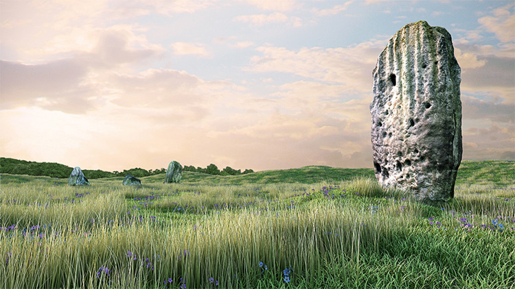
Tuilyies submitted by jonathanknox on 3rd May 2012. Tuilyies 3D model #2 -Tuilyies Standing Stones in Fife, Scotland, part of a digital documentation/visualisation pilot project by Pixogram. Accurate retopologised 3D models from photogrammetry to a +-10mm tolerance.
(View photo, vote or add a comment)
Log Text: The Tuilyies Stone Setting: There is a small layby on the A985, right by the stones, but as there was no direct entrance into the field, we ended up walking along the grass verge down to where the wire fence is jointed to a wooden one. This is by a small clump of trees, at NT 02801 86657, where we succeeded in clambering over the fence.
The stones are set in a very ‘lumpy and bumpy’ field that looks like it has several building platforms and banks within it, but no structures are visible.
The tall stone to the north north west of the setting of three stones is tall and impressive (although thin) with the eastern face peppered in cup marks.
Combined with the three stones to the south south east reminded us somewhat of the stone setting at Kilmartin. I amused myself by standing behind the taller stone trying to line it up with the three smaller ones, but there was always one stone hidden from view, behind the larger stone.
The Firth of Forth glinted in the sunlight to the south. Shame about the proximity to the main road.
St Mary's Well (Rothsay)
Trip No.51 Entry No.1 Date Added: 8th Oct 2017
Site Type: Holy Well or Sacred Spring
Country: Scotland (Isle of Bute)
Visited: Yes on 25th Sep 2017. My rating: Condition 2 Ambience 3 Access 5
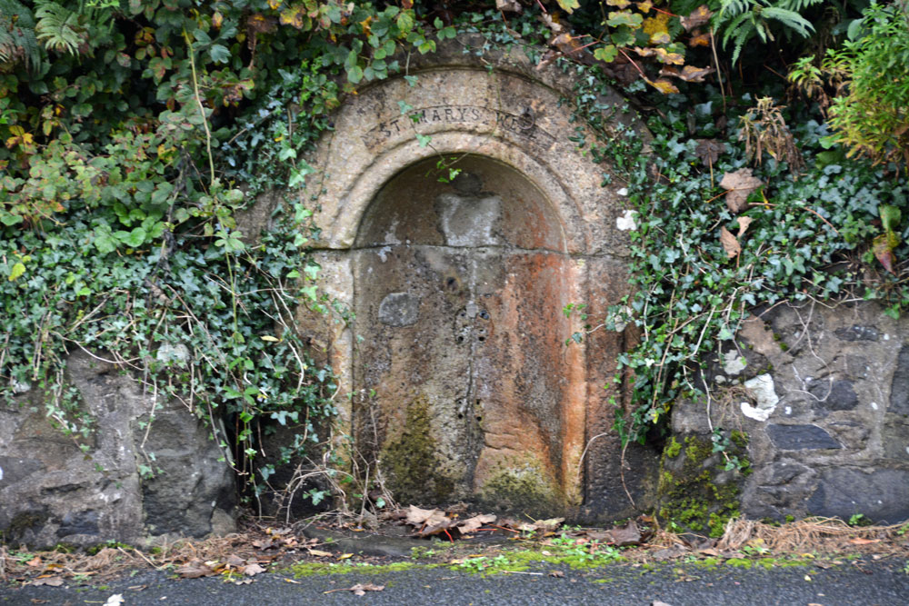
St Mary's Well (Rothsay) submitted by Anne T on 8th Oct 2017. St Mary's Well, showing it's sadly disused, dry state.
(View photo, vote or add a comment)
Log Text: St. Mary's Well, Rothsay: Almost immediately across the road from St Mary's Chapel, set into a dry stone wall and very sadly neglected. There is no outlet but the remains of a metal tethering ring for a cup or ladle is still embedded in the arch. Worth a walk across from the chapel to take a look.
St Blane's Well
Trip No.51 Entry No.2 Date Added: 8th Oct 2017
Site Type: Ancient Cross
Country: Scotland (Isle of Bute)
Visited: Yes on 25th Sep 2017. My rating: Condition 3 Ambience 4 Access 4
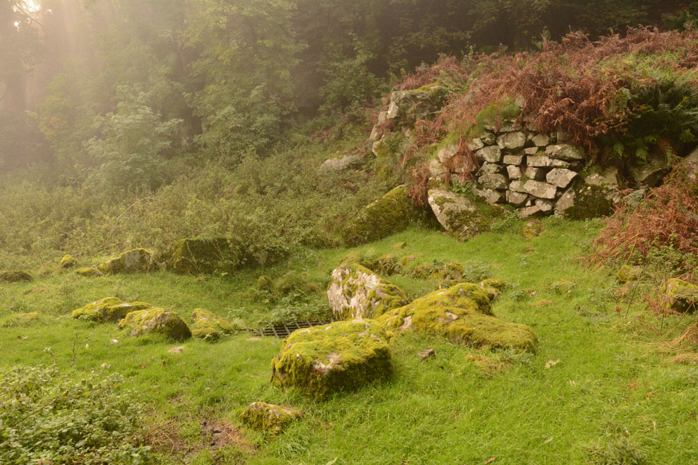
St Blane's Well submitted by Anne T on 8th Oct 2017. View of this well from the north. By this time of the afternoon, the sea haar was coming in with a vengeance, and with the last of the sun's rays coming through, this site was very atmospheric.
(View photo, vote or add a comment)
Log Text: St. Blane's Well, Isle of Bute: After St. Mary’s Chapel and Well, we made our way to the south end of the island, by which time the mist was starting to come in from the sea. There is a layby at NS 09299 53076 for around 6 cars at the start of the path uphill to the chapel. I was very disappointed to find quite a few other visitors there. They must have done what we did, and made their way straight to the south end of the island to work their way back. Should have timed it better.
At this site, as well as the chapel, there is a holy well, a hogback and a cross shaft. This whole place is very ancient and it was atmospheric in the mist.
St Blane's Chapel (Isle of Bute)
Trip No.51 Entry No.3 Date Added: 8th Oct 2017
Site Type: Ancient Cross
Country: Scotland (Isle of Bute)
Visited: Yes
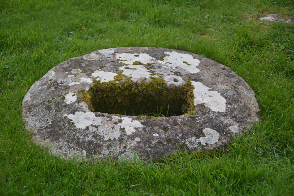
St Blane's Chapel (Isle of Bute) submitted by Anne T on 8th Oct 2017. This cross-base/socket stone is embedded within the ground in the lower (southern part) of the graveyard. There is apparently another cross base 70m north of the chancel, although we were unable to find this.
(View photo, vote or add a comment)
Log Text: Cross base/socket stone, St. Blane's Chapel, Isle of Bute: Whilst I was wandering through the ruins of the chapel and photographing it, husband Andrew was in search of this sandstone socket in the lower churchyard. In the end, it was easy to find – head south out of the ruins, into the upper churchyard, down the steps, and it is virtually in front of you to your left hand side. I confess that without the Canmore record, I might have very well missed this, as I’m used to seeing socket stones that are sitting on the ground, not buried within it.
Blackpark
Trip No.50 Entry No.4 Date Added: 9th Oct 2017
Site Type: Stone Circle
Country: Scotland (Isle of Bute)
Visited: Yes on 25th Sep 2017. My rating: Condition 3 Ambience 4 Access 4

Blackpark Stone Circle submitted by saille on 14th Jan 2004. At NS 091556, the stone circle in Blackpark Plantation has only three stones left standing, the remains of a larger complex of seven stones.
Now surrounded by forestry plantation.
Towards the west of the road, between Kingarth and Largizean farm, there are three more standing stones which are more in-line with each other than Blackpark.
(View photo, vote or add a comment)
Log Text: Blackpart Standing Stone, Isle of Bute: About 2.3 km north of St. Blane’s Chapel, still on Plan Road. There is a small car park just off the road, north of the stones, at NS 09160 55716. The ground was very boggy, with large pools of water both on the path to them and in between, so we had to pick our way very careful.
These three stones are some of the most mis-matched I’ve seen. The northern and southern most stones are made of a reddish conglomerate, a little like cement. The third stone looks like whinstone, which has split down the middle, and is the oddest of shapes, morphing what it looks like completely as you walk around it.
Thankfully the mist had thinned by the time we arrived here, and the sun was just starting to show throw the pine trees of the surrounding forest.
I was very intrigued by the southernmost stone, on a mound – is this a cairn? No mention of this on Canmore, although as I was walking around it I spotted graffiti, including what looked like a misshapen cross.
Scalpsie Barrow
Trip No.50 Entry No.5 Date Added: 9th Oct 2017
Site Type: Round Cairn
Country: Scotland (Isle of Bute)
Visited: Yes on 25th Sep 2017. My rating: Condition 3 Ambience 3 Access 5

Scalpsie Barrow submitted by durhamnature on 23rd Sep 2012. Photo of barrow, from "The book of Arran" by J A Balfour 1910 via archive.org
Site in Isle of Bute Scotland
(View photo, vote or add a comment)
Log Text: Scalpsie Barrow, Isle of Bute: We didn’t plan to stop here, but there was a car park and information board by the field alongside the A844 past Ambrismore on the way to Ardscalpsie, signposted to the beach, so we screeched to a halt to explore. The information board differentiated between the barrow and another cairn, also somewhere in the field, but the fog was so bad, we couldn’t see it, and it was very difficult to photograph the main barrow.!
Worth stopping to see. The gate into the field was about 100 metres further west along the road from the small car park. Walking back to the barrow, my feet got completely drenched. A shame the fog was so bad, as I’d have loved to have found the second cairn.
Acholter
Trip No.50 Entry No.6 Date Added: 9th Oct 2017
Site Type: Standing Stone (Menhir)
Country: Scotland (Isle of Bute)
Visited: Yes on 25th Sep 2017. My rating: Condition 3 Ambience 3 Access 4

Acholter submitted by Anne T on 9th Oct 2017. This was about as close as we could get to this standing stone (about 8-10 metres). The field was absolutely sodden in water and the cow pats were ankle deep. We cut our losses and took photographs as best we could through the thickening mist.
(View photo, vote or add a comment)
Log Text: Acholter Standing Stone, Isle of Bute: From the Scalpsie Bronze Age Barrow, we headed north up the A844 towards Colmac and East Colmac to see the stone circle, a standing stone with incised cross and an earthwork. By this time, we were starting to run out of time as we needed to get back to Rounsay for the ferry.
There had just been an accident at the southern end of Ettrick Bay – a camper van and a car had gone head on into each other at low speed. All the occupants of the vehicles were out on the roadside and others had stopped to help. I can imagine turning the corner of the A844 and coming onto this lovely stretch of sand and sea, not looking where you were going properly. We followed the line of cars past them. I spotted this standing stone on the map. We weren’t going to stop, but the stone was visible through the mist in the field, so we pulled up by the side of the road.
My goodness, the entrances to the fields were ankle deep in water, so we walked further south to another field gate and used an alternative route. The whole field was so very wet and absolutely covered in damp, smelly cow pats, that we could only get within about 10 metres of the stone. By this time, the mist really was so bad we could hardly see the stone.
Picking our way back to the road, me with very wet socks and shoes, I turned back to the field only to see a herd of large cows making their way towards us. Where had they come from? We didn’t see them in the field, and they made an eerie sight through the mist!
St Colmac Cottages Stone Circle
Trip No.50 Entry No.7 Date Added: 9th Oct 2017
Site Type: Stone Circle
Country: Scotland (Isle of Bute)
Visited: Saw from a distance on 9th Oct 2017. My rating: Ambience 2 Access 4
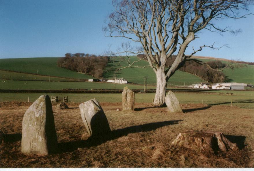
St Colmac Cottages Stone Circle submitted by saille on 20th Jan 2004. Stone Circle at Ettric bay.
NS044668
(View photo, vote or add a comment)
Log Text: St Colmac Cottages Stone Circle: Defeated by a pond between us and the stone circle, a large heap of cow dung by the gate, heavy mist, and running out of time before our ferry back, we stopped at the gate and photographed this from a distance.
We had tried to see the standing stone near Calmac Bridge, but the farmers were moving a large herd of cattle into the field, and we would have had to wait for ages. Rapidly running out of time before we needed to get back to Rounsay for the ferry, we pressed on to St. Colmac Cottages, where we parked at the entrance to the field with the stone circle. Here, the farmer has created a fenced walkway along the side of the road.
The walkway, however, was deep in wet slurry from the cows having just been moved down this path, and the field was sodden. Arriving at the gate into the field, the farmer had also dumped a whole load of cow manure just the other side of the gate, making it incredibly uninviting to walk to the stone circle, which we could just see through the mist in the field.
At this point, not having wellies, I realised I’d rather see the standing stone inscribed with a cross before we left the island, so we waded back to the car and set off just down the road to the ruined church at Calmac Bridge.
St Colmac's Cross
Trip No.50 Entry No.8 Date Added: 9th Oct 2017
Site Type: Standing Stone (Menhir)
Country: Scotland (Isle of Bute)
Visited: Couldn't find on 25th Sep 2017
Log Text: St Colmac's Cross, Isle of Bute: I really, really wanted to find this standing stone with incised Latin Cross, but we couldn't work out a way to get behind the barn at East St. Colmac Farm to view it. The Canmore records show this intriguing stone in a wooden enclosure, which was built round it after it was damaged in recent times (the top was knocked off).
By the time we'd had several attempts to find this stone, we were seriously running out of time to get back for our ferry back to Wemyss Bay. We needn't have worried, however, as the ferries were suspended because of the heavy fog. This necessitated a drive up to Rhubodach to get a shorter ferry ride across to Colintraive, then a very hairy mountain drive on a single track road with dense fog back to Dunoon. A not to be forgotten trip!
St George's Well (Edinburgh)
Date Added: 30th Dec 2015
Site Type: Holy Well or Sacred Spring
Country: Scotland (Midlothian)
Visited: Yes on 17th Dec 2015. My rating: Condition 3 Ambience 2 Access 4
St George's Well (Edinburgh) submitted by KiwiBetsy on 12th Sep 2006. The wellhouse was erected in 1810, to celebrate the jubilee of King George III, over the site of a reputed healing spring. Over the years attempts have been made to market the chalybeate water but it proved unpopular due to it's foul taste.
(View photo, vote or add a comment)
Log Text: St George's Well, Edinburgh: An easy walk along the Water of Leith walkway. I wouldn't have recognised this as a well without the Portal. It looks like a very run down stone gardener's house, complete with chimney, sitting between the walkway and the river, which was running very high at the time of my visit. The iron gate was unbolted but the door to the well house was locked. The area surrounding this little building was heavily littered, not only with general rubbish but lots of empty cans and bottles - in dire need of a clean up.
Ravenswood Avenue
Trip No.11 Entry No.3 Date Added: 26th Feb 2017
Site Type: Standing Stone (Menhir)
Country: Scotland (Midlothian)
Visited: Yes on 20th Feb 2017. My rating: Condition 3 Ambience 2 Access 4
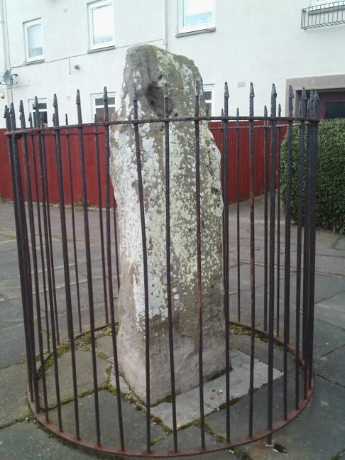
Ravenswood Avenue submitted by crannog on 27th Feb 2012. Closer look.
(View photo, vote or add a comment)
Log Text: Ravenswood Avenue Standing Stone, Edinburgh: Our third stop of the day, and another ‘not impressive’ one. Definitely not in situ, at the end of a heavily parked-up cul-de-sac, outside a small block of flat, protected by a tall circular iron railing.
I was glad to escape from this site – it felt very depressing and I surprised not to see any graffiti on the stone. One source I’d seen said there were a couple of cup marks, but I could only see any, only natural weathering and what looked like a heavily worn quarry mark.
St Anthony's Well (Edinburgh)
Trip No.11 Entry No.5 Date Added: 26th Feb 2017
Site Type: Holy Well or Sacred Spring
Country: Scotland (Midlothian)
Visited: Yes on 20th Feb 2017. My rating: Condition 3 Ambience 3 Access 4
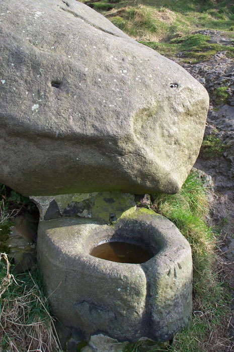
St. Anthony's Well (Edinburgh) submitted by feorag on 11th Aug 2006. St. Anthony's Well, Holyrood Park, Edinburgh. Photographed 16th March 2003.
(View photo, vote or add a comment)
Log Text: St Anthony's Well, Holyrood, Edinburgh: Located some 400 metres east south east from St. Margaret’s Well, the paths lead up the hill away from Arthur’s Seat, up to St. Anthony’s Chapel. Where the paths going up the hill divide (the left hand fork leading to the cave and chapel, the right continuing up the hill), there appears to be a large boulder about 100 yards up the right hand path. This is actually the well. From the base of the boulder a lead pipe protrudes into a stone basin. There was no water flowing. Again heavily graffitied and littered; the friend I was with described it as a 'Neolithic toilet'!
Edinburgh Runestone
Trip No.62 Entry No.2 Date Added: 8th Jan 2018
Site Type: Carving
Country: Scotland (Midlothian)
Visited: Yes on 19th Dec 2017. My rating: Condition 3 Ambience 2 Access 4
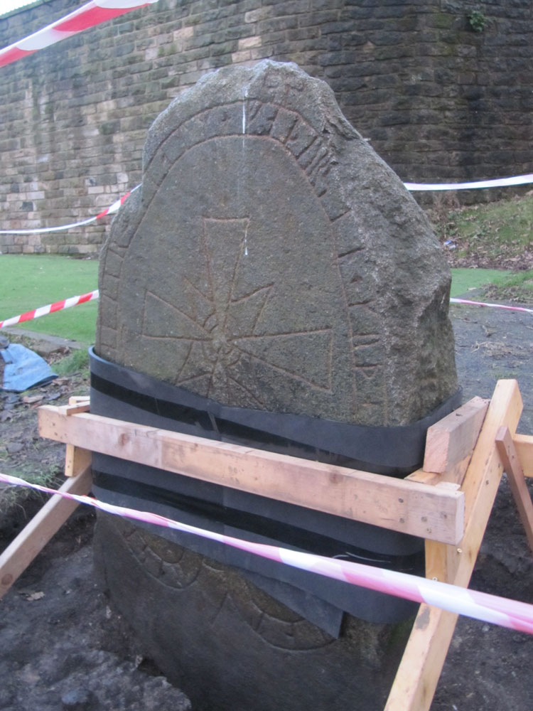
Edinburgh Runestone submitted by Anne T on 7th Jan 2018. The Runestone seen by clambering up the steep muddy track from Princes Street Gardens, just below the Castle Esplanade. The runes read: ""Ari engraved this stone in memory of Hialm his father. God help his soul."
(View photo, vote or add a comment)
Log Text: The Edinburgh Runestone: Getting to this stone was rather precarious! It was easy to walk up the 40 degree slope by clutching onto the nearby railings around the stone. Getting down was more difficult and left my friend with mud all over his walking boots. The stone is obviously in the middle of being moved - it has been strapped up and well protected. I'm glad its going to a much more accessible site. On my next trip up to Edinburgh I'll make a point of going to see this stone in its new location.
National Museum of Scotland (Pictish Stones)
Trip No.74 Entry No.2 Date Added: 20th May 2018
Site Type: Museum
Country: Scotland (Midlothian)
Visited: Yes on 17th May 2018. My rating: Condition 4 Ambience 4 Access 5
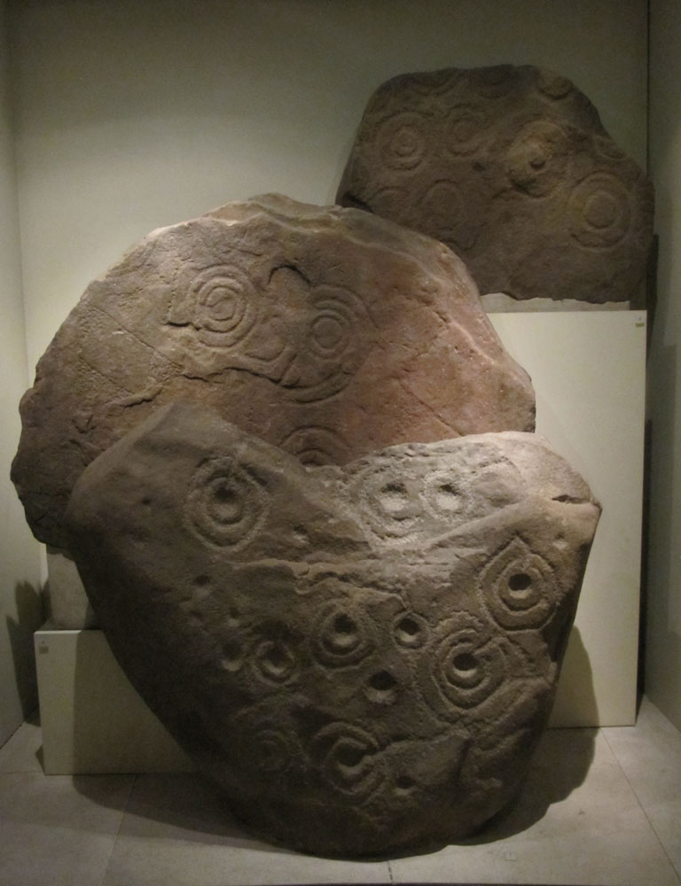
National Museum of Scotland (Pictish Stones) submitted by Anne T on 18th Jan 2018. A collection of 3 Pictish stones on display behind glass in Level -1 of the Tower. From front to back these are: Boulder from Letham Grange, Angus; Slab reused in a burial cist from West Yardhouse (?); and a slab from Lamancha.
(View photo, vote or add a comment)
Log Text: Pictish Stones at the National Museum of Scotland: See visit report for the National Museum of Scotland (Early Christian stones). Also went to the Research Library and came away with some great information on all the Pictish Symbol Stones held by the museum, and the names/details of various reference books.
Buck Stane
Trip No.106 Entry No.1 Date Added: 5th Nov 2018
Site Type: Standing Stone (Menhir)
Country: Scotland (Midlothian)
Visited: Yes on 28th Oct 2018. My rating: Condition 3 Ambience 4 Access 5

Buck Stane submitted by Creative Commons on 15th Jan 2014. The Buckstane. The inscription reads:
This march stone, a relic of feudal times occupied a commanding site on the old Roman road about 250 yards north of this spot.
By tradition the name was derived from the stone having marked the place where the buckhounds were unleashed when the King of Scotland hunted in this region.
Copyright Callum Black and licensed for reuse under the Creative Commons Licence.
(View photo, vote or add a comment)
Log Text: The Buck Stane, Braid Road, Edinburgh: Our first stop of the day in the Tour of Edinburgh Stones. The Buck Stone is in a niche on the western side of Braid Road, about 125m north of the junction with Buckstone Drive and before it turns into Buckstone Terrace.
There is a sign explaining what the stone is: The Buckstane. This march stone, a relic of feudal times, occupied a commanding site on the old Roman road about 250 yards north from this spot. By tradition the name was derived from the stone having marked the place where the buck hounds were unleashed when the king of Scotland hunted in this region”.
A nice, tidy, well looked after spot.
Niddrie House
Trip No.106 Entry No.5 Date Added: 6th Nov 2018
Site Type: Standing Stone (Menhir)
Country: Scotland (Midlothian)
Visited: Yes on 28th Oct 2018. My rating: Condition 3 Ambience 2 Access 5
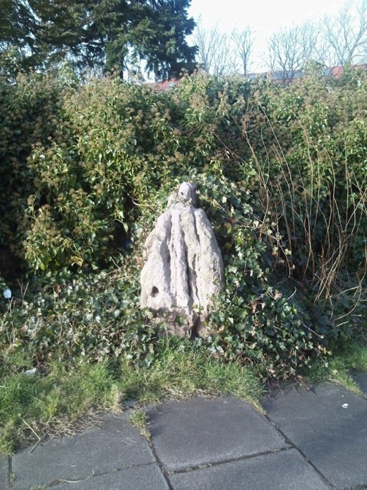
Niddrie House submitted by crannog on 27th Feb 2012. Half-covered in ivy with a great splosh of pink paint covering the top, this wee stone sits surrounded by established housing with new-build developments blossoming all around.
Has one cup mark.
(View photo, vote or add a comment)
Log Text: Niddrie House Stone: This has to be one of the saddest little standing stones I’ve seen. Largely hidden by ivy and surrounded by rubbish, in between a largish utility building and a padlocked, disused cemetery, with a bus stop about 10m to the south west and a new estate with many security cameras to the north east. And a splodge of what was red paint running down from the top of the stone, too. If I could have dug this up and taken it home with me, I would.
St Margaret's Well (Edinburgh Castle)
Date Added: 30th Dec 2015
Site Type: Holy Well or Sacred Spring
Country: Scotland (Midlothian)
Visited: Yes on 17th Dec 2015. My rating: Condition 3 Ambience 2 Access 4
St Margaret's Well (Edinburgh Castle) submitted by KiwiBetsy on 26th Sep 2006.
The site of the well lies between the railway track and Edinburgh Castle. It can be accessed on foot from the network of tracks that run both from the castle esplanade and from Princes Street Gardens.
(View photo, vote or add a comment)
Log Text: St. Margaret's Well, Edinburgh Castle: I arrived in Edinburgh on an early train but even at 08:45 it was wet and windy and too dark to see much. By 09:30, fortified by a cup of coffee, having met my old University friend, we set off towards the castle. The well sits on far side of the railway track, immediately under the castle and next to the footpath. The area is heavily littered, and without the image from the Portal I wouldn't have known this was a well. We braved the puddles to look inside the domed structure behind the plaque, but this was full of rubble and rubbish. Disappointing, but another well crossed off my 'to visit' list.
St Bernard's Well
Date Added: 30th Dec 2015
Site Type: Holy Well or Sacred Spring
Country: Scotland (Midlothian)
Visited: Yes on 17th Dec 2015. My rating: Condition 3 Ambience 2 Access 4
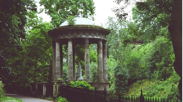
St Bernard's Well submitted by KiwiBetsy on 5th Dec 2004. One for the birds.
(View photo, vote or add a comment)
Log Text: St Bernard's Well, Edinburgh: This was by far the most attractive of the three wells we saw in Edinburgh today, although again I wouldn’t have known it was a well but for the plaque next to it telling us it had been refurbished in Victorian times. It sits at the base of a steep hill with housing and private gardens above, with the Water of Leith running below. It is apparently possible to get inside the structure during ‘Doors Open’ day, although the gate and door were very well padlocked, and the number of vodka bottles and cans inside the temple indicates its well used by drinkers who hop over the gate. We did intend going up to Arthur's seat to see 2 other wells and the hill fort but the wet and windy weather drove us indoors to get warm.
