Contributory members are able to log private notes and comments about each site
Sites Anne T has logged. View this log as a table or view the most recent logs from everyone
Alnham
Trip No.12 Entry No.1 Date Added: 7th Mar 2017
Site Type: Ancient Cross
Country: England (Northumberland)
Visited: Yes on 5th Mar 2017. My rating: Condition 3 Ambience 4 Access 5
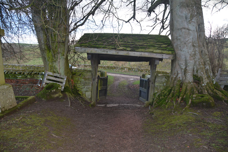
Alnham submitted by Anne T on 7th Mar 2017. Two cross bases lie either side of the lych gate. The church website describes the lych gate as being modern, but it leans/has settled into the trees next to it!
(View photo, vote or add a comment)
Log Text: Alnham, Northumberland. Ancient cross bases: From the A697, we turned left through the pretty little village of Whittingham. The road to the west of the village runs by the meandering course of the (at this point small) River Aln. Just past the village, we turned right onto the minor road leading through Eslington Park and Unthank, the road meandering through minor, muddy single track lanes to Alnham village. Taking the right hand fork (signposted as a dead end road, which it is – eventually), we drove up to the pretty little church.
This is a very remote spot indeed. Opposite the church, you can see the lumps and bumps of the deserted medieval village and the hump of what used to be Alnham Castle. Next to the church is a pele house/tower house, which is lived in. To the far side (from the church) is a footpath which runs up the side of the tower house; this is unusual in that the footpath runs through a small ford.
We had missed the monthly service, which had taken place that morning, but there were signs that other cars had parked on the grass verge outside the church. The lych gate leans into the tall trees either side of it, and the church has a long-deserted air, although candles were still burning on the window ledges inside.
Walking round the churchyard (with its electrified fence to keep any sheep from rubbing against the stone walls) we searched for the cross bases, but found none until we turned to go out of the church, and there they were – one on either side of the lych gate, with a third to the west by the wall.
This church is Grade 1 listed. There were many leaflets about the local countryside and walks, but no church guide. The British Listed Buildings and Wikipedia mention that the church was built on the site of a Roman fortlet, and originally dates from 1135, although because of the ancient cross bases, they think an earlier church existed on this site. Within the porch there is a carved fragment of a rectangular cross shaft, but the carving looks modern.
From the church, we headed further up the hillside to Castlehill Fort and Settlement.
Castle Hill (Northumberland)
Trip No.12 Entry No.2 Date Added: 7th Mar 2017
Site Type: Hillfort
Country: England (Northumberland)
Visited: Yes on 5th Mar 2017. My rating: Condition 3 Ambience 4 Access 4
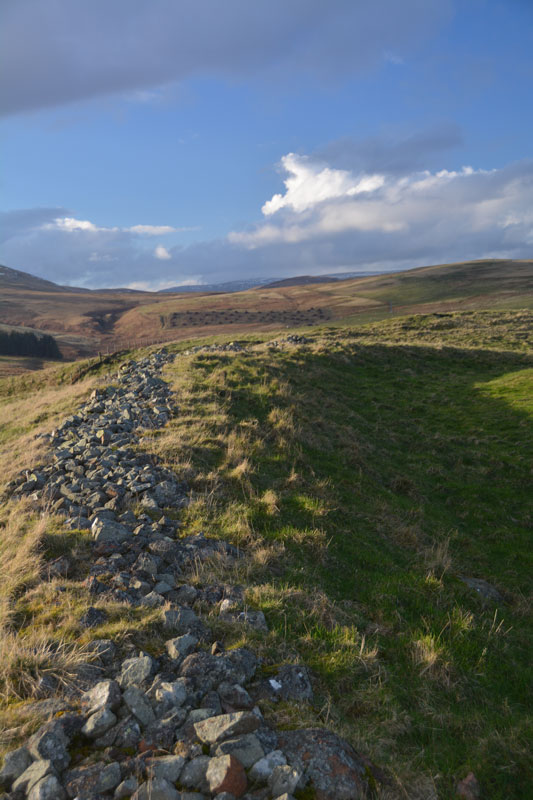
Castle Hill (Northumberland) submitted by Anne T on 7th Mar 2017. To the north west of the fort, the outer bank is made up of stones and earth, making a substantial boundary.
(View photo, vote or add a comment)
Log Text: Castle Hill Fort & Settlement, near Alnham, Northumberland: From St Michael & All Saints (Alnham) and its location next to the trickling River Aln, we headed further up the winding (almost harepin at a couple of points) narrow, single track road climbing up the hill to Castle Hill Fort and Settlement. At the top of the hill, there is a cottage located just below the lea of the hill. Just past this is a cattle grid and a footpath sign leading to the west and the fort. There is room for one car to park just before the cattle grid, where the ground is relatively firm.
Nothing can be seen of the fort at this point, but going through the gate and climbing up the gentle hill, following the line of what seems to be an old stone wall, the low lines of grass covered banks (the boundary lines of old enclosures?) comes into view. The ground then climbs a little more steeply, as you walk onto the first outer bank. Then the outlines of banks and ditches comes into view, together with the ghost of a round house immediately in front of you. There’s nobody here, not even sheep.
The early spring sun was low in the sky, making the contrast between the height of the outer defensive bank with its protruding line of stones, looking steeply down to the north west and Spartley Burn, its waters sparkling in the sunlight. To the east is Hazeltonrig Burn.
We walked all round the outer bank. Two banks and ditches to the north and east, becoming three to the west. Well worth a visit. I just wish I’d brought the notes with me to help interpret what I was seeing.
From Castle Hill, we set off towards Biddlestone, making our way back into Alnham, driving back down through Scrainwood, through Biddlestone Town Foot to Biddlestone. This road is gated, and very muddy. The road twists and turns, and a couple of times we almost went off down farm tracks rather than the road. Very remote. Very lovely.
Biddlestone
Trip No.12 Entry No.3 Date Added: 7th Mar 2017
Site Type: Ancient Cross
Country: England (Northumberland)
Visited: Yes on 5th Mar 2017. My rating: Condition 3 Ambience 4 Access 4
Biddlestone submitted by vagabondnma on 11th Mar 2007. The Biddle Stones - only two stones just next to the private road up to the chapel. The map reference is wrong. I'd say it should be NT958082.
(View photo, vote or add a comment)
Log Text: The Biddle Stones, Northumberland: From Castle Hill, Alnham, we returned to Alnham Village and took the minor road towards Biddlestone. Also a cycle route, the road was gated and very muddy. Being twisty and with numerous side roads joining, it was sometimes a little difficult to keep to the main road!. Nevertheless, we ended up at the entrance to Biddlestone Chapel, where the gate up the track was shut. We parked by the entrance and walked up the hill. The chapel was closed, but a list of keyholders is given on the noticeboard at the entrance to the track.
Having no real clue as to where the Biddle Stones were, we came upon them half way up the track to the chapel on the left hand side of the track. One is definitely a socket for a cross; the other has been paired with it.
We walked up to the chapel. The chapel is strange, being in a defensive position, with a ravine to its north, with a drop of some 60 to 70 feet down to the stream below. To the south looks like a building platform of some kind The numerous mole hills had brought up lots of small pieces of brick, so something had been demolished.
There was a lovely view over to the Netherton Burn valley below, with a farmer and his three dogs herding a flock of beautifully cream, fat sheep. No sign of the stone circle by the burn from here.
The Portsburgh Stone
Trip No.11 Entry No.1 Date Added: 2nd Mar 2017
Site Type: Natural Stone / Erratic / Other Natural Feature
Country: Scotland (Midlothian)
Visited: Yes on 20th Feb 2017. My rating: Condition 3 Ambience 3 Access 5
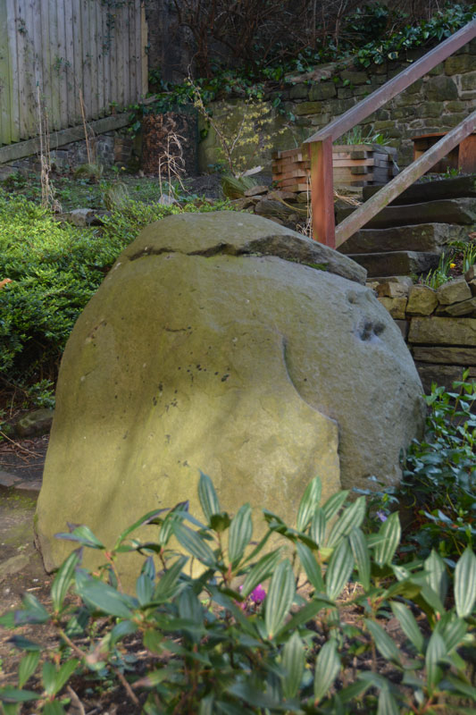
The Portsburgh Stone submitted by Anne T on 23rd Feb 2017. The Portsburgh Stone, photograph taken over the iron railings of the West Port Community Garden, which is only open on Sundays.
(View photo, vote or add a comment)
Log Text: Portsburgh Stone, Natural Erratic, Edinburgh: Intrigued by the 'no photograph' of this site in the heart of Edinburgh, I determined to find it, although we did mis-interpret the location published in the Portal text and walked in a couple of decreasing circles! The actual grid reference is NT 25283 73276, the West Port Garden (or Geddes Garden).
A notice on the padlocked gate to the garden told us that the garden was only open on Sundays, so I had to stand looking over the iron railings to try and get the best photographs I could of the stone.
Couldn’t spot any other erratics in the adjacent walls. Located the old Salvation Army building, and also walked around the nearby Art School buildings, but didn’t see anything. The Vennel, with its many steps, was very interesting to walk up.
St Anthony's Well (Edinburgh)
Trip No.11 Entry No.5 Date Added: 26th Feb 2017
Site Type: Holy Well or Sacred Spring
Country: Scotland (Midlothian)
Visited: Yes on 20th Feb 2017. My rating: Condition 3 Ambience 3 Access 4
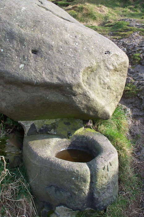
St. Anthony's Well (Edinburgh) submitted by feorag on 11th Aug 2006. St. Anthony's Well, Holyrood Park, Edinburgh. Photographed 16th March 2003.
(View photo, vote or add a comment)
Log Text: St Anthony's Well, Holyrood, Edinburgh: Located some 400 metres east south east from St. Margaret’s Well, the paths lead up the hill away from Arthur’s Seat, up to St. Anthony’s Chapel. Where the paths going up the hill divide (the left hand fork leading to the cave and chapel, the right continuing up the hill), there appears to be a large boulder about 100 yards up the right hand path. This is actually the well. From the base of the boulder a lead pipe protrudes into a stone basin. There was no water flowing. Again heavily graffitied and littered; the friend I was with described it as a 'Neolithic toilet'!
St Margaret's Well (Edinburgh)
Trip No.11 Entry No.4 Date Added: 26th Feb 2017
Site Type: Holy Well or Sacred Spring
Country: Scotland (Midlothian)
Visited: Yes on 20th Feb 2017. My rating: Condition 3 Ambience 3 Access 5
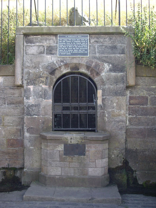
St Margaret's Well (Edinburgh) submitted by feorag on 12th Aug 2006. St. Margaret's Well in Holyrood Park, Edinburgh. Photographed 12th August 2006.
(View photo, vote or add a comment)
Log Text: St Margaret's Well, Holyrood, Edinburgh: Located just off Queen’s Drive in Holyrood, near Dynamic Earth, and 400 metres from St. Anthony’s Well, this well house can be seen from the road.
I had to photo-shop out the pile of rubbish that had gathered at the base of the well (disgusting!). There was a good flow of water out of the pipe inside the well house, although it was impossible to get a photograph of this there was a black heavy metal grill covering it.
I came across a reference on Pixyledpublications telling me “the spring itself is a holy well, called The Well of the Holy Rood or St. David’s Well and dates from 1198, the well head was re-erected from St. Margaret’s Well at Restalrig ….. legend has it that King David after mass decided to go hunting in the area and was thrown from his horse by a giant stag which then carried the king, stopping at the spring. In thanks for his deliverance, he built the Abbey of Holyrood there …. (the well house) has an internal width of six feet by five feet in height with a central pier with a carved head which is provided with a spout.”
The well house bears a plaque which reads: “This unique Well House dates from the late 15th Century. It originally stood at Restalrig, close to the Church, and its design is a miniature copy of St. Triduana’s Aisle there. In 1860 it was removed from its first site, which was then encroached upon by a railway depot, and was reconstructed in its present position near a natural spring.”
Ravenswood Avenue
Trip No.11 Entry No.3 Date Added: 26th Feb 2017
Site Type: Standing Stone (Menhir)
Country: Scotland (Midlothian)
Visited: Yes on 20th Feb 2017. My rating: Condition 3 Ambience 2 Access 4
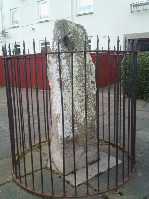
Ravenswood Avenue submitted by crannog on 27th Feb 2012. Closer look.
(View photo, vote or add a comment)
Log Text: Ravenswood Avenue Standing Stone, Edinburgh: Our third stop of the day, and another ‘not impressive’ one. Definitely not in situ, at the end of a heavily parked-up cul-de-sac, outside a small block of flat, protected by a tall circular iron railing.
I was glad to escape from this site – it felt very depressing and I surprised not to see any graffiti on the stone. One source I’d seen said there were a couple of cup marks, but I could only see any, only natural weathering and what looked like a heavily worn quarry mark.
Cat Stane (Inch)
Trip No.11 Entry No.2 Date Added: 26th Feb 2017
Site Type: Standing Stone (Menhir)
Country: Scotland (Midlothian)
Visited: Yes on 20th Feb 2017. My rating: Condition 2 Ambience 2 Access 5

Cat Stane (Inch) submitted by golux on 9th Feb 2014. View looking NW, without the incongruous background.
(View photo, vote or add a comment)
Log Text: Cat Stane (Inch), Standing Stone, Edinburgh: Also known as the Liberton Road / Gilmerton Road Standing Stone, this stone has obviously been relocated next to what appears to be the rear entrance of Inch View nursing home, off Gilmerton Road, next to Inch Park. Driving into the complex from Gilmerton Road, there is a circular car park in front of you. Immediately to 12 o’clock of this circle is a small access road to (the rear?) of Inch View Care Home for the Elderly. Just before a small wooden hut, the stone is located in a small rectangle of grass, surrounded by a knee high metal railing.
This area appeared to be a garden, so I started to take some quick photos, only to be challenged (quite rightly!) by one of the nurses who shot out to talk to us. She explained for security reasons, they needed to be vigilant for visitors. Having explained what we were doing, she told us some of the history of the surrounding area, particularly relevant to fans of Sir Walter Scott and Mary Queen of Scots.
Not in an impressive location, this stone could easily be mistaken for a large garden ornament, but worth seeing whilst in the area. I spotted some quarry marks in the face facing the building.
Stanwick Hillfort
Trip No.10 Entry No.3 Date Added: 26th Feb 2017
Site Type: Hillfort
Country: England (Yorkshire (North))
Visited: Yes on 19th Feb 2017. My rating: Condition 3 Ambience 4 Access 5
Stanwick Hillfort submitted by rich32 on 2nd Oct 2006. Stanwick is one huge site, if you could walk round the ramparts you’d cover about 4miles & internally you’ve got 750 acres to get lost in.
The earliest evidence dates the fortifications from the mid to late Iron Age, with occupation waning towards the end of the 1st century AD. It’s likely to have been an important stronghold for the Brigantes & may have been the home of queen Cartimandua, who ruled at the time those chaps from Rome visited.
Theres bundles of evidence from other per...
(View photo, vote or add a comment)
Log Text: Stanwick Iron Age Fortifications:(note: whilst the main entrance of this enclosure can be driven to, getting onto the monument could be difficult because of the short climb to the top of the bank). We'd been in this area before, but to the churches of Stanwick St John and Forcett, to see the Anglo Saxon crosses. It was almost dark at the last visit, so I was glad to be able to see the site properly, although it is so large, it's only possible to glimpse parts. We managed to park opposite the main English Heritage entrance (with signpost), avoiding the myriads of walkers and horse riders who passed the site without seeming to take notice.
There are some quite steep wooden steps up to the top of the bank (the soil around has been eroded, so these (what look like) railway sleepers have been put in to aid walkers). These lead onto the top of the bank which is heavily overgrown with trees and shrubs, with ditches on both sides. About 100 metres into the walk northwards along this embankment, it opens out with a very steep ditch down into what looks like a quarried area. The Pastscape notes say the ditch was built into bedrock, but this looks like a modern quarry.
The bank carries on for quite a way, and from the road, you can trace its line curving round to a farmhouse in the distance, but the tree roots make it quite difficult to walk. On the opposite side of the road, the bank can be seen extending into the far distance, towards Forcett.
We drove slightly further up the road, and at the road junction for Aldbro and Stanwick, you could see more fortifications heading off into the distance. As usual, it was getting to be dusk by this point and we wanted to find the Roman bridge at Piercebridge, so headed off. Shame most of this Iron Age monument was on private land. It really would have been great to wander along/next to these defences. What a huge area it covers!
Scots Dyke (Olliver)
Trip No.10 Entry No.2 Date Added: 26th Feb 2017
Site Type: Misc. Earthwork
Country: England (Yorkshire (North))
Visited: Yes on 19th Feb 2017. My rating: Condition 3 Ambience 4 Access 4
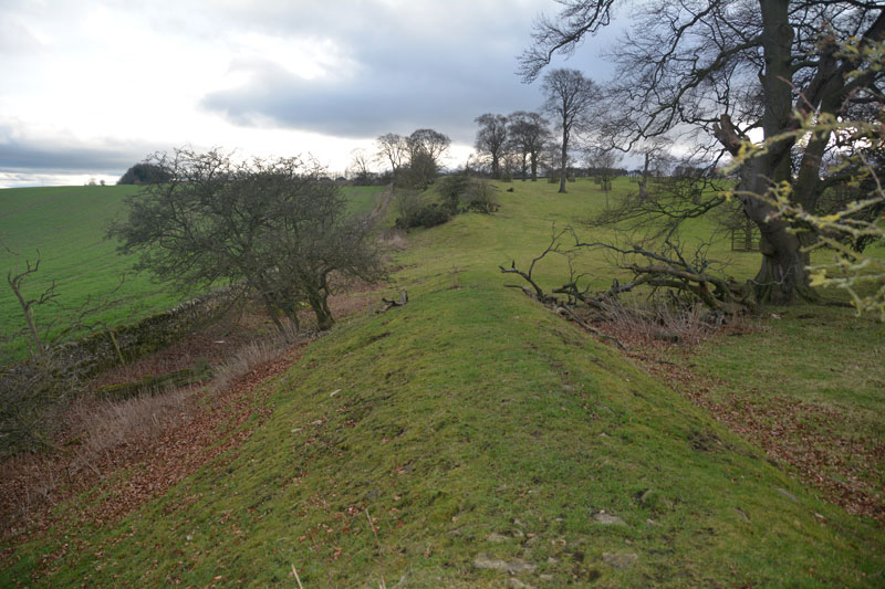
Scots Dyke (Olliver) submitted by Anne T on 26th Feb 2017. To the south of the trackway, the dyke runs for some 400 metres, with a ditch on either side.
(View photo, vote or add a comment)
Log Text: Scots Dyke (Olliver): From Scots Dyke at Easby, heading back into Richmond, we took the B6274 to Gilling West, turning off to the right to Olliver Cottages. Here, opposite Olliver Cottages, is a small (appears to be public) car park. Walking up the track towards Olliver itself (a large farm and prestigious office premises), after 400 metres, the track turns slightly to the right and goes up a shallow hill, transecting the dyke.
Facing up hill, the dyke the left-hand side dives down a steep hill and is transected by a farm house. Beyond the farm, looking northwards, a smaller section of the dyke can be seen at the field edge. To the right-hand side, the dyke continues for several hundred metres. The ditch is very steep at some points (Pastscape says 7 metres at the northern end). Standing on top of the dyke, looking eastwards, there are great views back to the A1 and beyond.
Looking more closely at the banks, they are made up of medium and large size stones, packed with earth. Under one tree was a small marker and stone - a treasured pet's burial place?
Scots Dyke (Easby)
Trip No.10 Entry No.1 Date Added: 26th Feb 2017
Site Type: Misc. Earthwork
Country: England (Yorkshire (North))
Visited: Yes on 19th Feb 2017. My rating: Condition 2 Ambience 3 Access 4
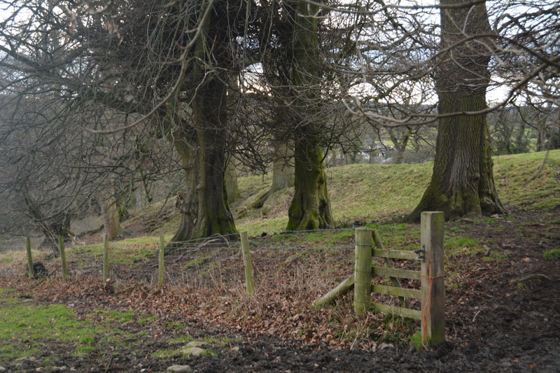
Scots Dyke (Easby) submitted by Anne T on 26th Feb 2017. This small section of Scots Dyke, south of Sandford House, can be seen as a bank about 2 metres tall, flanked by trees. This photo was taken from the layby next to it, where there were lovely views down to Easby Abbey and the River Swale.
(View photo, vote or add a comment)
Log Text: Scots Dyke (Easby): Having purchased our map (one of the few we don’t already possess), we headed off eastwards from Richmond, down the minor road passing through Anchorage Hill towards Brompton-on-Swale. Just past St. Nicholas, there is a right hand turn towards Easby. Turning down this road, there is a layby within 20 metres of the junction. With a lovely view south to the River Swale and Easby Abbey, our first sight of the dyke was within a few metres west of this layby – an earthwork bounded by relatively young trees.
Having photographed this small section as best I could (the gate was padlocked), I clambered round a tree, avoiding the deep rabbit holes.
There is a second section of the dike across the road, which Pastscape tells us runs for 360 metres south of the Darlington Road to Sandford House (monument 1034723), east of Whitefields Farm. From the layby on the lane leading down to Easby, on the opposite side of the road, a footpath leads to the left of Sandford House, and runs over the top of the dyke for some way. Heading northwards, the bank with its ditch to the east, there is a new build housing site to the west. Not a great ambience. We wondered how many of the new residents would know they were living next to an ancient monument.
Lowhouse
Trip No.9 Entry No.6 Date Added: 15th Feb 2017
Site Type: Stone Circle
Country: England (Cumbria)
Visited: Yes on 12th Feb 2017. My rating: Condition 3 Ambience 3 Access 4
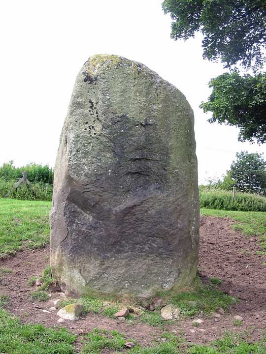
Lowhouse submitted by stu on 16th Jul 2004. Kitchenhill Bridge Stone (Lowhouse?), NY4961 3434.
Standing by the West Coast Mainline, this is a massive stone at least 3m tall. Not marked on the O.S maps.
(View photo, vote or add a comment)
Log Text: Lowhouse/Holme Head/Kitchenhill Standing Stone, Penrith, Cumbria: From Newbeggin, heading back up the M6, leaving at junction 41, turning right onto the B5305 and taking the first exit off the roundabout, we headed up the minor road signposted to Calthwaite. Where the road divides at Kitchenhill Farm, we turned right, heading over the railway line, then immediately over the small bridge over the River Petterill. At grid reference NY 49802 34135 there is a left hand turn on the bend, leading down to a small area of land by the river, used by the farmer for storing hay. There is room here for one car to park at the entrance. We walked back the short distance over the bridge over the river and went to look over the gate into the field. At first, in the gathering dusk, we couldn’t see anything, but then at the far end of the field, sheltered by a large tree, we spotted this huge grey stone.
The field is guarded by a barbed wire topped gate. I don’t like trespassing, but there was nothing in the field, so we let ourselves gingerly in and followed the tractor trail over the grass to the stone. It is huge. I spotted what seemed like other smaller (grey) stones in the base of the red sandstone wall to the right-hand side of the field. Getting closer to the stone, it sits on (what was) a lovely spot (pre railway line), overlooking the gently meandering river below.
Andrew was keen to try and get sight of two other stones in the area (and another I’d spotted travelling south on the M6 on the way down), so we drove to Plumpton, slightly further north, stopping near Plumpton Wall Farm to peer over the fields, but could see nothing. We retraced our route and headed off towards Calthwaite, stopping at the entrance to Hallrigg to peer eastwards over the fields. With the sleet hammering in our faces, Andrew got the binoculars out and spotted a stone next to Calgarth Plantation at grid reference NY 48253 37527. Looking on UK Grid Reference Finder, I couldn’t see any sign of it, although this is an old map on the Modern Antiquarian web site which would be worth investigating.
Newbeggin Wells
Trip No.9 Entry No.5 Date Added: 15th Feb 2017
Site Type: Holy Well or Sacred Spring
Country: England (Cumbria)
Visited: Yes on 12th Feb 2017. My rating: Condition 3 Ambience 3 Access 5
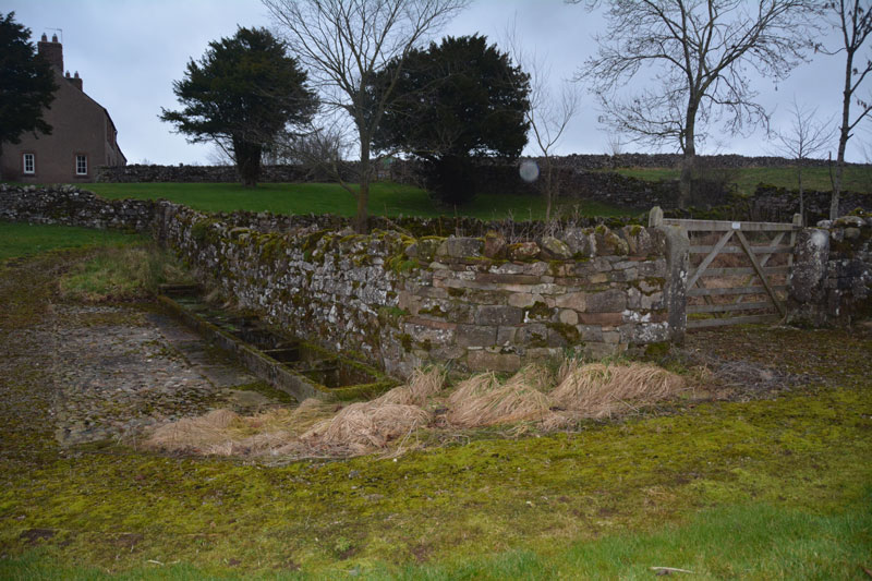
Newbeggin Wells submitted by Anne T on 14th Feb 2017. The Prospect Well, which is located on the village green in the middle of Newbeggin. The main well chamber is located behind the stone wall, with troughs set against the exterior wall. There was a fair flow of water into the troughs at the time of the visit. The water didn't taste of any particular mineral.
(View photo, vote or add a comment)
Log Text: Newbeggin Wells, near Sewborwens Standing Stone: We went originally to try and trace the standing stones, one of which stood in the wall of Rosemary House (we found Rosemary Cottage but not the house) and another which stood in the field behind.
Parking at the side of the road near Rosemary Cottage, opposite Sunbeam Well, we braved the sleet. It was getting to be dusk and cold, and light conditions were really weird. We walked the hundred or so yards between the two wells, then set off in seach of Holme Head standing stone, before it got dark.
I have since emailed the clerk of Dacre Parish Council to try to find out the location of the above stone, and to seek the landowners’ name, so we can visit.
Wikipedia, and Dacre Parish Council, record that Newbeggin is an ancient village, built on the Putnam Fault, which provides a line of springs running through the village. Neolithic burials have been found on nearby Flusco Pike and there are a number of barrows and cairns and other standing stones in close proximity.
St. Helen's Well (Newbiggin-on-Lune)
Trip No.6 Entry No.2 Date Added: 14th Feb 2017
Site Type: Holy Well or Sacred Spring
Country: England (Cumbria)
Visited: Yes on 11th Sep 2016. My rating: Condition 2 Ambience 3 Access 5
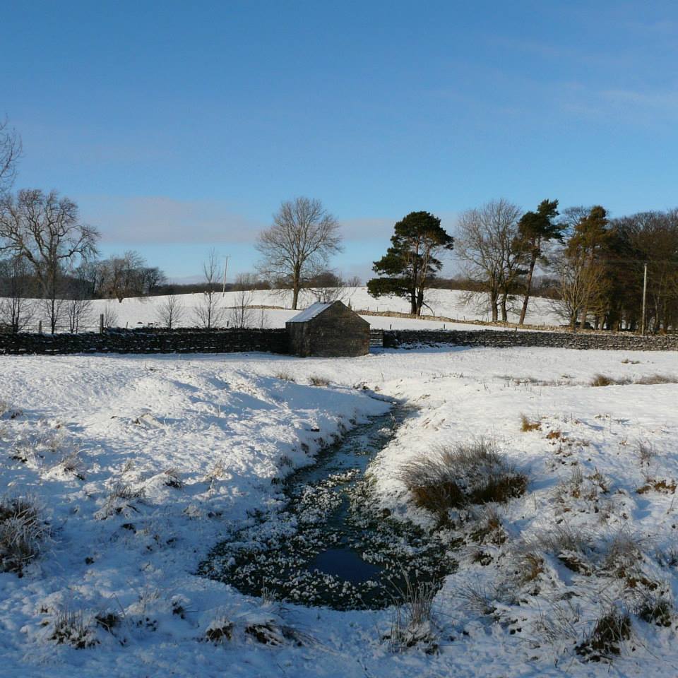
St. Helen's Well (Newbiggin-on-Lune) submitted by HeronEye on 2nd Mar 2014. St Helen's Well, Newbiggin on Lune.
The source of the River Lune.
This well pool is situated next to the mound of chapel that once stood here (picture left).
(View photo, vote or add a comment)
Log Text: St Helen's Well, Newbeggin-on-Lune, Cumbria: After seeing the Loki Stone at Kirby Steven, we followed the A685 south and west to Newbeggin-on-lune. St Helen’s Well is about 50 metres to the north of the A685 (called Fell Lane at this point). It sits almost at the junction where Chapel Butt Lane splits into two. There is parking for about three cars at this junction.
We initially took the left hand fork, walking down to where a footpath sign pointed right over the field containing the well, just before a field gate. Climbing the small stile, walking over the footbridge, we were confused as to where the well was. We understood this well was supposed to be the source of the River Lune, but there are small streams which run to the north/north east which carried a strong flow of water (there must have been a large amount of rain here recently, as the ground was incredibly boggy with large puddles across the paths, as opposed to being dry where we live). Wading through the puddles through the field gate, there was a large boggy area (complete with bull) which appeared to be the lowest point in the area, and the source of the water flow.
Retracing our steps, we asked a local lady who was walking her dog. Despite having visited this area for 34 years, she hadn’t heard of this well. Walking down the right hand lane, the well can be found by walking down the right hand side of Chapel Butt Lane (heading towards Friar Bottom Lane), with the pool becoming visible just after the first bend.
Sewborrans Stone
Trip No.9 Entry No.2 Date Added: 14th Feb 2017
Site Type: Standing Stone (Menhir)
Country: England (Cumbria)
Visited: Yes on 12th Feb 2017. My rating: Condition 3 Ambience 3 Access 4
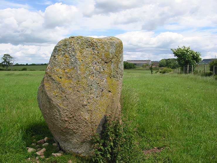
Sewborrans Stone submitted by stu on 16th Jul 2004. NY4884 2999.
1.5m high stone. Visible from the road.
(View photo, vote or add a comment)
Log Text: Sewborwens Standing Stone (and outliers), Penrith, Cumbria: From the Skirsgill Standing Stone, we made our way back on the A66, heading westwards (you can only turn left onto this dual carriageway). Turning round at the next roundabout, heading back to Penrith, we took the first left hand turn down the mnor road leading past the golf driving range and Greystoke Pillar (18th century monument to the 11th Duke of Norfolk). About 1.5 kms down this road from the A66, there is a barn on the right hand side of the road with a small (muddy) layby next to it. There is a gate into the main field to the east of the barn and the standing stone is visible next to the first fence line to the east.
There was nothing in the field, so we kept to its edge to look at the stone. Before reaching the stone, I spotted two more smaller stones in the hedge line, which looked like part of a row or avenue leading to the stone.
Having photographed the stone, I spotted more large stones against the wire fence. This modern fence has been put on top of what looked like an old (medieval?) stone wall line. There were at least three large boulders, two looking like they had been shaped and with flat bottoms, which had been moved against the old wall to clear the field.
An email to Cumbria County Council provided the information: "there are 2 smaller stones which may be related to the larger stone, beside the hedgerow bordering the B5288 and about 120 metres bearing 280 degrees from the major stone. The southernmost stone is c1.08 metres and the northermost stone is c0.75 metres.” They also added that notes from 1973 tell us: “Thompson records the ‘remnants of a stone sepulchural ring at Sewborrans”, but he doesn’t know what the original source was.
Skirsgill Standing Stone
Trip No.9 Entry No.1 Date Added: 13th Feb 2017
Site Type: Standing Stone (Menhir)
Country: England (Cumbria)
Visited: Yes on 12th Feb 2017. My rating: Condition 2 Ambience 3 Access 5
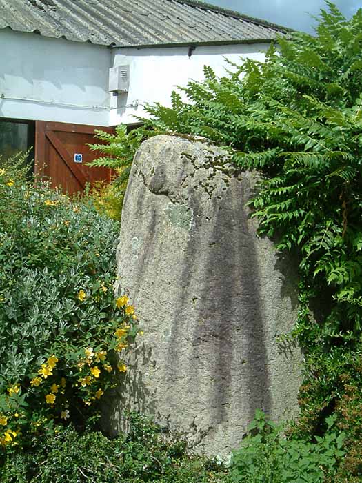
Skirsgill Standing Stone submitted by stu on 16th Jul 2004. NY5098 2874.
On the Skirsgill industrial estate near Penrith. Stone stands at the rear of the Liliput Lane factory.
(View photo, vote or add a comment)
Log Text: Skirsgill Standing Stone, Penrith: Situated in Skirsgill Business Park, just to the west of the southern part of Penrith, we’ve tried visiting this stone before, but never found it.
From Penrith, heading west across the M6 on the A66 towards Ullswater, take the very first turn into the Skirsgill Industrial Estate (easy to drive past, as it has a very short feeder lane into it). Follow the one way system into the industrial estate (note the intriguing thatched building to your left) and continue straight ahead between the two sets of industrial units. After several hundred metres, you will see a dead end with a gate leading into the field, an CrossFit Cumbria to your left. Parking can be difficult during the week, but plenty of spaces during the weekend. Walk along the dead end road towards the field, with the CrossFit building to your left. The standing stone can be found immediately at the end of this building. Was the building built to accommodate the stone, or has the stone been relocated to form part of its garden?
The face of the stone nearest to the building appears to have been quarried in more recent times, as the face is ‘squared off’. There is some modern grafitti on it.
Not the best of locations, but certainly intriguing! Could only find the Historic England listing – nothing in Pastscape.
Mossthorn Long Cairn 2
Trip No.9 Entry No.3 Date Added: 13th Feb 2017
Site Type: Cairn
Country: England (Cumbria)
Visited: Yes on 12th Feb 2017. My rating: Condition 3 Ambience 3 Access 5
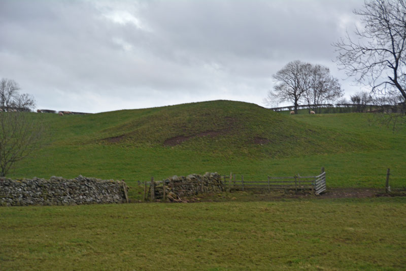
Mossthorn Long Cairn 2 submitted by Anne T on 13th Feb 2017. The long cairn at grid reference NY 48289 30440, taken from the layby outside The Wreays on the minor road from the A66 to Greystoke.
(View photo, vote or add a comment)
Log Text: Long Cairns near Mossthorn Farm, near Sewborwens Standing Stones: From Sewborwens Standing Stone(s), we drove westwards along this minor road, through the roadworks currently there, and parked in the layby outside The Wreay. The first long cairn is visible in the field immediately opposite.
Crossing the road to photograph this site, the wind chill must have been -5 degrees C, with the occasional flake of sleet. The roadworks had churned up the grass, so I waded through almost ankle deep mud to the stone wall and got a closer photograph.
We didn’t realise there was a second cairn at grid reference NY 48258 30606 until I checked on the Historic England site.
Given we want to come back and track the standing stones in Newbeggin Village at some point, I’m going to write to the farm to ask permission to walk the fields to see both long cairns at closer quarters.
West Lordenshaw Main Rock
Date Added: 10th Jan 2017
Site Type: Rock Art
Country: England (Northumberland)
Visited: Yes on 1st Jan 2017. My rating: Condition 3 Ambience 4 Access 4
West Lordenshaw Main Rock submitted by DrewParsons on 2nd Oct 2011. One of the deep cup and ring marks on this rock. September 2011.
(View photo, vote or add a comment)
Log Text: West Lordenshaw Main Rock, Northumberland: From Channel Rock, we walked back through the hill fort, stopping to admire a possible cairn field and three roundhouses next to the path. Main Rock generally had other visitors around it, but by this time it was starting to get really quite dark and we could spot heavy rain heading to us from across the valley in Rothsbury. I wanted to see both Main Rock and Horseshoe Rock before heading home, but time was too short and we only made it to Main Rock before torches would have been needed to see our way back to the car.
Having also visited the Portal site and seen how many other pieces of rock art there are here, I was regretting loss of our GPS last year on a Level 3 survey with the archaeology group – definitely need to replace it!
Needed to use the flash to get any photographs at this point. Some impressive motifs. Would have liked longer (and warmer weather) to sit and study this rock. A repeat visit (with GPS) to Lordenshaw is on my 'must' list!
East Lordenshaw Channel Rock
Trip No.8 Entry No.2 Date Added: 10th Jan 2017
Site Type: Rock Art
Country: England (Northumberland)
Visited: Yes on 1st Jan 2017. My rating: Condition 3 Ambience 4 Access 3
East Lordenshaw Channel Rock submitted by DrewParsons on 2nd Oct 2011. September 2011.
(View photo, vote or add a comment)
Log Text: Channel Rock, Lordenshaw, Northumberland: At the main Lordenshaw car park, there is a display board with a QR reference which I scanned to get me through to the Newcastle University Rock Art Mobile site. This is the first time I’ve been able to use this, as I had a good mobile signal, and found it great.
Their directions to Channel Rock are: “From the top of the hillfort, facing towards Rothbury down the valley, continue through the hillfort to your right. At the waymarked hillfort exit (65m) follow the left hand path. When you reach another waymarker (135m) turn off the path to the right, down the slope. You should see an expanse of white rocks straight ahead (70m).”
We carried on northwards through the hillfort, dropping down the slope to the north, past a waymarker, then headed right. At first difficult to find, as the light grey/whiteish Channel Rock sits within a rocky landscape, once spotted, its easy to identify and sits right on the edge of the hill; the cup marks and channel can be clearly seen.
Nearby is an impressive undercut rock, rounded by water. Brilliant site, sitting well below the crest of the hill/hillfort.
Lordenshaw Hillfort
Trip No.8 Entry No.1 Date Added: 10th Jan 2017
Site Type: Hillfort
Country: England (Northumberland)
Visited: Yes on 1st Jan 2017. My rating: Condition 3 Ambience 4 Access 4
Lordenshaw Hillfort submitted by DrewParsons on 2nd Oct 2011. View of the second of the two entrances. September 2011.
(View photo, vote or add a comment)
Log Text: Lordenshaw Hillfort, Northumberland: after an abortive trip to the Five Kings stone row, via Tosson Tower Bastle/Tower House, we parked at the main Lordenshaw's car park and headed northwards up the hill towards the hillfort. It was almost 3pm on new year's day and dusk was starting to fall, together with a biting wind and sleet flurries. We've been here before with our daughter and son-in-law on a glorious (but still windy) autumn afternoon, but didn't take any photographs at the time. Wanting to see Channel Rock and other rock art before darkness fell, we didn't linger too long in the hillfort. The defensive banks and ditches are still remarkably clear and the views, particularly down to Rothsbury were great. On the way back from Channel Rock, to the north west of the hillfort, I spotted what looked like cairns. There was an old boundary feature and in the interior of the hillfort, following the pathway to Main Rock, we spotted the stone ring bases of three round houses. Would love to go back on a warm summer's evening!
