Contributory members are able to log private notes and comments about each site
Sites Anne T has logged. View this log as a table or view the most recent logs from everyone
St Mary and St Alkelda
Trip No.19 Entry No.5 Date Added: 29th Apr 2017
Site Type: Ancient Cross
Country: England (Yorkshire (North))
Visited: Yes on 27th Apr 2017. My rating: Condition 3 Ambience 4 Access 4
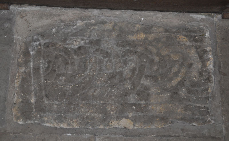
St Mary and St Alkelda submitted by Anne T on 29th Apr 2017. We were unable to get into the church on 27th April 2017, as evensong was in progress, but I found a photograph of this cross shaft embedded in the floor of the nave from a previous visit on 19th August 2013. I am doing some more research to determine the date of this fragment.
(View photo, vote or add a comment)
Log Text: Anglo Saxon Cross Fragment, Middleham: On the way to the holy well, we stopped off to look at the porch of St. Mary’s & St. Alkeld, but evensong was one, so we couldn't go inside but carried on westwards through the churchyard into the fields beyond to find St. Alkelda’s Well.
At home (29th April) reading through the entry from British Listed Buildings, I noted there was mention of a cross shaft fragment built into the floor of the nave. I looked up my photographs from 19th August 2013, when we’d had a holiday cottage not far away, at a time when we weren’t looking for Anglo Saxon cross fragments, and there was one photograph.
After a brief look around the exterior of the church, we carried on through the churchyard to find the site of St. Alkelda's Well.
St Alkelda's Holy Well
Trip No.19 Entry No.6 Date Added: 29th Apr 2017
Site Type: Holy Well or Sacred Spring
Country: England (Yorkshire (North))
Visited: Yes on 27th Apr 2017. My rating: Condition 2 Ambience 1 Access 4
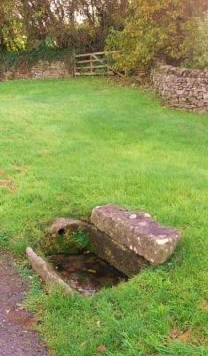
St Alkelda's Holy Well submitted by Sunny100 on 27th May 2010. St Alkelda's Holy Well at SE.124879. Square-shaped stone tank (now dried-up)
(View photo, vote or add a comment)
Log Text: St. Alkelda's Well, Middleham: How tragic – a now dried up well, completely uncared for.
From St. Mary’s and St. Alkeld’s church, I was determined to find St. Alkeld’s Well. Armed only with the mobile phone, OS maps and the grid reference from Pastscape, we set off westwards across the fields, through the gate in the churchyard across a grassy field with a play area at the far end, through a gate leading into where St. Alkeld’s Road and The Springs meet, then through a stile into a grassy field. Measuring the distance between the church porch and the well, the distance is just under 250 metres.
We walked past the well without realising it, thinking it was only a pile of stones and rubble that someone had tossed over their garden wall. On checking the grid reference, we walked back to it.
Having seen the image of the trough by the roadside on both the Portal and Yorkshire Holy Wells, we searched in vain, eventually walking back to The Springs and looking down the driveways. The well is sited at the bottom of the gardens of the two small houses, one called ‘Well Cottage’. Having taken some photographs, we followed the footpaths back into the town centre, ending up at a medieval cross at SE 12607 87679 (see on a previous visit).
Newbeggin Stone Row
Trip No.14 Entry No.2 Date Added: 28th Apr 2017
Site Type: Stone Row / Alignment
Country: England (Cumbria)
Visited: Yes on 25th Mar 2017. My rating: Condition 2 Ambience 3 Access 4
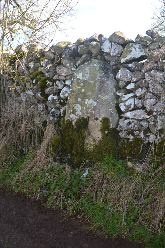
Newbeggin Stone Row (Possible) submitted by Anne T on 28th Mar 2017. This stone is built into a stone wall on a footpath which follows the Carlsike Burn, around Hoghouse Hill to Newbeggin. Located at NY 48058 29531. Note: 3rd April 2017. The Lead Officer for the Historic Environment and Commons says "This is slightly more interesting. I would not like to guess at when this might have been erected."
(View photo, vote or add a comment)
Log Text: Newbiggin Stone Row, Near Penrith: Following our first visit to try and find the standing stones mentioned on the village website, but drawn a blank, we did find 2 of the 4 wells, and recorded these in photographs. An email to the Parish Council, who'd featured one of these stones on their website, resulted in us being put in touch with Dr. Alan J Rich, the local historian. He was enormously helpful and emailed me across a map of 5 of the stones to be found around the immediate bounds of the village.
Also intrigued by The document “The Prehistoric Remains on Moordivock, near Ullswater” by M. Waistell Taylor MD, FSA, dated 1885 on page 342 and 343 talks about “remnants of former alignments of megaliths may still be made out elsewhere, in various localities in the district around Penrith, a few appearing as Standing Stones, and some partially sunk, or walled into the breast of fences. For instance in the direction from the S end of the village of Newton Reigny, by Mossthorn, on over Pallet Hill to Newbiggin; also from Sewborrens over the Riggs Farm to Newbiggin some few exist, and I have seen old people who remembered the removal of many of these stones at the beginning of the century. These lines may have been in connection with the barrows and stone circles, of which the dilapidated remains and half buried relics are frequent over this locality.”
Taking advantage of the sunny, spring weather, and armed with Dr. Rich's maps and book, we headed back to Newbiggin for a wander around the lanes and pathways in and around this long, linear village. In total we saw a total of 10 possible standing stones, and I've emailed details to the County Historical Officer to see if these can be verified as such, as they are not mentioned on the OS map. Curiously, plotting the grid references on UK Grid Finder, apart from the stone near Bell Mount, there is an alignment running north-east from Newbiggin towards Newton Reigny.
Horsley Hill Homestead
Trip No.18 Entry No.6 Date Added: 25th Apr 2017
Site Type: Ancient Village or Settlement
Country: England (Northumberland)
Visited: Yes on 23rd Apr 2017. My rating: Condition 2 Ambience 3 Access 4
Horsley Hill Homestead submitted by durhamnature on 16th Aug 2012. Meter-wide field stones, part of a collapsed dry stone wall, but perhaps of older provenance.
(View photo, vote or add a comment)
Log Text: Horsley Hill Homestead, Northumberland: Well, this site got the adrenalin racing, if only for the crossing of the footpath across the A69 dual carriageway, at a very fast spot! We parked in Horsley Village on the B6528, outside the Hearth café, and walked up Lead Lane, which runs just to the west of the Hearth, and to the side of the (now) antiques shop. Running past some houses, the tarmacked road quickly becomes a glorious grassy lane. It was very tranquil here, but for the wooden fence and footpath sign at it’s northern end, with the A69 just ahead.
I have to say I’d been worrying about going to this site for some days. We’d tried walking the long way round, from the north of the site, but it was a very long way round. In all fairness, there is a pedestrian sign on both sides of the A69, a tarmacked pavement and gap in the central barrier does aid a crossing. But, with traffic whizzing past a very high speed and heart in mouth, we waited until there was a sufficient gap in the traffic and RAN to the central reservation. It was very odd standing in the middle of such high speed cars and vans on a Sunday evening.
Eventually making it to the other side, the footpath takes a tranquil stroll up to a grassy meadow complete with mobile phone mast with all its electrics. Great views to the north, west and east from here. No wonder our ancestors built a homestead here.
The top of the hill is a large, long oval shape, aligned north-south with slopes down to the surrounding land on the north and eastern side, and signs of ridge and furrow ploughing to the north-east, although Pastscape tells us that this homestead was only 60 metres in length and 47 metres wide.
I’m glad I’d been out with the archaeology group, looking at different banks and features in other areas, as it was a little tricky to make out the low banks which defined this settlement, combined with the more modern trackways from the field gate to the east up to the mobile mast mounds. There are what appear to be very old boundary walls, together with many large stones in an old wall system just to the east of where the northern part of the footpath meets the field, but we concluded this just might be part of the old field system before it was cut by the A69.
The banks were easier to see with the naked eye rather than with the camera. Andrew thought he detected the low, round shape of a roundhouse, but I wasn’t convinced.
A second dash back across the A69 meant I could finally relax. Onto Croft’s Well in the centre of Horsley.
St. Mary's Well (Jesmond)
Trip No.18 Entry No.4 Date Added: 24th Apr 2017
Site Type: Holy Well or Sacred Spring
Country: England (Tyne and Wear)
Visited: Yes on 23rd Apr 2017. My rating: Condition 4 Ambience 4 Access 4
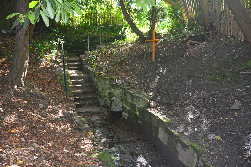
St. Mary's Well (Jesmond) submitted by Anne T on 24th Apr 2017. Standing on the slope above the well pool, looking back at the stone steps leading down to the well.
(View photo, vote or add a comment)
Log Text: St. Mary's Well, Jesmond: From the elusive (non-existent!) Axwell Park Tumulus, we headed off down the Coast Road to Jesmond to find this well. It was a delight – an oasis in the midst of the city.
Parking on Jesmond Dene Road where it meet Grosvenor Avenue, we headed west up The Grove – a shady footpath that runs between The Grove and Red Park Road, in between the back gardens of the houses.
We found the gate to this well to our right hand side, several hundred metres up the path, highlighted by the blue signpost.
Descending into this shady nook, down the stone steps, the first view of the well was of the small statues, tea-lights and mementos left on top of the well covering. As my eyes adapted to the shade, the pool of the well came into view.
The well was full of water, with a steady flow over the cobbles towards the pool. There was a cute copper jug left attached to the side of the well, which I took off and dunked into the water. Andrew and I both tasted the water, and it was completely tasteless, which was a surprise.
After enjoying the peace and calm, we headed off to find St. Mary’s Chapel, now ruined, just down the road. Really enjoyed this visit.
Holy Well, Greenside
Trip No.18 Entry No.2 Date Added: 24th Apr 2017
Site Type: Holy Well or Sacred Spring
Country: England (Tyne and Wear)
Visited: Yes on 23rd Apr 2017. My rating: Condition 4 Ambience 4 Access 5
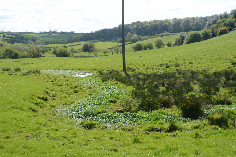
Holy Well, Greenside submitted by Anne T on 24th Apr 2017. Holy Well, Greenside from the gate in the field on Barlow Lane.
(View photo, vote or add a comment)
Log Text: Holy Well, Greenside: From Ryton Motte, we headed off south towards Greenside through the back lanes. Considering how close were are to Winlanton, Blaydon, Gateshead and Newcastle, you could be forgiven for thinking you were in the depths of the countryside at this site. Disappearing down a small road leading from Greenside to Barlow (Barlow Lane on UK Grid Finder) we parked where the lane met a tarmacked path leading to Reeley Mires Farm. It was then a question of walking a couple of hundred yards south-east down Barlow Lane, where the well is located at the base of the Drumlin.
To your right hand side, as you walk down the lane, there is a red metal gate into the field, although this is heavily overgrown by hawthorn and brambles, and is impossible to open. The central pool of the well can be seen at near the base of a telegraph pole, although the whole feature forms an attractive long ‘s-shape’ in the pasture.
It is a really pretty spot here. I was impressed there was so much water here, as it has been little rain here for weeks.
Have as yet been unable to find any notes/further information about this well. Thanks to durhamnature for his original entry.
Ryton Motte or Tumulus
Trip No.18 Entry No.1 Date Added: 24th Apr 2017
Site Type: Artificial Mound
Country: England (Tyne and Wear)
Visited: Yes on 23rd Apr 2017. My rating: Condition 3 Ambience 4 Access 4
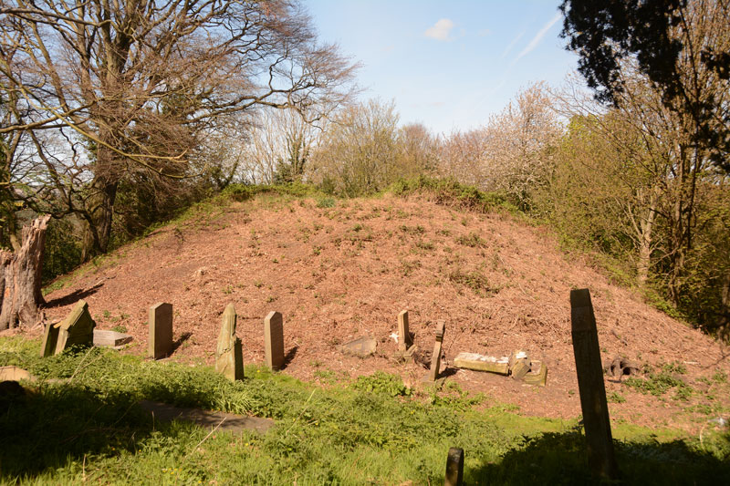
Ryton Motte or Tumulus submitted by Anne T on 24th Apr 2017. The motte seen from its eastern side. Graves had been cut into most sides of the bottom of the motte.
(View photo, vote or add a comment)
Log Text: Ryton Motte, Gateshead: Parking on the main road opposite The Old Cross pub and Holy Cross church on Barnmoor Lane, as there was an event on at the church, the first surprise was to see the old cross located on the village green.
Pastscape reveals this is relatively modern, having been erected in 1765, but the base looks much, much older. Historic England say in list entry 1018642 that there was evidence of an earlier cross on this site.
A stream of very well dressed people were exiting the church yard, indicating a service had just finished. I spent a few minutes photographing the cross, then we sauntered in the churchyard. The name board on the gate to the churchyard says that the church was founded in 1220, and whilst there appears to be old stones in the fabric of the church, popping our head into the church itself, it looks very Victorian. There were people inside, so we didn’t linger.
Walking round the tower at the west end of the church, and round to the north wall, we came across a man digging up brambles and dock plants around the graves. He told us he wasn’t’ associated with the church, but had got fed up of the graveyard looking as it did. He also said he’d just removed shrubbery and brambles off the motte, which looked bare and brown in the warm sunlight. He also told us to look out for the grave of a woman to the north-west of the motte, which had inscribed on the headstone about the grave also containing her husband, who’d lost his arm at Trafalgar.
The motte is certainly a significant structure (I thought it was only small, but it’s not, measuring 3.30 metres with a diameter of 30 metres, according to Pastscape. The mound certainly appears much higher when viewed from the river side, where it looms high above you.
These days, the river is largely hidden by trees, but glimpses of silver water appear as you follow the path round the motte and back up to the east side of the church. It would have had a very commanding spot above the river when it was built.
Exhibition Park Circle
Trip No.18 Entry No.5 Date Added: 24th Apr 2017
Site Type: Modern Stone Circle etc
Country: England (Tyne and Wear)
Visited: Yes on 23rd Apr 2017. My rating: Condition 4 Ambience 1 Access 4

Exhibition Park Circle submitted by Anne T on 24th Apr 2017. Standing at the bandstand side of the mound, looking northwards at the five stones.
(View photo, vote or add a comment)
Log Text: As we’d failed to find the Axwell Park Tumulus, we sat in Café Nero in Fenwicks and I was looked up details of sites we were going to on the mobile version of the Portal. I came across an entry for ‘Leazes Park Circle’ which mentioned a modern stone circle. This took me by surprise, as we’ve been parking our car by Leazes Park when we come into Newcastle, at least once a week, and not come across any mention of this before. Bringing the map up on my phone, we sat puzzling where this was, and decided to head off and look for it.
'Modern Stone Circle', Newcastle: In actual fact, it is in Exhibition Park, not Leazes Park, although I’ve spent a while trying to find more about this on the web. Not finding anything, I’ve emailed the Parks and Countryside Department at Newcastle City Council, simply out of curiosity.
Having stumbled upon the ‘circle’ (the grid reference on the Portal was also a bit off), I’m convinced it’s part of the children’s play park. However, I might yet be proved wrong. When we arrived, a student was walking over the tree trunk to the mound and generally walking around the ditch surrounding this tiny ‘monument’. Disappointing, but pleased to have found it and been able to contribute a photograph to the Portal.
St Peter's Minster (Conisbrough)
Trip No.17 Entry No.1 Date Added: 18th Apr 2017
Site Type: Sculptured Stone
Country: England (Yorkshire (South))
Visited: Yes on 15th Apr 2017. My rating: Condition 3 Ambience 4 Access 5
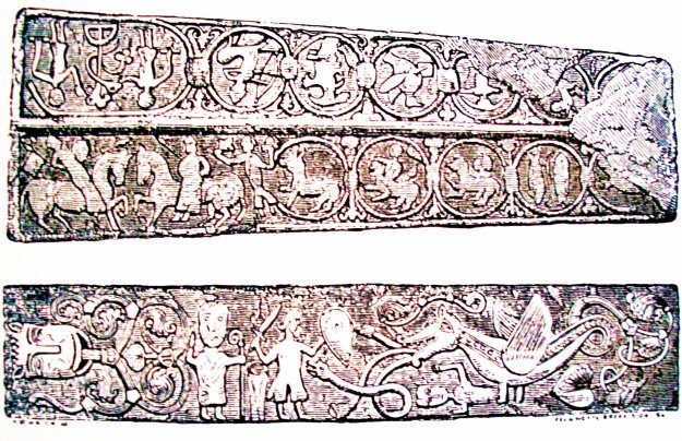
St Peter's Minster (Conisbrough) submitted by Sunny100 on 15th Aug 2010. Detailed illustration of the two early Medieval grave-slabs that are both richly carved with an assortment of mythical characters, beasts and symbols. These stone slabs are said to be the finest example of their kind in England.
(View photo, vote or add a comment)
Log Text: Anglo Saxon Carvings, Conisbrough: Having seen this on the Portal, with only a sepia image of the stones, I had been keen to visit this church for some time as it was only a short detour from my step-father's house; the nearby castle had been my very first ever school trip, over half a century ago (gulp). We managed to park in the (small) free car park outside the community centre, right next to the church.
We arrived just as the children’s Easter Egg hunt/service had ended, and children and parents streamed out of the church. With 2 year old grand-daughter in tow, desperate to join in, one lady coming out of the church saw us waiting and asked if we were visiting. When I said we were, she said we were very welcome, waited until the crowds had lessened, then took us in. Another gentleman took us round to see the grave stones and made sure we had the free history leaflet of the church. Grand-daughter and husband made a great game of finding all the Mouseman mice on the pews.
The church, whilst it looks Victorian from the outside, clearly has some very old parts, evident in the blocked up windows in the arches in the nave, and the tower. The church guide tell us that this is the "oldest building in South Yorkshire and is one of the ten oldest churches in England, with parts dating back to at least 750AD." The church warden was telling us that the church came many years before the castle, and so is sited on the highest part of the town; the castle therefore had to take the second highest spot.
As well as the grave stones, there is the very worn shaft of a cross outside, which the church guide leaflet says dates from the very earliest times of this church, around 750 AD. Lovely welcome and well worth the detour. Carried on to look at the castle before heading off into Doncaster.
Castle Hill (Whittonstall)
Trip No.16 Entry No.1 Date Added: 13th Apr 2017
Site Type: Ancient Village or Settlement
Country: England (Northumberland)
Visited: Yes on 12th Apr 2017. My rating: Condition 2 Ambience 3 Access 5
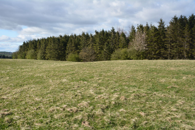
Castle Hill (Whittonstall) submitted by Anne T on 12th Apr 2017. Standing in the slight ditch at the south-western side of the settlement. Much easier to see with the eye than in the photograph.
(View photo, vote or add a comment)
Log Text: Castle Hill, between New Ridley and Whittonstall, Northumberland: This is only a couple of miles from our house, and being a lovely sunny evening, decided to try and find some of the earthworks on the OS map.
This site has the advantage of being close to Wheelbirks Farm with its café, unpasteurised milk and wonderful ice cream. Parking in the layby almost at the junction of the B6309 and the Lead Road, we walked along the busy main road for a couple of hundred yards until we reached the far end of the Castle Hill plantation. Here, the stone wall falls back from the road, and you can walk through to the brambles to the wall. An old gate (?) has been placed so the bars act as a ladder to climb over either into the plantation or the pastureland.
Standing at the stone wall, its possible to see the hump of the settlement with one accompanying outer ditch in front of you. Clambering over into the grassy field (didn't see anyone to ask - sorry), a quick walk along this corner of the field brought the whole of the settlement platform into view. It was much easier to see with the naked eye, rather than try and capture with the camera. Logging onto Pastscape when I got home, I was fascinated to read the history and interpretation of this very ordinary site. Obviously a lot more interesting in the past!
We did go on to Whittonstall to try to find the manorial earthworks not far from The Anchor pub, but these have all been ploughed out. We did carry on to Ebchester, near Newlands, where the line of Dere Street can be seen in the fields to the north east of the B6309. From the gate in the field near the layby almost opposite the junction with the road to Newlands, you can see a cross-section of the road. Interesting.
Three Howes Rigg (East)
Trip No.15 Entry No.2 Date Added: 11th Apr 2017
Site Type: Round Barrow(s)
Country: England (Yorkshire (North))
Visited: Yes on 9th Apr 2017. My rating: Condition 3 Ambience 3 Access 5
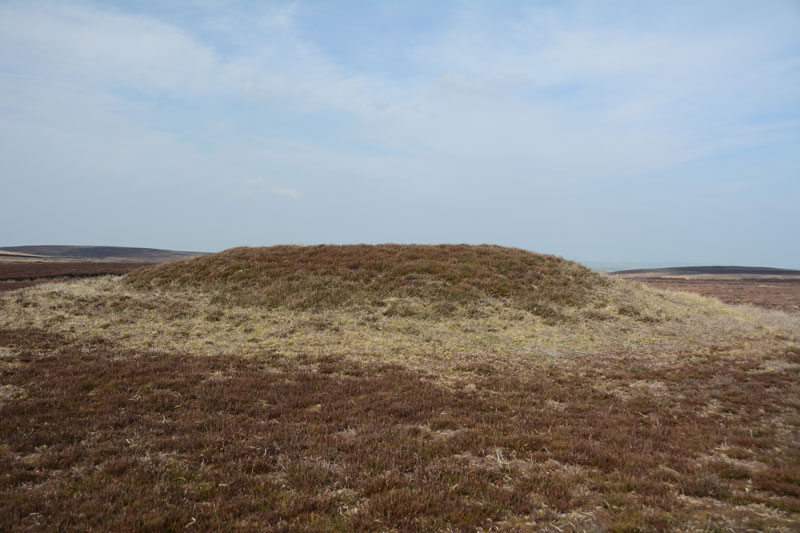
Three Howes Rigg (East) submitted by Anne T on 11th Apr 2017. The northern-most, most visible, of the three barrows on the eastern side of Smeathorns Road. As seen from the road.
(View photo, vote or add a comment)
Log Text: Three Howes Rigg (East), Smeathorns Road, North Yorkshire: Having stopped at White Cross and Three Howes Rigg (West) first, and having 'got our eye in', these barrows rise from the surrounding ground on access land. On the eastern side of Smeathorns Road, and clearly visible on UK Grid Finder, tramping across the heather moorland was easy on the feet.
Now largely used to feed the grouse (full feeding dishes on the tops of these barrows), they diminish in height from the north to the south. There is a fourth mound to the east of the middle barrow, but this looks more like a farmer's spoil heap rather than a barrow, and I couldn't find any reference to it on Pastscape or Historic England.
Looking at the map, there are so many barrows, crosses and other features around here, I'd like to spend more time in this area.
Three Howes Rigg (West)
Trip No.15 Entry No.2 Date Added: 11th Apr 2017
Site Type: Round Barrow(s)
Country: England (Yorkshire (North))
Visited: Yes on 9th Apr 2017. My rating: Condition 2 Ambience 3 Access 5
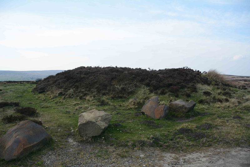
Three Howes Rigg (West) submitted by Anne T on 11th Apr 2017. The larger of the two round barrows on the western side of the road at Three Howes Rigg. The larger boulders presumably stop people from parking and destroying the site, although it creates a handy layby to stop and enjoy all five of the barrows at this location (bar the traffic speeding by!). Sited at NZ 68106 10279.
(View photo, vote or add a comment)
Log Text: Three Howes Rigg (West), Smeathorns Road, North Yorkshire: Despite being called ‘Three Howes’, there are actual 5 barrows in total! It would be easy to whizz by these barrows, as they appear as slight mounds at the top of the ridge. With cars speeding by at a good 60mph or so, it’s difficult to slow down and park, but there is a space between the two barrows on the western side of the road, flanked by large boulders to protect the fourth and fifth barrows.
Once identified, they are obvious in the landscape. Having first stopped at White Cross some 500 metres to the north, being on access land, we tramped over the heather and moorland to take a closer look.
We started with the two barrows to the west of the road and worked our way northwards. The northern-most has been cut slightly by the road to its eastern side; the southern-most was heavily covered in calf-high bracken. We missed the inscribed stone in the middle of this one, but the carving seems to be relatively modern, looking at the Historic England entry.
Millennium Stone Danby High Moor
Trip No.15 Entry No.3 Date Added: 10th Apr 2017
Site Type: Modern Stone Circle etc
Country: England (Yorkshire (North))
Visited: Yes on 9th Apr 2017. My rating: Condition 3 Ambience 3 Access 5
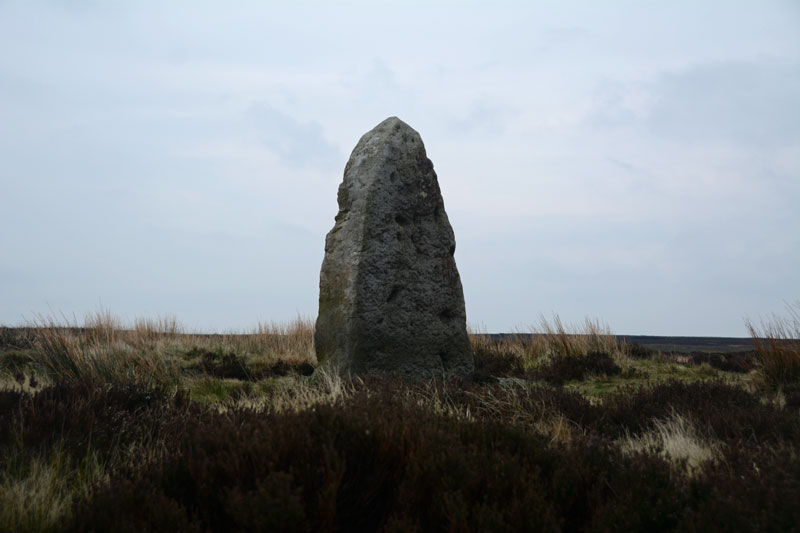
Millennium Stone Danby High Moor submitted by Anne T on 10th Apr 2017. Standing at the road junction of the moorland road from Ainthorpe and Knott Road, this stone sits over a metre above you.
(View photo, vote or add a comment)
Log Text: The Millennium Stone, Danby High Moor, North Yorkshire: Driving at a sedate pace along the moorland road from Wolf Pit Tumulus (which I realised as we got a phone signal back, that we’d picked up the wrong monument), I was really surprised to see what looked like a large standing stone at the junction of Knott Road. Immediately to our left was a small car park with an interpretation board (which didn’t mention this stone), and I spent a good half hour on the internet at home trying to find anything at all about it, which was a brief mention on the Hidden Teesside web site.
Getting out of the car to look more closely at this stone, my fleece and camera were almost blown away by the wind. The temperature had dropped from high teens to single figures in a very short while. I was glad to get back into the car, but pleased to have 'discovered' a stone not (yet) on the map! Next stop was the second 'White Cross' of the day - later discovered to be called 'Fat Betty'.
Young Ralph Cross
Trip No.15 Entry No.5 Date Added: 10th Apr 2017
Site Type: Ancient Cross
Country: England (Yorkshire (North))
Visited: Yes on 9th Apr 2017. My rating: Condition 3 Ambience 4 Access 5
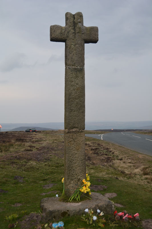
Young Ralph Cross submitted by Anne T on 10th Apr 2017. The Young Ralph Cross sits close to the side of the road on Ledging Hill.
(View photo, vote or add a comment)
Log Text: Young Ralph Cross, Ledging Hill, North Yorkshire: Just down the road from Fat Betty Cross/White Cross, Young Ralph’s Cross sits almost opposite the road junction of the minor road (Knott Road) to Rosedale and the road northwards across Castleton Rigg to Castleton.
Turning right at the road junction, we parked on the minor road leading north west towards Westerdale. This road was very busy, and traffic moved very fast. Whilst standing at Fat Betty, I heard several cars sounding their horns at each other.
From a distance, this cross looks as if it is made out of concerete, but the Historic England entry says this wayside cross possibly dates from the 11th century. The cross base looks much, much older than the shaft and head.
The Historic England entry talks about much weathered interlace ornament and cable moulded border. I couldn’t see any of this, perhaps put off a closer look by the biting wind and cold.
I was keen to try and find the Old Ralph Cross, but by this time it was late, we were cold and it was time to head off home. There is so much to see in this area, it would be well worth a repeat visit.
White Cross (Three Howes Rigg)
Trip No.15 Entry No.1 Date Added: 10th Apr 2017
Site Type: Marker Stone
Country: England (Yorkshire (North))
Visited: Yes on 9th Apr 2017. My rating: Condition 2 Ambience 2 Access 5
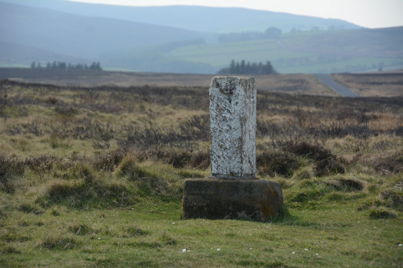
White Cross (Three Howes Rigg) submitted by Anne T on 10th Apr 2017. Standing on Smeathorns Road looking across to the stone and its earlier cross base, with the moors of the National Park in the distance to the west.
(View photo, vote or add a comment)
Log Text: White Cross, Three Howes Rigg, North Yorkshire: Approaching the Three Howes Tumuli on Smeathorns Road, we spotted this "White Cross" marked on the map at the road junction with Commondale Village. Stopping and running across the road in between the fast moving traffic, I took some photographs. This cross is listed by Historic England as entry 1250385, and is described as an "early to mid-C19 boundary stone on medieval base of wayside cross." The views across the National Park to the west would have been spectacular but for mist.
Fat Betty
Trip No.15 Entry No.4 Date Added: 10th Apr 2017
Site Type: Ancient Cross
Country: England (Yorkshire (North))
Visited: Yes on 9th Apr 2017. My rating: Condition 3 Ambience 4 Access 5
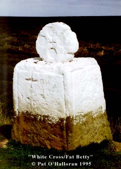
Fat Betty (White Cross) submitted by kelpie on 9th Jun 2002. NZ 68224 02001
This is reported as both a standing stone and a moorland cross (I prefer the latter).
(View photo, vote or add a comment)
Log Text: Fat Betty's Cross, Danby High Moor, North Yorkshire: From Wolf Pit Tumulus, carrying on down the road (New Way) over Danby High Moor, past the curiously named Lower Fryup Dale to the east, then over Seavey Hill, passing by the modern standing stone (Millennium Stone) at NZ 69699 01296, we turned west towards Rosedale Head. Where the Esk Valley Way crosses this road, there is a small, squat White Cross located to the north. Just a few metres up the Esk Valley Way footpath, stepping over a muddy ditch, we got the full force of the wind sweeping across this moorland. From a leisurely, warm lunch in Castleton an hour earlier, the temperature had dropped considerably, and I wished I’d brought a warmer coat!
The head of the cross bears four small circles on both sides, reminiscent of Anglo Saxon cross heads. There is considerable graffiti on the stone, together with offerings (see image of money at bottom of cross head).
Just over the road is Young Ralph’s Cross.
Bell Mount
Trip No.14 Entry No.1 Date Added: 3rd Apr 2017
Site Type: Natural Stone / Erratic / Other Natural Feature
Country: England (Cumbria)
Visited: Yes on 25th Mar 2017. My rating: Condition 2 Ambience 3 Access 5
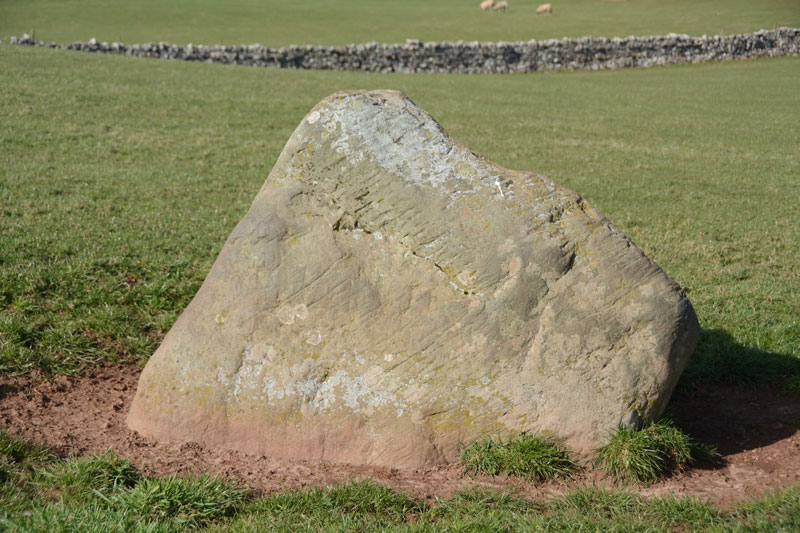
Bell Mount submitted by Anne T on 3rd Apr 2017. This stone sits almost on the brow of the hill. There are striations on its surface (plough or glacial?) indicating it has lain prone at some point in its history. There is slight evidence it is set within a depression.
(View photo, vote or add a comment)
Log Text: Bell Mount Erratic (or standing stone?): Saw this very briefly on our first visit to Newbeggin, but whizzed by in the car and didn't stop. This time, we parked by the open gate to the field. There being no stock, we took the chance to walk up the grassy slope to see this stone. Whilst it's not marked on the OS map (neither is the Sewborwens stone not far away), it showed distinct striations on one of the surfaces indicating it had lain prone at some point and been stood up. My geology isn't good enough to tell it the marks were as a result of glaciation or the plough, although the stone seemed to be set into a slight depression which was even all round, and didn't look like stock had been rubbing around it. Note to self: need to check geology of the area.
The Galloway Stone
Trip No.15 Entry No.2 Date Added: 3rd Apr 2017
Site Type: Natural Stone / Erratic / Other Natural Feature
Country: England (Cumbria)
Visited: Yes on 2nd Apr 2017. My rating: Condition 3 Ambience 2 Access 5
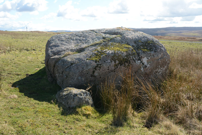
The Galloway Stone submitted by Anne T on 3rd Apr 2017. Looking south east over the Galloway Stone to the hills beyond.
(View photo, vote or add a comment)
Log Text: The Galloway Stone, near Orton, Cumbria: Spotted this named stone on the map as we drove towards Orton to find refreshments. There were many other large (but not quite as large as this) stones in the vicinity. With the M6 Northbound carriageway almost immediately behind, and above, this stone, I could have been forgiven for thinking this was left over from building the motorway.
In close up, the stone is clearly pink Shap granite, and had a red tint in the sunlight. A big surprise was find the bench mark with its large rivet on top of the stone.
Shapbeck Plantation
Trip No.15 Entry No.1 Date Added: 3rd Apr 2017
Site Type: Stone Circle
Country: England (Cumbria)
Visited: Yes on 2nd Apr 2017. My rating: Condition 3 Ambience 4 Access 4
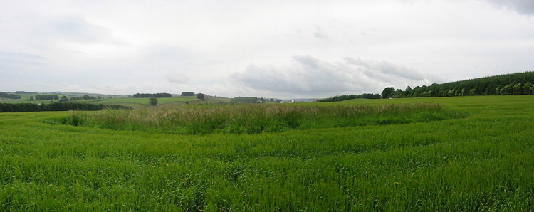
Shapbeck Plantation submitted by stu on 16th Jul 2004. NY552 188.
General view of the overgrown stone circle.
(View photo, vote or add a comment)
Log Text: Shapbeck Plantation Stone Circle: Our first stop of the day, whizzing off the M6 southbound at Eamont Bridge and travelling on the A6 through Clifton & Hackthorpe to Shapbeck Gate. There, a side road leads to a bridge across the River Leith, but there was no parking to be had. We turned back northwards up the A6 and parked in a layby some ¼ mile north of the footpath leading up to Shapbeck Plantation. We took our lives in our hands walking back to the footpath, with cars and motorbikes travelling fast along the road, and the verge was lumpy and bumpy and difficult to walk along.
Finally reaching the footpath, almost opposite the road leading to Southfield and Stonygill Bridge, we turned west over the fields towards Shapbeck Plantation, I was glad I had worn my wellies, as the gates into the fields were deep in muddy water. Careful of the stock in the first field, we crossed through the gate into a second field, where the footpath vanished – it had been ploughed out. Following the dry stone wall line up the hill towards the plantation, it was only when we had almost reached the top of the field that a fenced off area to the northern side of the field came into view.
Walking towards this, it was clear the farmer had been using this area as a dump for old metal items and other stones, although an inner and outer circle were clearly visible. It looked as if the circle had been built on a slight mound, with a ditch around the outside. At this time of year, there wasn't much vegetation, so it was possible to see lots of the stones.
Without the plantation, there would have been views 360 degrees around the site. Even today, this area was busy, busy, busy, with the A6, M6 and West Coast railway all intersecting and intermingling in the valley below. Walking across the fields, many of the smaller stones poking out of the earth had a very distinctly green tinge.
Definitely worth braving the traffic to visit this site.
Winderwath Stone Circle
Trip No.13 Entry No.4 Date Added: 28th Mar 2017
Site Type: Stone Circle
Country: England (Cumbria)
Visited: Yes on 25th Mar 2017. My rating: Condition 3 Ambience 4 Access 5
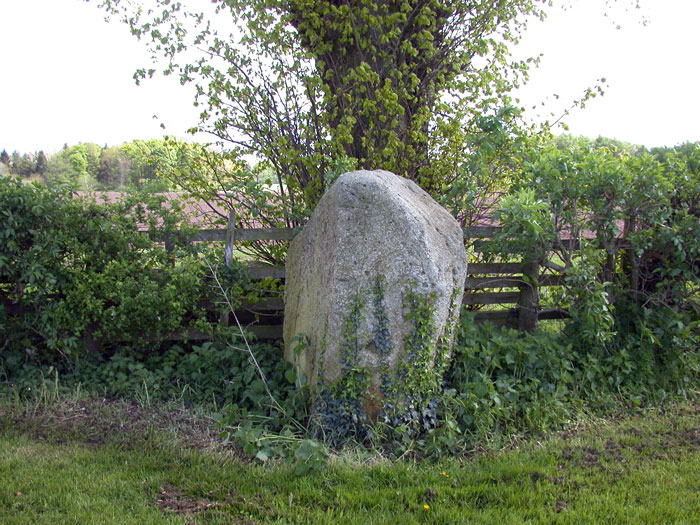
Winderwath Stone Circle submitted by nicoladidsbury on 11th May 2005. Winderwath standing stone This stone stands by the lane leading to Winderwath, and its magnificent gardens.
(View photo, vote or add a comment)
Log Text: Winderwath Stone Circle, Penrith: After our 'stone hunt' around Newbeggin and Newton Reigny, by this time it was gone 5pm and there was no hope of getting to Haweswater to look at the standing stones on Four Stones Hill before dark, so we set off to Winderwath. The Visit Cumbria website says in its entry for Winderwath Gardens: "There used to be a stone circle in the field adjacent to the lane that leads down to Winderwath, which was destroyed. Its stones were thrown into the River Eden nearby, except two – one stone remains standing by the lane, and a further stone lies behind the hedge, at the edge of the field." Note: this site is not included on the list of stone circles @ Photographer’s Resource and I could find no other reference to it on the web.
Sited on the minor road to Winderwath Gardens, it was interesting to find this tiny little turn off the A66 east. From Penrith, go passed the entrance to Centre Parks on the opposite side of the road and take the first road to your left, signposted to Culgaith. Following this little road which takes you past Woodside, Low Woodside and Winderwath Farm before taking a left to Winderwath Gardens, we’ve never seen so many rabbits scuttling about across the road and in the fields.
These stones are on the right hand side of the road as you drive down towards the gardens, about half way down the drive. This is again in a lovely valley, but being in an estate, it looks as if the ground has been heavily improved and levelled.
After having found the first stone, which seemed to have a couple of worn single cup marks in 2 of the faces (quite distinctive from the weathering patterns on the top of the stone), we peered over the hedge to find the second stone. It appears the tree in the fenceline is sitting on top of a few other smaller stones. The second, larger stone can hardly be seen from the driveway, so we found a gate in the top end of the field and quickly ran down to take a look. If someone had been around, we would have asked nicely.
