Contributory members are able to log private notes and comments about each site
Sites Anne T has logged. View this log as a table or view the most recent logs from everyone
Moon's Cross
Trip No.132 Entry No.6 Date Added: 7th Jun 2019
Site Type: Ancient Cross
Country: England (Devon)
Visited: Yes on 13th May 2019. My rating: Condition 3 Ambience 4 Access 5

Moon's Cross submitted by Anne T on 7th Jun 2019. First view of Moon's Cross as we approached, driving south along Fore Street from South Tawton.
(View photo, vote or add a comment)
Log Text: Moon's Cross, between South Tawton & South Zeal: From St Andrew’s Church in South Tawton, we headed south along Fore Street towards South Zeal. At a cross roads just outside South Tawton, there is the remains of a cross shaft in a socket stone. As the road is quite wide here, it was easy to park just south of the cross shaft, near the barn of the nearby farm.
Lying by the side of the cross shaft and its socket stone is a large stone by the side of the cross; at first glance it looked just like a boulder, but closer inspection indicated it might have been shaped. Is this just another gate post, or could it be a cross shaft fragment?
Oxenham Arms
Trip No.132 Entry No.8 Date Added: 7th Jun 2019
Site Type: Standing Stone (Menhir)
Country: England (Devon)
Visited: Yes on 13th May 2019. My rating: Condition 3 Ambience 4 Access 4
Oxenham Arms submitted by TheCaptain on 26th Apr 2004. Oxenham Arms, South Zeal, Devon SX651935.
An enormous and magnificent menhir built into the wall of a tremendous pub on the main street in the village of South Zeal, Devon.
In fact, the pub is believed to have been built by monks in the twelfth century around the menhir. As the pub website says "A very interesting part of the house is the small lounge behind the bar. In this room, set in the wall, is a monolith and the theory of archaeologists is that the monastic builders placed the...
(View photo, vote or add a comment)
Log Text: Oxenham Arms Menhir & Roman Stone: We originally headed off to the wrong pub, at the north western end of the village, but having thought the name of the pub wasn't what we remembered, we found the Oxenham Arms just down the hill from the village cross.
Walking into the pub from the bright sunshine of the street took my eyes some time to adjust, but we welcomed the coolness and the opportunity of a long, cold, icy drink.
I asked the barman if I could ask a cheeky question, and he said “on the scale of 1 to 10, how cheeky?” I replied “4”. He said “that’s not cheeky”. He very patiently told us where to find the standing stone, and also told us about the Roman pillar in the restaurant at the back. He very kindly said it was OK for me to take photos.
He also added (tongue in cheek?) that they thought it had taken 40 years to carve the granite standing stone, although how he knew, I don’t know. The stone apparently continues in one of the rooms upstairs.
Lovely atmosphere here. If we go back to Devon, I’d like to go for a meal here. A chance to see a couple of fine stones and have a drink at the same time - only the second time ever (the first being at the Templar Preceptory at Rothley).
There are several notices hanging on the wall and I’ve typed this up.
South Zeal Cross
Trip No.132 Entry No.7 Date Added: 7th Jun 2019
Site Type: Ancient Cross
Country: England (Devon)
Visited: Yes on 13th May 2019. My rating: Condition 3 Ambience 4 Access 5
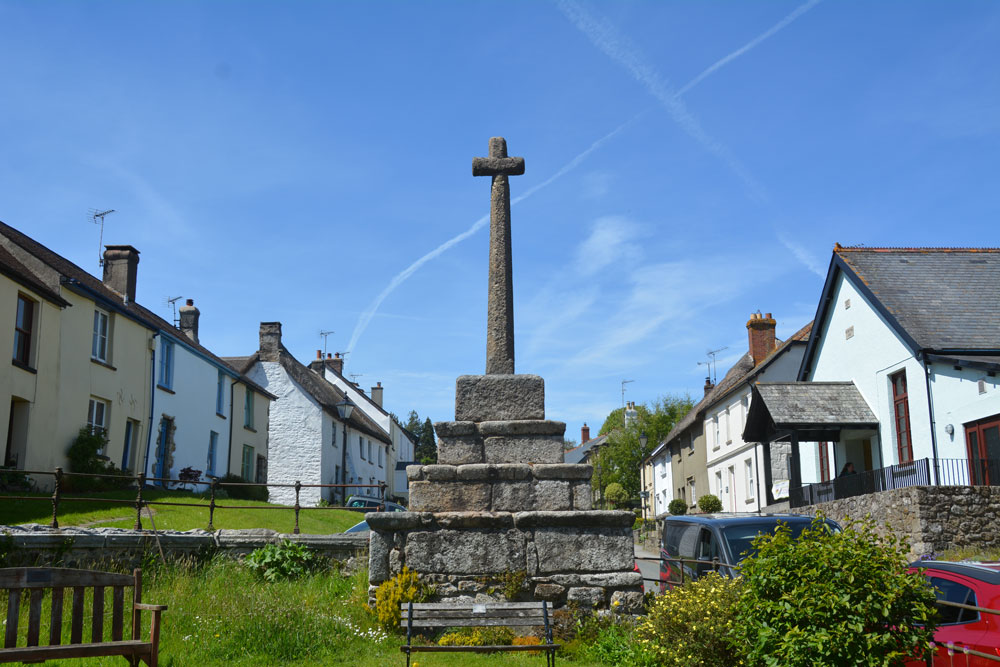
South Zeal Cross submitted by Anne T on 7th Jun 2019. The cross, as seen from the small communal garden next to the small but lovely Chapel of Ease, just to its south east. Historic England says: "(The cross) is an integral part of the South Zeal townscape. It is very special being one of the few medieval boroughs in Devon where a significant number of its late medieval houses survive to a greater or lesser extent".
(View photo, vote or add a comment)
Log Text: South Zeal Cross: Driving the short distance from Moon’s Cross into South Zeal, this is a busy little working village, not just a place for tourists to travel to Oh the cars that were parked up and down the street, but we managed to find a space just south of the village cross.
This is a tall, imposing monument, standing just north east of the small, but quaint St Mary’s Chapel and a small, beautifully kept communal garden. As we drove south east down the main road through the village (towards the Oxenham Arms) the cross dominated the village; standing further south east, as the village is on a hill, the cross towered above us.
Whilst visiting the cross, it's worth popping into the tiny, but welcoming St Mary's Chapel next door. Now turned into a place of rest and contemplation for modern day pilgrims.
Sticklepath Methodist Chapel Cross
Trip No.132 Entry No.9 Date Added: 8th Jun 2019
Site Type: Ancient Cross
Country: England (Devon)
Visited: Yes on 13th May 2019. My rating: Condition 3 Ambience 3 Access 5
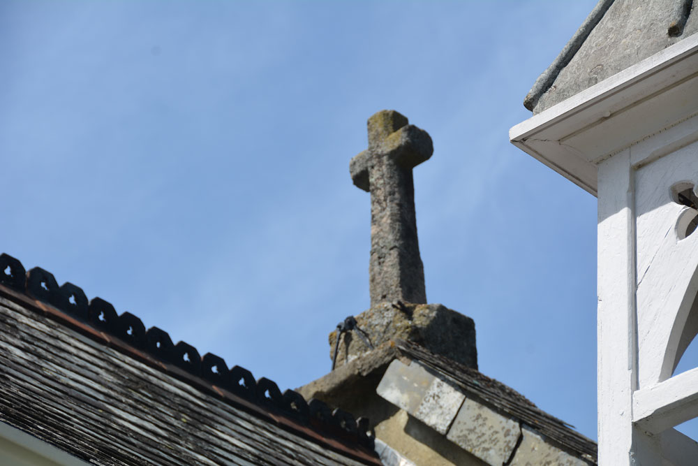
Sticklepath Methodist Chapel Cross submitted by Anne T on 8th Jun 2019. This cross-in-miniature is high up above the road, acting as a finial on the northern side of the Methodist Chapel. Pastscape says it was reused here in approximately 1816 (when the chapel was built). Photo taken from the south eastern side of the chapel 'garden', which is the only place we could get a decent view of the cross.
(View photo, vote or add a comment)
Log Text: Sticklepath Methodist Chapel Cross: A very small cross with socket stone being used as a coping stone on the apex of the roof of the Methodist Chapel.
To see the cross better, we let ourselves into the small ‘garden’ of the chapel (being used as a dump for building materials and rubble), and took a bit of a blurred photo. It does seem like a wayside cross in complete miniature, but instinct tells me it’s just a fancy roof finial which has been reused from another site/location.
Worth stopping off to see, especially with the Lady Well and the Sticklepath pre-Conquest boundary stone just west of the chapel.
Lady Well (Sticklepath)
Trip No.132 Entry No.10 Date Added: 8th Jun 2019
Site Type: Holy Well or Sacred Spring
Country: England (Devon)
Visited: Yes on 13th May 2019. My rating: Condition 4 Ambience 2 Access 5
Lady Well (Sticklepath) submitted by KiwiBetsy on 29th Aug 2006. The Lady Well invites visitors to 'Drink and be thankful.'
(View photo, vote or add a comment)
Log Text: Lady Well, Sticklepath: This well is right beside the road. The grid reference given by Pastscape must be the original site of the well, as it actually is at SX 63904 94124.
The ambience of the well was dreadful at the time of our visit, as it sat immediately next to a set of roadworks, and also in deep shade at the time of our visit. Pleased to have seen it, and ticked it off our list, but that’s about all.
The boundary marker is nearby, just up hill, literally on the other side of the road junction.
Sticklepath Boundary Marker
Trip No.132 Entry No.11 Date Added: 8th Jun 2019
Site Type: Marker Stone
Country: England (Devon)
Visited: Yes on 13th May 2019. My rating: Condition 3 Ambience 3 Access 4
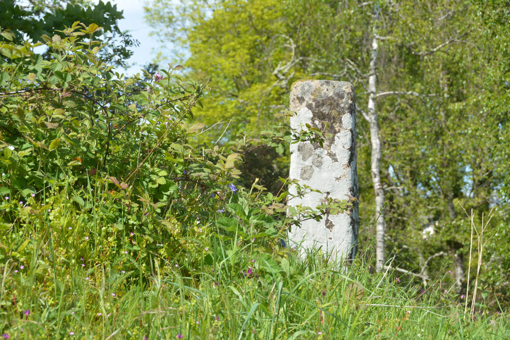
Sticklepath Boundary Marker submitted by Anne T on 8th Jun 2019. The southern face of the cross, which had a cross carved in relief upon it. We were unable to make out any carvings at the time of our visit.
(View photo, vote or add a comment)
Log Text: Sticklepath Inscribed Boundary Stone: This stone is only within 20m of Lady Well, separated by a minor road junction. At the time of our visit, the ambience was spoilt by roadworks which had been set up next to, and almost up to it.
With the stone sitting on top of a retaining wall between the pavement and the main road running through Sticklepath, and a footpath running up slope to its WSW side, Andrew stepped onto the bank and photographed all sides of it for me at close quarters.
Despite peering closely at each side of the stone, we were unable to make out any clear carvings on it at all. The only thing that was clear was the hole for the ball finial which topped the stone at some time in its past.
Belstone Boundary Marker
Trip No.132 Entry No.12 Date Added: 9th Jun 2019
Site Type: Marker Stone
Country: England (Devon)
Visited: Yes on 13th May 2019. My rating: Condition 3 Ambience 3 Access 5

Belstone Boundary Marker submitted by Anne T on 9th Jun 2019. Having parked down the narrow lane just to the west of this boundary stone, this was my first view of it as I approached the road junction.
(View photo, vote or add a comment)
Log Text: Belstone Boundary Marker: Only 1km from the Sticklepath Boundary Stone, this supposedly pre-Conquest stone at the junction of the B3260 and a minor dead-end road which goes north east to a farm.
I got some strange stares from the cars as I photographed this stone, which is no longer on the parish boundary, presumably to accommodate road improvements. Had it not been for the busy road, this would have been in a gloriously peaceful countryside location, with lovely views northwards (the hedge to the south was too tall to see over).
I think the description in the Pastscape entry has been confused with the Sticklepath BS, near Lady Well, as this stone is triangular in shape and the only marking we could see was a partial bench mark on its front.
The acute angle of the minor road junction with the B3260 made the turn right out of the busy road a little tricky, but possible after waiting for a sufficiently large gap in the traffic.
Belstone Ring Cross
Trip No.132 Entry No.13 Date Added: 9th Jun 2019
Site Type: Ancient Cross
Country: England (Devon)
Visited: Yes on 13th May 2019. My rating: Condition 3 Ambience 4 Access 4
Belstone Ring Cross submitted by hoya105 on 23rd May 2019. Inside St Marys Church, in the lovely village of Belstone with its Holy Well and great pub!
(View photo, vote or add a comment)
Log Text: Ring headed cross at St Mary The Virgin, Belstone: A lovely little village, with not only the ring headed cross in the church but the Coronation Stone and the old stocks on the village green.
The church has a lovely atmosphere, tucked away to the west of the little village shop cum pub. The church had a slim guide book which made interesting reading, and I went through it during our visit to make sure we didn’t miss anything special.
The ring-headed cross is against the south wall of the church, near where the nave and sanctuary join. It’s base had been covered with an Easter scene.
We wandered back to the village green and had tea and cake in the Old Schoolroom Tearooms. This was to be my first experience of “toilet twinning” – there were photos of toilets in other countries that the tearoom toilet had been twinned with – brilliant!)
Holy Well (Belstone)
Trip No.132 Entry No.14 Date Added: 9th Jun 2019
Site Type: Holy Well or Sacred Spring
Country: England (Devon)
Visited: Yes on 13th May 2019. My rating: Condition 3 Ambience 4 Access 4
Holy Well (Belstone) submitted by KiwiBetsy on 29th Aug 2006. This is a curative spring located near St Mary’s Church. The spring is protected by several large granite rocks.
(View photo, vote or add a comment)
Log Text: Belstone Spring Head: From the village green, we decided to walk to the well, following the lane past the church and turning right (ESE) onto the common ground/moorland.
Located almost immediately opposite a large pub, and just down slope, this was a lovely location which attracted families and dog walkers.
No water flowing at the time of our visit (the well chamber/basin was just muddy with nettles and ferns growing in it) but there were pools of water bubbling from the ground around it. Some of the ground was fairly boggy, but I managed to get close enough to look in the well chamber.
West Wyke Farm Cross
Trip No.132 Entry No.15 Date Added: 9th Oct 2019
Site Type: Ancient Cross
Country: England (Devon)
Visited: Yes on 13th May 2019. My rating: Condition 3 Ambience 3 Access 4

West Wyke Farm Cross submitted by Anne T on 9th Jun 2019. This cross sits just to the west of the entrance to farm buildings on the northern side of the track. It stands about 18 inches / 45 cms high.
(View photo, vote or add a comment)
Log Text: West Wyke Farm Cross: This cross is not recorded on Pastscape or Historic England, so we didn't expect to see it here. It looks relatively modern, like a small rounded-headed grave marker such as we saw in St Mary's in Belstone. It sits quietly by the entrance to the farm buildings, north of the track and West Wyke farmhouse.
Note: the track up to the farm and houses here is marked private road. We parked at the viewpoint at SX 65298 93020 and walked up the lane.
West Wykes Farm Tau and Latin Crosses
Trip No.132 Entry No.16 Date Added: 9th Oct 2019
Site Type: Ancient Cross
Country: England (Devon)
Visited: Yes on 13th May 2019. My rating: Condition 3 Ambience 5 Access 4

West Wykes Farm Tau and Latin Crosses submitted by Anne T on 9th Jun 2019. The Latin cross under the tree at West Wyke farm, having been rescued from 'duty as a gatepost' by E. Masson Phillips in 1958 and erected here. The cross has lost one of its arms, and on each face there is are incised Latin crosses. One, carved somewhat lopsidedly is 1 foot 7 inches high by 1 foot 2 inches. On the reverse face the cross measures 11 inches high by 11 inches across. Just to the right of the tree (just above centre right of the photo) can be see the octagonal arm of the Tau cross.
(View photo, vote or add a comment)
Log Text: West Wyke Tau and Latin Crosses: The lane to West Wyke farm and the houses here is marked private, so we parked at the viewpoint at SX 65298 93020 and walked the 600m or so up the lane - a very pleasant walk in the evening sunshine.
Despite taking the HE and Pastcape printouts with us, I didn't appreciate what I'd seen until sitting at the computer today (9th June 2019). Good job I photographed the pile of stones at the western side of the tree, as this was the Tau Cross! The smaller cross next to the entrance to the barns on the opposite side of the road is not recorded on HE or Pastscape, and I'd been really confused until re-reading the entries.
Merrivale settlement
Trip No.133 Entry No.1 Date Added: 22nd Jun 2019
Site Type: Ancient Village or Settlement
Country: England (Devon)
Visited: Yes on 14th May 2019. My rating: Condition 3 Ambience 4 Access 4
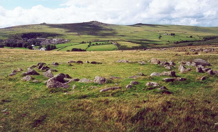
Merrivale settlement submitted by Brian Byng on 7th Feb 2002.
(View photo, vote or add a comment)
Log Text: Merrivale Prehistoric Settlement: This was our first stop of the day as part of a three day guided tour by Sandy G, who certainly knew his way around this site, and all the others in this Bronze Age complex.
We parked in the small car park at SX 55311 75018 and, having introduced ourselves to the rest of Sandy's small Expeditionary Force, we walked the short distance onto the moor to start at this site. With the nearer stone rows within site just at the top of the hill, expectations for an exciting rest of the day rose rapidly.
The only downside was the absolutely howling wind that blew throughout the day, sometimes makingit difficult to stand upright. However, it was a cheap way of exfoliating!
I found out when copying photos from the memory card of my camera to my computer that the external GPS device on my camera had stopped working, so I was unable to identify the precise locations of the hut circles I photographed.
Merrivale North Row
Trip No.133 Entry No.2 Date Added: 3rd Jul 2019
Site Type: Multiple Stone Rows / Avenue
Country: England (Devon)
Visited: Yes on 14th May 2019. My rating: Condition 3 Ambience 4 Access 4
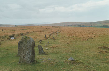
Merrivale North Row submitted by stewart on 12th Oct 2003. Grid Ref SX 555 747
There are two, main, rows at Merrivale - North and South.
The north row consists of two lines of stones, aligned east -west and nearly 200m long.
However, the two lines of stones are only about 1m apart so you can only just walk between them. It has larger stones at the west end and a blocking stone at the east.
The southern row doesn't start or finish on the same alignment, is not parallel to the northern one and was, probably, not built at the same time.
...
(View photo, vote or add a comment)
Log Text: Merrivale North Row (Merrivale 1): Between the prehistoric settlement and the first of our stone rows for the day, Sandy G had stopped to point out some of the stones of the Great Western Reave.
Continuing on, these stones could be seen from down slope at the Prehistoric Settlement, and proved a tantalising glimpse of what was in store for the rest of the morning. Sandy was amazing at explaining all the different features along the row, including part of which had recently been restored.
But my goodness, the wind was blowing, and blowing hard. At some points, it was a little tricky to stand upright – thank heavens for my walking poles!
Merrivale Centre N
Trip No.133 Entry No.3 Date Added: 4th Jul 2019
Site Type: Cairn
Country: England (Devon)
Visited: Yes on 14th May 2019. My rating: Condition 3 Ambience 4 Access 4
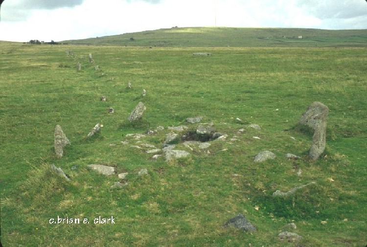
Merrivale Centre N submitted by bec-zog on 19th Nov 2003. Cyst (3) @ the Merrivale complex
(View photo, vote or add a comment)
Log Text: Merrivale Centre Cairn with Cist: Half way down Merrivale North (Row A or Row 1), we hopped across to row 2 to take a look at the cairn in the middle of the row. Fascinating. Worried about the complexity of recording all these sites in my photo/walk journal, Angie Lake told me about the Butler "Atlas of Antiquities" series of 5 books, which has hugely increased my understanding of these sites. Thanks, Angie!
Merrivale Centre Row
Trip No.133 Entry No.4 Date Added: 5th Jul 2019
Site Type: Multiple Stone Rows / Avenue
Country: England (Devon)
Visited: Yes on 14th May 2019. My rating: Condition 3 Ambience 4 Access 4
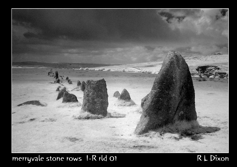
Merrivale Centre Row submitted by rldixon on 30th Jun 2008. centre ro taken in infra red may 2008
(View photo, vote or add a comment)
Log Text: Merrivale 2/Merrivale Centre Row: As we progressed further south over the moorland, and not far from Merrivale 1 (the northern-most row) at that, the stone rows kept getting better and better.
The row features a triangular blocking stone at the eastern end and twin blocking stones at the western end. It runs for 262.5m from SX 5530 7475 to SX 5556 7478 - see Pastscape 44056. The stones seem to vary in size quite a lot, and generally larger than those of the northern row/row 1/row A.
Merrivale Cists
Trip No.133 Entry No.5 Date Added: 6th Jul 2019
Site Type: Burial Chamber or Dolmen
Country: England (Devon)
Visited: Yes on 14th May 2019. My rating: Condition 3 Ambience 4 Access 4
Merrivale Cists submitted by ernar on 13th Oct 2004. Burial Cist with a fragmented capstone. The main Merrivale Stone row can be seen behind it.
(View photo, vote or add a comment)
Log Text: Merrivale Cist: I've seen quite a few cists, largely in Northumberland, and none this large. Impressive. I tried to persuade Janet to get into the cist to model it, but she politely declined (it would have made a nice refuge for the wind).
At this point, Angie got her dowsing rods out and was meandering around the cist and the stones. Very interesting to watch.
Merrivale Centre S
Trip No.133 Entry No.6 Date Added: 7th Jul 2019
Site Type: Cairn
Country: England (Devon)
Visited: Yes on 14th May 2019. My rating: Condition 2 Ambience 3 Access 4
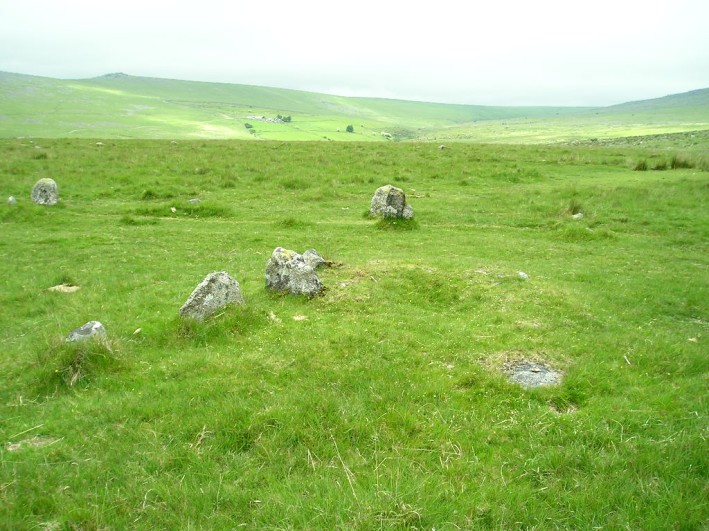
Merrivale Centre S submitted by thecaptain on 1st Nov 2004. Looking northish at the end of row 3 and the remains of its cairn.
The stones in the background are some of those in the southern (or central) avenue.
(View photo, vote or add a comment)
Log Text: Merrivale Centre S Cairn (cairn at the head of Merrivale 3/C stone row): Thank heavens for Sandy G's Stone Rows of Great Britain and Dave P's Prehistoric Dartmoor Walks websites to help sort out the photos for Merrivale 3and its cairn. This area certainly has a glut of stone rows and cairns, and the GPS device on my camera had failed. Whilst I carefully wrote down the numbers of the photographs and the sites they related to, and constantly asked Sandy G on the day which site I was looking at, there's nothing like being able to make a direct comparison almost two months later. Thanks, guys!
As the cairn has a separate site page, but I've recorded them both together, as per the Pastscape record (440357), I've given these two the same visit number.
Merrivale SW row 3
Trip No.133 Entry No.6 Date Added: 7th Jul 2019
Site Type: Stone Row / Alignment
Country: England (Devon)
Visited: Yes on 14th May 2019. My rating: Condition 2 Ambience 3 Access 4
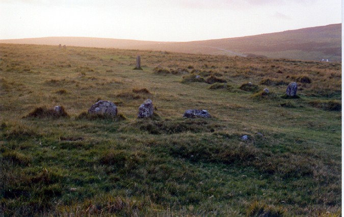
Merrivale SW row 3 submitted by AngieLake on 29th Oct 2004. In the foreground, Merrivale Single Row 3 (see thecaptain's overview plan) at sunset on 21st September, the day before the Autumn Equinox, 2004. In the distance, in the glare of the setting sun, can be seen the two west end stones of the southern row. Two other taller stones on the south side of that southern row are also visible above centre, and to right of pic. ('Thecaptain' has a theory that these, and other taller stones in the rows, align with the menhir at certain times of the year.) T...
(View photo, vote or add a comment)
Log Text: Merrivale Row 3/C: Without Sandy G being there to tell us, I would have struggled to identify this as a stone row in its own right, but with Sandy pointing out where it joining up at an angle with Merrivale 2/B and with the cairn at its head, it became more obvious. The cairn is recorded as a separate site page here, so I'm adding the same visit report number, as I've recorded them both together, as the Pastscape record (440357).
Merrivale circle
Trip No.133 Entry No.7 Date Added: 7th Jul 2019
Site Type: Stone Circle
Country: England (Devon)
Visited: Yes on 14th May 2019. My rating: Condition 3 Ambience 3 Access 4

Merrivale circle submitted by AngieLake on 9th Feb 2008. Merrivale Circle and menhir looking south towards King's Tor, at about 6.15pm on 10.10.07
(View photo, vote or add a comment)
Log Text: Merrivale Stone Circle: Will you forgive me for saying I wasn't hugely impressed by this stone circle. For some reason I was expecting the stones to be larger and for it to sit more dramatically in the landscape.
On walking to the circle from the western end of Row 2, we came across an impressively large, black coloured boulder buried in the grass, which does not appear to be marked by Butler. I estimated its grid reference to be SX 55304 74704, or just south of this.
The group walked round the circle and the menhir, looking at the pits in the ground, wondering if these could possibly be the remains of holes for other stones. Dave Parks said he had read somewhere that there was thought to have been a double stone circle here, but no proof had yet been found. He later came back to tell me that Butler has marked the pits on his diagrams of Merrivale, see pages 29-31 inclusive of Volume 3 of "Dartmoor Atlas of Antiquities".
I do like Butler's description of the circle: "Their arrangement is markedly eccentric, perhaps deliberately so, with the majority of stones up to a metre off a true circle 19m across and with very variable intervals between" and his notes that the numbers of stones seem to vary across the ages: "several detailed nineteenth century accounts of the site show that the number of stones has actually increased, a most unusual phenomenon, from 9 in the early part of the century, 9 in 1828 (Smith), 10 (1827, Rowe, 1829 Kempe), and 9 (1859 Wilkinson), before reaching the present total of 11 in Worth’s 1895 plan. It seems at least 2 stones have been added, probably by some of the early investigators who were not always particular in recording their restorations, which in any case were often somewhat arbitrary".
Merrivale row 4
Trip No.133 Entry No.8 Date Added: 17th Jul 2019
Site Type: Stone Row / Alignment
Country: England (Devon)
Visited: Yes on 14th May 2019. My rating: Condition 2 Ambience 3 Access 4
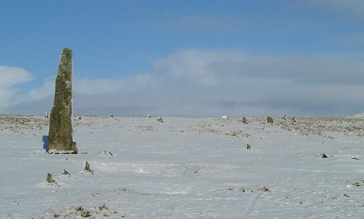
Merrivale row 4 submitted by Brian Byng on 7th Feb 2002. Row 4 azimuth 6 length 7m GR 5535 7458 Burl calls this E
A short row of 4 small stones next to the single standing stone.
It shows up rather well in this winter photo taken a few days ago.
(View photo, vote or add a comment)
Log Text: Merrivale 4 stone row: Without Sandy G and Dave P’s guidance on this, I would probably have looked at these stones and not thought much about them, but in association with the other two short rows (5 and 6), the tall, impressive menhirs and the fallen stone and cairn nearby, it was a jumble to unpick, so I was very grateful for the explanations!
