Contributory members are able to log private notes and comments about each site
Sites Anne T has logged. View this log as a table or view the most recent logs from everyone
Cross Well (Linlithgow)
Trip No.24 Entry No.3 Date Added: 16th May 2017
Site Type: Holy Well or Sacred Spring
Country: Scotland (West Lothian)
Visited: Yes on 13th May 2017. My rating: Condition 3 Ambience 3 Access 5
Cross Well (Linlithgow) submitted by KiwiBetsy on 17th Oct 2006. Site in West Lothian
The present Cross Well stands in the High street of Linlithgow just outside the lane that leads to Linlithgow Palace.
(View photo, vote or add a comment)
Log Text: Cross Well, Linlithgow: This was our last stop on this rainy day, and we arrived to find a small market around the well, along with an event happening at the Burgh Halls immediately behind it. Couldn’t really get close to the well itself until later in the afternoon, as there were lots of stallholders, children and dogs. Truly a centre point for the town. No water in the well today – the spout and basin were completely dry. I confess I was disappointed to find such a modern structure - I'd expected something a lot older and less ornate.
We tried to find the Dogwell, walking up Dog Well Wynd as far as the railway line, but nothing.
After photographing the well as best I could, we wandered around the loch, then back round via St. Michael’s church, with its internal walls marked by musket balls and sword sharpening marks from Cromwell’s soldiers.
St Thomas (Brompton)
Trip No.23 Entry No.4 Date Added: 16th May 2017
Site Type: Ancient Cross
Country: England (Yorkshire (North))
Visited: Yes on 11th May 2017. My rating: Condition 4 Ambience 4 Access 5

St Thomas (Brompton) submitted by Anne T on 16th May 2017. These three hogbacks are truly magnificent. Having been buried in the ground for so long, they look as if they have been carved recently. Well worth a visit just to see these, never mind the other cross fragments.
(View photo, vote or add a comment)
Log Text: Hogbacks and Crosses, Brompton, North Yorkshire: This is a visit I’d arranged some time ago, arranging to meet the church warden at 2pm on 11th May (details on the 'A Church Near You' website). The church is kept locked, as we found out when we’d tried to visit a couple of years ago, and I was much looking forward to this return visit.
We were a little late, having stopped to photograph the remains of the motte at Pickill, and having hit a little traffic in Northallerton, but we found the church wardens sweeping up cherry blossom from the porch of the church. We were certainly made very welcome.
There are three complete hogbacks, the carving of which is very crisp, almost as if they had been done yesterday – preserved after having been buried in the ground for so long.
A further two fragments sit, almost hidden, against the north eastern corner of the nave, wedged between an altar, some heating pipes and the wall.
Sitting to the south of these, against the boundary between the nave and the chancel, was a wheel head cross. Another cross sat on the south wall of the chancel, with a further 3 sitting on the southern window ledge of the western wall.
The Cock Shaft sits almost hidden at the back of the pews, in the south west corner of the church, and is named so because there are three cocks on the southern face.
To my surprise, Doreen said there were three further fragments in the external south and east walls of the church, so we hunted for these whilst she spoke to the man repairing the churchyard wall. There are also the remains of a grave marker, now broken in two, placed in separate parts high up on the eastern wall.
We were given the ‘Village Trail’ and also told much interesting history about the linen factories in the village, and started off on the walk to see the village green, Cockpit Hill and the water splash. A great day out.
Money Hill (Pickhill)
Trip No.23 Entry No.3 Date Added: 16th May 2017
Site Type: Artificial Mound
Country: England (Yorkshire (North))
Visited: Yes on 11th May 2017. My rating: Condition 2 Ambience 3 Access 5
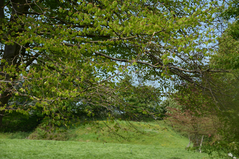
Money Hill (Pickhill) submitted by Anne T on 16th May 2017. The south eastern side of the motte rises about 3 metres high. Without the mentions on the OS map and the All Saints church guide, I would have driven straight past this scheduled ancient monument!
(View photo, vote or add a comment)
Log Text: Money Hill Motte, Pickhill: Leaving All Saints, going back down Money Hill to Street Lane, we stopped to look at the remains of the motte. I confess that without the grid reference and the OS map, I would have mistaken this for just another earthwork.
This is in fact a scheduled ancient monument, which was cut be the old railway line and the building of a bungalow. It is unusual in that it is square in shape.
Didn’t stop to wander round, as we were late for our appointment at St. Thomas’s, Brompton.
All Saints (Pickhill)
Trip No.23 Entry No.2 Date Added: 16th May 2017
Site Type: Ancient Cross
Country: England (Yorkshire (North))
Visited: Yes on 11th May 2017. My rating: Condition 3 Ambience 4 Access 5
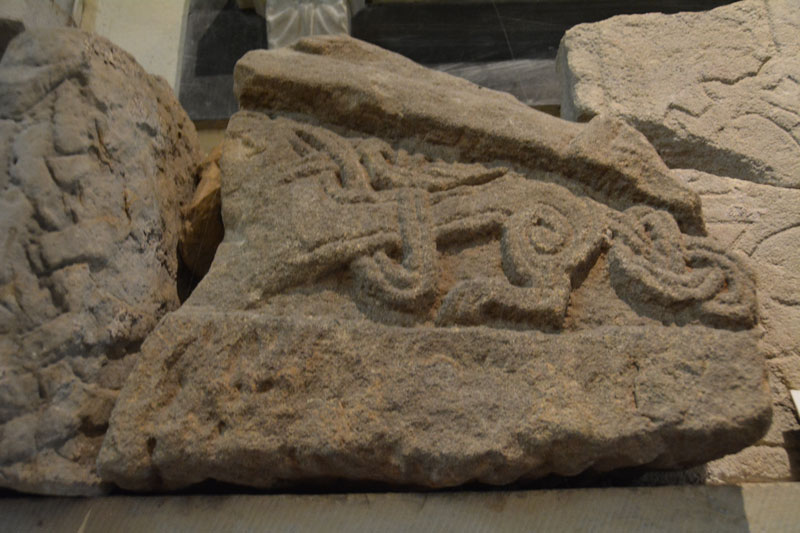
All Saints (Pickhill) submitted by Anne T on 16th May 2017. This piece of hogback shows the remains of a monster with an elaborately knotted tail.
(View photo, vote or add a comment)
Log Text: Hogback and Cross Fragments, Pickhill, North Yorkshire: This church was recommended by ‘Rev Robbo’ (Reverend Ian Robinson) of St. Gregory’s, Bedale, who told us that there was a collection of fragments in the base of the tower. I’d sent an email to the vicar but received no reply, so phoned the number on ‘A Church Near You’ website. The church is open during the day.
The church really is in a lovely location. Going through the lych gate, I was greeted by a mounting block with what looked like an old cross shaft on top, but which was a sundial. On the south wall of the tower there is a very interesting carved beam from the 15th century depicting a hunting scene and a green man.
In the churchyard there are some interesting grave markers. Mentioned in the church guide are 3 markers mentioning the children of the White family, who all died tragically young. The guide also mentions to look out for the mound on which the Norman castle was built.
Torphichen Churchyard Stone
Trip No.24 Entry No.1 Date Added: 15th May 2017
Site Type: Standing Stone (Menhir)
Country: Scotland (West Lothian)
Visited: Yes on 13th May 2017. My rating: Condition 3 Ambience 4 Access 5
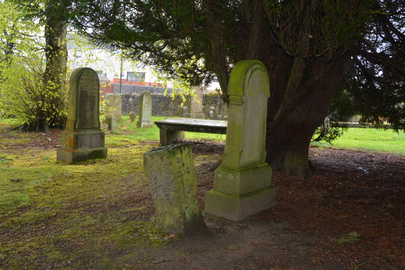
Torphichen Churchyard Stone submitted by Anne T on 15th May 2017. The Sanctuary stone sits in the part of the churchyard nearest to the road, tucked under a big yew tree and very near a modern grave marker.
(View photo, vote or add a comment)
Log Text: Torphichen Sanctuary Stone, West Lothian: After an exciting day at the filming of Robot Wars yesterday we stayed overnight at daughter and son-in-law's nearby. Torphichen is a lovely little village (Cairnpapple is also signposted further on from here), larger than I expected. The parish church incorporates/is next to the Preceptory of the Knights Hospitaller of the Order of St John of Jerusalem, which dates from the late 12th century.
The sanctuary stone is in the front of the churchyard (to the left of the gate as you enter, sheltering under a yew tree). There are other boundary stone markers around the area, and I really wanted to go and find these (the Canmore record says that they ‘once sat t a mile radius on each point of the compass. Of which the Gormyre Stone to the east-north-east and the Westfield stone survive’) but we had other priorities for the day. Another visit, probably in September/October.
There were some really interesting tombstones, particularly at the east end of the church – little people/heads/bones. Had some fun photographing these.
The Preceptory wasn’t open until 1pm on the day of our visit, so we missed it. Peering through a grill into the structure, it looked absolutely fascinating. Andrew discovered what looked like a well (similar to the Galilee Well at Durham Cathedral) against the east wall of the church, although I haven’t found any mention of it on any of the historical records (yet) although Canmore says there are 2 wells in the village, one of which supplied the Preceptory.
St Gregory's Church (Bedale)
Trip No.23 Entry No.1 Date Added: 14th May 2017
Site Type: Early Christian Sculptured Stone
Country: England (Yorkshire (North))
Visited: Yes on 11th May 2017. My rating: Condition 3 Ambience 4 Access 5

St Gregory's Church (Bedale) submitted by Sunny100 on 17th Aug 2010. Arched-shaped fragment of a 9th century Viking hogsback tombstone in the crypt of St Gregory's church, Bedale. The carving could depict Christ's crucifixion, or it could be The Tree of Life.
(View photo, vote or add a comment)
Log Text: Anglo-Danish stones, St. Gregory's, Bedale: We’d been to St. Gregory’s a long time ago, but the stone fragments had just been moved into the crypt at the advice of North Yorkshire Police because one stone had been stolen.
So as not to be disappointed this time, I’d been corresponding with ‘Rev Robb’ (Rev. Ian Robinson) to make an appointment to get into the crypt. At the time I’d last contacted him, it was just before Easter. He offered the date of 27th May, when a group was also visiting. I elected to leave it until he returned from holiday, and arranged 11th May, with us attending Holy Communion at 10am, staying on to look round the church and be shown the stones.
The parishioners made us very welcome indeed. After the service, Rev. Robinson came and introduced us and took us round to the crypt (which is on the outside of the church – I’d had visions of climbing down dusty, steep steps!), with a step down into the crypt, which is built under the altar in the sanctuary (note: later exploring the church, climbing up the steps to this altar, you are at least 6 to 8 feet above the congregation; it would not be good if you missed one of the steps!).
I gave Rev. Robinson a printout of the Portal page with the drawings. First of all he told me that since he’d been vicar here (for 6 years) there had only been the two stones – one had ‘gone missing’ and weren’t sure of it’s location (possibly Durham Cathedral?). He helped me identify the half torso. Because of the story associated with this stone, he was torn between keeping the stone because of it’s non-Christian origins vs being part of the church’s history.
The church guide says “A Viking myth tells of a man called Weland (pronounced Wayland), a highly skilled smith. He is captured by a king, who has his hamstrings cut to prevent him from escaping; but he escapes on a flying machine he has made. The caring on the stone …. Shows part of Welland on his machine. You can make out the fan shaped tail and one of the wings as well as his feet, legs and body bound together by Celtic knots. On the ned of the tombstone are the remains of a nativity scene ….. this is part of a hogback tombstone dating from the 10th century. In 2003 it was rediscovered in the crypt and has been identified as the Weland stone of which there are only three known examples in this country. The others are in Leeds Parish church and Sherburn Church, near Filey.”
The other stone “was part of a column or pillar, (and) is a good example of Anglian knotwork.”
Also in the crypt is a curious staircase which leads up to the side of the altar. We were told this was for the Chantry monks to go straight up to the main body of the church. There was also a small ‘arms column’ locked with three enormous, hand-made padlocks. In the vestry, there were numerous examples of chests locked with three keys (each needing a different key). There are five effigies; four at the west end of the nave, one in the vestry. The staircase to the bell tower had a portcullis (you can still see where it used to be raised up), and looking up into the tower there is a hatch; above this, the Reverend told us there was a room with a guard-robe and a fireplace.
Jingling Gate
Trip No.22 Entry No.1 Date Added: 11th May 2017
Site Type: Ancient Village or Settlement
Country: England (Northumberland)
Visited: Yes on 9th May 2017. My rating: Condition 2 Ambience 4 Access 5
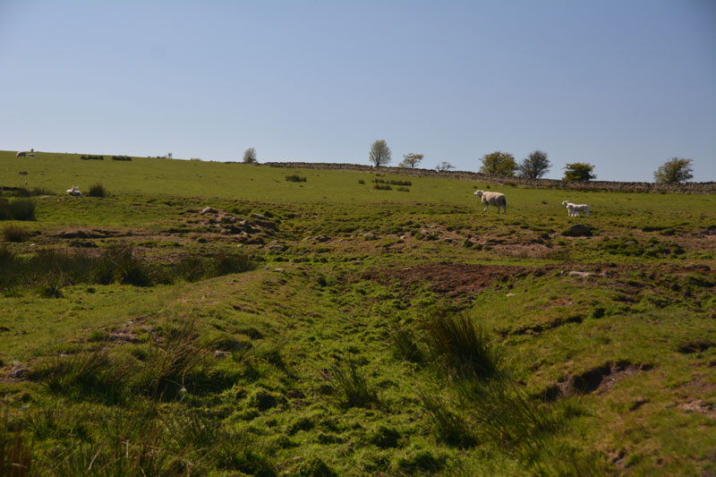
Jingling Gate submitted by Anne T on 11th May 2017. The double rampart on the northern side of this homestead.
(View photo, vote or add a comment)
Log Text: Jingling Gate Homestead, near Dotland, Hexhamshire: OK, probably this should have been called Edge House Homestead, but the name Jingling Gate sounds so much nicer! What a spot this is. Farmland here is so lush and green and the views are tremendous. Locals still hold onto much of their Hexhamshire identity rather than claim Northumberland citizenship.
This homestead is clearly visible on UK Grid Finder, but a little harder to make out on the ground. There was no gate into the field - there was a very long, continuous stone wall (must form the boundary of a farm), so we ended up peering over the stone wall.
The double banks on the northern side of the homestead were very clear, as was the southern corner, where it executes a tidy turn.
The middle has been quarried across, which makes the western side of the homestead a little difficult to make out. We didn't know there were hut circles inside until we got home and looked at the Pastscape record.
On the opposite side of the road, just north of the homestead, there is a long, low earth and stone boundary feature. No mention of a field system around the homestead. This is probably medieval, but interesting nevertheless.
It is so peaceful and quiet here. No one but the sheep and the occasional tractor. Bliss. On from here to find wells that were named on the OS Map - Midge Well, Jack's Well and Holly Well.
Lively Well (Witton-le-Wear)
Trip No.21 Entry No.3 Date Added: 6th May 2017
Site Type: Holy Well or Sacred Spring
Country: England (County Durham)
Visited: Yes on 4th May 2017. My rating: Condition 2 Ambience 4 Access 4
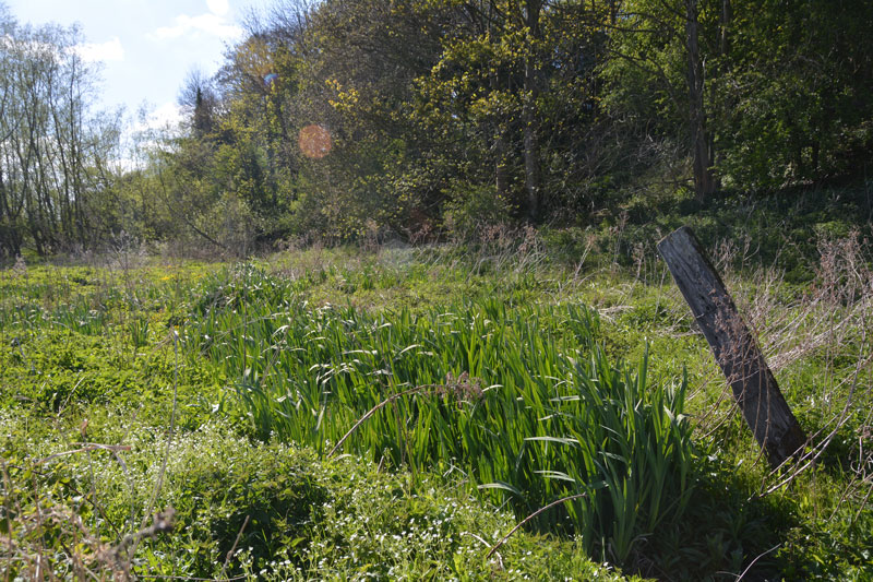
Lively Well (Witton-le-Wear) submitted by Anne T on 6th May 2017. The channel of water emerges from this area of ground, marked by a large stake, covered in reeds and rushes. Presumably this is the spring.
(View photo, vote or add a comment)
Log Text: Lively Well, Witton-le-Wear, County Durham: Andrew saw this well on the “Ancient, Healing and Holy Wells of County Durham” listing by Laurence Hunt, which formed the basis for today’s ‘well hunt’.
He says “On the banks of the river Wear below the level crossing at Witton le Wear. A footpath leads down from the level crossing. Whether of any great age or repute I was unable to determine, but this named well, consisting of a spring at the head of a small overgrown channel leading to the river Wear, is attractively sited and worth a visit. Its water is far from 'lively', however, being muddy and stagnant”
This is a really beautiful little village. We’ve whizzed up and down the A68 many, many times, but never turned left down to Witton-le-Wear. Well worth a detour! Would like to come again for a wander round. There is even a cross shaft in the church, although this is supposed to be 12th century.
We parked in the layby by the small station, just past the level crossing (as travelling from the A68 through Witton). There was a footpath with a sign to the cricket club immediately opposite, so we walked down this tarmacked path to the cricket pavilion (with its beehives and even a swarm of bees in a basket next to the path). We followed the path down to the gushing, rushing, pebbly River Wear, but decided we’d gone too far.
Spotting another path climbing up a steep bank on the other side of the railway crossing, we headed back across the cricket field, and where this footpath levels off, there is a small bridge over a channel of water at NZ 15059 31172 which seemed to rise out of nowhere. This disappeared under the footpath, not to reappear again (must be channelled into the river at some point). Following this small channel to the west for around 100 metres, there is a fenced off area of reeds and tall grasses, and I think this is where the spring rises (NZ 15023 31152)
Dropping small leaves into the water, we couldn’t determine a flow of water, or even which direction it flowed in – the leaves just sat sedately on the surface of the water.
Getting home, and trying to do some more research on this well, on the OS map of 1857 the well is not marked but the area is called Lively Bank Plantation. There is a small note on Keys to the Past, but the village dates back to Saxon times. I have emailed County Durham HER to find out more, if possible.
Holy Well (Wolsingham)
Trip No.21 Entry No.4 Date Added: 6th May 2017
Site Type: Holy Well or Sacred Spring
Country: England (County Durham)
Visited: Yes on 4th May 2017. My rating: Condition 4 Ambience 4 Access 5
Holy Well (Wolsingham) submitted by HOLYWELL on 17th Jan 2011. Holy well from Wolsingham as seen from the road.
(View photo, vote or add a comment)
Log Text: Holy Well, Wolsingham, County Durham: This was our last stop of the day and to find this, I loaded the map from the Portal page. To the north of the main village, the well is sited just to the west of Holy Well Farm on Holywood Lane.
At first sight, it looks like a very small barn, but looking closer, the golden names of the saints on the metal grill door shine out. The well chamber itself is very dark and gloomy (no light seems to penetrate) and I struggled to photograph it, even with my most powerful flash gun – it was easier to see the stone ledges, the flowers on those ledges and the well pool itself with the naked eye. The well pool was full of water, but the rest of the chamber was dry.
Curious to find out where the spring was that fed the chamber (as the well house is conveniently close to the road), I both leant over the stone wall and walked up the footpath just to the west of the well house. There is a dried up hollow immediately behind, although we’ve not had any rain in this part of the world for weeks, so it’s not surprising it was dry.
Ceoppa's Barrow
Trip No.21 Entry No.2 Date Added: 5th May 2017
Site Type: Round Barrow(s)
Country: England (Tyne and Wear)
Visited: Yes on 4th May 2017. My rating: Condition 3 Ambience 4 Access 4
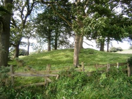
Ceoppa's Barrow submitted by durhamnature on 18th Jul 2012. View from south.
(View photo, vote or add a comment)
Log Text: Ceoppa's Barrow, Tyne & Wear: From Bucks Nook/North View, we headed off eastwards along Bradley Fell Road, taking the second right ((Kyo Lane), then dog-legging right/left along the Lead Road then down Horsegate Bank to Claython Terrace Road. Pulling in in the small layby next to the forestry track just before Heavygate Farm at NZ 12710 59129 we walked down the farmtrack running immediately to the west of Heavygate Farm.
Walking by the farmyard was an education in old farm equipment – old tractors, dumper trucks, old cars, pumps. The official grid reference for this barrow is NZ12605890, although I found it to be NZ12605890. Surprisingly, this barrow doesn’t seem to be scheduled.
The barrow is located not quite at the top of the hill, which seems to be at Broomfield Farm, but has brilliant views down to the Derwent Valley to the south.
The gates to the fields were wired shut, but we managed to get photographs from opposite the main entrance to the farm and the gates into the field at NZ 12775 58928. There was definite evidence of a surrounding ditch.
North View enclosure
Trip No.21 Entry No.1 Date Added: 5th May 2017
Site Type: Ancient Village or Settlement
Country: England (Tyne and Wear)
Visited: Yes on 4th May 2017. My rating: Condition 1 Ambience 3 Access 4
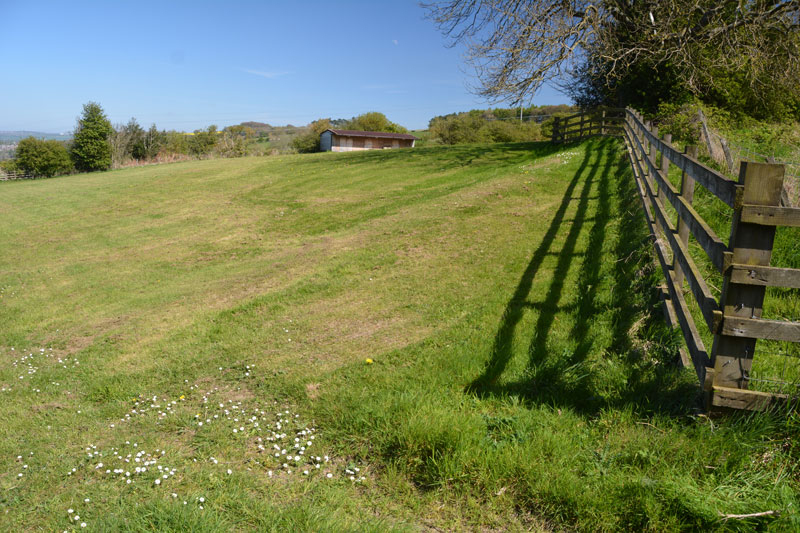
North View enclosure submitted by Anne T on 5th May 2017. The northern corner of the boundary seems to cut across the corner of the field, where the footpath moves from the wooded area to the west of North View Farm to the field (with stables) immediately behind the house. The footpath continues in a narrow, overgrown lane, between a fence to the left and an old stone wall/hedge line to your right.
(View photo, vote or add a comment)
Log Text: North View/Bucks Nook Enclosure, Gateshead: Whilst this site is literally within sight of the eastern end of Prudhoe, to drive to it, we needed to go through Greenside and take the Rockwood Hill/Bradley Fell road until we reached the point where the road divided,travelling south/wout-west towards Guard’s Farm, and north to join Kyo Bog Lane.
We parked at the fork in the road, just west of North View Farm at NZ 11320 61603. The footpath going to this site running south east through a wooded area from NZ 11320 61597 (the stile into the wood is barely visible from the road), where it runs to the west of North Farm to open pasture. The trees bordering the farm were strewn with ‘Dogs run free/keep out signs’, which were quite off-putting. Nevertheless, there was a clear path running up through the wood to a second and third stiles at NZ 11412 61533 and NZ 11418 61531.
Just before this second stile, there is a corner and definite change of slope which runs at an angle to the footpath (which now runs in a narrow between a fence to the north and an old stone wall/hedge line to the south) and, in the field immediately behind the garden of North View Farm (field contains a stable). At the time of our visit, this boundaryfeature was quite clear, due to the difference in the colour of the grass. From here, it was a little difficult to know where the boundary ran. Where it appeared to cross the footpath, there was a clear ‘hump’ in the ground. Where it disappeared into the field, it was difficult to tell where it ran.
Continuing along the footpath several hundred metres, there is a 6ft fence at NZ 11557 61447, with a stile over it, and more ‘dogs run free/keep out’ signs. It is possible to squeeze between the trees at this point and have a closer look at any possible earthworks. There was a difference in colour in the pasture about 10 metres before the hedge-line at the south-eastern corner, but without a definite plan, it was impossible to tell.
I found the Sitelines Tyne & Wear HER 172 record, but despite it saying the monument is scheduled, I’ve been unable to find anything (having done searches on the various names, grid references, postcodes, farm names). I have emailed T&W archives to see if it’s possible to get some more information. The feature is not visible on UK Grid Finder, although it is possible to pick out the northern corner (photographed).
This place has lovely views over the Tyne Valley to the north. It was worth coming here just to see the views back over Prudhoe and Crawcrook.
Collingham Crosses
Trip No.19 Entry No.5 Date Added: 2nd May 2017
Site Type: Ancient Cross
Country: England (Yorkshire (West))
Visited: Yes on 27th Apr 2017. My rating: Condition 3 Ambience 4 Access 5
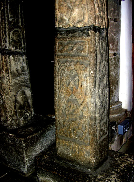
Collingham Crosses submitted by Thorgrim on 22nd May 2005. Dated to about 875 AD (the early years of the Viking occupation of the land around York) this cross is known as the Aerswith Cross. It shows clear Jellinge style carvings in the Danish manner.
(View photo, vote or add a comment)
Log Text: Collingham Crosses, West Yorkshire: What are the chances of meeting someone whose grandparents built the house you live in now and has recollections of visiting, together with photographs of what the house used to look like? The grandparents of Rev. Sylvia Earle who is vicar of Collingham did in fact build our house, and she was able to tell us what it was like when she was younger, and provided us with a photograph of what our (then) bungalow was like when it was first built.
The church has to be kept locked these days as Rev Earle told us someone had stolen a fragment from the west end, and someone tried to set a fire against the wood panelling at the east end of the north aisle. Shame.
We were left with the keys to return once we’d finished, so spent a good 40 minutes wandering around the church, photographing the crosses and fragments, including the cross fragment built into the north wall of the vestry. The Victorian builders built the nave and chancel at an angle. The Runic and Apostle crosses were lovely, together with the unusual round creset.
Most of the furniture within the building looked new and well cared for, with pristine kneelers. Much enjoyed this visit: we were made very welcome and this is a pleasant sanctuary inside, although the noise from the A58 invaded the privacy of the churchyard.
All Hallows (Bardsey)
Trip No.19 Entry No.3 Date Added: 2nd May 2017
Site Type: Ancient Cross
Country: England (Yorkshire (West))
Visited: Yes on 27th Apr 2017. My rating: Condition 3 Ambience 4 Access 5
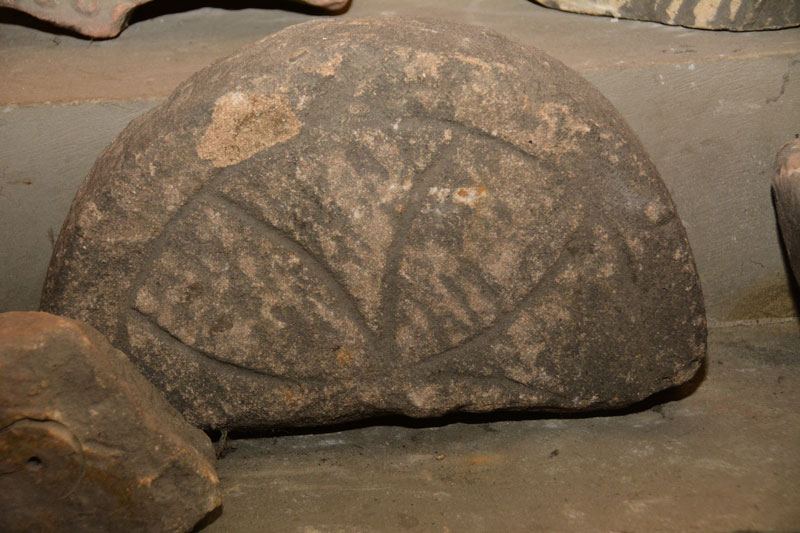
All Hallows (Bardsey) submitted by Anne T on 2nd May 2017. Close up of the cross head fragment. This is very similar to one embedded into the vestry wall at St. Oswald's @ Collingham.
(View photo, vote or add a comment)
Log Text: Anglo Saxon crosses, Bardsey, West Yorkshire: This is a very lovely spot, not far from the main A58 travelling south into Leeds. Considering how close it is to the main road, this is a peaceful, tranquil spot. Having checked with the parish office beforehand, the church is open all day until 5pm.
First impressions of the building were lovely. Approaching from the west wall, there is evidence on the external wall of many different roof lines, inserted windows and additions. Inside the building it is fascinating to see the tower, complete with windows, now completely absorbed into the interior.
Whilst there, a group of four people came in and started asking us questions about the building, of which I could only answer a couple. We gave them the church guide leaflets.
I found the collection of ancient stones on both sides of the door into the Maleverer Chantry. I most liked the 12th century font bowl, which Andrew found in two pieces at the base of the steps, tucked into a dark corner, the cross head fragment and the 11th century grave marker inscribed with a crude Latin cross.
St Cuthbert's Well (County Durham)
Trip No.20 Entry No.2 Date Added: 1st May 2017
Site Type: Holy Well or Sacred Spring
Country: England (County Durham)
Visited: Yes on 30th Apr 2017. My rating: Condition 3 Ambience 2 Access 4
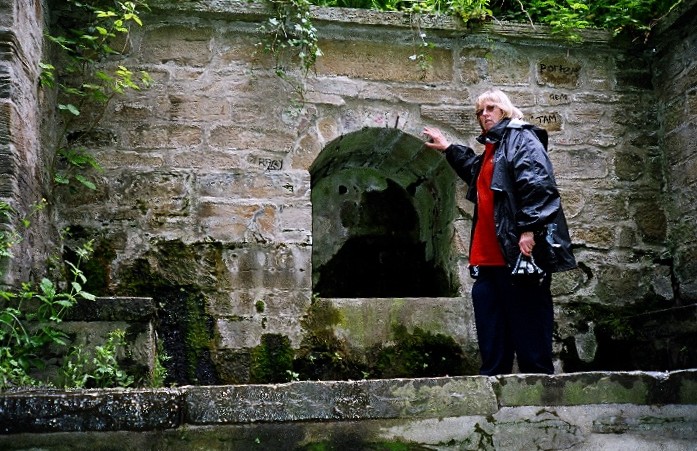
St Cuthbert's Well (County Durham) submitted by kiwiBetsy on 30th Nov 2004. St Cuthbert's Well .... well neglected.
(View photo, vote or add a comment)
Log Text: St. Cuthbert's Well, Durham: We had difficulty in locating this well from the 6 digit grid reference, so I've updated it with the official 10 digit reference from Pastscape.
From the Galilee Well, we took the steps/sloping path down to the riverside, then walked up and down, down and up, past the Old Fulling Mill to Prebend Bridge and back. Mystified by the grid reference, I stood with my phone looking up notes on the internet, trying to get a better grid reference. We knew it was near some steep steps, thanks to the entry by kiwiBetsy, but had difficulty locating the exact site. We must have looked so lost that two passing students heading to the Boat House asked us where we were looking for, but couldn't help, shrugged and walked off!
In the end, husband Andrew ran back up the footpath towards the city and spotted this structure half way up the hillside. There are two sets of steps to it – one almost from the path running next to the river (although these are now so overgrown that the path has disappeared in places); the second set of steps runs from the well structure back up to the cathedral.
There was a flow of water, but a trickle. Against the side of the footpath there was a second well structure, perhaps tapping the water so people who couldn’t make it up the steps could get water.
St Helen's Church (Bilton-in-Ainsty)
Trip No.19 Entry No.2 Date Added: 1st May 2017
Site Type: Ancient Cross
Country: England (Yorkshire (North))
Visited: Yes
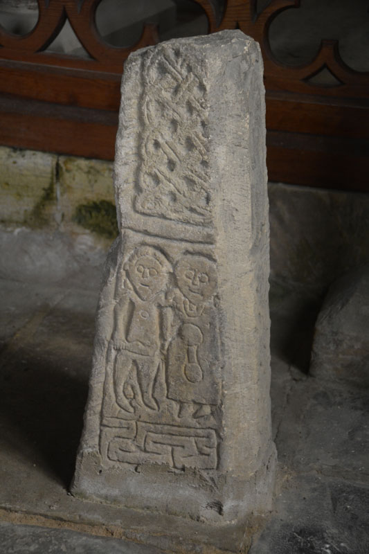
St Helen's Church (Bilton-in-Ainsty) submitted by Anne T on 1st May 2017. The southern face of the eastern-most shaft fragment in the south-east chapel. Said to depict Abraham sacrificing Moses.
(View photo, vote or add a comment)
Log Text: Anglo Saxon Crosses, St. Helen's Church, Bilton-in-Ainsty: We’d tried to visit this church before, but because there was no vicar in post, the church was kept locked. Emails to the York Diocese weren’t helpful.
Knowing we were coming down to Ingelby Arncliffe again, I checked on A Church Near You, and have been corresponding with the vicar, the Reverend Richard Battersby. In the last communication I had with him, he said he had set up a mother and toddler group on a Thursday morning, which met between 10 am and 11.30am. An email to enquire if it was OK to call in after this (so as not to clash with the M&T group) and drop the key off after had no reply, so I phoned and spoke to his mother, who told me the Bishop had sent him to an event so he wasn’t around.
There were three crosses in the small chapel at the south-east end of the church, next to a very interesting set of mass dial/scratch clocks and old graffiti. There was the lovely effigy of a woman in the sanctuary.
I waited until the M&T group had finished before taking photos of the wheelhead cross at the west end of the church. Even though it was a dull day, this proved difficult to get a good image of because the light streamed in above it. In the end, I had to use the flash to compensate. I was unable to get to the notes as the group was closing up and moving everything out of the church, so I grabbed a guide book, thanked them for letting me ‘barge in’ and quietly left.
The Rev. Battersby also recommended visiting Healaugh Church, although we didn’t have time today. Next stop was Bardsey near Leeds.
St Mary's Well, Durham City
Trip No.20 Entry No.4 Date Added: 1st May 2017
Site Type: Holy Well or Sacred Spring
Country: England (County Durham)
Visited: Yes on 30th Apr 2017. My rating: Condition 3 Ambience 3 Access 4
St Mary's Well, Durham City submitted by durhamnature on 21st Oct 2012. The well and stone wellhead.
Site in County Durham England
(View photo, vote or add a comment)
Log Text: St. Mary's Well, Durham: From St. Cuthbert’s Well we walked past the Old Fulling Mill and the Boat House, across Prebend’s Bridge, were we heard shrieks from the river below. Peering over the bridge, we saw the lady rowers trying to avoid going into the bank!
St. Mary’s Well is easy to find. Immediately to the western end of Prebend’s Bridge there is a footpath running off to your right. St. Mary’s Well is about 20 yards to the north up the footpath, on the western side.
Couldn’t find any entry on this in Pastscape, although again Laurence Hunt's Ancient, Healing and Holy Wells gave us some information, along with SolarMegalith's entry on the Portal.
Old Fulling Mill Museum of Archaeology
Trip No.20 Entry No.3 Date Added: 1st May 2017
Site Type: Museum
Country: England (County Durham)
Visited: Yes on 30th Apr 2017. My rating: Condition 3 Ambience 4 Access 4
Old Fulling Mill Museum of Archaeology submitted by durhamnature on 21st Jul 2012. The amazing setting for the museum- its the red-roofed building on the riverbank.
Site in County Durham England
(View photo, vote or add a comment)
Log Text: Old Fulling Mill, Durham: Now closed to the public. All exhibits have been transferred to the University of Durham Museum of Archaeology at Palace Green.
We walked up and down, then down and up, this lovely riverside path, directly underneath Durham Cathedral and the Castle, looking for St. Cuthbert's well. It is in a really lovely spot, although very close to the river, but as the signboard said, must have been prone to flooding.
Having read in the Portal entry that this museum contained examples of rock art, I was keen to visit, but the sign firmly said the museum was now closed. The University of Durham now have an on-line resource, but would love to go and pay a visit. At this time on a Sunday afternoon, it would have been closed, so a repeat visit will be necessary, but as it's such a beautiful location, and not far from home, this will not be too much of a hardship!
Galilee Well
Trip No.20 Entry No.1 Date Added: 1st May 2017
Site Type: Holy Well or Sacred Spring
Country: England (County Durham)
Visited: Yes on 30th Apr 2017. My rating: Condition 4 Ambience 4 Access 4
Galilee Well submitted by durhamnature on 24th Sep 2012. The Galilee Well
Site in County Durham England
(View photo, vote or add a comment)
Log Text: Galilee Well, Durham Cathedral: We arrived at the Cathedral only to find large marquees on the lawn outside, lots and lots of heavy duty cable laid neatly across the lawn. The west walls had been cordoned off with iron railing with filming equipment piled behind.
We decided to go to the café for tea and a sandwich then asked the guides at the desk where the well was and if we could access it. The lady who replied told us “there’s a really big event on at the cathedral; it’s only just been put on the web site. Even we aren’t allowed to go down there.” Helpful.
I remembered years ago walking up to the cathedral from the bridge on Silver Street, an old entrance tucked between two buildings, labelled the old Pilgrims Way up to the cathedral. We walked down into the town, found the entrance and followed the steps up the hill only to find out the path has been blocked off part way through. Retracing our steps, we found the riverside footpath which runs between Café Rouge and Geek Squad/9 altars café on the southern side of the river, at NZ 27282 42419. This path, high above the river, leads directly to the bottom of the west walls and the Galilee Well.
There is no information on this well on Pastscape, or in the cathedral notes for the Gaililee Chapel which must be immediately the other side of these enormous walls.
As the footpath is relatively narrow and has a steep drop down to the river Wear below, it was interesting to get a full face on photograph. The drop from the well into the water below is at least a couple of metres. There was no water flow at the time of our visit. Whilst standing on the path, I noticed a shelf of flat stones poking out of the bank very slightly. Whilst looking back up at the well from St. Cuthbert’s Well below, I noticed what looked like a cast iron bowl poking out of the sheer cliff. Is this associated with the Galilee Well? A pretty inaccessible place!
There is some information on the wells in Durham on the 'Ancient, Healing and Holy Wells of County Durham' by Laurence Hunt which we found useful in giving directions and information.
All Saints (Ingleby Arncliffe)
Trip No.19 Entry No.1 Date Added: 29th Apr 2017
Site Type: Ancient Cross
Country: England (Yorkshire (North))
Visited: Yes on 27th Apr 2017. My rating: Condition 3 Ambience 3 Access 5
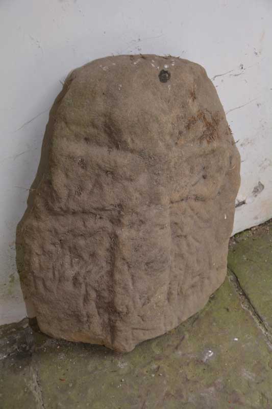
All Saints (Ingleby Arncliffe) submitted by Anne T on 4th Aug 2015. This is the cross which can be found leaning against the north wall of the porch of All Saints, Ingleby Arncliffe. The porch is at the base of the tower.
(View photo, vote or add a comment)
Log Text: Cross fragments (not found), Ingleby Arncliffe, North Yorkshire: We last visited here on 28th July 2015, but the church was locked and I’d arranged for the church warden, to unlock the church for us, although when I’d mentioned the Anglo Saxon fragments to the vicar, he’d replied “this doesn’t sound much like our church.” The stone cross is still located in the porch, shut behind a metal railing door to keep it safe.
Inside, the church is very simple and plain, furnished with box pews, now painted a dusky, dark rose pink. The effigies placed either side of the altar are interesting, together with some stained glass in the east window, which the Yorkshire Moors Gazeteer says represents the Fauconberg and St Quintin families. One of the effigies is of Sir William Colvill, the other of his brother, Robert. These effigies are both in armour with ailettes, and hold hearts in their hands. The British Listed Buildings entry for Ingleby Arncliffe says the ailettes (the origin of modern epaulettes) is a 'very rare feature'.
The vestry was locked, so we couldn’t get in. We also hunted high and low around the tower for possible cross fragments. I took photographs and have since enlarged them using Photoshop, but these only show weathered sandstone.
A disappointing visit, but we tried to find these cross fragments.
All Saints (Ingleby Arncliffe)
Date Added: 29th Apr 2017
Site Type: Ancient Cross
Country: England (Yorkshire (North))
Visited: Yes on 28th Jul 2015. My rating: Condition 3 Ambience 3 Access 5

All Saints (Ingleby Arncliffe) submitted by Anne T on 4th Aug 2015. This is the cross which can be found leaning against the north wall of the porch of All Saints, Ingleby Arncliffe. The porch is at the base of the tower.
(View photo, vote or add a comment)
Log Text: Ancient Cross, All Saints Ingleby Arncliffe, North Yorkshire: All Saints at Ingleby Arncliffe is very close to the A19 so we thought we’d stop off on the way back home, but finding this church was quite interesting – we had three unsuccessful attempts, driving down different roads from the centre of the village of Ingleby Cross. In the end, I got the GPS out and found the church straight away. The church is located about a quarter of a mile to the south-east of Ingleby Cross village, having to cross the A172 to reach it. From the cross roads the church is approx. 200 yards to the right hand side with a small parking area by the main gate to the churchyard.
The church many now be really distant from the village, but is right next to the manor house which dominates the view of the churchyard. The church itself was (not surprisingly for the early evening) locked, but we could gain access to the porch which is in the lower part of the tower. There was a cross (very similar to the one at Wath) leaning up against the north wall. We walked right around the building twice but could see no other crosses/old stone fragments built into the fabric of the building. There are supposed to be two more stones built into the tower along with another in the vestry according to the Yorkshire Moors Gazetter. The entry for Ingleby Arncliffe on the British History site says “A hog-back stone found about fifty years ago in a hedge bank and a later coped gravestone are now in the Cathedral Library.”
We peered through the windows of the church, and it appears to be all original box pews with a three-tier pulpit. I have sent an email to the vicar, through the ‘A Church Near You’ web site, asking if it’s possible to pick up a key next week to get inside the church and also see if we can find the stones in the tower.
