Contributory members are able to log private notes and comments about each site
Sites Anne T has logged. View this log as a table or view the most recent logs from everyone
St Margaret (Hornby)
Date Added: 6th Jun 2015
Site Type: Ancient Cross
Country: England (Lancashire)
Visited: Yes on 4th Jun 2015. My rating: Condition 3 Ambience 4 Access 5

St Margaret (Hornby) submitted by Anne T on 6th Jun 2015. The smaller fragment contains chevron patterns on its upper part and some form of scroll work on its lower section.
(View photo, vote or add a comment)
Log Text: Anglo Saxon Cross Fragments, St. Margaret's Church, Hornby: From Gressingham, we continued east along the twisty-turny Back Lane, over the narrow bridge over the River Lune, to its junction with the A683. Turning right, we were almost immediately in Hornby. St. Margaret’s sits on the left hand side of the road, before the main road takes a right hand turn. There is ample parking on the right hand side of the road opposite the church which is distinctive with its octagonal tower.
Opening the gate from Main Street, you fall into the porch of the church, which is very dark. Inside, the church appears very modern and (to me) without personality, although there is evidence of much older structures such as the traces of old roof lines in the interior west wall; Pastscape records it as having building having started in 1514, with the nave being rebuilt in 1817 with clerestorey being added in 1889.
There was no church guide, just one board with an A4 sheet of notes. This told us that: “Under the tower are two fragments of 9th century crosses, one showing the five loaves and two fishes; this is unique in England, though there are two in Ireland. They both came from the Priory ...”, although the Pastscape record says they are 8th to 9th century and that both fragments had been reused in a 19th century barn wall at Priory Farm before coming to the St. Margaret’s. The church notes continued: “The churchyard contains a huge cross base, which may be pre-Conquest or Norman. The original cross could have been twelve feet high. Its presence is something of a mystery.”
The Anglo Saxon Cross Fragment with the carving of the five loaves and two fishes was impressive, and definitely worth stopping to see. Alongside it, to the right, was a much smaller fragment with chevrons.
The churchyard is beautifully kept, with well mown grass and shrubs being clipped into amazing shapes and kept low to the ground. The cross base is huge in comparison to others that I’ve seen – I had to climb on top of a stone to photograph the top, which has a slot for a cross to go into on top.
Halton St Wilfrid's Churchyard
Date Added: 6th Jun 2015
Site Type: Ancient Cross
Country: England (Lancashire)
Visited: Yes on 4th Jun 2015. My rating: Condition 3 Ambience 3 Access 5
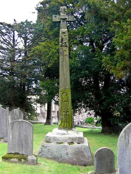
Halton St Wilfrid's Churchyard submitted by LivingRocks on 18th Apr 2005. The partially restored high cross in St Wilfrid's Churchyard.
(View photo, vote or add a comment)
Log Text: Ancient Cross, St. Wilfrid's, Halton: From St. Margaret’s in Horby, we followed the busy A683, turning off onto the road to Halton just south of Caton. Although only a side road, this road seemed busier than the main road.
This must be one of the most dangerous sites I’ve visited. The church is located on a bend on this busy, busy road and the gate into the church is less than a foot from the edge of the road with no pavement, and it’s quite stiff to open – nearly got run over trying to get into the church and had to be very careful exiting, as you couldn’t see what was coming round the bend to the right.
The church looks more like a house with a stone tower, and unfortunately was locked, which was a shame, because the Pastscape record tells us there are pieces of 5 Anglo Saxon stones built into the interior of the tower.
According to the Pastscape record 41153, the pre-Norman cross (restored in 1890) tells the story of the Sigurd legend (which I’ll need to find out about), although to my eye not all the pieces matched and must be several crosses amalgamated together. A bit of a disappointment really.
St Wilfrid (Melling)
Date Added: 18th Jun 2015
Site Type: Ancient Cross
Country: England (Lancashire)
Visited: Yes on 6th Jun 2015. My rating: Condition 3 Ambience 3 Access 4
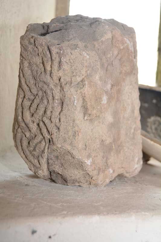
St Wilfrid (Melling) submitted by Anne T on 6th Jun 2015. We turned the stone round very, very carefully to see what the other two sides were like. It has obviously been recut at some point, and the British History Online notes say it was taken out the church wall a few years ago.
(View photo, vote or add a comment)
Log Text: Anglo Saxon Cross, St. Wilfrid's Church, Melling: From seeing the reconstructed cross at Halton, we set off back to Melling, to work our way back towards Levens Park/Sizergh Fell to end the day. Following the A683 back through Hornby, we drove through the village of Melling, with very narrow roads, and with cars and huge trucks trying to pass each other, it was a bit precarious to say the least. The church is on a very narrow section of Main Street, so we ended up parking in Gillison Close, having to turn right just past the church into a road that eventually turns into Lodge Lane. There was no footpath for 200 yards down this small road, which, given the amount of traffic on it, was exciting for pedestrians [note: there are steps up to the church, so disabled access is going to be difficult].
Formerly called St. Peter’s (but I haven’t been able to find out when the dedication changed), this pretty church is Grade 1 listed. The British History Online notes state that the church “stands on the west slope of an elevated plateau, the top of which forms an ancient earthwork known as Castle Mount”. This church looks ancient from outside but deceptively modern inside, apart from the tower. The ADS website was down at the time of writing this, but both Wikipedia and the “A Church Near You” website states that “the earliest fabric in the church dates from around 1300 or earlier ... it is possible that a church has been on the site since the 10th century.”
We found a fragment of Anglo Saxon cross tucked away on a window sill on the west interior wall, alongside a modern ceramic bowl and a piece of medieval grave marker. This short piece of cross shaft has basket-work interlacing which British History Online says was taken out of the churchyard wall a few years ago. Curiously, the on-line records of the Corpus of Anglo Saxon Stone Sculpture has only a one line mention of this stone, saying there are similarities with cross shafts found at Aspatria and Lancaster.
There is apparently a piece of Norman chevron ornament, found below the tower floor, which is now built into the vestry wall, but this was not accessible during our visit.
In the porch there are a couple of medieval grave markers displayed against the east wall. Outside, near the south wall, there is a very tall sundial, which must have been meant to have been read from horseback. It still has it’s (now green) brass plate on the top, but no gnomon. Wikipedia says it probably dates from the 18th century and is Grade II listed.
St John the Baptist (Tunstall)
Date Added: 7th Jun 2015
Site Type: Early Christian Sculptured Stone
Country: England (Lancashire)
Visited: Yes on 4th Jun 2015. My rating: Condition 3 Ambience 3 Access 5
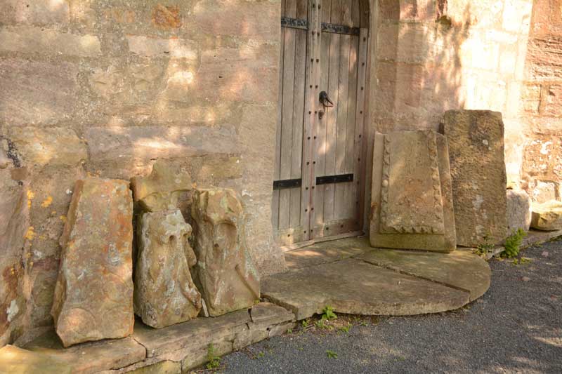
St John the Baptist (Tunstall) submitted by Anne T on 7th Jun 2015. We searched and searched for the Roman altar, but couldn't find it. Outside the west door, there is a display of architectural stones, including medieval grave markers and what looked like a very worn Anglo Saxon Cross Head/Finial.
(View photo, vote or add a comment)
Log Text: Votive Stone, St. John The Baptist, Tunstall: Driving from St. Wilfrid’s, Melling, we continued north along the A683. Just mile or so along the road, the A683 becomes a ‘minor road’ splitting off to the left, whilst the main carriageway continues as the A687. Following the A683 into Tunstall village, Church Lane is the last turn to the right hand side, almost at the end of the village. This road disappears into green fields with a few large houses along the way. After about 600 metres, the church appears to your left hand side, with parking places outside the entry stile. This is a glorious country setting with a beautifully looked after churchyard.
The ADS web site was down at the time of writing, but the British History Online notes are really helpful, telling me that this church, now named St. John The Baptist, used to be dedicated to St. Michael, and is largely of “15th century date .... there are some remains, however, of a 13th century structure, fragments of which have been used in the rebuilding”.
The church guide was £5, so we didn’t buy it, but quickly looked through it to find it mentioned a Roman altar as well as the votive stone, but no clues as to the whereabouts of either - I had to use my phone to find out where the votive stone was; we found no suggestion of the Roman altar, although there was a display of architectural pieces and medieval grave markers by the west door which included what looked like a very worn Anglo Saxon cross head.
To assist future visitors, the votive stone is on the eastern-most of the three windows (nearest to the organ), on the left hand side of the window surround. Curiously, it has been placed on its side.
At the east end of the south aisle there is a small chapel which contains a much broken effigy, said to be of Sir Thomas Tunstall. There is also an ancient chest just outside the south chapel and outside a sundial shaft which stands on three octagonal steps.
Luston Holy Well
Trip No.169 Entry No.1 Date Added: 8th Aug 2021
Site Type: Holy Well or Sacred Spring
Country: England (Herefordshire)
Visited: Yes on 14th Jul 2021. My rating: Condition 3 Ambience 3 Access 5
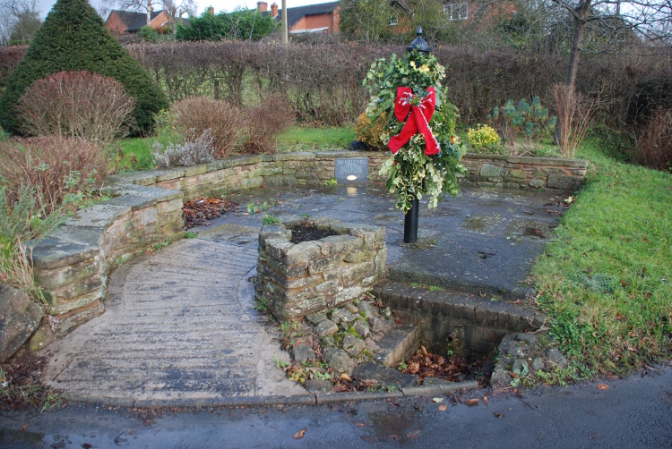
Luston Holy Well submitted by jfarrar on 22nd Dec 2014. Holy Well in centre of the village. Was the village water supply until the mains arrived in 1950
(View photo, vote or add a comment)
Log Text: Luston Holy Well: This well is not shown on the HE map search, or listed on the HE Research Records or Herefordshire SMR. It is located at the corner of the B4361 and Eye Lane.
We parked on Townsend Park, opposite the well and walked across the road.
There is a plaque on the north eastern corner of the well proclaiming it to be a holy well. Can’t (yet) find out any more information about it.
The handle of the pump had been chained and padlocked in place. We couldn’t hear any water flowing, and looking down the drain cover, the water was stagnant.
St Michael's Churchyard Cross (Knill)
Date Added: 1st Aug 2024
Site Type: Ancient Cross
Country: England (Herefordshire)
Visited: Yes on 16th Jul 2024. My rating: Condition 3 Ambience 4 Access 4
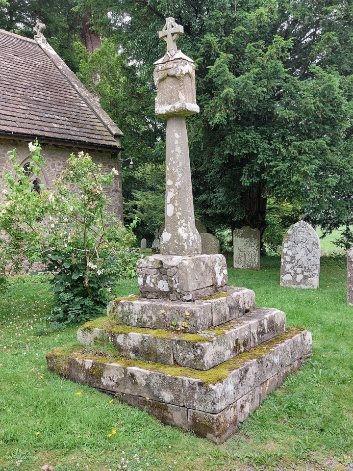
St Michael's Churchyard Cross (Knill) submitted by Anne T on 1st Aug 2024. The cross is about 4m south of the south porch and is very prominent in the churchyard.
(View photo, vote or add a comment)
Log Text: Knill churchyard cross: our first (and only) site visit for some considerable time, due to my current mobility issues. The church was easy to access, and it was lovely to be out in a really rural area on a warm, if overcast day.
Whilst old, the church seemed unremarkable, with no monuments inside of note apart from one very pretty stained glass window and the font, which is thought to date from the 12th century.
A very impressive carved large wooden dragon sits just to the south east of the church.
St John the Baptist and St Alkmund (Aymestrey)
Trip No.165 Entry No.1 Date Added: 21st Jul 2021
Site Type: Ancient Cross
Country: England (Herefordshire)
Visited: Yes on 9th Jul 2021. My rating: Condition 4 Access 4
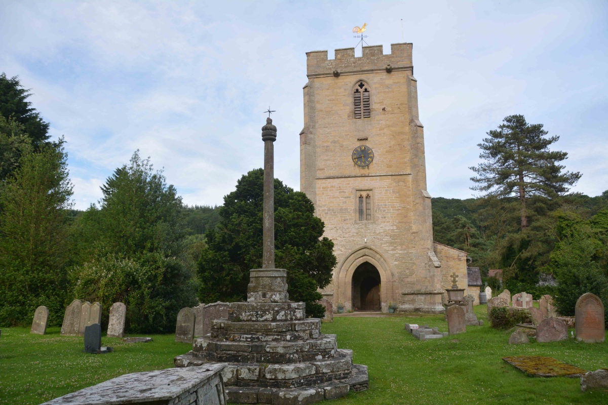
St John the Baptist and St Alkmund (Aymestrey) submitted by Anne T on 21st Jul 2021. Standing just inside the lych gate, looking past the cross to the west door into the church.
(View photo, vote or add a comment)
Log Text: Churchyard Cross (Aymestrey): We were here for my son and DIL's wedding rehearsal, but I was also very keen to get out into the churchyard to photograph this cross before dusk fell. Whilst the cross is medieval, Beaker burials have been found nearby, and I'm doing further research on the church to find out if a wooden building might have pre-dated the 12th century church. A very pretty spot, although difficult to find the church car park (the small lane is just to the north of the northern wall of the churchyard), and we missed this, so parked in the village hall and walked back the 150-200m to the church along the (at that time of night) quiet A4110.
St Michael's Church (Kingsland)
Trip No.166 Entry No.1 Date Added: 22nd Jul 2021
Site Type: Ancient Cross
Country: England (Herefordshire)
Visited: Yes on 11th Jul 2021. My rating: Condition 3 Access 4
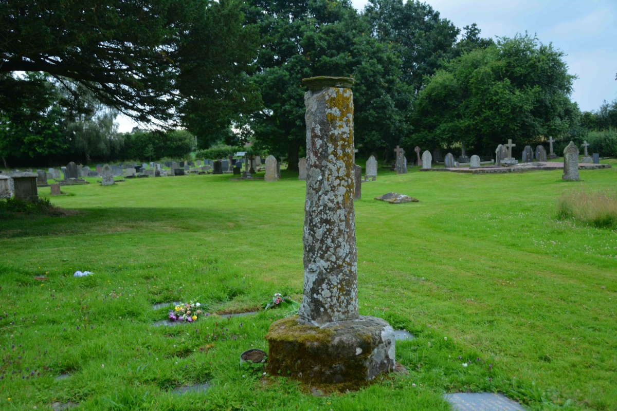
St Michael's Church (Kingsland) submitted by Anne T on 22nd Jul 2021. Standing nearer the church, looking south west, towards the site of Kingsland Castle (motte and bailey).
(View photo, vote or add a comment)
Log Text: St Michael's Churchyard Cross plus Motte and Bailey: This is the church my son and DIL should have been married in over a year ago, but thanks to Covid, then urgent roof replacement works, the wedding was moved to Aymestrey. Lovely church (from what we could see of it behind the scaffolding, almost Minster sized), but the cross took a little bit of spotting, as at first glance it looked just like a sundial (to be viewed from the back of a horse).
A gate from the near the entrance to the churchyard leads off onto a pleasant walk towards the motte and bailey site. As we enjoyed our walk, the rain started to pelt down, so we retreated back to the car. Nice site, and a lot to see.
Bredwardine Church
Date Added: 27th Jul 2021
Site Type: Carving
Country: England (Herefordshire)
Visited: Yes on 13th Jul 2021. My rating: Condition 4 Ambience 4 Access 4
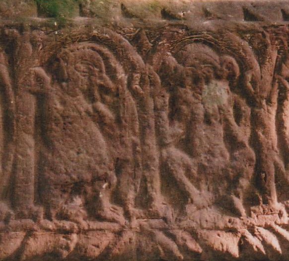
Bredwardine Church submitted by AngieLake on 28th Nov 2018. Close up of possible Sheela-na-Gig on lintel above blocked North door of St Andrew's Church at Bredwardine in Herefordshire.
Taken in 2011? while researching Rev Francis Kilvert. His diaries make very interesting reading. (He came from Wiltshire and visited a grand house near Kington Langley, where my gran lived, and worked at the time.)
(View photo, vote or add a comment)
Log Text: Brewardine Church (St Andrew's): A very pretty church, in a lovely setting, and we were very surprised to not only find it open, but a number of other visitors came and went whilst we were there.
There is parking for a number of car in the small lane that runs up to the church, although most of the other visitors came on bicycles.
In addition to seeing parts of the 12th century structure, a number of carvings and a Norman font on weird tripod-like legs, there is also a churchyard cross. We spent some time just enjoying being able to look round a church and its churchyard again after a good 15 months of not being able to do this. And in glorious sunshine, too!
Arthur's Stone
Trip No.168 Entry No.2 Date Added: 28th Jul 2021
Site Type: Chambered Tomb
Country: England (Herefordshire)
Visited: Yes on 13th Jul 2021. My rating: Condition 3 Ambience 4 Access 4
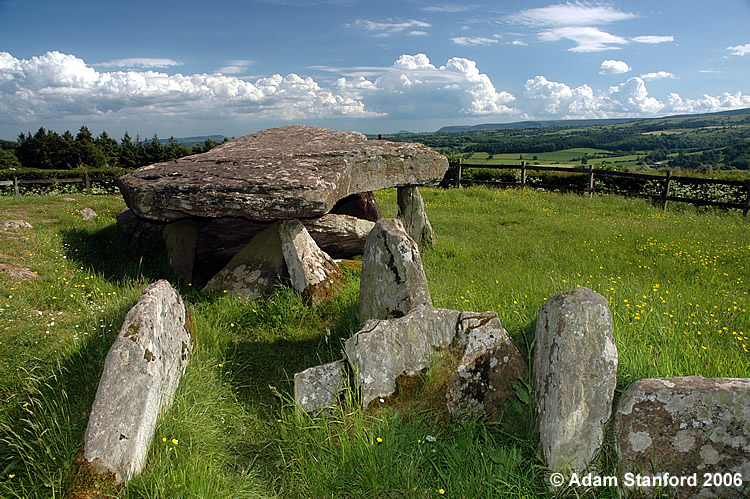
Arthur's Stone submitted by Adam Stanford on 21st Jul 2006. Taken during recent work to investigate the full extent of the covering mound for this monument. Cheers AS.
(View photo, vote or add a comment)
Log Text: Arthur's Stone: This was a really weird visit. No sooner had we parked in the small layby next to the stone's enclosure, and I'd started to take photographs, than a lady walked along the lane, right into the enclosure, sat down and started to have a picnic, so she was prominent in all the photographs. I was absolutely gobsmacked!
I plucked up the courage to ask her to move whilst I finished taking photographs, which she very kindly (but reluctantly) did, to the railing of the enclosure. Feeling somewhat guilty, I started talking to her, and it turned out she was an archaeologist who had come up to join a party of university students in a dig. A pleasant enough chat, but left me feeling uneasy that people would act that this (but then perhaps that's just me), and sort of ruined the visit for me.
Kilpeck church
Trip No.168 Entry No.3 Date Added: 28th Jul 2021
Site Type: Early Christian Sculptured Stone
Country: England (Herefordshire)
Visited: Yes on 13th Jul 2021. My rating: Condition 3 Ambience 4 Access 4
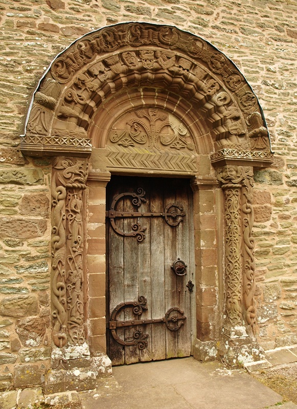
Kilpeck church submitted by bat400 on 21st Nov 2018. The entry of Kilpeck Chruch. A wooden porch (not original) that covered this doorway for a period of time it thought to have helped protect the carvings.
Photo by bat400, 2014.
(View photo, vote or add a comment)
Log Text: Kilpeck Church and Castle: Our second church of the day, and I was delighted to find this open. Again, there was a steady stream of visitors, many of whom had a quick look in the church then walked round the outside to look at the corbels and gargoyles.
I bought a book about the church, largely aimed at children, called "From Big Bang to Beasties and Beyond" by Diana Thomas, which is very informative, with lots of information.
After taking photographs inside and out (including all the corbels and most of the gargoyles), we wandered over to the motte and bailey site - much, much larger and more interesting than we thought, and spent a happy half hour enjoying the sunshine. Only one other couple wandered over to look at the castle whilst we were there.
Higgin's Well
Trip No.168 Entry No.4 Date Added: 29th Jul 2021
Site Type: Holy Well or Sacred Spring
Country: England (Herefordshire)
Visited: Yes on 13th Jul 2021. My rating: Condition 3 Ambience 3 Access 4
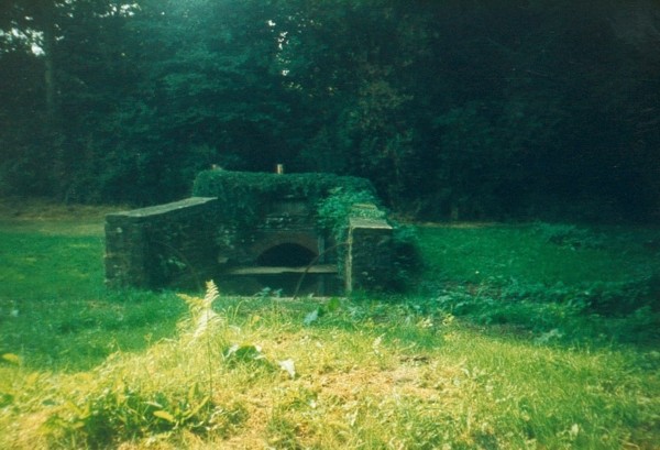
Higgin's Well submitted by HOLYWELL on 28th Aug 2006.
Higgin's Well Little Birch
(View photo, vote or add a comment)
Log Text: Higgins's Well, Little Birch: We parked outside the church (St Mary's) and walked down the lane towards the well. We could hear water running in the distance, so followed our ears.
A very small stream runs downhill behind the well from Athelstan's Wood currently appearing to flow both into the well and to another pond and stream, joining a larger stream which runs to the south of the well.
The well is very overgrown, and was deep in shadow at the time of our visit. Stepping inside the gate, there is an 80cm stone slab which runs between the northern wall of the well and the well pool, so it's possible to step into the well and, if you wanted, dip your bucket into the well pool.
Watching Place Waymarker
Trip No.130 Entry No.1 Date Added: 22nd May 2019
Site Type: Marker Stone
Country: England (Devon)
Visited: Yes on 11th May 2019. My rating: Condition 3 Ambience 3 Access 5
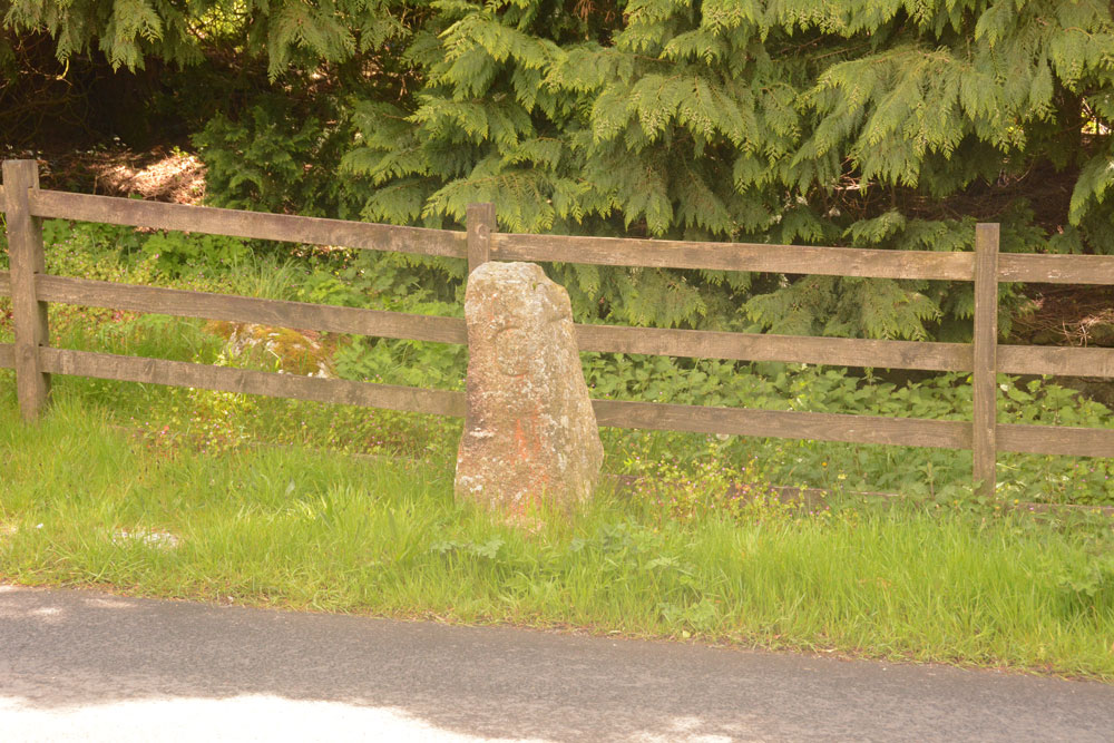
Watching Place Waymarker submitted by Anne T on 22nd May 2019. The Beetor/Watching Place waymarker. This stone dates only to the 18th century, but marks the original site of the Beetor Cross, now located some 100m to the south.
(View photo, vote or add a comment)
Log Text: Watching Place Waymarker/original site of Beetor Cross: Having seen the OS map and sorted out the Pastscape entries, I finally realised that this 'standing stone' was where the cross had originally been located.
Our first stop today was to go and photograph it so I could complete the Beetor Cross entry. It was nice to understand the relationship between the waymarker stone and the wayside cross, although it too me a while to understand the confusion between the names (HE calls the waymarker the Beetor Cross and the cross the Watching Place Cross).
I had to be careful photographing the front of the cross as cars sped quickly at irregular intervals.
Moretonhampstead Cross
Trip No.130 Entry No.4 Date Added: 24th May 2019
Site Type: Ancient Cross
Country: England (Devon)
Visited: Yes on 11th May 2019. My rating: Condition 3 Ambience 3 Access 5
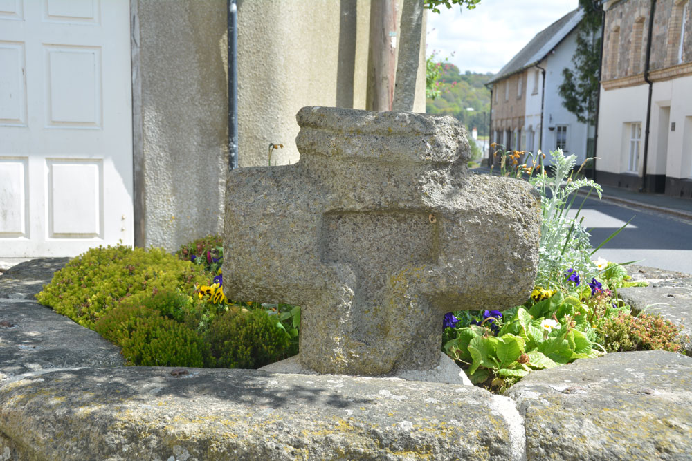
Moretonhampstead Cross submitted by Anne T on 24th May 2019. The eastern side of the cross head, with its T shaped recess (Pastscape describes it as cross shaped).
(View photo, vote or add a comment)
Log Text: Moretonhamstead Village Cross: The remains of this old village cross can be found, surprisingly, on Cross Street, outside the gate at the south side of the churchyard. I confess I had not expected to see a wayside/village cross mounted in a large flower bed! I got some strange looks from locals and visitors photographing this flower bed from different angles.
We then went to explore the church (St Andrew's) then for soup and a cup of tea in a nearby café (the Gateway Tearooms) with superb table service. Carrot and ginger soup with freshly made soda bread. Yum!
Higher Combe Cross
Trip No.130 Entry No.7 Date Added: 30th May 2019
Site Type: Ancient Cross
Country: England (Devon)
Visited: Saw from a distance on 11th May 2019. My rating: Condition 3 Ambience 3 Access 4

Higher Combe Cross submitted by Anne T on 30th May 2019. Andrew (husband) balanced on top of the low stone wall between the minor road to Lustleigh and Cross Park Field to get this photograph of the cross head, from about 100m away. Not the best focused of photographs, but the closest we could get.
(View photo, vote or add a comment)
Log Text: Higher Combe Cross: If we could have obtained access to this cross, access would have been a short walk across a field of improved pasture. Shame the gate was double-chained with two electric fences virtually up against the gate. Lovely horse in the field, though.
Andrew resorted to standing on top of the low stone wall just to the south of the cross, where there was a sufficient enough gap in the trees/hedges to see through. A shame, because it looked as if it was in such a lovely location, just above a small stream, and against an old hollow way.
Bishop's Stone (Lustleigh)
Trip No.130 Entry No.9 Date Added: 1st Jun 2019
Site Type: Ancient Cross
Country: England (Devon)
Visited: Yes on 11th May 2019. My rating: Condition 3 Ambience 3 Access 5
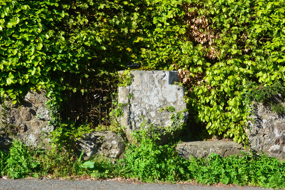
Bishop's Stone (Lustleigh) submitted by Anne T on 1st Jun 2019. The Bishop's Stone, seen from part way across this busy, minor road. The Pastscape photograph shows the stone set against an iron railing; a substantial hedge has since grown up around it.
(View photo, vote or add a comment)
Log Text: Bishop's Stone, Lustleigh: This stone is on a corner of a busy road junction of three minor roads– I needed to pick my time to step part way across the road to photograph the stone from the front. The metal railing shown in the Pastscape photo is now largely hidden by a beech hedge. The stone goes about around a metre or so back into the garden of the house. It’s a lot bigger than it looks at first glance. We were also lucky that the bright sunlight also helped to show up the incised shield.
South Harton Cross
Trip No.130 Entry No.10 Date Added: 1st Jun 2019
Site Type: Ancient Cross
Country: England (Devon)
Visited: Yes on 11th May 2019. My rating: Condition 3 Ambience 4 Access 5
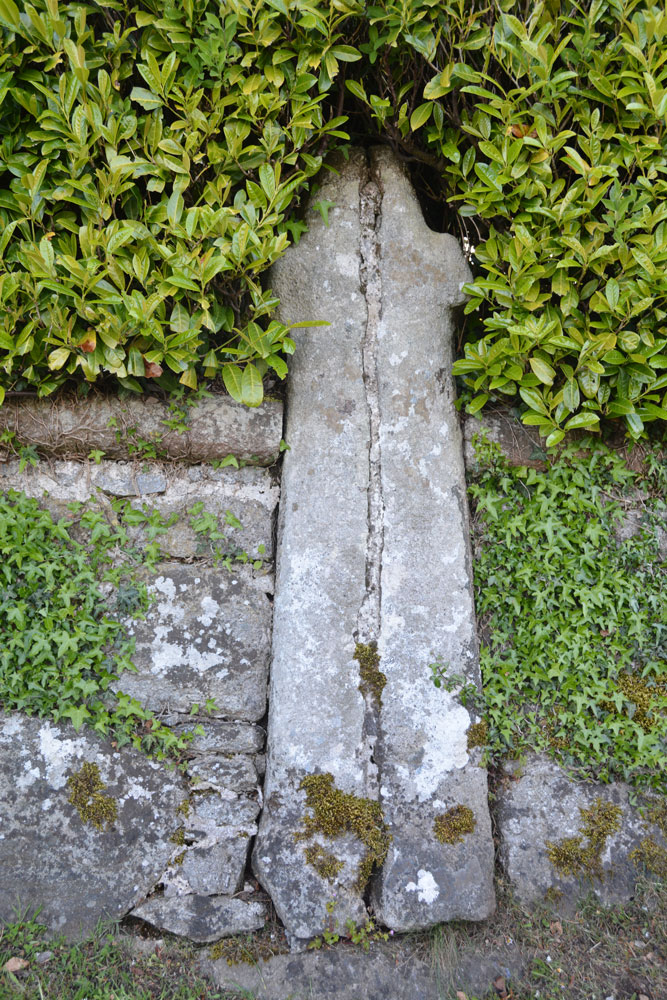
South Harton Cross submitted by Anne T on 1st Jun 2019. This wayside cross leans against a drystone wall, just west of the gateway into South Harton Farm. It has been split into two and re-assembled at some point in its past, but is a nice specimen, and it was worth braving the tiny lanes to find it.
(View photo, vote or add a comment)
Log Text: South Harton Wayside Cross: As we drove along the minor roads from the Bishop’s Stone towards South Harton Farm, the sun went in and a haze started to drift across the fields and it started to become very chilly.
This cross simply leans against the dry stone wall, just to the west of the gated driveway leading to South Harton Farm. It has very obviously been cemented together, but is none-the-less spectacular, and I’m glad we braved the narrow lane to find this cross.
Out of curiosity, I walked to the gate and looked to see if the cross was visible from the other side of the wall, but it is hidden by the drystone wall and the hedge.
Shorter Cross
Trip No.131 Entry No.2 Date Added: 3rd Jun 2019
Site Type: Ancient Cross
Country: England (Devon)
Visited: Yes on 12th May 2019. My rating: Condition 3 Ambience 3 Access 5
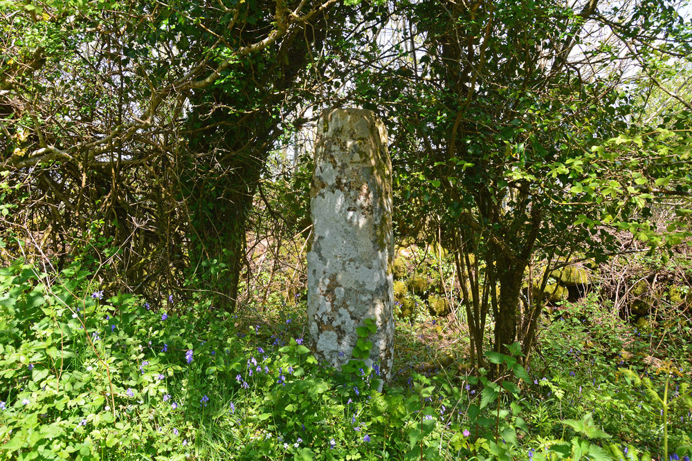
Shorter Cross submitted by Anne T on 3rd Jun 2019. At first glance the standing stone is just another tree-trunk along the side of the minor road - until you look closer. It is remarkably like a standing stone, but very well preserved.
(View photo, vote or add a comment)
Log Text: Shorter Cross, near Druid's Well, Chagford: Not far from Druid’s Well (about 350m as the crow flies), this is a lovely cross, more like a standing stone, with no cross arms.
The cross is well hidden behind/between trees, but we were able to walk into the dip/ditch between the road and the dry stone wall. The crosses on both faces of the stone were clearly visible; on the side nearer the road there was a small, square, equal armed cross inside a larger cross in relief.
Addiscott Cross
Trip No.132 Entry No.1 Date Added: 5th Jun 2019
Site Type: Ancient Cross
Country: England (Devon)
Visited: Yes on 13th May 2019. My rating: Condition 3 Ambience 3 Access 5

Addiscott Cross submitted by Anne T on 5th Jun 2019. The cross, taken from half way across the minor road (showing its southern face).
(View photo, vote or add a comment)
Log Text: Addiscott Wayside Cross: Our first stop on this bright, sunny and breezy day, which made us glad to be out of doors.
The Pastscape entry is indeed correct, as the cross is virtually hidden by the surrounding shrubbery and almost impossible to see until we got closer and the sun bounced off its light yellow surface.
A lovely cross, very well made. It looks as if it could have been carved yesterday, although Pastscape dates it to the 14th century and HE to the 15th.
Ringhole Copse Cross
Trip No.132 Entry No.2 Date Added: 5th Jun 2019
Site Type: Ancient Cross
Country: England (Devon)
Visited: Yes on 13th May 2019. My rating: Condition 3 Ambience 3 Access 5

Ringhole Copse Cross submitted by Anne T on 5th Jun 2019. Standing on the grass verge to the east of the Ringhole Copse Wayside Cross, looking west. Historic England says this cross "(is) on an upland ridge which is the watershed between the valleys of tributaries to the River Yeo and River Taw". With the busy A30 just metres away to the north (right hand side of the cross), the cross felt lonely and isolated. Just think what foot traffic passed it in Medieval times!
(View photo, vote or add a comment)
Log Text: Ringhole Copse Wayside Cross: Not on our original list, but we spotted this cross on the map, with only a minor detour to our next few stops for this morning.
This wayside cross is adjacent to, and just south of, the A30, about 20m west of the road which connects the minor roads running over the A30 . Strangely, it looks as if it is in its original spot, although the HE scheduling information tells me that it was relocated to its present position in 1988 when they improved the A30.
The incised cross on the eastern side is clearly visible, but only part of the carving on the western face is visible under the covering of lichen.
