Contributory members are able to log private notes and comments about each site
Sites Anne T has logged. View this log as a table or view the most recent logs from everyone
St Andrew's Church (Aycliffe)
Date Added: 21st Sep 2014
Site Type: Ancient Cross
Country: England (County Durham)
Visited: Yes on 18th Sep 2014. My rating: Condition 3 Ambience 4 Access 5
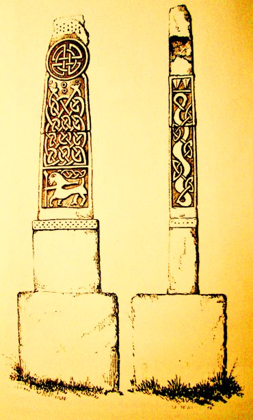
St Andrew's Church (Aycliffe) submitted by Sunny100 on 5th Aug 2010. Site in County Durham England. Illustration of one of the cross-shafts in St Andrew's church at Aycliffe. It dates from the 9th-10th century and has seen restoration. Carved on it is the Agnus Dei (Lamb of God) with a mythical character riding on it's back with what could be a spear. The shaft stands on a solid stone base and originally stood in the churchyard.
(View photo, vote or add a comment)
Log Text: St. Andrew’s Church, Aycliffe Village, County Durham: A treasure-house of Anglo-Saxon cross-shafts.
OK - it’s only just over 9 miles between Escomb Saxon Church and Aycliffe Village, but I drove more than twice that distance as I managed to get hopelessly lost trying to follow the directions the bar maid at the Saxon Inn in Escomb had given me (I must have misunderstood). However, backtracking to the safety of the A68/A1 and heading north to junction 59, the church is really easy to find. Driving north up the A167, you pass ‘St Andrew’s Way’ (which leads to an industrial estate to your left), then just as you enter Aycliffe Village there is a left hand turn (officially called Church Lane, but I didn’t spot a street sign).
I confess to a certain degree of trepidation as I turned down the lane – it got narrower and narrower and I was scared I wouldn’t be able to turn the car around, but then the lane suddenly widened out into a very generous parking area. Two cars were already there – the Church Warden and her friend. I wasn’t expecting such a large church which appeared to rise up out of the surrounding flatness of the fields like a mini-cathedral.
As this church is only open for two hours on a Thursday afternoon between 1st May and 30th September each year, I phoned in advance to say I was going, to ensure I could gain entry. Thank goodness I had. The Church Warden was really, really friendly and gave me both a wonderful history of the church, pointing out features such as the Blacksmith’s Grave Cover and helping me find the Anglo Saxon cross shafts not in the display area, along with some of the features externally, but also leaving me space to wander and take photographs and understand and enjoy what I was looking at.
I had to chuckle (but only to myself) about the ancient and wonderful Anglo Saxon cross stored in the south west corner with a huge modern ladder propped up on the wall against it.
The wardens have laid out a small ‘museum’ area at the back of the church. My one disappointment was a lack of a church guide (when I was handed a leaflet I asked if there was a proper guide, only to be told ‘that’s it!’ My cheeks reddened). However, the church warden went back to her house and came back with a book on the church – a bargain at only £5.
Over a cup of tea, I was given ‘chapter and verse’ on the adventures they had had putting heating, new lighting and a sound system into this Grade 1 listed building. Apparently officers from Durham Council had been out to sit on the choir stalls to ensure their feet weren’t too close to the new heating pipes for health and safety reasons! What fun.
The Church Warden ended my visit by saying if I wanted to go back ‘out of season’ I had her phone number, to call her, and we’d ‘come to some arrangement’.
On reading the guide book at home, I realised this was the church that had been mentioned when I worked at Northumbria University. One of the alumni had emailed in describing how he shared a room with two students from Teesside who had raided a churchyard for bones – and this was the cemetery they had come from. The guide book included Photostats of some of the newspaper articles from the time.
This church is a real treat for Anglo-Saxon cross enthusiasts.
St Andrew's Church (Bolam)
Trip No.103 Entry No.2 Date Added: 13th Oct 2018
Site Type: Ancient Cross
Country: England (Northumberland)
Visited: Yes on 11th Oct 2018. My rating: Condition 3 Ambience 4 Access 5
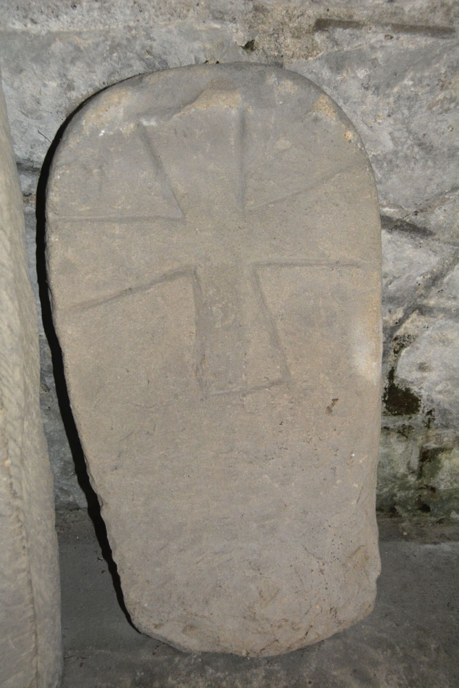
St Andrew's Church (Bolam) submitted by Anne T on 13th Oct 2018. This is AS Corpus Bolam 01, an eleventh century round-headed grave marker measuring 78.8cms high, 40cms wide and 13cms deep. It is propped against the south wall of the tower, inside. The horizontal arms of the cross touch the edges of the stone. Found in 1884 when the church was refurbished.
(View photo, vote or add a comment)
Log Text: St. Andrew's Church, Bolam: Hogback, Ancient Crosses and Sculptured Stones: It is almost four years to the day when I first visited this church (15th October 2014), but had only just started making contributions to the Portal and thought the cut-off date for any entries was 1,000AD. That visit took place on a beautiful sunny day with no wind; the church was peaceful and tranquil, and I sat and read the guide book, enjoying the atmosphere of ages. Today, the wind rattled the door with great frequency, and the wind whistled through the crack, making it sound like there was a cat howling outside. I was glad of company today!
As well as the AS fragments in the church, a hogback and other grave markers built into the porch, there is also the remains of a cross and cross base.
This is the church where a German bomb came through the south wall but did not explore. The pilot later visited the church to apologise and arranged for a window to be inserted into the east wall of the south aisle – an angel holding a candle.
The information sheet ‘Earth’ says “the oldest part of the church is the Saxon tower, and you can find traces of a sundial inside the porch.” We spent ages looking for this, but couldn’t find it.
The saltire marked stones on either side of the chancel arch were fascinating, as was the arch between the nave and the chancel.
Above the south door, in the porch, are the remains of two triangular inscribed grave slabs (mentioned in the architectural assessment).
St Andrew's Church (Bothal)
Trip No.104 Entry No.1 Date Added: 25th Oct 2018
Site Type: Ancient Cross
Country: England (Northumberland)
Visited: Yes on 24th Oct 2018. My rating: Condition 3 Ambience 4 Access 5
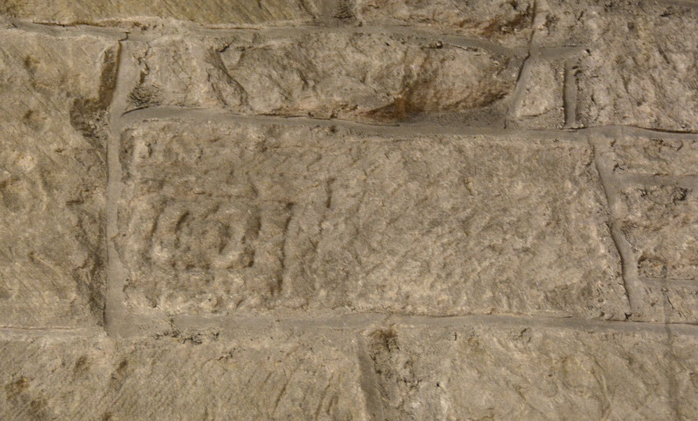
St Andrew's Church (Bothal) submitted by Anne T on 25th Oct 2018. This is AS Corpus Bothal 07, part of a cross shaft built into the north wall of the chancel (towards its western end). Dated to the late tenth to early eleventh century, we initially had difficulty in picking this stone out, but once we'd seen it, could not 'unsee' it. The Corpus describes the pattern as 'formed by concentric punch outlined rectangles with a coiled centre.'
(View photo, vote or add a comment)
Log Text: Anglo Saxon Cross Shaft Fragment, St Andrew's Church, Bothal: I had arranged to collect the key to the church from the Reverend John Parks, who lives in Pegswood. The church in Bothal is very easy to find, and in a very scenic place, with a nearby footpath running down to the River Wansbeck.
The narrow west end of the church faces the road, and is largely hidden by tall, dense trees. My first thought was “how am I going to photograph the outside?” This did prove to be a little bit of a challenge, but in the end, walking into the much larger and spacious churchyard, I managed a couple of shots.
There are a number of entries on HE for St. Andrew’s Church, and whilst we spent about an hour and a half here, I felt I wanted to stay longer to explore all the elements in the guide book and the architectural assessments, but Andrew was getting bored and a cup of tea in Morpeth then holy wells beckoned.
There are several really interesting ‘cut outs’ of the wooden panel in the chancel that give viewing access to a remnant of medieval plasterwork, an old tombstone reused as a lintel, and an old wooden door. The cut outs were quite small, which made photographing these features a little tricky. At one point, I thought I was going to drop the camera down the small window on the south wall of the chancel, in an attempt to photograph the bottom of the lintel above! Photographing the remnant of medieval plasterwork was interesting, as Andrew had to shine the torch (kindly provided by the church in a neat holder next to the grille) whilst I manually focussed the camera. Not a great photo by any means, but I had fun trying!
On the eastern and northern external walls of the church there are musket ball holes.
St Andrew's Church (Bywell)
Date Added: 2nd Oct 2014
Site Type: Ancient Cross
Country: England (Northumberland)
Visited: Yes on 25th Sep 2014. My rating: Condition 3 Ambience 4 Access 5
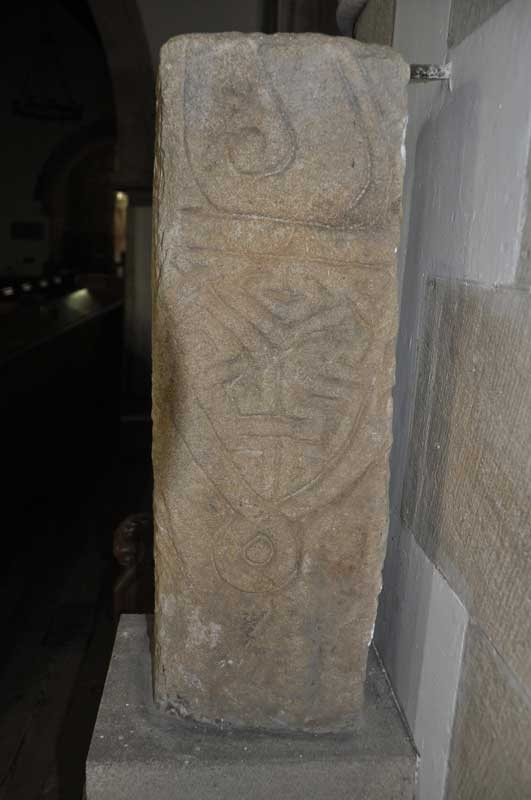
St Andrew's Church (Bywell) submitted by Anne T on 30th Sep 2014. Close up of the second decorated side of the larger fragment, which is the lower part of a cross shaft (Corpus of Anglo-Saxon Stone Sculpture reference: Bywell 01). This face shows the remains of a ring knot and shield shaped pendant.
(View photo, vote or add a comment)
Log Text: Bywell Anglo Saxon Cross (St. Andrew's Church): This is a very pretty spot, nestled in a bend of the River Tyne, surrounded by neatly kept estate lands. The two neighbouring churches on this site are less than 2 miles from my house, but although I've been here on more than one occasion, can't say I've noticed the Anglo Saxon cross in St. Andrew's.
The grid reference on the Anglo-Saxon Corpus Stone Sculpture web site indicated that the cross shaft was located at St. Peter's rather than in St. Andrew’s, the Churches Conservation Trust church, but instinct told me otherwise. However, I went to check anyway. This is the first time I’ve been able to get into the St. Peter's during the day to look around (outside carol services). I was investigating when I heard the west door rattle, which gave me the creeps. There was another gentleman who was walking from Ovingham and wanted to come and look, so we exchanged a few courtesies as we walked around.
What I hadn’t realised was that there were some interesting grave covers with crosses built into the porch of the church.
I couldn’t find the cross shaft, so set off to St. Andrew’s where I saw the stone as soon as I walked through the door.
St Andrews, Bywell Grid reference: NZ 04837 61485
The prettiness of the church, with its unique Saxon tower, never fails to hit me every time I come here. I always remember a good friend's reaction to this when we stopped off here on the way to our presentation at Aykley Heads ("makes me want to get my walking boots on").
The cross shaft is located to the north side of chancel, between the choir stalls and the altar.
St Andrew's Church (Bywell)
Trip No.150 Entry No.2 Date Added: 27th Sep 2019
Site Type: Ancient Cross
Country: England (Northumberland)
Visited: Yes on 10th Sep 2019. My rating: Condition 3 Ambience 4 Access 4

St Andrew's Church (Bywell) submitted by Anne T on 30th Sep 2014. Close up of the second decorated side of the larger fragment, which is the lower part of a cross shaft (Corpus of Anglo-Saxon Stone Sculpture reference: Bywell 01). This face shows the remains of a ring knot and shield shaped pendant.
(View photo, vote or add a comment)
Log Text: St Andrew's Church, Bywell: Living only a few miles from here and having visited, and taken friends there, many times over the years, it seemed remiss not to go down and photograph the wonderful collection of medieval cross slabs built into the fabric of this ancient church. Armed with Peter Ryder's "Medieval Cross Slab Grave Covers in Northumberland, 1: South West Northumberland" from Archaeologia Aeliana, Series 5, XXVIII, we were able to find all the slabs on his list - 27 in total. Brilliant! Really enjoyed this visit.
St Andrew's Church (Corbridge)
Date Added: 26th Sep 2019
Site Type: Ancient Cross
Country: England (Northumberland)
Visited: Yes on 16th Mar 2014. My rating: Condition 3 Ambience 4 Access 5
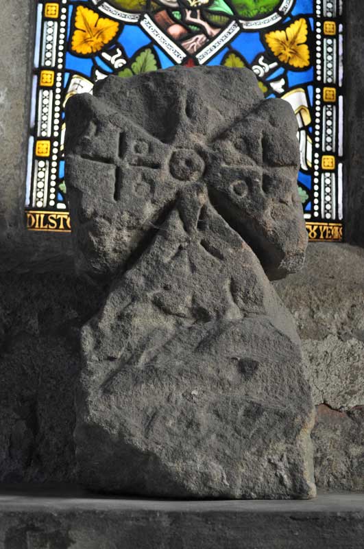
St Andrew's Church (Corbridge) submitted by Anne T on 7th Oct 2014. The eleventh century finial, though to be from the gable end of the original church. Currently located in the South Transept
(ASCorpus ref: Corbridge 05).
(View photo, vote or add a comment)
Log Text: St Andrew's Church, Corbridge: My first proper visit to this church to find, and photograph, the Anglo Saxon cross fragments and grave markers in the south transept. What a beautiful church.
St Andrew's Church (Corbridge)
Date Added: 26th Sep 2019
Site Type: Ancient Cross
Country: England (Northumberland)
Visited: Yes on 14th Sep 2019. My rating: Condition 3 Ambience 4 Access 5

St Andrew's Church (Corbridge) submitted by Anne T on 7th Oct 2014. The eleventh century finial, though to be from the gable end of the original church. Currently located in the South Transept
(ASCorpus ref: Corbridge 05).
(View photo, vote or add a comment)
Log Text: St. Andrew's Church, Corbridge: We returned to this beautiful church, right in the heart of Corbridge, with Peter Ryder's list of medieval grave slabs. Not to be confused with St. Andrew's, Bywell, about 6 miles away.
Always a draw for visitors, this is a peaceful and thought provoking church. As we started on our list of slabs, working out way down the list from 1-21, the Canon came in with a couple of choristers and started practicing for a service, so parts of the church were 'out of bounds' to avoid disturbing them. We returned briefly on Sunday, 22nd September, mid-afternoon, to photograph the couple of slabs remaining. We were unable to find slab 21, but later realised we were looking in the wrong place, so will return to complete the list.
St Andrew's Church (Forteviot)
Trip No.84 Entry No.3 Date Added: 25th Jul 2018
Site Type: Class III Pictish Cross Slab
Country: Scotland (Perth and Kinross)
Visited: Visited (still working on) on 14th Jul 2018. My rating: Ambience 3 Access 5
Log Text: St. Andrew's, Forteviot: We drove up to this church to find a lovely local lady garden by the gate into the churchyard. She told us the church would be locked, "but it'll be open on 29th (July)." We explained we were only here for the day, so this was too late. She told us about the recently erected modern cross, just down the road from the church, next to the bus stop. We thanked her kindly and walked down to take a look.
St Andrew's Church (Heddon on the Wall)
Trip No.99 Entry No.1 Date Added: 23rd Sep 2018
Site Type: Ancient Cross
Country: England (Northumberland)
Visited: Yes on 19th Sep 2018. My rating: Condition 3 Ambience 5 Access 4
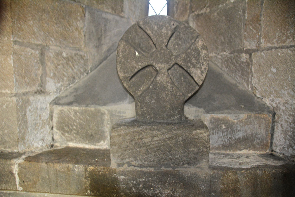
St Andrew's Church (Heddon on the Wall) submitted by Anne T on 23rd Sep 2018. The Saxo-Norman cross finial (or possibly a grave marker), cemented to the north window sill in the sanctuary of this old church. Found underneath the vestry floor during renovations, this is dated to the eleventh century. See AS Corpus Heddon-on-the-Wall entry for more information.
(View photo, vote or add a comment)
Log Text: St Andrew's Church, Heddon on the Wall: The church is no longer open every day, but we were asked to go along to Holy Communion at 10.30am on a Thursday and stay and enjoy the church afterwards. A very kind lady called Ann showed us round (I think she mentioned her husband was the historian), and I got proper photographs of the Anglo Saxon Cross Head in the Sanctuary this time (last time I visited I wasn’t aware this was an old piece, just thought it was an architectural fragment).
There are a number of other really interesting fragments on the west window sill of the meeting room. I really love the way the arches between the nave and chancel and chancel and sanctuary have settled over the years. Wonderful place! Would have loved to have wandered around this church on my own.
St Andrew's Church (Presteigne)
Trip No.168 Entry No.6 Date Added: 8th Aug 2021
Site Type: Ancient Cross
Country: Wales (Powys)
Visited: Yes on 14th Jul 2021. My rating: Condition 3 Ambience 4 Access 4
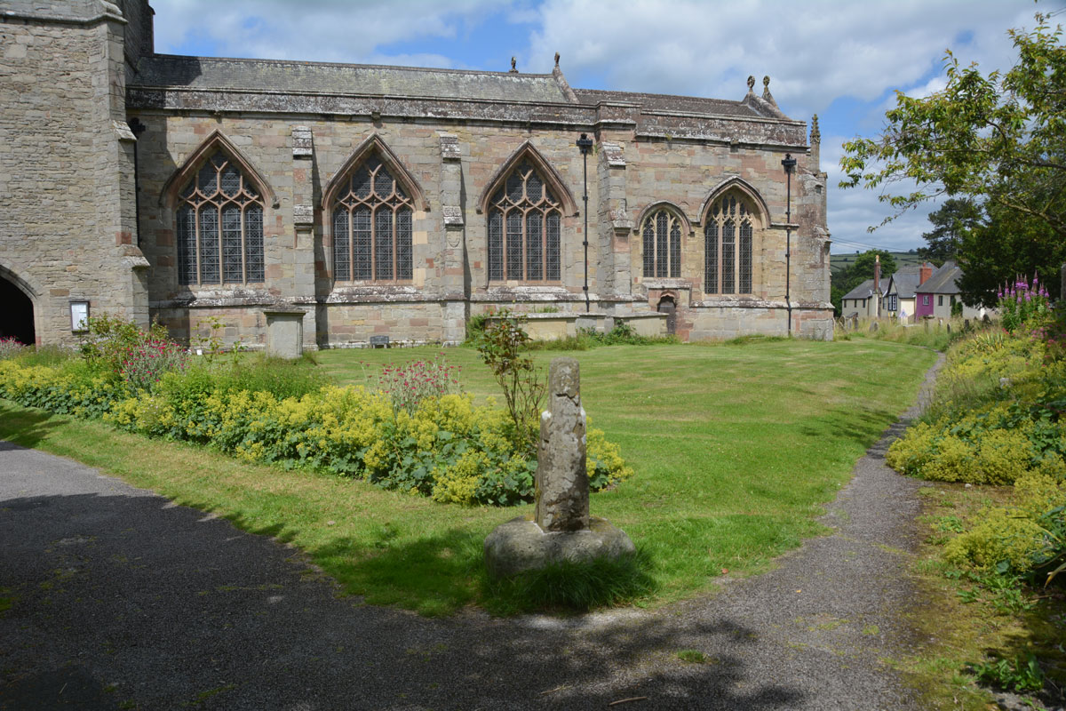
St Andrew's Church (Presteigne) submitted by Anne T on 8th Aug 2021. First view of the churchyard cross, which can be found just inside the south-eastern entrance of the churchyard.
(View photo, vote or add a comment)
Log Text: St Andrew's Churchyard Cross, Presteigne: From the Kinnerton Standing Stone, we drove into New Radnor to try and get some lunch, only to find all the shops, pubs and cafe all shut down, which meant driving onto Presteigne. Andrew was keen to see the c1510 AD Flemish tapestry in the church, but as we walked into the churchyard, found this cross, too.
St Andrew's Cross (South Tawton)
Trip No.132 Entry No.5 Date Added: 7th Jun 2019
Site Type: Ancient Cross
Country: England (Devon)
Visited: Yes on 13th May 2019. My rating: Condition 3 Ambience 3 Access 4
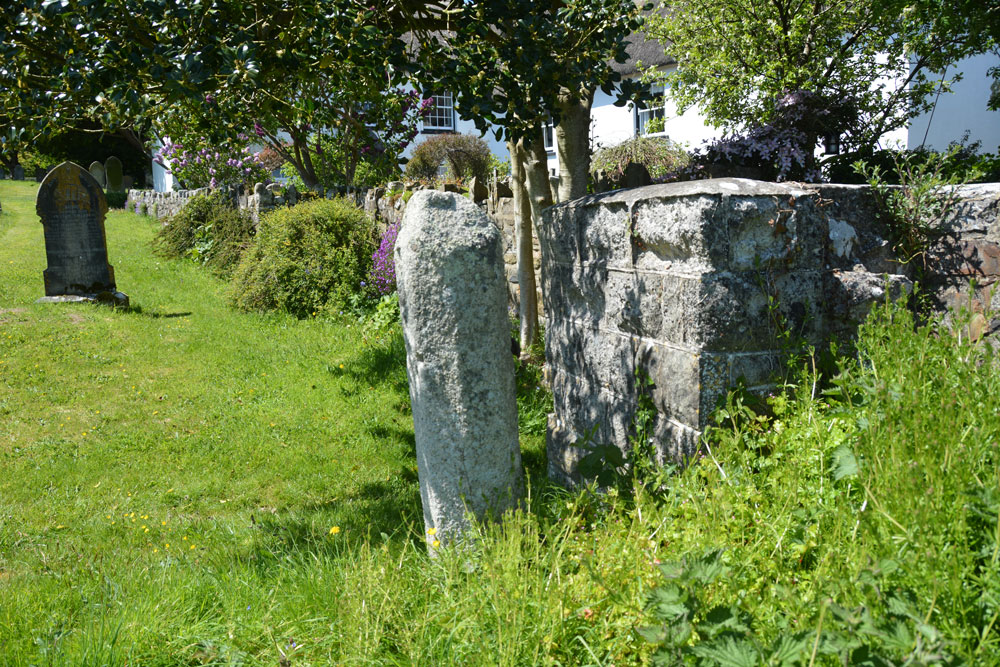
St Andrew's Cross (South Tawton) submitted by Anne T on 6th Jun 2019. The alleged cross shaft, as seen just from its eastern side. Located just inside the gate at the northern side of the churchyard.
(View photo, vote or add a comment)
Log Text: Alleged wayside cross shaft, St Andrew's Church, South Tawton: This ‘cross shaft’ (gate post?) can be found at the gate at the end of the path running north from the west end of the church. Whilst it has more recently been identified as a gatepost, it look remarkably like a couple of other cross shafts we’ve seen in the area.
Of more interest was the granite grave cover, located right in the middle of the lych gate. According to the church guide, this is dated to the medieval period and was set in the north jamb of the north doorway in 1903.
St Andrew's Well (Kirkandrews-on-Eden)
Trip No.40 Entry No.6 Date Added: 22nd Aug 2017
Site Type: Holy Well or Sacred Spring
Country: England (Cumbria)
Visited: Yes on 20th Aug 2017. My rating: Condition 3 Ambience 4 Access 4
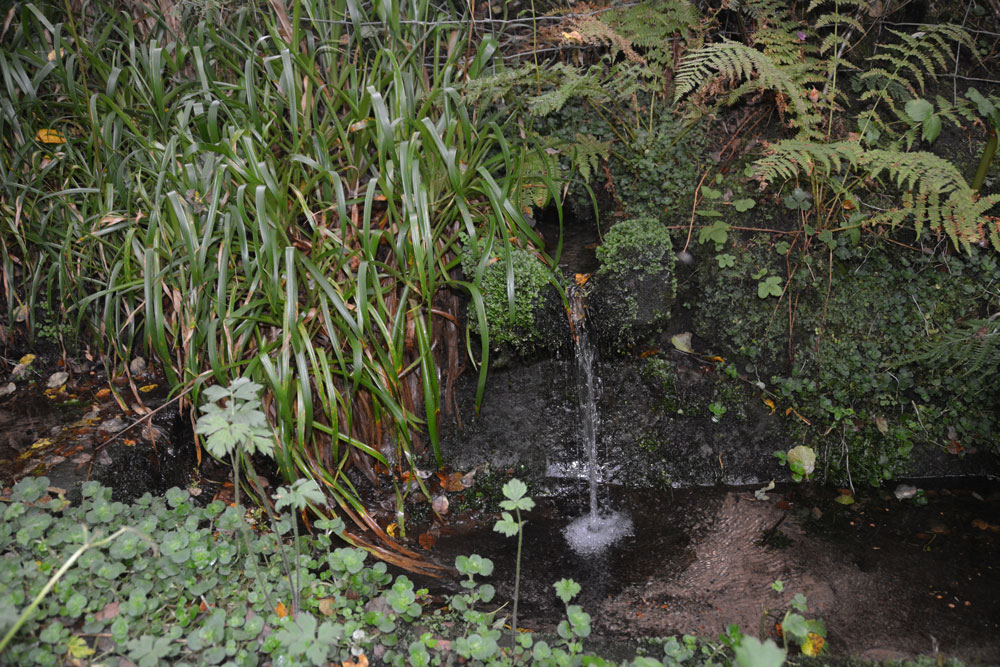
St Andrew's Well (Kirkandrews-on-Eden) submitted by Anne T on 22nd Aug 2017. Standing looking at the bank where the spring emerged, with the well pool - a rectangular stone (or brick?) basin - below. There was a steady flow of water, which could be heard from quite a way away.
(View photo, vote or add a comment)
Log Text: St Andrew's Well, Kirkandrews-on-Eden: From Stapleton, we headed to junction 44 of the M6 and stopped for refreshments at Houghton Park Garden Centre, then set off via the A689 (western part of the bypass round Carlisle, turning right at the roundabout where the A689 joins Burgh Road. Kirkandrews is almost 2.5 km to the north west of this point.
In the middle of Kirkandrews-on-Eden the road splits. The left hand fork goes directly to Monkhill, the right hand fork to Beaumont. The old churchyard is somewhat hidden behind bushes, but is approx. 120 metres from the fork in the road. We parked at the wide farm entrance a little further up the road and walked back to the footpath sign.
We followed the footpath for about 50 metres (the old grave stones peer out of the very high grass to your right hand side. As the path starts to descend, we could hear a steady trickle of water and found the well hidden behind weeds that were as tall as I was. Gently moving these aside, so we have a clear view (we thought the weeds might be poisonous) I took photographs. My husband announced this was a very spooky spot (overgrown trees next to a decidedly no longer used grave yard) although I found it strangely tranquil.
There was a channel running down the hillside taking rainwater down to the well pool. The main water came out of the bank to the side at a 90 degree angle to the sandstone basin, then trickled down into a second channel running down the hill.
The basin was much silted up with sandy soil but the flow was strong and clear. Although Pastscape says the well pool is 1.0 metre square, I thought it was rectangular, measuring 1.5 m long b about 80cm wide.
Don’t know what happened to the church, but then just discovered the small mention below – closed in the 1750s with no visible evidence remaining.
St Andrew's Well (Ovington)
Trip No.163 Entry No.1 Date Added: 11th Jun 2021
Site Type: Holy Well or Sacred Spring
Country: England (Northumberland)
Visited: Yes on 8th Jun 2021. My rating: Condition 2 Ambience 2 Access 4
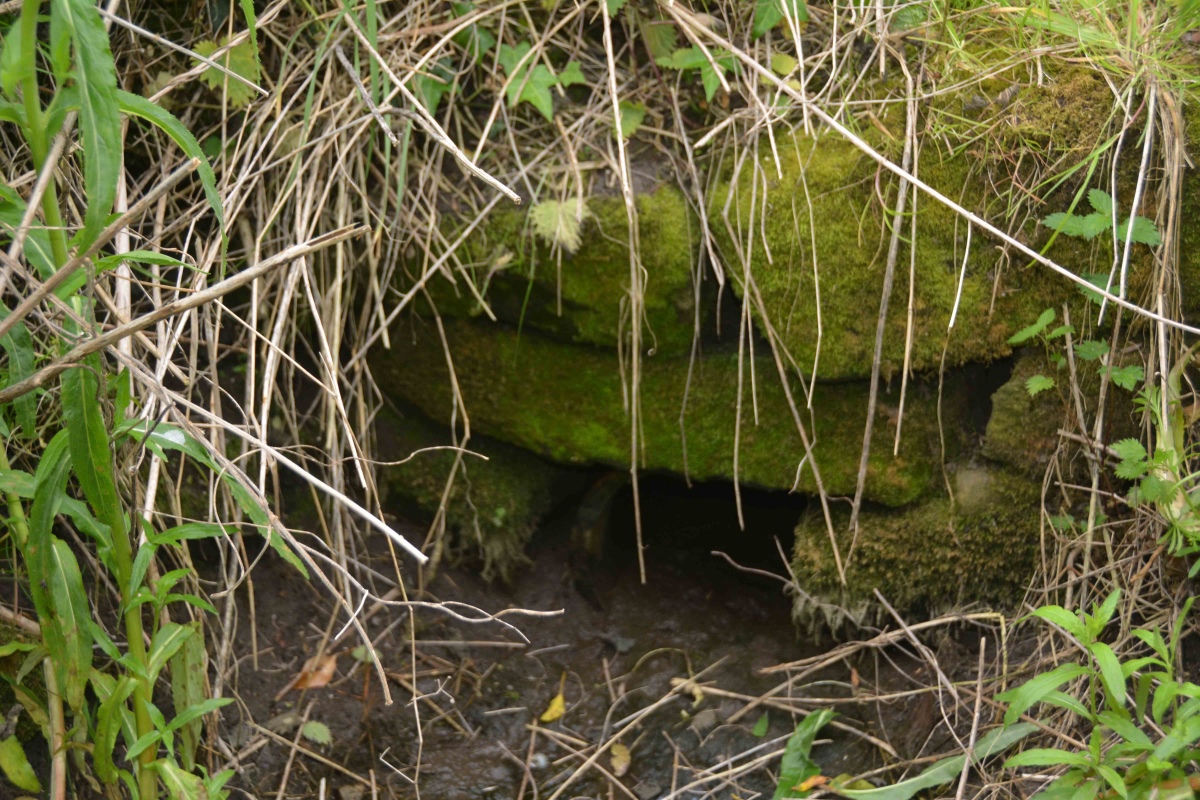
St Andrew's Well (Ovington) submitted by Anne T on 11th Jun 2021. Stepping carefully round the hole for the well, with feet either side of what would have been the water channel flowing from the well, the remain of a stone structure can be seen.
After a period of rain, water flows into a small channel which leads south. The ground was still muddy and boggy at the time of our visit, after a prolonged dry period.
(View photo, vote or add a comment)
Log Text: St Andrew's Well, Ovington: Parking in Ovington village by the old red phone box (now the Village Information Centre), it was a very pleasant walk along St Andrew's Lane to find this well, now no longer shown on the OS maps, but still very much there.
We carried on towards Whittle Dene, another glorious location, to find Dean Head Well and Eddybroth Well.
St Andrew's Well (Wells)
Trip No.136 Entry No.3 Date Added: 12th Jun 2019
Site Type: Holy Well or Sacred Spring
Country: England (Somerset)
Visited: Saw from a distance on 17th May 2019. My rating: Condition 4 Ambience 4 Access 4
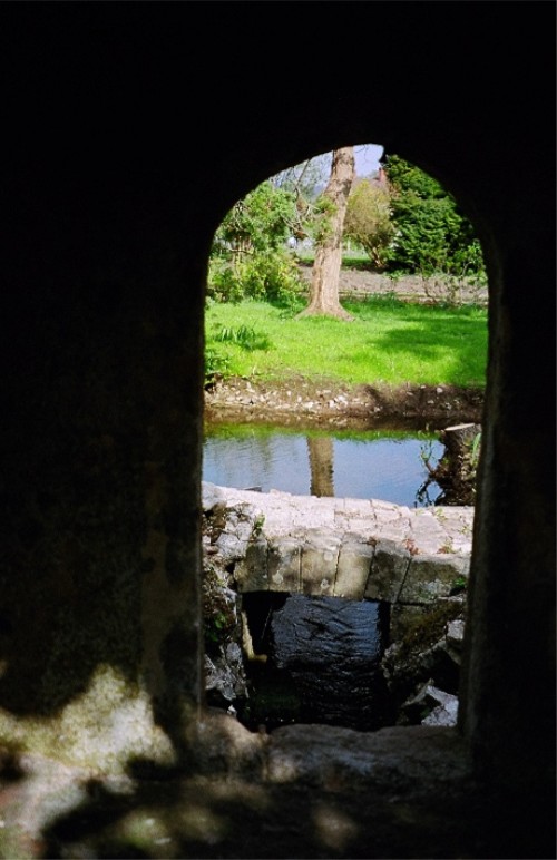
St Andrew's Well (Wells) submitted by KiwiBetsy on 21st Nov 2004. A peep hole gives a view of St Andrew's Well.
(View photo, vote or add a comment)
Log Text: St Andrew's Well, Wells Cathedral: After having had an abortive trip trying to find the sculptured Anglo Saxon stones (now shut up in boxes and cages on the triforium, only accessible by cathedral staff) I only photographed this through the hole in the garden wall separating the cathedral from the Bishop’s Palace. We didn’t have time to go to the Palace as we needed to beat the traffic and get to Deerhurst or Bradford on Avon before the churches shut for the evening.
St Anne's Well (Cotehill)
Trip No.146 Entry No.3 Date Added: 28th Aug 2019
Site Type: Holy Well or Sacred Spring
Country: England (Cumbria)
Visited: Yes on 27th Aug 2019. My rating: Condition 3 Ambience 3 Access 4
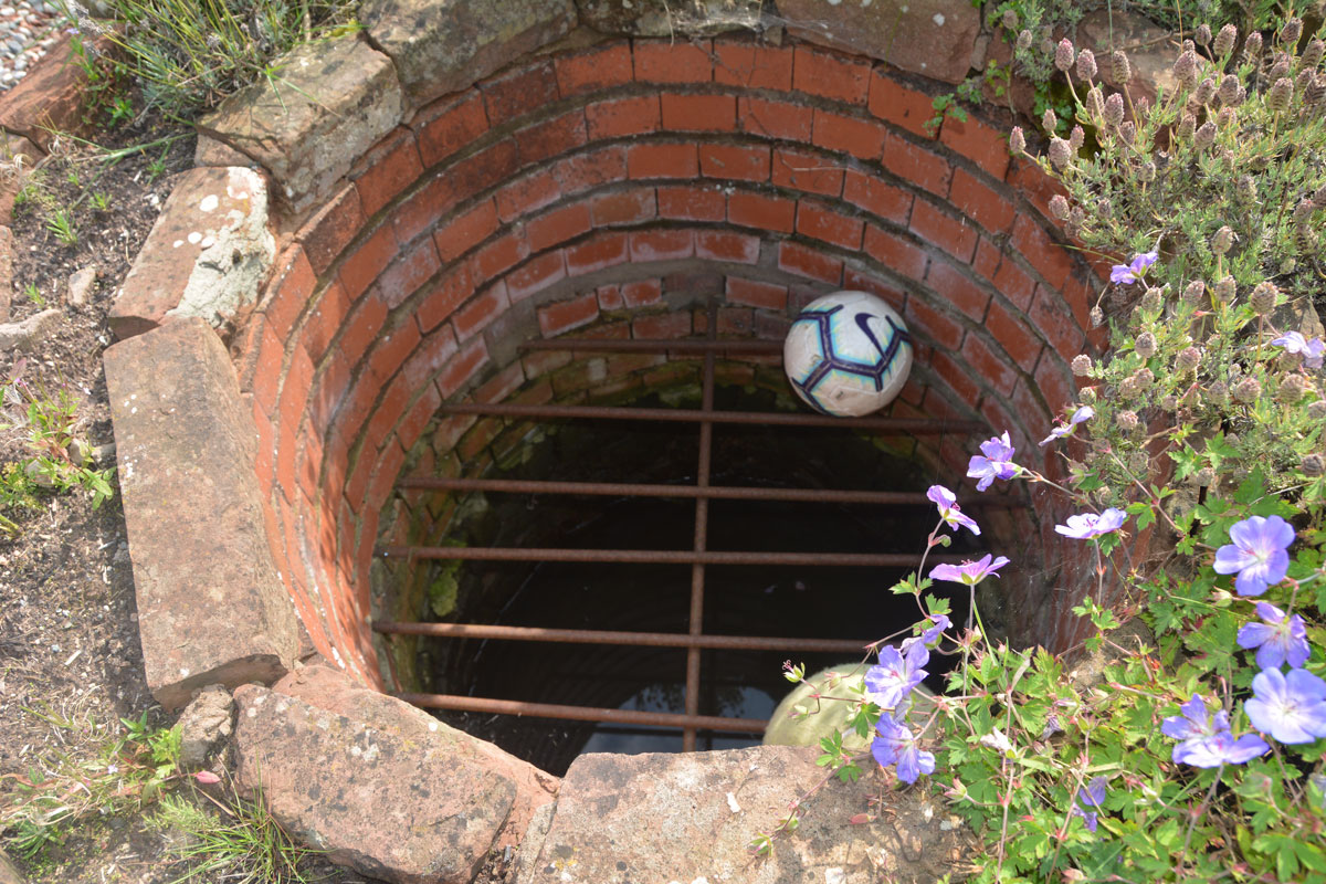
St Anne's Well (Cotehill) submitted by Anne T on 28th Aug 2019. Taking a closer look, there is a proper, brick-lined well, topped with a substantial metal grille.
(View photo, vote or add a comment)
Log Text: St Anne's Well, Cotehill: We squeezed on the odd little road junction that led to a small, new housing development, under the footpath sign.
We followed the footpath sign, which led straight through someone’s garden. We got a bit lost at this point, as several tracks through the grass had been mown flatter than others. Andrew followed two of them but could not see the well structure at all. As we were standing looking more closely at the map, the lady of the house and her children came out. I asked her if she knew where St. Anne’s Well was, and she said she had never heard of it.
Looking more closely, Andrew said the circle for the well was on the edge of the courtyard enclosed by the houses, before the footpath went through the garden of the house, so we retraced our steps a few metres.
There, in the house to our right hand side (facing the footpath and the meadows/open farmland beyond), was a circular brick flower bed. Andrew pronounced “that’s it”. I said ‘surely not’.
The structure was about 10m on private property within the garden, and I was to go up and knock on the door of the house and ask for permission to take photographs, but there no signs of life. “Who can run quickest?” I asked Andrew jokingly, and took a few steps into the garden, feeling very guilty.
There, inside the circular brick structure was a heavy iron grate, with a pool of water inside. This was definitely a well. I took three photographs very quickly, retreating back to the courtyard.
No mention in Pastscape or Historic England, although the well is shown as a blue circle on the HE map.
St Anne's Well (Shap)
Date Added: 6th Sep 2022
Site Type: Holy Well or Sacred Spring
Country: England (Cumbria)
Visited: Yes on 12th Jun 2020. My rating: Condition 4 Ambience 4 Access 4
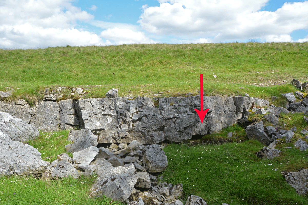
St Anne's Well (Shap) submitted by Anne T on 6th Sep 2022. The water from this well emerges from a small, easily spotted area of limestone pavement, immediately to the east of the small forested area.
(View photo, vote or add a comment)
Log Text: St Anne's Well, Shap: Stopped off for a break on one of very rare essential car journeys during lockdown, when exercise restrictions had been relaxed slightly. A lovely spot, although difficult to park as the long, thin, layby next to the motorway maintenance compound was full with cars of other walkers and dog walkers.
Heading east to walk around the forested areas, the noise of the motorway disappeared, and it was easy to spot the small area of limestone pavement this well is located in.
A very peaceful and lovely spot, although a fair way from any habitation in this era.
St Anthony's Well (Edinburgh)
Trip No.11 Entry No.5 Date Added: 26th Feb 2017
Site Type: Holy Well or Sacred Spring
Country: Scotland (Midlothian)
Visited: Yes on 20th Feb 2017. My rating: Condition 3 Ambience 3 Access 4
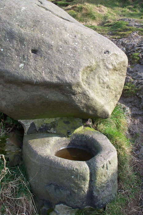
St. Anthony's Well (Edinburgh) submitted by feorag on 11th Aug 2006. St. Anthony's Well, Holyrood Park, Edinburgh. Photographed 16th March 2003.
(View photo, vote or add a comment)
Log Text: St Anthony's Well, Holyrood, Edinburgh: Located some 400 metres east south east from St. Margaret’s Well, the paths lead up the hill away from Arthur’s Seat, up to St. Anthony’s Chapel. Where the paths going up the hill divide (the left hand fork leading to the cave and chapel, the right continuing up the hill), there appears to be a large boulder about 100 yards up the right hand path. This is actually the well. From the base of the boulder a lead pipe protrudes into a stone basin. There was no water flowing. Again heavily graffitied and littered; the friend I was with described it as a 'Neolithic toilet'!
St Bartholomew (Sproxton)
Trip No.121 Entry No.3 Date Added: 19th Mar 2019
Site Type: Ancient Cross
Country: England (Leicestershire and Rutland)
Visited: Yes on 17th Mar 2019. My rating: Condition 3 Ambience 4 Access 4

St Bartholomew (Sproxton) submitted by Anne T on 19th Mar 2019. Anglo Scandinavian Cross in Leicestershire and Rutland England. This is some of the detailed work on the northern, narrow, face of the cross.
(View photo, vote or add a comment)
Log Text: Sproxton Cross, St Bartholomew's Church: This church was a little way out of the village and we parked in a small metalled area next to a 'gallop' at SK 85667 24972 and braved the wind to walk back down the road to the gate into the churchyard.
The vicar had previously told us the cross had been moved inside the church, but looking after 11 churches in total, he must have been confused, because as soon as we rounded the west end of the church to reach the entrance through the south porch, the cross came into sight. What is inside the church is an 11th century cross slab/grave marker.
This is a very quiet spot, apart from the occasional car that came hurtling past.
The inside of the church appears relatively modern, but has some really interesting corbels. We also found a portion of carving, either part of a fluted column, or cemented to it, next to the north western side of the door into the tower.
We did have a good scout around for the shaped stone in the south western wall mentioned by The Journal of Antiquities, but were unable to find it.
In the field to the south of the church is a well, but could find no mention of this on Pastscape or Historic England.
St Bartholomew's Church (Newbiggin by the Sea)
Trip No.97 Entry No.2 Date Added: 30th Sep 2018
Site Type: Ancient Cross
Country: England (Northumberland)
Visited: Yes

St Bartholomew's Church (Newbiggin by the Sea) submitted by Anne T on 26th Sep 2018. This unusual fragment is built into the southern end of the east wall, near the altar (inside). It has been interpreted as "a net with entangled fishes" (the fishes head can just be seen towards the top of the stone). This fragment is dated to the 12th century and is said to have been part of a column capital.
(View photo, vote or add a comment)
Log Text: Ancient cross slabs, Newbiggin by the Sea: The website for St. Bartholomew’s announces that the church “has one of the most important collections of coffin lids and grave markers in the county, mostly re-set during the 1913 restoration, when the north aisle, demolished in antiquity, was reinstated. Other fragments are distributed around the church and in the South porch. There are around 20 pieces in all. Most of the slabs are of late twelfth or thirteenth century date; several show signs of post medieval re-use.”
I have included my photographs and notes here, as I think these grave markers are more spectacular than those in Kilmartin churchyard – their designs are less worn and Peter Ryder, archaeologist for the church, has written about them in his assessment of the church, dated January 2013.
On the day of our visit, the mid afternoon sun was streaming through the windows on the northern side of the church, which made photographing some of the fragments a little tricky (my photographic skills weren’t quite up to it!) and the stream of visitors into the church made me feel rude by continually using the flash.
Some of the cross slabs are in the vestry and some in the tower, but it was not possible to see these. Another three have been used as paving slabs on the external west wall of the tower, but I didn’t spot these, as they seem to be worn.
From the small guide book “The Church of St. Bartholomew”, centre right page:
The two (cross slabs) above the altar at the east end are outstanding with their richly carved borders, delicate florets and symbolic shears and keys. An engraving of one was published as long ago as 1854, shortly after their discovery, when they were recognised as being of national importance.
St Bartholomew's Church (Whittingham)
Trip No.100 Entry No.1 Date Added: 24th Sep 2018
Site Type: Ancient Cross
Country: England (Northumberland)
Visited: Yes on 23rd Sep 2018. My rating: Condition 3 Ambience 4 Access 4
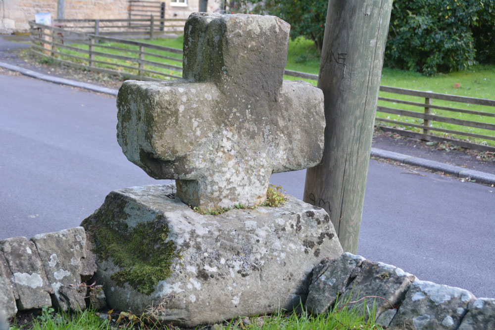
St Bartholomew's Church (Whittingham) submitted by Anne T on 24th Sep 2018. Looking south east across the cross head and base, showing its slightly damaged/chipped lower arm (towards the centre, left of the photo). Historic England simply says the cross is 'medieval'.
(View photo, vote or add a comment)
Log Text: Ancient Cross, St Bartholomew's Church, Whittingham: [please note: there are steps up to the churchyard and church; there may be wheelchair access which we didn't spot on the day - please check before visiting]. This cross was remarkably easy to spot, as it was sited on the corner of the wall to the south east of the churchyard, right by a parking spot for one car at the base of the steps into the churchyard.
There was an informative church guide, although the language was slightly archaic and we had to re-read several of the passages to ensure we were interpreting these correctly.
The guide reads: “Whittingham [spoken as “Whitingjum”, or “Witnjum”] is a name which has evolved from the Anglo Saxon Hwita-ing-ham, meaning “the home of Hwita’s people”. The present church stands on rising ground which could have been the meeting place of Hwita’s people for their Moots before it became the site of a church.
Our visit was interrupted by two people coming in to prepare for the 4pm service. As they were praying at the altar, it seemed disrespectful to continue taking photographs.
The church guide is very useful in explaining all the features, and I’ve emailed one of the church wardens to see if it’s possible to get hold of a copy of the detailed guide mentioned both in the church and on one of the websites I’ve visited (the Northern Vicar’s blog).
There is still Saxon work to be seen in the tower, with its semi-circular arch and squared, heavy side, dated to 900AD by the ‘long and short’ stone work (as we saw at Heddon on 20th Sept, last week).
There is also a section of Saxon stonework in the north aisle wall, forming what would have been a half-arch which was later filled in, and it thought to be the entrance to a small side chapel in the original church.
The guide goes onto say: “Almost certainly there had been another earlier church built on this site, but its possible form can only be conjectured (see the detailed guide). There is a record of a consecration at 735AD. It is also likely there was a yet earlier church existing at the time of the Synod of 684AD.
The guide also mentions, as one of the ‘curios’ a stone on the aisle walling to the left of the porch, at the wall’s left hand corner. Just to the right of the top of the buttress is a stone bearing two arrows (Norman chevrons). “This could be an inserted fragment from some demolished structure [or are these natural fault lines in the stone?].
We popped across the road to see the still working water fountain, although this is too recent a feature to log on the Portal.
