Contributory members are able to log private notes and comments about each site
Sites Anne T has logged. View this log as a table or view the most recent logs from everyone
Howden Hill Cist
Trip No.125 Entry No.4 Date Added: 25th Apr 2019
Site Type: Cist
Country: England (Northumberland)
Visited: Yes on 20th Apr 2019. My rating: Condition 3 Ambience 4 Access 3
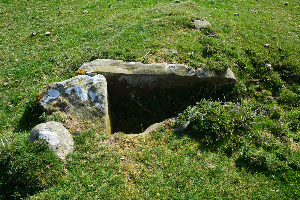
Howden Hill Cists submitted by Anne T on 25th Apr 2019. The possible stone lined cist at NY 83104 69692.
(View photo, vote or add a comment)
Log Text: Possible stone lined cist and stone setting on Howden Hill: Getting to the sheepfold near the two cairns and the rock art panels was a little challenging, as we had to cross electric fences, cross a number of field drains, boggy areas, and avoid the deep tufts and holes in some parts of the access land.
Thank goodness for the GPS. We headed for the centre of the southern side of the prominent sheepfold at NY 83080 69696, before min on trying to find the rock art panels to the east of the sheepfold.
Surprisingly, we found ourselves looking around in awe, as we found ourselves in the middle of what looked like a stone setting with a possible small standing stone and small lumps and bumps on the ground with stones protruding, which could be other cairns.
Walking towards the rock art panels, I stumbled across what I thought were two cairns and called Andrew and Jennifer back to take a look. We later found out at home that one of the cists (stone-lined trough) is only mentioned on the HE and ERA-1414 entries.
Just to the SW of the cists was a small standing stone at NY 83082 69685, which might be marking part of another cist/dolmen?
Homers Lane (Warden)
Trip No.126 Entry No.2 Date Added: 1st May 2019
Site Type: Rock Art
Country: England (Northumberland)
Visited: Couldn't find on 1st May 2019. My rating: Ambience 2 Access 4

Homers Lane (Warden) submitted by Anne T on 1st May 2019. But which boulder is it?? Looking over the dry stone wall, we were within 8-9m of the previously recorded location of the rock art panel. All the large boulders from around the tree to the top right hand side of the photo, which is where the panel had previousy been located, appeared to have rolled down the hill. We spent ages peering over the wall trying to spot any possible boulders the same size and shape as the panel, or any boulders with possible cups but drew a blank. Disappointing.
(View photo, vote or add a comment)
Log Text: Homers Lane, Warden, Rock Art Panel: Having visited Warden Hill Hillfort, we decided to drive the 1.15km to try and find this rock art panel, as it was so close. Driving north up the almost single track lane we managed to park next to the gate into the field with the rock art panel in, at NY 91110 68391, and walked back south the 50m or so towards the grid reference where the panel was located.
I'd gone armed with the ERA information and their photographs, and the GPS took us to within 9m of the previously recorded location of the panel. We leaned over the very ivy covered dry stone wall and tried to identify the boulder, but could not see it.
The field was planted with wheat, but with a large, long pile of fertiliser combined with a wide grassy edge to the field, we thought if we trod very carefully, we could let ourselves in through the gate and walk back to the piles of boulders. This was easy enough to do, although I wish there was someone I could have asked permission from first!
Using the GPS, we got to within 3m of the recorded grid reference, but still could not find a boulder the right size and shape. With the ERA photos in hand, I identified the two trees in one of the their photos, lined them up, but there were no boulders at that location. It looked as if they had been rolled further downhill, towards the drystone wall, to make room for the huge pile of fertiliser.
Andrew very bravely balanced on the boulders, trying to locate the panel, but after a reasonably through search, had to give up. Disappointing, but the NADRAP survey photos were dated 2008 - some 11 years ago.
Warden Hill Hillfort
Trip No.126 Entry No.1 Date Added: 5th May 2019
Site Type: Hillfort
Country: England (Northumberland)
Visited: Yes on 1st May 2019. My rating: Condition 2 Ambience 4 Access 4
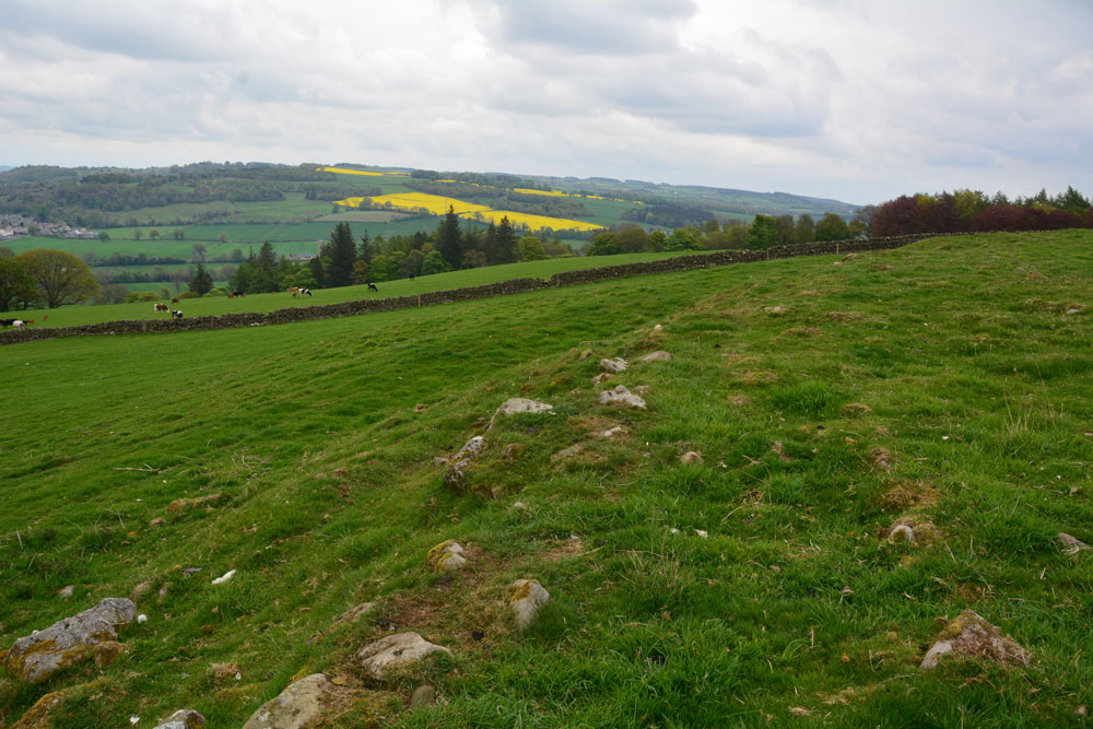
Warden Hill Hillfort submitted by Anne T on 5th May 2019. Standing almost on the north western corner of the hillfort, looking north east over the northern rampart, with the Tyne Valley in the distance.
(View photo, vote or add a comment)
Log Text: Warden Hill Hillfort: Homer’s Lane is very narrow, so we struggled to park the car. We eventually ended up bumped up on the verge at the wide entrance to a farm house at NY 91187 67190, ensuring there was plenty of room for tractors, trailers and other traffic to get past.
Walking back to the start of the footpath at NY 91217 67247, we used the kissing gate and walked up hill, turning left onto the well-marked path, zig-zagging through what is virtually a small village at High Warden (there are so many signposts and ‘private’ signs’ people must have become fed up with walkers). We ended up on a small woodland path leading northwards along the edge of a field towards the telecoms mast just below the summit of Warden Hill. By the mast, the track dog-legs slightly westwards, with the path running north up-hill through the centre of a field of pasture.
Towards the top of the hill there is a trig point, immediately to the east of the gate into the next field. Going through the gate, there is an interesting series of low banks which are medieval/post medieval in date. Walking 10-15m further onto the hill, the outer banks of the hill fort become clear.
We spent ages walking around the outside and inside of the hillfort. We’d taken the printed HE and Pastscape records with us, determined to understand all the features. We particularly looked for the Roman signal station, and identified a small, square structure where the grid reference said it should have been. From here, running eastwards, a line of stones poked up intermittently out of the grass.
There are brilliant views in most directions, although the endless noise of the A69 became a little tedious.
St George's Well (Minsteracres)
Trip No.128 Entry No.1 Date Added: 7th May 2019
Site Type: Holy Well or Sacred Spring
Country: England (Northumberland)
Visited: Yes on 6th May 2019. My rating: Condition 3 Ambience 4 Access 4
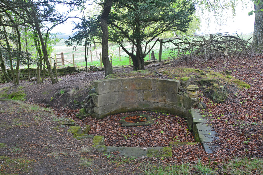
St George's Well (Minsteracres) submitted by Anne T on 7th May 2019. Getting closer, the structure of the well emerges from the surrounding tall trees. There is a semi-circular back wall, which has no exit tap or pipe; water must emerge directly from the ground into the small, circular well basin inside a larger, paved well pool.
(View photo, vote or add a comment)
Log Text: St George's Well, Minsteracres: Minsteracres had an open day today between 11am and 4pm, so we decided to drive up and see if we could find the well. I understood that it was located near to the chapel, but this was mistaken, as we found out on arrival.
Driving up the private road from the A68, we parked just past the cattle grid about 200m away from the main buildings, parked on the grass alongside the vegetable garden to our north, and walked back to The Shrubbery, a woodland with specimen and ornamental trees and two signposted walks.
With only a rough grid reference to guide us, but with the OS map in hand, it quickly became apparent that the well wasn’t in The Shrubbery, so we made our way back to the road and walked a little back towards the A68, heading north-north-east. In a small wood to our right hand side, the well became quickly apparent. I quickly recorded the waypoint on our GPS.
Whilst there was water in the pool, there was no water bubbling into the well pool. The well had a fairly large ditch running from it, so there appears to still be a fair flow of water from it at certain times.
Someone had recently been clearing away weeds and shrubs from the area. Scrapping away some of the leaves at the base of the steps into the well basin, water quickly flowed in to fill up the space where the leaves had been, although there was no evidence of flow.
The Hanging Stone (Haydon)
Trip No.128 Entry No.2 Date Added: 7th May 2019
Site Type: Standing Stone (Menhir)
Country: England (Northumberland)
Visited: Yes on 6th May 2019. My rating: Condition 3 Ambience 4 Access 4
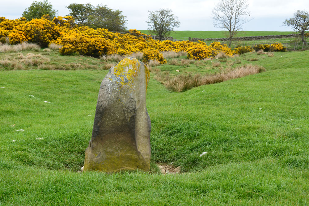
The Hanging Stone (Haydon) submitted by Anne T on 7th May 2019. Standing just behind the stone looking north east. The stone is in a slight dip in the landscape and a (water?) channel runs almost from the base of the stone to the north east, where it joins another small stream. I wondered if at some point the stone marked the location of a spring, although this is not shown on the early OS maps. From here, it looks as if the top half of the stone is 'hooked'
(View photo, vote or add a comment)
Log Text: The Hanging Stone, south of Haydon Bridge: We tried to find the Treacle Well (Traking Well) in Slaley, but despite an old footpath opposite the church being shown on the OS map, we couldn’t find our way through the houses to see it, so headed off through Hexham and off west on the B6305 to find The Hanging Stone.
This is marked on the OS map; Andrew found it on the 1860 map of the area, so it has been there a long time. There are no references to it on HE (although it is marked on their map), and only the briefest of mentions on Pastscape.
This stone wasn’t what I was expecting. I half thought that we’d see a flat stone marking the site of a gallows, not a standing stone! But it is very definitely a standing stone, and one that seems to have been here for some considerable time.
The road was very busy and the cars very fast. We did manage to bump up onto the soft verge, but for safety should have pulled up on the driveway up to the farm. The entrance to the field is at NY 88081 61695. After photographing the stone over the stone wall, I didn’t fancy trekking all the way up to the farm house in the distance, so took a chance and let myself into the field.
The stone is located in a dip, below current ground level, and has stones packed around its base. To its north east a rounded channel runs off to join a stream or modern field drain, as if the stone marked the start of a spring at some point.
Duddo Five Stones
Trip No.137 Entry No.1 Date Added: 12th Jun 2019
Site Type: Stone Circle
Country: England (Northumberland)
Visited: Yes on 29th May 2019. My rating: Condition 3 Ambience 5 Access 4
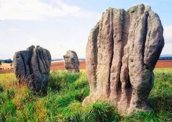
Duddo Five Stones submitted by Bladup on 31st Dec 2013. Duddo Five Stones
(View photo, vote or add a comment)
Log Text: Duddo Five Stones, Northumberland: We had three tries at reaching this stone circle, until we discovered the actual, relatively new 'permissive path'. Our first attempt was using the footpath to the north of the stones, but the footpath had been ploughed out and we had to retrace our steps. Then we used the marked footpath which ran from NT 93907 42659, through the Duddo Farm cottages onto open land full of wild flowers, to NT 93495 43489, where we could see the stones atop a small rise in the field. Andrew walked further on to see if there was a footpath from the north/north east, but nothing, so we decided to follow the tractor tracks through the wheat field, to NT 93084 43470, where we spotted a line of marked canes and a proper path through the crop to the stones – this was the last part of the permissive footpath, which we followed up to the stones.
Stan Beckensall is certainly right in saying this is a spectacular site – the views all around are amazing, and far-reaching. The stones are very attractive, with their very fluted profiles.
There is an interpretation board (put up by DEFRA, facing away from the stone circle, at NT 92968 43718.
I took my time photographing the stones from different angles, and each individual stone. I did manage to catch the four cup marks on the eastern most stone, but how ERA/NADRAF spotted these amongst the natural features, I’m not sure!
We followed the permissive footpath all the way back down to the road, to the west of the village, running from NT 93221 42619 all the way to the stones. There were a number of cars parked here (there wasn’t when we drove past the first time), together with a small sign saying ‘stone circle’ (which I’d missed) and also a sign explaining about the permissive footpath).
Alnmouth Wall Rock 32
Trip No.138 Entry No.1 Date Added: 13th Jun 2019
Site Type: Rock Art
Country: England (Northumberland)
Visited: Yes on 3rd Jun 2019. My rating: Condition 3 Ambience 3 Access 4
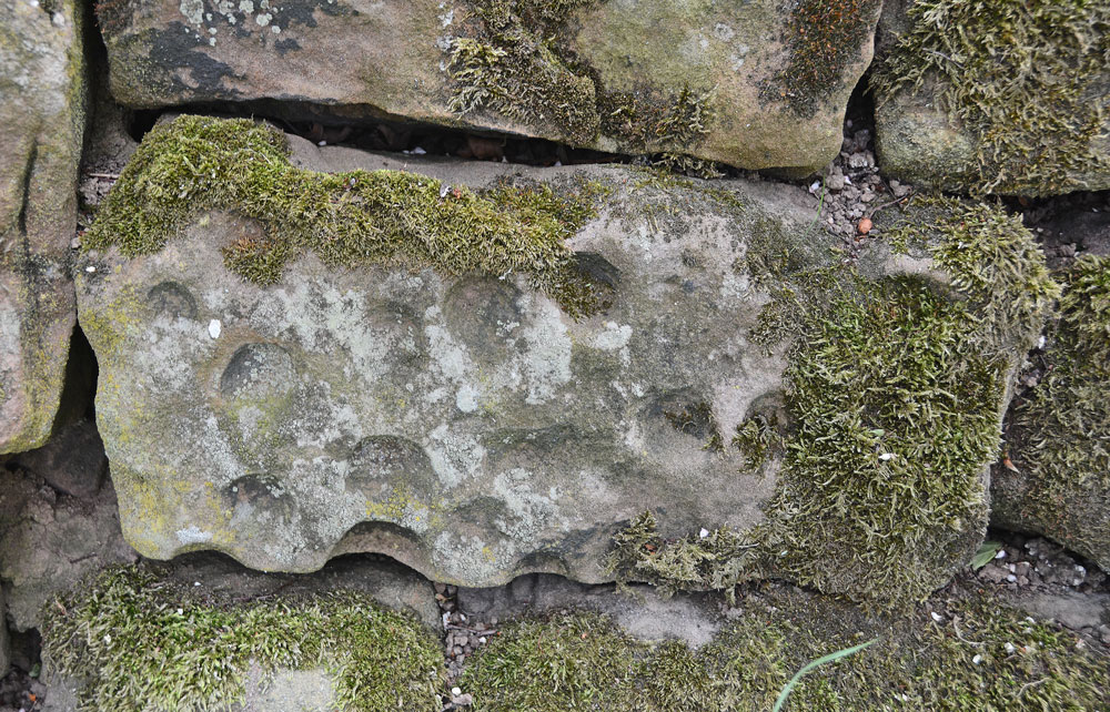
Alnmouth Wall Rock 32 submitted by Anne T on 12th Jun 2019. Close up of Alnmouth Wall Rock Panel 32.
(View photo, vote or add a comment)
Log Text: Alnmouth Wall Rock Panels, Alnmouth: A short walk up a lane towards the trig point, with some very friendly horses in the field and some lovely views over the sea and beach. The wall runs for quite a long way, with its eastern side up a slope so it was a little precarious (for those who don't like slopes!) to photograph those panels.
If you visit, there were many, many rabbit holes, so be careful when walking, especially around the trees and the base of the wall.
I have recorded these panels in the order we saw them on the day. Some of the wall was hidden by wooden fencing (a small fenced off area for farm bits and pieces) and brambles/barbed wire, Many panels at the base and top of the wall are covered by turf, so we only managed to see 11 out of 39.
I have three panels I'm trying to match up my photos with those recorded on ERA (138.7, 8 and 11). Despite having reasonably accurate grid references, it's been a bit of a challenge to match up the and will add these when I can.
Carrawburgh Roman Fort
Trip No.140 Entry No.4 Date Added: 23rd Jun 2019
Site Type: Stone Fort or Dun
Country: England (Northumberland)
Visited: Yes on 23rd Jun 2019. My rating: Condition 2 Access 4
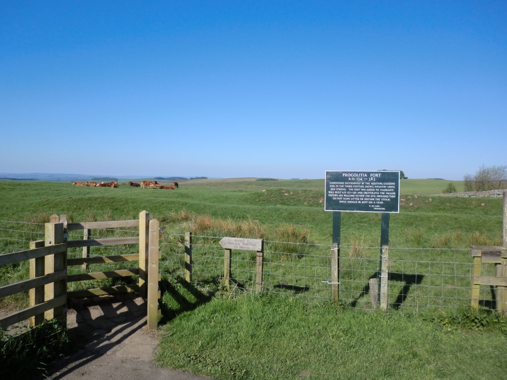
Carrawburgh Roman Fort submitted by johndhunter on 22nd Jun 2019. Signpost at the entrance to the fort taken in May 2012 – The sign post tells us that it was successively garrisoned by the Aquitani (from present day south west France), Cugerni (from present day Xanten on the Rhine) and in the third century Batavi (from the present day Dutch Rhine Delta) infantry units some 500 strong, It also tells us that it was built after the Wall on the infilled Vallum. ( The Vallum is a massive earthwork which runs to the south of the wall along its complete length, co...
(View photo, vote or add a comment)
Log Text: Carrawburgh Roman Fort/Brocolitia: When I last came here in 2014 there was a £4 charge for the car park which allowed you to also park at Housesteads and at other car parks at locations along the wall. Today, the machine has been upgraded and it is £1 for up to one hour. Other charges apply beyond that time. Having been to the Sill and paid to park there, we thought that charge covered this car park as well, but we had no receipt to leave in the car, so we paid our £1 again.
The sign at the entrance to the fort reads: “Carrawburgh (Procolitia) AD 134-383.
Garrisoned successively by the Aquitani, Cugerni and, in the third century, the Batavi; infantry units 500 strong. This was the last fort to be added to Hadrian’s Wall and obliterates the vallum. / Permissable access to the fort. No access to the trail. Please do not leave litter or disturb the cattle and sheep. Dogs to be kept on a lead. J. du Cane. Freeholder.”
The earthworks are nowhere near as impressive as the remains of Great Chesters Rman fort, further to the west, but it is a sizeable fort. We walked around the eastern, southern and western sides of the earthworks; some remains of the ramparts on the western side remains. We needed to walk back to the south eastern corner to go through the gate to the path down to the Temple of Mithras.
On our way back, Andrew went off the track to try and find a tumulus nearby. This had all but disappeared and we were unable to locate it, but we came across a spring, marked by a wooden post (as Robin Hood’s Well in Chollerton), with large stones and boulders piled up around a drinking trough. The spring is marked on the HE map of the area but no formal records of it (for photos see my separate entry below).
Aescia Roman Fort
Trip No.140 Entry No.1 Date Added: 25th Jun 2019
Site Type: Stone Fort or Dun
Country: England (Northumberland)
Visited: Yes on 23rd Jun 2019. My rating: Condition 3 Ambience 4 Access 4
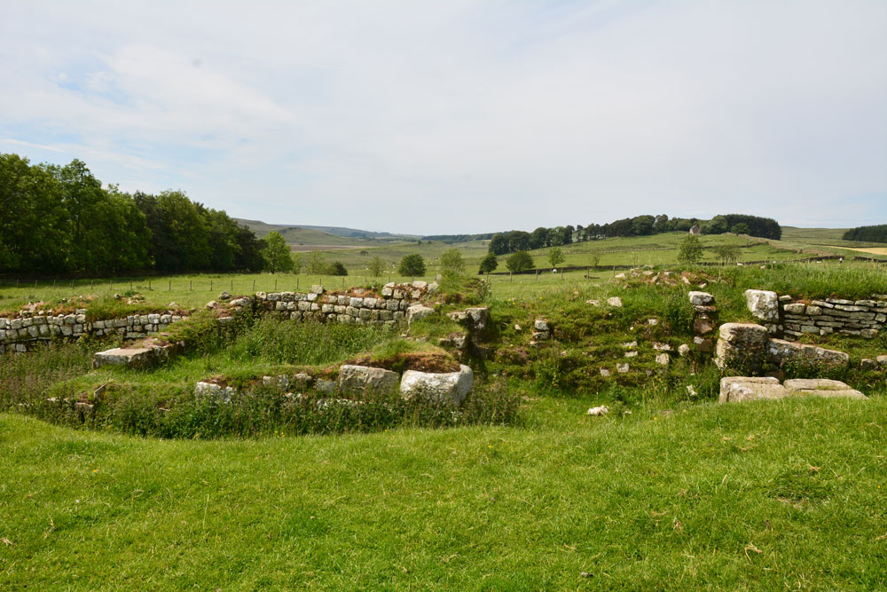
Aescia Roman Fort submitted by Anne T on 24th Jun 2019. The western gate of the fort, looking west. The most visible remains of buildings run north-south along this western edge of the fort.
(View photo, vote or add a comment)
Log Text: Aesica (Great Chesters) Roman Fort: In a repeat of our last visit in November 2016 (when we came here to see where the Roman aqueduct finished) we parked just off the small, gated road at NY 70421 66432, by the track leading up to Modern Farm and the Hadrian’s Wall Path.
Whilst I was photographing the inside of the fort, Andrew hopped over the stile at NY 70443 66807 and walked down the slope. As well as seeing a large stone with carved edging embedded in the dry stone wall, he identified the site of the bath house, previously earthed over by English Heritage to preserve it, as some stone were sticking out of the dry earth. Just down the slope was a piped spring which emerged into a modern cattle trough. Was this the spring that served the bath house?
The bath house, visible on UK Grid Finder, is centred on NY 70473 66733; the spring emerges at NY 70473 66698.
The Sill
Trip No.140 Entry No.3 Date Added: 25th Jun 2019
Site Type: Museum
Country: England (Northumberland)
Visited: Yes on 23rd Jun 2019. My rating: Condition 4 Ambience 3 Access 5

The Sill submitted by Anne T on 25th Jun 2019. The Sill building, as seen from its north eastern corner. It is located in Once Brewed, immediately next to the B6318 (Old Military Road).
(View photo, vote or add a comment)
Log Text: The Sill, Once Brewed: After visiting Great Chesters/Aesica, we popped over to the Sill for a cup of tea and a bowl of soup. It took three attempts to get our (simple) order correct, although as the Sill was popular with walkers, it meant queuing up each time to get the correct items.
I was curious to see if Tynedale North of the Wall Archaeology Group had their display about their surveys at Edges Green and Cleughfoot. We walked round the very small exhibition, which included a piece of rock art (on loan from the Great North Museum) and an inscribed Roman stone, but could see nothing from the group.
It was difficult to know if the display was aimed at adults or children; having wandered around it, most of it seemed aimed at the younger age group.
A pleasant place for a rest and refreshments, but I had expected more of a museum.
Tony's Patch 1
Trip No.141 Entry No.4 Date Added: 1st Jul 2019
Site Type: Rock Art
Country: England (Northumberland)
Visited: Yes on 30th Jun 2019. My rating: Condition 3 Ambience 3 Access 4

Tony's Patch 1 submitted by Anne T on 1st Jul 2019. The irregular 'cups' seen from further down slope, using flash to give a bit more contrast/depth. At the time of our visit, on the warmest weekend of the year (so far) the heavens opened and we got drenched. The light was so bad it was like dusk.
(View photo, vote or add a comment)
Log Text: Tony's Patch Rock Art: The information for this nature reserve said there was room to park one car by the stile into the field at NY 81961 65368, and indeed there was, but only just. As we readied ourselves to walk towards the wood, the first spots of rain started, but we decided it would only be a short shower, so thought we'd walk down anyway, and if the rain got heavy, we'd be sheltered in the wood. Ha!
From the stile we headed ENE across this field of, for the most part, knee high grass, heading towards the gate into the nature reserve. Then followed the path through the wood, finding a small turn off to our right to this stone at about NY 82262 65565. By this time, the rain was hammering down, and we had started to get soaked.
I don't think anyone had been here for some time, as the branches from the trees had grown right over the rock and I kept getting caught up in them.
We eventually found the cup marks at the bottom, right hand side of the rock, where the rock starts to become 'undercut'. We needed to push some of the bracken aside to see them.
I really don't understand how NADRAP could have classified these are having ben made by water running over the rock surface? Where are the water channels that would have worn? Or if these were solution holes, the rock must have been in a different position for these to form.
Having photographed these as best I could in the very low light levels, we headed back to the car. By this time, the grass in the field was wet, but we waded through. I don't think my walking sandals will ever be quite the same!
Joicey Shaft a
Trip No.141 Entry No.1 Date Added: 1st Jul 2019
Site Type: Rock Art
Country: England (Northumberland)
Visited: Yes on 30th Jun 2019. My rating: Condition 3 Ambience 3 Access 4
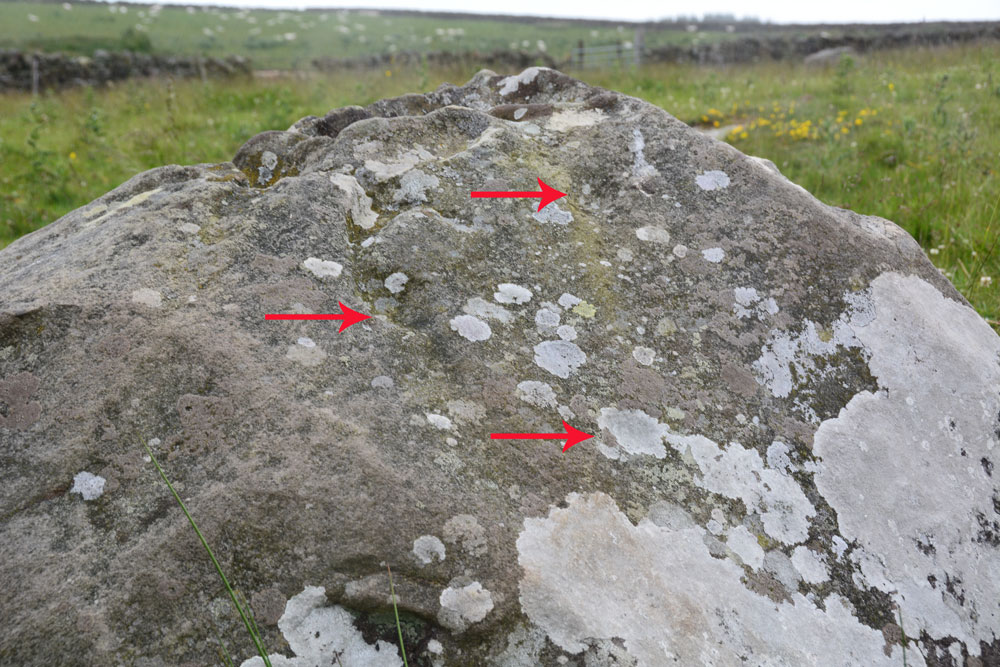
Joicey Shaft a submitted by Anne T on 1st Jul 2019. ERA/NADRAP says there are two cups here, the one to the east "fed by a natural gully from above". We thought we found three cups, marked with the red arrows, but there were so many erosion features, it was difficult to be certain.
(View photo, vote or add a comment)
Log Text: Joicey Shaft A: With the most of the rest of the UK enjoying warm sunshine, up in this part of Northumberland, the storm clouds had gathered. Having checked the weather forecast to make sure rain wasn't due to arrive until this evening, we set off to find these rock art panels, within easy reach of a road. This road was marked on the old OS map as a bridle path, but on the modern OS map it is now a metalled, yellow road, indicating it can be driven down.
OK, the road isn't the best, being potholed in parts, but the stone can be found just through a gate across the road at NY 82906 66462. Both boulders are on the northern side of the road, about 40m apart.
Being here was really wierd, as holes had been drilled in the northern-most gatepost, and as the wind howled through them, it played a tune, the 'melody' varying between different notes dependant upon the width of the hole.
I managed to photograph panel A before the rain started to come down, then we had to sit in the car for 10 minutes or so before there was a break in the clouds.
In walking back from panel B, I spotted through the gate on the south side of the road, a lump which looked like a cairn. I almost dismissed it as a farmer's manure dump, but realised the tractor track respected its western side (albeit cutting it a little). Andrew has just pointed out it is shown on the 1860 OS map.
Hadrian's Wall (Brunton Turret)
Trip No.142 Entry No.1 Date Added: 7th Jul 2019
Site Type: Misc. Earthwork
Country: England (Northumberland)
Visited: Yes on 4th Jul 2019. My rating: Condition 3 Ambience 4 Access 4
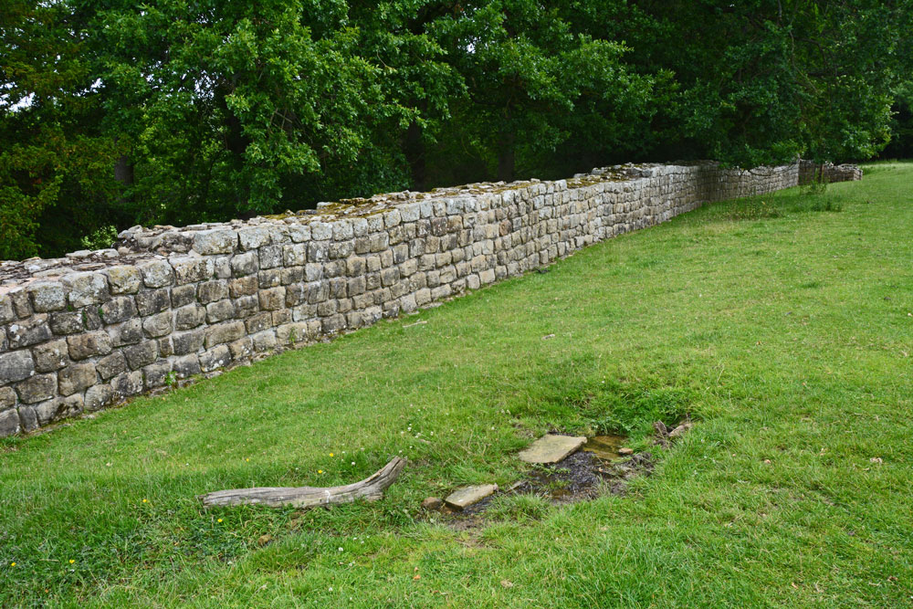
Hadrian's Wall (Brunton Turret) submitted by Anne T on 7th Jul 2019. Walking east along with wall, from near its south western corner. The small structure in the right/foreground is the spring, which was flowing freely at the time of our visit. There were the remains of some stone slabs around where it emerged from the ground.
(View photo, vote or add a comment)
Log Text: Brunton Turret 26b, Hadrian's Wall: Parked at the layby by the stile. We met a party of four Americans who were walking the wall and who had started at Newcastle on Monday, and from Corbridge this morning. I wished them a ‘happy 4th July’ and one of the ladies replied “Good job we’re friends again”, which raised a smile.
There was also a spring at NY 92109 69847 with the remains of a structure around it, flowing quite quickly and forming a small stream running downhill and round the bottom end of the turret.
The information sign at the top end of the site reads: ”Turrets were positioned equidistantly between largely milecastles where small garrisons of soldiers guarded gates that allowed for trave lthrough the Wall. Shortly after work on the wall started, large forts, such as Chesters, were also constructed to house garrisons of between 500 and 1,000 soldiers.
(Image) Right: layout of Brunton turret. The ‘curtain’ wall is a different thickness on each side of the turret. The turret was laid out with short ‘wing’ walls either side. These were supposed to be incorporated within the curtain wall once it was finished. But between completing the section of the Wall to the west and that to the east, the builders were ordered to narrow the curtain wall. This left about 1m of eastern wind-wall exposed”.
Hadrian's Wall (Chesters Bridge Abutment)
Trip No.142 Entry No.2 Date Added: 7th Jul 2019
Site Type: Misc. Earthwork
Country: England (Northumberland)
Visited: Yes on 4th Jul 2019. My rating: Condition 3 Ambience 4 Access 4
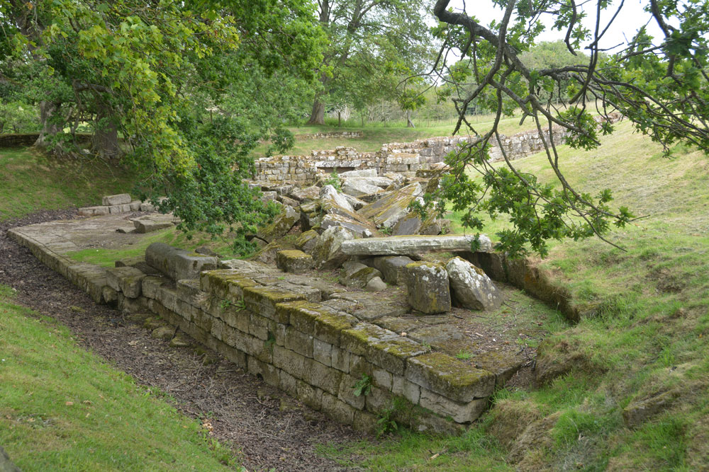
Hadrian's Wall (Chesters Bridge Abutment) submitted by Anne T on 7th Jul 2019. A look at the western side of the bridge abutment, giving an idea of its substantial structure and size. Behind me is a huge store of blocks which have fallen from the structure over the years and have been placed neatly waiting for restoration at some point?
(View photo, vote or add a comment)
Log Text: Chesters Bridge Abutment: It's been some time since we came here to photograph the rock art panel, which is still here (although heavily lichen covered). This is where “The River Hunters” did a search in their series not long ago, just opposite the bath house at Chesters on the opposite bank. This was visible from the bridge abutment.
We met the American party again and another gentleman who said he had been walking round the poppy field trying to get some good photos. I set him a challenge - looking for the phallus symbol and the rock art. He got quite excited about the symbol and told me that he walked the wall looking for these symbols. He'd recently been trying to find one near Gilsland but without success.
One of the sources used by Historic England is my book bought for £1 from Hexham car boot sale: Bruce, J C, Handbook to the Roman wall, (1863), 117-120 and Bruce, J C, Handbook to the Roman wall, (1863), 109-111
Hadrian's Wall (Turret 44b)
Trip No.143 Entry No.3 Date Added: 11th Jul 2019
Site Type: Misc. Earthwork
Country: England (Northumberland)
Visited: Yes on 8th Jul 2019. My rating: Condition 2 Ambience 4 Access 4
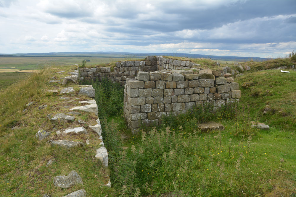
Hadrian's Wall (Turret 44b) submitted by Anne T on 11th Jul 2019. Standing almost at the western edge of the turret, with the crags dropping down sharply, just off shot to the left, looking north across the turret. Photo by Andrew T
(View photo, vote or add a comment)
Log Text: Turret 44b, Hadrian's Wall: Located on the crag above King Arthur's Well, this is a lovely spot. We had difficulty in locating the holy well, so whilst I continue to search for the it and see if I could find any structure or water course, Andrew ascended the steps to the top of the crag, and came back about 20 minutes later.
This turret is on the Hadrian’s Wall path, which runs almost due east-west here. It is in a very pretty spot. Even with it being a Monday afternoon, and a very warm day, there were lots of walkers here. Many passed me on the paved section of path but none appeared to stop and look at the turret, as no-one seemed to linger at this point. Perhaps they had already seen too many turrets around here - there are certainly a lot of them!
King Arthur's Well (Walltown Gap)
Trip No.143 Entry No.2 Date Added: 12th Jul 2019
Site Type: Holy Well or Sacred Spring
Country: England (Northumberland)
Visited: Yes on 8th Jul 2019. My rating: Condition 1 Ambience 4 Access 4
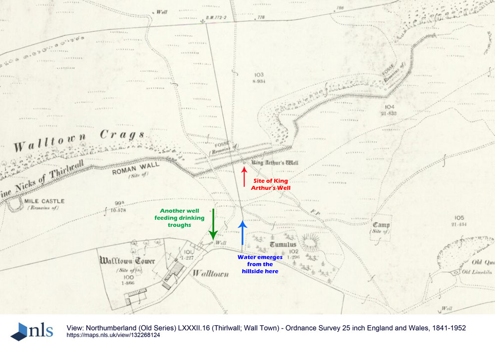
King Arthur's Well (Walltown Gap) submitted by Anne T on 12th Jul 2019. This is an image taken from the National Library of Scotland's 1895 OS map for Thirwall and Wall Town, dated 1895, and licensed for re-use under Creative Commons. Link: https://maps.nls.uk/copyright.html. The location of King Arthur's Well is marked by the red arrow, although if it exists is well hidden under turf and reeds. The blue arrow marks the location NY 68041 66551, where a spring emerges further down the hillside. The green arrow marks the location of another well which feeds drinking t...
(View photo, vote or add a comment)
Log Text: King Arthur's Well, Walltown Crags: Whilst this well may now be destroyed or lost, the scenery here is fantastic, and it was well worth coming out to look.
We were unable to find this holy well, despite having the GPS to guide us to the spot. However, we did see signs of reeds and tall grasses where the water might have pooled and flowed.
On the way up to the nick in the crags where the well is located, there is water emerging from the hillside at NY 68041 66551, which runs in a small stream down the slope, feeding two drinking troughs in the field below. We did visit after a period of prolonged dry weather, so wondered if the water emerges from higher up the hill after wet weather.
Gilsland Spa Well
Trip No.146 Entry No.1 Date Added: 28th Aug 2019
Site Type: Holy Well or Sacred Spring
Country: England (Northumberland)
Visited: Yes on 27th Aug 2019. My rating: Condition 3 Ambience 3 Access 4
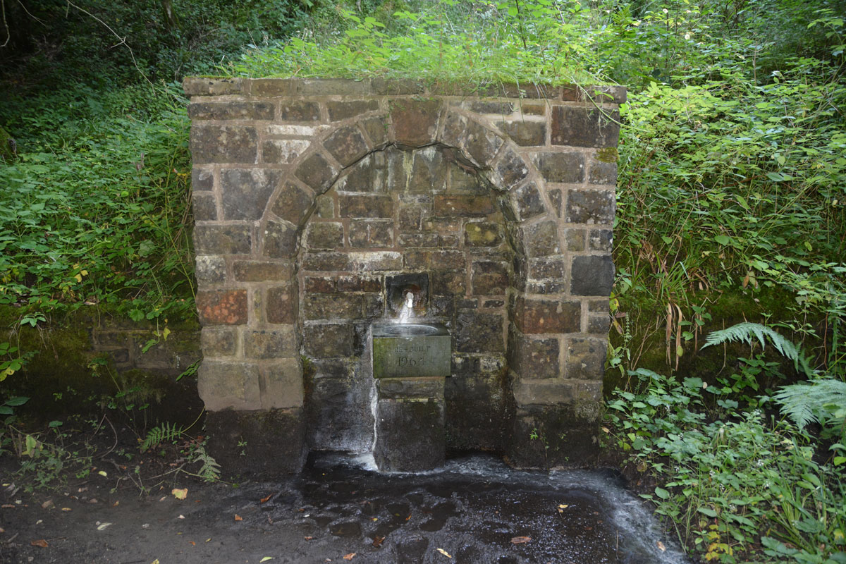
Gilsland Spa Well submitted by Anne T on 28th Aug 2019. Standing between the well structure and the river Irthing. The spring emerges from the base of a tall cliff, and smells strongly of sulphur. The plinth, basin and pipe/spout were rebuilt in 1964.
(View photo, vote or add a comment)
Log Text: Gilsland Spa Well: From the hotel car park, we followed the signs for the Sulphur Spa, leading on a path with a steep drop to our right hand side down to the River Irthing below. The path winds round to the left, then splits just above the southern side of the footbridge across the river. Take the right hand fork, walk about 20m, then take the small flight of steps down to the well, which can be smelt well in advance of reaching it!
The ground was very wet, with a steady flow of water coming out of the well spout. The eastern side of the well basin was covered with a white sulphurous stain, which carried on with the flow of water overflowing from the basin down to the river. I did dip my finger into the running water and had a quick taste. Very sulphurous, but not really unpleasant
As we approached the well, another couple were making a beeline from the well, coming from a path to the east. We fell into conversation, and it turned out they were from Doncaster (which is where I lived my early life), and lived near the race course. They were staying at the hotel for a week, returning home on Friday.
The path leading west from the well and the footbridge had been eroded away by the river. We got to within 120m of the sulphur spring, but not even Andrew wanted to walk this section of path; he said it would have been easier to walk along the river bed. We did try and see it from the other side of the river, but it was too heavily wooded to see anything.
This well is mentioned only briefly in the Springs of Living Water book by Fr John Muster, page 80, under the small section headed ‘Spa Wells’: “Though called holy wells, none are ever found identified with a saint. A good example is the one at Gilsland”. They have a photo on page 86.
No entries on Pastscape or HE, although if you type in the grid reference to the HE map search, it shows a circle where this well is located, and calls the general area to the west of the well a ‘Sulphur Spring’.
Crag House Cross Base
Trip No.147 Entry No.1 Date Added: 4th Sep 2019
Site Type: Ancient Cross
Country: England (Northumberland)
Visited: Yes on 3rd Sep 2019. My rating: Condition 3 Ambience 4 Access 5
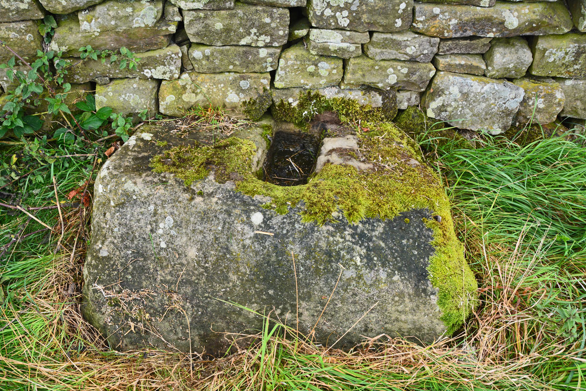
Crag House Cross Base submitted by Anne T on 4th Sep 2019. Close up of the cross base, showing its slightly inclined top surface, but the socket hole is cut vertically. Pastscape says this indicates the cross base may have been cut in situ.
(View photo, vote or add a comment)
Log Text: Crag House Cross Base, north of Acomb: There have been many times I’ve done a search for sites to visit in this area, but found nothing. Now, having recently done a search for holy wells near Hexham, this cross base appeared on the list. Not only was it on Pastscape, but it was also scheduled on HE.
As I was photographing the small stone by the gatepost, a four-by-four pulled up and wound the window down. “Are you looking at the monument?” the lady in the car asked us. “We’ve come to photograph the cross base”, I replied. “Yes, that’s what we call The Monument. We’ve never seen anyone visit it before”.
It turned out they live in Crag House, and are turning the adjacent land into a nature reserve to be handed over to a Wildlife Conservation Trust. The gentleman said he’d never been able to find out what the small stone was for, but we all thought it was some sort of boundary marker.
The lady said she keeps a blog of the work they are doing to their nature reserve, so she was going to say she’d met us photographing the monument.
In Acomb, the name of the cross is heavily reflected in road names leading up to the cross: Cross Bank, etc. The cross base sits at the top of the hill, not far south of the Military Road (B6318), with St. Oswald’s Church at Heavenfield just across the road (within 500m of the cross base). It has amazing views over Hexham.
Eastern Sanctuary Cross (Hexham)
Trip No.147 Entry No.2 Date Added: 6th Sep 2019
Site Type: Ancient Cross
Country: England (Northumberland)
Visited: Yes on 3rd Sep 2019. My rating: Condition 2 Ambience 2 Access 5
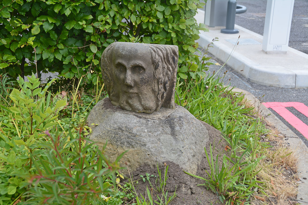
Eastern Sanctuary Cross (Hexham) submitted by Anne T on 5th Sep 2019. Cross base or top of a gate post (with a carved stone head inserted into the socket hole)? Really strange. Hodges, writing in 1897, appeared to confirm this was indeed the base of the eastern sanctuary cross of Hexham Priory.
(View photo, vote or add a comment)
Log Text: Eastern Sanctuary Cross of Hexham Priory (or just the top of a gate post??): We stopped to photograph the scheduled Glover's Pant before making our way to the eastern side of Hexham. We were incredibly surprised to find this cross base, which we’ve looked for before, but at the old grid reference. On this visit, I spotted it straight away, and took its current grid location with our GPS. It is now sited at the eastern entrance to the car park. Andrew walked right past it, and I might have too, had I not remembered about the carved stone head being in the socket hole! I almost got myself run over trying to take photographs from various angles.
I also found Hodges’ 1897 paper listed in the Pastcape reference (copied in the text below). He reports that the locations of all four of Hexham Priory Sanctuary Crosses were now known. He reports the location of the northern one is at Cross Bank. I’m wondering if this is the one at Crag House, north of Acomb, although this is some 5km from the location of this cross base.
Seal Well (Hexham)
Trip No.147 Entry No.3 Date Added: 6th Sep 2019
Site Type: Holy Well or Sacred Spring
Country: England (Northumberland)
Visited: Yes on 3rd Sep 2019. My rating: Condition 2 Ambience 3 Access 4
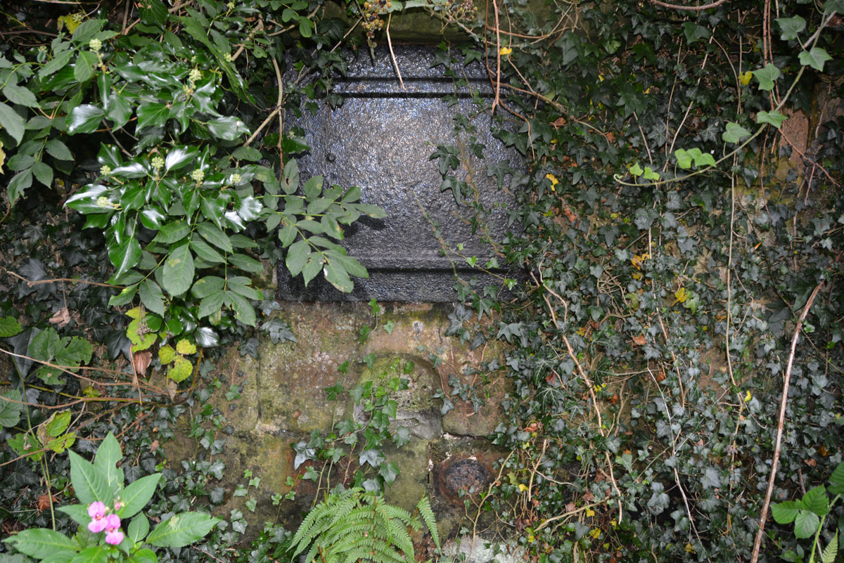
Seal Well (Hexham) submitted by Anne T on 5th Sep 2019. There was a vague path through the weeds to the well (we tried to reach it by a path a few metres to the west of the well, but it was far too overgrown to walk down), so I carefully made my way through the nettles and brambles to take a closer look.
(View photo, vote or add a comment)
Log Text: The Seal/Sele Well, Hexham: Walking into a part of Hexham we’d never been to before, we came across the Cock Shaw Burn which runs SW-NE along the western side of the Sele. We passed a gloriously ornate drinking fountain (now dry) next to the southern side of the school, right next to the footpath. At the western side of the Sele, a footpath turned to our right, downhill. At the bottom, a footbridge crosses the Cock Shaw Burn. We turned left along the footpath running along its southern side, and about 30m along, spotted a stone and cast iron structure behind the nettles.
We managed to trample down the nettles to get a closer look. I unhooked some of the ivy from the ring in the indentation in the middle of the well to get a closer look at the underlying well structure. No-one has seen this well in some time, but it was very nice to find it.
This is a really old part of Hexham, and one we’d never explored before. Nearby, a second burn (presumably the Cowgarth Burn) runs along a cobbled road through Tanner’s Yard.
We went onto find, and photograph, Wine's Well (to the west of Hexham) and the Park Well (to the east). These are recorded as just 'wells' on Pastscape, and have no holy or healing characteristics that I'm aware of.
