Contributory members are able to log private notes and comments about each site
Sites Anne T has logged. View this log as a table or view the most recent logs from everyone
Broomhouse (Haltwhistle)
Trip No.113 Entry No.2 Date Added: 1st Jan 2019
Site Type: Ancient Village or Settlement
Country: England (Northumberland)
Visited: Yes on 1st Jan 2019. My rating: Condition 2 Ambience 4 Access 4
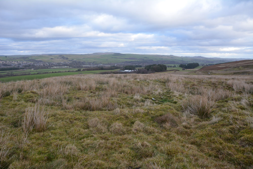
Broomhouse (Haltwhistle) submitted by Anne T on 1st Jan 2019. One of the three roundhouses within the settlement, with well formed earth and stone foundations. If the GPS on my camera has worked properly, this is the one at the north eastern side. To the top left hand side of the photo is Haltwhistle, which lies to the north, over the A69.
(View photo, vote or add a comment)
Log Text: Iron Age/Romano British Settlement, Broomhouse, south of Haltwhistle: From the smelt works, we headed back to the A69 and turned left towards Haltwhistle. Just before crossing the river South Tyne for the second time, we turned left up Bellister Bank, parking on the grass verge where the road was slightly wider, just before the footpath which headed south east past the farm houses, and over the South Tyne Way. As we approached the farm buildings, it sounded like ‘the Hounds of the Baskervilles’, with four farm dogs barking at a gate to warn us off going into the farmyard.
The South Tyne Way was a busy place, with any number of walkers following its route. We headed over the bridge and followed the track south east up the hill. As the track reached the top of the hill and turned to our right, we headed over the moorland to the west, and within 50m had come across the outer ditch of this settlement.
The outer stony bank with a ditch either side is pretty much intact, although to its eastern side confused with a modern drainage ditch. Inside the settlement are three clear roundhouses, still with their stone and earth foundations.
There were great views over to Haltwhistle to the north. On the way back, we noticed the gate where the dogs had been was open. “Better be careful”, warned my huband. We walked past the farmyard expecting the dogs to come barking at our heels, but nothing. A few paces further and four dogs came running up to us – all wagging tails and friendly this time. They were closely followed by the farmer, who bid us ‘good day’.
No listing on HE scheduling, although the site, together with the positions of the roundhouses, are shown on their map.
Corby Crags Rock Shelter
Trip No.115 Entry No.1 Date Added: 24th Jan 2019
Site Type: Cave or Rock Shelter
Country: England (Northumberland)
Visited: Yes on 20th Jan 2019. My rating: Condition 3 Ambience 4 Access 4
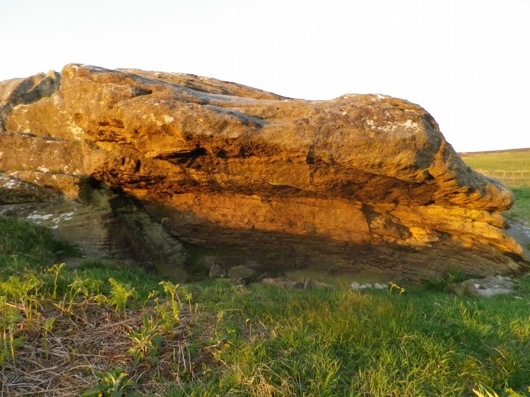
Corby Crags Rock Shelter submitted by Modern-Neolithic on 8th Jun 2013. Corby Crags Rock shelter in Northumberland.
(View photo, vote or add a comment)
Log Text: Corby Crags Rock Shelter: Parked at NU 12646 09945 and walked up to the gate at NU 12763 10096 (avoiding the fast moving cars), and followed the track up to almost the top of the hill, then turned south west, following little tracks through the bracken. On our way up the hill, we spotted a mound of stones surrounded by a circular bank (visible on aerial photographs) at NU 12845 09824. Likely to be mining debris, but it did look suspiciously like a cairn, but fits the description below.
We missed the rock art here, as Andrew confused the name with Corby’s Crags just north of here (but the HE map labels the area around the rock shelter as Corby’s Crags), and he didn’t check the ‘nearby sites’ list on the Portal. Grrr.
Corby's Bridge
Trip No.115 Entry No.2 Date Added: 24th Jan 2019
Site Type: Ancient Village or Settlement
Country: England (Northumberland)
Visited: Yes on 20th Jan 2019. My rating: Condition 2 Ambience 3 Access 4

Corby's Bridge submitted by Anne T on 22nd Jan 2019. The most obvious structures within this settlement were over a modern barbed wire fence. According to Pastscape, this outer enclosure measures about 105m in diameter.
(View photo, vote or add a comment)
Log Text: Corby's Bridge Settlement: This site was quite difficult to make out, as there were stones and banks everywhere, with trees and shrubs growing between them.
On the way down the slope from the rock shelter, we thought we saw the foundations of two old buildings (the stones were aligned in a shape), but were too moss covered to really distinguish. Walking further down the slope, as it becomes gentler, there are obvious traces of low, circular banks with stones in them. From this point there are several lines of stones running north east to south west down the slope. The best evidence of structures is at the south/south eastern end of the settlement, were there are stony walls, with aligned stones up to about 1.5m in height. There was a fence in between us and the southern part of the settlement, with no gate through, so we contented ourselves with leaning over the fence and getting photos.
Fairy Stone (Fourstones)
Trip No.116 Entry No.2 Date Added: 27th Jan 2019
Site Type: Natural Stone / Erratic / Other Natural Feature
Country: England (Northumberland)
Visited: Couldn't find on 26th Jan 2019
Log Text: Fairy Stone (Fourstones): This is one of the sites I added to the Portal from The Northern Antiquarian, so whilst we were in the area, decided to try and find it. We parked at NY 89360 67929 on the outskirts of Fourstones Village (I didn’t think there was much at Fourstones, but there is a large papermill there).
Armed with the grid references (the one given by TNA, the other by Pastscape, we wandered along the road, up past the farms and along the lanes, but could find no trace of this stone. What a shame – I was looking forward to rediscovering it. Andrew, through looking at the age of the stone walls and the road surface, was able to tell where the road had been widened, which helped our search before admitting defeat.
I did photograph an old well/drinking trough next to the farm at about NY 89325 68021. This is a lovely old village.
Acomb Sanctuary Cross
Trip No.116 Entry No.1 Date Added: 27th Jan 2019
Site Type: Ancient Cross
Country: England (Northumberland)
Visited: Yes on 26th Jan 2019. My rating: Condition 3 Ambience 3 Access 4
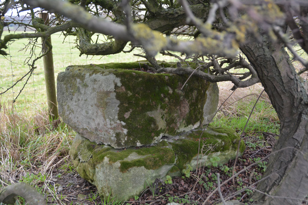
Acomb Sanctuary Cross submitted by Anne T on 27th Jan 2019. First view of this cross base, set upon sandstone blocks. It was certainly well hidden, but visible at this time of year with no leaves on the hawthorn hedge.
(View photo, vote or add a comment)
Log Text: Acomb Sanctuary Cross: I spotted this cross base whilst doing some research for a Journal of Antiquities tumulus not far away a few days ago. This cross base is just off the A6079 Cross Bank, going north from Acomb. This is a very busy road and after driving up and back down the road a couple of times, the only safe place we could find to park was just off the road at the entrance to a grassy farm track at NY 92364 66984. Walking north to the cross base, which we’d spotted as a rectangular lump of stone under the hedgerow, we were constantly having to jump up onto the grass verge as the fast travelling cars didn’t give us much room, and it felt quite dangerous.
Fortunately, between lulls in the traffic, I crossed the road to get a ‘context’ photo of the cross base. Close up, the quite large socket hole was filled with leaves and grass. The base sits on two other stones which are barely larger than the base itself.
Andrew managed to find a lower part of the fence and climbed into the field to get photos from the other side.
Hallington Holy Well
Trip No.118 Entry No.1 Date Added: 15th Feb 2019
Site Type: Holy Well or Sacred Spring
Country: England (Northumberland)
Visited: Yes on 14th Feb 2019. My rating: Condition 3 Ambience 4 Access 4
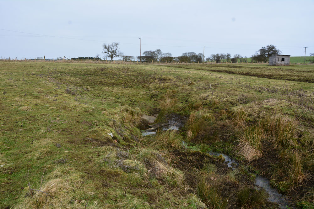
Hallington Holy Well submitted by Anne T on 15th Feb 2019. Standing a little bit further down towards the field boundary, looking back at the small pool of water near where the spring emerges, and the much larger hollow of what we interpreted as the well pool (now dry). There is evidence of stones around the rim of the larger pool area, indicating there might have been a structure here at one time.
(View photo, vote or add a comment)
Log Text: Hallington Holy Well: We drove past this well, despite having the OS map with the location of the well marked. In the end we drove slowly back towards Hallington village, identifying the field because it is smaller than the others, with a fence line and line of trees that runs parallel to the road, about 100m away.
The gate into the field was open, but a large wooden shed indicates the field is usually used for horses. We walked south to the well pool, about 50m from the gate, coming across a large hollow with boulders/stones poking out of the bank; we interpreted this as having at one point having been a larger well pool.
The spring bubbles up from the western bank of the channel, just where the larger ‘pool’ narrows into the channel into which the water flows south to the field boundary. The water is clear and freely flowing. The collection of stones and wooden blocks leading across the mud indicated people still collect the water today, although I didn’t’ taste the waters.
This is a very lovely spot, and it was a great start of our afternoon out.
St Mary's Well (Kirkwhelpington)
Trip No.118 Entry No.2 Date Added: 15th Feb 2019
Site Type: Holy Well or Sacred Spring
Country: England (Northumberland)
Visited: Yes on 14th Feb 2019. My rating: Condition 2 Ambience 4 Access 4
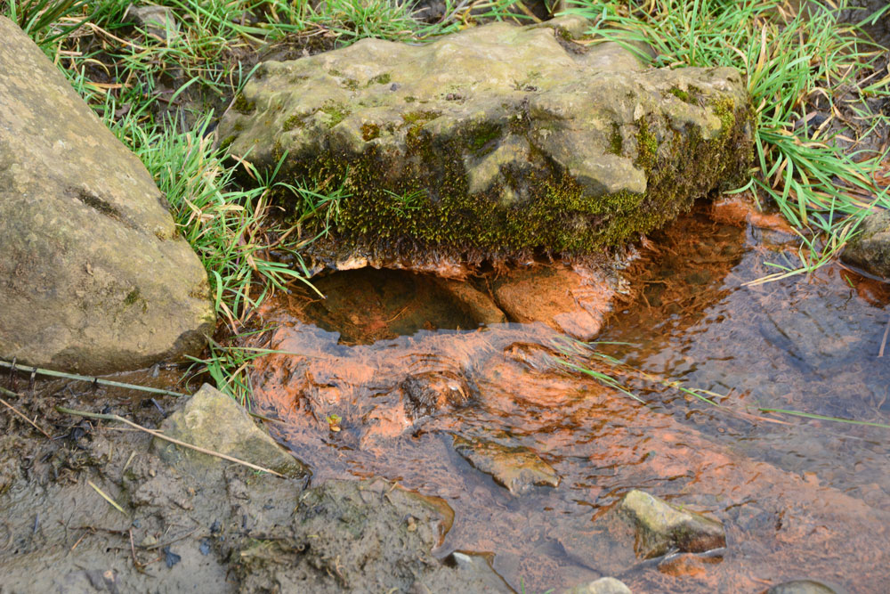
St Mary's Well (Kirkwhelpington) submitted by Anne T on 15th Feb 2019. Whilst there is no sign of the well at the grid reference given, this spring bubbles up at the side of the small stream almost directly south. I wondered if the water from the well had been culverted down to here.
(View photo, vote or add a comment)
Log Text: St Mary's Well, Kirkwhelpington: We had previously stopped off at St Bartholomew's Church in the village, and photographed the sundial and some medieval grave slabs. Parking at the eastern end of the the village, almost opposite the entrance to Eastlands, we crossed the small bridge over the ford and headed up over the fields. Having passed the last houses to our left hand side, we let ourselves through the gate into the field and turned right (east). This was the start of a short circular walk which took in 2 holy wells, the ruins of a moated medieval manorial complex and a tumulus.
No signs of the well in the field, which should have been located about 50m due west of the only tall tree in this part of the field, but walking down by the small stream, I spotted a spring issuing out of the bank, with larger stones above it, and what appeared to be a small iron basin over which the water flowed. Has the water from the well been culverted down to here?
There was no end of rig and furrow around here. This land used to belong to Newminster Abbey, which used to own land up to the Scottish Borders. The ruins of the Abbey can be found in Morpeth town centre.
St George's Well (Kirkwhelpington)
Trip No.118 Entry No.3 Date Added: 15th Feb 2019
Site Type: Holy Well or Sacred Spring
Country: England (Northumberland)
Visited: Yes on 14th Feb 2019. My rating: Condition 3 Ambience 4 Access 4
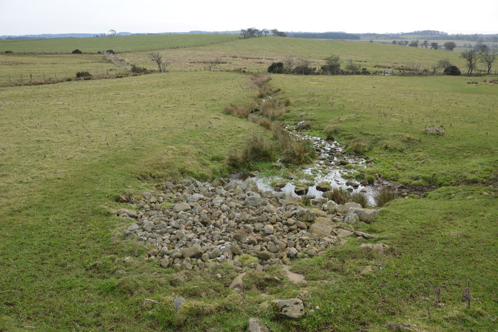
St George's Well (Kirkwhelpington) submitted by Anne T on 15th Feb 2019. Standing just to the north and just upslope from the well, looking down across the pile of stones which protect the spring head, the small pool into which the water comes up into, and the channel down which the water runs to join a small stream running east-west along the bottom of the field.
(View photo, vote or add a comment)
Log Text: St George's Holy Well, Kirkwhelpington: The second stop of four on our short circular walk around Kirkwhelpington. This well is in a lovely location, very peaceful and quiet (once the farmer and his numerous dogs had driven off in his four-wheel drive buggy!). Two holy wells within a couple of hundred yards was a treat, although I'm interested in finding out how they became known as holy wells and what they cured.
The water emerges very peacefully up into a small pool at the base of the stones. By the time the water has gone a couple of metres further downslope, it is quite lively, creating ripples through the grass.
Boulders appear to mark the edge of the pool and water channel, although I couldn't see any signs of a permanent structure.
The Fawns (Kirkwhelpington)
Trip No.118 Entry No.5 Date Added: 17th Feb 2019
Site Type: Rock Art
Country: England (Northumberland)
Visited: Yes on 14th Feb 2019. My rating: Condition 2 Ambience 4 Access 3
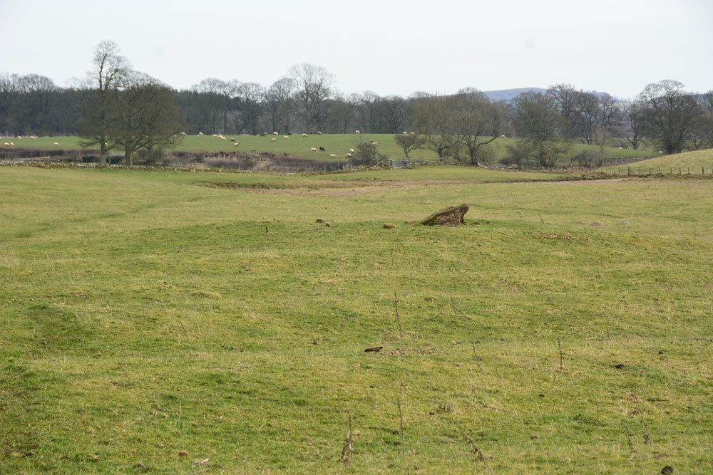
The Fawns (Kirkwhelpington) submitted by Anne T on 17th Feb 2019. First view of the cairn as we made our way south east from the Fawns Moated Manorial Site up the hill. The cairn has been partly damaged by later ploughing, but the rig and furrow seem to respect the centre of the barrow. It is located at the foot of two hillocks which are prominent in the landscape. To the south, the gate out of this field crosses a small stream which needs to be stepped across.
(View photo, vote or add a comment)
Log Text: Cairn SE of The Fawns (220m west of Broom House farm): This cairn is easily visible from the top of the ridge, as we walked from the Fawns Farm/Moated Manorial Earthworks, along the footpath, then down hill. The brown blob of the rubbing post comes into sight first, then the circular mound of the cairn comes into view as you get nearer.
A lovely spot to be buried in - very peaceful and quiet, at the bottom of two hillocks, with a small stream (now) running to the south. The gate from this field onto the footpath back to the village crosses this stream, which needs a long stride to get over it, but it's not very deep.
Wish I'd been able to see the rock art panel and the urns, but a trip to London would be necessary (if the British Museum can find these!).
It is a gentle walk down to the river valley below from here, following ancient dry stone walls now white with lichen. We drove to Kirkharle for a cup of tea and some soup, then visited St Wilfred's Church just along the road, which is where Capability Brown was baptised (he was born in Kirkharle). We stopped to see a very strange monument dedicated to "A Most Unfortunate Man" at the side of the road between the church and Kirkharle Courtyard.
The Rothbury Cross
Trip No.119 Entry No.1 Date Added: 25th Feb 2019
Site Type: Ancient Cross
Country: England (Northumberland)
Visited: Yes on 24th Feb 2019. My rating: Condition 3 Ambience 4 Access 5
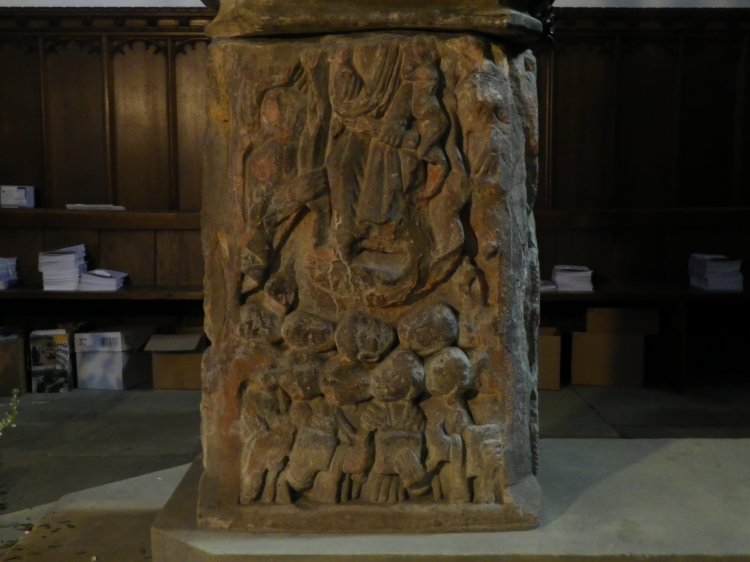
The Rothbury Cross submitted by Modern-Neolithic on 26th May 2013. The north panel displays "The Accession of Christ" with angels either side and the apostles looking upwards.
(View photo, vote or add a comment)
Log Text: The Rothbury Font/Anglo Saxon Cross & Other Fragments: We started off in Rothbury, parking on Haw Hill, just outside the church. We intended to go for a cup of tea, but the town was inundated with tourists and bikers, so we went straight to the church to find the font. I’d forgotten how glorious this was, but then it’s a long time since we looked in the church.
There were odd lights in the church, highlighting a few pieces, including the font, but it was so dark under the tower that, after hunting unsuccessfully for the light switches, we had to go and get the large flash gun from the car.
I also photographed the pieces on the west interior wall of the porch, and a sundial to the south of the nave. At the NW corner of the tower, there was a collection of fragments and a bell. The sign said: “These fragments of an Anglo Saxon Cross was discovered during recent building work in the All Saints Churchyard. It is believed to have been a carving that broke as it was being worked on”. The way the fragments were stacked in a jumble made it impossible to see any carvings on them.
We missed two scratch clocks on the exterior south wall; I looked for a church guide book, but the only thing on display were postcards, cards and the parish magazine.
On the western wall of the south transept, on the window sill, is a modern carving. The sign reads: “This carving celebrates the 500th anniversary of Bernard Gilpin. It depicts a historic incident in Rothbury Church. Bernard Gilpin was a Catholic priest whose brave efforts to bring Christianity and peace to the warring families of the Borders eventually earned their respect. They rewarded him with the honorary title of The Apostle of the North. Queen Mary order Gilpin to be brought to London to be burnt at the stake as a heretic. However, the Queen died before he reached London so he was able to return to the North to continue his good works”.
The notice board by the Font reads:
“The pedestal consists of the base of the ancient Saxon cross of Rothbury dating from the 8th century AD.
East Side: Before the Fall of Man
North Side: The Ascension of Christ with angels wither side and the Apostles looking upwards. The Evangelicals hold their gospels (this is said to be one of the oldest carvings of this subject in Britain).
West Side: After the Fall
South Side: The Saxon knot-work pattern
Other fragments of the Rothbury Cross are in the Museum of the Society of Antiquaries of Newcastle upon Tyne (Great North Museum). [The bowl is dated 1664].”
Steng Cross and Winter's Gibbet
Trip No.119 Entry No.2 Date Added: 25th Feb 2019
Site Type: Ancient Cross
Country: England (Northumberland)
Visited: Yes on 24th Feb 2019. My rating: Condition 3 Ambience 4 Access 4
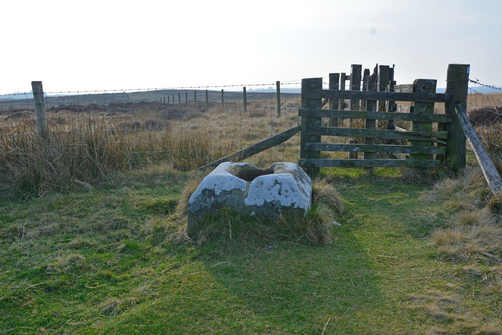
Steng Cross and Winter's Gibbet (Elsdon) submitted by Anne T on 25th Feb 2019. It's not until you walk almost up to the cross base that we realised how much larger it is than others we've seen. Pastscape records: "It measures 0.8m square chamfered down to 0.6m square, and stands to 0.4m above ground level, the socket stone is 0.4m by 0.25m and is 0.2m deep".
(View photo, vote or add a comment)
Log Text: Steng Cross & Winter's Gibbet, near Elsdon: If there was a category for Ambience = Spooky/Very Spooky I would assign it to this site.
This is a remote spot, at the very top of the moor at the western end of the forest which runs along the north side of the road. The thought of anyone being hung in chains and left to rot, murderer or not, doesn't bear thinking about. I expected to turn around and find the ghost of William Winter breathing over my shoulder at any moment. Even the birds seemed silent with the cold wind whistling along the long, straight road nearby. I was glad to escape back to the car and head off to Elsdon.
Just inside Northumberland National Park, St Cuthbert’s Way runs on the south side of the fence next to the cross, although to get to it you have to walk back to the road, a little further west, then onto the marked footpath.
The Elsdon Stone
Trip No.119 Entry No.3 Date Added: 27th Feb 2019
Site Type: Early Christian Sculptured Stone
Country: England (Northumberland)
Visited: Yes on 24th Feb 2019. My rating: Condition 3 Ambience 4 Access 4
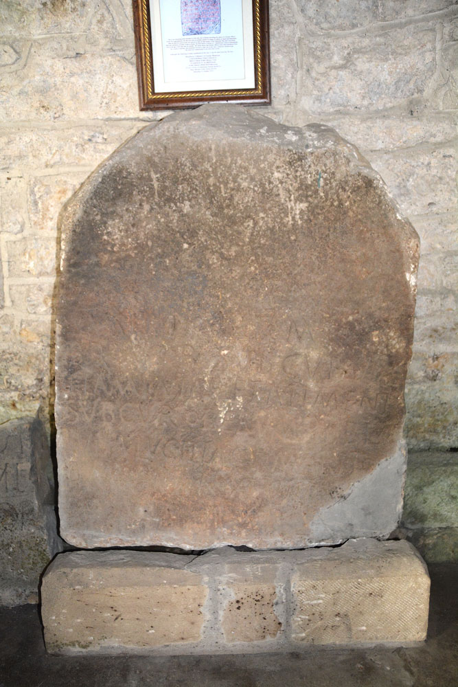
The Elsdon Stone submitted by Anne T on 27th Feb 2019. This is the unique Elsdon Stone, which is sited against the north wall of the nave, opposite the south door into the church. The inscription is barely visible unless the light catches it. There is a notice above with an explanation of the stone with a brief history of the Roman officer, and what remains of the legible inscription, in Latin.
(View photo, vote or add a comment)
Log Text: St Cuthberts, Elsdon (The Elsdon Stone): We stopped off at the very friendly and informal tea shop for tea (one tea bag in a pot for 2) and an ‘omelette sandwich’ (was supposed to be fried egg, and it took me a while to recover from the taste). We’ve been to the church before, but not with the HE and Pastscape information with us.
Spotted the unique Roman soldier’s tombstone (it lists his entire military career), the medieval cross slabs and the horse skulls. We thought we’d seen everything in this church on a previous visit on 25th August 2013, but indeed missed a great deal. Whilst I photographed most of what we took in today, at the time I wasn’t so interested in the medieval grave slabs and the Elsdon Stone (after all, it was only Roman, wasn’t it?!). I really wished I’d thought to take Peter Ryder’s articles on the medieval grave slabs, but until we got to the village, had no real thought of going back to the church.
I was really saddened to see how much the inside of the church has deteriorated since our visit four and a half years ago. There is so much black mould and dust around, especially towards the western end of the church.
I also hadn’t realised how complicated the stone work around the junction of the nave and the transept was – all small spaces and intricate junctions.
I could have spent all afternoon the churchyard photographing all the amazing grave markers.
Rugley Walls (Cambo)
Trip No.119 Entry No.4 Date Added: 27th Feb 2019
Site Type: Holy Well or Sacred Spring
Country: England (Northumberland)
Visited: Saw from a distance on 24th Feb 2019. My rating: Condition 2 Ambience 3 Access 4

Rugley Walls (Cambo) submitted by Anne T on 27th Feb 2019. The site of the holy well, as seen from the road, which shows up as a puddle and a brighter green grass against the rest of the pasture. A return trip in better light, more time and a pair of wellies will occur in the relatively near future …..
(View photo, vote or add a comment)
Log Text: Rugley Walls Holy Well: (note wellies a must if trying to get to the well): We stopped off here very quickly as we wanted to leave enough time to see the settlement at Catcherside.
Whilst we could see the source of the well, and there was a gate into the field, we would have need our wellies to get over the stream and boggy area to reach the well. As the light was starting to fail, we elected to carry on to Catcherside.
The well is shown on HE map but no mention on Pastscape. I need to look up the Holy Wells of Northumberland papers. All indications from Keys to the Past are that the well is connected to the deserted medieval village of Rugley Walls, which lies to the eastern side of the B342 road which runs through here.
I'd really like to see the structure that Andy Curtis photographed, so a return visit is on my wish list.
Camp Hill (Catcherside)
Trip No.119 Entry No.5 Date Added: 28th Feb 2019
Site Type: Hillfort
Country: England (Northumberland)
Visited: Yes on 24th Feb 2019. My rating: Condition 3 Ambience 4 Access 4
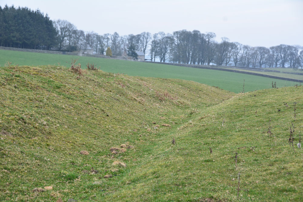
Camp Hill (Catcherside) submitted by Anne T on 28th Feb 2019. Standing in the deepest part of the ditch towards the north western part of the hillfort, looking north east towards Catcherside Farm.
(View photo, vote or add a comment)
Log Text: Camp Hill Hillfort, Catcherside, Knowesgate: We drove up to Catcherside, which was very obviously a very well looked after cluster of farmhouses with a common courtyard between. As Andrew was looking for somewhere to park, a man walked out of Catcherside Cottage so I leapt out of the car and asked if it would be OK if we could park for 20 mins to go and look at the settlement. He said it was his daughter’s farm, but went away to ask, came back and said that was OK. As Andrew came back from parking a little way out of the lane, he hadn’t brought my walking poles, so the gentleman lent me one of his. Nice!
As we walked by the gate into the garden of the cottage, I spotted a carved stone at NY 99191 87596, which looked like a round cross or pillar base (reminded me of the one we saw at Bamburgh Castle in the Stones Museum).
The farmland here looks really fertile, and the sheep were magnificent. The hillfort has been ploughed out on the southern and south western side, but the ditch, rampart and hollow way through the entrance on the north western sides are still clear. We did look for signs of structures within the oval platform at the top of the hill, but these looked as if they had been ploughed out by rig and furrow. A really nice walk on a warm February evening.
Three Kings
Trip No.122 Entry No.1 Date Added: 30th Mar 2019
Site Type: Stone Circle
Country: England (Northumberland)
Visited: Yes on 28th Mar 2019. My rating: Condition 3 Ambience 4 Access 3
Three Kings submitted by cosmic on 29th Aug 2004. Three Kings from East
(View photo, vote or add a comment)
Log Text: Three Kings Stone Circle, Byrness: Driving up the A68 from Corbridge, passing through Rochester, we turned left off the A68 at NT 78013 01533 into the Border Forest Caravan Park. We thought we’d get to a car park where we could leave the park, but instead ended up at a Reception hut with a barrier closing off the road. There was no one in the hut, so I rang the buzzer. Rather than explain what I wanted, a man’s voice came through the speaker “I’ll be with you in a moment”, and rang off. Seconds later a man on a bike appeared. I asked him if there was anywhere we could park to go and see the Three Kings, and he said “as we’d asked, we could park here” (by the hut), and he gave very precise directions for reaching the stone circle. He also told us that the Forestry Commission hadn’t been maintaining the track to the stone circle very well, and some of it was very overgrown.
Stopping to almost scratch the pet pig’s nose (he was called Bubbles (sadly not more 'Squeak')), we set off south west through the static caravan area, crossing over the metal bridge, then turned north west along part of the Pennine Way, walking over a wider bridge where two rivers meet, then turned almost due west along a forest track, which turned a corner southwards and climbed steadily uphill.
We missed the first track up to the stone circle, as it really was very overgrown, but continued up the hill and came to reasonably well defined track, over a boggy area, then uphill along a moss covered track which eventually came to some wooden steps, which even had a handrail in parts. From the comparative dark of the forest, we came out into a sunlit clearing with the four poster to our right hand side.
Bremenium Roman tumulus
Trip No.122 Entry No.2 Date Added: 30th Mar 2019
Site Type: Artificial Mound
Country: England (Northumberland)
Visited: Yes on 28th Mar 2019. My rating: Condition 2 Ambience 4 Access 4
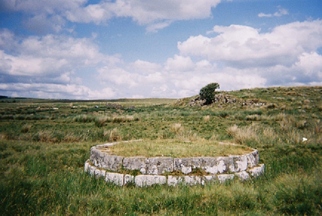
Bremenium Roman tumulus submitted by tombraider on 12th Jul 2015. Charming well-preserved suburban survival!
(View photo, vote or add a comment)
Log Text: Petty Knowes Roman Cemetery/Bremenium Roman Tumulus: We walked too far north along the track, past Lamb Crags, and had to double back. We should have turned immediately right through the gate at NY 83788 98236. However, being on top of the crags gave us a good viewpoint down to the tomb below, although the sun was by now directly in the camera lens.
As I was walking round the one remaining, circular tomb, the farmer came speeding up on this quad bike and came to a halt by the fence. At first, I thought we were trespassing, and asked him, but he said “no, you’re alright”. His farmhand had told him 8 people had walked up to have a look, so he’d come up to see us. “No, there’s only the two of us”, Andrew replied.
The farmer very kindly walked us round the base of the tomb and pointed out three carvings on the bottom (visible) layer – two diamonds and a bull. He showed us another layer which is now buried under the earth, but the top of its lip can be felt underfoot.
He also pointed out the 51 Roman graves by the quarry (“head for the beech tree”); he also told us about some interesting stones near the footbridge, and that the small extension at the old School House (next to the war memorial) was partly built out of Roman stones. He said he himself had moved some stones into his own garden.
Howden Hill 3
Trip No.125 Entry No.7 Date Added: 25th Apr 2019
Site Type: Rock Art
Country: England (Northumberland)
Visited: Yes on 20th Apr 2019. My rating: Condition 3 Ambience 4 Access 3
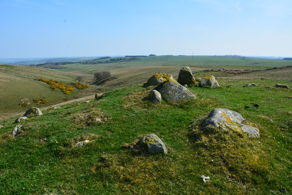
Howden Hill 3 submitted by Anne T on 24th Apr 2019. Photo showing the location of the cairn from its north western side, showing the steep slope down to Settlingstone Burn below.
(View photo, vote or add a comment)
Log Text: Howden Hill/Settlingstone Burn 3: Standing at the Howden Hill Rock Art Panels 1 and 2, two large stones and a large erratic were prominent on the skyline a couple of hundred metres to the east. They looked well worth investigating, so we followed the tractor trail up to the them. Wow. The location is lovely.
What a setting for the remains of this cairn, which sits high above Settlingstone Burn, at the top of a steep slope. The rock art panel within it is the most prominent of the stones within the cairn with its almost luminescent yellow/green lichen which served to highlight the cup marks. Whilst NADRAP/ERA says the cups may be caused by erosion, we thought they were pretty convincing, the outer cups being seemingly arranged in lines. If this was the original cist cover, it has been overturned at some time in the distant past.
Howden Hill 1
Trip No.125 Entry No.2 Date Added: 24th Apr 2019
Site Type: Rock Art
Country: England (Northumberland)
Visited: Yes on 20th Apr 2019. My rating: Condition 3 Ambience 4 Access 3
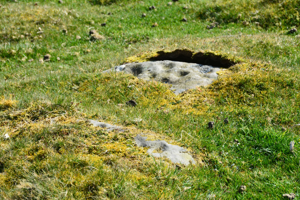
Howden Hill 1 submitted by Anne T on 24th Apr 2019. Howden Hill panels 1 and 2 together. Howden Hill 1 is the northern most panel, shown towards the bottom middle-left of the photograph, mostly covered in turf.
(View photo, vote or add a comment)
Log Text: Howden Hill 1: Rock Art panel within Bronze Age Stone setting, not far to the south of Hadrian's Wall. Setting is quite fascinating, comprising cists, cairns, low banks and rock art. We had not expected to see this cists, so this came as a nice surprise. Whilst we could see quite deep cups on this rock, most of it was covered by turf, so we left it alone to preserve it.
Immediately to the east of the easternmost of the two cists we saw, Historic England List ID 1418656 says: "The first and most northerly panel (ERA 1415) is roughly triangular in shape and dips steeply into the ground from an uncovered high point on its south edge; it is about 0.8m by 0.5m and is oriented east to west. There are about thirty cup marks scattered across the boulder and some appear to form slightly curved or straight lines".
Howden Hill 2
Trip No.125 Entry No.3 Date Added: 24th Apr 2019
Site Type: Rock Art
Country: England (Northumberland)
Visited: Yes on 20th Apr 2019. My rating: Condition 3 Ambience 4 Access 3
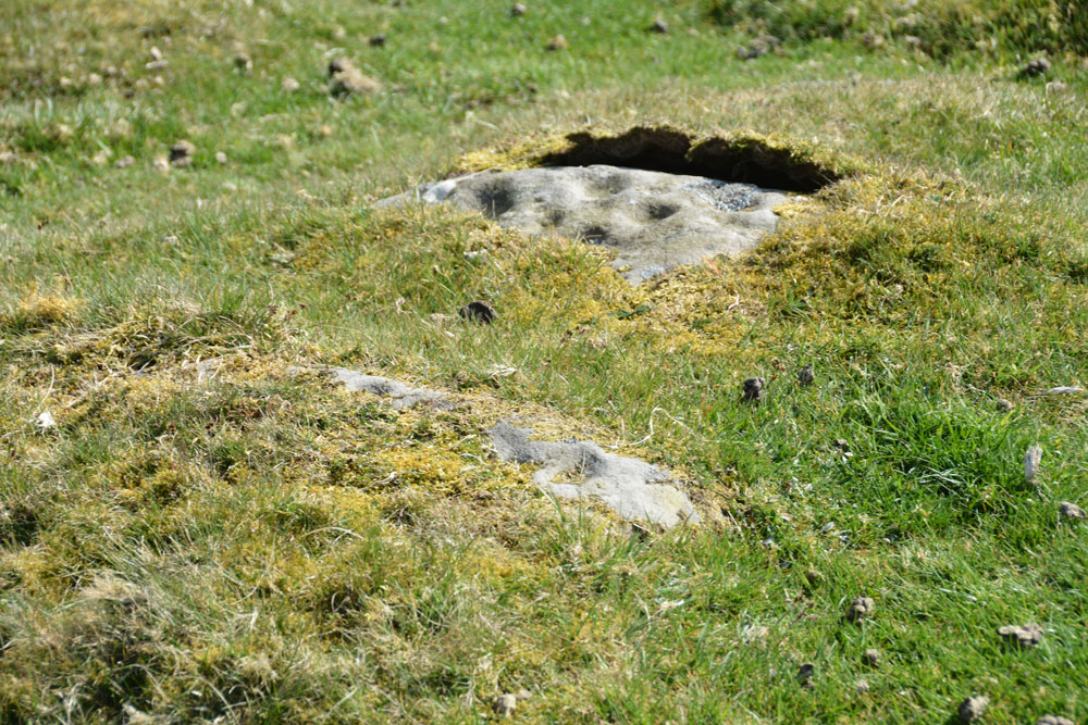
Howden Hill 2 submitted by Anne T on 24th Apr 2019. Howden Hill panels 1 and 2 shown together. Howden Hill 2 is the top-most panel in the photograph, probably less than 1 metre to the south of Howden Hill 1. We thought they were possibly part of the same outcrop, but looking at the ERA photographs, they are two separate stones, possibly the original cists covers of the nearby cists.
(View photo, vote or add a comment)
Log Text: Howden Hill 2: Literally 1m to the north of Howden Hill 1, and has most visible. It is clear that both rocks continue under the turf, but not wishing to cause any damage, viewed them as they were. Having seen Andy Curtis's photograph on Geograph beforehand, I'd expected both panels to be covered in turf, and was surprised to find the cups that were above ground were very visible in the strong sunlight. Both panels are to the east of the sheepfold and the two cists that we saw and went back to examine after photographing what was visible of these two RA panels.
Recorded as HE 1418656 and ERA-1414: "The second panel (ERA 1414) lies immediately to the south of the first, and is a rounded boulder about 0.9m across. there are more than fifty cup marks, again some forming prominent lines, curved arcs or more scattered groups; the latter are particularly clustered on the south and west sides. It is possible that the panels represent a broken, decorated cist cover".
West Howden Hill
Trip No.125 Entry No.1 Date Added: 25th Apr 2019
Site Type: Ancient Village or Settlement
Country: England (Northumberland)
Visited: Yes on 20th Apr 2019. My rating: Condition 2 Ambience 4 Access 4
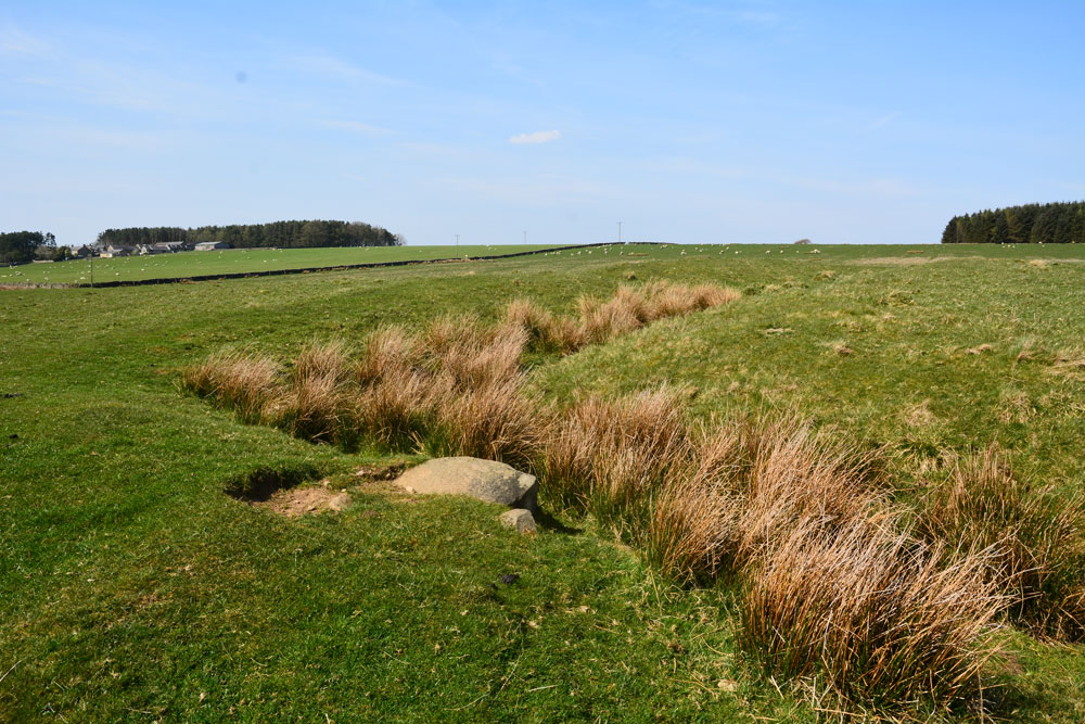
West Howden Hill submitted by Anne T on 25th Apr 2019. The south western corner of this Romano British settlement, looking north west towards the small forested area to the north of Grindon farm. This large farm can be seen just above centre-left of the photo.
(View photo, vote or add a comment)
Log Text: West Howden Hill RB Settlement: Unusually, our daughter joined us for this trip, as it was on her way to our house from Scotland, and we met outside the Old Repeater Station on the Old Military Road (B6318) and took one car the 1.4km down to the gate with the path leading to the access land on Howden Hill/Brown Moor.
This settlement straddles the marked track from North Road which runs from the Old Military Road and Old Repeater Station , past a large farm called Grindon, to reach the access land. We parked on the grass verge next to the gate into the field at NY 82336 69216 and made our way through the fields towards the location of the rock art.
There is no entry for this settlement on HE, but it is marked on their map as an enclosure.
I didn’t see this settlement until we were almost upon it. The outer ditches and banks are very clear, with an entrance half way along its eastern side. I also stopped to take photos on the way back, together with some large erratic boulders which lay next to the footpath. The site is gently sloping towards the south east and there are prominent boulders protruding from its central platform, although we could make out no discernible structures.
