Contributory members are able to log private notes and comments about each site
Sites Anne T has logged. View this log as a table or view the most recent logs from everyone
Danby Rigg (Crossley Gate)
Trip No.32 Entry No.4 Date Added: 5th Jul 2017
Site Type: Cairn
Country: England (Yorkshire (North))
Visited: Yes on 2nd Jul 2017. My rating: Condition 2 Ambience 4 Access 4
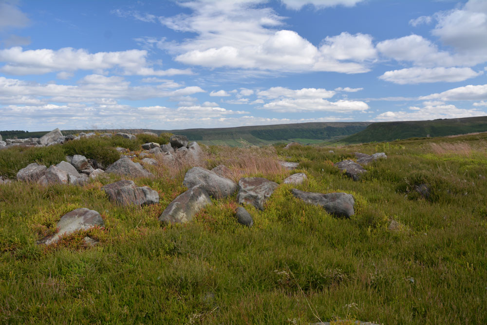
Danby Rigg (Crossley Gate) submitted by Anne T on 4th Jul 2017. Standing on the western side of the cairn looking towards Little Fryup Dale.
(View photo, vote or add a comment)
Log Text: Round cairn overlooking Crossley Gate, Danby Rigg, North Yorkshire: From the other marker stones along the track between Little Fryup Dale and Danby Dale, we walked back to the trig point, then took the footpath (mountain bike track) headed north east along the path that runs along the eastern edge of Danby Rigg. There are great views down to Lower Fryup Dale below. Even I managed this path. There was a steady breeze, which got stronger as the afternoon progressed, but it was warm and relatively easy walking until we headed off into the heather.
We first saw the long, low cross dyke just before the cairn. This mound was largely hidden in the tall heather, which had just started to flower, attracting the steady buzz of the worker bees. I could make out the stones in the mound.
This cairn is just to the north of this cross dyke and is prominent with its stoney mound surrounded by bright green growth which shows up the circular nature of the feature. On the horizon to the west it looks as if other low cairns pop up out of the heather.
Danby Rigg (Slate Hill)
Trip No.32 Entry No.1 Date Added: 5th Jul 2017
Site Type: Marker Stone
Country: England (Yorkshire (North))
Visited: Yes on 2nd Jul 2017. My rating: Condition 4 Ambience 4 Access 4
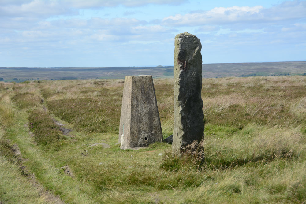
Danby Rigg (Slate Hill) submitted by Anne T on 4th Jul 2017. First view of this marker stone and the trig point (TP2728 at NZ 70788 05869) on the eastern edge of Danby Rigg.
(View photo, vote or add a comment)
Log Text: Marker/Standing Stone & Trig Point, Danby Rigg, North Yorkshire: Not marked on the OS map, this stone sits within a couple of metres of Trig Point TP2728 (Danby Moor). It is sited almost on the eastern edge of Danby Rigg, where the ridge starts to slope sharply down to Little Fryup Dale. There is no information recorded about it on Pastscape, although their information for the area indicates a number of way markers, some scheduled, which mark the route of a medieval footpath which runs from Slate Head to Ainthorpe. Other way markers (such as this) mark out two separate footpaths from Little Fryup Dale in the east to Danby Dale at the western most side of the ridge. This sits at the side of the western most track, continuing the farm track east-west over the ridge.
The area has a long history and plays host to many features, including cairn cemeteries, cross dykes, cairn circles and round cairns, many dating to the Bronze Age and possibly Neolithic.
The easiest way to reach this stone and trig point is to walk from (or park at) the cross roads just to the south of Slate Hill House (where Castle Lane, New Way and Slate Hill meet). There is a farm track and a footpath starting almost from the same point up to the top of Danby Rigg. The footpath is somewhat overgrown and steep towards the top, so we followed the well used farm track which heads almost directly west then tracks north east up the slope. Almost as soon as the path levels out, you see the stone and the trig point. The views back towards where Little Fryup Dale meets Great Fryup Dale. The views across these valleys and northwards back towards Ainthorpe are stunning.
Glaisdale Rigg Tall Cairn
Trip No.32 Entry No.8 Date Added: 5th Jul 2017
Site Type: Cairn
Country: England (Yorkshire (North))
Visited: Yes on 2nd Jul 2017. My rating: Condition 3 Ambience 4 Access 4
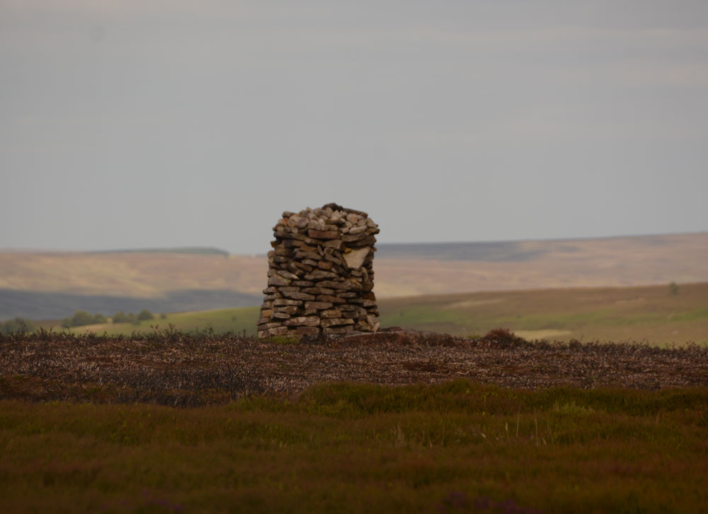
Glaisdale Rigg Tall Cairn submitted by Anne T on 4th Jul 2017. This modern tall dry stone cairn sits about 100 metres east of the Glaisdale Rigg moorland road, 500 metres south of a nearby Trig Point (TP3365 at NZ 74060 04148) and just north of Hart Leap, a Bronze Age boundary feature.
(View photo, vote or add a comment)
Log Text: Glaisdale Rigg Dry Stone Cairn, North Yorkshire: I spotted this whilst we were walking along the road to find Hart Leap. It looks relatively modern (there are lots of grouse shooting butts in the area) but by this late in the evening and after having walked seemingly miles across knee deep heather, my feet and ankles declined to go any further on this uneven ground, so I admired it from a distance.
When I got home, I found out it featured on the North Yorkshire Moors CAM web site from 2001, asking anyone who knew when and why this was built to contact them. I sent an email off to the author who replied virtually by return. He told me they never did find out any information, but he "did read that it was there in 1965."
Milnholm (Newcastleton)
Trip No.31 Entry No.4 Date Added: 30th Jun 2017
Site Type: Ancient Cross
Country: Scotland (Scottish Borders)
Visited: Yes on 24th Jun 2017. My rating: Condition 3 Ambience 4 Access 5
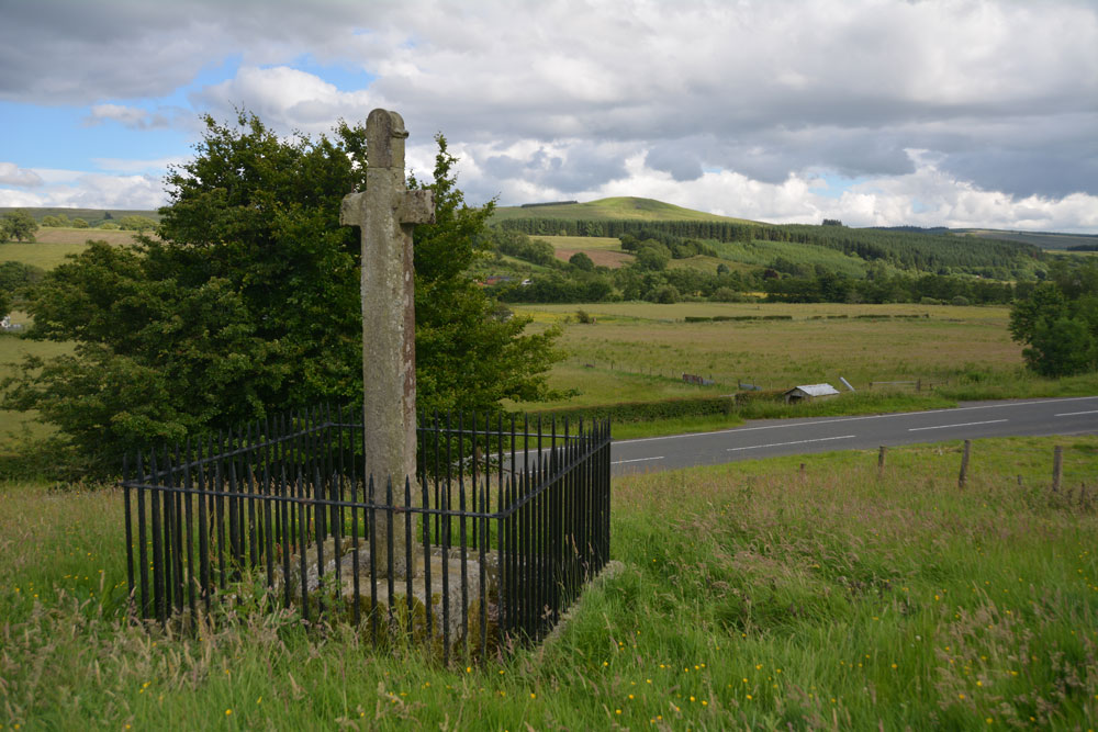
Milnholm (Newcastleton) submitted by Anne T on 30th Jun 2017. Standing behind the cross looking over to Carby Hill Settlement (middle right of the photograph).
(View photo, vote or add a comment)
Log Text: Milnholm Cross, Newcastleton: Not my usual type of cross, but interesting nevertheless. This cross sits just to the south of Newcastleton Village, on the right hand side of the B6357. There is a small layby at NY 47633 86073 where a side road heads off up the hill, signposted to Ettleton cemetery. It is very reminiscent of a site near Eskdalemuir that we visited some time ago. Carby Hill settlement can be clearly seen to the south-west.
The railings made it quite difficult to photograph the cross properly. I wasn’t that enamoured of it, or the location (more interested in going up to the cemetery at Ettleton, but we didn’t go there). There is an interpretation board at the base of the steps.
Old Castleton (Newcastleton)
Trip No.31 Entry No.2 Date Added: 30th Jun 2017
Site Type: Misc. Earthwork
Country: Scotland (Scottish Borders)
Visited: Yes on 24th Jun 2017. My rating: Condition 2 Ambience 4 Access 4
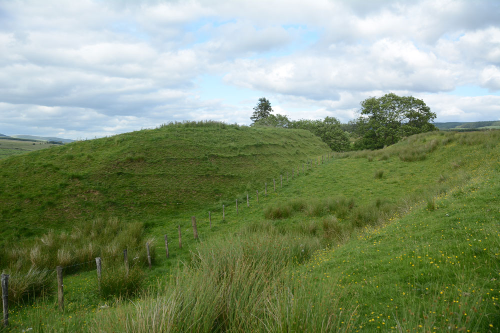
Old Castleton (Newcastleton) submitted by Anne T on 30th Jun 2017. Approaching the earthworks from the north eastern end of the cemetery, there is a large 'motte' to the left hand side, a broad ditch (moat?) to the middle and a large bank/rampart to your right. To the middle left of the photograph the ground drops steeply (100 feet straight down!) into Liddel Water.
(View photo, vote or add a comment)
Log Text: Old Castleton Earthworks (Liddel Castle), Near Newcastleton: At the north-eastern end of the cemetery, there is a small iron gate which leads out onto the field with the earthworks. The gate had been tied fast, but rather than walk all the way round, I used my un-knotting skills (honed from many years of knitting with cats around) and let ourselves into the field. Whilst the earthworks seemed big viewed from the B6357, they were very large as we approached them.
I was surprised, on reaching the western flank of the earthworks that the ground disappeared straight down some 100 feet to the Liddel Water below on it’s western side and a small burn running north-south to its east. There appeared to be the remains of a large ditch (moat?) to its southern flank and the mound is further divided into two parts east-west across the middle
Very impressive. A lot of history in a small area round here, with St. Martin's cemetery and the old cross nearby.
Castleton (Newcastleton)
Trip No.31 Entry No.3 Date Added: 30th Jun 2017
Site Type: Ancient Cross
Country: Scotland (Scottish Borders)
Visited: Yes on 24th Jun 2017. My rating: Condition 1 Ambience 4 Access 5
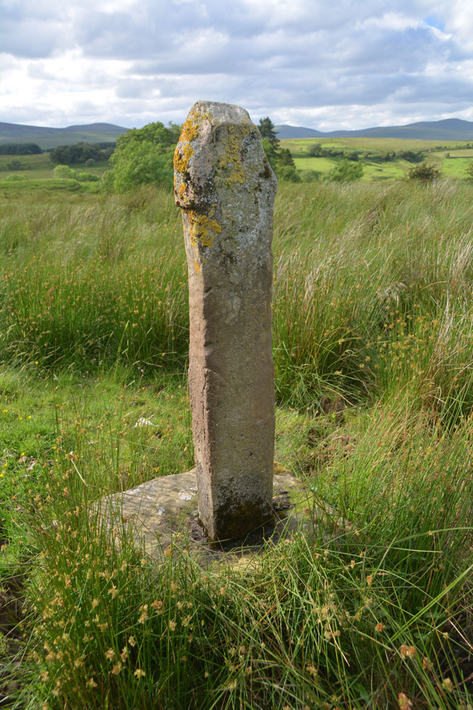
Castleton (Newcastleton) submitted by Anne T on 30th Jun 2017. Standing just behind the cross at its eastern side, looking back over the Liddel Water valleys.
(View photo, vote or add a comment)
Log Text: Castleton Cross, Near Newcastleton: Whilst this cross can be seen from the road, it is best viewed from the field (gate opposite the cemetery, otherwise its a clamber over a barbed wire fence in boggy ground). The shaft is a modern replacement, made of concrete. The field contains many lumps and bumps - the remains of the old village. This spot is virtually opposite Old Castleton earthworks (Liddel Castle) and with the enigmatic cemetery with its strange grave markers and brilliant views, it was well worth the stop. Shame the road was so busy at this time on night; cars whizzed by at 60 mph at regular intervals. Not the safest place to walk.
Caddrounburn Calvert
Trip No.31 Entry No.1 Date Added: 26th Jun 2017
Site Type: Ancient Village or Settlement
Country: Scotland (Scottish Borders)
Visited: Yes on 24th Jun 2017. My rating: Condition 2 Ambience 4 Access 5

Caddrounburn Calvert submitted by Anne T on 26th Jun 2017. Standing near the north west corner of Enclosure B, looking south west towards Liddel Water. The ditch between Enclosure B and Enclosure B can be seen to the middle right of the photo.
(View photo, vote or add a comment)
Log Text: Caddrounburn Calvert, Scottish Borders: [Note: whilst the site can be seen from the road by Liddel Water, it is a short climb up the slope to walk round the exterior walls of the settlement. I found the tussocks of grass and hidden lumps of stone challenging on my ankles, but took a walking pole to help.]
Following the road to the west of Kielder Water, this twists and turns gently through the countryside. The border here takes some interesting lines, but we ascertained we were just into the Scottish Borders. This fort/settlement is in a lovely spot overlooking a bend of Liddel Water. The grass was almost knee high, but it was still possible to make out Enclosure B from the road. To the western side of Enclosure B, there was a deep ditch and the start of another boundary feature, but the grassy was too long and lush to make out much of Enclosure B at this time of year.
We parked on the south side of the road at NY 58270 98319, where it widens out very slightly on a bend (avoiding the sheep and their large lambs who were totally unperturbed by the car) and headed up the slope to Enclosure B.
The banks are high (up to 1.5 metres) in places, clearly made up of stones and earth. Whilst not quite a square, the corners are well rounded and there is an about 8 foot wide entrance at its south western corner. The banks appear to be between 3 to 4 meters wide, including the tumble at either side. There was a north-south bank from about the middle of Enclosure B to about half way down the enclosure, before it petered out. I (stupidly) thought this was the division between Enclosure A & B, but looking at the site on UK Grid Reference Finder once I got home, I was sadly mistaken! We’d missed Enclosure A completely, although I did spot the ditch dividing the two areas. The grass was very lush and thick, and any banks of Enclosure A were certainly hidden from both the road and Enclosure B. I’d love to see this site again in the winter.
Gibbie's Knowe (Kielder)
Trip No.31 Entry No.3 Date Added: 19th Jun 2017
Site Type: Ancient Village or Settlement
Country: England (Northumberland)
Visited: Yes on 17th Jun 2017. My rating: Condition 3 Ambience 5 Access 3

Gibbie's Knowe (Kielder) submitted by Anne T on 19th Jun 2017. About 200 metres further south along the track, the whole of Gibbie's Knowe defended Iron Age settlement comes into view. It sits within a loop of Kielder Burn.
(View photo, vote or add a comment)
Log Text: Gibbie's Knowe, Kielder Forest: After our long trek up to Dour Hill Chambered Cairn, the heat was definitely getting to both of us. Andrew decided to drive the 12 miles down the Forest Drive toll road from Cottonshopeburnhaugh to Kielder. Goodness, this road is remote, but lovely.
We stopped off to see Gibbie’s Knowe, an Iron Age defended settlement, parking off Forest Drive just west of East Kielder Farm (there is a small layby at NY 65257 95857) and following the track south-south-west up the slope towards Kielder Village. We were unable to get down to the mound, but retraced our steps and drove further west along Forest Drive to park in the layby and walk down the overgrown track to the site of an old observation hide (no longer there) at NY 64791 95234. A lovely spot, with the sun glinting off this deep loop of Kielder Burn.
Unfortunately, it was almost 6pm by this time, and we were flagging with the heat, so we abandoned our next walk to Devil’s Lapful long cairn.
Rochester (Otterburn)
Trip No.31 Entry No.2 Date Added: 19th Jun 2017
Site Type: Modern Stone Circle etc
Country: England (Northumberland)
Visited: Yes

Rochester (Otterburn) submitted by Anne T on 19th Jun 2017. View of this modern stone circle from the gateway into the field from the rear of the Camien Café.
(View photo, vote or add a comment)
Log Text: Rochester (Otterburn) Modern Four Poster: We’ve seen this stone circle and a tumble-down round house whilst driving by on the A68 on a number of occasions but never stopped. However, today, after a hot but pleasant afternoon walking to Dour Hill Cairn, we doubled back to the café for refreshments and got chatting to the owners.
The café owners told us there used to be a round house here, but it was demolished by the University of Newcastle who ran the Brigantium project. There is now a timber faced building on the site and they intend using it for ‘Dark Skies’ and the Redefest music festival which is run on 1st weekend of August in Redesdale (this year it will be Friday 4th August to Saturday, 5th August). See https://redefest.org.uk/about-us.
Dour Hill (Rochester)
Trip No.31 Entry No.1 Date Added: 19th Jun 2017
Site Type: Chambered Cairn
Country: England (Northumberland)
Visited: Yes on 17th Jun 2017. My rating: Condition 2 Ambience 4 Access 3
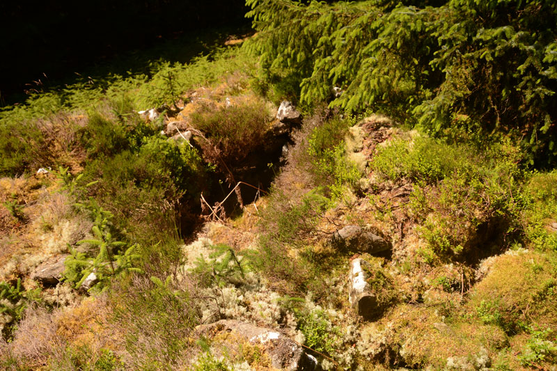
Dour Hill (Rochester) submitted by Anne T on 19th Jun 2017. This is the larger Bronze Age cist, sited towards the north western end of the cairn. We had to pull back a large conifer branch to get a clear view. This chamber was easily deeper and much more visible than the smaller chambers up and down the length of the cairn.
(View photo, vote or add a comment)
Log Text: Dour Hill Chambered Cairn, Near Otterburn: We picked the hottest day of the year so far to visit here, and climbed the gently sloping hill up past the very tall forest plantations towards the top of Dour Hill.
This visit was interesting as the army were carrying out exercises on the Otterburn Ranges less than 400 metres away. They must have been at the top of Dour Hill as, as soon as we'd reached the cairn, there was an almighty boom and the ground under our feet trembled with the ordnance being fired. On the way back to the A68 we heard the radios and voices not far away.
Unlike Bellshiel Law chambered cairn, this cairn sits in a forest clearing and nature has been allowed to reclaim it. The chambers can still be made out, and there is a large, deep Bronze Age cist cut into the cairn to the north west of its middle section (I had to pull back a large conifer branch to photograph it properly).
Well worth the walk. Would have liked to have seen the Bronze Age round cairn some 170 metres to its east but the forest was dense and we missed it.
Chatton 1a
Trip No.30 Entry No.2 Date Added: 14th Jun 2017
Site Type: Rock Art
Country: England (Northumberland)
Visited: Yes on 11th Jun 2017. My rating: Condition 2 Ambience 4 Access 4
Chatton 1a submitted by SolarMegalith on 18th Mar 2013. Cup-and-ring mark on Chatton 1a panel shining in the sun after the rain (photo taken on March 2013).
(View photo, vote or add a comment)
Log Text: Chatton 1a, Rock Art, Northumberland: After our trip to the Farne Islands, as we were nearby and had an hour or so to spare, we decided to head off to Chatton to see if we could find the rock art and the rock shelter. Little did I realise that we’d be blown off the top of the hill – I found it almost impossible to stand and take photographs, despite it being a relatively calm, sunny day.
Andrew (husband) related that friends (Martin Green and Dot) who’d visited the trig point here had been unable to find any rock art. They also said that there was now a sign on the gate leading onto the track (at NU 07833 28678) leading up to the rock art site, but we didn't see any. However, the track was clear and easy to follow.
I confess to being really disappointed, as the marks were very worn and faint, and we had difficulty identifying them, even though we knew what we were looking for. We found three examples: Chatton 1a, Chatton 2 and Chatton 3.
Husband set off to the Ketley Crags rock shelter, but didn't take the camera with him, so a separate trip will be required (note: found an alternative route avoiding the stream).
Chatton 3
Trip No.30 Entry No.2 Date Added: 14th Jun 2017
Site Type: Rock Art
Country: England (Northumberland)
Visited: Yes on 11th Jun 2017. My rating: Condition 2 Ambience 4 Access 4
Chatton 3 submitted by SolarMegalith on 3rd Aug 2013. The best preserved motif on Chatton 3 panel seen at night (photo taken on June 2013).
(View photo, vote or add a comment)
Log Text: Chatton 3, Rock Art, Northumberland: See visit report for Chatton 1a.
Chatton 2
Trip No.30 Entry No.2 Date Added: 14th Jun 2017
Site Type: Rock Art
Country: England (Northumberland)
Visited: Yes on 11th Jun 2017. My rating: Condition 2 Ambience 4 Access 4
Chatton 2 submitted by SolarMegalith on 18th Mar 2013. Close-up of the "television set" motif (photo taken on March 2013).
(View photo, vote or add a comment)
Log Text: Chatton 2, Rock Art, Northumberland: See visit report for Chatton 1a.
St. Cuthbert's Well (Farne Islands)
Trip No.30 Entry No.1 Date Added: 14th Jun 2017
Site Type: Holy Well or Sacred Spring
Country: England (Northumberland)
Visited: Yes on 11th Jun 2017. My rating: Condition 2 Ambience 4 Access 3
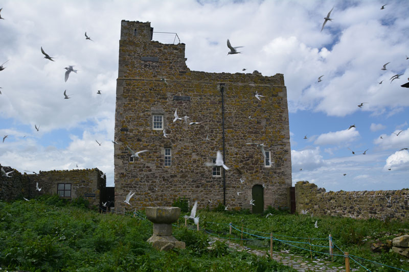
St. Cuthbert's Well (Farne Islands) submitted by Anne T on 14th Jun 2017. The traditional site of St. Cuthbert's well (described as being a fountain of water which emerged from the spring) is believed to be on the ground floor of Prior Castell's Tower. This is my version of the image on the Pastscape record for this site, with Arctic Terns in full flight protecting their chicks. The wardens told me that if you moved their equipment, there is a stone lined chamber with steps leading down, which still contains water.
(View photo, vote or add a comment)
Log Text: St. Cuthbert's Well (site of), Inner Farne: Requires boat trip and short walk from the jetty to see exterior of the building within which it is located. The sea was very calm today, but there were lots of people on the boat – there must have been around 3 to 4 space places. We had a trip around the islands, stopping to see the seals and various colonies of birds in their different nesting places.
Eventually arriving at Inner Farne, the island was full of people with big cameras and enormous lenses, and I felt the ‘poor relation’ with my small lens. The terns were in full flight, protecting their eggs and their chicks.
I took my list of sites with grid references and asked the National Trust Warden who was manning the information point. She said it was not possible to get into the lighthouse compound to look for the cross base, as it was owned by Trinity House and off-limits. She said there was a well in the basement (Pastscape says ground floor) of Prior Castell’s Tower, but as it was used by the wardens for accommodation, the public were not allowed in. She did confirm that there was a door/panel that could be opened, with a few steps leading down to a stone lined chamber containing water, which would be the well.
She also said that they believed what is now called “The Fisherman’s Hut” was the site of St. Cuthbert’s Cell and the place of his death. “There’s a small window where he would watch for people coming to the island, and if he didn’t want to talk to them, wouldn’t open the door.” Pastscape says there is considerable doubt about the position of the cell and there are various theories about its location.
I also had the location for a cross base, but as this was located inside the lighthouse grounds (or on the cliff edge!), this area was out of bounds to tourists.
Beckermet Ancient Crosses (St Bridget's)
Date Added: 4th Jun 2017
Site Type: Ancient Cross
Country: England (Cumbria)
Visited: Yes on 24th Oct 2014. My rating: Condition 3 Ambience 4 Access 5
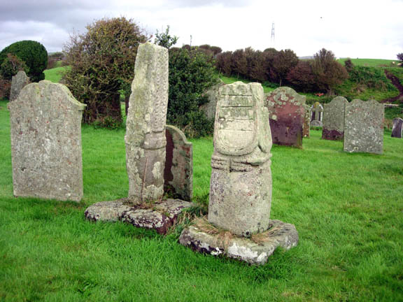
Beckermet Ancient Crosses (St Bridget's) submitted by astronomer on 13th Oct 2006. The squat Saxon cross at Beckermet is stylistically very similar to Eliseg's pillar at Llangollen and to others in the Lyme, the moorlands fringing the eastern border of Cheshire and Staffordshire with the Peak District, especially between Macclesfield and Leek. The western side of the Beckermet cross, shown here, displays a panel thought to carry Viking runes carved on its surface.
(View photo, vote or add a comment)
Log Text: Ancient crosses, St. Bridget’s Church, Beckermet: Despite having been given directions by the vicar of St. John’s, Beckermet, we had several attempts at finding St. Bridget’s, but got there in the end. We need to take a left hand turn off the main road through Beckermet opposite Crofhouse Farm into a small housing estate, then taking the right hand turn marked ‘St. Bridget’s Church’ a few hundred yards down this lane and following this narrow lane down to the church. By this time, the wind had got up and whilst it wasn’t particularly cold, it wasn’t a day to linger.
There was some parking outside the church, which looked virtually derelict, although there were some recent burials in the churchyard, with fresh flowers and containers of water by the church door. The door to the church was open, shut only by a wooden latch which pivoted on a central nail.
Both cross shafts were to the south of the church, looking onto open countryside, with the towers of Seascale/Sellafield in the near distance.
The taller of the two cross shafts, Beckermet St. Bridget 02, dates from the tenth to eleventh century, and is made of St. Bees sandstone. According to the ASCorpus notes, the three encircling mouldings around the cylinder are rare.
I found the shorter of the two cross shafts fascinating, with the remnants of an inscription on its western face.
Apparently, there was a third fragment, part of a cross-head, which is now under plaster in the east wall of the chancel.
Langdale Axe Factory
Date Added: 4th Jun 2017
Site Type: Ancient Mine, Quarry or other Industry
Country: England (Cumbria)
Visited: Yes on 11th Aug 2015. My rating: Condition 3 Ambience 5 Access 3
Langdale Axe Factory submitted by Thorgrim on 15th Nov 2003. The Langdale Pikes in Great Langdale.
(see article on Langdale Axes)
(View photo, vote or add a comment)
Log Text: Mickleden Way, finding pointers to the Pike O'Stickle Axe Factory: I was lucky enough to win a copy of Gabriel Blamires book in a Portal photographic competition. It arrived just in time for our trip over to the Lakes on 10th/11th August. We followed Chapter 4: The Mickleden Way, having parked at the National Trust pay and display car park next to the Old Dungeon Ghyll Hotel, and headed up behind the pub onto the stoney footpath into the hills.
This is a beautiful and easy walk with Mickleden Beck in the valley to the left hand side and Langdale Fell with Pike O’Stickle to our right. We were passed by a number of small climbing parties coming back the other way.
We found boulders 4.1 to 4.7. We had intended finding more but dusk stopped us in our tracks and had us retracing our steps back to the Hiker's Bar at the hotel The Pike O’Stickle Pentagon was perhaps the most dominant and impressive stone. To be found at NY 2738 0640 it stands out proudly on the hillside and is one of the more convincing markers/pointers. There has been some recent activity around both sides of the stone, with gullies being made to channel water off the hillside around it, hence it’s a bit tricky to get up to. From the banks of one of these gullies I picked up a lump of shiny black stone (now dried it is a dull green-grey with light brown inclusions) which was incredibly sharp. We later identified it as a piece of stone used for the axes, so it now sits proudly on my window ledge.
As our walk continued there were so many stones and stony outcrops that we started to wonder how Gabriel Blamires had chosen the pointers he did, as there were others which equally stood out in the landscape. He has obviously done an immense amount of research to check everything out. I did get excited at boulder 4.4 as bending down to retrieve the lens cap for my camera, I noticed that the top profile of the boulder seemed to echo the pattern of the peaks above.
Following the book to the letter, and thankful for our GPS, we got to boulder 4.7 before spotting what looked like an area of cairns.
There are many more boulders detailed in Gabriel's book, along with some stunning walks/ways and I really look forward to finding out more.
I do agree with rich32 that you would have needed ropes and parachutes to attempt to get up to the axe factory!
Hurl Stone
Date Added: 31st May 2017
Site Type: Standing Stone (Menhir)
Country: England (Northumberland)
Visited: Yes on 30th Aug 2014. My rating: Condition 2 Ambience 3 Access 4
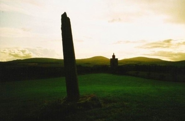
Hurl Stone submitted by Bladup on 30th Dec 2013. The Hurl stone, In the background is a folly built in 2000.
(View photo, vote or add a comment)
Log Text: The Hurl Stone, Newtown, Northumberland. Second visit: Saturday, 30th August 2014. Armed with a letter from the landowner allowing us access, we set off back to the Hurl Stone before the weather turned.
The farmer was busy herding sheep down the road to the field next to the Newtown Mill standing stone. He was using an army style buggy and 4 sheep dogs, which was fascinating in itself. Having watched this, we drove the 100 yards further up to farm at Newtown and bumped up onto the grass verge next to the gate leading into the Hurl Stone field.
It was a longer walk than it looked, through lush ankle high grass to the top of the slight hill. The tall Hurl Stone commandeered the horizon, but I was only about 20 yards away when I realised it had been concreted in. It looked as if at some time it had toppled and been recently re-erected (but if they’d done this, why let the stone lean, unless it was to give the impression it had indeed been hurled? Sorry, this is me being sceptical). This took a little of the shine off seeing the Hurl Stone, but my goodness, what a 360 degree view, which I’ve tried to represent in the photographs submitted to the Portal.
The face of the stone facing the recently built tower (I’m told this is used as a conference centre, but haven’t been able to verify this yet) looks as if it has broken at some time in the past. The quartz crystals within the stone sparkled in the sunlight. There was some, but not much, graffiti carved into it.
The landowner, who resides nearby, opens his gardens under the National Garden Scheme, and according to an archived article in the Hexham Courant, our local paper, has a 14th century chapel, a crusader tomb and two grave slabs belonging to Knights Templar, so I’ll be looking out for dates to go and see these other treasures.
I’m going to write to thank the landowner for allowing us access.
First visit, August 17th 2014: Driving down the road southwards past the hamlet of Newton, we at first only saw the recently built tower in the field to our right. Driving a little further on, we stopped at the standing stone on the opposite side of the road, just below Ewe Hill, to take photographs. When we turned the car and drove back up the road, the Hurl Stone appeared like a sharp needle, just below the top of the hill.
It’s proximity to the modern tower seems suspicious (we immediately asked ourselves if the stone had been moved to provide a good view of it from Liliburn Tower, the landowner’s house, as from the maps, the modern tower and the stone seem to be in direct alignment?).
There were no public footpaths to the stone, so I stopped at the field gateway and took a photograph. I have since written to the landowner to ask for permission to walk to the stone across the field.
Harbottle
Trip No.28 Entry No.7 Date Added: 30th May 2017
Site Type: Modern Stone Circle etc
Country: England (Northumberland)
Visited: Yes on 28th May 2017. My rating: Condition 3 Ambience 5 Access 4
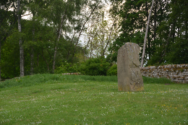
Harbottle submitted by Anne T on 30th May 2017. This modern standing stone can be found on a grassy bank at the western side of the car park for the castle.
(View photo, vote or add a comment)
Log Text: Harbottle Modern Standing Stone/Castle: From Holystone, we passed through Harbottle to get back to the A68, so stopped to look at the castle. The site is lovely.
I spotted the modern standing stone to the west of the car park. The standing stone is inscribed with words:
The Sad Castle
Who Made me/Into a ruin/like an old city?
Was it the soldiers who rode out on horseback?
Was it my old enemy the Scots?
Or was it those Border Reivers?
Perhaps it was just the centuries passing.
Felicity Lance
Apparently there are supposed to be 2 poems, the above by Felicity Lance, another by Robert Corley from Harbottle School, carved into the stone by local stonemason David Edwick. I walked all around the stone, even photographing the other faces to see if anything came up on the camera, but only saw the one poem.
The Pastscape record says there could have been a pre-Conquest fortress on the site. The motte is very steep, and a walk around the moat/outer ditch was charming. Walking into the ruins from the eastern side, there are lots of lumps and bumps of the remains of walls and buildings. Very enigmatic. Really pleased to have been here.
Outer Golden Pot (Otterburn)
Trip No.28 Entry No.4 Date Added: 29th May 2017
Site Type: Marker Stone
Country: England (Northumberland)
Visited: Yes on 28th May 2017. My rating: Condition 2 Ambience 4 Access 5
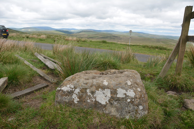
Outer Golden Pot (Otterburn) submitted by Anne T on 29th May 2017. From it's eastern side, the Outer Golden Pot has wonderful views over Upper Coquetdale.
(View photo, vote or add a comment)
Log Text: Outer Golden Pot (Otterburn): What stunning views across to Upper Coquetdale from here. No wonder the site is marked as a view point on the Otterburn Ranges Access Map. The fencing surrounding this Golden Pot has been broken on three sides, so it’s possible to appreciate its form more fully than the Middle Golden Pot.
The base is smaller than the Shitlington Cross but is about the same size as many of the Anglo Saxon Cross Bases we’ve seen in and around churches in North Yorkshire.
As I stepped back towards the road to photograph the base, I saw what looked like a cart track running diagonally up the hillside, crossing under the road and carrying on in a north-east/south-west direction. Andrew pointed out that if I moved a bit further over, I could see the second ditch, so this was the old course of Dere Street, now metalled and called ‘Roman Road’.
After stopping to photograph this stone, we went in search of Ridlees Cairn and Bushman’s Crag, to the south east of these intriguing cross bases.
Inner Golden Pot (Otterburn)
Trip No.28 Entry No.2 Date Added: 29th May 2017
Site Type: Marker Stone
Country: England (Northumberland)
Visited: Yes on 28th May 2017. My rating: Condition -1 Ambience 4 Access 5
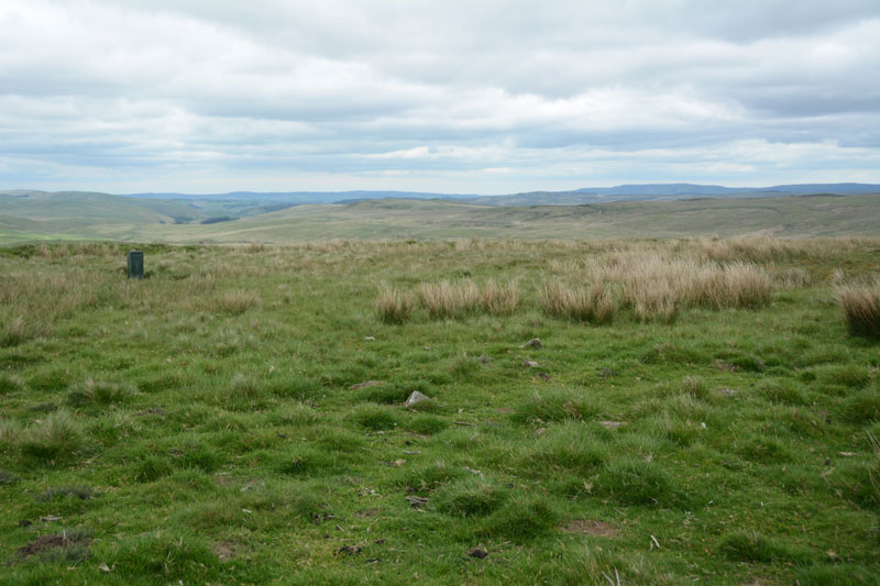
Inner Golden Pot (Otterburn) submitted by Anne T on 29th May 2017. At the site of the Inner Golden Pot there were only broken sandstone pieces and modern army equipment. I thought it was worth stopping to look to see if anything remained, especially as it was a nice viewpoint.
(View photo, vote or add a comment)
Log Text: Inner Golden Pot, Otterburn Ranges: No trace of this cross base can be found, but I couldn't resist having a look. There were some small sandstone pieces around the grid reference point, together with a funny green box - presumably some military equipment. A great viewpoint across to Upper Coquetdale.
