Contributory members are able to log private notes and comments about each site
Sites Anne T has logged. View this log as a table or view the most recent logs from everyone
Roman Bridge Remains (Bitts Park)
Trip No.181 Entry No.1 Date Added: 17th Jul 2022
Site Type: Ancient Trackway
Country: England (Cumbria)
Visited: Yes on 17th Jul 2022. My rating: Condition 2 Ambience 1 Access 4

Roman Bridge Remains (Bitts Park) submitted by Anne T on 17th Jul 2022. The main bulk of the stones from the old Roman Bridge dredged from the River Eden are now displayed between the river and the main avenue through the northern side of Bitts Park. It's not at all obvious what these stones were from, as there was no information board at the time of our visit.
(View photo, vote or add a comment)
Log Text: Roman Bridge Remains, Bitts Park: A lovely park, and a lovely walk. Stones are hidden largely in deep shade between the main avenue running along the northern side of the park and the river. We needed to drop down onto the sandy paths below the avenue, and follow the river along. The four stone 'sculptures' come into view first. The rectangular 'display' of stones is about another 100m further westwards.
Roman Cross (Sheepstor)
Trip No.134 Entry No.15 Date Added: 22nd Jun 2019
Site Type: Ancient Cross
Country: England (Devon)
Visited: Yes on 15th May 2019. My rating: Condition 3 Ambience 4 Access 5
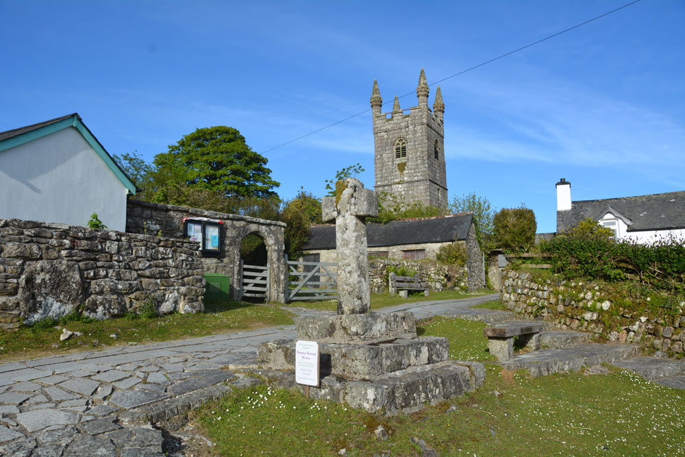
Roman Cross (Sheepstor) submitted by Anne T on 22nd Jun 2019. The Roman/Rumon Cross in Sheepstor, showing its location just outside St Leonard's Church.
(View photo, vote or add a comment)
Log Text: Roman Cross, Sheepstor: After having been to Whittenknowles, Drizzlecomb & Yellowmead, we drove back through Sheepstor and I asked to be able to stop and photograph this cross, which I'd seen on the way, just outside St. Leonard’s Church in Sheepstor village.
The cross has been restored, and almost looks modern, but reading its relatively complicated history, it is fortunate to have survived (see the references in the main site page text).
The cross is in a lovely location, and I would have loved to have had time to pop into the church, but my aching feet and the need for a meal and a drink dictated otherwise!
Roman Milestone (Temple Sowerby)
Trip No.68 Entry No.3 Date Added: 6th Apr 2018
Site Type: Marker Stone
Country: England (Cumbria)
Visited: Yes on 5th Apr 2018. My rating: Condition 3 Ambience 3 Access 5
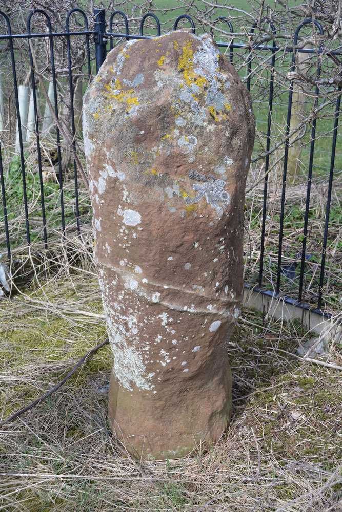
Roman Milestone (Temple Sowerby) submitted by Anne T on 6th Apr 2018. Close up of the southern face of the milestone. If there was an inscription, it has long been scoured away by the winds and rains. Today the A66 Temple Sowerby by-pass rushes by just to the west of this milestone. To think this has sat by a routeway for around 2,000 years.
(View photo, vote or add a comment)
Log Text: Roman Milestone, in its original position, Temple Sowerby: This was a very curious site - now a newly created 'dead end' and technically a private road. The milestone is hidden behind a mound of dirt and stones at the side of the road, protected by a metal railing. Traffic on the he modern A66 Temple Sowerby by-pass whizzes by at high speed. Shame the railing and hedge behind attracts so much rubbish - really spoiled the ambience.
To think this has been on an ancient routeway for such a long time. The weather has long scoured away any inscription. I have been trying to find out how they know it's in its original location, but haven't found out anything (yet).
Rood Well
Trip No.105 Entry No.5 Date Added: 5th Nov 2018
Site Type: Holy Well or Sacred Spring
Country: Scotland (East Lothian)
Visited: Yes on 27th Oct 2018. My rating: Condition 4 Ambience 4 Access 5
Rood Well submitted by KiwiBetsy on 2nd Oct 2006. The Rood Well, also known as The Well of the Holy Rood or the 'Cardinal’s Hat', sits beside the B6370. It is located in a small garden area on the northeastern edge of Stenton, on the left if you are heading for Dunbar.
(View photo, vote or add a comment)
Log Text: Rood Well, Stenton: A very pretty well, and very easy to find. Just by the side of the road, some 300 metres north east along the B6370 from The Tron. The well is below pavement level, with steps leading down to it. The well cavity was damp but there was no pool of water. I couldn’t see any pipe leading into the well chamber, so assume the water must seep up into the cavity. Being closely surrounded by a stone wall on three sides, with a ploughed field beyond, it was a little tricky to photograph.
As the Canmore entry from the Old Church (ID 57841) says, the finial on the well is thought to come from the Old Church (14th century). There is a small plaque on the side of the well which reads: “16th century historic building”.
Ros Castle hillfort
Date Added: 19th Aug 2014
Site Type: Hillfort
Country: England (Northumberland)
Visited: Saw from a distance on 17th Aug 2014. My rating: Condition 4 Ambience 5 Access 3
Ros Castle hillfort submitted by SolarMegalith on 25th Jun 2014. Well-preserved rampart in the southern part of Ros Castle hillfort (photo taken on May 2014).
(View photo, vote or add a comment)
Log Text: Driving back across Hepburn Moor towards the A1, the purple heather spreading in front of us was truly impressive. Although early evening with looming black clouds, we were going to stop off and look at this really impressive ancient monument, but when I opened the car door, it was torn from my hand by the wind and the map I'd been using was whipped across the dashboard to the far side of the car. We'd also had difficulty standing upright in the wind at Fowberry Moor only an hour before, so despite seeing an intrepid family with backpacks and young children in tow make their way across the moor, we decided to leave walking to the top of this Iron Age Hill Fort until another day.
I wasn’t aware that there was any rock art in this area, but thanks to SolarMegalith’s photographs, we’ll look forward to seeing this on our next visit.
Rothley Cross
Date Added: 20th Mar 2019
Site Type: Ancient Cross
Country: England (Leicestershire and Rutland)
Visited: Yes on 17th Mar 2019. My rating: Condition 3 Ambience 4 Access 4
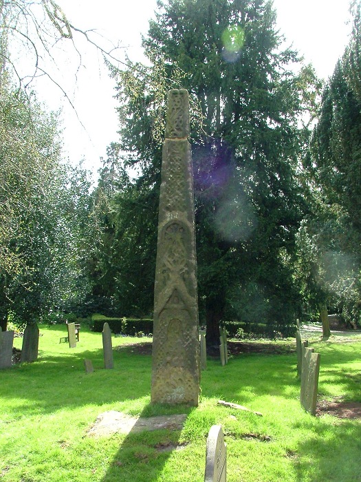
Rothley Cross submitted by gautrek on 20th Apr 2005. An Anglo-Saxon cross dating from the mid ninth century. It is 9ft high.it can be found in the grounds of St Mary and St John the Baptist church in Rothley.OS map (Charnwood,O.S.129, SK586126)
(View photo, vote or add a comment)
Log Text: The Rothley Cross, Leicestershire: The church is usually kept locked, but we had arranged to pick up a key from the Parish Office mid-afternoon. However, calling at the office, there was no reply. Walking back to the church, I spoke to a lady who had been busy clearing the churchyard of broken branches, and she told us the administrator had gone home ill. However, fortuitously, she had a key to the vestry and very kindly let us in.
The church has a long history, and has some amazing grave slabs and a Norman font. The bases of the pillars are said to date to the original Norman church. We found a cross scratched into one of the pillars.
The Rothley Cross is to be found to the south east of the church, near some tall yew trees. At the time of our visit, the cross was in deep shade, although the worn carving was still visible.
We also spotted an unsual carved mark - much more ornate than a mason's mark on the external western jamb of the vestry door.
Roughting Linn Rock Art
Date Added: 20th Jun 2014
Site Type: Rock Art
Country: England (Northumberland)
Visited: Yes on 20th May 2014
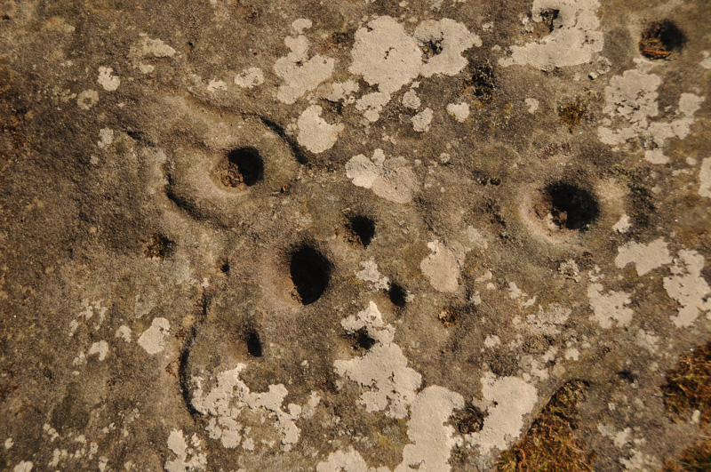
Roughting Linn Rock Art submitted by Anne T on 20th May 2014. Close up of some of the marks on the Roughting Linn outcrop.
(View photo, vote or add a comment)
Log Text: None
Rubers Law
Trip No.93 Entry No.2 Date Added: 31st Aug 2018
Site Type: Hillfort
Country: Scotland (Scottish Borders)
Visited: Saw from a distance on 29th Aug 2018. My rating: Condition 3 Ambience 4 Access 3
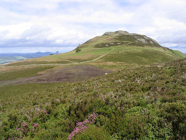
Rubers Law submitted by Creative Commons on 30th Aug 2010. Site in Scottish Borders Scotland
Approaching Rubers Law
Walking through heather near Cloon Craig towards the distinctive summit of Rubers Law with the Eildon Hills on the horizon to the left.
Copyright Walter Baxter and licensed for reuse under the Creative Commons Licence.
http://www.geograph.org.uk/profile/6638
(View photo, vote or add a comment)
Log Text: Rubers Law (only seen from a distance): This impressive hill fort dominates the area. We decided it was too far and too high to attempt today, although I was fascinated by its changing profile as we drove along the minor roads to Bedrule. We will come back when we're feeling fit and strong - it looks like a long walk, gaining height very quickly over a relatively short distance.
I stopped to take photo from the well house (MP 93.1), then at various points along the route:
1. NT 57304 12321
2. NT 59495 15298 By entrance to track signposted to Rubers Law
3. NT 59965 17983 From Bedrule Parish Church
Rugley Walls (Cambo)
Trip No.119 Entry No.4 Date Added: 27th Feb 2019
Site Type: Holy Well or Sacred Spring
Country: England (Northumberland)
Visited: Saw from a distance on 24th Feb 2019. My rating: Condition 2 Ambience 3 Access 4

Rugley Walls (Cambo) submitted by Anne T on 27th Feb 2019. The site of the holy well, as seen from the road, which shows up as a puddle and a brighter green grass against the rest of the pasture. A return trip in better light, more time and a pair of wellies will occur in the relatively near future …..
(View photo, vote or add a comment)
Log Text: Rugley Walls Holy Well: (note wellies a must if trying to get to the well): We stopped off here very quickly as we wanted to leave enough time to see the settlement at Catcherside.
Whilst we could see the source of the well, and there was a gate into the field, we would have need our wellies to get over the stream and boggy area to reach the well. As the light was starting to fail, we elected to carry on to Catcherside.
The well is shown on HE map but no mention on Pastscape. I need to look up the Holy Wells of Northumberland papers. All indications from Keys to the Past are that the well is connected to the deserted medieval village of Rugley Walls, which lies to the eastern side of the B342 road which runs through here.
I'd really like to see the structure that Andy Curtis photographed, so a return visit is on my wish list.
Rumbling Well (Buittle)
Trip No.182 Entry No.2 Date Added: 20th Jul 2022
Site Type: Holy Well or Sacred Spring
Country: Scotland (Dumfries and Galloway)
Visited: Couldn't find on 19th Jul 2022
Log Text: Rumbling Well, Buittle: Unable to get to. Since the Google Earth images and the map on Canmore were produced, an additional lake with platforms for fishing has been introduced at the head of the reservoir.
We parked in the 2-car layby by the footpath sign at NX 80296 61523 and made our way across the fields towards the reservoir, thinking we’d be able to walk around the head of this new lake. What we should have done was parked further north at about NX 80275 61662 (but this was only a field gate with no footpath sign and only passing places to park in), and walked towards the northern side of the reservoir.
With a party of teenagers arriving to swim in the waters, and temperatures in excess of 30 degrees C, the call of cross fragments and other sites called louder, so we gave up, saying we’d come back another day, as there is so much to see in this area.
Rutherford's Well
Date Added: 21st Sep 2014
Site Type: Holy Well or Sacred Spring
Country: Scotland (Dumfries and Galloway)
Visited: Yes on 19th Sep 2014. My rating: Condition 3 Ambience 2 Access 4
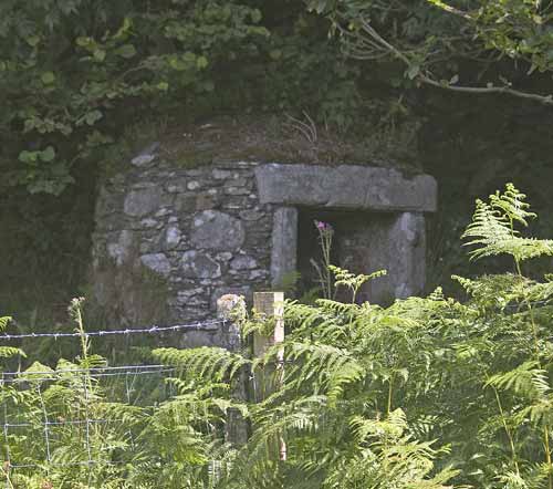
Rutherford's Well submitted by kelpie on 13th Jul 2004. This well is accessed via the path to the right of the ruined church in Anwoth. The well is housed in a domed building and there is a low stone trough outside.
NX 58384 56221
(View photo, vote or add a comment)
Log Text: Rutherford's Well, Anwoth, Dumfries and Galloway: Having just visited Cairn Holy 1 and 2, husband, Andrew, had identified some Pictish motifs, a holy well and some rock art at Trusty’s Hill which seemed worth visiting on our way back home. Anwoth seemed the ideal location for a base for this short walk. Whilst the Old Kirk was marked on the OS map, we didn’t expect this to be so eerie or atmospheric, and we spent a good half an hour wandering around the church – it even has tombstones and memorials inside the old walls of red sandstone - before setting off to find the well.
Parking the car next to the footpath which runs down the right hand side of the church (coming from the A75 and driving north into Anwoth), we set off in search of this Holy Well. I have to say it was difficult to find! We eventually spotted it to the left hand side of the footpath, just before the first metal gate leading uphill to Rutherford’s Monument, hidden behind a wire fence, and tucked between this fence and a tumbled down old stone wall (dyke in this part of the world) behind. The well is only around 190 metres from the rear of the Old Kirk which can be clearly seen across the boggy field between the Kirk and the well.
People obviously still visit regularly, as there were t-lights inside and around. The Scottish Churches website reports that the water from the well is still used for baptisms today. As with other wells we’ve visited, there is a modern brick-built structure over the well itself. The Stewartry Kirks web site tells me that the well is really a shallow pool fed by a spring which comes from the base of the slope behind. The well is named after Samuel Rutherford, minister of Anwoth between 1627 to 1639. Rutherford must have been an amazing man, if the church was dedicated to him, the well named after him, and a huge (but ugly – sorry! Just my opinion) monument built to him on the hills nearby.
Ryton Motte or Tumulus
Trip No.18 Entry No.1 Date Added: 24th Apr 2017
Site Type: Artificial Mound
Country: England (Tyne and Wear)
Visited: Yes on 23rd Apr 2017. My rating: Condition 3 Ambience 4 Access 4
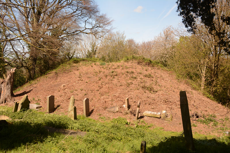
Ryton Motte or Tumulus submitted by Anne T on 24th Apr 2017. The motte seen from its eastern side. Graves had been cut into most sides of the bottom of the motte.
(View photo, vote or add a comment)
Log Text: Ryton Motte, Gateshead: Parking on the main road opposite The Old Cross pub and Holy Cross church on Barnmoor Lane, as there was an event on at the church, the first surprise was to see the old cross located on the village green.
Pastscape reveals this is relatively modern, having been erected in 1765, but the base looks much, much older. Historic England say in list entry 1018642 that there was evidence of an earlier cross on this site.
A stream of very well dressed people were exiting the church yard, indicating a service had just finished. I spent a few minutes photographing the cross, then we sauntered in the churchyard. The name board on the gate to the churchyard says that the church was founded in 1220, and whilst there appears to be old stones in the fabric of the church, popping our head into the church itself, it looks very Victorian. There were people inside, so we didn’t linger.
Walking round the tower at the west end of the church, and round to the north wall, we came across a man digging up brambles and dock plants around the graves. He told us he wasn’t’ associated with the church, but had got fed up of the graveyard looking as it did. He also said he’d just removed shrubbery and brambles off the motte, which looked bare and brown in the warm sunlight. He also told us to look out for the grave of a woman to the north-west of the motte, which had inscribed on the headstone about the grave also containing her husband, who’d lost his arm at Trafalgar.
The motte is certainly a significant structure (I thought it was only small, but it’s not, measuring 3.30 metres with a diameter of 30 metres, according to Pastscape. The mound certainly appears much higher when viewed from the river side, where it looms high above you.
These days, the river is largely hidden by trees, but glimpses of silver water appear as you follow the path round the motte and back up to the east side of the church. It would have had a very commanding spot above the river when it was built.
Saffron Well (Barhaugh)
Trip No.94 Entry No.4 Date Added: 2nd Sep 2018
Site Type: Holy Well or Sacred Spring
Country: England (Northumberland)
Visited: Yes on 31st Aug 2018. My rating: Condition 2 Ambience 3 Access 4

Saffron Well (Barhaugh) submitted by Anne T on 2nd Sep 2018. This well pool is more than a little neglected and overgrown. The waters issue seemingly from nowhere, directly out of the hillside, then running into Barhaugh Burn. Photo taken by Andrew T
(View photo, vote or add a comment)
Log Text: Saffron Well (Barhaugh): After the peace and quiet of Kirkaugh Wells and the Church of the Holy Paraclete, we drove past this even more remote spot. Andrew was brave enough to hop over the stile and descend the very steep, overgrown path down to the river. He reported that a ‘stream just started from nowhere, forming a pool, then running into Barheugh Burn’. Due to the sheer amount of foliage and trees, it was difficult to photograph. Only a very short entry on Pastscape. I've done several internet searches and not been able to find out anything else.
Salters Nick Settlement
Date Added: 25th Aug 2014
Site Type: Ancient Village or Settlement
Country: England (Northumberland)
Visited: Yes
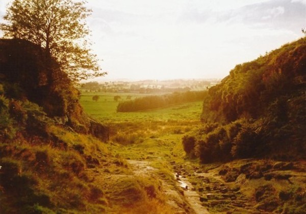
Salters Nick Settlement submitted by Bladup on 30th Dec 2013. The natural entrance through the crags to the settlement.
(View photo, vote or add a comment)
Log Text: Following our visit to The Poind And His Man, there was a settlement marked on the map at Salter's Nick, and I was keen to try and see this as it was nearby.
We continued westwards along the footpath from the Poind and His Man, the pebbly surface giving way to concrete slabs leading onto access land. The kindly farmer (presumably the one living in East Shaftoe Hall?) has provided a small car parking space for walkers, complete with signs about where to park, so next time we visit, we’ll drive down rather than walk from Craig Hall. There were other cars already parked there, although we walked for well over a kilometre before seeing other people on Shaftoe Crags to our left.
From the above mentioned car park, there is a gravelled track heading off left towards East Shaftoe Hall, but the actual footpath is over grass and carries on westwards, past a wood on the right; where this ends there is another small wood to the left. Walking slightly up hill, there is a well-built stone wall to the right hand side, and a limestone pavement which drops down a few feet to a small brook on the left, giving the impression of an old road. There were a large number of cows and calves in the field, complete with bull, but they appeared very docile and only mildly curious. Looking at the internet later, we found out that this track used to be an old Drover’s Road.
The settlement is just on top of the hill, just where the footpath takes a slight turn to the right. Walking into this area, the settlement isn’t immediately obvious given the covering of heather and bracken at this time of year, but a bank where the bracken stands taller than the rest defines its eastern boundary. It’s easy to step up this small bank and into the main settlement area; across what appears to be a valley to the south, large limestone blocks and outcrops can be seen. Walking a little further on into the settlement to where the western bank appears to rise up, we were suddenly taken aback by the appearance of steep drops to the south and west – we were suddenly on the edge of an amazing limestone outcrop, looking down on other walkers below, and across to others climbing on Shaftoe Crags.
A natural entrance, formed by a crack in the crags, became apparent as we walked across the settlement area to the north. I could immediately identify with our ancestors and why they had chosen to settle here – it was easily defensible from the west and south, with 360 degree views (hidden a little in modern days by the woods to the east) all around, and what looked like superb farmland to the west and east.
I wanted to see the natural entrance from below, so we walked back to the footpath and carried on westwards. There were clear signs of how the old drover’s road had been cut through the settlement (there were pick marks on the sandstone rocks), and an easy walk that takes you below the crags at the western end of Salter’s Nick.
We did try and find the heavily weathered rock art mentioned on the Northumbria County Council leaflet for this site (which I downloaded on my phone whilst we were there, so we could understand what we were looking at), but they didn’t identify exactly where these where, so we’ll need to research Stan Beckensall’s records to find out where they are. The same leaflet (Exploring Bolam, walk number 3, Bolam Lake to Shaftoe Crags), tells us: “This trackway was probably used for smuggling illicit salt into Scotland on pack horses during the time of the Salt Tax. The return cargo was often illegally distilled whisky. There is also a settlement split by the trackway. The southern end of the fort consists of a series of defensive walls and works, and two pairs of semi-detached stone foundation round-houses. Attached to the north side is an Iron Age field system, of native or Romano-British origin.”
Looking at the map, the Middleton Standing Stone is only about half a kilometre away, if you carry along the footpath after Salter’s Nick; we’d done the walk to Middleton the other way round, from South Middleton Medieval Village on 27th May 2014. This is a much easier (and prettier) walk than the walk we'd previously done, and we'd use this route again.
Sanctuary Stone (Greystoke)
Trip No.146 Entry No.6 Date Added: 30th Aug 2019
Site Type: Early Christian Sculptured Stone
Country: England (Cumbria)
Visited: Yes on 27th Aug 2019. My rating: Condition 2 Ambience 3 Access 5
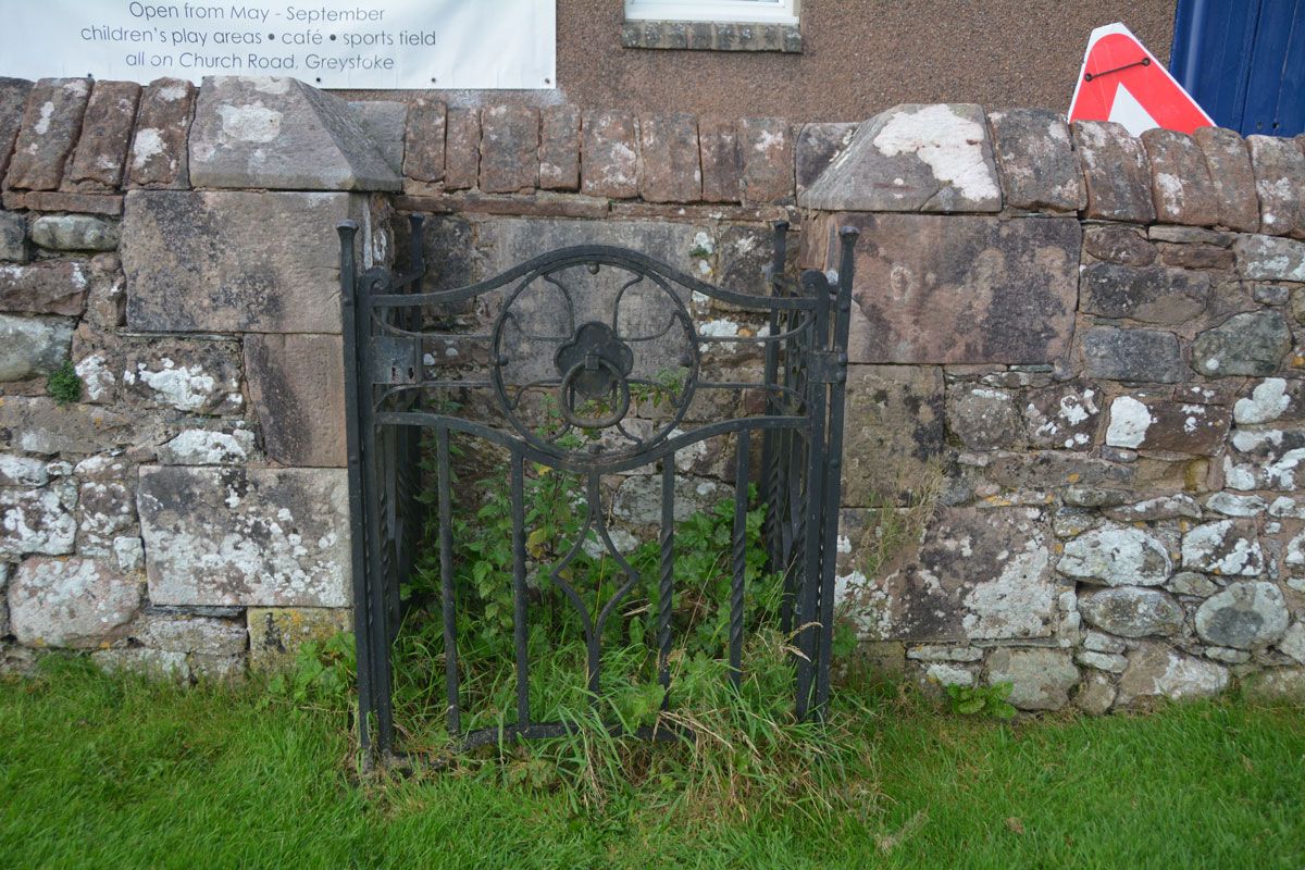
Sanctuary Stone (Greystoke) submitted by Anne T on 29th Aug 2019. Nothing could be seen of the actual sanctuary stone, which lies virtually flat to the ground within in a concrete base. It used to lie some 10 feet south of its current position. With a very busy heated, outdoor swimming pool, I didn't dare lean over and pull the nettles away (perhaps I should have asked permission at the swimming pool).
(View photo, vote or add a comment)
Log Text: Greystoke Sanctuary Stone: We didn't know this stone was here until I read the church guide book as we walked around the church. There is also a plaque stone somewhere, but we'd almost run out of time today. This stone was disappointing, as it wasn't visible underneath a dense covering of nettles and weeds. I'm now kicking myself for not asking at the swimming pool reception a few metres away if it was possible to pull a few of these away to take a closer look. There was a photograph of the cleared enclosure on the Old Cumbria Gazetteer.
Sanduck Cross
Trip No.130 Entry No.6 Date Added: 25th May 2019
Site Type: Ancient Cross
Country: England (Devon)
Visited: Yes on 11th May 2019. My rating: Condition 3 Ambience 4 Access 4

Sanduck Cross submitted by Anne T on 25th May 2019. Getting a bit closer to the cross, it slopes a little. Historic England says this is probably due to disturbance by tree roots around it. The cross was moved to its current location after a fire at Sanduck Farmhouse in 1901, and has been fitted into a modern socket stone.
(View photo, vote or add a comment)
Log Text: Sanduck Wayside Cross: We were going past this spot to get to the next cross on our list, when we spotted this on the OS map, so decided to stop and look for it. We parked outside a very lovely house built around a courtyard; as the road was very narrow, we pulled into a small tarmacked area opposite the house, thinking we’d only be there for a couple of minutes. As we stopped, a lady came out of the house and into her garden. The cross was on a bank at the top of the grass verge, just to the western end of her garden. We said hello to the lady and she replied, and wandered back to the house.
Because the cross was immediately adjacent to private land and against a hedgerow with tall trees around, we didn’t ask to get into the field behind as the back of the cross would have been hidden by the hedge.
Scalpsie Barrow
Trip No.50 Entry No.5 Date Added: 9th Oct 2017
Site Type: Round Cairn
Country: Scotland (Isle of Bute)
Visited: Yes on 25th Sep 2017. My rating: Condition 3 Ambience 3 Access 5

Scalpsie Barrow submitted by durhamnature on 23rd Sep 2012. Photo of barrow, from "The book of Arran" by J A Balfour 1910 via archive.org
Site in Isle of Bute Scotland
(View photo, vote or add a comment)
Log Text: Scalpsie Barrow, Isle of Bute: We didn’t plan to stop here, but there was a car park and information board by the field alongside the A844 past Ambrismore on the way to Ardscalpsie, signposted to the beach, so we screeched to a halt to explore. The information board differentiated between the barrow and another cairn, also somewhere in the field, but the fog was so bad, we couldn’t see it, and it was very difficult to photograph the main barrow.!
Worth stopping to see. The gate into the field was about 100 metres further west along the road from the small car park. Walking back to the barrow, my feet got completely drenched. A shame the fog was so bad, as I’d have loved to have found the second cairn.
Scots Dyke (Easby)
Trip No.10 Entry No.1 Date Added: 26th Feb 2017
Site Type: Misc. Earthwork
Country: England (Yorkshire (North))
Visited: Yes on 19th Feb 2017. My rating: Condition 2 Ambience 3 Access 4
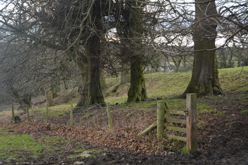
Scots Dyke (Easby) submitted by Anne T on 26th Feb 2017. This small section of Scots Dyke, south of Sandford House, can be seen as a bank about 2 metres tall, flanked by trees. This photo was taken from the layby next to it, where there were lovely views down to Easby Abbey and the River Swale.
(View photo, vote or add a comment)
Log Text: Scots Dyke (Easby): Having purchased our map (one of the few we don’t already possess), we headed off eastwards from Richmond, down the minor road passing through Anchorage Hill towards Brompton-on-Swale. Just past St. Nicholas, there is a right hand turn towards Easby. Turning down this road, there is a layby within 20 metres of the junction. With a lovely view south to the River Swale and Easby Abbey, our first sight of the dyke was within a few metres west of this layby – an earthwork bounded by relatively young trees.
Having photographed this small section as best I could (the gate was padlocked), I clambered round a tree, avoiding the deep rabbit holes.
There is a second section of the dike across the road, which Pastscape tells us runs for 360 metres south of the Darlington Road to Sandford House (monument 1034723), east of Whitefields Farm. From the layby on the lane leading down to Easby, on the opposite side of the road, a footpath leads to the left of Sandford House, and runs over the top of the dyke for some way. Heading northwards, the bank with its ditch to the east, there is a new build housing site to the west. Not a great ambience. We wondered how many of the new residents would know they were living next to an ancient monument.
Scots Dyke (Olliver)
Trip No.10 Entry No.2 Date Added: 26th Feb 2017
Site Type: Misc. Earthwork
Country: England (Yorkshire (North))
Visited: Yes on 19th Feb 2017. My rating: Condition 3 Ambience 4 Access 4
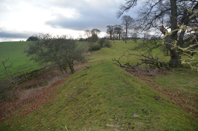
Scots Dyke (Olliver) submitted by Anne T on 26th Feb 2017. To the south of the trackway, the dyke runs for some 400 metres, with a ditch on either side.
(View photo, vote or add a comment)
Log Text: Scots Dyke (Olliver): From Scots Dyke at Easby, heading back into Richmond, we took the B6274 to Gilling West, turning off to the right to Olliver Cottages. Here, opposite Olliver Cottages, is a small (appears to be public) car park. Walking up the track towards Olliver itself (a large farm and prestigious office premises), after 400 metres, the track turns slightly to the right and goes up a shallow hill, transecting the dyke.
Facing up hill, the dyke the left-hand side dives down a steep hill and is transected by a farm house. Beyond the farm, looking northwards, a smaller section of the dyke can be seen at the field edge. To the right-hand side, the dyke continues for several hundred metres. The ditch is very steep at some points (Pastscape says 7 metres at the northern end). Standing on top of the dyke, looking eastwards, there are great views back to the A1 and beyond.
Looking more closely at the banks, they are made up of medium and large size stones, packed with earth. Under one tree was a small marker and stone - a treasured pet's burial place?
Seal Howe
Date Added: 9th Sep 2014
Site Type: Cairn
Country: England (Cumbria)
Visited: Yes on 7th Sep 2014. My rating: Condition 3 Ambience 3 Access 4
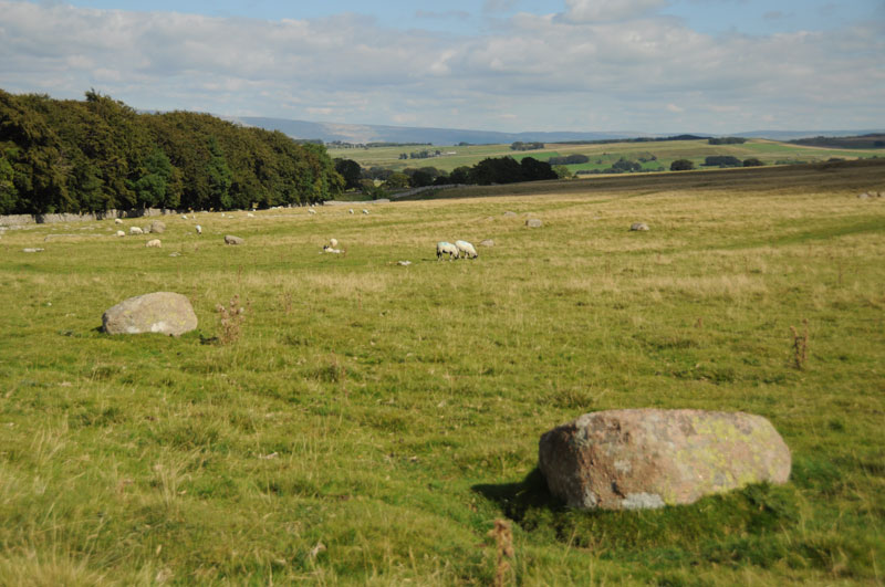
Seal Howe submitted by Anne T on 9th Sep 2014. To the left hand side of the path leading to Seal Howe, we were amazed at the number of red granite rocks lying in the landscape. They stood out clearly from the limestone pavement bedrock.
(View photo, vote or add a comment)
Log Text: Seal Howe Cairn, Oddendale, Cumbria: Having passed Kalmott Cairn Circle by the stone wall next to Oddendale, we made our way to the Bield and Cairn Circle marked on the map.
All around, the limestone pavement/bedrock pushed its way above the grass; it was particularly spectacular on the right hand side of the path. My husband and I were both transfixed and amazed at the number of red Shap Granite stones in the landscape and wished we had a GPS device to map the locations of some of the stones, as there seems to be a much larger prehistoric landscape here. These red granite stones must have been transported up to the site from where they were quarried (which a quick check on the geology of the Lake District indicates just south of Shap).
The modern cairn built on top of Seal Howe wasn’t quite what I was expecting, but the views over to Yorkshire to the east were spectacular. To the north-north-west, the scar of Hardendale Quarry was easily visible.
From Seal Howe, we made our way over the west side of the track to where the map promised us a ‘cairn circle’. This was a treat I wasn’t expecting – the Oddendale Stone Circle.
