Contributory members are able to log private notes and comments about each site
Sites Anne T has logged. View this log as a table or view the most recent logs from everyone
Chapel Well (Cambusbarron)
Trip No.108 Entry No.7 Date Added: 10th Nov 2018
Site Type: Holy Well or Sacred Spring
Country: Scotland (Stirling)
Visited: Yes on 30th Oct 2018. My rating: Condition -1 Ambience 2 Access 4
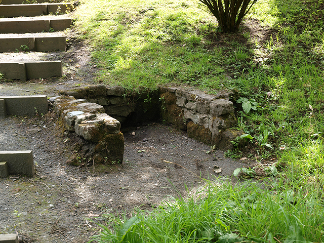
Chapel Well (Cambusbarron) submitted by peigimccann on 12th Sep 2016. Bruce's Well 7-7-09
(View photo, vote or add a comment)
Log Text: Bruce's Well, Cambusbarron: Even with the GPS from the Portal, we had great trouble finding this well, and in the end had to ask two locals. One pointed us to an old water fountain in a nearby park, now repurposed as a planter; the other took us to a footpath by the side of a small stream and pointed us down the path, saying “a lot of people come to look, but there’s not really much to see.”
We found the steps, as photographed on the Portal, but there was a sign declaring this the site of the well only.
In the middle of the village, a police officer was standing in a doorway with a number of people outside making phone calls. As we headed up the steps from the site of the well back to the car, a white clothed forensics officer exited the house. Haven't found out what happened, but this certainly made it a memorable visit to the site of this well.
Bull Stone (Crook of Devon)
Trip No.109 Entry No.2 Date Added: 10th Nov 2018
Site Type: Standing Stone (Menhir)
Country: Scotland (Perth and Kinross)
Visited: Yes on 31st Oct 2018. My rating: Condition 2 Ambience 3 Access 4
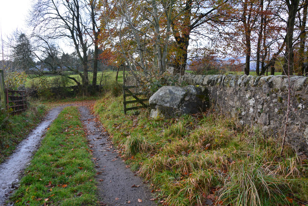
Bull Stone (Crook of Devon) submitted by Anne T on 10th Nov 2018. The Bull Stone, showing how it sits in relation to the footpath leading south from Church Road, and the farm track leading east.
(View photo, vote or add a comment)
Log Text: The Bull Stone, Crook of Devon: We parked in St Serf’s Road, Crook of Devon, at NO 03303 00037 and walked down Church Road, then took the right hand fork of the footpath, which lead almost directly south. Just under 220 metres from the fork, there is a farm track which leads off to the east. The Bull Stone is showed on the map just up this track, on its northern side.
I thought this stone was just part of an old stone wall, as the stone was fragmented and cemented together again. It wasn’t until I saw the photo on TNA that I believed we had seen the right stone! Not a brilliant monument, but a nice, short walk, and another to ‘tick off the list’ of sites seen.
Tullibole
Trip No.109 Entry No.1 Date Added: 11th Nov 2018
Site Type: Sculptured Stone
Country: Scotland (Fife)
Visited: Yes on 31st Oct 2018. My rating: Condition 2 Ambience 3 Access 4
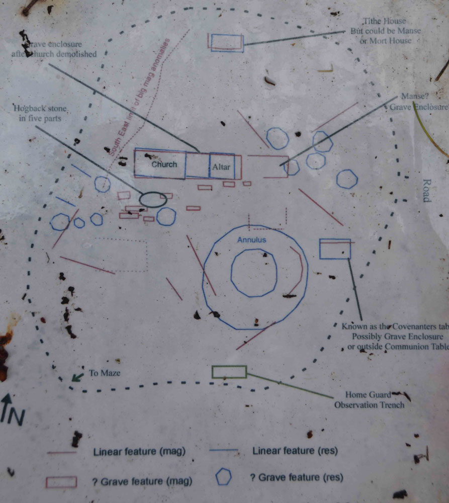
Tullibole submitted by Anne T on 11th Nov 2018. The paper sheets covered by plastic on the information board, propped up by the large memorial surrounded by iron railings, were sodden with rain. I photographed the plan for future visitors in case it became illegible in the near future. This shows where to find the hogback pieces, but beware, we only found what we thought were two pieces, deeply buried under grassy tussocks.
(View photo, vote or add a comment)
Log Text: Tullibole Church Ruins with hogback in five pieces: Our first stop of the day, and as Andrew told me this was a site where 11 witches were tried, condemned and burned, a site I thought would be a good, spooky, start to the Halloween. But, this is essentially a field with a few gravestones sticking out of it, and it turned out the trials had taken place at nearby Tullibole Castle. The remains of the church are there, on the south side buried deep in the grass and turf, but more visible on the northern side, where several courses of stones stick up out of the ground.
There is a display board next to a large monument surrounded by a metal railing and tall conifers, but we had difficulty orientating ourselves to the photos, eventually picking up the display board (which was propped up against the railings, and taking it over to the chest tombs).
We did find one part of the hogback, and possibly a second, but the grass tussocks were so high, we were unable to find any more pieces.
As the information sheets were covered in plastic, but the rain was seeping through, and they are likely to become even more worn and stained, I photographed a couple of them and typed them up for future reference.
Carleith (Crook of Devon)
Trip No.109 Entry No.3 Date Added: 11th Nov 2018
Site Type: Cairn
Country: Scotland (Perth and Kinross)
Visited: Saw from a distance on 31st Oct 2018. My rating: Condition 3 Ambience 4 Access 4
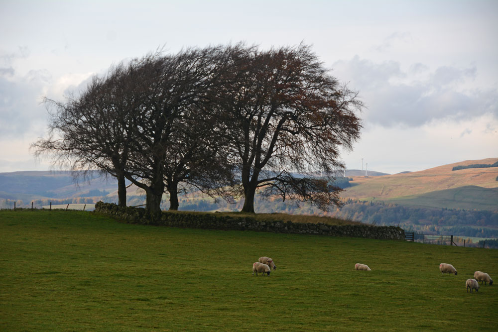
Carleith (Crook of Devon) submitted by Anne T on 11th Nov 2018. Using the camera lens on maximum zoom to try and get an idea of this perfectly circular cairn, bounded by a drystone dyke.
(View photo, vote or add a comment)
Log Text: Carleith Cairn (Crook of Devon): We didn’t go into the field as there were two very boisterous young bullocks who crowded the gate, along with their protective mothers, so I photographed it mainly from the gate into the field. From the edge of the field, this looked almost completely round, and I would have loved to have walked over it. The view to the distant hills was lovely.
Wizard's Stone (Dollar)
Trip No.109 Entry No.4 Date Added: 11th Nov 2018
Site Type: Natural Stone / Erratic / Other Natural Feature
Country: Scotland (Clackmannanshire)
Visited: Yes on 31st Oct 2018. My rating: Condition 3 Ambience 3 Access 4

Wizard's Stone (Dollar) submitted by Anne T on 11th Nov 2018. Site in Clackmannanshire Scotland. Standing just to the east of the stone, looking north west across the footpath.
(View photo, vote or add a comment)
Log Text: Wizard's Stone (Dollar): We stopped off at a café in Dollar for a sandwich and cup of tea, then set off north east out of the town to find the Wizard’s Stone. This was really easy to spot. There is a small area to park on Hillfoot Road, where the road divides, at NS 96634 98999.
Rather than walk up ‘the (marked foot) path’ we walked into the field to photograph the stone. There are a number of pieces lying immediately around the stone, the larger of which appears deeply embedded in the ground; a smaller piece looks as if it had spalled off through, perhaps, frost action.
Deil's Cradle (Dollar)
Trip No.109 Entry No.5 Date Added: 11th Nov 2018
Site Type: Natural Stone / Erratic / Other Natural Feature
Country: Scotland (Clackmannanshire)
Visited: Saw from a distance on 31st Oct 2018. My rating: Condition 3 Ambience 3 Access 3
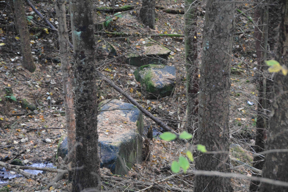
Deil's Cradle (Dollar) submitted by Anne T on 11th Nov 2018. Site in Clackmannanshire Scotland. With this large erratic at the bottom of a small gorge, with daylight failing, we wanted to get to Tullibody to see the Maiden's Stone, so photographed it from a distance only.
(View photo, vote or add a comment)
Log Text: Devil's Cradle, Dollar: With this being Halloween, I was keen to try and see this massive erratic rock. From the Wizard’s Stone eastwards, the road gets narrower, not much wider than a single track road, so we parked in Tarmangie Drive, at NS 96743 99038, and walked up Upper Hillfoot Road (the southern part) at NS 96743 99038. Looking down through the woodland, we saw a large erratic by the side of a small burn.
This stone is in a very deep gorge, and we couldn’t immediately see a way to get to it With a 70 degree slope on one side and a near vertical drop on the other, we decided, with the failing light, to carry on to Tullibody and see sites which we really wanted to get to before dark, so photographed this stone only from a distance.
Haer Stane
Trip No.109 Entry No.8 Date Added: 12th Nov 2018
Site Type: Standing Stone (Menhir)
Country: Scotland (Clackmannanshire)
Visited: Yes on 31st Oct 2018. My rating: Condition 3 Ambience 3 Access 4
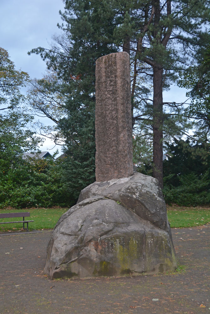
Haer Stane submitted by Anne T on 12th Nov 2018. Site in Clackmannanshire Scotland. Approaching the Haer Stane, which is at the far (north western) end of the park. It was dusk on Halloween, and the light was failing fast!
(View photo, vote or add a comment)
Log Text: Haer Stane, Tullibody: This is one of the strangest erratics I’ve seen, as it’s been repurposed as a war memorial. We parked on School Road, by the school, and walked down to the entrance to this long, thin park; the only gate we could find into this area was through a lych gate at the corner of School Road and Lychgate Road. The erratic is almost at the far (north western) end of the park.
The stone was adjacent to the rear of the school where a large construction project is taking place, so the noise was very intrusive. We were the only people taking note of this erratic; all the other people around must have been locals who were walking their dogs.
The crosses on the eastern face of the cross shaft have been well done, and mimic Anglo Saxon crosses with interlaced designs.
Court Cave
Date Added: 12th Nov 2018
Site Type: Cave or Rock Shelter
Country: Scotland (Fife)
Visited: Yes on 1st Nov 2018. My rating: Condition 2 Ambience 3 Access 4
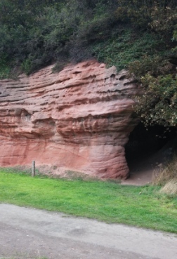
Court Cave submitted by johnur on 13th Nov 2018. West entrance to Court Cave in September 2018. Comparison with old photos on Canmore will show that the ground level outside the cave is now several feet higher than it was 100 years ago. The top of the old wall in the Canmore photos is now just below the present ground level. This is due to pit waste from Michael Colliery accumulating on the foreshore to establish a ground level which became permanent when rock armour was installed in the late 20th century to prevent coastal erosion.
(View photo, vote or add a comment)
Log Text: Court Cave, East Wemyss: This cave is signposted as 'Dangerous' and 'Keep Out' due to falling rocks from the roof, so despite reading about the symbols on Canmore, we didn't venture in.
The Maiden Stone (Tullibody)
Trip No.109 Entry No.7 Date Added: 12th Nov 2018
Site Type: Sculptured Stone
Country: Scotland (Clackmannanshire)
Visited: Yes on 31st Oct 2018. My rating: Condition 3 Ambience 3 Access 4
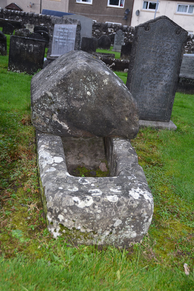
The Maiden Stone (Tullibody) submitted by Anne T on 12th Nov 2018. Site in Clackmannanshire Scotland. The Maiden Stone from the east. Whilst there are no visible carvings on the coped cover, I thought it might resemble how a hogback looked on a Viking tomb.
(View photo, vote or add a comment)
Log Text: The Maiden Stone, Tullibody: This stone coffin is next to the ruins of the old church. We parked in the car park for the new church and walked through the graveyard which runs parallel to the road. Some really unusual tombstones, and quite spooky to walk through the graveyard and look around the outside of the Old Church as dusk was falling on Halloween!
Balfarg Henge
Trip No.110 Entry No.2 Date Added: 12th Nov 2018
Site Type: Henge
Country: Scotland (Fife)
Visited: Yes on 1st Nov 2018. My rating: Condition 3 Ambience 4 Access 5
Balfarg Henge submitted by cosmic on 4th Dec 2003. Balfarg is a henge which was excavated when a housing estate was built round it in the 1970's. There are only two standing stones but post holes found inside the henge have been marked with a set of wooden posts.
Surprisingly only one part of the henge ditch seems to have been subject to vandalism (by bikes?)
(View photo, vote or add a comment)
Log Text: Balfarg Henge: From Balbirnie stone circle, to reach this recreated henge, we needed to turn right across the busy A92, then almost immediately left down the B969 Western Avenue. The SatNav then took us directly to the henge. Right in the middle of a housing estate, on a circular street appropriately called ‘The Henge’.
Typically for me, just as we stopped the car and I jumped out with my camera, a large delivery van decided to draw up and park in one of the parking spots right next to the outer boundary of henge, so I tried to avoid photographing him!
Balbirnie
Trip No.110 Entry No.1 Date Added: 13th Nov 2018
Site Type: Stone Circle
Country: Scotland (Fife)
Visited: Yes on 1st Nov 2018. My rating: Condition 3 Ambience 4 Access 5

Balbirnie submitted by Nick on 5th Nov 2002. From the A92 running north from Glenrothes, turn east onto the un-numbered road for Star and Kennoway. 100m along this road is a sign for the Balbirnie housing development, turn in here and about 150m/200m along, where the road curves right, you will see the circle just below you. Park up in the housing development itself and walk back. The site itself dates from c3000 B.C., and used to be located 125m to the north west of where it stands at present. It was always known locally as the "Druid...
(View photo, vote or add a comment)
Log Text: Balbirnie Stone Circle: It was a good job we had the SatNav and the GPS, which took us almost to the spot. As this was right next to a modern housing estate, we found layby to park in about 100m metres away in Tofthill and walked back to the stone circle, which has a footpath running to its eastern side. Nicely preserved stone circle with cists with an information board and a recreated rock art panel.
We took a few minutes to spot the rock art panel, but realised it had fallen over slightly, so wasn't very visible. I did my best to photograph it in situ.
Balfarg Riding School mortuary enclosure and henge
Trip No.110 Entry No.3 Date Added: 13th Nov 2018
Site Type: Henge
Country: Scotland (Fife)
Visited: Yes on 1st Nov 2018. My rating: Condition 3 Ambience 3 Access 4
Balfarg Riding School mortuary enclosure and henge submitted by SandyG on 3rd Jan 2015. The reconstructed mortuary enclosure. View from north west (19th April 2014).
(View photo, vote or add a comment)
Log Text: Balfarg Riding School Henge Reconstruction: This now recreated henge is just by the A92, at the end of Old Leslie Road, with part of it seeming to have been cut by the construction of the A92. Traffic streams by constantly.
We arrived with the sun high in the sky and deep shadows, which tested my photography skills. I had expected a circular henge, but this was oval. I didn't pick up any atmosphere at this site at all. Sadly, it was just like walking through some old fence posts set up to cast some interesting shadows.
The information board reads: “You are standing in a revered landscape where ceremonies were performed by generations of prehistoric people. Here is an artist’s reconstruction of how the stone circle looked around 4,000 years ago. By this time it had already been in use for 1,000 years, when it became a place of burial. It stood close to the Coul Burn which then enclosed a wider sacred landscape. The picture shows the site of the Balfarg Henge and timber enclosure in the distance.”
Dogton
Trip No.110 Entry No.5 Date Added: 13th Nov 2018
Site Type: Class III Pictish Cross Slab
Country: Scotland (Fife)
Visited: Yes on 1st Nov 2018. My rating: Condition 3 Ambience 4 Access 4
Dogton submitted by cosmic on 15th Feb 2006. Dogton from East
(View photo, vote or add a comment)
Log Text: The Dogton Cross: With the clocks having gone back an hour on the Sunday before, it was difficult to correctly judge how fast dusk would fall. It was getting a little dark, but whilst we were here, we really wanted to see this stone.
With the roads busy at this time of night, we managed to park just off the road at the entrance to the track leading up to Kinglassie House, just off the B922 and set off up the footpath to find this cross.
The gate into the field the stone was in was an amalgamation of several gates tied together, so it was easier just to step over the tumbled stones by the gate post. Fortunately the field the stone was in had just been harvested, so we walked up through the corn stubble, just as dusk was setting in.
I photographed each face of the cross by leaning over the railings, or poking the camera through the railings, then stitched them together.
The sign on the railings reads: “Dogton Stone. This stone is a free-standing Celtic cross probably 10th century AD. The top and arms of the cross have been destroyed, but the centre boss is still visible on the east face. A horseman is carved below it and there are entwined serpentine animals on the south face. Cared for by Historic Scotland.”
When I got back home and looked at the Canmore records, I was surprised to see the cross and its railings had been, in the not too distant past (photo dated 1927), incorporated into a dry stone wall, no longer there.
Pitcorthie.
Trip No.111 Entry No.3 Date Added: 14th Nov 2018
Site Type: Standing Stone (Menhir)
Country: Scotland (Fife)
Visited: Yes on 2nd Nov 2018. My rating: Condition 3 Ambience 2 Access 4
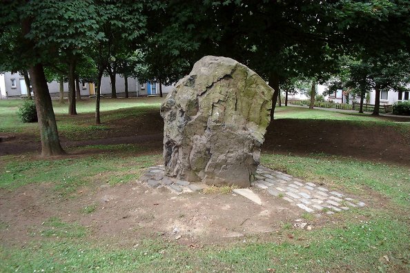
Pitcorthie. submitted by Nick on 3rd Nov 2003. NT113863
Also known as Easter Pitcorthie, Pitcorthie standing stone resides in the middle of a Dunfermline housing estate. It stands approx 1.5m in height and has an unsculptred and jagged appearance. Although it is a pretty cool stone the presence of 100 living and bedroom windows does not induce a lengthy stay . NMRS state that the stone appears to have been subjected to fire or heat. It has been subjected to graffiti.
This unsculptured standing stone, on the crest of slightly rising gro...
(View photo, vote or add a comment)
Log Text: Pitcorthie Standing Stone, Dunfermline: Our last site visit of our short holiday, and I wish we'd picked a better spot to end on. After the Balfarg Henge, I shouldn't have been surprised that this stone is surprisingly right in the middle of a housing estate, on Standing Stone Walk.
It is a poor, sadly neglected stone; it could just have been a garden feature, especially as it is set in a rectangular pavement of black stones. Like a previous visitor to the stone, being surrounded by rows and rows of houses, we very much felt watched as I was taking photographs and looking around.
Tuilyies
Trip No.111 Entry No.2 Date Added: 14th Nov 2018
Site Type: Standing Stones
Country: Scotland (Fife)
Visited: Yes on 2nd Nov 2018. My rating: Condition 3 Ambience 4 Access 4
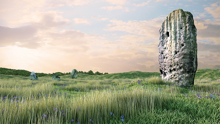
Tuilyies submitted by jonathanknox on 3rd May 2012. Tuilyies 3D model #2 -Tuilyies Standing Stones in Fife, Scotland, part of a digital documentation/visualisation pilot project by Pixogram. Accurate retopologised 3D models from photogrammetry to a +-10mm tolerance.
(View photo, vote or add a comment)
Log Text: The Tuilyies Stone Setting: There is a small layby on the A985, right by the stones, but as there was no direct entrance into the field, we ended up walking along the grass verge down to where the wire fence is jointed to a wooden one. This is by a small clump of trees, at NT 02801 86657, where we succeeded in clambering over the fence.
The stones are set in a very ‘lumpy and bumpy’ field that looks like it has several building platforms and banks within it, but no structures are visible.
The tall stone to the north north west of the setting of three stones is tall and impressive (although thin) with the eastern face peppered in cup marks.
Combined with the three stones to the south south east reminded us somewhat of the stone setting at Kilmartin. I amused myself by standing behind the taller stone trying to line it up with the three smaller ones, but there was always one stone hidden from view, behind the larger stone.
The Firth of Forth glinted in the sunlight to the south. Shame about the proximity to the main road.
Kelvingrove Museum and Art Gallery
Trip No.107 Entry No.4 Date Added: 15th Nov 2018
Site Type: Museum
Country: Scotland (North Lanarkshire)
Visited: Yes on 29th Oct 2018. My rating: Condition 3 Ambience 3 Access 5

Kelvingrove Museum and Art Gallery submitted by Creative Commons on 13th Mar 2014. Kelvingrove Art Gallery And Museum
Taken from Kelvingrove Park.
Copyright Paul McIlroy and licensed for reuse under this Creative Commons Licence
Site in North Lanarkshire Scotland
(View photo, vote or add a comment)
Log Text: Kelvingrove Museum, Glasgow: After Glasgow Cathedral and the Govan Stones, I found the exhibition of Scotland's Early People a little small and disappointing, but what they had on display was interesting. Best items on display for me were the beaker found when they excavated Temple Wood in Kilmartin and a wooden ladder from a crannog. And of course the rock art stone Andy B was photographed with!
Limestone Brae (West Allen)
Trip No.112 Entry No.1 Date Added: 13th Dec 2018
Site Type: Ancient Cross
Country: England (Northumberland)
Visited: Yes on 9th Dec 2018. My rating: Condition 3 Ambience 4 Access 4
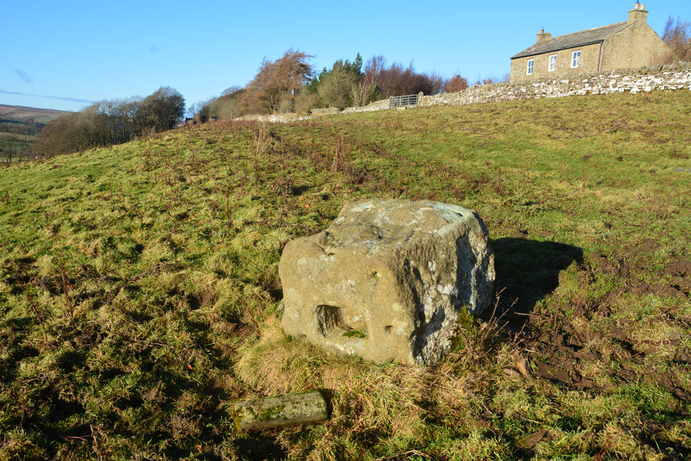
Limestone Brae (West Allen) submitted by Anne T on 13th Dec 2018. Standing just south west of the cross base, looking back towards the road and Glengarrif House. As it's such a large stone, we wondered how it became overturned, and when.
(View photo, vote or add a comment)
Log Text: Limestone Brae Overturned Cross Base: We parked next to the chapel, just before the lane to Throssel Hole Buddhist Abbey. At first sight this stone just seemed like a boulder in the field. “Are you sure that’s it?” I asked my husband. We let ourselves in through the gate into the field and walked along the tussocky grass to the stone. As soon as we saw the other side, it was obvious this is an old cross base which has been overturned.
Looking to the gate to the south of the cross base, there looks as if there is an old hollow way, somewhat obscured by its use as a quad bike route, but there is a definite dip in the ground. The cross has superb views west/north west over the River West Allen Valley.
Park House (West Allen)
Trip No.112 Entry No.2 Date Added: 13th Dec 2018
Site Type: Marker Stone
Country: England (Northumberland)
Visited: Yes on 9th Dec 2018. My rating: Condition 3 Ambience 4 Access 4
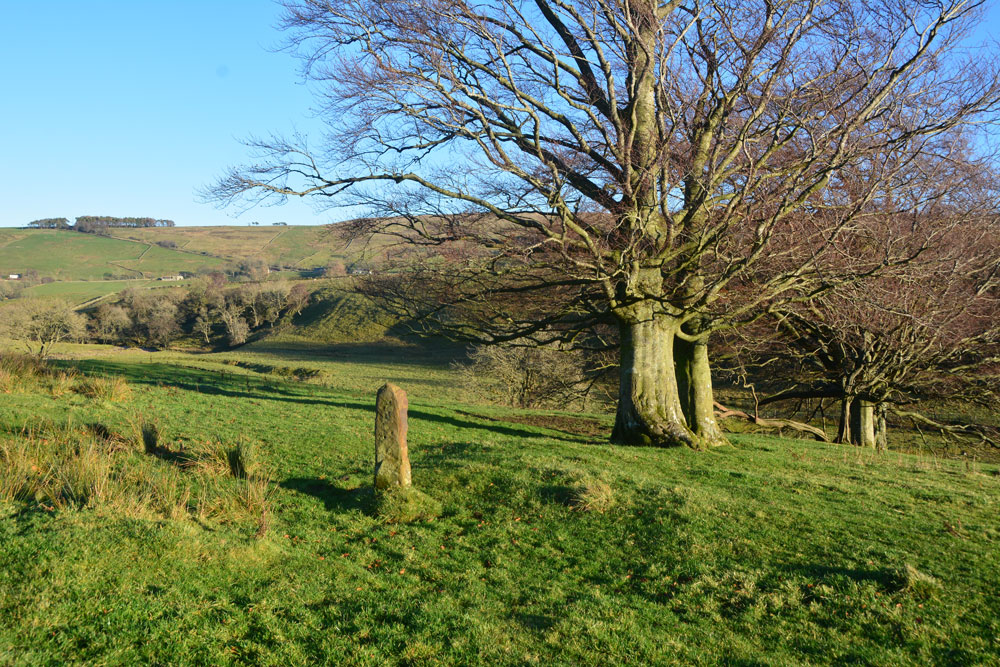
Park House (West Allen) submitted by Anne T on 13th Dec 2018. First view of this boundary marker/standing stone/gatepost, walking north along Isaac's Tea trail from Park House, with the Mohope Burn running more or less along the centre of the photo.
(View photo, vote or add a comment)
Log Text: Boundary stone (?) near Parkhouse, Mohope Burn, West Allen: Andrew found this stone in a book about Isaac’s Tea Trail in Waterstones in Hexham, and as this is an area we’ve not really explored before, we decided to drive out and take a look. Andrew says no one is sure what this stone is – an old standing stone or a boundary marker, or something else.
We walked down the lane eastwards towards Park House, where a sign post directs you to ‘Malakoff Bridge 1”. The path goes through the garden of the house and along its north-south eastern boundary with the Mo Hope to your right hand side. A kissing gate leads onto Isaac’s Tea Trail, running north south. The stone is approximately 2/3rds of the way into the second field. We needed wellies at there was a considerable amount of standing water near the field gates.
This valley is really beautiful. Such a remote valley, but with lots of houses scattered about. The Mohope Burn meanders to your right (eastern side). The stone sits in a row of trees, and my immediate thought was that it was a gatepost, but it doesn’t line up with the other gaps in the stone walls.
There is nothing recorded on Historic England or Pastscape for this location, although the HE map shows the stone lies between the Mohope Burn (to its eastern side) and Blind Burn (to the west). A quick search on Pastscape reveals the whole area has lead mines within 1km of this stone plus lime kilns. Pastscape 957727 records a lime kiln nearby the stone at NY 7750 5106, some 30m to the north.
Going to the next field boundary, a track carries on north-south, but another drops down to the Mohope Burn. Perhaps the stone marks the edge of a trackway and a possible ford across the river?
Tommy Stout's Well (Thornley Gate)
Trip No.113 Entry No.1 Date Added: 1st Jan 2019
Site Type: Holy Well or Sacred Spring
Country: England (Northumberland)
Visited: Yes on 1st Jan 2019. My rating: Condition 3 Ambience 4 Access 4
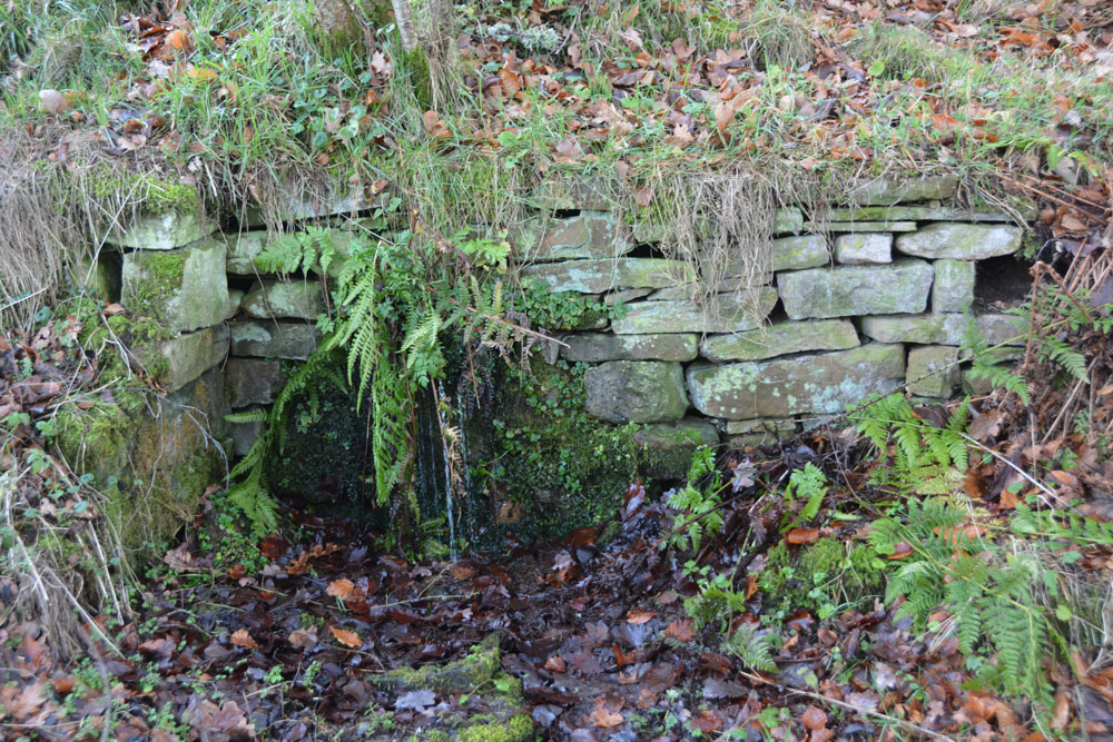
Tommy Stout's Well (Thornley Gate) submitted by Anne T on 1st Jan 2019. At first the well looks just like part of a small retaining wall by the side of the path running above the southern side of the River East Allen. As you get closer, you can see (and hear) a steady stream of water issuing from underneath a slightly protruding dressed stone in the middle of the wall. Now covered by ferns and lichen, it wasn't possible to determine whether the water came through a pipe, even running my fingers gently under the water to check - too much shrubbery. The water was cle...
(View photo, vote or add a comment)
Log Text: Tommy Stout's Well, Thornley Gate: Another site ticked off the list of Isaac’sTea Trail. This is obviously a popular spot for walkers, as there are paths both sides of the river, and we passed a number of dog walkers. The small layby on the south side of the river was full (2 cars), so we parked on the grass verge by the entrance to the Allen Smelt Mill.
The well is through the kissing gate on the opposite side of the road from the smelt mill gate, with the well some 15m further on, to your left hand side.
Water appears out of the hillside below a small protruding dressed stone, largely hidden by moss and lichen. There is a fair flow of clear water which comes out; I did taste it, but there was nothing really to taste. Above the simple, dressed stone well head with drain there is a marshy area in the field above, from which the source of the water appears to come. Between the well and the kissing gate, on the other side of the fence, is a stunning little stream with a mini waterfall, which is a different water course to that of the well.
Also being interested in some industrial archaeology, we spent some time wandering around the fascinating remains of the smelting works opposite. There is still quite a lot left, and it is left accessible for visitors. Some of the underground flues are currently being excavated.
Broomhouse (Haltwhistle)
Trip No.113 Entry No.2 Date Added: 1st Jan 2019
Site Type: Ancient Village or Settlement
Country: England (Northumberland)
Visited: Yes on 1st Jan 2019. My rating: Condition 2 Ambience 4 Access 4
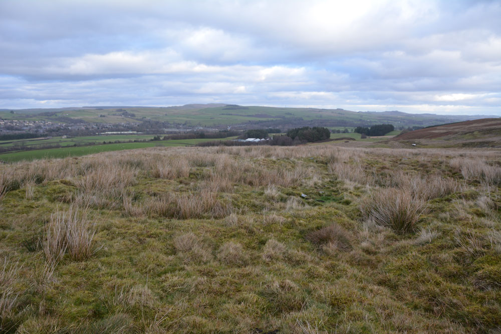
Broomhouse (Haltwhistle) submitted by Anne T on 1st Jan 2019. One of the three roundhouses within the settlement, with well formed earth and stone foundations. If the GPS on my camera has worked properly, this is the one at the north eastern side. To the top left hand side of the photo is Haltwhistle, which lies to the north, over the A69.
(View photo, vote or add a comment)
Log Text: Iron Age/Romano British Settlement, Broomhouse, south of Haltwhistle: From the smelt works, we headed back to the A69 and turned left towards Haltwhistle. Just before crossing the river South Tyne for the second time, we turned left up Bellister Bank, parking on the grass verge where the road was slightly wider, just before the footpath which headed south east past the farm houses, and over the South Tyne Way. As we approached the farm buildings, it sounded like ‘the Hounds of the Baskervilles’, with four farm dogs barking at a gate to warn us off going into the farmyard.
The South Tyne Way was a busy place, with any number of walkers following its route. We headed over the bridge and followed the track south east up the hill. As the track reached the top of the hill and turned to our right, we headed over the moorland to the west, and within 50m had come across the outer ditch of this settlement.
The outer stony bank with a ditch either side is pretty much intact, although to its eastern side confused with a modern drainage ditch. Inside the settlement are three clear roundhouses, still with their stone and earth foundations.
There were great views over to Haltwhistle to the north. On the way back, we noticed the gate where the dogs had been was open. “Better be careful”, warned my huband. We walked past the farmyard expecting the dogs to come barking at our heels, but nothing. A few paces further and four dogs came running up to us – all wagging tails and friendly this time. They were closely followed by the farmer, who bid us ‘good day’.
No listing on HE scheduling, although the site, together with the positions of the roundhouses, are shown on their map.
