Contributory members are able to log private notes and comments about each site
Sites Anne T has logged. View this log as a table or view the most recent logs from everyone
Haystack Hill (Ingram)
Trip No.34 Entry No.3 Date Added: 21st Jul 2017
Site Type: Ancient Village or Settlement
Country: England (Northumberland)
Visited: Yes on 18th Jul 2017. My rating: Condition 2 Ambience 4 Access 3
Haystack Hill (Ingram) submitted by SolarMegalith on 16th Mar 2013. Remains of a stone wall - view from the NE (photo taken on March 2013).
(View photo, vote or add a comment)
Log Text: Haystack Hill Settlement Complex, Ingram, Northumberland: Having stopped off at North Haystack Hill, it was getting hot by this point, although there was a pleasant breeze. The path was levelling out now and there was an electric fence to our left hand side. Where this had dropped down to the grass at one point, we made our way across to the gate at the north western part of the field. The ground here was very boggy, descending into deep puddles at various points, so we picked our way around. A sign on the gate said ‘end of access land’ although there is a permissive footpath around the edge of the field leading into the south western corner of this complex settlement.
This site is huge. I wish I’d printed off an aerial photograph to take with me, so I could have understood it better – a good excuse for a return visit.
We first explored the rectangular enclosure with its row of hut circles in, then made our way between the B2 (the southern most of the two B enclosures) and C.
Wow. Although deep in bracken, it was still possible to make out tall banks and circular features I felt very priviledged to have come here, as I did at Burdhope last week. A brilliant, brilliant site. With the other hillforts all around, it was very atmospheric.
Hawthornside Farm (Bonchester Bridge)
Trip No.93 Entry No.1 Date Added: 31st Aug 2018
Site Type: Holy Well or Sacred Spring
Country: Scotland (Scottish Borders)
Visited: Yes on 29th Aug 2018. My rating: Condition 3 Ambience 3 Access 5
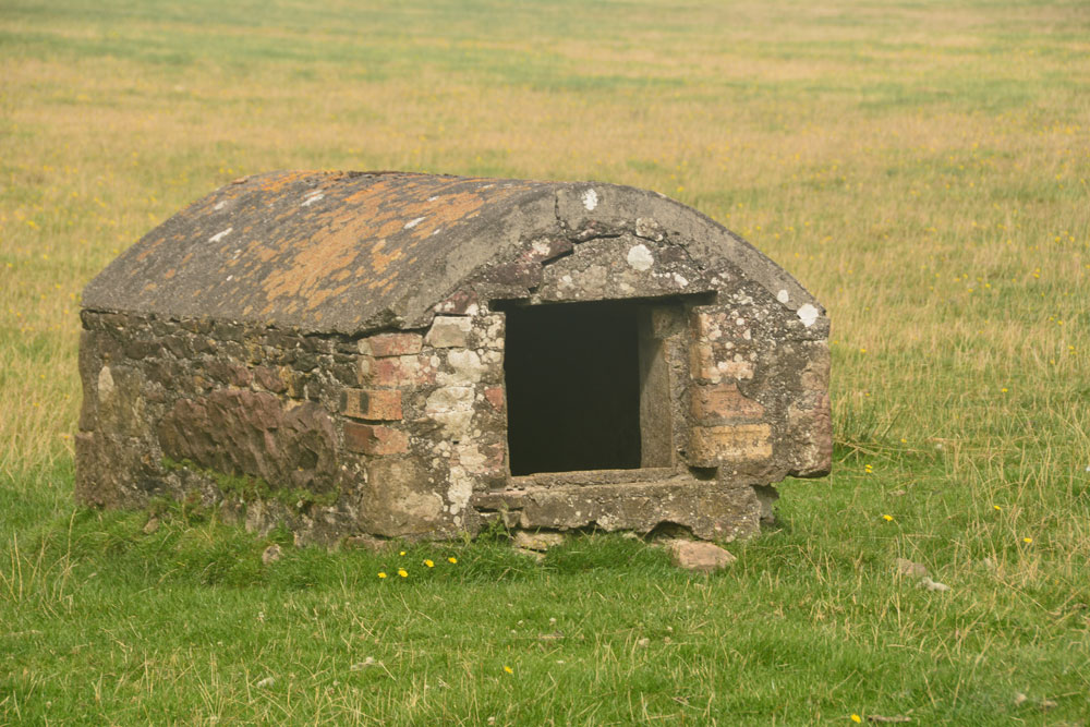
Hawthornside Farm (Bonchester Bridge) submitted by Anne T on 31st Aug 2018. This 'well house' is marked as a tank on the Canmore map, although the structure looks old and the chamber holds clear water. I'd love to know more about this well/tank if anyone has any information. We spotted it by chance trying to find our way to Bedrule.
(View photo, vote or add a comment)
Log Text: Well/tank, Hawthornside Farm (Bonchester Bridge): We spotted this ‘well house’ purely by chance as we passed by, then needing to turn the car round to go to Bedrule Church with its hogback fragments. This is a lovely site, right by the A6088. The well house (or ‘sink’ as it is labelled on the Canmore map) has Rubers Law Hillfort in the background.
There is no mention of Canmore, apart from the word ‘tank’ on its large scale map. The water appears to come straight up into the well basin – there is no sign of a pipe in or out. It does have the hinges for a (presumably wooden) door, which is no longer there. The water was beautifully clear and the inside of the structure clean.
Hawklemass Well (Whittingham)
Trip No.100 Entry No.2 Date Added: 24th Sep 2018
Site Type: Holy Well or Sacred Spring
Country: England (Northumberland)
Visited: Yes on 23rd Sep 2018. My rating: Condition 2 Ambience 4 Access 4
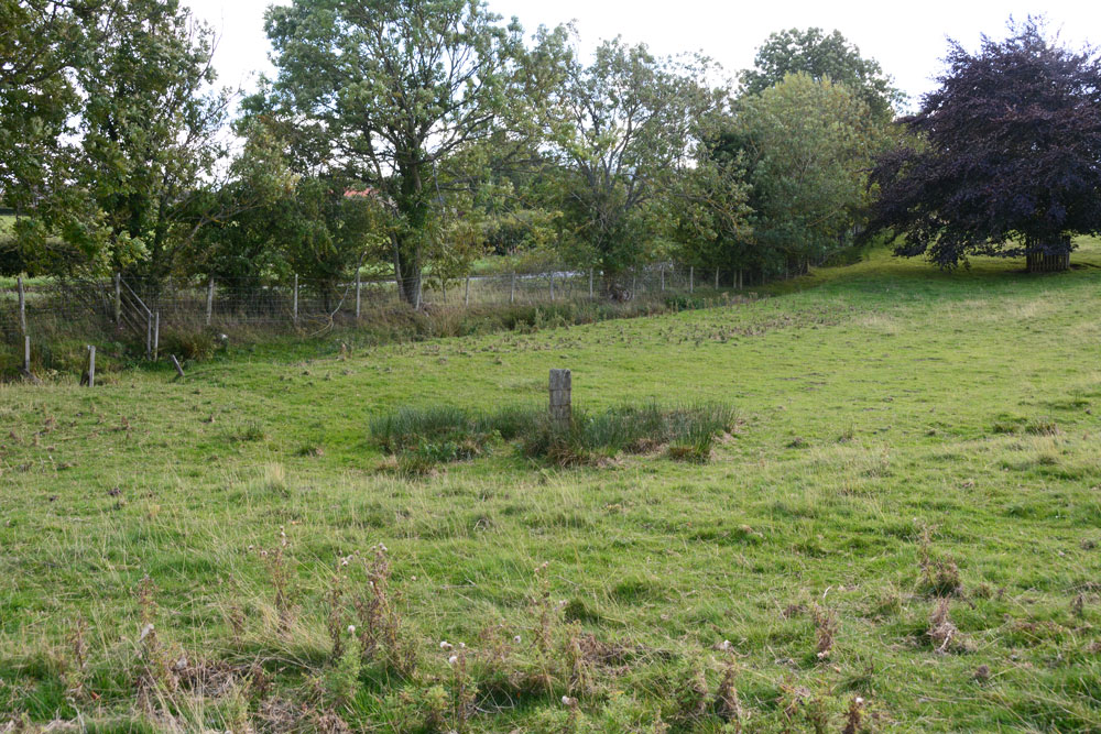
Hawklemass Well (Whittingham) submitted by Anne T on 24th Sep 2018. The well site, seen from slightly higher up the slope, just to its north west, looking east.
(View photo, vote or add a comment)
Log Text: Hawklemass Well, Whittingham: From St Bartholomew's Church in Whittingham, we drove round to this site, parking on the verge near the footpath sign to the church, which was quarter of a mile over the hill. Stepping over the stile into the field, there was a boggy patch marked by a substantial post, such as I've seen on a number of other wells, including Robin Hood's Well in Colwell. Sited at the bottom of a slope, it was a natural place to find such a well.
At the hedgerow to the east of the well, but just to the west of the road, there was a small gully or drain coming down alongside the hedgerow, which seemed to form a rectangular pool in the grass near the well. The OS map shows two drains or small streams which meet near this point.
There was no sign of any stone or brick structure to indicate this has been a well basin or trough. There is no record of this well on the modern OS map, neither on HE or Pastscape, or any other local record on the internet - curious.
On such a nice sunny afternoon, this site seemed entirely peaceful and normal - I was disappointed not to meet the Hawklemass Ghost mentioned by The Northern Antiquarian!
Hawick Mote
Trip No.29 Entry No.1 Date Added: 31st Jul 2017
Site Type: Misc. Earthwork
Country: Scotland (Scottish Borders)
Visited: Yes on 3rd Jun 2017. My rating: Condition 3 Ambience 3 Access 5
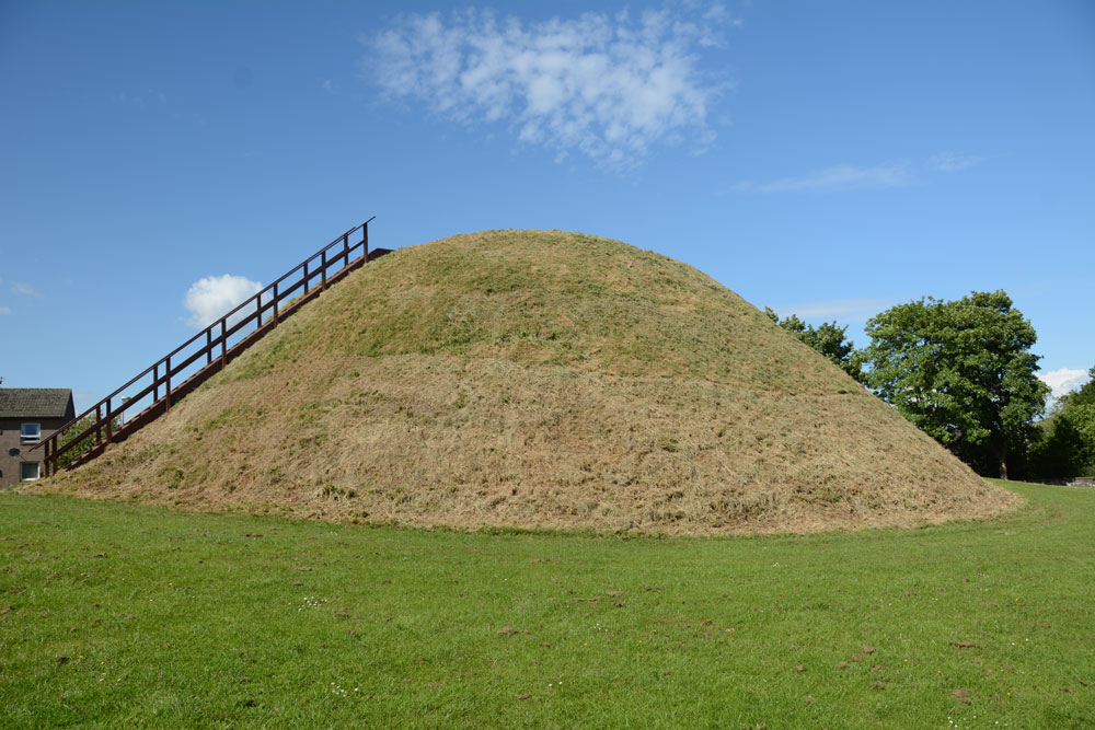
Hawick Mote submitted by Anne T on 27th Jul 2017. The Mote from the south western side, which has a ladder leading to the top of the mote which has an interpretation board.
(View photo, vote or add a comment)
Log Text: Hawick Motte/Mote, Scottish Borders: We arrived in Hawick, intending to buy a map, but the majority of the shops (apart from Dorothy Perkins, the bookmakers, charity shops and 1 café, were closed (looking at the opening times, they largely shut at 2pm on a Saturday. The town seemed deserted apart from a few tourists. We later found out that most local people had gathered near the community centre for the Riding of the Marches.
We couldn’t get a map, so relied on Andrew’s phone with TrigPoint on it. We were on our way to Lord’s Tree Cairn, driving down a street called Loan, when we spotted The Mote, so screeched to a halt by the side of the road and went round to take a photograph.
Quite extraordinary, The Mote is in the middle of a housing estate, with people’s washing hung up nearby. It rises steeply up out of the ground and there is a wooden staircase which takes you to the viewing point at the top. Andrew said it was only as large as our living room – no room for more than 12 people at most. Looking at this on UK Grid Reference Finder, it is located in Moat Park at the Southern end of the town. Plenty of dog walkers, all whom ignored me taking photographs.
Haughhead Kip (Eckford)
Trip No.47 Entry No.2 Date Added: 3rd Oct 2017
Site Type: Sculptured Stone
Country: Scotland (Scottish Borders)
Visited: Yes on 20th Sep 2017. My rating: Condition 3 Ambience 4 Access 4
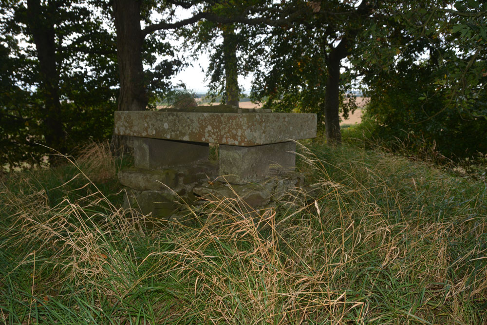
Haughhead Kip (Eckford) submitted by Anne T on 3rd Oct 2017. First view of the 'altar' with the inscribed stone on top, sited on top of the mound/tumulus.
(View photo, vote or add a comment)
Log Text: Haughhead Kip Tumulus & Inscribed Stone, Scottish Borders: This is one of the strangest sites I’ve been to recently, although in a lovely location. Sited just to the east of the A698, north of the B6401 and south of Kale Water, to the north west of the little village of Eckford, we parked on a corner of this narrow road at NT 72558 26695, where there was just enough room to pull the car right off the road. The B6401 was a busy little road, and we avoided cars walking west back to the field with the tumulus.
There is a gate into the field at NT 72289 26736, and it wasn’t until we were 20-30 metres into the field that we realised it had been planted with really tiny cabbage or turnip plants, drilled into wide rows. Being so close to the tumulus, we carefully picked our way across the rest of the field until we got to the gate to the tumulus at about NT 72184 26830. From there, it was a little climb up to what I can only describe as either an altar or a tumbledown box grave.
Certainly worth stopping to see. Canmore debates whether or not the mound was erected to contain the altar. Due to it’s location close to Kale Water, I think it was a tumulus used to locate the inscribed stone on top of it, to give it greater importance.
Hart Leap Stones
Trip No.32 Entry No.9 Date Added: 6th Jul 2017
Site Type: Misc. Earthwork
Country: England (Yorkshire (North))
Visited: Yes on 2nd Jul 2017. My rating: Condition 2 Ambience 4 Access 5
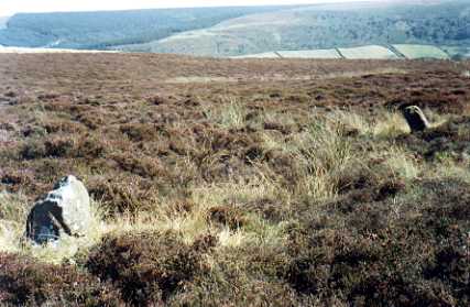
Hart Leap Stones submitted by kelpie on 7th Jul 2002. Said to mark the dying leap of a hunted hart these are probably the remains of a stone row. NZ 73476 03555
(View photo, vote or add a comment)
Log Text: Hart Leap, Glaisdale Rigg: From the Black Hill Cross/Standing Stone, despite having the grid references for this site, we drove past it twice and had to park up and get out and explore. Fortunately there was a moorland track heading eastwards across the moor with room to pull up in. In driving further north along the road, there is another trig point, TP3365 (Glaisdale Rigg).
Exploring first to the east of the road, we spotted two stones lying low in the grass. The earthwork is barely discernible on the eastern side of the road, but is much clearer on the west. We walked the bank on the western side. The Historic England entry mentions a third stone on the eastern side of the road, but we didn’t spot this.
I’m certainly pleased to have been ‘out and about’ with the archaeology group, as at least I could start to interpret what I was seeing on the ground. The site has superb views over Great Fryup Dale.
Harpton Round Barrows
Trip No.168 Entry No.2 Date Added: 3rd Aug 2021
Site Type: Round Barrow(s)
Country: Wales (Powys)
Visited: Yes on 14th Aug 2021. My rating: Condition 2 Access 4
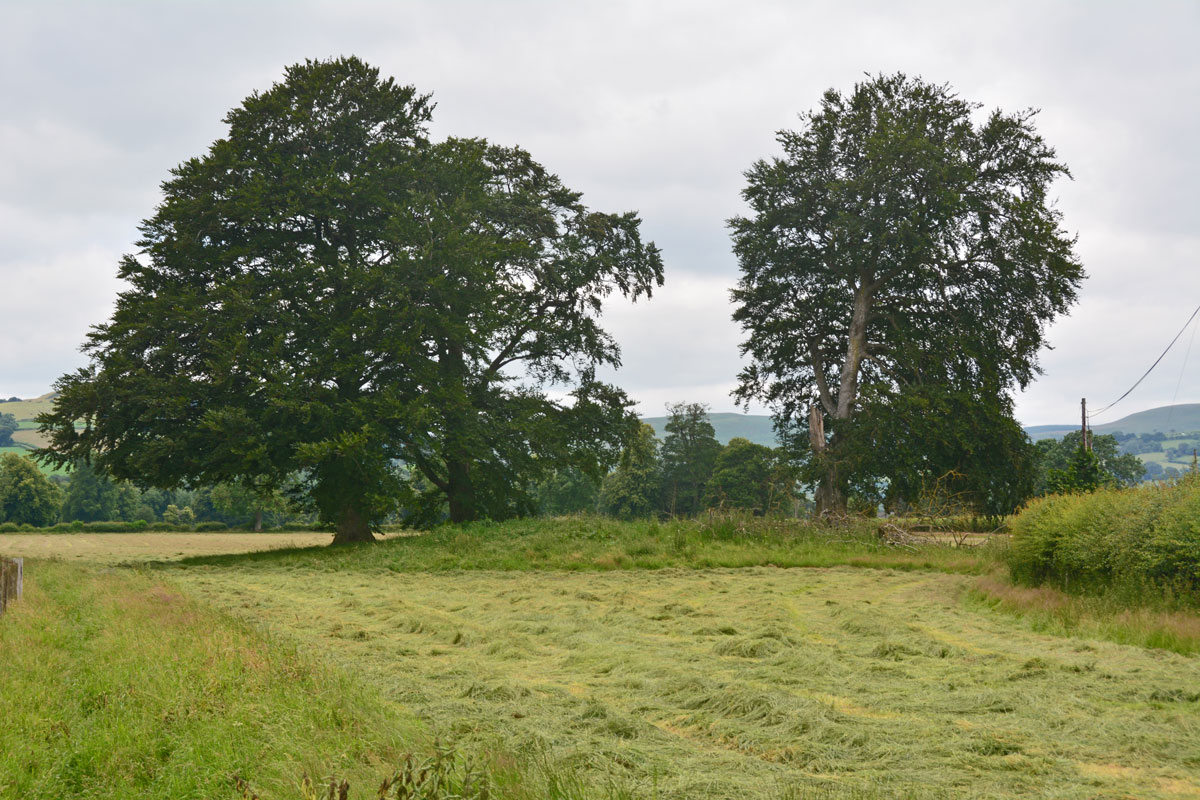
Harpton Round Barrows submitted by Anne T on 3rd Aug 2021. The eastern-most of the two barrows, viewed from the well chained and padlocked gate into the field. This barrows is at SO 2422 5998.
(View photo, vote or add a comment)
Log Text: Harpton Round Barrows: Not the most exciting of stops, but interesting, never-the-less. Andrew did try and find the nearby Castle Nimble, but the only access seemed to be through private farmland, and as we didn’t want to trespass, gave up and went onto the more exciting four-poster stone circle.
Harbottle
Trip No.28 Entry No.7 Date Added: 30th May 2017
Site Type: Modern Stone Circle etc
Country: England (Northumberland)
Visited: Yes on 28th May 2017. My rating: Condition 3 Ambience 5 Access 4
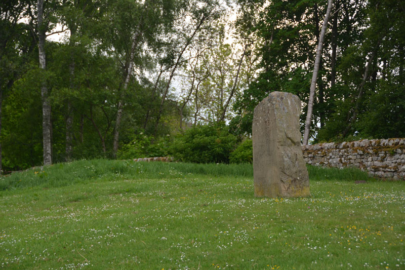
Harbottle submitted by Anne T on 30th May 2017. This modern standing stone can be found on a grassy bank at the western side of the car park for the castle.
(View photo, vote or add a comment)
Log Text: Harbottle Modern Standing Stone/Castle: From Holystone, we passed through Harbottle to get back to the A68, so stopped to look at the castle. The site is lovely.
I spotted the modern standing stone to the west of the car park. The standing stone is inscribed with words:
The Sad Castle
Who Made me/Into a ruin/like an old city?
Was it the soldiers who rode out on horseback?
Was it my old enemy the Scots?
Or was it those Border Reivers?
Perhaps it was just the centuries passing.
Felicity Lance
Apparently there are supposed to be 2 poems, the above by Felicity Lance, another by Robert Corley from Harbottle School, carved into the stone by local stonemason David Edwick. I walked all around the stone, even photographing the other faces to see if anything came up on the camera, but only saw the one poem.
The Pastscape record says there could have been a pre-Conquest fortress on the site. The motte is very steep, and a walk around the moat/outer ditch was charming. Walking into the ruins from the eastern side, there are lots of lumps and bumps of the remains of walls and buildings. Very enigmatic. Really pleased to have been here.
Hanging Stanes (Braid Road)
Trip No.105 Entry No.3 Date Added: 5th Nov 2018
Site Type: Marker Stone
Country: Scotland (Midlothian)
Visited: Yes on 28th Oct 2018. My rating: Condition 2 Ambience 3 Access 5
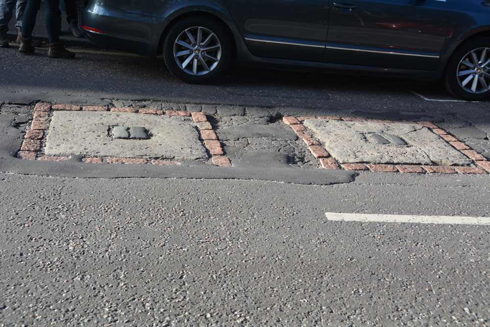
Hanging Stanes (Braid Road) submitted by Anne T on 5th Nov 2018. The two gallow bases are embedded in the road surface. I originally thought this site was associated with witches, but was the site of the execution of the last two highwaymen in Scotland. We picked this site up from the Ancient Stones website, and as it was very close to the Buckstane, thought we'd take a look.
(View photo, vote or add a comment)
Log Text: The Hanging Stanes: Having spotted this site on the Ancient Stones website, and with them being just down the road from the Buck Stane, we decided to pay this site a visit on the way into Edinburgh City Centre. I don't know why I thought these were originally associated with witches, but found out otherwise during the visit.
We pulled up next to the junction of Braid Road and Comiston Road, as per the directions on the Ancient Stones, only to find some people from the house immediately next to it were leaving and getting into their car. The older gentleman from the house asked me if we’d seen the plaque on the street and told me around 30 people each day come to see these stones.
The plaque in the pavement reads: “The Hanging Stanes. Thomas Kelly and Henry O’R eil, the last two highwaymen in Scotland to be executed, were hanged in public on 25th January 1616, from the gallows erected on the two stanes still visible on the spot, which was where the robbery took place. Paid for by public subscription. 1995.”
I risked getting run over to avoid my shadow falling across the stones, but they were half in shade and half in the sun, so the photos weren’t great. With these stones being sited on the slope of a hill with views over the city centre, without the traffic and the people around, this would have been a very atmospheric and enigmatic place.
Hands Well
Trip No.170 Entry No.6 Date Added: 12th Aug 2021
Site Type: Holy Well or Sacred Spring
Country: England (Derbyshire)
Visited: Yes on 16th Jul 2021. My rating: Condition 3 Ambience 3 Access 5
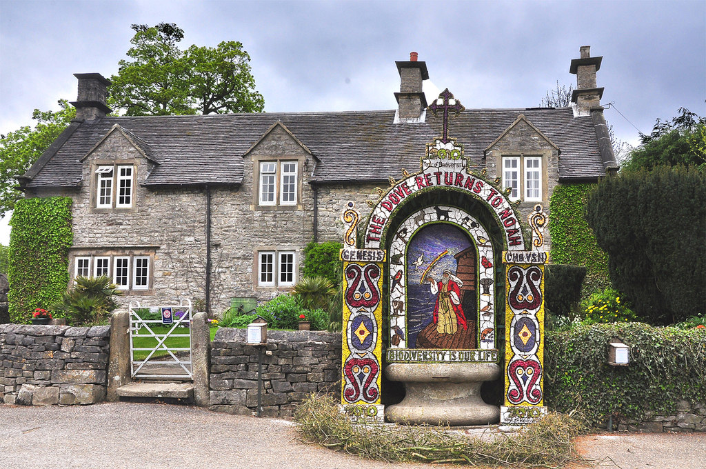
Hands Well submitted by Creative Commons on 6th May 2013. Hands Well dressing and cottage - Tissington 2010
Copyright Mick Lobb and licensed for reuse under the Creative Commons Licence.
(View photo, vote or add a comment)
Log Text: Hands Well, Tissington: The sixth, and final, well marked on the Tissington village leaflet map, and looked like a large, stone cotton-reel. As we approached it, some people were dipping their hands into the water. There was no flow of water into the basin, although the water appeared fresh and clear.
Halton St Wilfrid's Churchyard
Date Added: 6th Jun 2015
Site Type: Ancient Cross
Country: England (Lancashire)
Visited: Yes on 4th Jun 2015. My rating: Condition 3 Ambience 3 Access 5
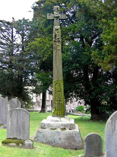
Halton St Wilfrid's Churchyard submitted by LivingRocks on 18th Apr 2005. The partially restored high cross in St Wilfrid's Churchyard.
(View photo, vote or add a comment)
Log Text: Ancient Cross, St. Wilfrid's, Halton: From St. Margaret’s in Horby, we followed the busy A683, turning off onto the road to Halton just south of Caton. Although only a side road, this road seemed busier than the main road.
This must be one of the most dangerous sites I’ve visited. The church is located on a bend on this busy, busy road and the gate into the church is less than a foot from the edge of the road with no pavement, and it’s quite stiff to open – nearly got run over trying to get into the church and had to be very careful exiting, as you couldn’t see what was coming round the bend to the right.
The church looks more like a house with a stone tower, and unfortunately was locked, which was a shame, because the Pastscape record tells us there are pieces of 5 Anglo Saxon stones built into the interior of the tower.
According to the Pastscape record 41153, the pre-Norman cross (restored in 1890) tells the story of the Sigurd legend (which I’ll need to find out about), although to my eye not all the pieces matched and must be several crosses amalgamated together. A bit of a disappointment really.
Hallrigg Standing Stone
Trip No.175 Entry No.1 Date Added: 28th May 2022
Site Type: Standing Stone (Menhir)
Country: England (Cumbria)
Visited: Saw from a distance on 28th May 2022. My rating: Condition 3 Ambience 3 Access 1
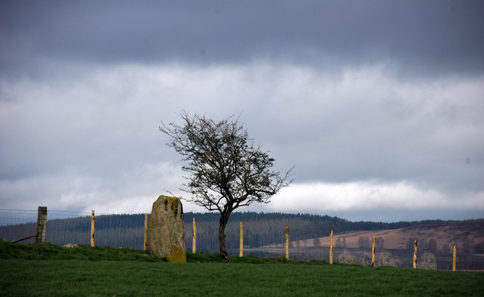
Hallrigg Standing Stone submitted by nicoladidsbury on 9th Apr 2007. Hallrigg Standing Stone - rediscovered standing stone, 2 miles north of Lowhouse Standing Stone, 5 miles north of Penrith. It appears to be red sandstone, approx 1.5m tall
(View photo, vote or add a comment)
Log Text: Hallrigg Standing Stone, Plumpton: The nearest we could get was the very back (staff only area) of the Pot Place Car Park, and we asked permission to take this photograph from the member of staff working in this area.
We did try numerous other ways to get closer to the standing stone, but couldn't even find a track and/or gate to walk across the fields, or who to ask permission off.
Photo taken with a tripod and 50-300mm zoom lens at maximum zoom, but even this didn't give an excellent photo, given the haze in the atmosphere.
Hallington Holy Well
Trip No.118 Entry No.1 Date Added: 15th Feb 2019
Site Type: Holy Well or Sacred Spring
Country: England (Northumberland)
Visited: Yes on 14th Feb 2019. My rating: Condition 3 Ambience 4 Access 4
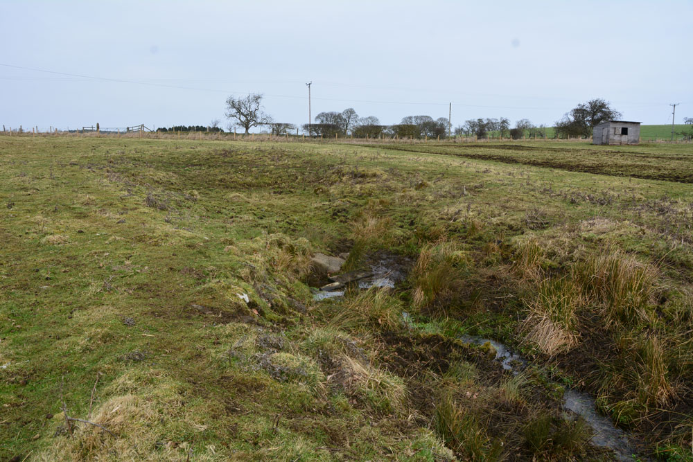
Hallington Holy Well submitted by Anne T on 15th Feb 2019. Standing a little bit further down towards the field boundary, looking back at the small pool of water near where the spring emerges, and the much larger hollow of what we interpreted as the well pool (now dry). There is evidence of stones around the rim of the larger pool area, indicating there might have been a structure here at one time.
(View photo, vote or add a comment)
Log Text: Hallington Holy Well: We drove past this well, despite having the OS map with the location of the well marked. In the end we drove slowly back towards Hallington village, identifying the field because it is smaller than the others, with a fence line and line of trees that runs parallel to the road, about 100m away.
The gate into the field was open, but a large wooden shed indicates the field is usually used for horses. We walked south to the well pool, about 50m from the gate, coming across a large hollow with boulders/stones poking out of the bank; we interpreted this as having at one point having been a larger well pool.
The spring bubbles up from the western bank of the channel, just where the larger ‘pool’ narrows into the channel into which the water flows south to the field boundary. The water is clear and freely flowing. The collection of stones and wooden blocks leading across the mud indicated people still collect the water today, although I didn’t’ taste the waters.
This is a very lovely spot, and it was a great start of our afternoon out.
Hall Well (Tissington)
Trip No.170 Entry No.1 Date Added: 11th Aug 2021
Site Type: Holy Well or Sacred Spring
Country: England (Derbyshire)
Visited: Yes on 15th Jul 2021. My rating: Condition 4 Ambience 4 Access 5
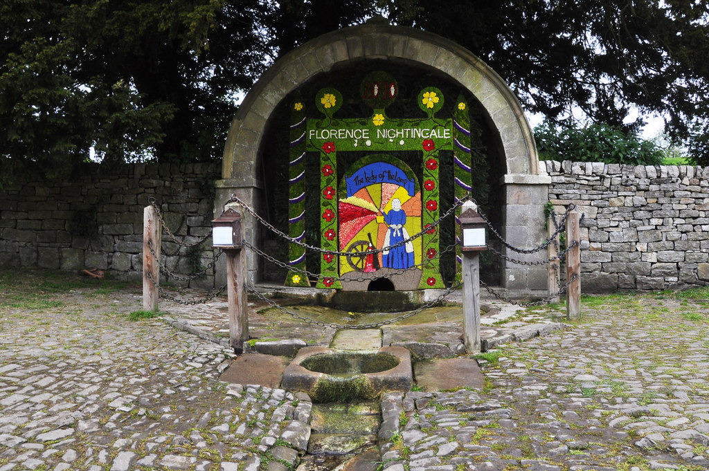
Hall Well (Tissington) submitted by Creative Commons on 6th May 2013. Dressing of Hall Well - Tissington 2010
Copyright Mick Lobb and licensed for reuse under this Creative Commons Licence.
(View photo, vote or add a comment)
Log Text: Hall Well, Tissington: We have been to Tissington before, on a Well Dressing weekend, a long, long time ago (about 38 years!), but because of the sheer number of visitors and really only interested in seeing the church, we took a quick look around only. This time, we walked round to see the wells in their 'ordinary' state. There was a large number of visitors again, but no-one else seemed particularly interested in the wells. It being a very, very hot and humid day, we were grateful for the cafe being open, although the queues to get ice-cream from the traditional sweet shop were horrendous, so we gave up.
I picked up a leaflet in the main cafe which showed the location of the wells, which made locating them easy.
A very pleasant village, and well worth visiting. Would have liked to have spent longer.
Hall Well (Irthington)
Trip No.40 Entry No.2 Date Added: 24th Aug 2017
Site Type: Holy Well or Sacred Spring
Country: England (Cumbria)
Visited: Yes on 20th Aug 2017. My rating: Condition 2 Ambience 3 Access 5
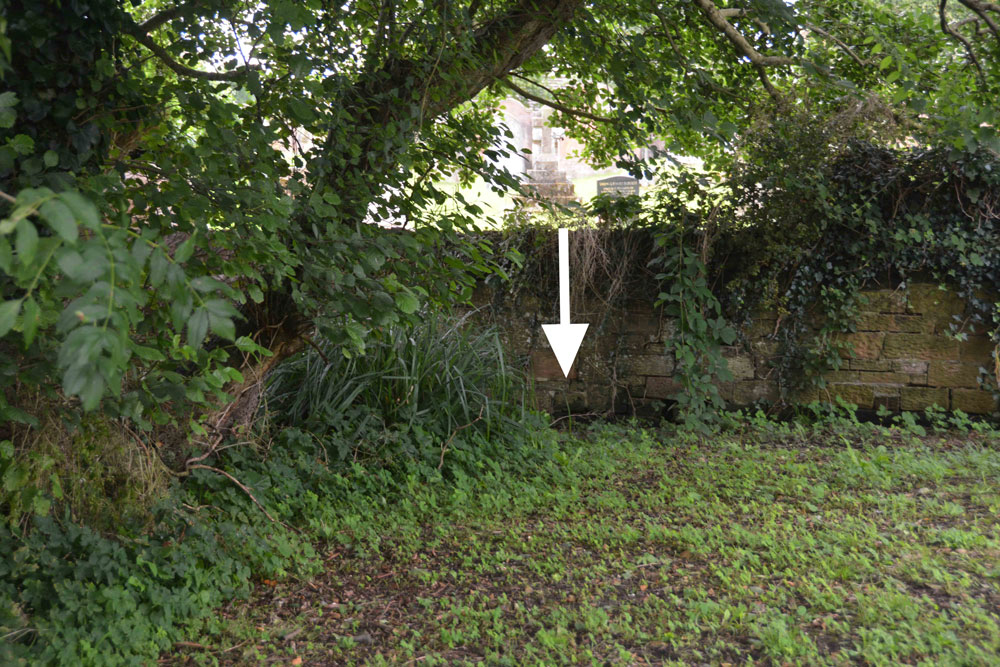
Hall Well (Irthington) submitted by Anne T on 24th Aug 2017. At the southern end of this small grassy area is a boggy area. Just underneath the wooden fence into the neighbouring garden a stream appears from under the bank. This stream has a good flow of water.
(View photo, vote or add a comment)
Log Text: Hall Well, Irthington: From Walton we made our way over to Irthington – not a planned visit, but because I saw the holy well and 2 mottes in close proximity in this village.
This small village (too large to be called a hamlet, but too small to be a good sized village) is obviously old. It’s not that far from Carlisle Airport and stands on the line of Stanegate and is also close to the line of Hadrian’s Wall.
Being armed with the OS map and a GPS, we went in search of the holy well first (passing by the first motte as we’d look for somewhere to park on the way back). According to the OS map the well lies not far outside the south-eastern wall of the church yard. Walking through the churchyard, this area is covered in brambles, nettles and shrubs, but we found some steps leading through the wall and onto the grassy area beyond. At the grid reference above there are some reeds and shrubs sitting in a boggy area. Peering over the fence into the garden of the house sitting immediately to the south, a stream suddenly appears out of the ground and rushes through the garden and is piped under the road, presumably to the modern water pumping station opposite. Nothing exists of any well housing (that we could see) and I’ve emailed the vicar through the ‘A Church Near You’ website.
Just down the road is one of the mottes. Note: the grid reference given by Pastscape indicates the site of the well is around the steps from the churchyard.
Haining House (Lambley)
Trip No.43 Entry No.2 Date Added: 5th Sep 2017
Site Type: Cairn
Country: England (Northumberland)
Visited: Yes on 2nd Sep 2017. My rating: Condition 3 Ambience 4 Access 4
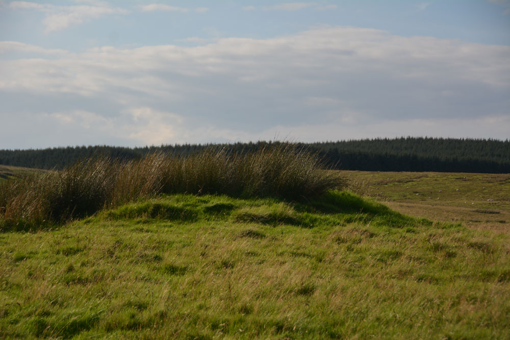
Haining House (Lambley) submitted by Anne T on 5th Sep 2017. First view of the cairn, peeking northwards over the stone wall which runs parallel with the track leading up to Haining House on Hartleyburn Common.
(View photo, vote or add a comment)
Log Text: Haining House Cairn, Hartleyburn Common: It was difficult to park here, as the road was so narrow. In the end we managed to bump the car up a slight bank to the north east of the track to Haining House. The track to the farm house was well looked after, although to drive to it, you’d have had to opened (and shut) three gates.
The cairn was easily identify-able, and being on access land, we walked to the gate located in the stone wall just to the west of the cairn, and walked back. There are some curiously deeply cut valleys to the north west of this cairn, now in a u-shaped feature. There are some cup and ring marked rocks along this section of the burn, although we planned to walk further west to see some more settlements this afternoon.
However, leaving the cairn and letting ourselves into a field with a gate, the heads of some very curious, and large, cattle/bullocks appeared above a slight mound. We retreated and went to look at the map for some other sites to see.
Haer Stane
Trip No.109 Entry No.8 Date Added: 12th Nov 2018
Site Type: Standing Stone (Menhir)
Country: Scotland (Clackmannanshire)
Visited: Yes on 31st Oct 2018. My rating: Condition 3 Ambience 3 Access 4
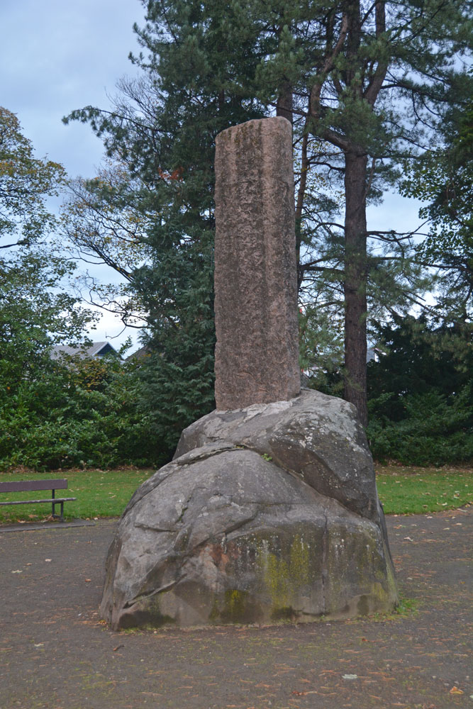
Haer Stane submitted by Anne T on 12th Nov 2018. Site in Clackmannanshire Scotland. Approaching the Haer Stane, which is at the far (north western) end of the park. It was dusk on Halloween, and the light was failing fast!
(View photo, vote or add a comment)
Log Text: Haer Stane, Tullibody: This is one of the strangest erratics I’ve seen, as it’s been repurposed as a war memorial. We parked on School Road, by the school, and walked down to the entrance to this long, thin park; the only gate we could find into this area was through a lych gate at the corner of School Road and Lychgate Road. The erratic is almost at the far (north western) end of the park.
The stone was adjacent to the rear of the school where a large construction project is taking place, so the noise was very intrusive. We were the only people taking note of this erratic; all the other people around must have been locals who were walking their dogs.
The crosses on the eastern face of the cross shaft have been well done, and mimic Anglo Saxon crosses with interlaced designs.
Hadrian's Wall (Turret 44b)
Trip No.143 Entry No.3 Date Added: 11th Jul 2019
Site Type: Misc. Earthwork
Country: England (Northumberland)
Visited: Yes on 8th Jul 2019. My rating: Condition 2 Ambience 4 Access 4
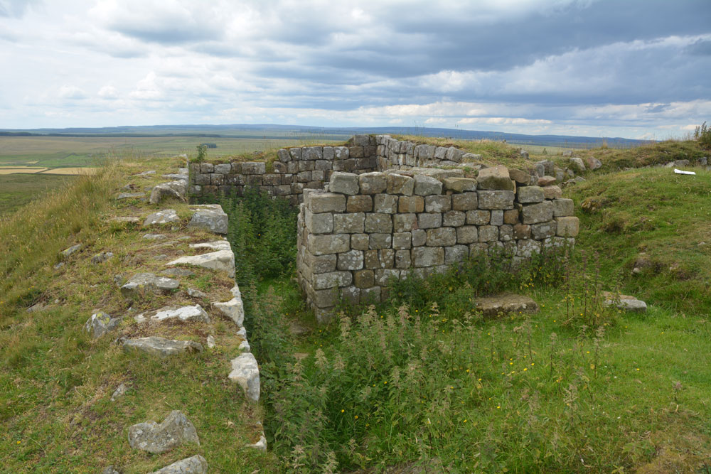
Hadrian's Wall (Turret 44b) submitted by Anne T on 11th Jul 2019. Standing almost at the western edge of the turret, with the crags dropping down sharply, just off shot to the left, looking north across the turret. Photo by Andrew T
(View photo, vote or add a comment)
Log Text: Turret 44b, Hadrian's Wall: Located on the crag above King Arthur's Well, this is a lovely spot. We had difficulty in locating the holy well, so whilst I continue to search for the it and see if I could find any structure or water course, Andrew ascended the steps to the top of the crag, and came back about 20 minutes later.
This turret is on the Hadrian’s Wall path, which runs almost due east-west here. It is in a very pretty spot. Even with it being a Monday afternoon, and a very warm day, there were lots of walkers here. Many passed me on the paved section of path but none appeared to stop and look at the turret, as no-one seemed to linger at this point. Perhaps they had already seen too many turrets around here - there are certainly a lot of them!
Hadrian's Wall (Poltross Burn)
Trip No.143 Entry No.1 Date Added: 11th Jul 2019
Site Type: Stone Fort or Dun
Country: England (Cumbria)
Visited: Yes on 8th Jul 2019. My rating: Condition 3 Ambience 4 Access 4
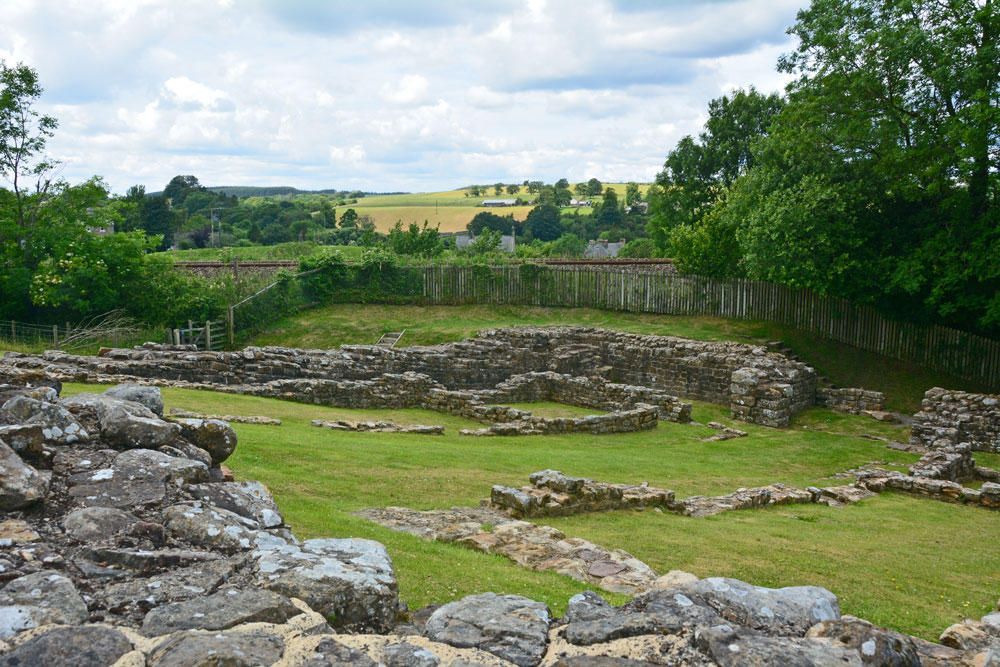
Hadrian's Wall (Poltross Burn) submitted by Anne T on 11th Jul 2019. Standing at the south western corner of the milecastle/small fort, looking towards its north eastern corner.
(View photo, vote or add a comment)
Log Text: Poltross Burn Milecastle: We last visited this site on 27th October 2013, and it hasn’t’ changed at all. Andrew, in typical engineering fashion, went round and talked about the offsets and revetted construction of this small fort. It’s layout is remarkably easy to read.
Andrew recalled reading about a house built right on top of the wall, but we were unable to find it.
Hadrian's Wall (Heddon on the Wall)
Date Added: 17th Jul 2019
Site Type: Misc. Earthwork
Country: England (Northumberland)
Visited: Yes on 20th Sep 2018. My rating: Condition 3 Ambience 4 Access 5
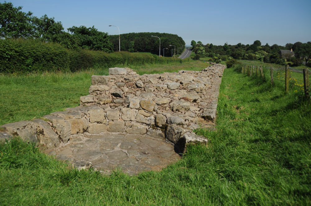
Hadrian's Wall (Heddon on the Wall) submitted by Anne T on 8th Jul 2019. This round structure, built into the body of the wall, is thought to be a medieval corn drying kiln. A creative use of this stone structure! Photo taken 14th June 2014. Looking east down the stretch of wall, with the B6528 running parallel, to the west of the line of the Wall.
(View photo, vote or add a comment)
Log Text: Section of Hadrian's Wall at Heddon-on-the-Wall: This well preserved section of the 'wide' wall can be found a few hundred metres to the east of the church, and comes as quite a surprise as I turned the corner from The Towne Gate, heading east.
There are some structures built into the body of the wall, one said to be medieval corn drying kiln. I saw quite a few tourists passing this spot on the other side of the B6528, but none stopped to walk into this part of the wall and take a closer look.
