Contributory members are able to log private notes and comments about each site
Sites Anne T has logged. View this log as a table or view the most recent logs from everyone
St Ebba's Chapel
Trip No.75 Entry No.4 Date Added: 22nd May 2018
Site Type: Ancient Cross
Country: England (Northumberland)
Visited: Yes on 20th May 2018. My rating: Condition 2 Ambience 4 Access 4
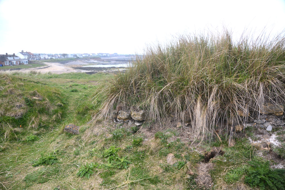
St Ebba's Chapel submitted by Anne T on 22nd May 2018. Inside the ruins of the chapel, looking at the northern doorway and remains of the northern wall.
(View photo, vote or add a comment)
Log Text: St Ebba's Chapel/Early Christian Monastery site: I have long wanted to come to this spot, ever since seeing the Time Team Excavation of this in July 2013. Whilst the rest of Northumberland had a hot day with blue, cloudless skies, this part of the coast was murky. Still, this was a very enigmatic place.
We’d stopped off at a café/restaurant in Beadnell village for refreshments before arriving here, and I’d looked at their guide book “Limekilns and Lobsterpots” before arriving, which intrigued me further.
A lonely spot, largely surrounded by sea on a narrow promontory. I wish I’d been able to see the excavations, but found the Wessex Archaeology report.
St Maurice's Well (Ellingham)
Trip No.75 Entry No.5 Date Added: 22nd May 2018
Site Type: Holy Well or Sacred Spring
Country: England (Northumberland)
Visited: Yes on 20th May 2018. My rating: Condition -1 Ambience 4 Access 4
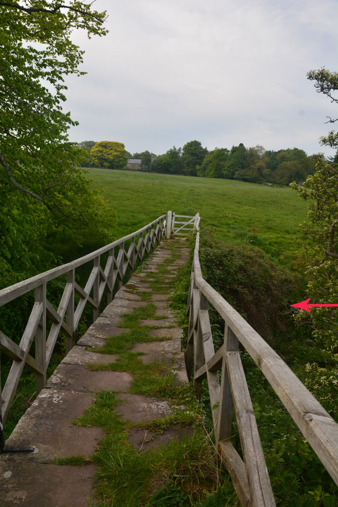
St Maurice's Well (Ellingham) submitted by Anne T on 22nd May 2018. We think this was the site of St. Maurice's Well, just to the south western side of this charming stone-flagged footbridge across the Long Nanny.
(View photo, vote or add a comment)
Log Text: St. Maurice's Well, Ellingham (destroyed): This church was in a glorious spot amongst old houses. The church looked relatively modern, and as it was still open, we popped our heads in. There was some really great stained glass windows. They also had a book sale, so we bought a couple of books on cathedral architecture for a £2 donation.
Inside, we spotted the head of an old font, dating (according to the church guide) to the Norman or Early English Church (but looked 16th/17th century in style to me). On either side of the path from the lych gate to the church were the old pinnacles from the previous church, dating to 1805.
Finding the right footpath from the church proved interesting, as it had a number of footpaths running from/around it, but we eventually orientated ourselves. Back to the Long Nanny stream.
From the description, we found the footbridge and the gorge/bank, but couldn’t really find any structures. I asked a lady (about 40ish) walking her dog if she knew where the well was. She replied “They used to come from the school to get the water. There used to be steps, but they’re gone, and no-one knows where the well was. It’s lost.”
We tried to find the location, which needed to be in a slight ravine (hence the reference to steps), and any old stonework. We thought we might have spotted something. But, then again, perhaps not! It was worth it to see the wonderful stone-flagged footbridge.
Five Ashes Cairn (Netherwitton)
Trip No.76 Entry No.1 Date Added: 27th May 2018
Site Type: Round Cairn
Country: England (Northumberland)
Visited: Yes on 26th May 2018. My rating: Condition 2 Ambience 4 Access 4
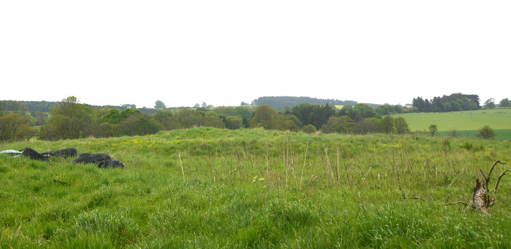
Five Ashes Cairn (Netherwitton) submitted by Anne T on 27th May 2018. First proper view of the Five Ashes Cairn from the gate into the field at approximately NZ 09596 90631. It is located on a slight rise in the landscape. The farmer has kept the area of, and just around the cairn, free of crops.
(View photo, vote or add a comment)
Log Text: Five Ashes Cairn, Netherwitton: From St. Giles’s Church, we drove back through Netherwitton, taking the right hand turn which runs northwards, to the west of the meandering River Font. Parking at NZ 09891 90457, next to the entrance to the field with the footpath running through, we set off across the mowed footpath. This section of shorter grass petered out after about 100metres. Five Ashes Cairn was visible to our west after about 300metres. There was a gate into the cairn field, technically trespassing, but the area with, and around, the cairn, had been left clear of crops, so we kept to the field edge and made our way the 50m or so across to the cairn.
At this time, a whole ribbon of small planes began to fly across, one at a time, about 30 seconds apart. I lost count after 20, then came the hang gliders and microlights, the some more small planes. They were all heading roughly from north east to south west, and we haven’t been able to find out where they came from, or where they were going to, although the Borders Gliding Club isn’t that far away from this location, near Milfield and Maelmin.
If we hadn’t have known this what we were looking at, and that it was marked on the OS map, anyone could have been forgiven for thinking this was just a farmer’s mound/junk heap with straw bales and other items left on its north eastern side.
This cairn looked quite large, with a steeper bank on its western side. It looks as if it has been crudely excavated, with various lumps and bumps under the long, tussocky grass (and lots of short, fierce nettles at ankle level!) over the mound.
Ewesley Enclosure
Trip No.76 Entry No.6 Date Added: 27th May 2018
Site Type: Misc. Earthwork
Country: England (Northumberland)
Visited: Yes on 26th May 2018. My rating: Condition 2 Ambience 4 Access 4
Ewesley Enclosure submitted by SolarMegalith on 16th Jun 2013. Bank and ditch in the western part of the probable Iron Age enclosure (photo taken on June 2013).
(View photo, vote or add a comment)
Log Text: Ewesley Defended Settlement, Northumberland: This was our last stop of the day, and it was really warm. There is a permissive footpath which runs along the dismantled railway line, although we drove past and had to retrace our steps to find it. The footpath sign is on a gate at approx.. NZ 05932 92605, just south of the railway bridge, and a small bridge over a stream, on the B642, before the farm to the north of the bridge.
Be warned, as the ‘footpath’ is really non-existent, and if we’d have strayed off the higher ground, we’d have needed waders to cross certain parts. As it was, we found an old boundary bank running north-south across a fence line and followed that to the drier side on the other side of a burn/drainage ditch.
The southern part of the structure can be clearly seen from the road, and it’s clearly a settlement of some kind, although why it’s southern been built on a slope, I’m not sure. There is an outer bank and ditch, which we followed up to where the settlement is cut by the railway line, and we found the easiest way down and across, up to its northern side, where some of the inner banks remain.
This is certainly a settlement of some kind; we couldn’t reconcile ourselves to it being a henge. Certainly enigmatic..
Clavering's Cross
Trip No.76 Entry No.5 Date Added: 28th May 2018
Site Type: Ancient Cross
Country: England (Northumberland)
Visited: Yes on 26th May 2018. My rating: Condition 3 Ambience 4 Access 4
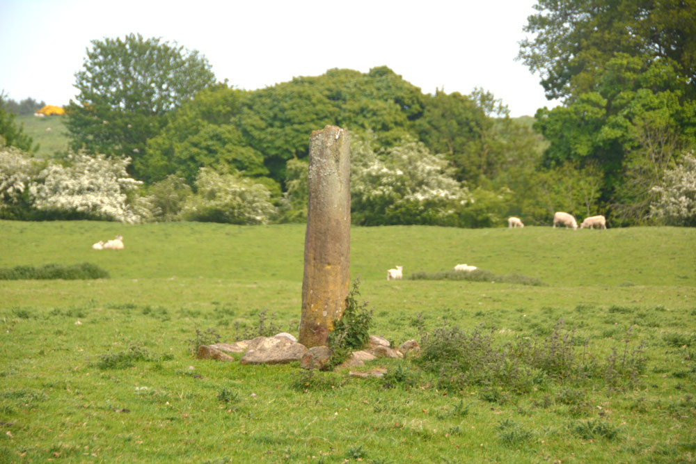
Clavering's Cross submitted by Anne T on 28th May 2018. Getting close, approaching from the north west, the fracture at the top of the cross shaft is clearly visible. Is the cross head really in the dike at the west side of this field??
(View photo, vote or add a comment)
Log Text: Clavering's Cross, Stanton: Disappointed by the third cairn, which we were really unsure of, I’d spotted this cross on the OS map, and as it wasn’t too far away, we thought we go on our way to Ewesley.
Parking on the verge just north of the farmhouse, there were roadworks being set up and a very large, yellow skip had been placed by the gate into the field. As there was a large ditch to its south, there was a very narrow piece of land to walk across, and with the side of the skip looming above my left hand side, I managed the two steps across, because I really wanted to see this cross.
We had to shoo the lovely, fat hens out of the way to open the gate, and spent a few minutes walking round and taking photographs. The steps were in a sorry state, which is unusual - Pastscape tells us the cross has (within living memory) been relocated back to the site where it originally stood, so perhaps the steps weren't built properly during the relocation.
Netherwitton B
Trip No.76 Entry No.3 Date Added: 28th May 2018
Site Type: Round Cairn
Country: England (Northumberland)
Visited: Yes on 26th May 2018. My rating: Condition 3 Ambience 4 Access 4
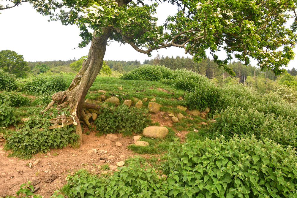
Netherwitton B submitted by Anne T on 28th May 2018. The internal structure of the cairn can be seen more clearly on its south western side, where a hawthorn tree has grown up from the base, and animal sheltering under it have rubbed away the surrounding earth.
(View photo, vote or add a comment)
Log Text: Netherwitton Round Cairn B: This cairn is located in a really lovely spot, on what was a small promontory, one side forming an old bank of the River Font, the river having changed course many years ago. We walked past this without realising this was the second cairn on the map, both saying: “That looks distinctly like a cairn”, then realising after I’d photographed it that it was the second Bronze Age cairn mentioned on Pastscape. Whilst small, it's a really nice example of a cairn, and the internal structure can be seen where a hawthorn tree grows out of its south west side, and animals have rubbed the earth away. This cairn has been apparently undisturbed by the antiquarians. I wonder why? Curious.
Netherwitton A
Trip No.76 Entry No.4 Date Added: 28th May 2018
Site Type: Round Cairn
Country: England (Northumberland)
Visited: Yes on 26th May 2018. My rating: Condition 3 Ambience 4 Access 4

Netherwitton A submitted by Anne T on 28th May 2018. This photo is three stitched together and shows the southern edge of the cairn, with its stony structure.
(View photo, vote or add a comment)
Log Text: Netherwitton Round Cairn A: This cairn is clearly visible from both Five Ashes cairn and Netherwitton B. There were some magnificent sheep and lambs in this field, all seemingly oblivious to the ancient monument underneath their hooves. All of them scattered as we approached the cairn. My first impression was ‘how many tens of thousands of stones did they use to create this cairn?’; the second ‘the interior has certainly been hacked about by whoever excavated this’.
We walked all round the higher outer bank of the cairn – it’s big. A very pleasant walk, to see three Bronze Age cairns very close to each other. This must have been a thriving community back in the day, especially with the River Font to the east and the Ewesley Burn to the west. I would have expected a standing stone or two to be in this area – it’s very fertile farmland here.
Milfield Reconstructed Henge at Maelmin Heritage Centre
Trip No.77 Entry No.1 Date Added: 1st Jun 2018
Site Type: Henge
Country: England (Northumberland)
Visited: Yes on 31st May 2018. My rating: Condition 4 Ambience 4 Access 4
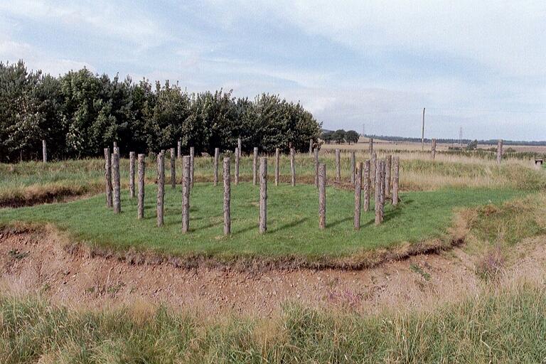
Milfield Reconstructed Henge at Maelmin Heritage Centre submitted by Andy B on 27th Feb 2003. Part of the Burnham family trip to Northumberland, August 2002
(View photo, vote or add a comment)
Log Text: Maelmin Recreated Henge, Milfield: We had a bit of a tortuous journey to get here, having been stuck in roadworks on the A1 northbound, so instead of the hour and a half it would have taken us, it was almost two and a half, so we were eager to get out of the car and walk.
Having found the ‘Archaeological Guide’ by Clive Waddington in a local charity shop about 10 days ago, I had read it from cover to cover and was really keen to see this site. I’d shown the booklet to our three year (going on 63) old grand-daughter and we’d talked through the photos on the journey here. As we walked into the centre of the henge from the car park, she turned to me and, pulling a face, said; “It’s just a ‘thing’ with a deep hole”.
Having spotted all the information boards round the site and running through the woods, she ran from one to the other. On getting to the Dark Age hut at the far side of the site, she was fascinated by this, and we had to go inside. Opening the door was amusing, at the wood had swollen in the rain and it took a while to get it to swing open gently without trapping fingers.
We walked back around to the henge following the circular path around the field, taking in the airfield. We found a sign saying ‘Mesolithic hut’ but there was only a hollow in the ground with a few poles laid inside.
No totem poles, or none that we could spot, anyway. It looks like these have now been replaced with two taller plain tree trunks.
After reading the story of the recreation of the henge, I did enjoy seeing it but had expected more from the heritage trail, which was essentially a ‘trail’ of information boards but without any real specific context or associated feature to look at. Would go again, without dearly loved child, to soak in the atmosphere. We went onto the Heatherslaw Light Railway - a great 15in gauge railway, ideal for small children and grandparents!
Brandy Well (Great Whittingham)
Trip No.92 Entry No.1 Date Added: 21st Aug 2018
Site Type: Holy Well or Sacred Spring
Country: England (Northumberland)
Visited: Yes on 21st Aug 2018. My rating: Condition 3 Ambience 4 Access 4
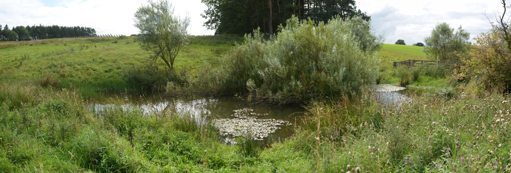
Brandy Well (Great Whittingham) submitted by Anne T on 21st Aug 2018. This panorama of the well pool is taken from just over the wooden footbridge at its north western side. A very peaceful, lovely spot.
(View photo, vote or add a comment)
Log Text: Brandy Well, Todridge Farm, near Great Whittingham: We decided to stop off here on our way to Carlisle to look for this unusually named holy well, near The Queens Arms pub/Chinese restaurant we’ve been to several times. We parked at NY 99652 71590, on the verge before the entrance to Todridge Farm. The farm is more than just a farmhouse and a barn – it’s a hamlet with a number of houses.
Following the track to NY 99143 71795, there is gate into the field on the right hand side (the footpath sign has worn away, it’s just a small white plaque), and we followed this diagonally across the field to the end of the wood, passing a small solar energy ‘farm’ to our right hand side. At about NY 99084 71982 there is a small wooden gate with a footpath sign on it, but this was firmly tied up with a number of ropes (the hinges had broken), so we used the larger gate into the field, and walked a few tens of metres down the slope to the bridge.
On the bridge, you can hear water trickling at the edge of the pool; looking down, there is a dam which lets water out into the stream beyond. Having photographed the well pool from the bridge, we walked up to the land bridge/tractor track at NY 99134 71998 and turned left towards the northern side of the pool. There, in the corner of the fence, we could see the remains of a stone structure, now fallen into what looked like an extension to the pond, where people used to pull water out of.
This is a very pretty spot and a very pretty, if now overgrown, pond, full of waterlilies.
Kirkhaugh Cross
Trip No.94 Entry No.3 Date Added: 1st Sep 2018
Site Type: Ancient Cross
Country: England (Northumberland)
Visited: Yes on 31st Aug 2018. My rating: Condition 3 Ambience 4 Access 4
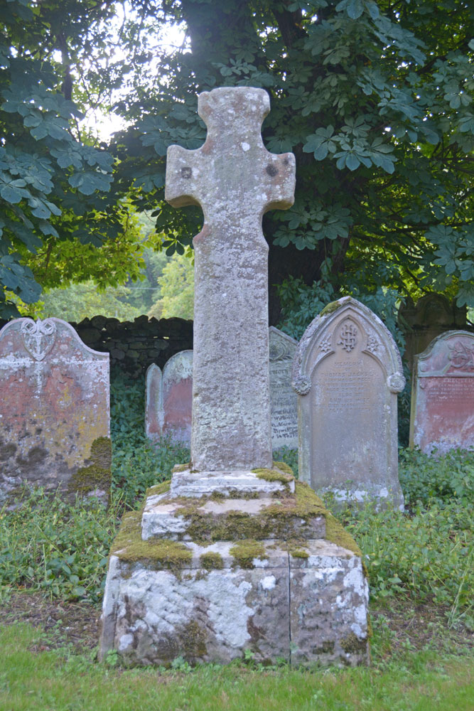
Kirkhaugh Cross submitted by Anne T on 1st Sep 2018. Our first view of this Saxo-Norman cross, approaching along the path through the churchyard from the west, turning towards the south door of the church. The cross is located some 10m from the church door. This side of the cross (Face A in the Corpus record) is said to have two lightly incised crosses, one top and one bottom, although we could not find these.
(View photo, vote or add a comment)
Log Text: Kirkhaugh Cross, Church of the Holy Paraclete: Having seen one of the wells on the opposite side of the road, we turned our attention to finding the cross. This church is virtually hidden behind the trees, with only a portion of its eastern end and a narrow, tall spire peeping out of the trees at its western end.
I thought at first this cross was a modern grave marker, as it sits up a modern plinth, but closer examination showed this cross has been used as a gate post at least once in its past.
Behind the cross is a grave stone which has grown into the side of a large horse chestnut tree and been cracked. With the River South Tyne babbling away just behind the eastern churchyard wall, this is a lovely spot.
Kirkhaugh Wells
Trip No.94 Entry No.2 Date Added: 1st Sep 2018
Site Type: Holy Well or Sacred Spring
Country: England (Northumberland)
Visited: Yes on 31st Aug 2018. My rating: Condition 3 Ambience 4 Access 5
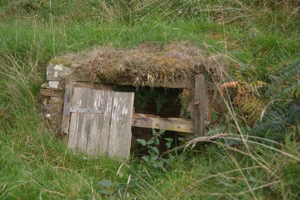
Kirkhaugh Wells submitted by Anne T on 1st Sep 2018. At first glance, this structure looks like a 'doorway into the hillside' but closer inspection through the rotten wooden doors shows a curving, stone well chamber.
(View photo, vote or add a comment)
Log Text: Kirkhaugh Wells, near Church of the Holy Paraclete: After having spent about 2 hours wandering around Epiacum fort, we left to go for a cup of tea in Alston, where we called to the Top Café for tea and crumpets. As suggested by Alastair Robertson, we called into Local Links/Library at the Town Hall to see if they had a copy of his book/report on the fort, but the librarian knew nothing about it (“he wrote a book, but it’s out of print”), and had no further information. We left, walking across to the church of St. Augustine of Canterbury in Alston; I hadn’t taken my camera, and apart from some 13th century gravestones and architectural fragments, the only thing of note was the Derwentwater Clock, set up in the north west corner of the church. Surprisingly, there were instructions to see it working – remove one of the blocks from under the weights on its right hand side, then set the pendulum in motion. Brilliant to see something so old ticking away. To see the hand made cog wheels turning was amazing.
Driving firstly along the A686 following the River South Tyne northwards out of Alston, on the eastern side of the river, we took the minor, very single track road with no passing places, to Kirkhaugh. Just past the farm building is a small triangle of grass; we parked just past this on the grass verge, and made to walk down what looked like the driveway to the Old Rectory, but is actually the only access to the Holy Paraclete Church – Paraclete being another term for ‘Holy Ghost’. The OS map showed ‘Wells’ marked around this point.
As I looked out of the car window, I saw what at first looked like a ‘doorway into the hillside’ but is a disintegrating well house. I walked up the slope to take photographs, and could see inside the well house which is still full of clear water.
The second well, which I saw walking back up the road from the church, is up a hill opposite the farmhouse; now a ruinous brick and concrete structure, it drains into a trough at the bottom of the slope by the road. Presumably it is then piped into the River South Tyne.
Whitley Castle (Alston)
Trip No.94 Entry No.1 Date Added: 2nd Sep 2018
Site Type: Hillfort
Country: England (Northumberland)
Visited: Yes on 31st Aug 2018. My rating: Condition 3 Ambience 4 Access 4
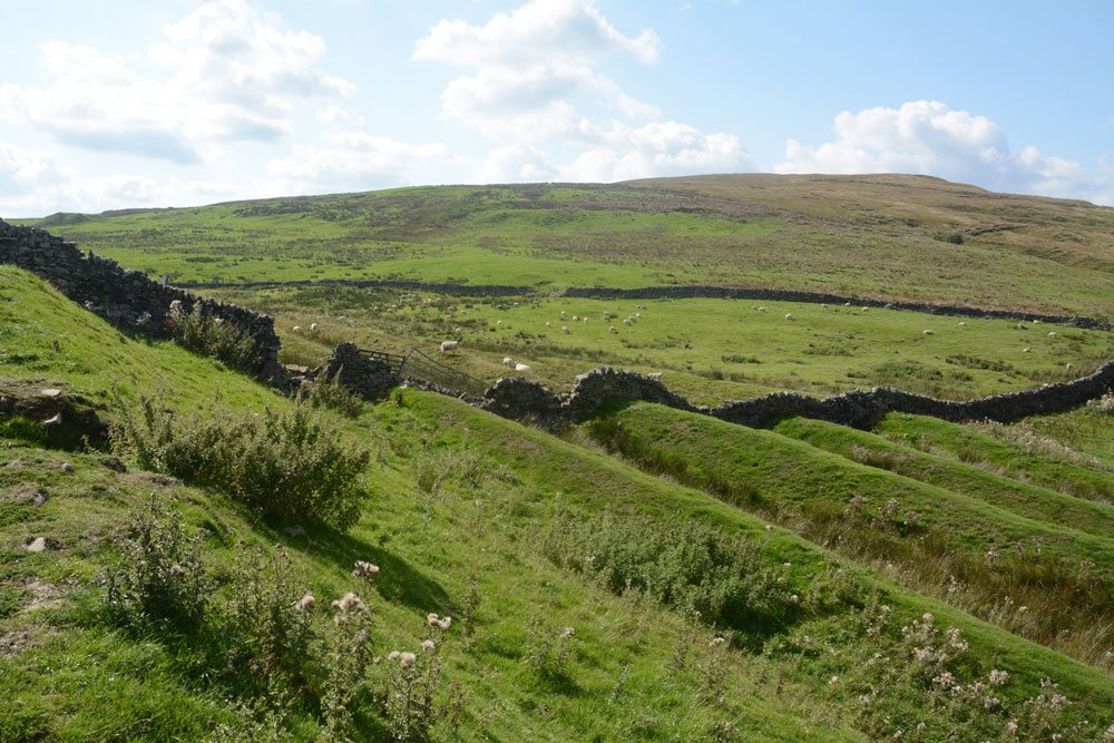
Whitley Castle (Alston) submitted by Anne T on 2nd Sep 2018. Standing just to the east of the stone wall dividing the site, at its western end, looking over this remarkable series of ramparts. The fort has 'numbered flower pots' scattered around, which link up with a map, so it's easy to find your way around and interpret this site.
(View photo, vote or add a comment)
Log Text: Whitley Castle / Epiacum Fort/Iron Age Hillfort: We were initially going to Kirkheugh to see the old cross there, but were on the wrong side of the river, and passed the fort, named Whitley Castle on the OS map, so stopped in the car park. There was a van and two other cars in the car park, and we could see people on the hillside above, so thought it must have attracted lots of other visitors.
There are new signs around, along with leaflets under the information board. Now called by its Roman name of Epiacum, the way to the fort is well signposted, and by following the numbered tour (spot the numbered flowerpots) we understood where we were.
As we climbed the hill, one of the men at the top had a stepladder – Postman from the Portal? I asked myself. Another had a ranging pole. By the time we reached the top they were sitting having a cup of coffee before continuing. I asked them if they were doing a survey, and realised I was talking to Stewart Ainsworth of Time Team fame. He, Alastair Robertson and colleague (whose name I didn’t ask but whose face was very familiar) were doing a survey in preparation for taking down a ‘modern’ stone wall to open up the fort site. At the moment, to get access to the Vicus and other parts of the site, you have to walk a long way round through different gates. What a multiple ditch system!
For my future reference: Stewart mentioned a 138 page report produced by English Heritage, which I’ve downloaded to both the picture folder and my Megalithic Portal/Useful Information About Sites folder.
Also see https://www.epiacumheritage.org/
St Cuthbert's Church (Norham)
Trip No.95 Entry No.1 Date Added: 9th Sep 2018
Site Type: Ancient Cross
Country: England (Northumberland)
Visited: Yes on 6th Sep 2018. My rating: Condition 3 Ambience 5 Access 5
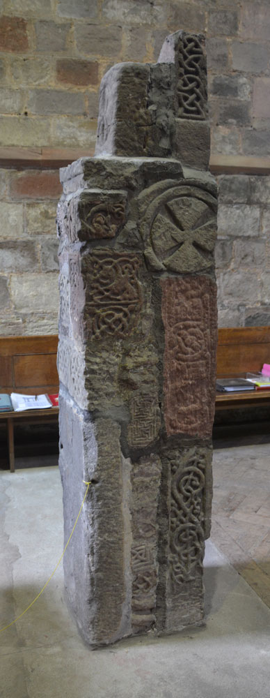
St Cuthbert's Church (Norham) submitted by Anne T on 9th Sep 2018. This is the side of the pillar which faces the south door into the church.
(View photo, vote or add a comment)
Log Text: Anglo Saxon Pillar, Norham: The journey seemed to take a lot longer than anticipated, and we didn’t arrive here until almost 3pm. At first, keeping the tower of the church in view, we went the wrong way, past the village cross and the first school, then turned round, travelling back along West Street (the B6470), turning down North Way to Church Lane. We spotted the churchyard first; the church is at the bottom of Church Lane, so we ended up parking near the gate at the bottom at NT 89710 47356 and walking up to the south porch along the path.
Andrew thought there were originally 25 stones here, but there are actually only 18, built into a ‘pillar’, with different sides showing, some recorded separately on the Corpus. A few of the fragments have been lost between their finding in 1833 and today, but the Corpus holds some drawings from the 19th century.
After photographing the Saxon pillar, we looked around outside, spotting the musket ball holes where Oliver Cromwell’s army had shooting practice, and looked at the site of the original Saxon church, which is on a mound slightly higher than the modern church.
Norham Cross
Trip No.95 Entry No.5 Date Added: 9th Sep 2018
Site Type: Ancient Cross
Country: England (Northumberland)
Visited: Yes on 6th Sep 2018. My rating: Condition 3 Ambience 4 Access 5
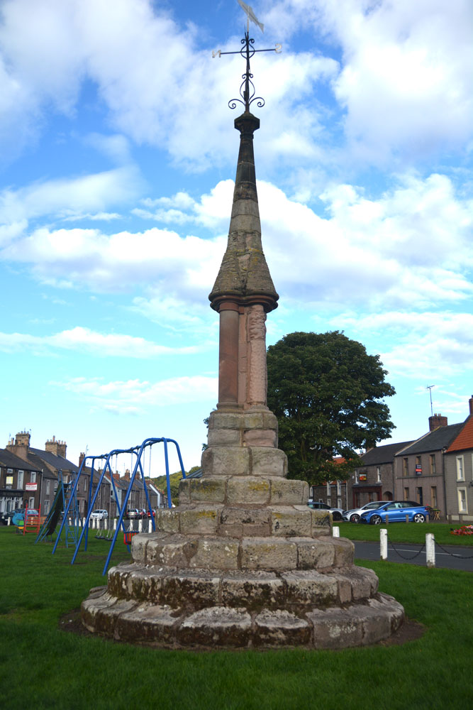
Norham Cross submitted by Anne T on 9th Sep 2018. Norham Cross, looking eastwards across the children's playground and up the main street in the village, to the Castle at the top of the hill.
(View photo, vote or add a comment)
Log Text: Norham Village Cross: (Before looking at this cross, we stopped off to look at the Victorian Jubilee Fountain just over the border in Scotland, which still has its original pump handle, although this doesn't work). We passed this cross several times today, but with it being immediately next to the children’s playground, there were children sitting on its lower steps, and propping their bicycles against it. When we passed by on the way back from seeing the holy wells at Upsettlington, there was fortunately no children around it, so we stopped to take photographs, much to the amusement of two ladies passing by who stopped to watch. It was nice to see the cross still very much part of village life today.
Whilst the top part of this cross looks Victorian/relatively recent, the steps look much, much older and are very worn.
Ulgham Cross
Trip No.97 Entry No.3 Date Added: 17th Sep 2018
Site Type: Ancient Cross
Country: England (Northumberland)
Visited: Yes on 16th Sep 2018. My rating: Condition 3 Ambience 3 Access 5
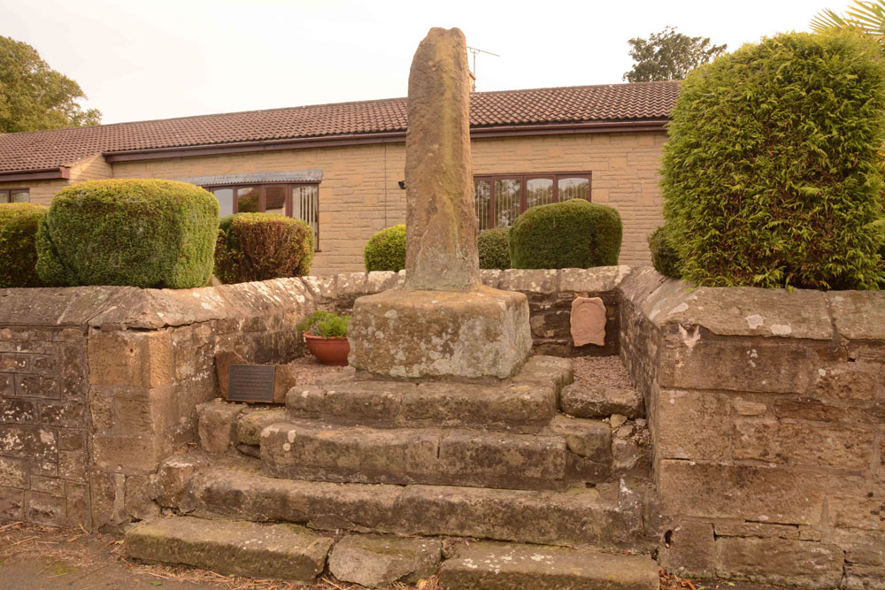
Ulgham Cross submitted by Anne T on 17th Sep 2018. The Ulgham Cross, which is set in a recess in the roadside wall, near to the junction of the B1337 and Ulgham Lane. It has an overall height of 3m, the plain (but weathered) cross shaft standing on four very old stone steps, which look as if they used to belong to an old village cross.
(View photo, vote or add a comment)
Log Text: Ulgham Cross, Near Ashington, Northumberland: From Newbeggin By The Sea, we headed inland to try and find this cross, which we thought was near the church. In typical Tate fashion, we'd arrived when there was a Sculpture Show at the Church; as they were charging to go in, we declined, and set off to find this cross, which is around 320m WSW of the church of St John The Baptist.
The photographs we'd seen of the cross had black painted iron railings in front of it, and we were temporarily confused as these have now been removed. This cross is located just west of the junction of Ulgham Lane with the B1337, in front of two modern bungalows. With the railings no longer in place, I walked up the four steps and had a look at the back of the cross. It looks as if it’s had a hard life and has numerous holes and weathering. It looked to my untrained eye as if it might have been a repurposed standing stone.
Much to the amusement of the passing traffic, I darted in and out of the road to try and get the best photographs I could, as the sunlight behind the cross was dazzling.
St Andrew's Church (Heddon on the Wall)
Trip No.99 Entry No.1 Date Added: 23rd Sep 2018
Site Type: Ancient Cross
Country: England (Northumberland)
Visited: Yes on 19th Sep 2018. My rating: Condition 3 Ambience 5 Access 4
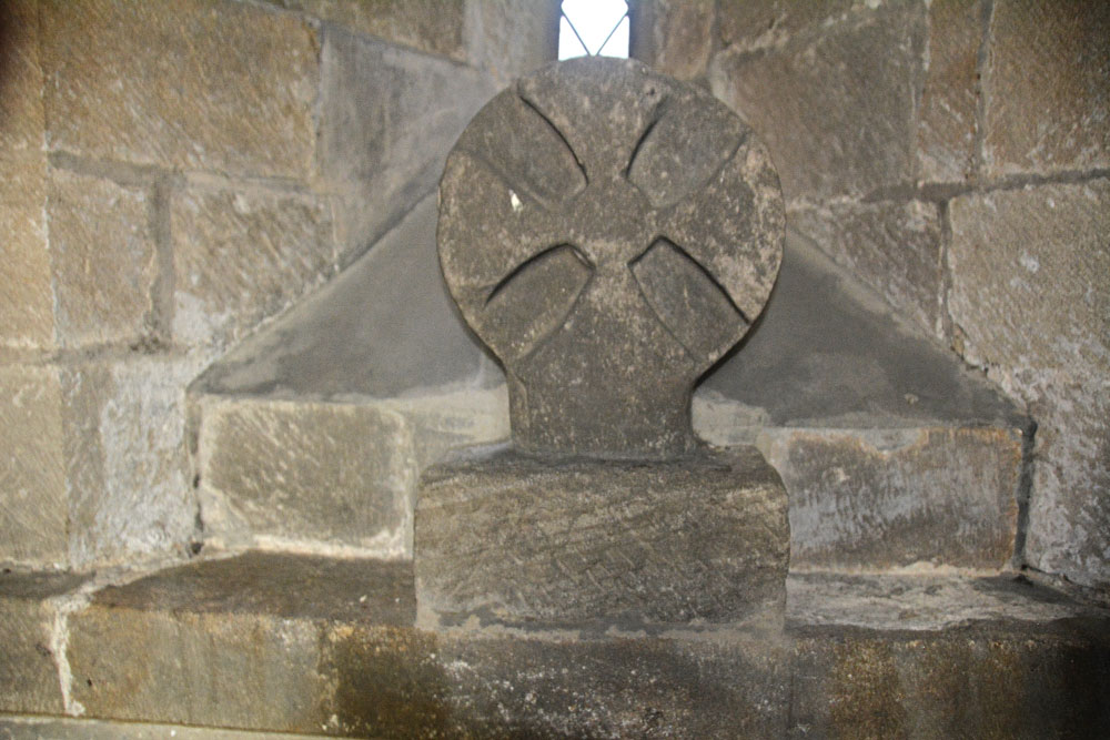
St Andrew's Church (Heddon on the Wall) submitted by Anne T on 23rd Sep 2018. The Saxo-Norman cross finial (or possibly a grave marker), cemented to the north window sill in the sanctuary of this old church. Found underneath the vestry floor during renovations, this is dated to the eleventh century. See AS Corpus Heddon-on-the-Wall entry for more information.
(View photo, vote or add a comment)
Log Text: St Andrew's Church, Heddon on the Wall: The church is no longer open every day, but we were asked to go along to Holy Communion at 10.30am on a Thursday and stay and enjoy the church afterwards. A very kind lady called Ann showed us round (I think she mentioned her husband was the historian), and I got proper photographs of the Anglo Saxon Cross Head in the Sanctuary this time (last time I visited I wasn’t aware this was an old piece, just thought it was an architectural fragment).
There are a number of other really interesting fragments on the west window sill of the meeting room. I really love the way the arches between the nave and chancel and chancel and sanctuary have settled over the years. Wonderful place! Would have loved to have wandered around this church on my own.
Woodhorn Cross
Trip No.97 Entry No.1 Date Added: 23rd Sep 2018
Site Type: Ancient Cross
Country: England (Northumberland)
Visited: Yes on 16th Sep 2018. My rating: Condition 3 Ambience 4 Access 5
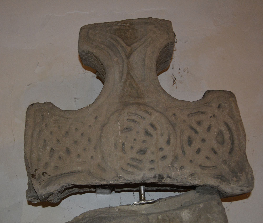
Woodhorn Cross submitted by Anne T on 23rd Sep 2018. Face a of the cross head of AS Corpus Woodhorn 01, described as: "There is a flat central roundel cleverly composed of a central motif of two intersecting loops which spin out into intersecting circles of interlaced strands. The upper arm has a split plait motif, in which the strands are bent into a V shape between the four end knots and the diagonal strand becomes an edge strand. On the right arm is a ring-knot of two concentric rings crossed diagonally by two closed circuit loops. On the left ...
(View photo, vote or add a comment)
Log Text: Woodhorn Church Museum: This church is now deconsecrated and is a museum. It is only open on Bank Holidays and Heritage Days, such as ‘Doors Open Days’. We arrived just before 1pm and they had just arrived to open the church up.
The Woodhorn Cross was easy to find, but asking where the other Norman stones recorded on a notice by the cross, plus the other stones featured on the Corpus, the Friends of the Church who were helping out told us they didn’t know where they were located, but gave us a leaflet about the church.
We found other fragments incorporated into the fabric of the building, plus others under a table at the north side of the sanctuary, plus others under the altar! AS Corpus Woodhorn 02 and 03 appear to be in the main museum nearby.
Hawklemass Well (Whittingham)
Trip No.100 Entry No.2 Date Added: 24th Sep 2018
Site Type: Holy Well or Sacred Spring
Country: England (Northumberland)
Visited: Yes on 23rd Sep 2018. My rating: Condition 2 Ambience 4 Access 4
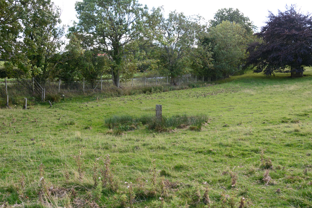
Hawklemass Well (Whittingham) submitted by Anne T on 24th Sep 2018. The well site, seen from slightly higher up the slope, just to its north west, looking east.
(View photo, vote or add a comment)
Log Text: Hawklemass Well, Whittingham: From St Bartholomew's Church in Whittingham, we drove round to this site, parking on the verge near the footpath sign to the church, which was quarter of a mile over the hill. Stepping over the stile into the field, there was a boggy patch marked by a substantial post, such as I've seen on a number of other wells, including Robin Hood's Well in Colwell. Sited at the bottom of a slope, it was a natural place to find such a well.
At the hedgerow to the east of the well, but just to the west of the road, there was a small gully or drain coming down alongside the hedgerow, which seemed to form a rectangular pool in the grass near the well. The OS map shows two drains or small streams which meet near this point.
There was no sign of any stone or brick structure to indicate this has been a well basin or trough. There is no record of this well on the modern OS map, neither on HE or Pastscape, or any other local record on the internet - curious.
On such a nice sunny afternoon, this site seemed entirely peaceful and normal - I was disappointed not to meet the Hawklemass Ghost mentioned by The Northern Antiquarian!
St Bartholomew's Church (Whittingham)
Trip No.100 Entry No.1 Date Added: 24th Sep 2018
Site Type: Ancient Cross
Country: England (Northumberland)
Visited: Yes on 23rd Sep 2018. My rating: Condition 3 Ambience 4 Access 4
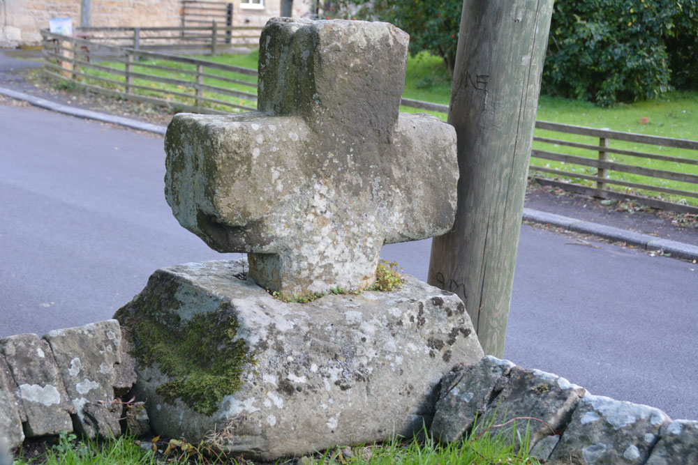
St Bartholomew's Church (Whittingham) submitted by Anne T on 24th Sep 2018. Looking south east across the cross head and base, showing its slightly damaged/chipped lower arm (towards the centre, left of the photo). Historic England simply says the cross is 'medieval'.
(View photo, vote or add a comment)
Log Text: Ancient Cross, St Bartholomew's Church, Whittingham: [please note: there are steps up to the churchyard and church; there may be wheelchair access which we didn't spot on the day - please check before visiting]. This cross was remarkably easy to spot, as it was sited on the corner of the wall to the south east of the churchyard, right by a parking spot for one car at the base of the steps into the churchyard.
There was an informative church guide, although the language was slightly archaic and we had to re-read several of the passages to ensure we were interpreting these correctly.
The guide reads: “Whittingham [spoken as “Whitingjum”, or “Witnjum”] is a name which has evolved from the Anglo Saxon Hwita-ing-ham, meaning “the home of Hwita’s people”. The present church stands on rising ground which could have been the meeting place of Hwita’s people for their Moots before it became the site of a church.
Our visit was interrupted by two people coming in to prepare for the 4pm service. As they were praying at the altar, it seemed disrespectful to continue taking photographs.
The church guide is very useful in explaining all the features, and I’ve emailed one of the church wardens to see if it’s possible to get hold of a copy of the detailed guide mentioned both in the church and on one of the websites I’ve visited (the Northern Vicar’s blog).
There is still Saxon work to be seen in the tower, with its semi-circular arch and squared, heavy side, dated to 900AD by the ‘long and short’ stone work (as we saw at Heddon on 20th Sept, last week).
There is also a section of Saxon stonework in the north aisle wall, forming what would have been a half-arch which was later filled in, and it thought to be the entrance to a small side chapel in the original church.
The guide goes onto say: “Almost certainly there had been another earlier church built on this site, but its possible form can only be conjectured (see the detailed guide). There is a record of a consecration at 735AD. It is also likely there was a yet earlier church existing at the time of the Synod of 684AD.
The guide also mentions, as one of the ‘curios’ a stone on the aisle walling to the left of the porch, at the wall’s left hand corner. Just to the right of the top of the buttress is a stone bearing two arrows (Norman chevrons). “This could be an inserted fragment from some demolished structure [or are these natural fault lines in the stone?].
We popped across the road to see the still working water fountain, although this is too recent a feature to log on the Portal.
Holy Trinity (Old Bewick)
Trip No.100 Entry No.3 Date Added: 24th Sep 2018
Site Type: Ancient Cross
Country: England (Northumberland)
Visited: Yes on 23rd Sep 2018. My rating: Condition 3 Ambience 5 Access 4

Holy Trinity (Old Bewick) submitted by Anne T on 24th Sep 2018. The consecration cross on the southern column of the sanctuary.
(View photo, vote or add a comment)
Log Text: Ancient crosses, Holy Trinity Church, Old Bewick: This is truly a real gem of a church, with great historical notes in a binder in the church. I took these temporarily out of the folder and read out from them as we went round and saw the individual features identified. There was another set of notes, from a talk given in 2017 which I also photographed and will transcribe into my walk journal when time allows.
In some ways, this church is more enigmatic than Escombe Saxon Church, and is smaller. It comprises a nave, a chancel and a semi-circular apse which has been beautifully decorated.
There is so much to look at – original Norman windows. A 14th century effigy. Huge slabs in the west wall. There is what is described as a cross shaft in corner of porch. There is a lovely consecration cross on south pillar of sanctuary. The carvings on north pillar of chancel are particularly nice.
The cross base (?) in the churchyard that I photographed on 13th April 2014 no longer appeared to be there.
