Contributory members are able to log private notes and comments about each site
Sites Anne T has logged. View this log as a table or view the most recent logs from everyone
Holy Trinity (Rolleston)
Trip No.129 Entry No.2 Date Added: 21st May 2019
Site Type: Ancient Cross
Country: England (Nottinghamshire)
Visited: Yes on 10th May 2019. My rating: Condition 3 Ambience 4 Access 4
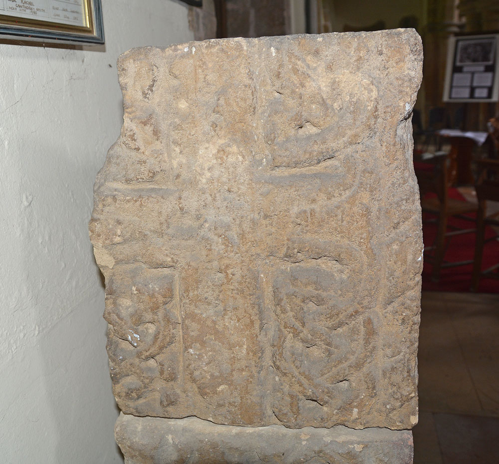
Holy Trinity (Rolleston) submitted by Anne T on 21st May 2019. The western side of the top-most block of the three making up the remains of this stone cross.
(View photo, vote or add a comment)
Log Text: Cross Shaft Fragments and Cross Slabs, Holy Trinity, Rolleston: By the time we’d photographed the sundial in the churchyard then walked up to the village cross, the church had been opened (thankfully) and we let ourselves in. The cross shaft was immediately opposite the south door into the church, although in a really difficult position to photograph (between a heavy wooden desk with information leaflets and a fire extinguisher). The most ornate section of the cross was to its western side, so after Andrew had moved the chairs, I virtually had to squeeze myself in next to the desk and squat down as best I could to capture the carvings – not the most elegant of positions!
It wasn’t until after I had photographed the cross and was making my way towards the fragments in the eastern wall of the northern aisle that I realised the chairs in the church had been set up in a labyrinth pattern. We did have to move some of the chairs to access several parts of the church, but made sure we put the chairs back exactly where we found them.
Thank goodness I had my printouts with Peter Ryder’s drawings and descriptions, as we would have missed a lot here! We’d spotted one or two of the most obvious carved stones built into the external fabric. However, now knowing how much was on the external walls, we went round the outside again and spotted so much more.
Holy Trinity (Old Bewick)
Trip No.100 Entry No.3 Date Added: 24th Sep 2018
Site Type: Ancient Cross
Country: England (Northumberland)
Visited: Yes on 23rd Sep 2018. My rating: Condition 3 Ambience 5 Access 4

Holy Trinity (Old Bewick) submitted by Anne T on 24th Sep 2018. The consecration cross on the southern column of the sanctuary.
(View photo, vote or add a comment)
Log Text: Ancient crosses, Holy Trinity Church, Old Bewick: This is truly a real gem of a church, with great historical notes in a binder in the church. I took these temporarily out of the folder and read out from them as we went round and saw the individual features identified. There was another set of notes, from a talk given in 2017 which I also photographed and will transcribe into my walk journal when time allows.
In some ways, this church is more enigmatic than Escombe Saxon Church, and is smaller. It comprises a nave, a chancel and a semi-circular apse which has been beautifully decorated.
There is so much to look at – original Norman windows. A 14th century effigy. Huge slabs in the west wall. There is what is described as a cross shaft in corner of porch. There is a lovely consecration cross on south pillar of sanctuary. The carvings on north pillar of chancel are particularly nice.
The cross base (?) in the churchyard that I photographed on 13th April 2014 no longer appeared to be there.
Holy Stone (North Tyneside)
Trip No.65 Entry No.1 Date Added: 4th Feb 2018
Site Type: Ancient Cross
Country: England (Tyne and Wear)
Visited: Yes on 3rd Feb 2018. My rating: Condition -1 Ambience 2 Access 4
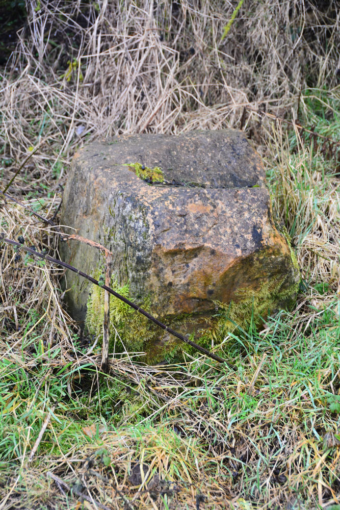
Holy Stone (North Tyneside) submitted by Anne T on 4th Feb 2018. Is this the socket stone that has been moved? Looks convincing from the side .....
(View photo, vote or add a comment)
Log Text: Holy Stone Cross Base, North Tyneside: Having been to the industrial estate nearby, we decided to try and track down this stone. Donning wellies, as there had been torrential rain the night before, we followed the footpath from the Holystone Pub/Premier Inn (where there is a car park almost next to the A19, just north east of the pub) towards Holystone Farm, crossing the bridge above a busy railway line. At the recently built Holystone Cottage, another footpath runs north east across the fields towards the A19. The stone is supposed to be located at the junction of the footpath and the front wall of Holystone Cottage.
By chance we met a couple of dog walkers, and I asked them if they knew of this stone. The man said he was brought up locally and remembered playing in the fields at the back of the cottage, where there a three foot high stone they used to gather around. He said the stone had been destroyed some years ago, but the cross base might remain.
He walked us to the spot where he remembered the stone being, but nothing. He did say that there had been recent site investigation in the field, prior to building new houses.
We did find what looked very much like a cross base in the corner of a neighbouring field at NZ 30210 70783. This looked very convincing from the side, but from the top, there was what might have been a long, thin, damaged slot, very unlike the carved slots we've seen in other cross bases.
Hollinghill Enclosure
Date Added: 1st Aug 2015
Site Type: Misc. Earthwork
Country: England (Northumberland)
Visited: Yes on 15th Jul 2015. My rating: Condition 2 Ambience 3 Access 3
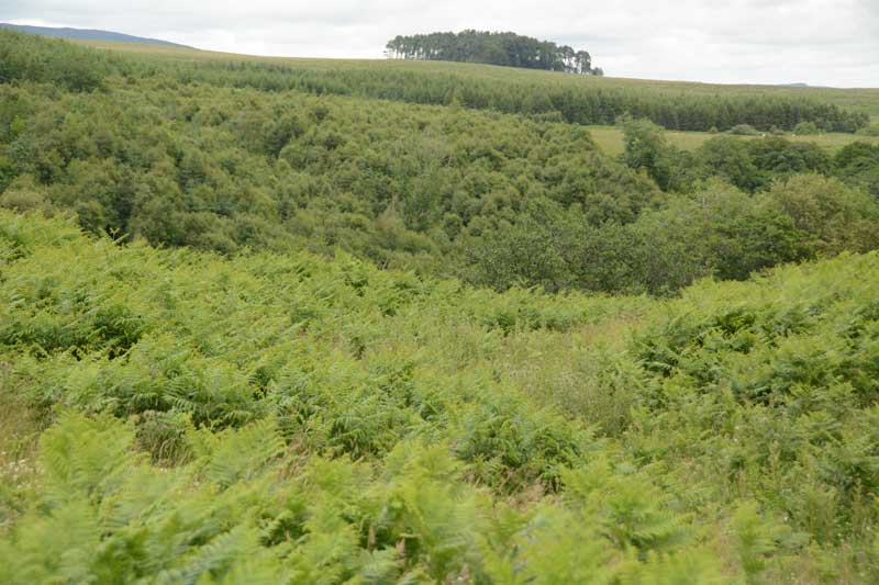
Hollinghill Enclosure submitted by Anne T on 18th Jul 2015. Believe it or not, there is a ditch approximately 1 metre deep in the lower right hand quadrant of the photograph, on the gentle slope leading down to Fallowlees Burn. Across the burn to the north lies the Fontburn Four Poster Stone Circle. This photograph is taken from the Greenleighton Walk footpath, where it cuts the eastern bank of the enclosure half way along its length.
(View photo, vote or add a comment)
Log Text: Hollinghill Enclosure, near Fontburn Reservoir, Northumberland: Before setting off on this walk, we'd identified a number of sites (2 enclosures and several rock art boulders) close to tracks/marked pathways on the Ordnance Survey map. Parking at the car park to the east of Fontburn Reservoir (near the fishing hut and as far south as we could get), we followed the Waterside Walk along the south side of the reservoir. This was slow as we got caught up with a large walking group who hogged the boardwalks, but we finally managed to overtake them. At the sign for the Nature Reserve, we clambered up the small slope onto the track across the access land leading to the west of the reservoir. I confess to finding walking across this access land challenging due to the heavily tussocked grass, no clear pathways, the number of drainage channels, small streams and boggy areas to cross (but seasoned walkers will have no difficulty!). Passing the large cup marked boulder (Fontburn B) on route, we made our way onto the ridge running east-west south of Fallowlees Burn, and onto the National Trust Greenleighton walk with its grassy, mown trackways clearly visible.
It is relatively easy to spot this settlement as the path cuts right through it and there is a lone, low hawthorn tree at its western side. From here, you can see across the Burn to Fontburn Four Poster (it looks, from a distance) as if someone has cut down the hawthorn trees near the stones making up this little circle).
Stopping for a drink and to take photos, we carried on westwards until we got to West Shank enclosure, which is much more visible in the landscape in the then took the modern farm track down the slope to Fallowlees Burn, then across the wooden bridge. On the north side of the bridge two sets of quad bike tracks lead off to the left and right. To the right, the land slopes upwards. Fontburn a(i), a(ii) and a(iii) sit on this land, no more than 100 metres from the footpath, but at this time of year a(i) and a(ii) are hidden by tall bracken. Fontburn a(iii) gleams at you from across the valley.
Having taken these three boulders in, we retraced our steps to the footbridge and took the quad bike tracks to the left hand side, picking our way over two small streams which join Fallowlees Burn close to the the footbridge. From here, it is easy walking up the slope, about 200 yards to Fontburn a(vi), a(vii) and a(viii) and Fallowlees Settlement.
All in all, this 4 and a half mile walk took us 6 hours because of the heavy terrain and exploring the archaeology, but well worth it.
Hollin Stump Cairn
Trip No.6 Entry No.4 Date Added: 2nd Oct 2016
Site Type: Cairn
Country: England (Cumbria)
Visited: Yes on 11th Sep 2016. My rating: Condition 3 Ambience 4 Access 3
Hollin Stump Cairn submitted by HeronEye on 14th Mar 2014. Looking East to Hollin Stump cairn from the footpath to Gaythorne Plain ring cairn.
(View photo, vote or add a comment)
Log Text: Hollin Stump Cairn, Gaythorp Plain, Cumbria: From St Helen's Well at Great Asby, we headed south south west, following the single track road to ASby Winderwath Common, were the metalled carriageway turned west across Gaythorne Plain. We parked by the cattle grid on opposite Linglow Hill, where a dog walker had taken up much of the dry parking area and was waiting for his 2 lively terriers to wear themselves out tearing across the grass.
We hadn’t spotted a gateway into the field containing Hollin Stump Cairn from the road, so followed the bridlepath south. There was a gate into the field about a quarter mile from the road, but there was a herd of large cows (and a bull) surrounding the cairn, so we only go to view this from a distance.
We carried along the bridlwway to find the Gaythorn Plain Ring Cairn/Stone Row (not sure we found it, need to process the photos). The latter was visit 7/5 (not yet logged).
Hogtivis Stone
Date Added: 28th Aug 2014
Site Type: Early Christian Sculptured Stone
Country: Wales (Pembrokeshire)
Visited: Yes on 23rd Aug 2014. My rating: Condition 3 Ambience 4 Access 4
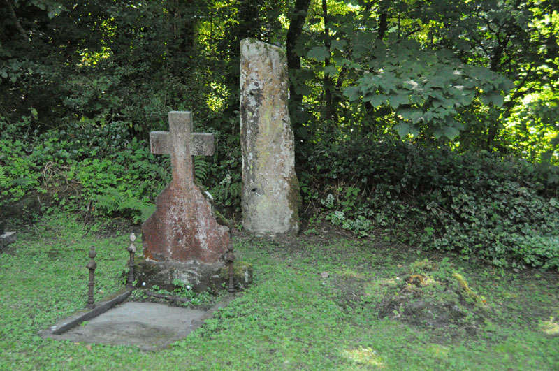
Hogtivis Stone submitted by Anne T on 25th Aug 2014. Photograph showing the location of the Hogtivis Stone from the west end of the church. It is nestled snuggly against the boundary bank of the church yard and the car park, between grave stones.
(View photo, vote or add a comment)
Log Text: Intrigued by just the word ‘Stone’ on the map, we drove from Garnturne burial chamber towards Sealyham Bridge, looking for the church next to ‘The Stone’. There are just a few farms and an outdoor centre here; it is a very pretty little spot. Just before the bridge over the river Afon Anghof, there was a small cark park (surrounded by overhanging trees on three sides) on the right hand side of the road. The church was invisible, being hidden by these trees, so we ended up driving past, turning round and going back. Turning into the car park, the top of the church and the gateway into the church yard immediately became visible.
This was one of the smallest churches I’ve come across. The wrought iron gate to the church spelled out the year 1870, and the church did indeed look relatively modern; but looking closer, there appeared to be a tiny chapel embedded in the larger building which looked much, much older. The church was locked, so sadly we couldn’t get in, as I would have loved to look round the interior of the building, and there was no contact telephone number to call to arrange a visit. Doing some research on arriving home, I found out that the nave and south aisle were separated by Norman arches, which I would love to have seen.
The churchyard was also tiny, largely dominated by wrought iron railings surrounding a large family plot immediately to the south of the church, by the porch. The two bells were rung by ropes coming down the exterior west end of the building.
In the corner of the churchyard, lodged snuggly against the bank between the church yard and the car park, and tucked between two graves, was The Stone. It had obviously been used as a gatepost at some time, with several holes, some still containing metal pins (my immediate reaction was ‘poor thing’). There were obvious signs of carving on the right hand side of the front face of The Stone which looked like Ogham, plus some other possible carving to the left, which the records tell me is a Latin inscription. Funnily enough, the camera was able to pick out the Latin inscription better than my eye, as recorded in the image submitted here.
The Archaeological Data Service record states that the stone is 5th or 6th century, and “was found in 1897 'a few hundred yards' from Little Treffgarne farmhouse. If it was in situ, then it may have been associated with the monastic site of Little Treffgarne”.
This site is only a couple of kilometres from the A40, east of the village of Wolf’s Castle, and 9 miles north of Haverfordwest. The Genuki website saying this parish is traditionally known and the birthplace and burial place of Owain Glyndwr who “is said to have been born at Little Trefgarn and to have been interred at the small village of Wolf’s Castle’.
Hoddom Parish Church
Trip No.127 Entry No.1 Date Added: 6th May 2019
Site Type: Sculptured Stone
Country: Scotland (Dumfries and Galloway)
Visited: Yes on 2nd May 2019. My rating: Condition 2 Ambience 2 Access 4
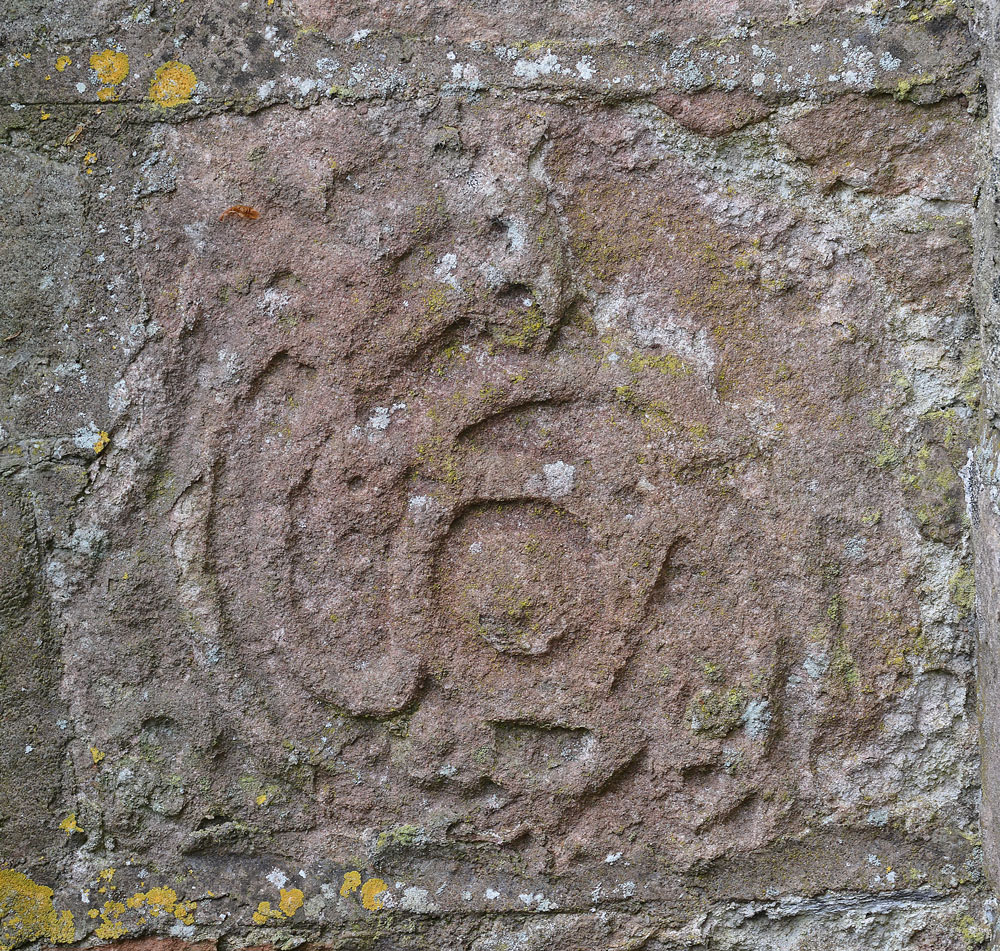
Hoddom Parish Church submitted by Anne T on 6th May 2019. A close up of the stone, taken with my zoom lens. I'm still trying to find out more details about where it came from and its age. The Canmore record mentions this church replaced an earlier one built in 1610, "of which fragments remain", but nothing more. Other fragments have been lost, and a Roman altar has been built into the porch of the new parish church at Hoddom.
(View photo, vote or add a comment)
Log Text: Sculptured Stone at Hoddom Old Parish Church: Our first stop of the day, and a strange place. A church in ruins, boarded up, although with parts of the churchyard really nicely tended – presumably because of the war graves.
Sitting on the southern side of the B725 to the south west of Ecclefechan, we parked in the layby outside the main gates into the churchyard, immediately next to the ruins. It took us ages to find the location of the sculptured stone, and trying to describe its location is a little tricky as the church is built in the shape of a square cross, orientate N-S, E-W. The stone is built into the outside corner of the eastern wall of the southern 'arm' and the south wall of the eastern 'arm'. We were unable to get right up to it because of the proximity of the railed family grave enclosure, although we succeeded in knocking some brambles down from the front of the stone so we could view it.
Hinderwell Cross Head
Trip No.159 Entry No.5 Date Added: 7th Mar 2020
Site Type: Ancient Cross
Country: England (Yorkshire (North))
Visited: Yes on 4th Mar 2020. My rating: Condition 2 Ambience 3 Access 4
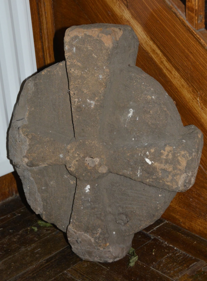
Hinderwell Cross Head submitted by Anne T on 7th Mar 2020. We very carefully moved the flower arrangement next to the stone to photograph it. The mastic repair to the lower arm can be clearly seen on this side.
(View photo, vote or add a comment)
Log Text: The Hinderwell Cross Head, St Hilda's Church: Whilst the church itself is well kept and nicely presented, this cross head is tucked away in the foyer of the church, at the bottom of the stairwell leading to the gallery/organ.
After photographing the well, we wandered up to the church, finding it open. Just inside, to the left hand side of the lobby, next to the stairs ascending to the gallery, was a cross head, which I photographed. Inside was a leaflet describing local heritage, and I found a short section about both Lythe and the Hinderwell Cross in there.
Just outside the south door, about 3m to the south west, is part of either a cross base or a column, which I also photographed.
Guy Points, in his Gazetteer of Anglo Saxon and Viking Sites: Yorkshire, only mentions the well (pages 161/162).
Higher Combe Cross
Trip No.130 Entry No.7 Date Added: 30th May 2019
Site Type: Ancient Cross
Country: England (Devon)
Visited: Saw from a distance on 11th May 2019. My rating: Condition 3 Ambience 3 Access 4

Higher Combe Cross submitted by Anne T on 30th May 2019. Andrew (husband) balanced on top of the low stone wall between the minor road to Lustleigh and Cross Park Field to get this photograph of the cross head, from about 100m away. Not the best focused of photographs, but the closest we could get.
(View photo, vote or add a comment)
Log Text: Higher Combe Cross: If we could have obtained access to this cross, access would have been a short walk across a field of improved pasture. Shame the gate was double-chained with two electric fences virtually up against the gate. Lovely horse in the field, though.
Andrew resorted to standing on top of the low stone wall just to the south of the cross, where there was a sufficient enough gap in the trees/hedges to see through. A shame, because it looked as if it was in such a lovely location, just above a small stream, and against an old hollow way.
High Moorland Visitor Centre
Trip No.135 Entry No.17 Date Added: 1st Aug 2019
Site Type: Museum
Country: England (Devon)
Visited: Yes on 16th May 2019. My rating: Condition 3 Ambience 3 Access 4
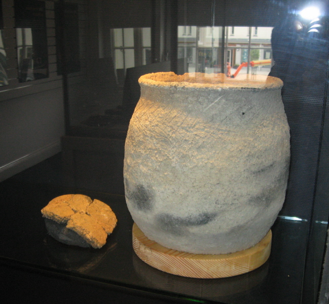
High Moorland Visitor Centre submitted by AngieLake on 5th Feb 2011. A modern replica of a pot from the recent Bellever hut circle excavations. Made by a local lady potter and displayed in the 'Going for Bronze' exhibition in summer 2010.
(View photo, vote or add a comment)
Log Text: Thornworthy Cist and Ter Hill Cross, Princetown National Park Visitor Centre: We had about 15 minutes before the centre closed on the Thursday, so we flew in with Dave Parks for me to see and photograph the Thornworthy Cist and the Ter Hill Cross. There was scaffolding around the back of the building, so I used this to step onto the weedy garden to photograph the cist slab from the top.
By the time I'd taken some photographs, I was being ushered out of the garden as they wanted to close the centre for the night, but I was bid 'you are more than welcome to come back tomorrow if you can".
High Moorland Visitor Centre
Trip No.136 Entry No.1 Date Added: 12th Jun 2019
Site Type: Museum
Country: England (Devon)
Visited: Yes on 17th May 2019. My rating: Condition 4 Ambience 3 Access 4

High Moorland Visitor Centre submitted by AngieLake on 5th Feb 2011. A modern replica of a pot from the recent Bellever hut circle excavations. Made by a local lady potter and displayed in the 'Going for Bronze' exhibition in summer 2010.
(View photo, vote or add a comment)
Log Text: Princetown Visitor Centre, second visit: We had arranged to meet one of Sandy G's intrepid Dartmoor Explorers here at around 10.30am, to have a final look around before starting our journey back home. .
I confess to being really disappointed with this Centre as there was only the cast of a standing/inscribed stone and a prehistoric trackway. There were lots of information banners and photographs. The main entrance was really a shop front for cards, maps, books and guide books. I photographed the stone then we left to start the journey home.
The centre was advertising an exhibition due to arrive shortly.
High Banks Farm
Date Added: 22nd Sep 2014
Site Type: Rock Art
Country: Scotland (Dumfries and Galloway)
Visited: Couldn't find on 19th Sep 2014
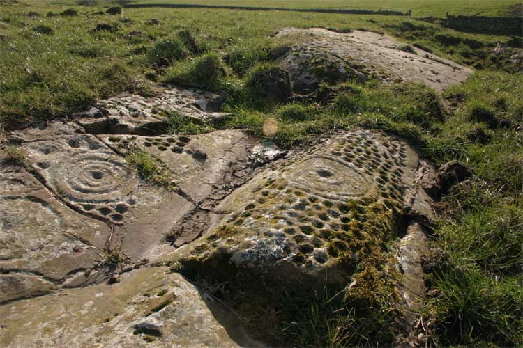
High Banks Farm submitted by TerryStaniforth on 23rd Feb 2005. More detail.
(View photo, vote or add a comment)
Log Text: High Banks Farm Rock Art: Found the track to High Banks Farm easily enough, but husband wouldn't risk our car on the farm track, saying that we'd need a four wheel drive to attempt it. Our tight schedule of sites to visit for the rest of the afternoon didn't allow time to walk up to this rock art site, so sadly we've had to leave this until another day - a future treat!
Higgin's Well
Trip No.168 Entry No.4 Date Added: 29th Jul 2021
Site Type: Holy Well or Sacred Spring
Country: England (Herefordshire)
Visited: Yes on 13th Jul 2021. My rating: Condition 3 Ambience 3 Access 4
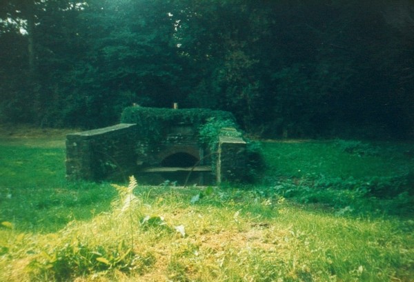
Higgin's Well submitted by HOLYWELL on 28th Aug 2006.
Higgin's Well Little Birch
(View photo, vote or add a comment)
Log Text: Higgins's Well, Little Birch: We parked outside the church (St Mary's) and walked down the lane towards the well. We could hear water running in the distance, so followed our ears.
A very small stream runs downhill behind the well from Athelstan's Wood currently appearing to flow both into the well and to another pond and stream, joining a larger stream which runs to the south of the well.
The well is very overgrown, and was deep in shadow at the time of our visit. Stepping inside the gate, there is an 80cm stone slab which runs between the northern wall of the well and the well pool, so it's possible to step into the well and, if you wanted, dip your bucket into the well pool.
Hier Well (Benrig)
Trip No.158 Entry No.1 Date Added: 2nd Mar 2020
Site Type: Holy Well or Sacred Spring
Country: Scotland (Scottish Borders)
Visited: Yes on 27th Feb 2020. My rating: Condition 2 Ambience 4 Access 4
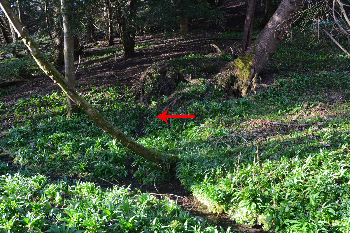
Hier Well (Benrig) submitted by Anne T on 2nd Mar 2020. The red arrow shows where the spring which feeds Hier Well emerges from the base of a wooded slope, just underneath the roots of an uprooted tree. There is a fair trickle of water emerging from the bank.
(View photo, vote or add a comment)
Log Text: Hier Well, Benrigg/Maxton: We first tried to get here by following St Cuthbert’s Way from the cemetery/old chapel ruins at Benrig, but there was a steep drop down to the river below on one side, and the path was muddy and slippery. Andrew said a set of steps down to the Crystal Well were too steep for me to cope with (although later, from below, they looked OK), so we tried again from the church by Glebe House (more details below).
We found the source of the spring, as described at the foot of a wooded slope, but no sign of the structure photographed by Cope, even though we walked alongside the stream to the wooden bridge looking.
A beautiful woodland location, and very peaceful. On the far side of the ford, another well (Well-brae) was marked on the OS map, but after heavy rain in the area, the ford was too deep to cross at this point, without wellies, which we didn't have.
Hexham Abbey
Date Added: 24th Aug 2015
Site Type: Ancient Cross
Country: England (Northumberland)
Visited: Yes on 3rd Sep 2014. My rating: Condition 3 Ambience 4 Access 5
Hexham Abbey submitted by Thorgrim on 18th Sep 2004. Roman tombstone now in Hexham Abbey NY773684
Memorial to Flavinus a Roman Standard hero
(see same design in Colchester Castle)
(View photo, vote or add a comment)
Log Text: Hexham Abbey, Northumberland: St Acca and Spital Cross Shafts.
23rd August 2015: Took my daughter and her husband to the new visitor centre after a lovely lunch in the Refectory (much recommended). We had great fun dressing up as Queen Ethelreda, Bishop Wilfrid and Augustinian monks). There was brass rubbing and computerised caligraphy to try. As well as interactive displays for the young at heart, there is also a serious section with a display of Anglo Saxon and Viking stones, a model of, and press-screen history of the abbey. A great time was had by all and I found not only the Spital Cross but a number of other stones I'd been searching for in the Anglo Saxon Corpus of Stone Sculpture and not found in my previous visit. Well worth coming.
3rd September 2014: Acca succeeded St. Wilfrid as the Bishop of Hexham in AD709, withdrawing (or also said to have been deposed) from office in AD732 and dying in AD740. The two crosses purported to mark the head and foot of his grave stand in the south transept of Hexham Abbey (on the right hand side as you enter the main church from the porch), next to St. Etheldreda’s Chapel. However, there is some confusion as to whether or not these two cross shafts are St. Acca’s grave markers, or whether the larger may just be a preaching cross set up in the first years of Christianity. However, Hexham Abbey proudly displays them as St. Acca’s.
The two cross shafts stand side by side. The larger cross shaft is called ‘St. Acca’s Cross’. The second, smaller cross-shaft, is known as the ‘Spital Cross’.
I approached a steward to ask if was OK to take some photographs, and he told me it was, providing I didn’t use flash. He knew a fair bit about the crosses, very kindly photocoping a leaflet on Acca and Acca’s Cross for me to take away. He told me that St. Acca’s cross had been broken up in antiquity and the pieces scattered, being put back together in the 19th century – there is a plain piece of modern stone where the cross arms would have been. Interestingly, he told me that the lower portion of St. Acca’s cross was found at nearby Dilston, where it had been used as a lintel in a farmhouse door.
St. Acca’s Cross is most gloriously decorated with vine scrolls which interleave and entwine.
The Spital Cross, as described in his leaflet: “was found at Spital which is 1.3 km west of Hexham, and stood near a house on the site of the medieval Hospital ofSt. Giles.” This cross shaft has very interesting vine scrolls on three sides and a crucifixion scene on its front face.
The area within the Abbey immediately around the crosses is used by the Stewards who greet people who come to look at the Abbey and to display information for visitors and worshippers – which strangely echoes their possible past uses as preaching crosses. When I was there, most people actually walked by without noticing them, although because I was taking photographs, a couple of people came up to ask more.
Opposite both cross shafts, and at the bottom of the Abbey night stair, is a Roman tombstone which dates from the first century.
Hethpool Stone Circles
Trip No.45 Entry No.1 Date Added: 14th Sep 2017
Site Type: Stone Circle
Country: England (Northumberland)
Visited: Yes on 12th Sep 2017. My rating: Condition 3 Ambience 5 Access 5
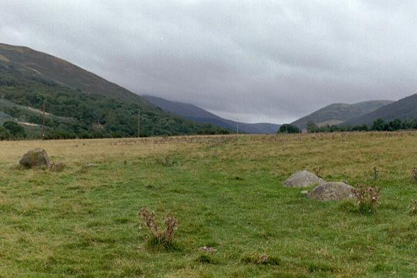
Hethpool Stone Circles submitted by Andy B on 27th Feb 2003. Part of the Burnham family trip to Northumberland, August 2002
(View photo, vote or add a comment)
Log Text: Hethpool Stone Circles, College Valley: We needed to be up really early this morning, but completed what we needed to do by 9am. As there were high winds and rain forecast for this evening/tonight and for the next few days, husband suggested we make the most of the good weather and go up to College Valley. He organised a pass from Saville’s in Wooler (we were one of 8 cars today – usually there are only 1 or 2 the receptionist said).
The last time we were here was over 15 years ago, in the days when I didn’t have a camera, and whilst we saw the stone circle and Little Heatha Fort, didn’t have any evidence of our trip.
Considering this is marked on the map as a (singular) stone circle, it immediately looked (to me) as if there two side-by-side circles – the stones weren’t in one simple circle and they were too widespread. We climbed up to the telegraph pole up the hill to try and get a better look at the circle, but it was still too spread out (and many of the stones too low to the ground) to photograph well.
Given that the small car park at the entrance to the valley was pretty full, and we saw long crocodiles of walkers, we seemed to be the only people interested in the stone circle, which was surprising.
Hethpool Cairn
Trip No.45 Entry No.7 Date Added: 15th Sep 2017
Site Type: Cairn
Country: England (Northumberland)
Visited: Yes on 12th Sep 2017. My rating: Condition 2 Ambience 4 Access 5
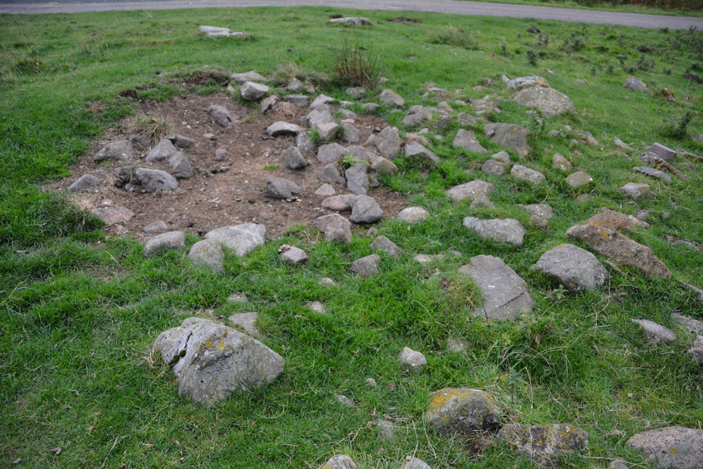
Hethpool Cairn submitted by Anne T on 13th Sep 2017. The Hethpool Cairn, showing its probably robbed centre.
(View photo, vote or add a comment)
Log Text: Hethpool Cairn, College Valley: By this time, it was getting reasonably late in the afternoon, and there was a definite chill in the air. After having been out a lot earlier than our normal setting off time, it seemed way past tea-time. Just as we were approaching Hethpool Stone circles, we both noticed a stony mound to the left hand side of the road, tucked between the road and a narrow band of forest that separates it from the stone circles.
OK, this could be just a dump of stones by the roadside, but I photographed it anyway, enjoying the view south down the valley before we set off for home. Opening up Pastscape later that evening, I was pleased to find this cairn recorded.
Hetherington (Wark)
Trip No.171 Entry No.2 Date Added: 30th Aug 2021
Site Type: Ancient Village or Settlement
Country: England (Northumberland)
Visited: Yes on 15th Aug 2021. My rating: Condition 3 Ambience 4 Access 4
Hetherington (Wark) submitted by Anne T on 27th May 2017. The north western corner of the farmstead, which is sited on a gentle eastern slope.
(View photo, vote or add a comment)
Log Text: Hetherington (Wark): Our second visit to this site, the first being on 25th May 2017, but I forgotten all about it! A lovely site, and pleasant to explore on a sunny afternoon. Didn't realise that this site has been excavated twice, once in 1957, and again in 1972-73, so must try and find the excavation reports, if they are available.
Hetherington (Wark)
Date Added: 30th Aug 2021
Site Type: Ancient Village or Settlement
Country: England (Northumberland)
Visited: Yes on 25th May 2017. My rating: Condition 3 Ambience 4 Access 4

Hetherington (Wark) submitted by Anne T on 27th May 2017. The north western corner of the farmstead, which is sited on a gentle eastern slope.
(View photo, vote or add a comment)
Log Text: Hetherington (Wark): Homestead, built on top of an Iron Age Settlement. Lovely spot, and well worth exploring.
Hele Cross
Trip No.129 Entry No.4 Date Added: 23rd May 2019
Site Type: Ancient Cross
Country: England (Devon)
Visited: Yes on 10th May 2019. My rating: Condition 3 Ambience 4 Access 5

Hele Cross submitted by Anne T on 23rd May 2019. Standing 'behind' the cross on the farm track, putting the location of the cross into its context with the cross roads and the farm buildings opposite. We did look for remnants of the old chapel which once stood here/near here, thinking perhaps the farm buildings might have incorporated part of it into the current structure, but as Pastcape says, there are no signs (that we could see).
(View photo, vote or add a comment)
Log Text: Hele Cross, Devon: This cross is not far from the Beetor Cross – some 850m to the east, measured from UK Grid Reference Finder. The lane was narrow and a little windy, but a good introduction to the driving around this part of the world. There were few places to park, so we bumped up on the verge next to the farm, at about SX 72084 84153, where they had already parked one of their vehicles.
This area was heavily shaded by trees, with a (narrower) lane running east from the cross (eventually joining up with Yard Hill), and to the south a drop down to a stream.
The cross was again raised up above the road and was clearly visible once we’d walked onto the road junction. A tractor track up to a field gate allowed us to walk up ‘behind’ the cross and take photos. The socket stone was completely covered in ivy and brambles, so we didn’t really see this at all. (Later research using Crossing's Ancient Stone Crosses of Dartmoor (1902) says the chapel was by the stream).
